
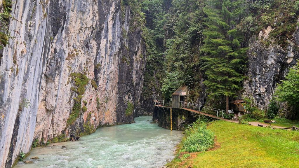
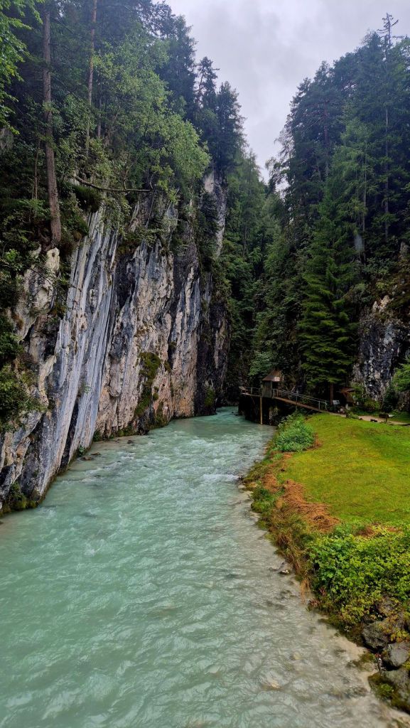
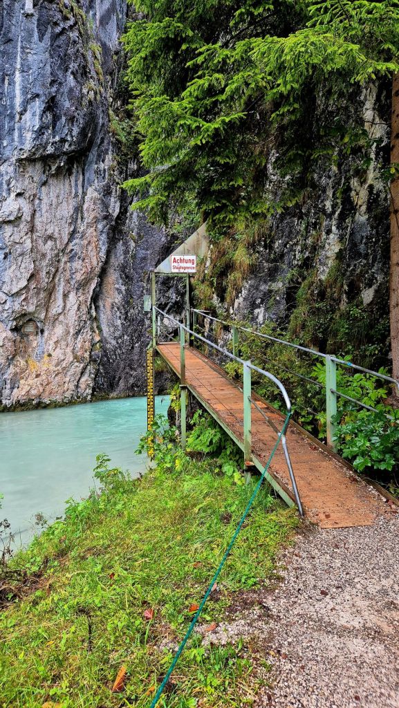
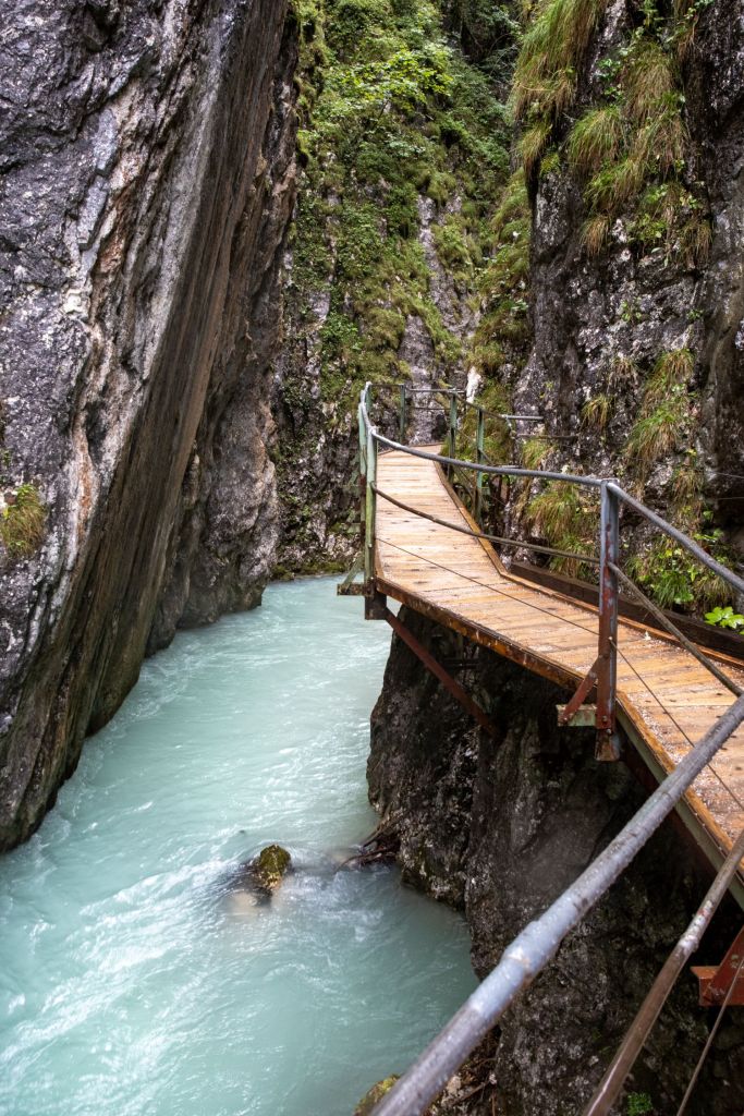
The Leutasch Gorge (German: Leutaschklamm or Leutascher Geisterklamm) is a gorge near Mittenwald and Unterleutasch on the Bavarian-Tyrolean border area through which the Leutascher Ache river flows. It is very steep-sided and was not opened to tourists until 2006. To do this a 1.4 million euro, EU-supported, Austro-German project was undertaken to build steel walkways and bridges over a distance of 970 metres. With a total length of 1,650 metres it is the longest accessible gorge in the Eastern Limestone Alps. The gorge was opened on 24 May 2006.
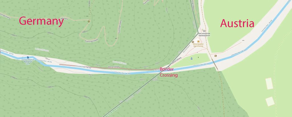
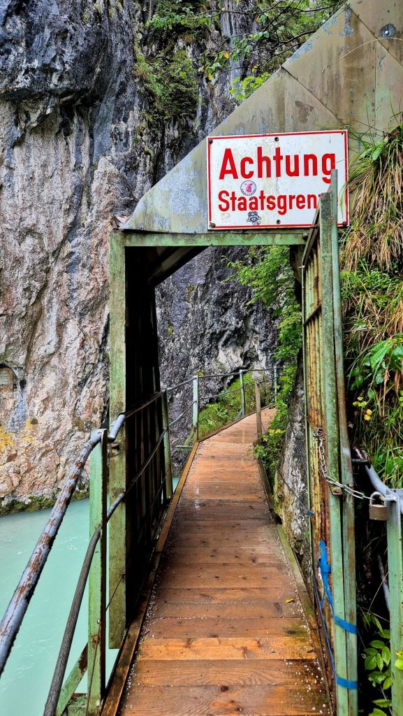
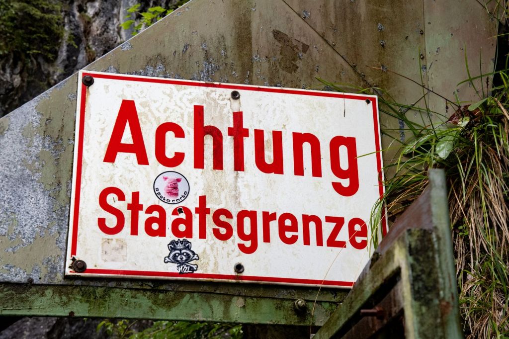
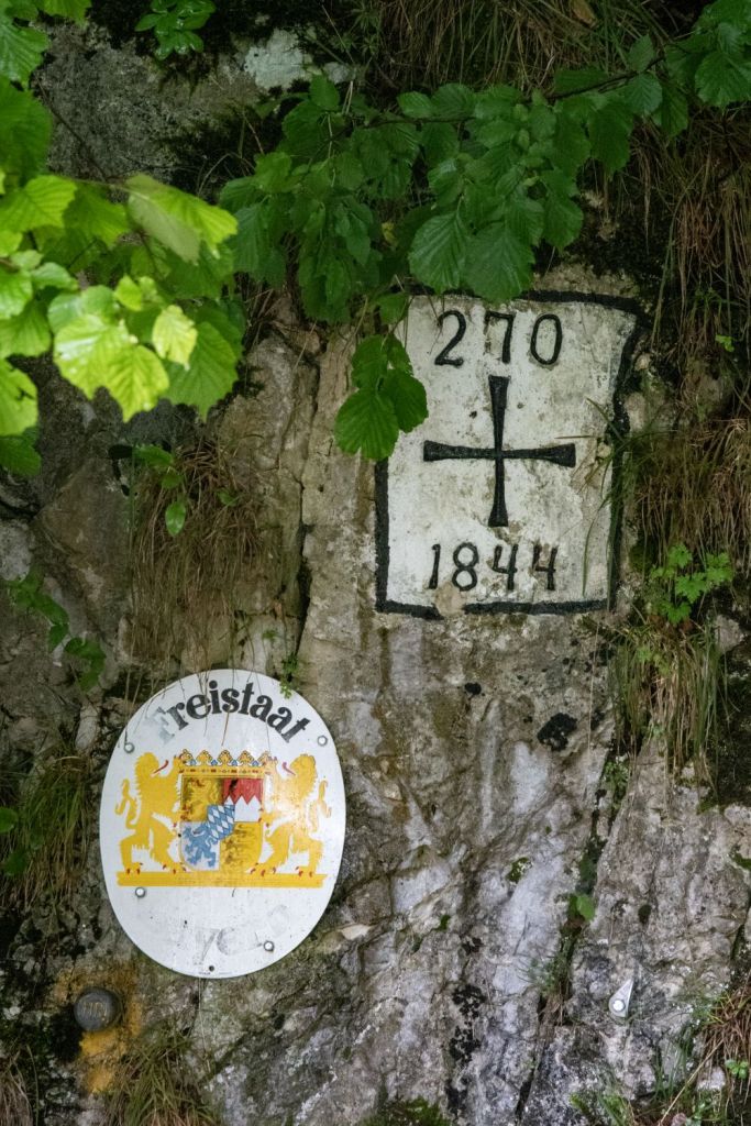
We visited this point as part of the IBRG LIVCO-25 expedition. Our focus due to time constraints was only the border between Austria and Germany, the signs and border markers. Unfortunately we did not have time to explore the gorge apart from at its entrance. The weather was not great on the day of our visit.
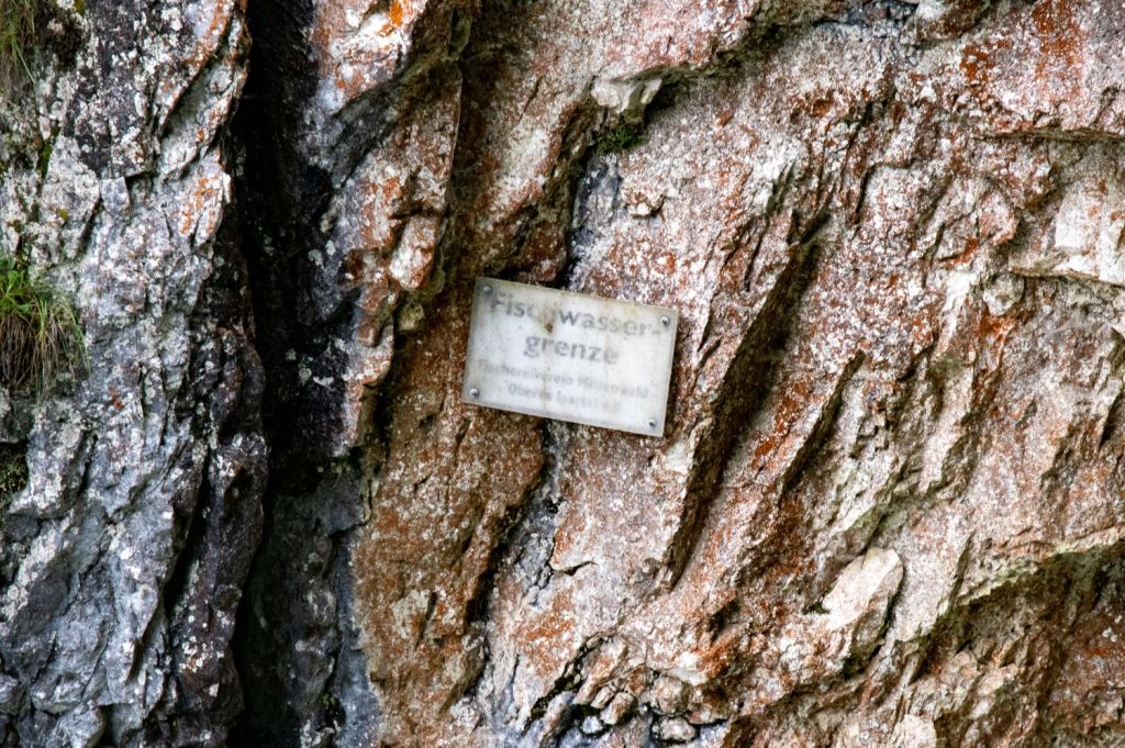
The fishing water boundary defines the spatial scope of fishing rights on rivers, lakes, or coasts, often marked by signs, bridges, or prominent geographical features. It is recorded in the fishing water register and separates sections open to fishing. The boundary is sometimes marked by boundary stones.
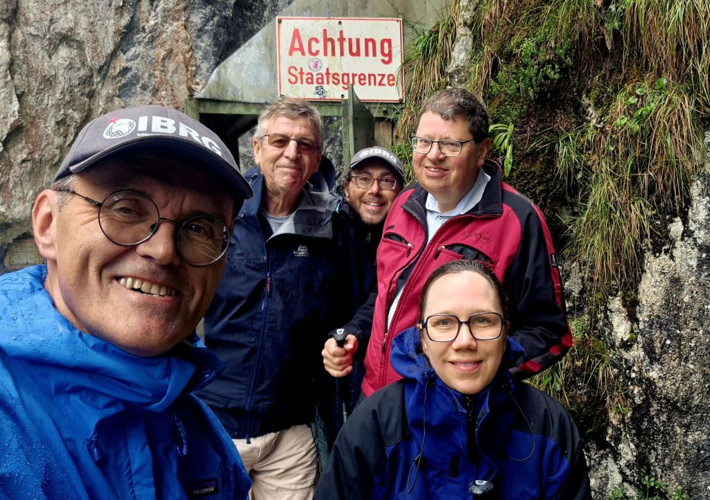
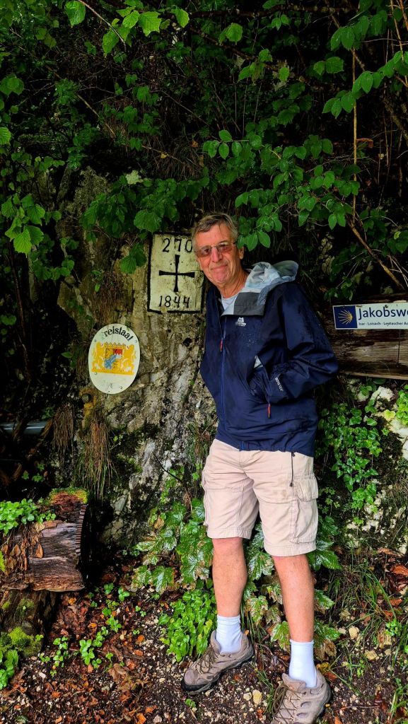
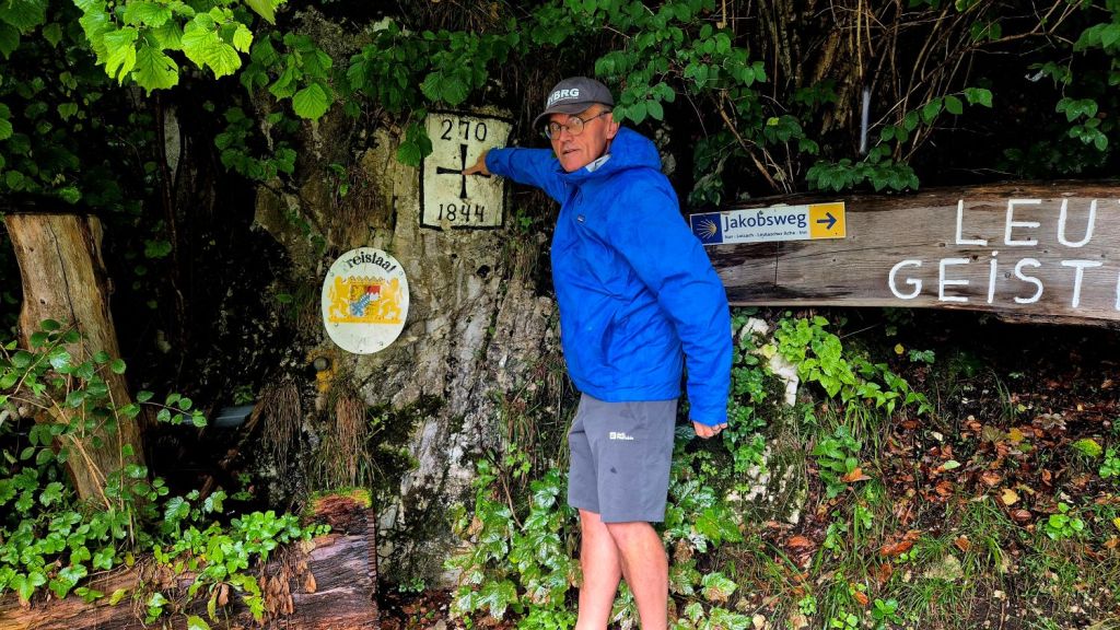

Date of Visit: 30 August 2025
