

Russia, the world’s largest country by area, stretches from Northern Asia to Eastern Europe. The Arctic Ocean borders Russia to the north and the Pacific to the east. Russia shares a maritime border with the United States. The country also has a short coastline on the Baltic Sea in the northwest. The exclave of Russia, Kaliningrad also borders the Baltic Sea as well as Lithuania and Poland. The southern borders of Russia are with Georgia, Azerbaijan, Kazakhstan, China, North Korea, and Mongolia. The western and southwestern borders of Russia are with Finland, Norway, Estonia, Belarus, Ukraine, and Latvia.
In a word, Russia is huge, twice as big as the second largest country Canada. Extending nearly halfway around the Northern Hemisphere and covering much of eastern and northeastern Europe and all of northern Asia. For most geographers today, the dividing line between Europe and Asia runs down the eastern edge of the Ural Mountains (in Russia), then along the Emba River (in Kazakhstan) to the shore of the Caspian Sea.
Russia has a maximum east-west extent of some 9,000 km and a north-south width of 2,500 to 4,000 km. There is an enormous variety of landforms and landscapes, which occur mainly in a series of broad latitudinal belts. Arctic deserts lie in the extreme north, giving way southward to the tundra and then to the forest zones, which cover about half of the country and give it much of its character. South of the forest zone lie the wooded steppe and the steppe, beyond which are small sections of semidesert along the northern shore of the Caspian Sea.
By the early 18th century, Russia had vastly expanded through conquest, annexation, and exploration to become the Russian Empire, the third-largest empire in history. The monarchy was abolished following the Russian Revolution in 1917, and the Russian SFSR became the world’s first constitutionally socialist state. Following a civil war, the Russian SFSR established the Soviet Union with three other republics, as its largest and the principal constituent. The country underwent a period of rapid industrialisation at the expense of millions of lives. The Soviet Union played a decisive role in the Allied victory in World War II, and was a superpower and rival to the United States during the Cold War. The Soviet era saw some of the most significant technological achievements of the 20th century, including the world’s first human-made satellite and the launching of the first human into space. It is a nuclear power.
Following the dissolution of the Soviet Union in 1991, the newly independent Russian SFSR renamed itself the Russian Federation. In the aftermath of the constitutional crisis of 1993, a new constitution was adopted, and Russia has since been governed as a federal semi-presidential republic. Since his election in 2000, Vladimir Putin has dominated Russia’s political system and Russia has experienced a shift from democracy towards an authoritarian state. It ranks low in international measurements of freedom of the press and civil liberties and has high levels of perceived corruption.
The Russian economy is the world’s eleventh-largest by nominal GDP and the sixth-largest by PPP. It has the world’s largest stockpile of nuclear weapons, with the fifth-highest military expenditure. Russia’s extensive mineral and energy resources are the world’s largest, and it is among the leading producers of oil and natural gas globally. It is a permanent member of the United Nations Security Council, a member of the G20, the SCO, BRICS, the APEC, the OSCE and the WTO, as well as the leading member of the CIS, the CSTO, and the EAEU. Russia is home to 30 UNESCO World Heritage Sites.
Border Facts
Russia – Norway Border consists of a 195.7-kilometer land border between Sør-Varanger, Norway, and Pechengsky District, Russia, and a 23.2-kilometer marine border in the Varangerfjord.
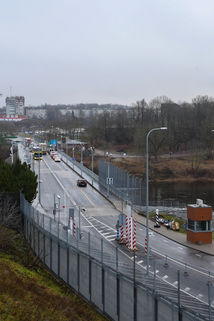
The border line was defined by a treaty in 1826 and essentially remains the same border today. It further consists of a border between the two countries’ exclusive economic zones (EEZ) in the Barents Sea and the Arctic Ocean. Between 1944 and 1991 the border was between Norway and the Soviet Union. From 1991 to 1999 it was the only border between Russia and NATO. There is one legal border crossing point, with stations on both sides, at Storskog in Norway and Borisoglebsky in Russia, located on the E105 highway some 15 km east of Kirkenes.
Since 2016 with this route being used by migrants there has been a fence built to deter migrants on the Norwegian side.
Prior to the recent Ukrainian invasion by Russia there were cross border arrangements to allow residents easier travel. Crossing the border unofficially is strictly forbidden and subject to fines and possible imprisonment. Following the invasion of Ukraine by Russia, Russian citizens are no longer allowed to cross the border.
Russia – Finland Border is 1,340 km long and runs north -south from the FINORU tripoint marked by Treriksrøysa, a stone cairn near Muotkavaara (69°03′06″N 28°55′45″E) to the shore of Gulf of Finland, in which there is a maritime boundary between the respective territorial waters, terminating in a narrow strip of international waters between Finnish and Estonian territorial waters. On the Finnish side there is a border zone up to 3km wide where a permit is required to visit. The border runs mostly through uninhabited taiga forests and sparsely populated rural areas, not following any particular natural feature or river. It is an external border of the European Union. Following the invasion of Ukraine by Russia, Russian citizens are no longer allowed to cross the border. In 2022 there is general agreement to build an anti migrant fence.
The Karelian question is a dispute in Finnish politics over whether to try to regain control over eastern Finnish Karelia and other territories ceded to the Soviet Union in the Winter War and the Continuation War. Finland are not actively seeking the return of these territories.
Russia – Estonia border is 294km long.
It begins in the Gulf of Finland. Oriented towards the south, it follows the river Narva and runs alongside Lake Peipsi before coming to an end at the tripoint formed by the Latvian, Russian and Estonian borders. The Treaty of Tartu established the border between the 2 countries. However, with the annexation of Estonia in 1940 the border in effect disappeared. Petseri county and the territory of Ivangorod passed under the control of the USSR.
In 1991, the fall of the USSR enabled Estonia to regain its independence. The border was at this point slightly modified as Russia has kept the annexed territories, notably at the southern end of the border. The final border agreement was made in 1996, although tensions still remain and have prevented an adjustment of the border in 2005 to remove anomalies such as the Saatse Boot. Cross border collaboration is occurring in the Narva area.
Russia – Latvia Border The length of the border is 214 km. From 1925 to 1945 Abrene County was part of the Republic of Latvia. On 16 January 1945, the area was transferred from the Latvian Soviet Socialist Republic to Pskov Oblast and renamed Pytalovsky District. Ever since Latvia regained independence, Latvia claimed the previous Latvian territory, on the basis of the 1920 Treaty of Riga. In 2007 a treaty on the Russian-Latvian state border was signed and ratified, and the Pytalovsky District remains part of Russia. Since 2017 the border has been demarcated with 648 border posts every 440m (approx).
Russia – Lithuania Border: The modern Lithuanian-Russian border was established after World War I. For the most part it follows the older border between former German province of East Prussia to the south with Russia to the north. The 227 km border border passes through some distinct physical features such as the Curonian Spit, the Neman River, Lake Vištytis, and Curonian Lagoon. During the period when Lithuania was part of the USSR, the boundary between Russia and Lithuania was considered an internal boundary. After the USSR broke up, Lithuania became an independent nation, and the boundary became external. There is a tripoint between Lithuania, Russia, and Poland LTPLRU.
Russia – Belarus Border is the longest shared border of Belarus being 1312 km long. The border was established in 1991. In 2011 Belarus and Russia formed a customs union and checks ceased on the border, although passport checks were sometimes undertaken. With Belarus introducing visa free travel to EU citizens in October 2016 Russia reestablished passport controls on the border. This has caused problems as some crossings have no control facilities and therefore it is necessary to enter Russia and exit Belarus at a designated crossing point.
Russia – Poland Border is a nearly straight-line division between the Republic of Poland (European Union member) and the Russian Federation (CIS member) exclave of Kaliningrad Oblast, a region not connected to the Russian mainland.
It is 232 kilometres long. Its current location and size were decided as part of the aftermath of World War II. The Poland–Russia borders were confirmed in a Polish-Russian treaty of 1992 (ratified in 1993). In 2004 it became part of the boundary of the European Union and Commonwealth of Independent States. As of 2008, there were three road crossings (Gołdap-Gusev, Bezledy-Bagrationovsk and Gronowo-Mamonovo) and three train crossing (Braniewo-Mamonovo, Skandawa-Zheleznodorozhny and Głomno-Bagrationovsk).
Russia – Ukraine Border is 2,295.04 kilometres long of which 1,974.04 kilometres a is land border and 321 kilometres is a sea border.
It extends from a point in the Black Sea 22.5 kilometres south of the Kerch Strait, where the first contact the territorial waters of both states, is to the north of this strait, passing it is on the Sea of Azov to the point on the coast which goes to the land border and so on to BYRUUA in the north. The Treaty Between the Russian Federation and Ukraine on the Russian-Ukrainian State Border was signed in 2003 and ratified in 2004. The maritime border remained a source of conflict concerning concerning the waters of the Azov Sea and the Kerch Strait.
The border between the 2 counties has been in a state of flux since 2014 with the illegal annexation of Crimea by Russia and the Russian backed separatists within Donetsk and Luhansk leading to 409.3 km of the border not being under the control of the Ukrainian government. In February 2022 Russia invaded Ukraine, for the purposes of this website the de jure situation is the one which is accepted.
Russia – Georgia Border is de jure 894 km in length and runs from the Black Sea coast in the west and then along the Greater Caucasus Mountains to the tripoint with Azerbaijan in the east, thus closely following the conventional boundary between Europe and Asia. In 2008 Russia recognised the independence of two self-declared republics within Georgia (Abkhazia and South Ossetia), meaning that in a de facto sense the border is now split into four sections: the Abkhazia–Russia border in the west, the western Georgia–Russia border between Abkhazia and South Ossetia, the South Ossetia–Russia border and the eastern Georgia–Russia border between South Ossetia and Azerbaijan. At present most of the international community refuse to recognise the independence of the two territories and regard them as belonging to Georgia. It is not possible to visit these annexed regions from Georgia.
Russia – Azerbaijan Border is 338 km in length. Prior to the dissolution of the Soviet Union it was an internal border. The border starts in the west at the Georgian tripoint and proceeds in south-eastwards direction over various mountain ridges of the Caucasus Mountains, before turning to the north-east roughly halfway and then proceeding along the Samur river valley to the Samur Delta on the Caspian Sea coast. Mount Bazardüzü, the highest peak in both Dagestan and Azerbaijan, lies on the frontier. Parts of the border are fenced and equipped with technical facilities including barbed wire, sensors and cameras.
Russia – Kazakhstan Border is 7,644-kilometre long and is the second longest in the world after the USA – Canada border. Prior to the dissolution of the Soviet Union it was an internal border. The border starts in the west at the Caspian Sea and runs in a broadly west–east direction to the tripoint with China, though in places it is extremely complex. The border consists almost entirely of a series of overland lines traversing the Eurasian Steppe, though in sections rivers are utilised, such as the Maly Uzen, Ural and Uy. The border runs across lake Botkul. In the far eastern section the border runs through the Altai Mountains.
Russia – Mongolia Border is 3,452 km long. The boundary is the third longest border between Russia and another country, behind the Kazakhstan–Russia border and the China–Russia border. The border starts in the west at the western tripoint with China, located just 100 kilometres east of the China-Kazakhstan-Russia tripoint. It then proceeds overland in a broadly north-east direction through the Altai Mountains, up to the vicinity of Mongolia’s Uvs Lake, briefly cutting into the lake so as to leave the far north-eastern corner in Russia. The border then proceeds eastwards, angled slightly to the south-east; this section also cuts across Lake Tore-Khol. The border then turns north across the Ulaan Taiga mountains, forming a broad arc through the Sayan Mountains around Mongolia’s Lake Khövsgöl. The border continues overland eastwards, arching broadly north (a short part of which utilises the river Chikoy) and then south in two long arcs, before turning north-east and then east, skirting south of Russia’s Lake Barun-Torey, to terminate at the eastern Chinese tripoint. The eastern tripoint is marked by a monument and is accessible via access roads.
Russia – China Border is 4,209.3 kilometres long and is the world’s sixth-longest international border. The China–Russian border consists of two non-contiguous sections separated by Mongolia: the long eastern section between Mongolia and North Korea and the much shorter western section between Kazakhstan and Mongolia.
The eastern border section is over 4,000 kilometres (2,500 mi) in length. According to a joint estimate published in 1999, it measured at 4,195 kilometres (2,607 mi). It starts at the eastern China–Mongolia–Russia tripoint (49°50′42.3″N 116°42′46.8″E), marked by the border monument called Tarbagan-Dakh (Ta’erbagan Dahu, Tarvagan Dakh). From the tripoint, the border line runs north-east, until it reaches the Argun River. The border follows the Argun and Amur river to the confluence of the latter with the Ussuri River. It divides the Bolshoy Ussuriysky Island at the confluence of the two rivers, and then runs south along the Ussuri. The border crosses Lake Khanka, and finally runs to the south-west. The China–Russia border ends when it reaches the Tumen River, which is the northern border of North Korea. The end point of the China–Russia border, and the China–North Korea–Russia tripoint, at (42°25′N 130°36′E), is located only a few kilometers before the river flows into the Pacific Ocean, the other end of the North Korea–Russia border.
The much shorter (less than 100 kilometres (62 mi)) western border section is between Russia’s Altai Republic and China’s Xinjiang. It runs in the mostly snow-covered high elevation area of the Altai Mountains. Its western end point is the China–Kazakhstan–Russia tripoint, whose location is defined by the trilateral agreement as 49°06′54″N 87°17′12″E, elevation, 3327 m. Its eastern end is the western China–Mongolia–Russia tripoint, at the top of the peak Tavan Bogd Uul (Mt Kuitun),at the coordinates 49°10′13.5″N 87°48′56.3″E.
Russia – North Korea Border is very short consisting of 17.3 kilometres of land border and 22.1 km of maritime border. It is the shortest of the international borders of Russia. The terrestrial boundary between Russia and North Korea runs along the thalweg of the Tumen River and its estuary, while the maritime boundary separates the two countries’ territorial waters in the Sea of Japan. The principal border treaty was signed on April 17, 1985. A separate, trilateral treaty specifies the position of the China–North Korea–Russia tripoint. The North Korea–Russia and China–North Korea borders run along the middle of the Tumen River, while the China–Russia border approaches the junction point overland from the north. Because the theoretical tripoint is in the middle of the river, where it would be impractical to install a border monument, the agreement provides instead that the three countries install border monuments on the riverbank, and that the position of the tripoint be determined with respect to those monuments
Russia – Japan Border is the de facto maritime boundary that separates the territorial waters of the two countries. According to the Russia border agency, the border’s length is 194.3 km. Prior to 1945 there was a land border on the the island of Sakhalin. The existing de facto Russian-Japanese border follows several sea the straits: the La Pérouse Strait, the Nemuro Strait, and Izmeny Strait (Notsuke Strait) and the Sovietsky Strait, which separate Sakhalin and the Kuril Islands from the Japanese island of Hokkaido. In Japan’s view, the de jure border passes through the La Perouse Strait and the Vries Strait . Japan claims the southern group of the Kuril Islands (e.g. Iturup, Shikotan, Kunashir and Habomai), which were occupied by the Soviet Union in 1945 and incorporated into its Sakhalin Oblast. Russia treats the islands as an integral part of the country.
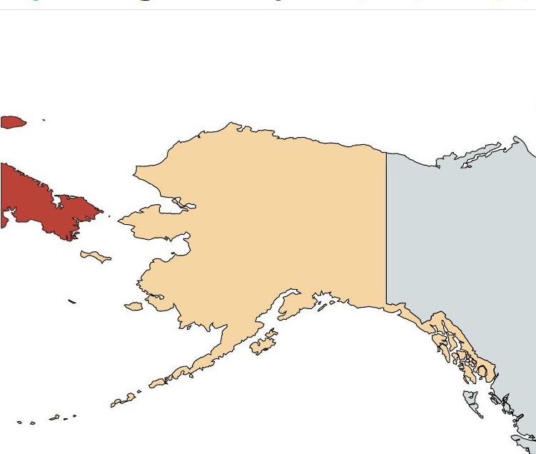
Russia -USA Border The Russian mainland and mainland Alaska are separated by the Bering Strait measuring about 81 km. When the United States purchased Alaska from Tsarist Russia, the two nations drew a line between two small islands in the Bering Sea to designate the boundary. The distance between Big Diomede, which is on the Russian side and Little Diomede on the US side, is roughly 3.9km. The border also serves as the International Date Line. In winter it is possible to walk between the islands. The US island is occupied by Inuit people whereas the Russian island is a military base.
Russian Tripoints
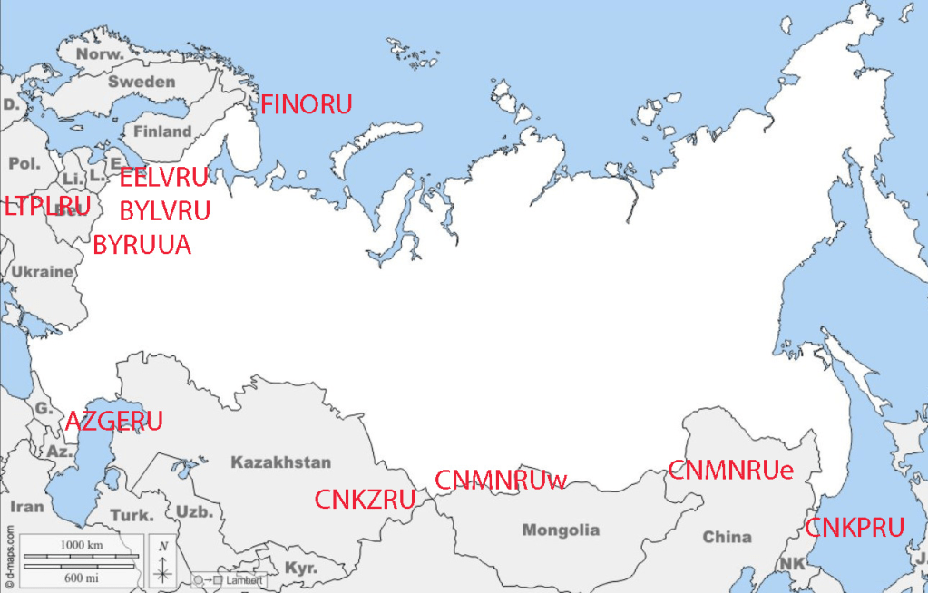
| NUMBER | NAME | COUNTRIES | COORDINATES | TYPE | LINKS | |
| 1 | AZGERU | Azerbaijan – Georgia – Russia | 41°54’45″N 46°25’32″E | Dry | The tripoint is located at Pereval Machkhalroso pass (2790m) in the Caucasus Mountains | |
| 2 | BYLVRU | Belarus – Latvia – Russia | 56°10’12″N 28°09’04″E | Wet | The tripoint is located at the confluence between a small creek and the Zilupe river. The are border markers in each country each marked with Neverica. There is a bridge crossing the river into Russia> BM#001 LVRU are on either side of the bridge. Slightly to the west there is a similar bridge leading from Latvia to Belarus. BM#001 BYLV are on either side. All the borders are well demarcated. Prior to Latvia becoming independent this was a joint festival area, and there are many monuments situated on either side. Since the invasion of Ukraine these bridges have been removed. Deeleman (2015) Krogh (2003) | |
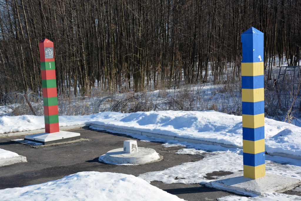
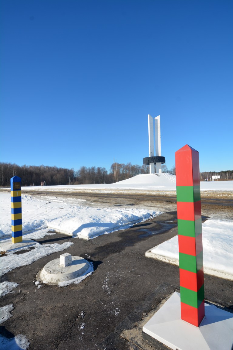
| 3 | BYRUUA | Belarus – Russia – Ukraine | 52°6’44″N 31°46’53″E | Dry | The tripoint is located at Senkivka and is marked by the Three Sisters monument which symbolises the friendship of peoples. Visited from UA. 3 border crossing points close together. Several border markers and national signs. My favourite tripoint. In 2024 the monument is likely to be dismantled following the Russian invasion of Ukraine. Krogh (2012) | |
| 4 | CNKPRU | China – North Korea – Russia | 42°25’6″N 130°38’17″E | Wet | The tripoint is located in the Tumin river at the intersection the North Korea–Russia and China–North Korea borders that run along the middle of the Tumen River with the China–Russia border that approaches the junction point overland from the north. The principal border treaty was signed on April 17, 1985. The 3 countries have tripoint monuments on their respective banks. Interpretation of various treaties may mean that a China–North Korea border zone exists in the river forming a condominium meaning the tripoint technically is not located there. Krogh (2011) | |
| 5 | CNKZRU | China – Kazakhstan – Russia | 49°6’57″N 87°17’9″E | Dry | The tripoint is located on a ridge junction 8km east of an unnamed remote peak. | |
| 6 | CNMNRUe | China – Mongolia – Russia (east) | 49°50’44″N 116°42’51″E | Dry | The tripoint is marked by the border monument called Tarbagan-Dakh and is accessible via access roads. Marker is elevated above salt marsh on stilts. | |
| 7 | CNMNRUw | China – Mongolia – Russia (west) | 49°10’40″N 87°49’24″E | Dry | The tripoint is located at the summit of Nairamdal Peak or Friendship Peak (4,082 m) which is the one of five peaks of the Tavan Bogd mountains. | |
| 8 | EELVRU | Estonia – Latvia – Russia | 57°31’05″N 27°21’05″E | Wet | The tripoint is between the towns of Misso (Estonia), Pededze (Latvia) and Palkino (Russia. The tripoint is located in the Pededze river where the LVRU border intersects with the EERU border. 70m north of the its confluence with the Laikupe river (EELV border). It is accessible from EE and LV (permit required). The Estonians have demarcated their side of the border and BM#001 is located there. Deeleman (2015) Krogh (2003) Wallis (2007) | |
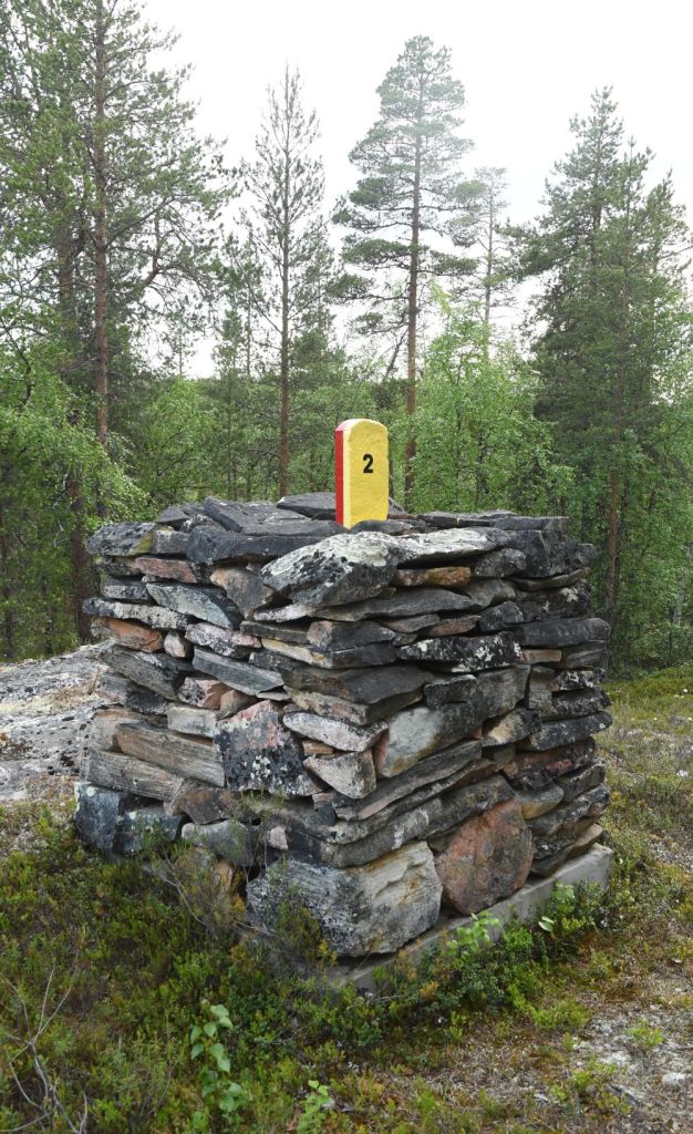
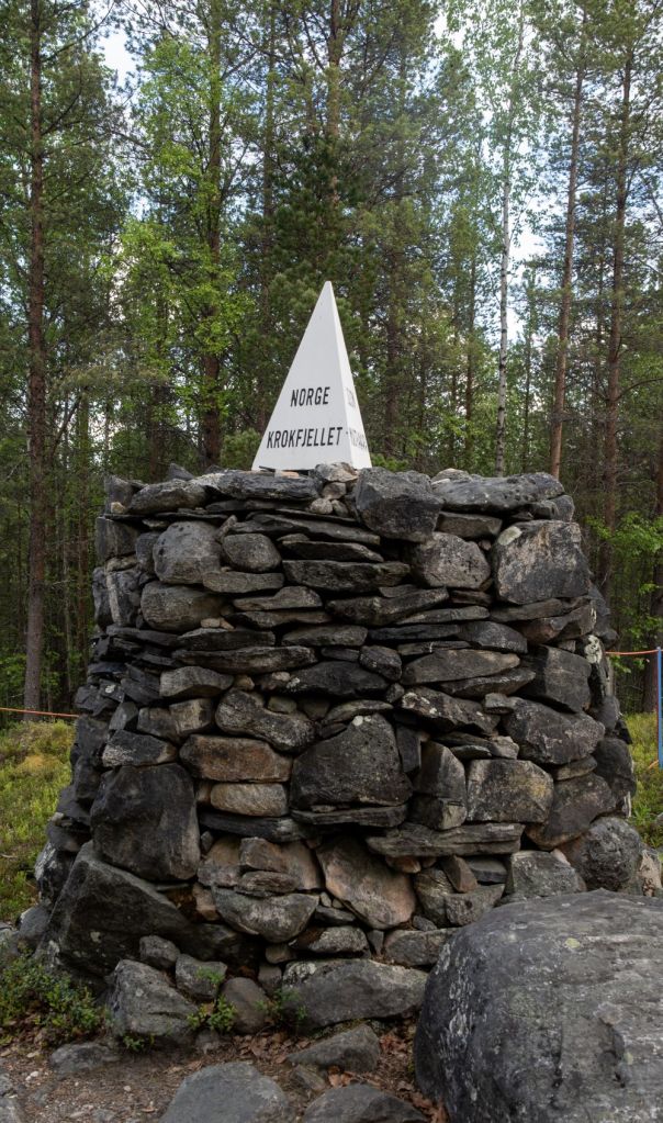
| 9 | FINORU | Finland – Norway – Russia | 69°03’07″N 28°55’44″E | Dry | Treriksrøysa (‘Three-Country Cairn’) is a cairn which marks the tripoint. The site is on a hill called Krokfjellet (Norwegian) or Muotkavarre (Finnish and Russian), in the Pasvikdalen valley. It is the only place in Europe where three time zones meet. The tripoint is marked by a cairn (which is unnumbered). There is a white pyramid on top with the respective countries names written on. Krogh (2012) Van der Giessen (2024) | |
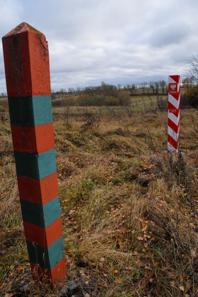
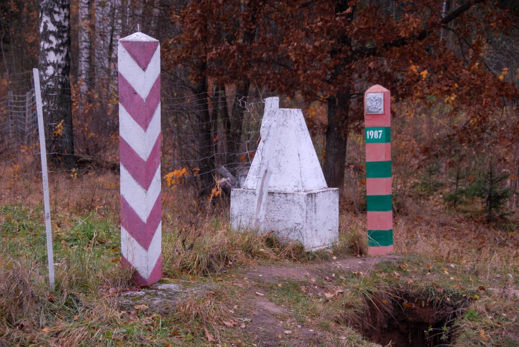
| 10 | LTPLRU | Lithuania – Poland – Russia | 54°21’48″N 22°47’31″E | Dry | This tripoint has added interest not only because of the proximity to the Russian exclave of Kaliningrad but that the point also forms the division between 2 Polish administrative divisions: Podlaskie Voivodeship and Warmian-Masurian Voivodeship, a quadripoint of sorts. In 2009 when I visited the old style tripoint monument, in 2010 a new granite monument was built and the area landscaped. In 2024 there are fortification to separate the RU section. Deeleman (2015) Krogh (2011) Wallis (2007) |
Tripoint Gallery
Please click in the images below to access tripoint visit reports
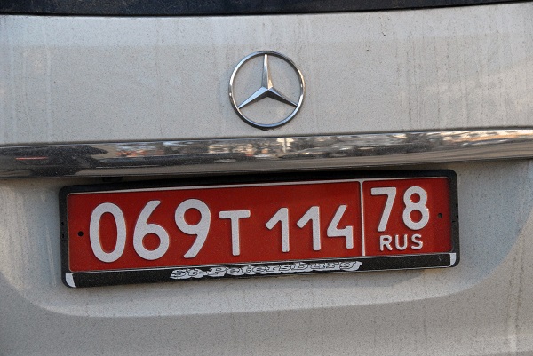
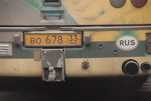
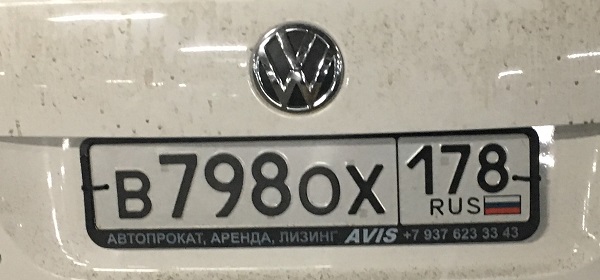
Russian Registration Plates

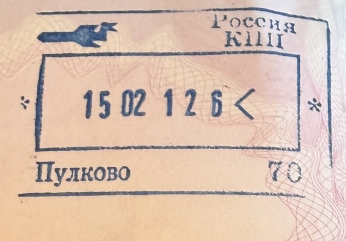
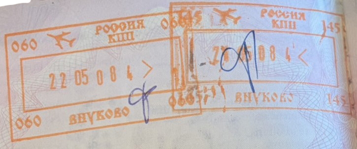
Russian Passport Stamps


Site Navigation
In order to find your way around the site, either click on the links (text in red) or use the menus at the top and side of the pages. About leads you to the main areas of the site. The European Tripoints menu leads directly you to my TP visits reports whereas the Country Visits page allows you to choose which country to look at first

Mobile Advice
Tables display correctly when holding your mobile horizontally.
To access the links to other pages please click on the 3 horizontal dots at the bottom of the page.

