
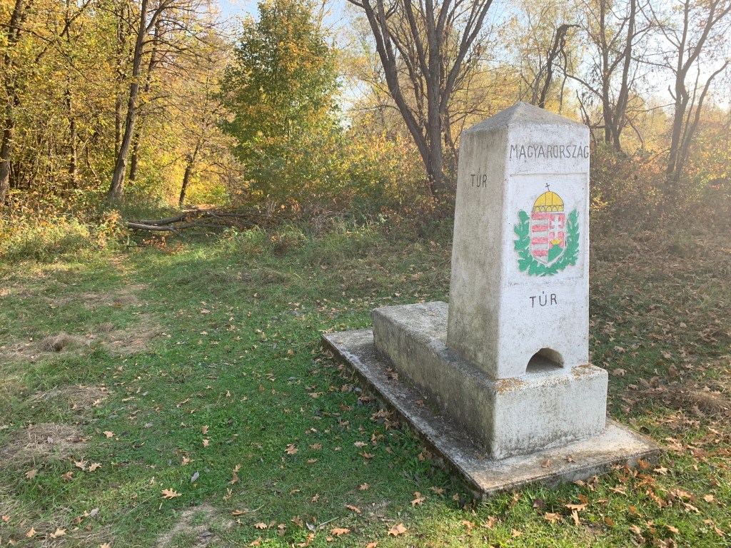
Hungary -Romania – Ukraine Tripoint is mainly visited from the Hungary side where there is easy access by foot to the site. The border is clearly demarcated by the river Tur (the border between Hungary and Romania at this point) and by border markers between Hungary and Ukraine. Each country has a similar monument on their territory which are in theory visible from one another. The tripoint is therefore a wet tripoint. (On my visit in October the foliage was dense and it was only possible to see the Ukranian monument from both countries, just.) The Hungary–Romania border is an internal border of the European Union, but as Romania is not part of the Schlengen zone it is technically not allowed to cross this border outside an official border crossing. Both Hungary’s and Romania’s borders with Ukraine are the external border of the EU. This tripoint is close to the eastern most point of Hungary. Both Romania and Ukraine are on Eastern European Standard time (one hour ahead of Hungary).
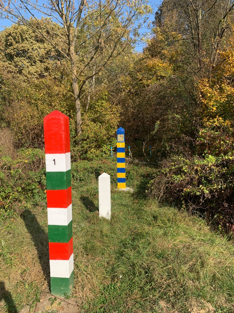
I decided prior to my visit to see if it was possible to visit and photograph each monument. This was not without its challenges as the lack of photos of either the RO or UA monument would indicate. In contrast the HU monument was easily located and there were supplemental border markers near by.
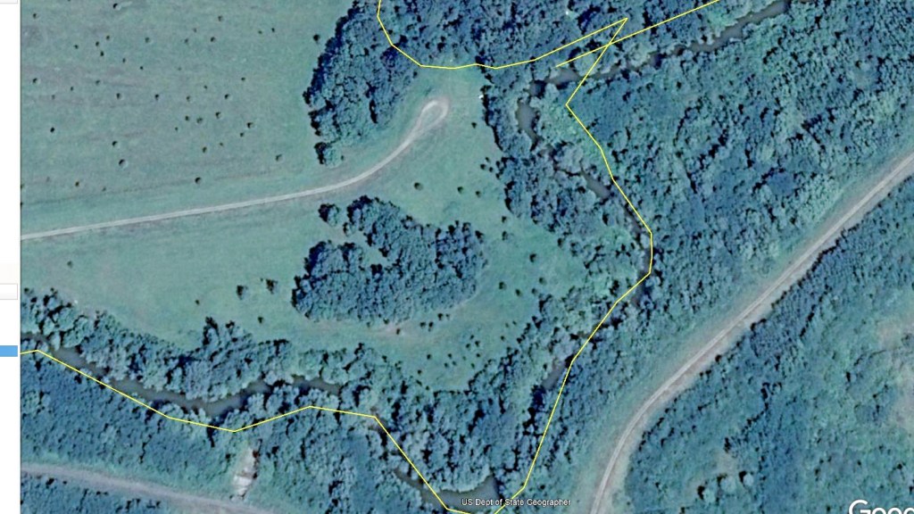


HUROUA Actual Wet Tripoint

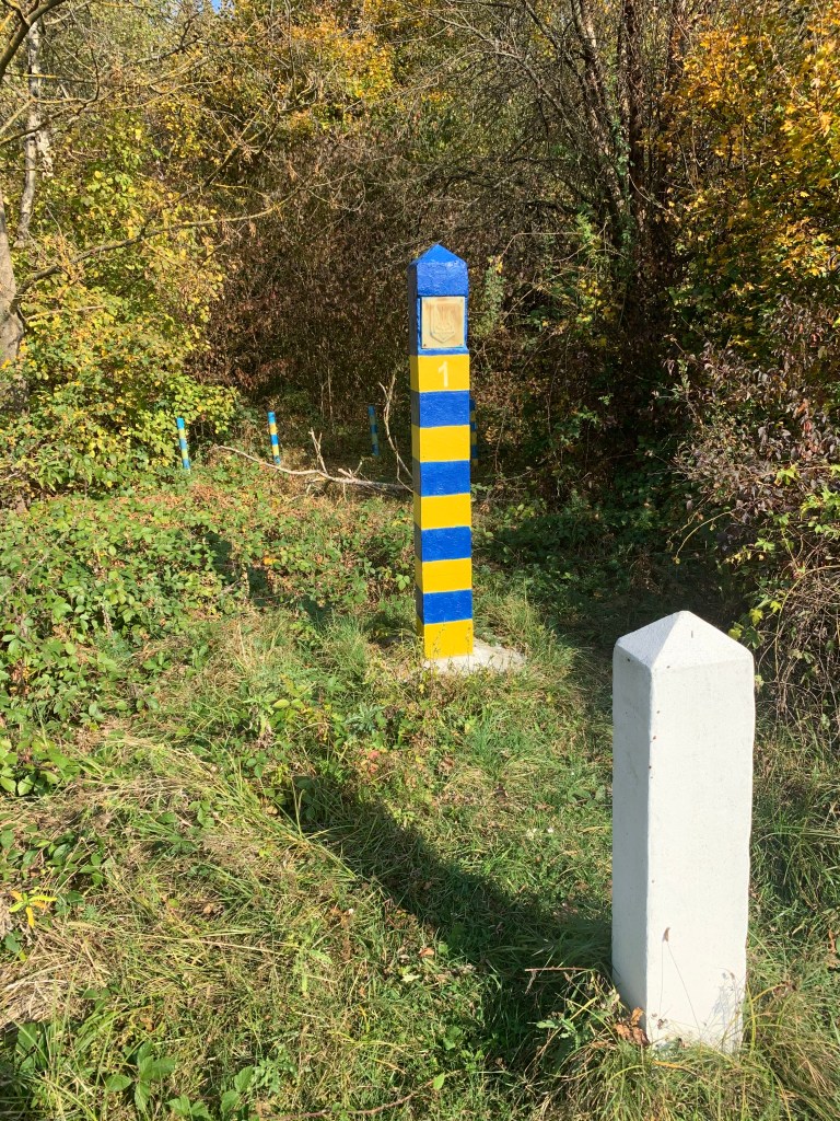
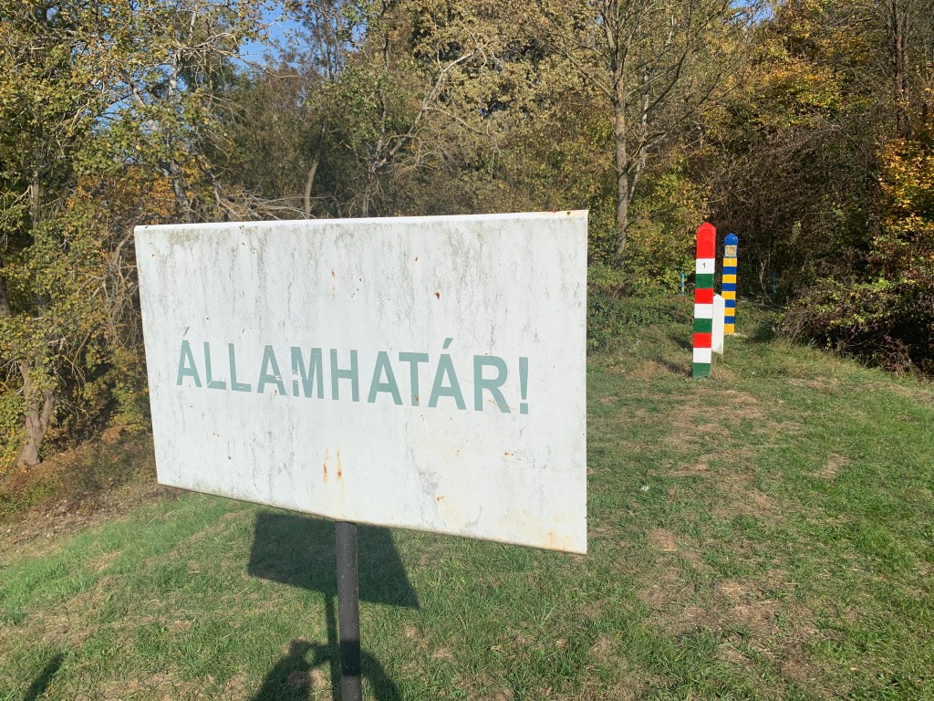
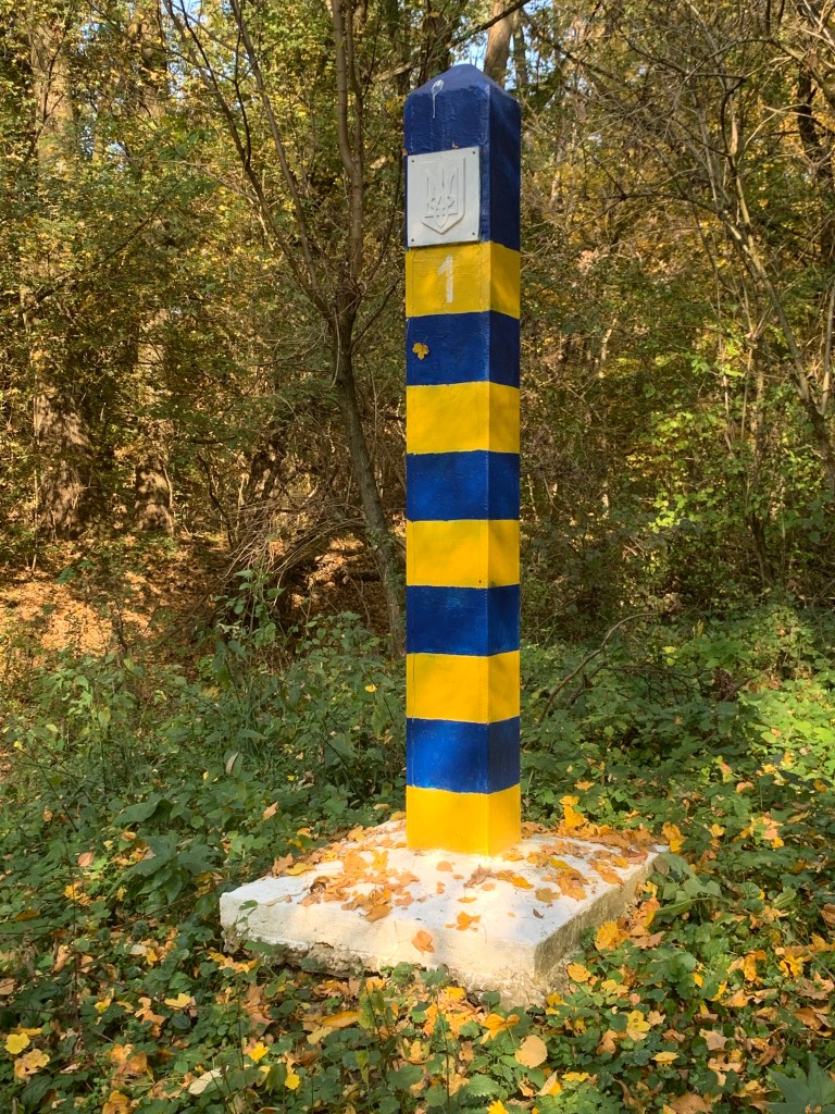
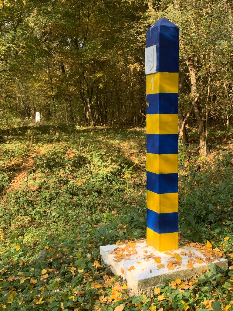
HUROUA – Hungarian Side
The Hungarian side had an easy access road from the bridge that crossed the Tur and although signs said no vehicle access it was possible to drive directly to the tripoint.


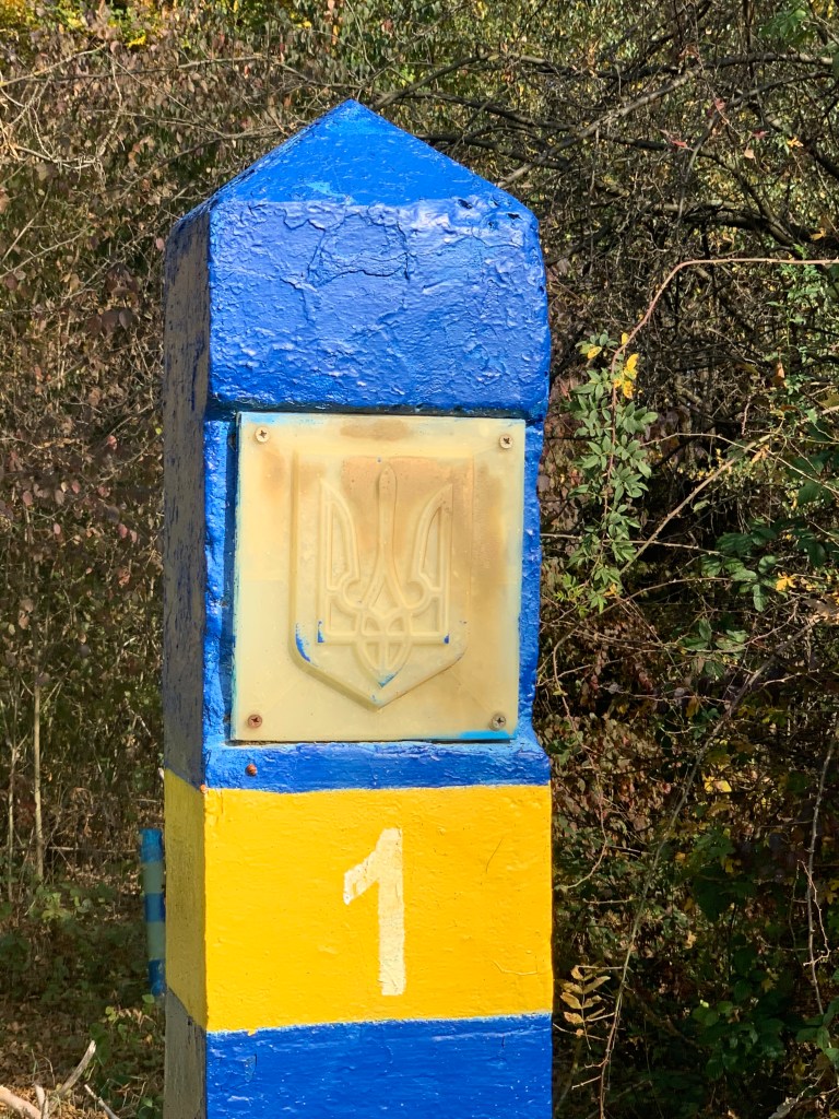

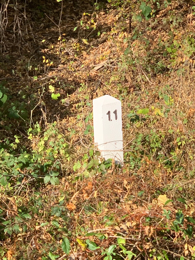


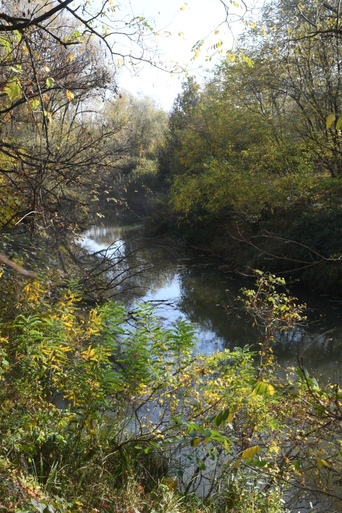
HUROUA – Ukrainian side


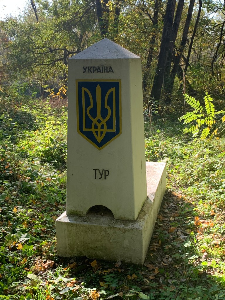
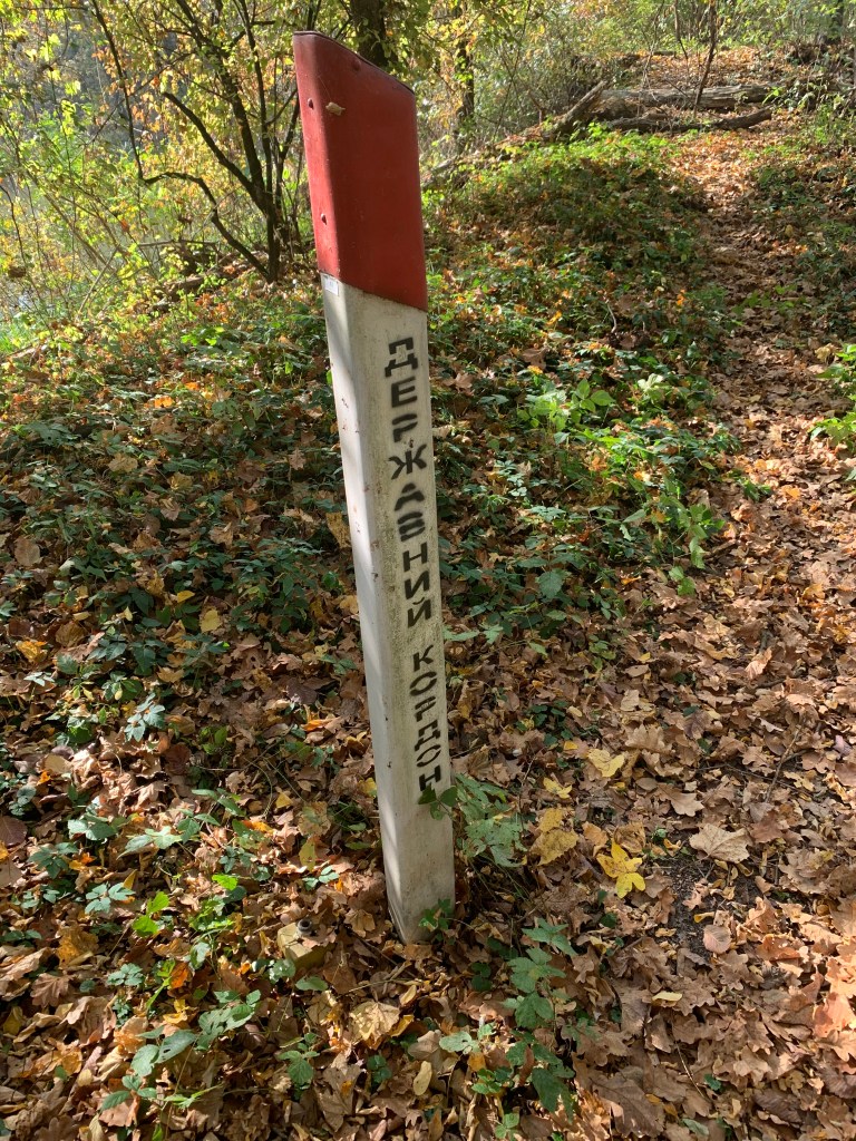
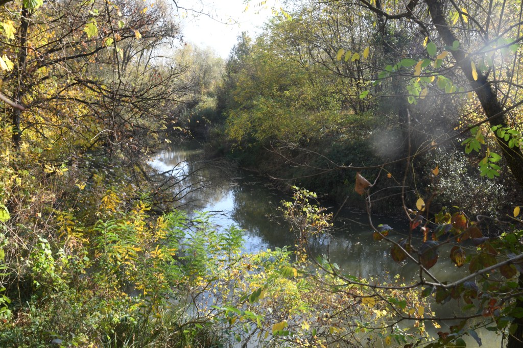
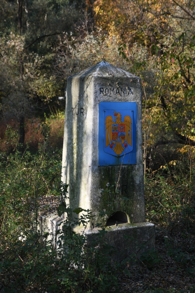
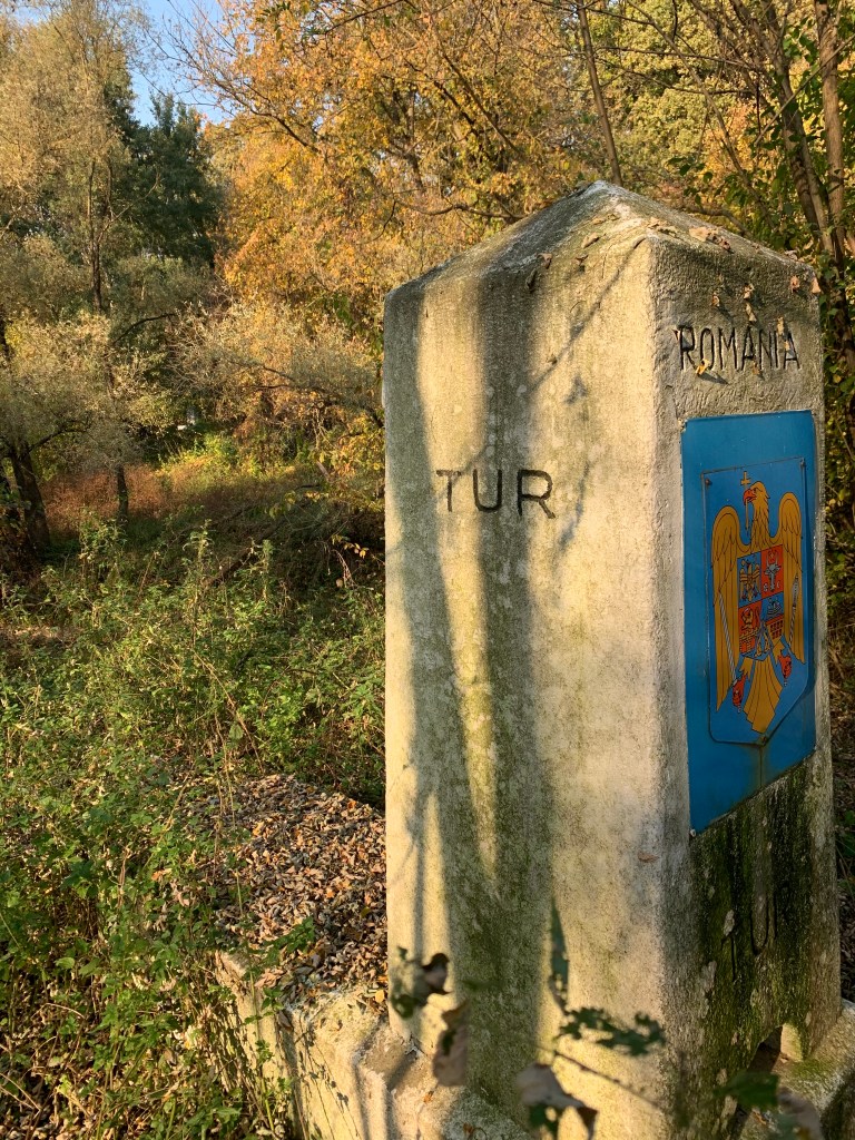
HUROUA – Romanian side
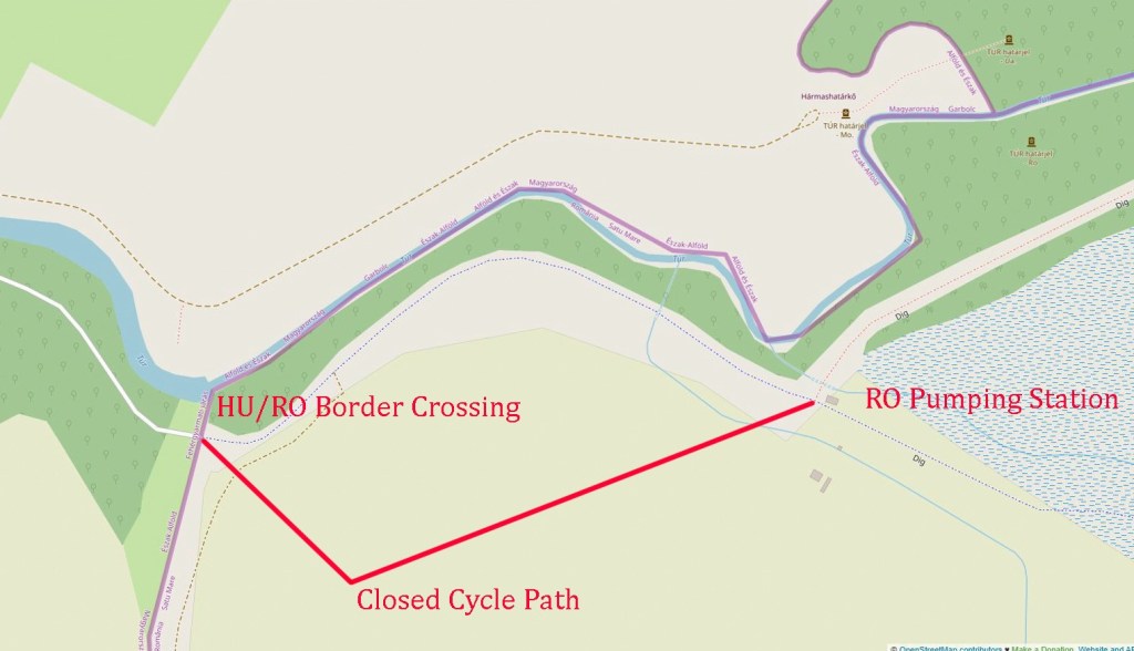
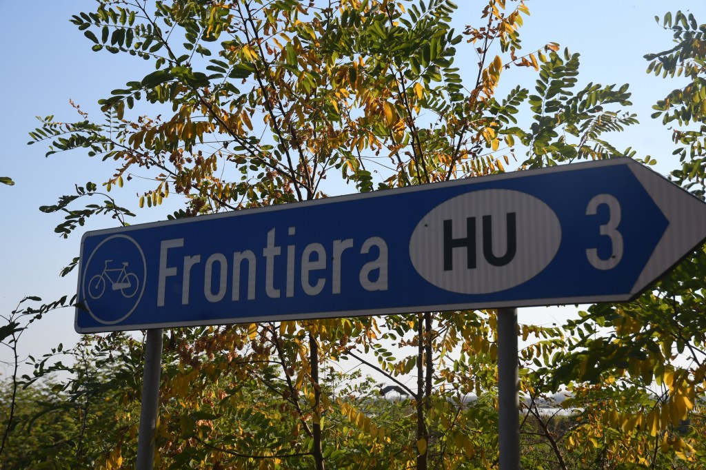
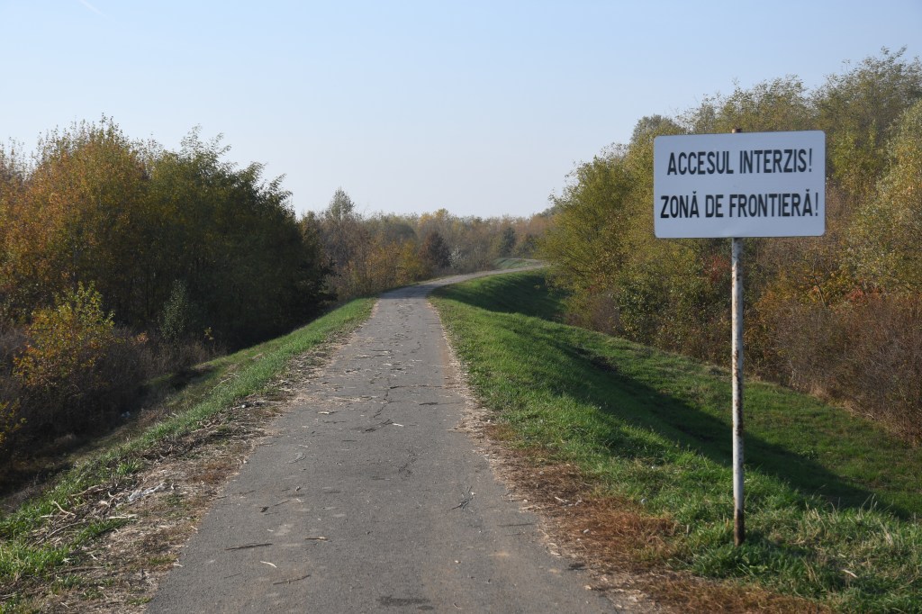
Although close in terms of distance (600m) from the HU monument, getting to the Romanian side was problematic. Initially I had planned to use the cycle path on the other side of the river. This would have involved crossing the HU/RO border unofficially as Romania is not part of the Schlengen area. On investigation however whilst this would have been a straightforward walk in, the presence of Romanian borderguards just over the border meant I needed to drive 40 km and enter officially. See my report on the bordercrossing on the other side of the Tur here

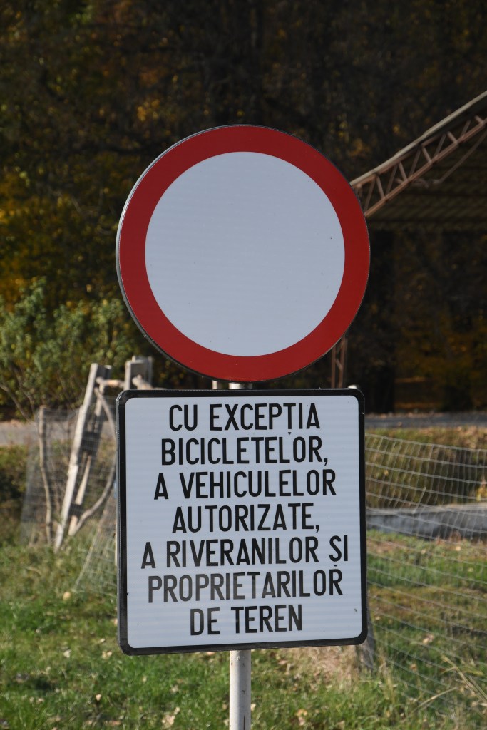
For those of you who wish to visit this side the closest point to drive to is indicated on the map so its on foot from there. It is approximately 4 km to the tripoint along a cycle way. Signs indicate that cars are not allowed. It was not clear if the monument was in a restricted border zone, the cycle path was only usable up to the pumping station.


On returning to the car I noticed that the Romanian Borderguards I saw earlier was parked nearby. They were focusing possible smuggling of cigarettes from Ukraine and were polite and curious why a tourist was there. Were not happy with me taking their picture although I could take a photo of their car (without the license plate).

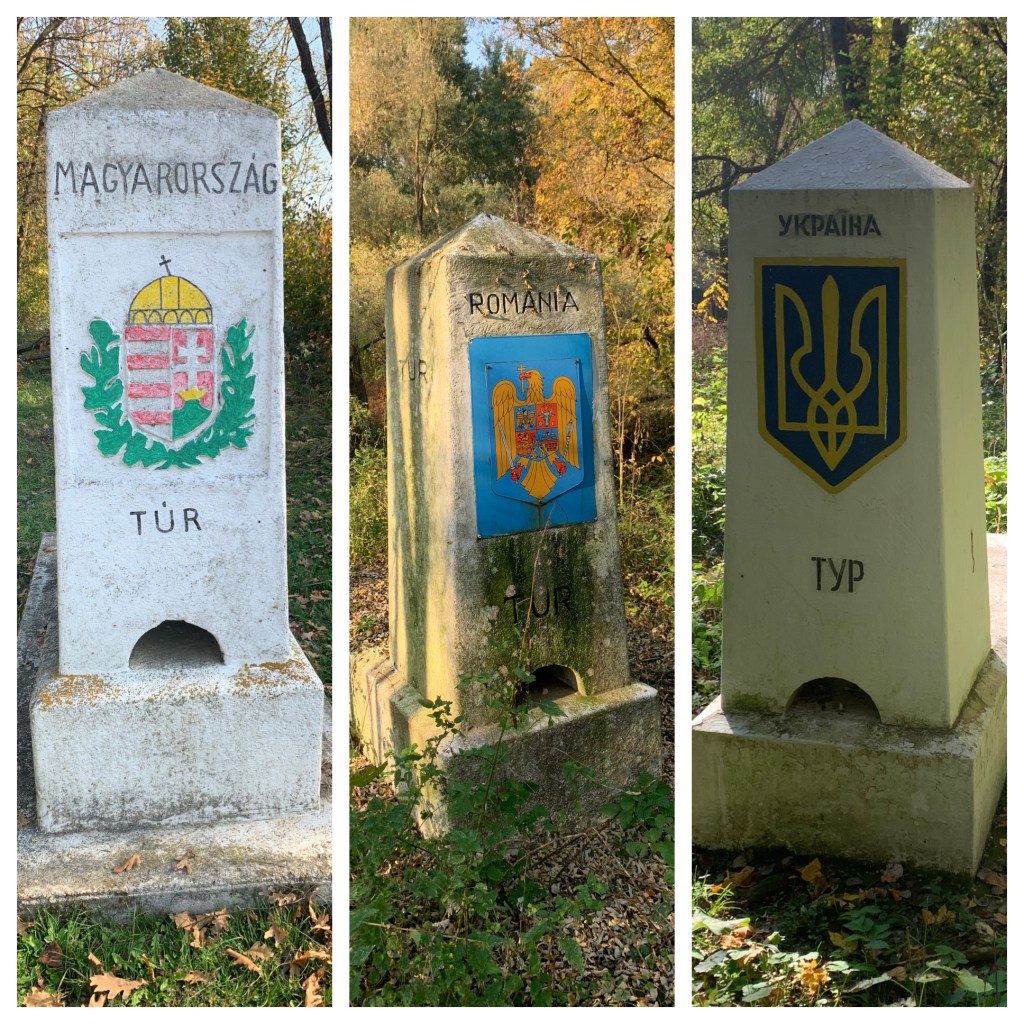
The 3 Monuments together. A unique photograph that sums up the goal of the day. Wet tripoints can appear a little disjointed unless all 3 sides can be accessed. These monuments stitch the tripoint together for me. In terms of challenge and risk this visit was up there. A celebration glass of wine or two was drunk when I was safely away from the border and in my hotel.


Click on the flags above to access further country specific information and more border POI’s

Date of Visit: 25/10/2019. Visiting the Hungarian side is straightforward and would probably take an hour to see everything. Visiting the other 2 sides took much more time but gave a much greater sense of the geography and difference between the 3 countries.

I would love to go to all three of those countries someday!
LikeLike
Really great pictures – thanks for sharing. I went to Kremenec in 2018 and would like to get to this one someday as well as SK/HU/UA at Chop.
LikeLike