
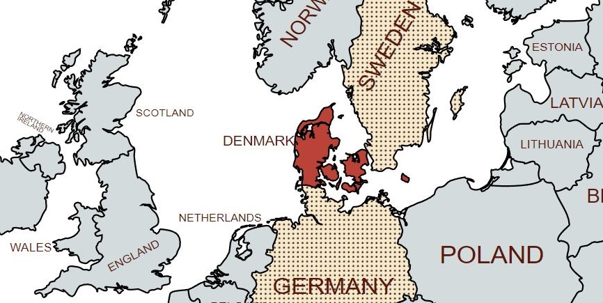
Denmark (Danish: Danmark) is a Nordic country in Northern Europe. It is the most populous and politically central constituent of the Kingdom of Denmark, a constitutionally unitary state that includes the autonomous territories of the Faroe Islands and Greenland in the North Atlantic Ocean. European Denmark is the southernmost of the Scandinavian countries, lying southwest of Sweden, south of Norway, and north of Germany. It shares the longest maritime boundary in the world at 2,646 kilometres. with Canada, and since 2022 a new land border with Canada on Hans Island.
Spanning a total area of 42,943 km2 it consists of the peninsula of Jutland and an archipelago of 443 named islands, of which the largest are Zealand, Funen and the North Jutlandic Island.
The island of Bornholm is located east of the rest of the country, in the Baltic Sea. Many of the larger islands are connected by bridges; a bridge-tunnel across the Øresund connects Zealand with Sweden; the Great Belt Fixed Link connects Funen with Zealand; and the Little Belt Bridge connects Jutland with Funen. Ferries or small aircraft connect to the smaller islands.
The Kingdom of Denmark includes two overseas territories, both well to the west of Denmark: Greenland, the world’s largest island, and the Faroe Islands in the North Atlantic Ocean. These territories are self-governing under their own parliaments (the Løgting and Inatsisartut) and form, together with continental Denmark, part of the Danish Realm.
Denmark is a highly developed country with a high standard of living: the country performs at or near the top in measures of education, health care, civil liberties, democratic governance and LGBT equality. Denmark is a founding member of NATO, the Nordic Council, the OECD, OSCE, and the United Nations; it is also part of the Schengen Area. Denmark maintains close political, cultural, and linguistic ties with its Scandinavian neighbours.
In 1973, Denmark, together with Greenland but not the Faroes, became a member of what is now the European Union, but negotiated certain opt-outs, such as retaining its own currency, the krone.
Border Facts
Denmark – Germany Border is 68 km long. The border with Denmark has moved over time. The current border being established in 1920. The border marks the separation between the regions of Schleswig-Holstein in Germany and Jutland in Denmark. It begins in the west, to the south of Tønder, and ends in the east, to the north of Flensburg.
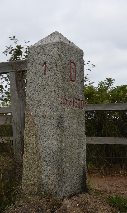
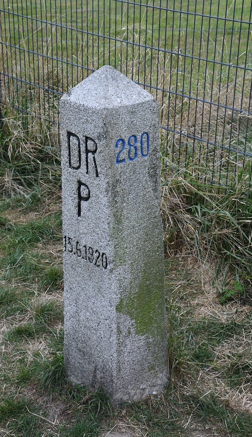
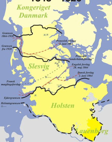
The demarcation of the border between Germany and Denmark followed the signing in 1864 of the Gastein Convention, bringing to a close the Danish-German war after which Denmark ceded some of its territories to the members of the German Confederation. Following the end of WW1 the border was moved about 50 km southwards to it’s present position, as determined by the Schleswig referendum in 1920. This approximately followed the not clearly defined language border.
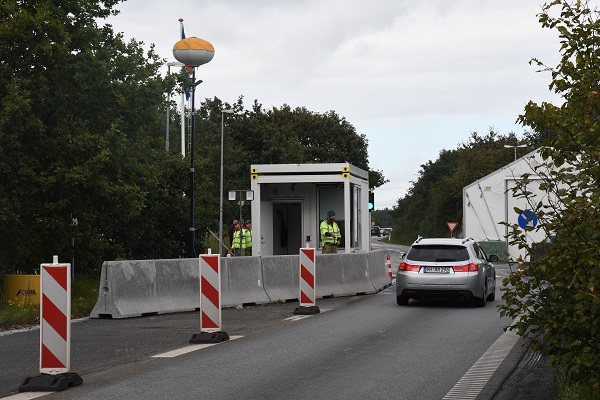
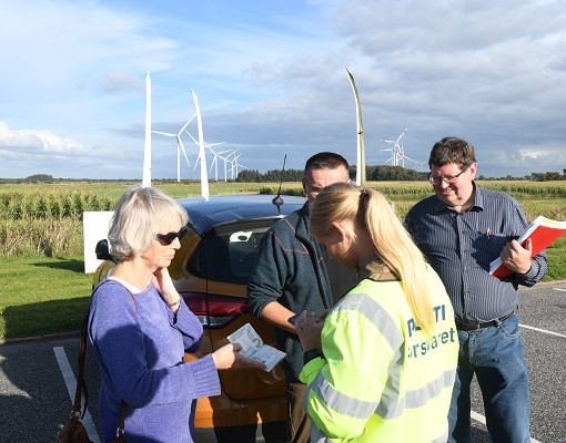
In 2001, all border controls were removed based on the Schengen Agreement. However, due to the migrant crisis in 2016 temporary border controls were reestablished, these are still in place in 2019. Controls between Sweden have also been reintroduced as a response to illegal migration. Border closures occurred in 2020 at the height of the COVID 19 crisis where movement between Denmark and Germany was severely restricted with many border crossings closed completely. Many thanks to my fellow border enthusiast Steen Schelde for these photos.
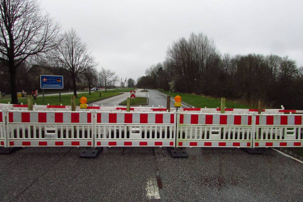
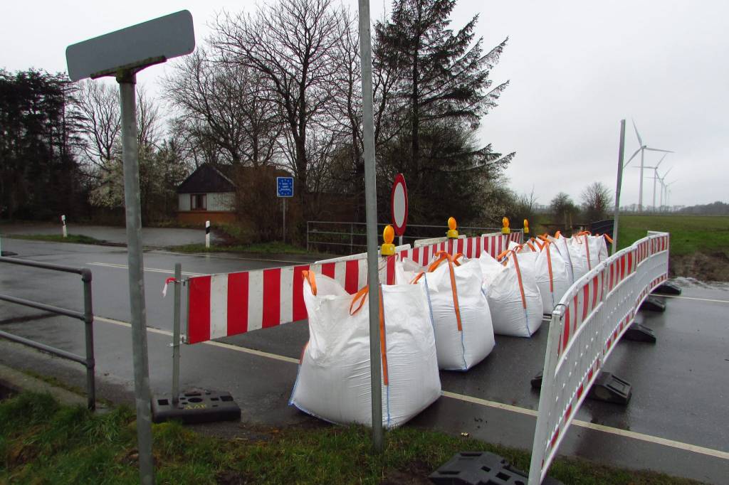
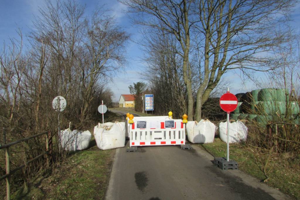
In 2021 there were ad hoc border control checks on many crossings visited as part of the IBRG DEDK21 trip.
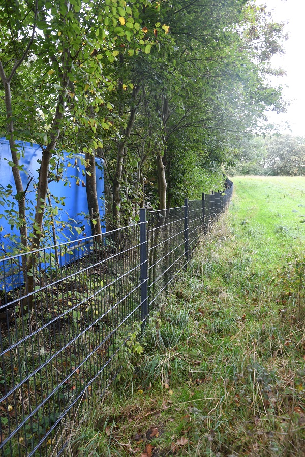
In January 2019, the Danish government began constructing a fence along the border in an attempt to keep wild boar, which can carry African swine fever virus, from crossing into Denmark. Whilst interesting from a border perspective it is actually very effective and stopping border visits and close scrutiny of border markers.
The 1.5-meter tall and half-meter deep fence cost €11 million. It runs along the entirety of the Danish-German border, from the Wadden Sea in the west to the Flensburg Fjord in the east. Critics say it is a waste of money that won’t work against a problem that doesn’t exist, while environmentalists have raised concerns about its impact on the ecosystem. The fence is also symbolic for the Danish right-wing keen on hard borders and keeping migrants out. Others focus on the potential impact of ASF on the 5,000 pig farms that export 28 million pigs annually, accounting for half of Danish agricultural exports and 5% of all exports, according to the Danish Agriculture and Food Council.
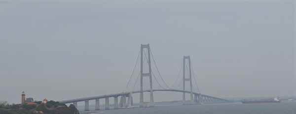
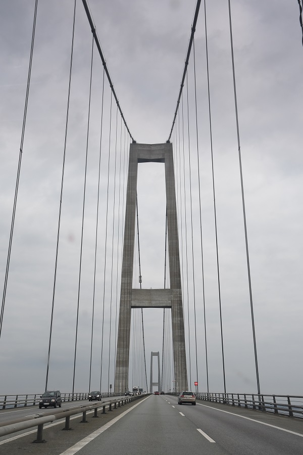
Denmark – Sweden Border dates from 1658. It is entirely a maritime border, along Kattegat and Øresund, and in the Baltic Sea between Bornholm and Scania. The territorial waters (12 mile zone) of the two countries meet exclusively along the Øresund, extending to about 115 kilometres (71 mi), approximately between Höganäs and Falsterbo. There is one road and rail connection, the 16 kilometres long Øresund fixed link, opened in 2000, besides a number of ferry links.
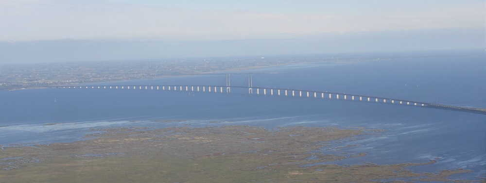
The towns of Malmö (Sweden) and Copenhagen (Denmark) are linked by the Øresund Bridge which crosses the strait of the same name. Construction of the bridge began in 1995 and was completed in 1999. Initially inferior to forecasts, traffic flow increased significantly in 2005, likely linked to the growing phenomenon of Danish citizens acquiring homes in Sweden (where property prices are lower).
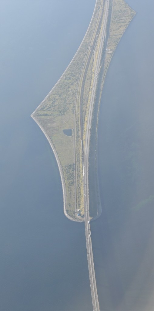
The Øresund Bridge (Danish: Øresundsbroen is a combined railway and motorway bridge across the Øresund strait between Denmark and Sweden. It is the longest in Europe with both roadway and railway combined in a single structure, running nearly 8 kilometres from the Swedish coast to the artificial island Peberholm in the middle of the strait. The crossing is completed by the 4-kilometre Drogden Tunnel from Peberholm to the Danish island of Amager.
Denmark is situated 4km off the Swedish coast and the bridge is of a total length of 7845 metres. The two regions linked by the bridge form the Øresund cross-border territory. This space comprises more than 3,730,000 inhabitants, and by way of its unique situation, is very advanced in terms of cross-border cooperation.
With both Sweden and Denmark being part of the Nordic Passport Union since the 1950s, border controls between the two countries have been abolished for decades and travellers can normally move freely across the Øresund Bridge. In 2001, both countries also joined the Schengen area, and since then the abolishment of border controls is primarily regulated by European Union law. However, in November 2015, during the European migrant crisis, Sweden introduced temporary border controls at the border to Denmark.
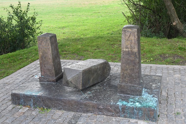
Greenland (Denmark) – Canada Border the maritime boundary between Canada and Greenland originates in the North Atlantic Ocean and follows a northerly course through Davis Strait and Baffin Bay until it reaches the Arctic Ocean. The boundary was established through a bilateral agreement that was finalized in 1973. A territorial sovereignty dispute (now solved) over tiny Hans Island briefly interrupts what is otherwise the longest maritime boundary in the world at 2,646 kilometres.
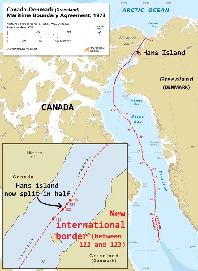
Hans Island is an island in the centre of the Kennedy Channel of Nares Strait in the high Arctic region, split between the Canadian territory of Nunavut and the Danish autonomous territory of Greenland. The island itself is barren and uninhabited with an area of 130 hectares, measuring 1,290 by 1,199 metres, and a maximum elevation of 168.17 m. It was the location for the most friendly border dispute ever – the so called “Whisky Wars”. In 1984, Canadian soldiers visited the island and planted a Canadian flag, also leaving a bottle of Canadian whisky. The Danish Minister of Greenland Affairs came to the island himself later the same year with the Danish flag, a bottle of Schnapps, and a letter stating “Welcome to the Danish Island” (Velkommen til den danske ø). The two countries proceeded to take turns planting their flags on the island and exchanging alcoholic beverages.
Hans Island is the smallest of three islands in Kennedy Channel off the Washington Land coast; the others are Franklin Island and Crozier Island. The strait at this point is 35 km wide, placing the island within the territorial waters of both Canada and Denmark (Greenland). A 1,280-metre-long border traverses the island. In 2022 the respective governments agreed to delimit the island which therefore adds an additional land border to each of them. Further details are here. Many thanks to fellow IBRG member Lars Hole for sharing this.
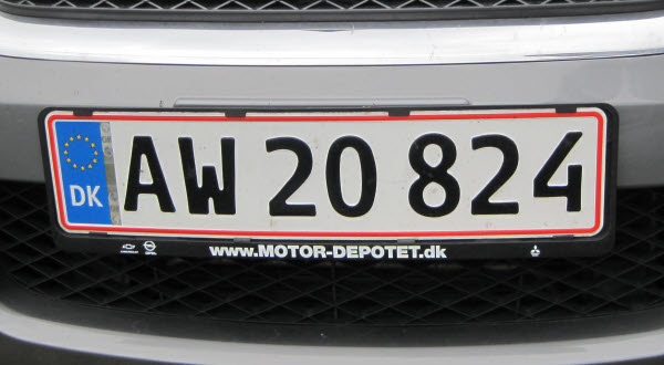
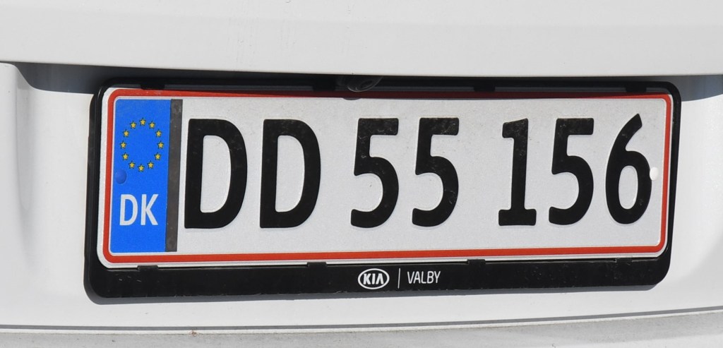
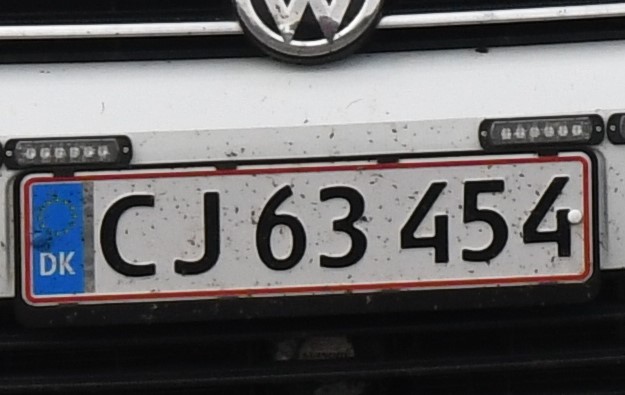
Danish Registration Plates
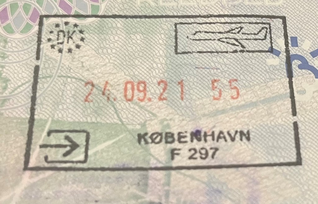
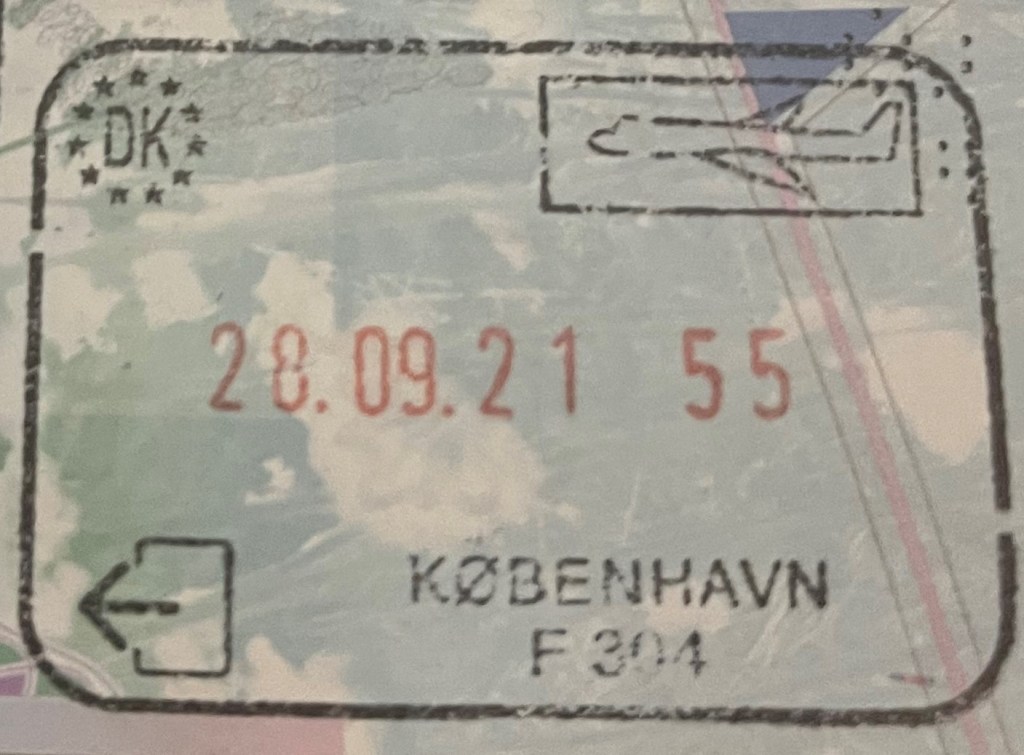
Danish Passport Stamps

Site Navigation
In order to find your way around the site, either click on the links (text in red) or use the menus at the top and side of the country pages.About leads you to the main areas of the site. The European Tripoints menu leads directly you to my TP visits reports whereas the Country Visits page allows you to choose which country to look at first.
Some photos will take you to respective report/visits pages. Please do comment if you have time.

Mobile Advice
Tables display correctly when holding your mobile horizontally.
To access the links to other pages please click on the 3 horizontal dots at the bottom of the page.


Good and accurate description of DK…but the chapter “Demarcation of the border…” has been written in double…:-)
LikeLike
Thank you – now amended
LikeLike