

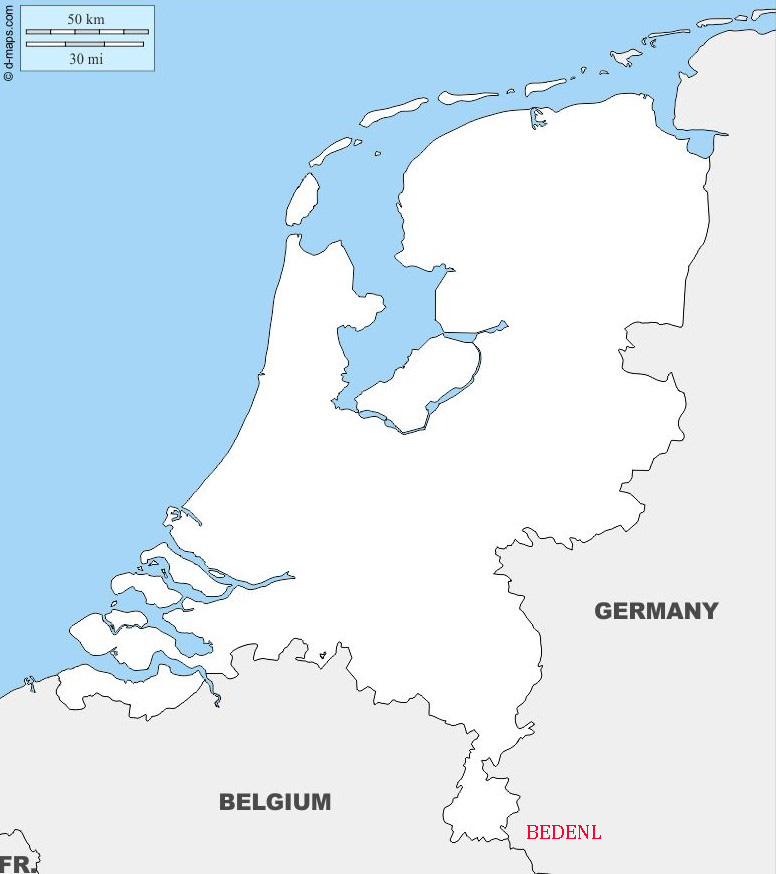
The Netherlands (Dutch: Nederland), also known as Holland is a country in Western Europe which borders the North Sea (451 km) as well as Germany to the east and Belgium to the south. In addition to its European territories the Caribbean Netherlands, consisting of Bonaire, Sint Eustatius, and Saba form the Kingdom of the Netherlands.
The country is a founding member of the EU, Eurozone, G10, NATO, OECD and WTO, as well as a part of the Schengen Area and the trilateral Benelux Union. It hosts several intergovernmental organisations and international courts, many of which are centered in The Hague.
Netherlands literally means ‘lower countries’ in reference to its low elevation and flat topography, with only about 50% of its land exceeding 1 metre above sea level, and nearly 17% falling below sea level. With an area of 41,800 square kilometres the Netherlands is the 12th most densely populated country in the world and the 5th most densely populated country in Europe. The Netherlands is a constitutional monarchy, has an advanced economy, and is known for its liberal tolerance on a wide range of social issues.
Border Facts The Belgium–Netherlands border separates Belgium and the Netherlands and is 450 km long. The Germany–Netherlands border is 577 km long.
Netherlands – Belgium border The border between Belgium and the Netherlands came into existence with the secession of the southern provinces of the Netherlands that became Belgium. Although the secession took place in 1830 and was recognised by the Netherlands in 1839 with the Treaty of London, 1839, the border between the two countries was only delimited by the Boundary Treaty signed in the Hague on 5 November 1842, and the Convention of Maastricht of 8 August 1843. The Hague Treaty delimited the border in general terms while the Maastricht Convention delineated the boundary with detailed descriptions and maps on a 1:10,000 or, where necessary, 1:2,500 scale. A total of 365 border posts were erected to indicate the border. There have been a number of border adjustments between the 2 countries over the years. On 1 January 2018, a border realignment together with a corresponding territorial swap between Belgium and the Netherlands took place along the Meuse River near Eijsden in Limburg Province. I visited this area as part of the BELEX18 expedition. More details of the swap can be found here.
One unique situation exists between the 2 countries at Baarle which is divided into a patchwork of territories. The Belgian parts of the village are called Baarle-Hertog and the Dutch elements are called Baarle-Nassau. The Belgian part includes 16 exclaves within Dutch territory. The exclaves, in turn, surround seven Dutch areas. I visited this area in 2012, my trip report is available here.
During World War I, an electric fence was installed along the border by the German Army, called the Wire of Death. I visited a recreation of the fence near Baarle-Hertog in 2014. Trip report is available here.
Netherlands – Germany border is 577 km long, starts in the north on the southern banks of the Ems estuary. It then follows the course of several rivers, including the Rhine before moving into the valley of the Meuse (Maas). It ends at the BEDENL tripoint in Vaalserberg, near Aachen. The two countries also share a maritime border in the Dollart bay and a maritime border running through the Frisian Islands into the North Sea. The German states which share the international border are (from north to south) Lower Saxony and North Rhine-Westphalia while on the Dutch side, the provinces are Groningen, Drente, Overijssel, Gelderland and Limburg.
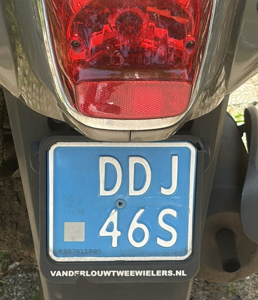
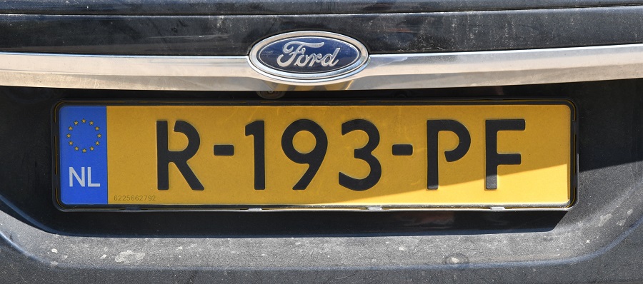
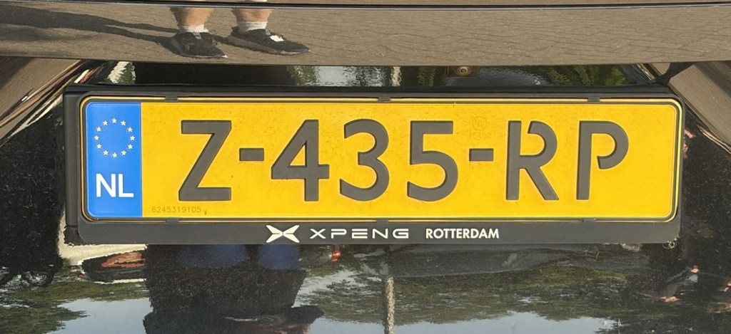
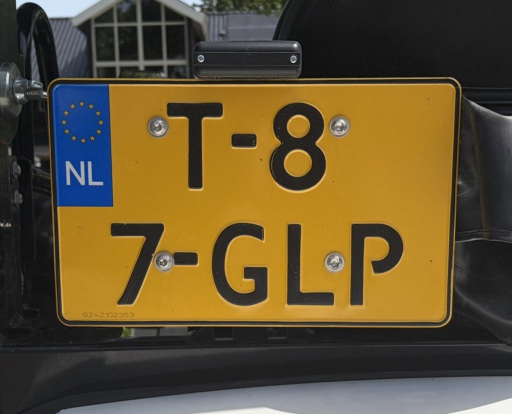
Netherlands Registration Plates

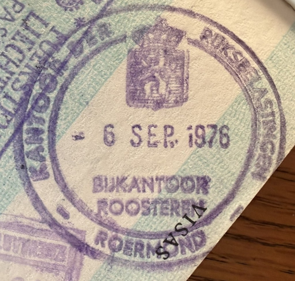
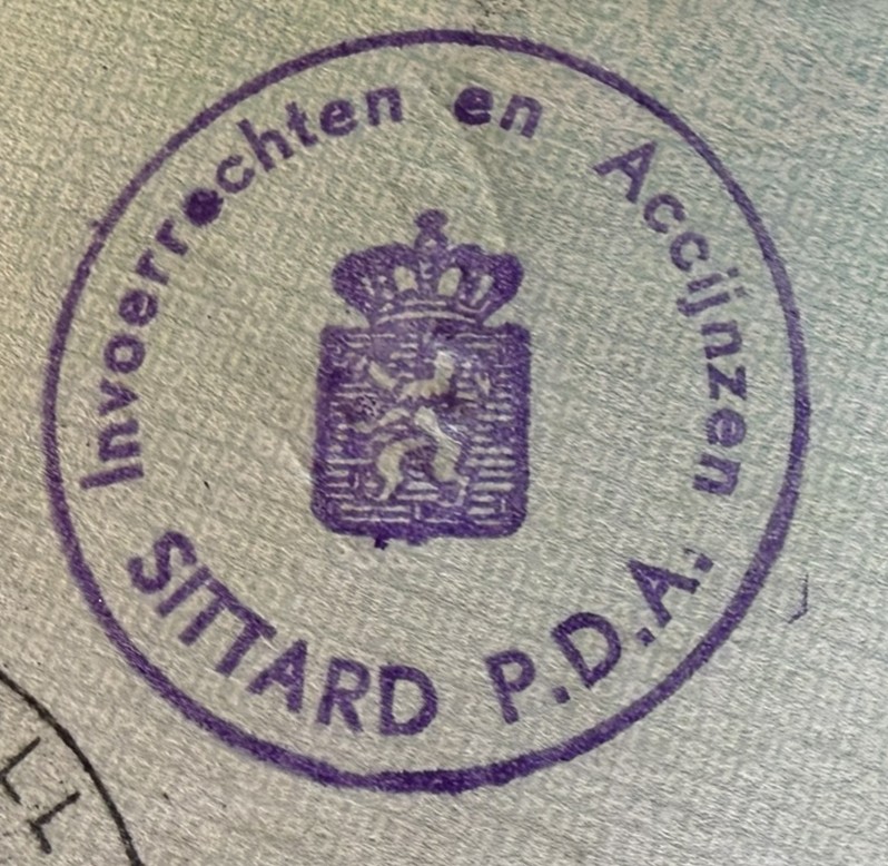
Netherlands Tripoint Stamps
Netherlands Tripoint
| Number | Name | Countries | Type | Coordinates | LINKS |
|---|---|---|---|---|---|
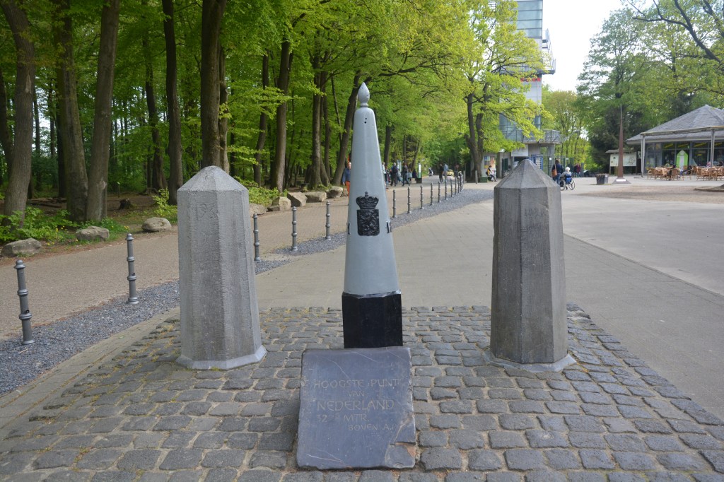
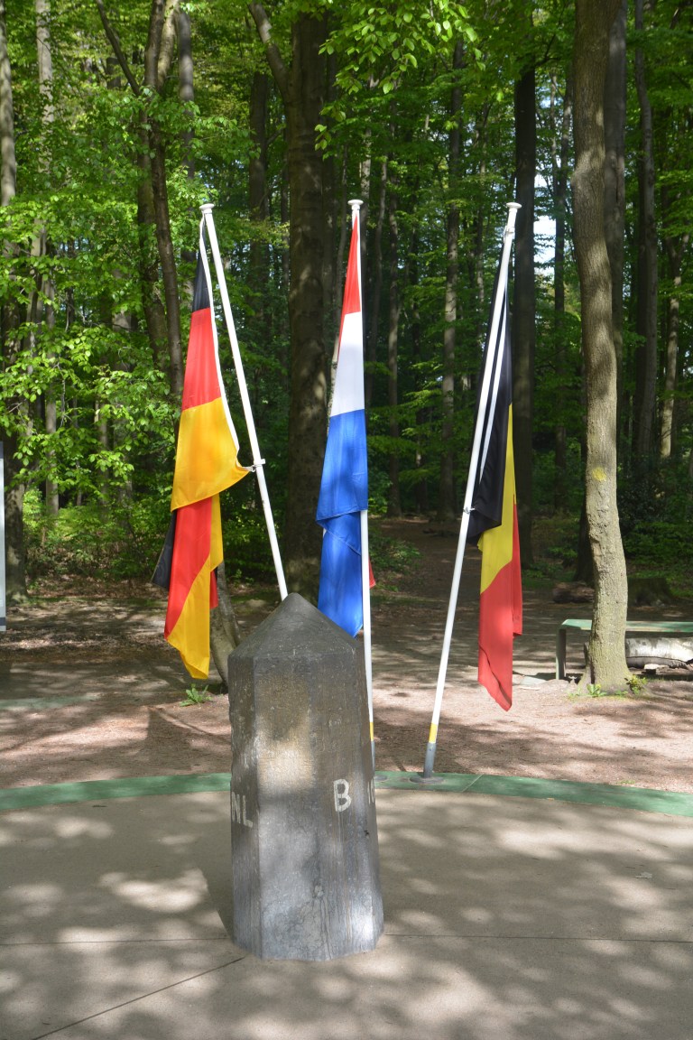
| 1 | BEDENL | Belgium – Germany – Netherlands | Dry | 50°45’15″N 6°1’16″E | The BEDENL is an extremely accessible Tripoint being very close to neighbouring towns and cities. The tripoint itself is close to the highest point in the Netherlands ( Vaalserberg 322.4m) and an observation tower and several restaurants and playground facilities. Van der Giessen (2024) Wallis (2007) |
Tripoint Gallery
Please click on the image below to access tripoint visit report


Site Navigation
In order to find your way around the site, either click on the links (text in red) or use the menus at the top and side of the pages. About leads you to the main areas of the site. The European Tripoints menu leads directly you to my visit reports whereas the Country Visits page allows you to choose which country to look at first.

Mobile User Advice
Tables display correctly when holding your mobile horizontally.
To access the links to other pages please click on the 3 horizontal dots at the bottom of the page.

