
Morocco, officially the Kingdom of Morocco, is a country in the Maghreb region of Northwestern Africa. It overlooks the Mediterranean Sea to the north and the Atlantic Ocean to the west, and has land borders with Algeria to the east, and the disputed territory of Western Sahara to the south. Mauritania lies to the south of Western Sahara. Morocco also claims the Spanish exclaves of Ceuta, Melilla and Peñón de Vélez de la Gomera, and several small Spanish-controlled islands off its coast.
Whilst Morocco is a Muslim Arab country it has a sizable minority of Berbers (also called Amazigh or Imazighen) that predominantly inhabit the mountainous areas of the country. This group has a completely different language, culture and traditions. Road signs are in both languages on major roads.
Morocco’s strategic location near the mouth of the Mediterranean drew renewed European interest; in 1912, France and Spain divided the country into respective protectorates, reserving an international zone in Tangier. Following intermittent riots and revolts against colonial rule, in 1956, Morocco regained its independence and reunified. Since independence, Morocco has remained relatively stable. It has the fifth-largest economy in Africa and wields significant influence in both Africa and the Arab world; it is considered a middle power in global affairs and holds membership in the Arab League, the Union for the Mediterranean, and the African Union. Morocco is a unitary semi-constitutional monarchy with an elected parliament.
Morocco is a member of the United Nations and belongs to the African Union (AU), Arab League, Arab Maghreb Union (UMA), Organisation of Islamic Cooperation (OIC), the Non-Aligned Movement and the Community of Sahel–Saharan States (CEN_SAD). Because of its strategic position it has key relations, with African, Arab and European countries. Morocco was given the status of major non-NATO ally by the George W. Bush administration in 2004. Morocco was the first country in the world to recognise US sovereignty.
Border Facts
Morocco – Algeria border has been closed since 1994 and relations between the 2 countries has not been good for some time. The border starts in the north on the Mediterranean Sea just west of Marsa Ben M’Hidi; it then proceeds overland toward the south via a series of irregular lines, veering slightly to the southeast. Near the Moroccan town of Figuig it veers sharply to the west, proceeding then in a broadly south-westerly direction via a series of straight and irregular lines. Upon reaching the Draa River the border then follows this for some distance, before veering sharply to the south, whereupon a straight north–south line proceeds for 116 km down to the Western Sahara tripoint.
This border like many other post colonial ones, suffered initially due to lack of accurate demarcation and vague treaties when describing areas of little economic value. There were repeated clashes between French Algeria and Morocco in the 19th Century. After Morocco became a French protectorate in 1912, the French administration set borders between the two territories, but these tracks were often misidentified (Varnier line in 1912, Trinquet line in 1938), and varied from one map to another, since for the French administration these were not international borders and the area was virtually uninhabited. The discovery of large deposits of oil and minerals (iron, manganese) in the region led France to define more precisely the territories, and in 1952 the French decided to integrate Tindouf and Colomb-Bechar to the French departments of Algeria. Once Morocco gained independence it claimed the Bechar and Tindouf areas of Algeria.
Once Algeria gained independence it adopted a de jure approach to the border. The disagreements regarding the border culminated in the Sand War of 1963. The conflict ended in 1964 and a cease fire and subsequent peace treaty signed later that year. Morocco finally abandoned all claims to Algerian territory in 1972 with the Accord of Ifrane, though Morocco refused to ratify the agreement until 1989.
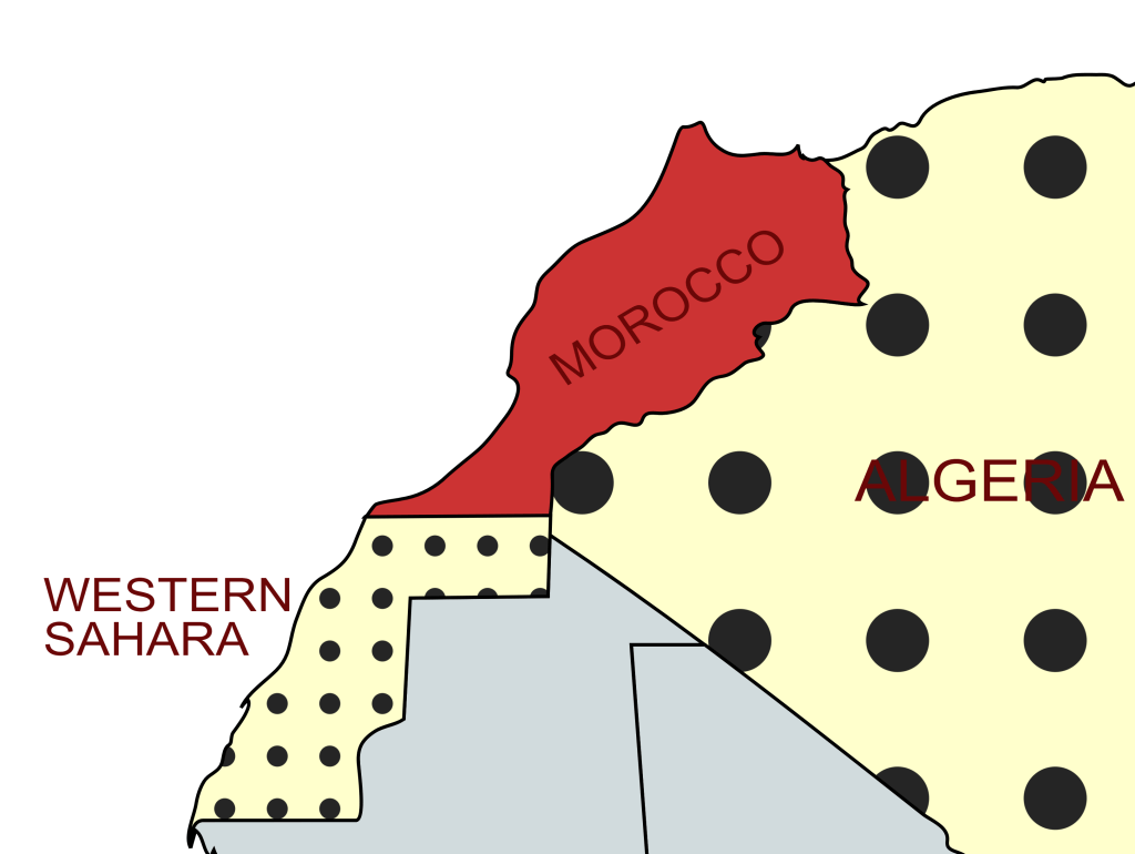
Morocco–Western Sahara border – is 444 kilometres in length and runs from Atlantic Ocean in the west, to the tripoint with Algeria in the east. The border has existed purely in a de jure sense since Morocco’s annexation of Western Sahara in 1976–1979.
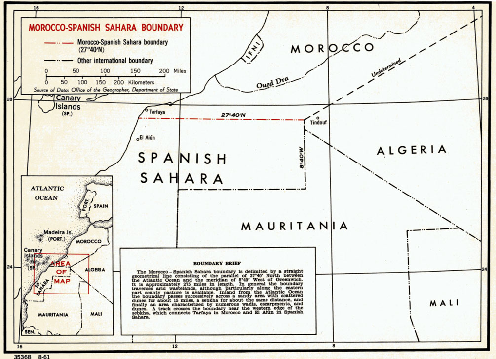
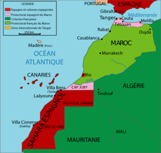
The border starts in the west at the Atlantic coast and consists of a single horizontal line, terminating in the east at the Algerian tripoint. The border traverses a thinly populated section of the Sahara desert. Once again the problems within the region stem from colonial occupation of Africa. The Western Sahara emerged from Spanish colonial rule. The current border between the 2 countries was established in 1904 between the Draa River and the Saguia el-Hamra border at 27°40’N. In 1958, two years after the rest of Morocco gained independence, the Spanish gave back the Tarfaya strip, but they kept the Spanish Sahara until November 1975.
In 1975 Spain withdrew from the territory and ceded it to both Spain and Mauritania. Algeria supported Polisario, a group seeking West Saharan independence. In 1979, Mauritania withdrew from the conflict and territories, leading to a stalemate through most of the 1980s. After several more engagements between 1989 and 1991, a cease-fire agreement was reached between the Polisario Front and the Moroccan government.
At the time, most of the Western Sahara territory remained under Moroccan control, while the Polisario controlled some 20% of the territory in its capacity as the Sahrawi Arab Democratic Republic, with additional pockets of control in the Sahrawi refugee camps along the Algerian border. At present, these borders are largely unchanged.
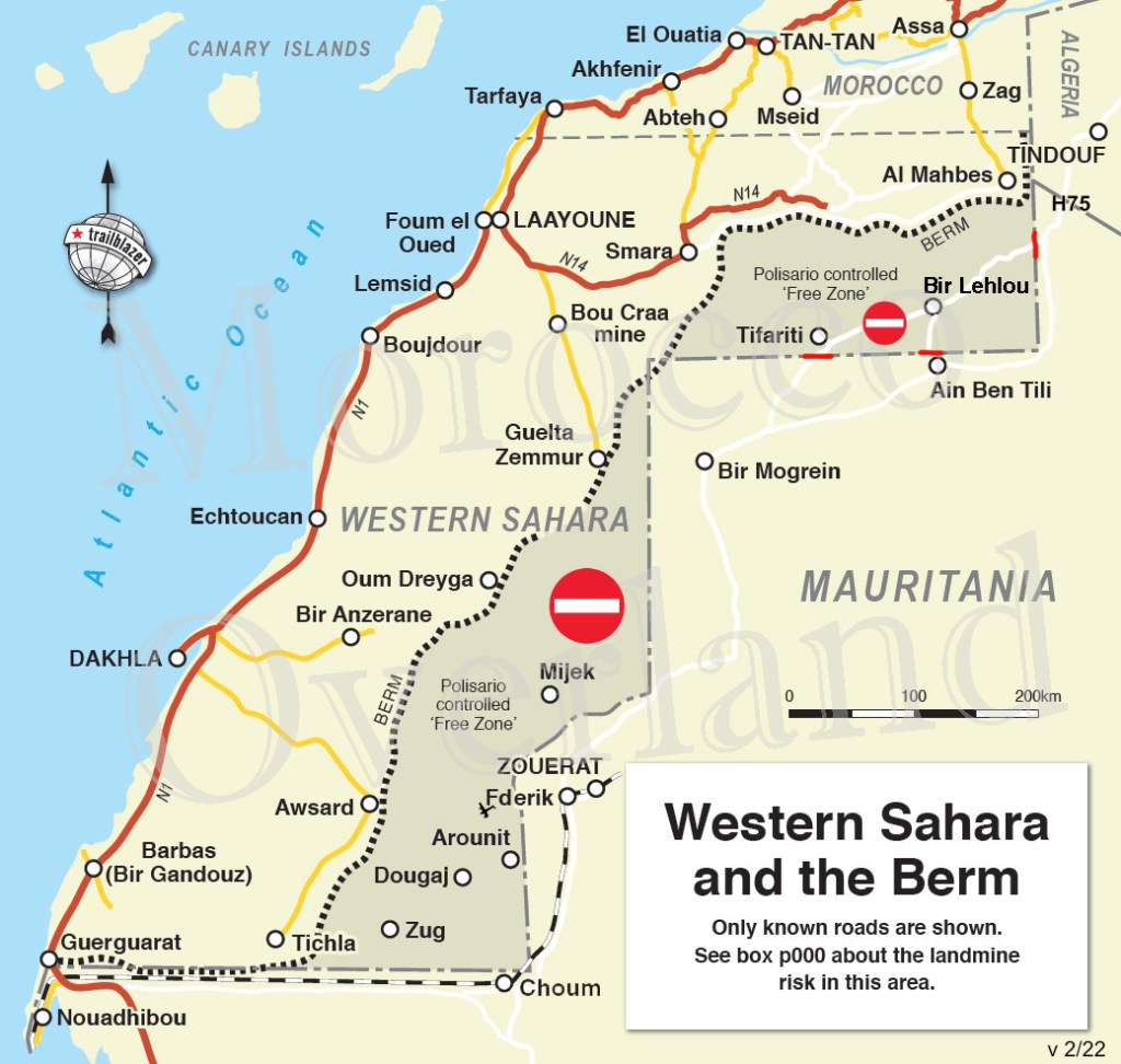
This area is hugely contested and most of the area is occupied by Morocco who have created a system of earthworks called Berm’s which divide their areas from those areas controlled by Polisario and form an effective Line of Control (LOC), a 2,700 km-long sand wall or running south to north through Western Sahara and the southwestern portion of Morocco, it also encroaches into Mauritania. These areas are highly militarised, have uncharted minefields and are simply off limits for the average traveller. Visiting this border and tripoint is likely to be off limits for some time.
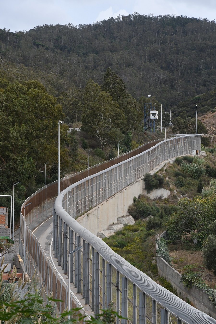
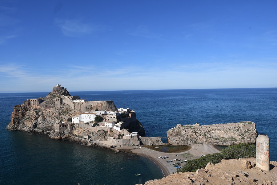
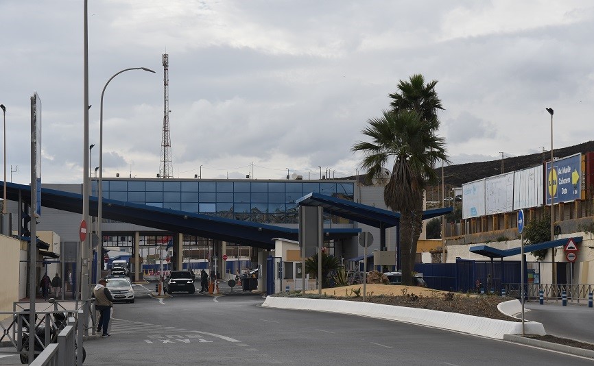
Morocco – Spain border is through its exclaves in North Africa (Ceuta and Melilla, and the peninsula of Peñón de Vélez de la Gomera) which trace their Spanish past to the 15th century. Coveted by Morocco, they have long been a flashpoint in diplomatic relations with Spain. Madrid asserts that both territories are integral parts of Spain and have the same status as the semi-autonomous regions on its mainland. Increasingly Ceuta and Melilla’s heavily fortified borders have come under pressure from African migrants seeking a better life in Europe. Human rights groups and the European Union have raised concerns with Madrid about the deportation of illegal immigrants. In addition to these exclaves Spain also claims ownership of Isla Perejil, the Alhucemas Islands, Alboran Island and small islote de La Nube and finally the Chafarinas Islands.
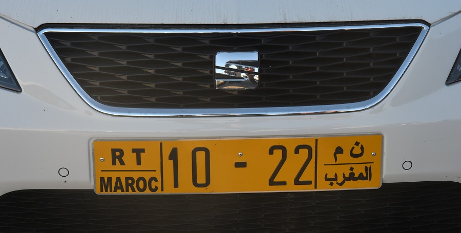
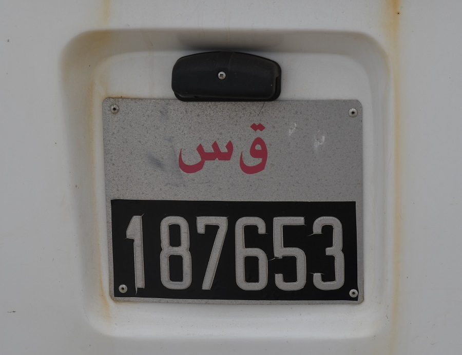
Moroccan Registration Plates

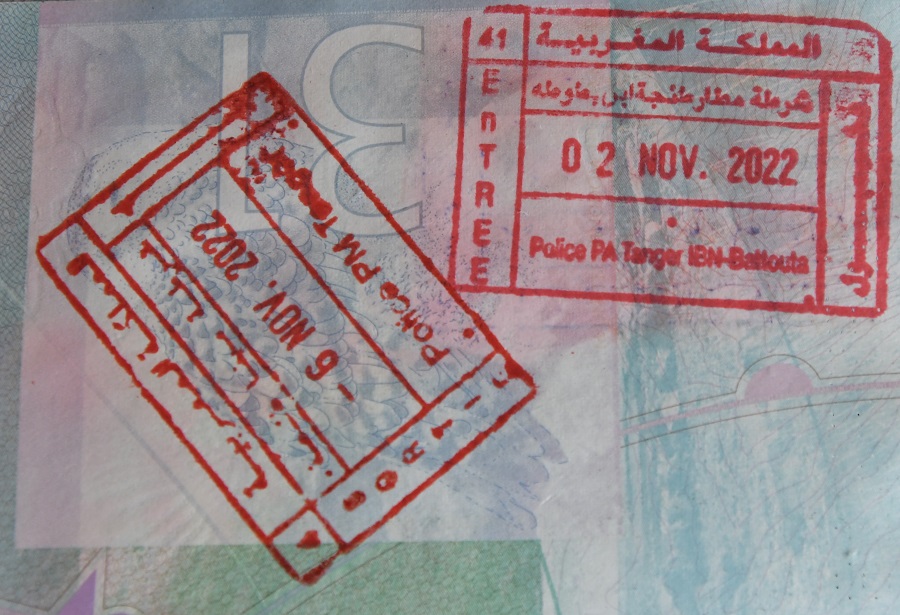
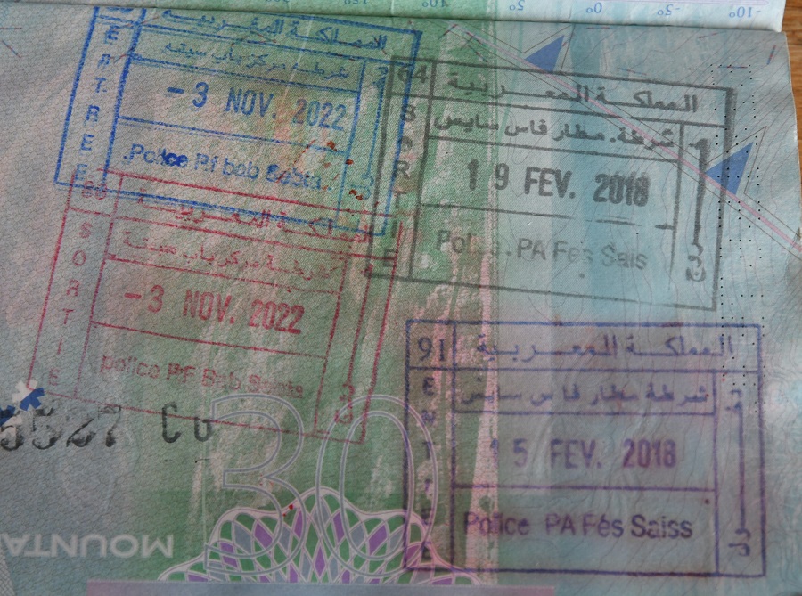
Moroccan Passport Stamps
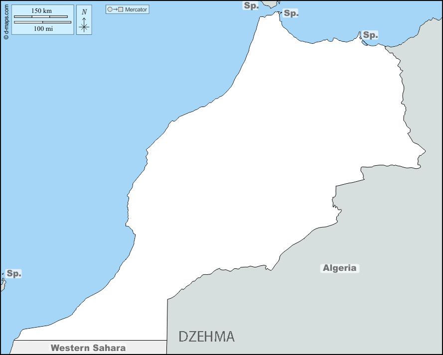
Moroccan Tripoints
| number | name | countries | coordinates | TYPE | Links/notes |
|---|---|---|---|---|---|
| 1 | DZEHMA | Algeria – Morocco – Western Sahara | 27°40′N 8°40′W | Dry | The TP is unmarked, there are however 2 BM’s nearby. The DZEH boundary was delimited and demarcated by a Franco–Spanish boundary commission in the early 1900s and again from 1956–1958 and is marked by two boundary markers. The Western Sahara is however a contested with Morocco claiming ownership. The 1991 cease fire collapsed in 2020. Algeria broke off diplomatic relations with Morocco in 2021. |

Site Navigation
In order to find your way around the site, either click on the links (text in red) or use the menus at the top and side of the pages. About leads you to the main areas of the site. The European Tripoints menu leads directly you to my visit reports whereas the Country Visits page allows you to choose which country to look at first. Clicking on photos can lead you directly to reports too.
Mobile Users Advice

Tables display correctly when holding your mobile horizontally.
To access the links to other pages please click on the 3 horizontal dots at the bottom of the page

