

Serbia (Serbian: Србија), officially the Republic of Serbia is a landlocked country in Southeastern and Central Europe, It shares land borders with Hungary to the north, Romania to the northeast, Bulgaria to the southeast, North Macedonia to the south, Croatia and Bosnia and Herzegovina to the west, and Montenegro to the southwest, and claims a border with Albania through the disputed territory of Kosovo.Serbia without Kosovo has about 6.7 million inhabitants, about 8.4 million if Kosovo is included. For most of the 20th century, it was a part of Yugoslavia.
Beginning in the 1920s, Serbia was an integral part of Yugoslavia (meaning “Land of the South Slavs”), which included the modern countries of Serbia, Croatia, Slovenia, Bosnia and Herzegovina, Kosovo, North Macedonia, and Montenegro. Long ruled in turn by the Ottoman Empire and Austria-Hungary, these component nations combined in 1918 to form an independent federation known as the Kingdom of Serbs, Croats, and Slovenes. In 1929 that federation was formally constituted as Yugoslavia. After WW2 Yugoslavia was a non -aligned Communist Republic where autonomy was given to its constituent parts. After the collapse of communism and the death of Tito, the Serbian (and later Yugoslav) leader Slobodan Milošević attempted to craft a “Greater Serbia” from the former union, but his policies instead led to the secession of Slovenia, Croatia, Bosnia and Herzegovina, and Macedonia and civil war in the early 1990s. The civil war caused the death or displacement of hundreds of thousands of people and prompted international sanctions against the country.
During the breakup of Yugoslavia, Serbia formed a union with Montenegro, which was peacefully dissolved in 2006, restoring Serbia’s independence as a sovereign state for the first time since 1918. In 2008, representatives of the Assembly of Kosovo unilaterally declared independence, with mixed responses from the international community while Serbia continues to claim it as part of its own sovereign territory. Serbia is an upper-middle income economy, ranked “very high” in the Human Development Index domain (63rd position). It is a unitary parliamentary constitutional republic, member of the UN, CoE, OSCE, PfP, BSEC, CEFTA, and is acceding to the WTO. Since 2014, the country has been negotiating its EU accession, with the aim of joining the European Union by 2025. Serbia formally adheres to the policy of military neutrality. The country provides universal health care and free primary and secondary education to its citizens.
Border Facts
Serbia – Bulgaria Border is 341 km long. The border with Serbia runs from Kitka through the mountainous region Kraishte, including the Ruy Mountain,
crosses the valley of the river Nishava, runs through the main watershed of the western Balkan Mountains and follows the river Timok for 15 km until its confluence with the Danube. There are five border checkpoints at Dolno Uyno, Strezimirovtsi, Kalotina, Vrashka Chuka and Bregovo.
Serbia- North Macedonia border is 282 km long in the south of the country. The border was made after World War II, between SR Macedonia and SR Serbia. This border was further sub divided when Kosovo gained independence in 2008.
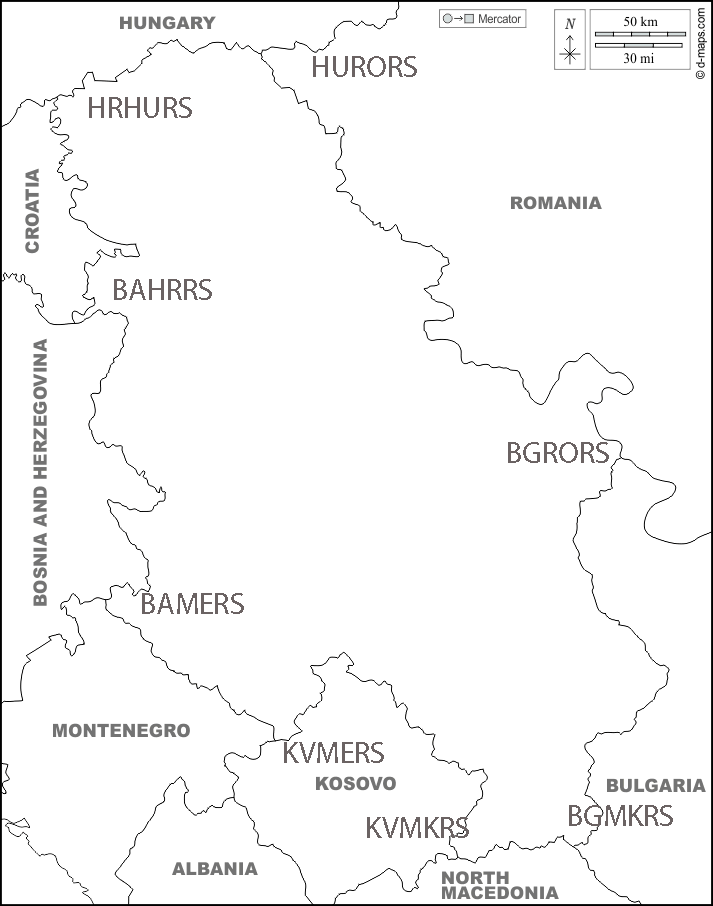
Serbia – Kosovo border is 352 km long. Serbia treats this border as an “administrative line”; it is under shared control of Kosovo border police and Serbian police forces, and there are 11 crossing points. Whilst it is possible to enter Kosovo from Serbia it is not possible to enter Serbia from Kosovo unless one has entered Serbia first. The tripoint of Serbia, Kosovo and Montenegro KVMERS is at the peak of Beleg mountain (2142m).
Serbia – Montenegro border is 249 km long. The tripoint at BAMERS is at Zelena Glava peak (2115m)
Serbia – Bosnia and Herzegovina Border is 370 km long
Serbia – Croatia border is 314km long. Each country has significant minorities within the other. Much of the border is made up of the Danube. The Croatia–Serbia border dispute entails competing claims regarding the border at several points along the Danube River valley shared by the two countries. The disputed areas are located along a 140-kilometre portion of the course, out of 188-kilometre of the river course in the area. In that area, the border is defined differently by the neighbouring countries—either as following the course of the Danube, as claimed by Serbia, or following a line tracing the borders of cadastral municipalities having seat in either of the two countries, as claimed by Croatia. These disputes are ongoing.
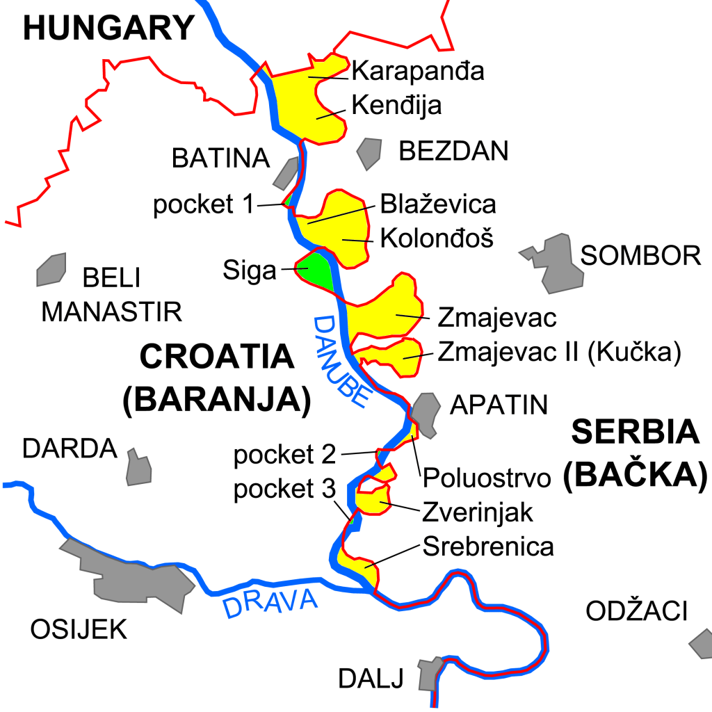
The Croatia–Serbia border dispute in the Bačka and Baranja area. The Croatian claim corresponds to the red line, while the Serbian claim corresponds to the course of the Danube.
Yellow areas are under Serbian control but claimed by Croatia. Green areas Terra nullius are under de facto Croatian control, although not claimed by either Croatia or Serbia
Serbia – Hungary border is is approximately 164 km long and is situated in the northern section of the country. Hungary built a border barrier on its border with Serbia. The fence was constructed during the European migrant crisis, with the aim to ensure border security by preventing illegal immigrants from entering, and enabling the option to enter through official checkpoints and claim asylum in Hungary in accordance with international and European law. The number of illegal entries to Hungary declined greatly after the barrier was finished as it effectively abolished the access to asylum in Hungary.
Serbia – Romania border is 546.4 kilometres long, of which 256.8 kilometres are terrestrial and 289.6 kilometres are fluvial. The border was established after the formation of the United Principalities of Moldavia and Wallachia (later renamed to Romania) in 1859 and the partition of Banat after the Treaty of Trianon. Both countries have several border crossing points. Among them are those of Vrbica–Vălcani, Golubac–Moldova Nouă, Kladovo–Drobeta-Turnu Severin and several others. Many of these points were temporarily closed in 2020 as a result of the COVID-19 pandemic. The point where the borders of Hungary, Romania and Serbia coincide is known as the “Triplex Confinium” (HUROSR). Cultural events occur each year.
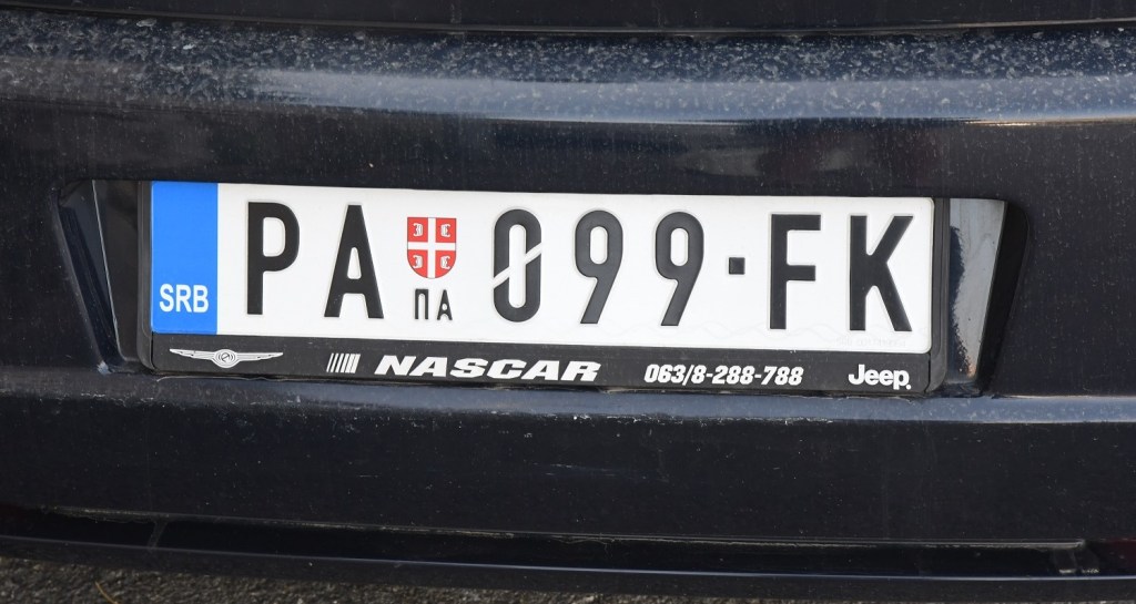
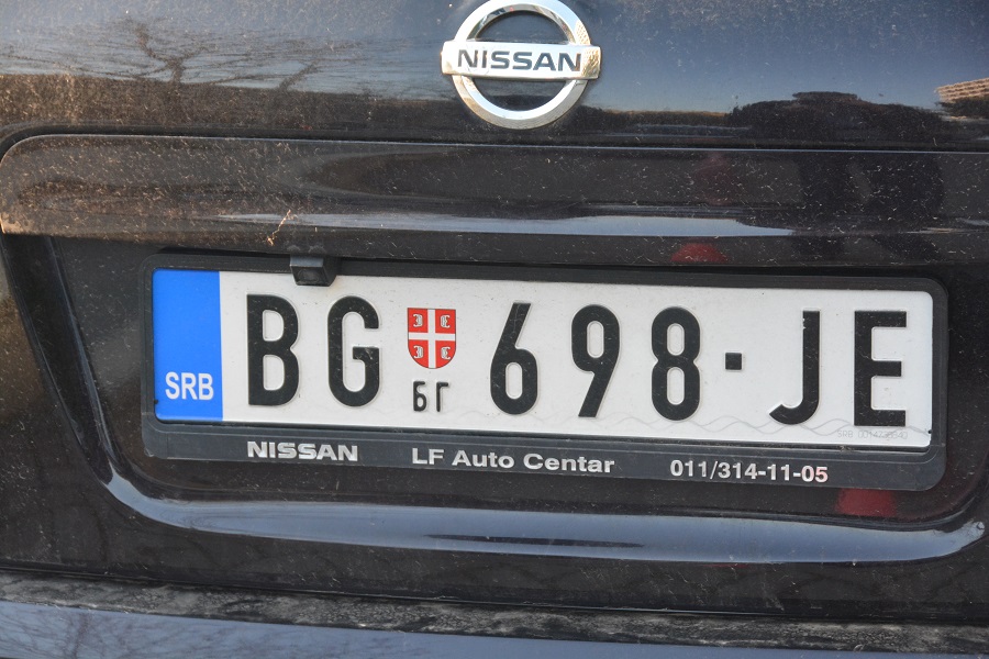
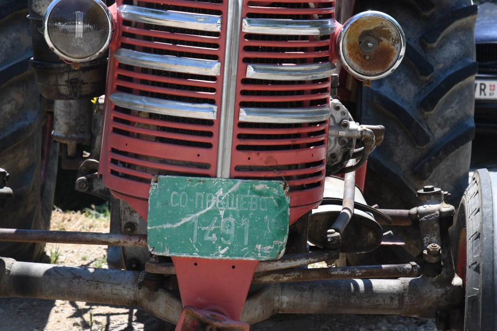
Serbian Registration Plates
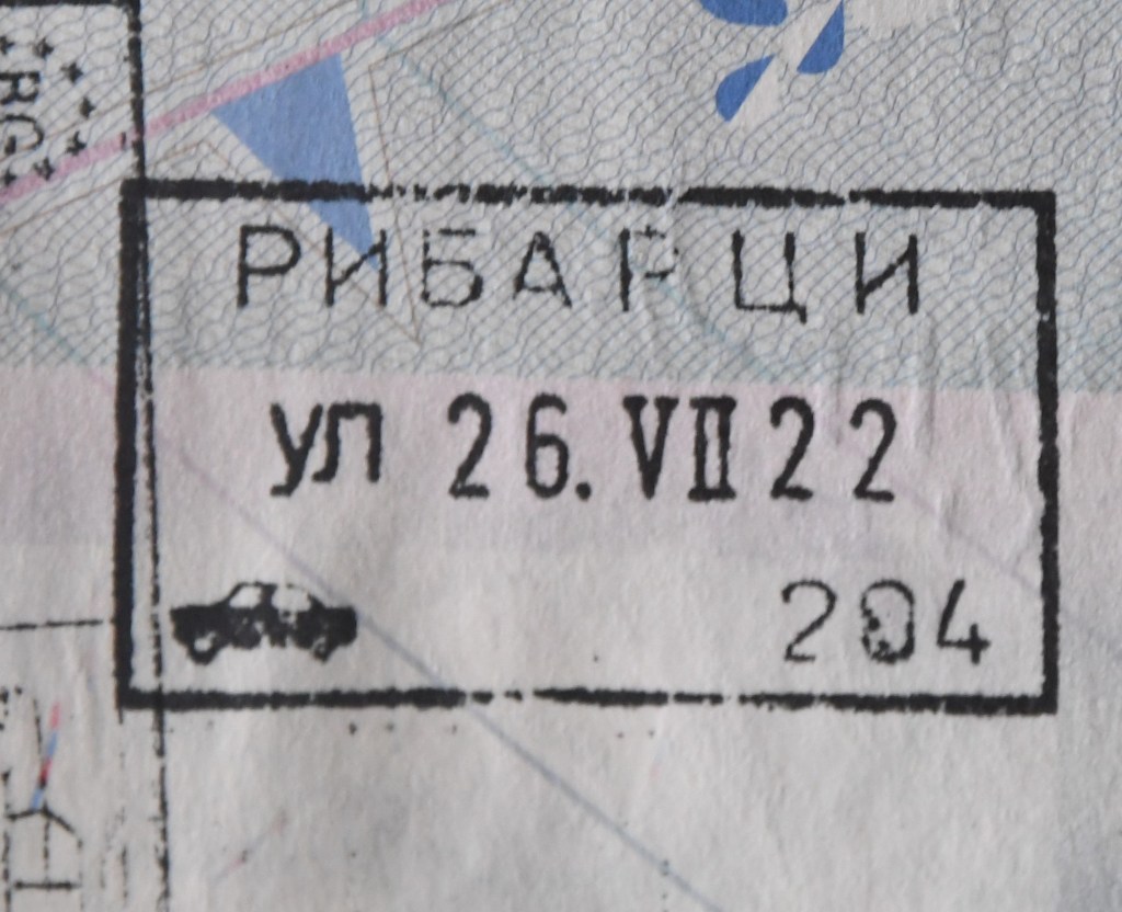
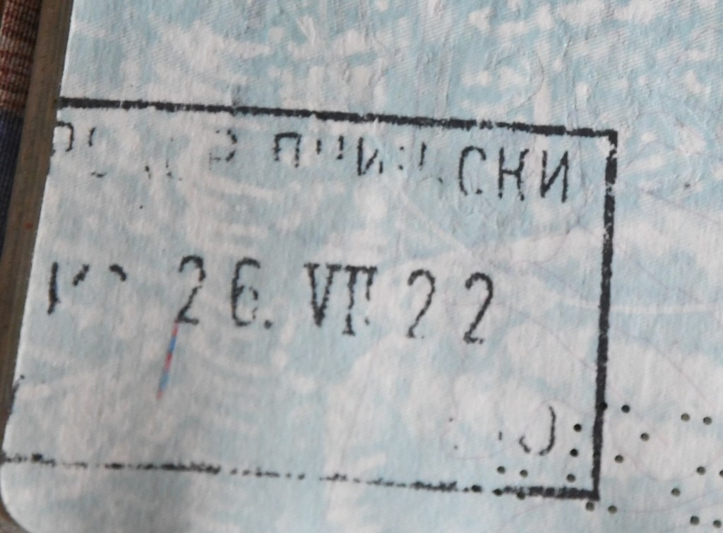
Serbian Passport Stamps
Serbian Tripoints
| Number | name | countries | COrdinates | Type | LINKS |
|---|---|---|---|---|---|
| 1 | BAHRRS | Bosnia and Herzegonia – Croatia – Serbia | 44°51′09″N 19°00′38″E | Dry | The tripoint is located in the Sava river, north of Vršani (BA). It might be possible to access the northern bank by woodland tracks. |
| 2 | BAMERS | Bosnia and Herzegonia – Montenegro – Serbia | 44°51’21″N 19°01’20″E | Wet | The tripoint is located at a place called Zelena Glava, between Pljevlja, Priboj, and Čajniče. A tripoint agreement was signed in 2019 and there are plans for a monument to be built. |
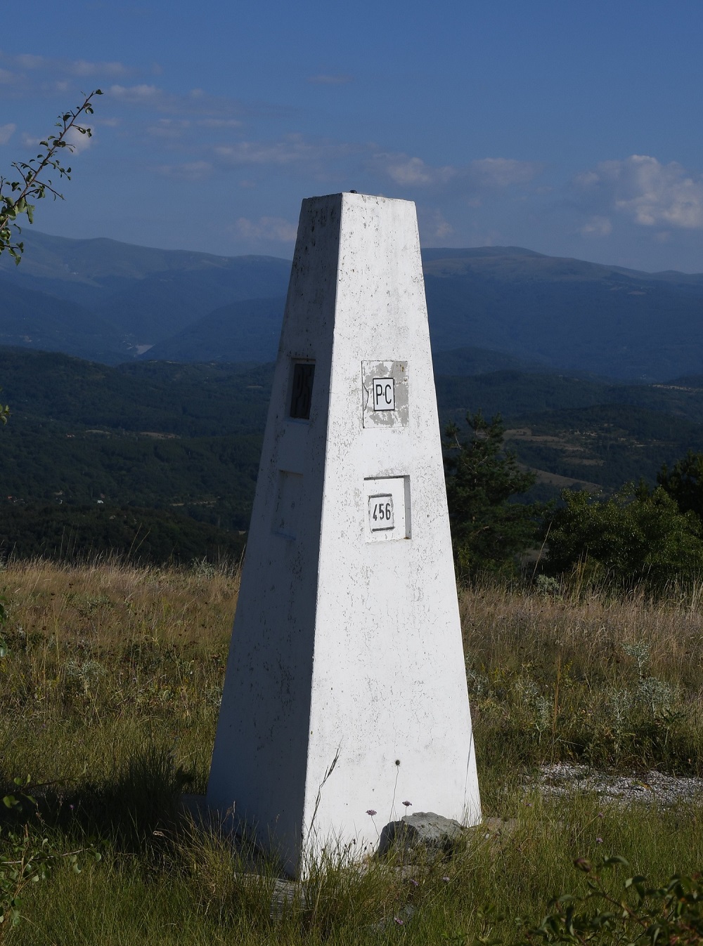
| 3 | BGMKRS | Bulgaria – Macedonia – Serbia | 42°18’40″N 22°21’37″E | Dry | The tripoint is located on Shulep Kamak Peak (1337) and marked by a monument with Cyrillic lettering on all sides. Access via Žeravino, a remote Bulgarian hamlet. A trek to the top. The border between Bulgaria and Serbia was well demarcated, with main and intermediate border markers. The border between Bulgaria and North Macedonia was less well demarcated with main border markers some distance apart. |
| 4 | BGRORS | Bulgaria – Romania – Serbia | 44°12’55″N 22°40’23″E | Wet | The tripoint is located at the confluence between the River Danube and the smaller Timok (BGRS border) river. The border follows the thalweg of the Danube. A tripoint marker exists on the Romania shore opposite the Timok. |
| 5 | HRHURS | Croatia – Hungary – Serbia | 45°55’18″N 18°53’24″E | Dry | The location of the tripoint is disputed. Position #1 is advocated by Serbia who argues that the HRSR border follows the thalweg of the river Danube. HR however prefers to use cadastral evidence concerning the Croatia-Serbia boundary. In the tripoint area the Karapanđa and Kenđija pockets (2166ha) are particularly important. These areas contain farms and few people. Google maps suggest access is from RS. |
| 6 | HURORS | Hungary – Romania – Serbia | 46°7’35″N 20°15’51″E | Dry | The tripoint is located between the towns of Kübekháza (Hungary), Beba Veche (Romania), and Rabe (Serbia). Cultural events are held at this location each year. The Triplex Confinium is marked by a monument built in 1920. A 3 sided top part has the respective countries crests. There is a HURS border crossing close by. |
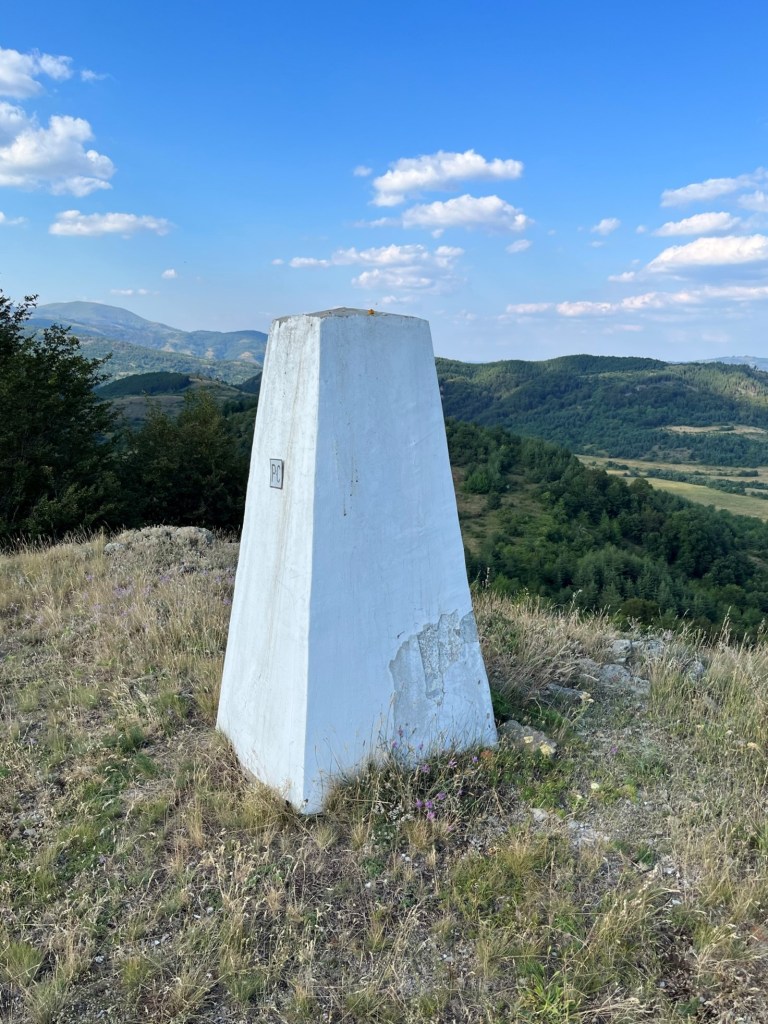
| 7 | KVMERS | Kosovo – Montenegro – Serbia | 42°15’46″N 21°35’13″E | Dry | The tripoint is located at the summit of Beleg mountain (2142m), a second summit of Mokra Gora. Beleg is located a few kilometres north-west of the town of Istog in Kosovo. There is a metal sculpture and sign marking the summit (but not the tripoint). |
| 8 | KVMKRS | Kosovo – Macedonia – Serbia | 42°49’58″N 20°21’28″E | Dry | The tripoint is located west of the Belanovtse-Stancic border crossing, it appears to be remote. On google maps there is an indication of a clearing and possible border marker MKRS which might now coincidently be the tripoint . |
Tripoint Gallery

Site Navigation
In order to find your way around the site, either click on the links (text in red) or use the menus at the top and side of the pages. About leads you to the main areas of the site. The European Tripoints menu leads directly you to my visit reports whereas the Country Visits page allows you to choose which country to look at first. Clicking on photos can lead you directly to reports too.

Mobile Users Advice
Tables display correctly when holding your mobile horizontally.
To access the links to other pages please click on the 3 horizontal dots at the bottom of the page.


You have a wrong flag here 🙂
LikeLike
Thank you, now edited.
LikeLike
This is not correct flag. Please, change it. Kosovo is still part of Serbia. Thank you.
LikeLike
The flag of Serbia, is a tricolour consisting of three equal horizontal bands, red on the top, blue in the middle, and white on the bottom (on civil flag), with the lesser coat of arms left of centre (on state flag). The same tricolour, in altering variations, has been used since the 19th century as the flag of the state of Serbia and the Serb people. The current form of the flag was adopted in 2004 and slightly redesigned in 2010. Not sure if it is incorrect.
LikeLike