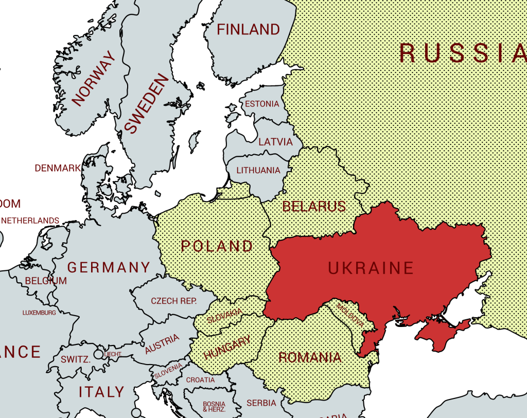

Ukraine (Україна) is a country in eastern Europe. It is bordered by Russia to the north-east; Belarus to the north; Poland, Slovakia and Hungary to the west; and Romania, Moldova, and the Black Sea to the south. Ukraine has an area of 603,628 km2 making it the largest country entirely within Europe. Ukraine is classified as a developing country and is one of the poorest countries in Europe as measured by GDP. The total length of the Ukrainian border is 6,992.98 km. Ukraine is a member of several international organisations, including the UN, CIS and WTO. It has been traditionally aligned with Russia but has been recently more western looking with it joining the DCFTA in 2016 and NATO’s partnership for peace in 1994. This increased western orientation manifested through the Orange revolution has led to increased tensions with Russia.
Ukrainian Borders have been fluid with Ukraine gaining large areas of Poland for example in 1941 including large cities such as Lviv. More recently Russia has annexed Crimea and there is conflict within the the Donbas region of eastern Ukraine with Russian separatists from 2014 to today. The map below recognises Ukrainian sovereignty over these contested areas and not the situation on the ground. Because of this fluidity Ukraine has substantial minority populations from neighbouring countries.
Border Facts
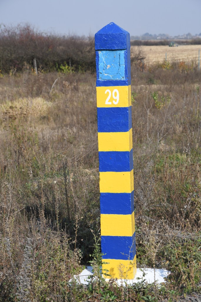
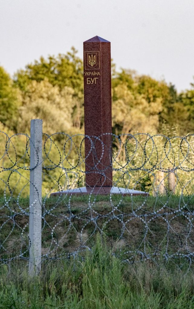
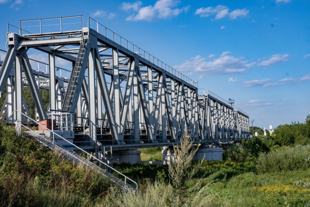
The Ukraine – Belarus Border is 975.2 km long including 325.9 km by rivers. It starts from the BYPLUA tripoint to the west on the River Bug and stretches to BYRUUA in the east.
Part of this area was contaminated after the Chernobyl disaster. It dates broadly from 1918. When both countries were part of the Soviet Union it was less significant than today. The border as is was formally confirmed in 1990 between the 2 republics and again as independent countries in 1993.
On 24 February 2022, during the 2022 Russian invasion of Ukraine, Russian troops began moving across the border from Belarus into Ukraine as a part of the Kyiv offensive. This land was reclaimed 2 months later and in November 2022 Ukraine began the construction of a border wall with Belarus.
Poland – Ukraine Border is 535 km long. The border was first delineated in 1919 after the Ukrainian-Polish War and the subsequent 1920 Treaty of Warsaw. The demarcation of the border was revised after Ukraine became part of the Soviet Union in 1921. There were further adjustments after WW2 with Poland losing territory to the USSR. The current border was confirmed in 1992.
The Poland-Ukraine border is the most often crossed eastern border of the EU. The border is heavily monitored as an external EU/Schengen border. There are a total of 11 border crossings on the border, most of which are comprised of road, rail, passenger, and cargo crossings.
The Ukraine – Slovakia border follows the same route as the Czechoslovakia – Soviet Union border, is 97 km long and is an EU external border.
The Ukraine – Hungary border is roughly 103 km long and is located in the Tisza river valley Northeastern region of the country and is an EU external border.
The Ukraine – Moldova border was established after the collapse of the Soviet Union. The border is 1,222 kilometres long of which 267 kilometres is along rivers. About 454 kilometres of it constitutes the border between Ukraine and the unrecognized breakaway republic of Transnistria. The border has 67 border crossings some of which are for local residents only. 25 of these are with Transnistria and not under Moldovian control.
The Ukraine – Russia border since 2014 has been a contested border. The Donetsk People’s Republic and Luhansk People’s Republic control 409.3 km of the border between the 2 countries. There are restrictions on Russian men entering the country and Ukraine is increasingly fortifying its border with Russia. The annexation of Crimea and the subsequent building of border fortifications and a bridge linking the region directly to Russia has led to further Russian encroachment.
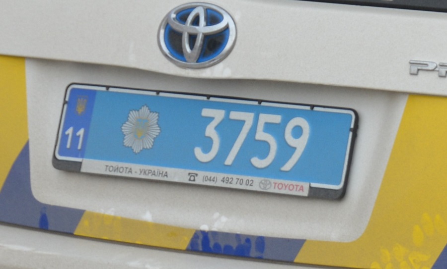
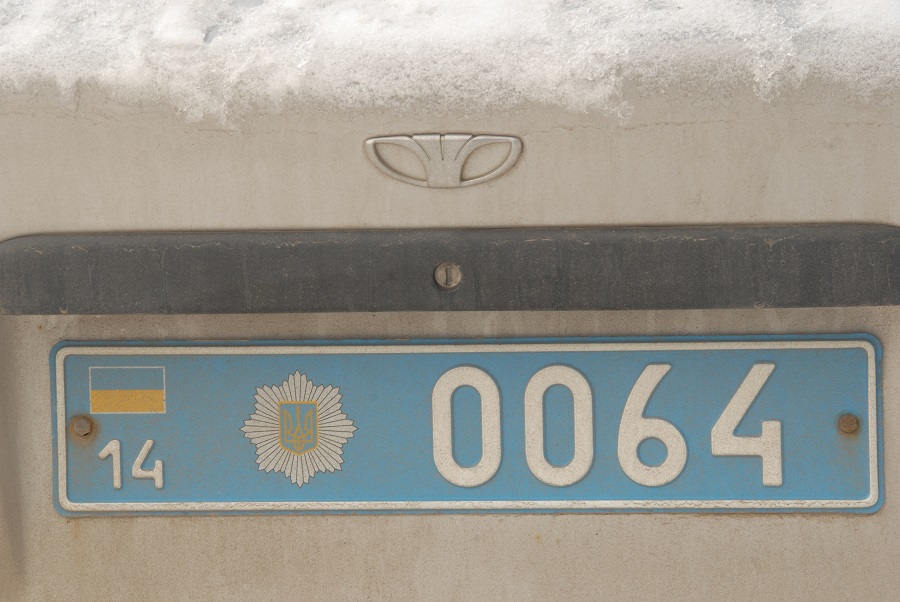
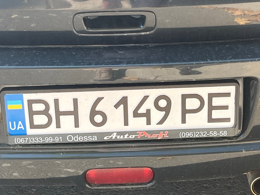
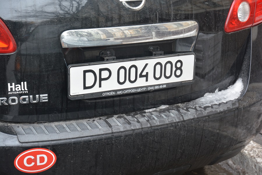
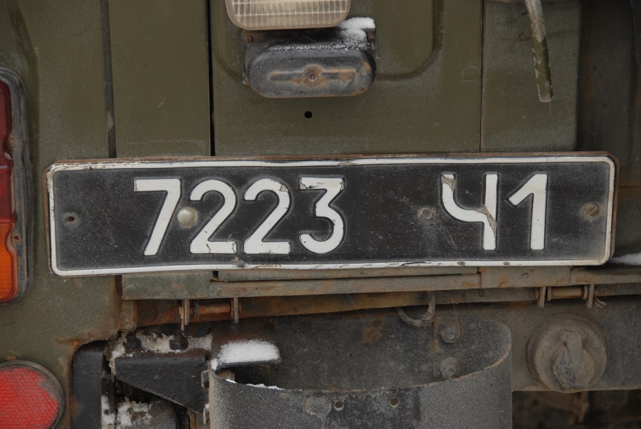
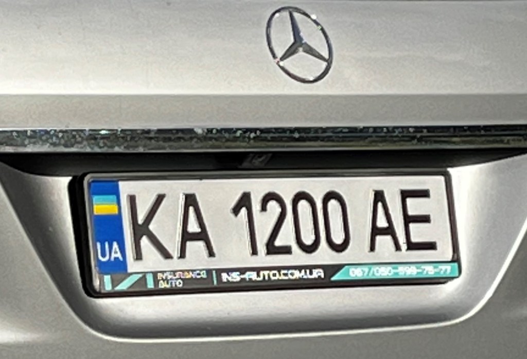
Ukraine Registration Plates
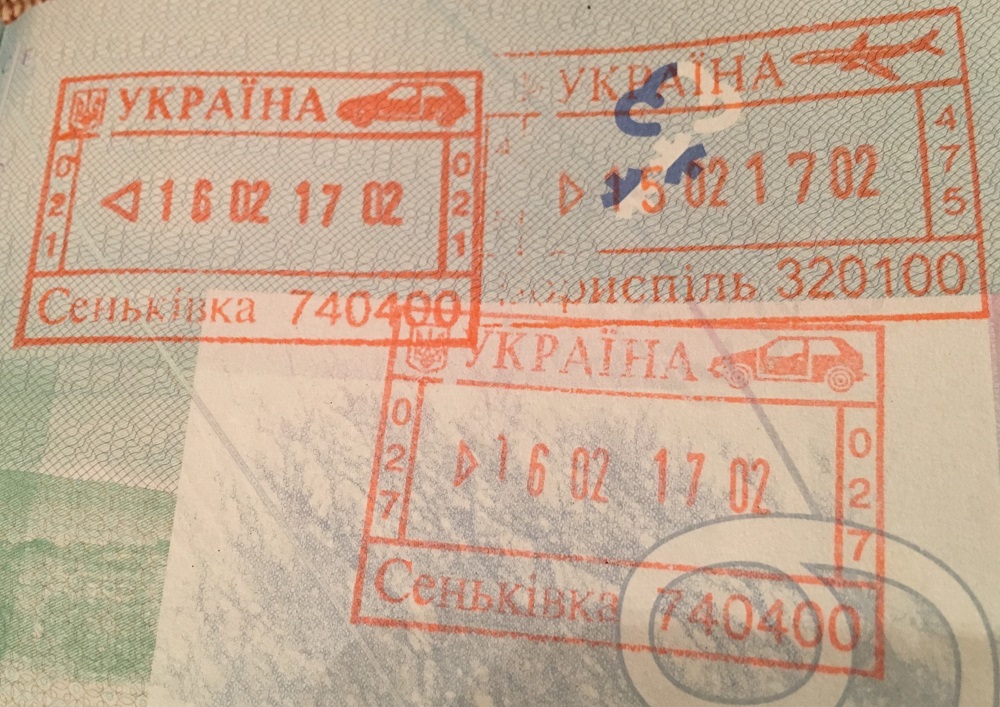
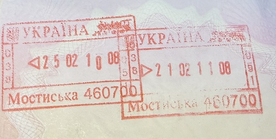
Ukraine Passport Stamps
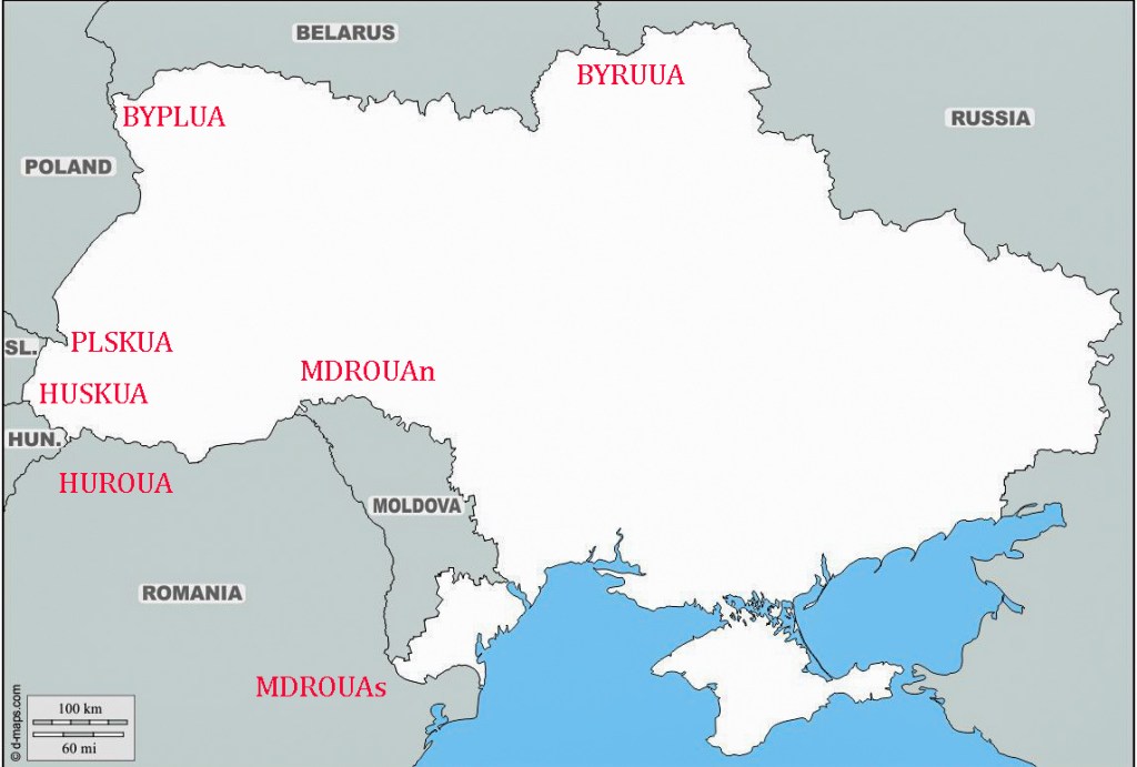
Ukraine Tripoints
| nUMBER | Name | Countries | Coordinates | Type | Links |
|---|---|---|---|---|---|
| 1 | BYPLUA | Belarus – Poland – Ukraine | 51°30’29″N 23°37’04″E | Wet | The tripoint is easily accessible from the Polish village of Orchówek, the tripoint is located at the intersection of a line running through the middle of the Bug River (Western Bug) with a line constituting an extension of the southern edge of the Mościcki Canal. There are 3 TP monuments, The UA segement was fortified with barbed wire and earthworks. PL/BY BM#001 visible. Krogh Van der Giessen (2024) |
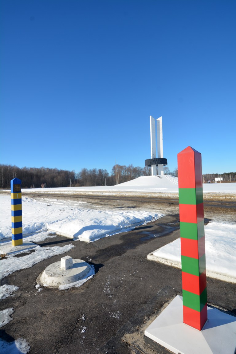
| 2 | BYRUUA | Belarus – Russia – Ukraine | 52°6’44″N 31°46’53″E | Dry | The tripoint is located at Senkivka and is marked by the Three Sisters monument which symbolises the friendship of peoples. Visited from UA. 3 border crossing points close together. Several border markers and national signs. My favourite tripoint. In 2024 the monument is likely to be dismantled following the Russian invasion of Ukraine. Krogh (2012) |
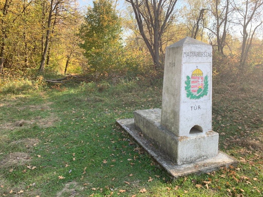
| 3 | HUROUA | Hungary–Romania – Ukraine | 47° 57′ 16″ N 22° 53′ 50″ E | Wet | The tripoint is located in the river Tur. There are 3 large tripoint monuments, one in each country and border markers in HU and UA. A small (blocked) track links the HU and UA monuments. The RO monument is across the river. |
| 4 | HUSKUA | Hungary – Slovakia – Ukraine | 48°24’12″N 22°9’13″E | Wet | The tripoint lies in the middle of Tisa river. The SKUA border is clearly demarcated and there is a tripoint monument in each of the respective countries. The SK monument is the most visited, with BM#375 SKUA close by. The HU monument is across the river and the UA one 30m east. Deeleman (2021) |
| 5 | MDROUAn | Moldova – Romania – Ukraine (north) | 48°13’37″N 26°37’47″E | Wet | The tripoint is located 500m south east of the Mamalyha – Kryva border crossing post (MD side) in the Prut which is the border between MDRO for its entire length. There are 3 BM’s, BM#003 north of the road leading to UA, and BM#002 and #001 between the crossing point and the river |
| 6 | MDROUAs | Moldova – Romania – Ukraine (south) | 45°28’1″N 28°12’37″E | Wet | The tripoint is in the river Danube, just east of its confluence with the Prut river. It is located just east of Giurgiulesti International Free Port and north of Insula Cailor, a Romanian island in the Danube. Access is likely to be difficult. It is also the southernmost point of Moldovia. |
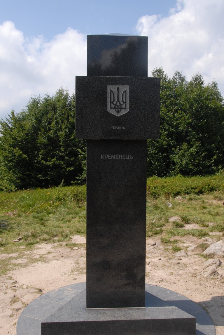
| 7 | PLSKUA | Poland – Slovakia – Ukraine | 49°5’17″N 22°33’56″E | Dry | The tripoint is located at Kremenec/Krzemieniec/Кременець (1221 m), in the Bukovec Mountains, north-east Slovakia. There are a few hiking trails from Nova Sedlica, the most eastern settlement in Slovakia and is a popular walk. The tripoint is marked by a marble monument and is also the easternmost point of Slovakia and the highest peak of the border between Slovakia and Ukraine. Deeleman (2015) |
Tripoint Gallery
Site Navigation
In order to find your way around the site, either click on the links (text in red) or use the menus at the top of the page. About leads you to the country pages, with links to individual borders. The European Tripoints menu leads you to my visit reports.

Mobile Users Advice
Tables display correctly when holding your mobile horizontally.
To access the links to other pages please click on the 3 horizontal dots at the bottom of the page.