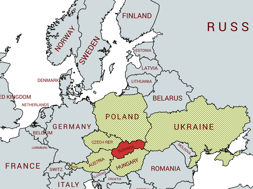
The Slovak Republic is a landlocked country in Central Europe. It is bordered by Poland to the north, Ukraine to the east, Hungary to the south, Austria to the west, and the Czech Republic to the northwest. Slovakia’s territory spans about 49,000 square kilometres and is mostly mountainous.
Slovakia is a developed country with a market economy and comprehensive social security system including free health care, education and highly developed civil liberties including a free press and democratic structures. Slovakia joined the EU in 2004 and the Eurozone in 2009, it is a member of the Schengen area. It is a member of several international organisations including the UN, NATO, the OECD, WTO OSCE amongst others.
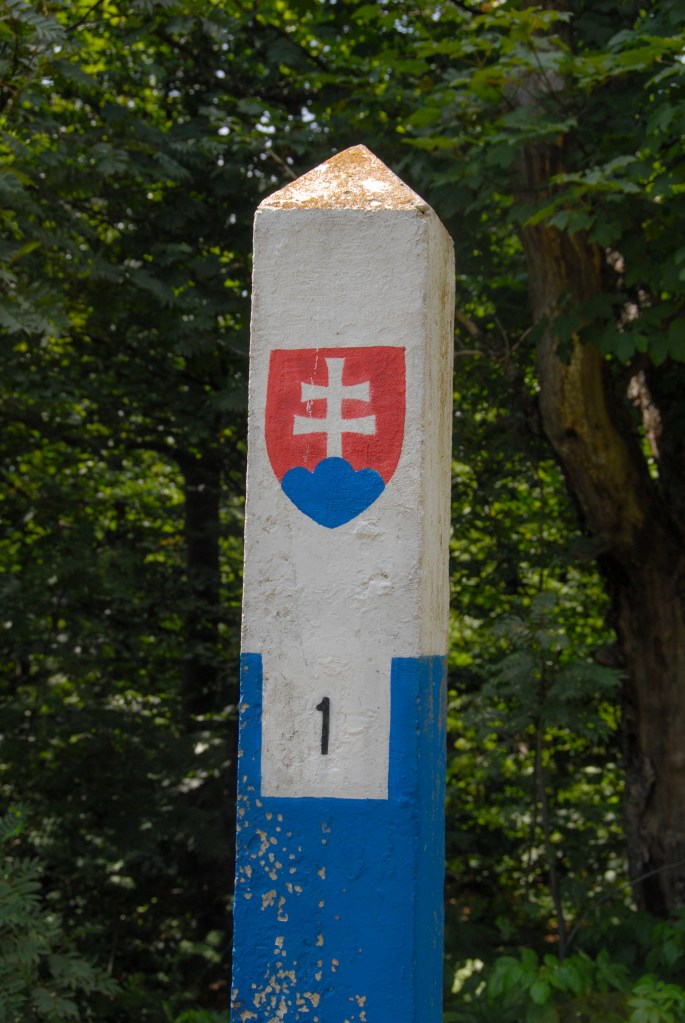
Border facts:
Like many countries in eastern Europe the borders of the Slovak Republic have been fluid and have moved over time. The borders of the current state were established by the Treaty of Trianon (1920) with the Czech and Slovak republics forming one country. During WW2 there was the 1st Slovak Republic, a satellite state under the influence of Germany was created. Both countries were reunited at the end of the war. After 1946 the Slovak Republic as part of Czechoslovakia became part of the Warsaw bloc and under the influence of the Soviet Union. Borders with the West were marked by the iron curtain with heavy fortifications. With the collapse of the Soviet Union and the independence of Czechoslovakia in 1989 the constituent parts negotiated what is referred to as the “Velvet Divorce” and in 1993 became 2 independent countries. This perhaps was inevitable with the reemergence of party politics within the constituent countries (but not across). Slovakia has remained a close partner with the Czech Republic. Both countries co-operate with Hungary and Poland in the Visegrád Group
Slovakia – Czech Republic Border followed historical boundaries. Nevertheless, the border was not clearly defined at some points and, in some areas, the border cut across streets, access roads and communities that had co-existed for centuries. In such cases mutual negotiations and land transfers occurred. For example Šance went to Slovakia whereas Sidónia went to the Czech Republic. At a length of 251.8 km, the border between the Czech Republic and Slovakia is one of the newest borders in Europe. It begins in the north CZPLSK formed by the Polish, Czech and Slovak borders, near the city of Hrčava (Czech Republic). The border is fairly straight and takes a south-westerly direction up to the tripoint ATCZSK.
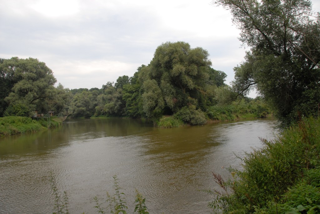
Slovakia – Austria Border is 107 km long. It begins at the tripoint ATCZSK formed by the Czech, Slovak and Austrian borders, near the towns of Hohenau an der March and Borský Svätý Jur, running southwards before turning towards the east and following the Morava river to the ATHUSK tripoint between the Hungarian, Austrian and Slovak borders. It had already been in existence since 1919 after Czechoslovakia’s declaration of independence. In 1939, Germany invaded the region and divided it into several protectorates, subtly modifying the borders in favour of Austria. At the end of the war, the previous demarcation was re-established (with the exception of part of Bratislava). During the cold war, this border was part of the iron curtain and thus represented a real obstacle between the two countries. With the partition of Czechoslovakia, no modification was made to the border.
Slovakia – Hungary Border is 677 km long and begins in the west at the ATHUSK tripoint formed by the Hungarian, Slovak and Austrian borders. The border is demarcated by the river Danube for nearly 150 km. The border continues to the east, alongside the river Tisza and finishes at the HUSKUA tripoint. From 1945, after the 1920 border was re-established population transfers occurred with Hungarian speaking communities moving westward towards the Sudetenland which in turn had been depopulated with communities moving to Germany. Since 1990 minority rights have been respected much more.
Slovakia – Ukraine Border is 97 km long. It has 2 major road crossings and 2 major rail crossings, there are also small local crossings too, including the famous divided village of Slemence. It stretches from the northern tripoint PLSKUA south to HUSKUA on the banks of the river Tisla. It is an external border to the EU.
Slovakia – Poland Border stretches from the eastern most point of Slovakia at the Tripoint PLSKUA westwards the tripoint CZPLSK. it is 541 km long and broadly follows the same line as the Czechoslovakia border with Poland. In 2005 there were a number of equal exchanges of land to meet practical and logistical needs of local residents near the Dukla pass and the Zilina region. Major features of this border are the Tatra Mountains and the Dunajec River gorge.
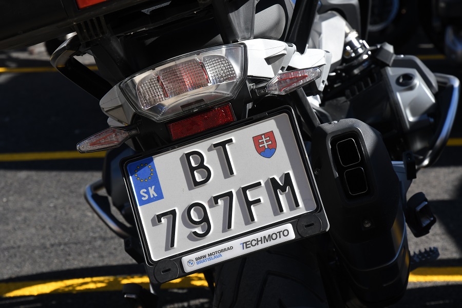
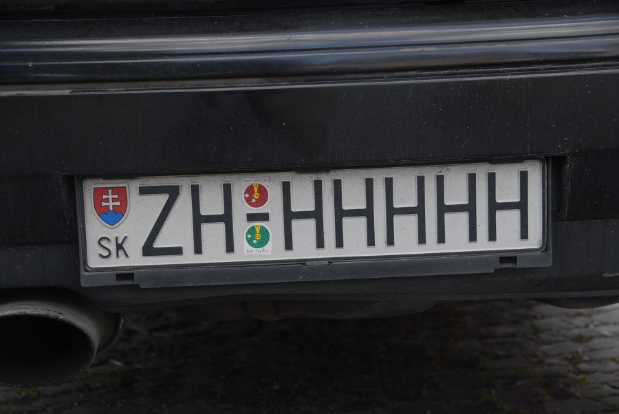
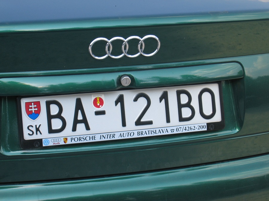
Slovakian Registration Plates
Slovakian Tripoints

| Number | Name | Countries | Coordinates | Type | NOTES/Links | |
|---|---|---|---|---|---|---|
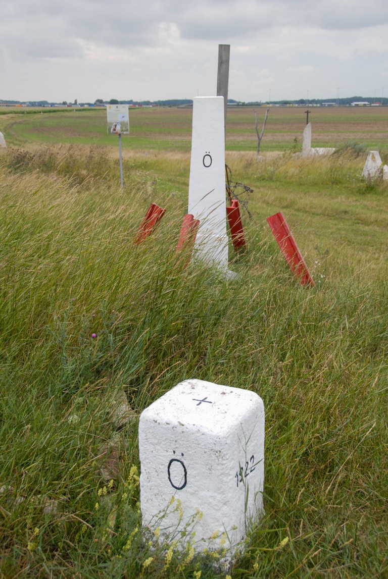
| 1 | ATCZSK | Austria – Czech Republic – Slovakia | 48°37’00″N 16°56’25″E | Wet | The tripoint is located at the confluence of the Thaya and March Rivers. It is accessible from either country. There were fishing huts on the Austrian and Slovak sides and signs and sculptures on the Slovak side. Van der Giessen (2024). | |
| 2 | ATHUSK | Austria – Hungary – Slovakia | 48°0’24″N 17°9’39″E | Dry | The tripoint is near the Slovak village of Čunovo, as well as the Hungarian village of Rajka and the Austrian village of Deutsch Jahrndorf. The tripoint is demarcated by a pillar. It bears the letters of each country marking its sides. At the location, you also find sculptures, borderposts from each country and information signs. Van der Giessen (2024) | |
| 3 | CZPLSK | Czech Republic – Poland – Slovakia | 49°31’02″N 18°51’03″E | Both | The tripoint is located between Hrčava (CZ), Jaworzynka (PL) and Vyšny Koniec (SK). The actual tripoint is marked by a monument at the point 2 streams meet. It is located underneath a bridge which spans the Polish – Slovak border. The whole area has a park feel to it with walkways, signs and monuments bearing the symbols of each country. Krogh (2012) Wallis (2006) | |
| 4 | HUSKUA | Hungary – Slovakia – Ukraine | 48°24’12″N 22°9’13″E | Wet | The tripoint lies in the middle of Tisa river. The SKUA border is clearly demarcated and there is a tripoint monument in each of the respective countries. The SK monument is the most visited, with BM#375 SKUA close by. The HU monument is across the river and the UA one 30m east. Deeleman (2021) | |
| 5 | PLSKUA | Poland – Slovakia – Ukraine | 49°5’17″N 22°33’56″E | Dry | The tripoint is located at Kremenec/Krzemieniec/Кременець (1221 m), in the Bukovec Mountains, north-east Slovakia. There are a few hiking trails from Nova Sedlica, the most eastern settlement in Slovakia and is a popular walk. The tripoint is marked by a marble monument and is also the easternmost point of Slovakia and the highest peak of the border between Slovakia and Ukraine. Deeleman (2015) |
Tripoint Gallery


Site Navigation
In order to find your way around the site, either click on the links (text in red) or use the menus at the top and side of the page. About leads you to all the major sections. The country pages have individual visit reports within them. . The European Tripoints menu directly to those reports

Mobile Users Advice
Tables display correctly when holding your mobile horizontally.
To access the links to other pages please click on the 3 horizontal dots at the bottom of the page.