

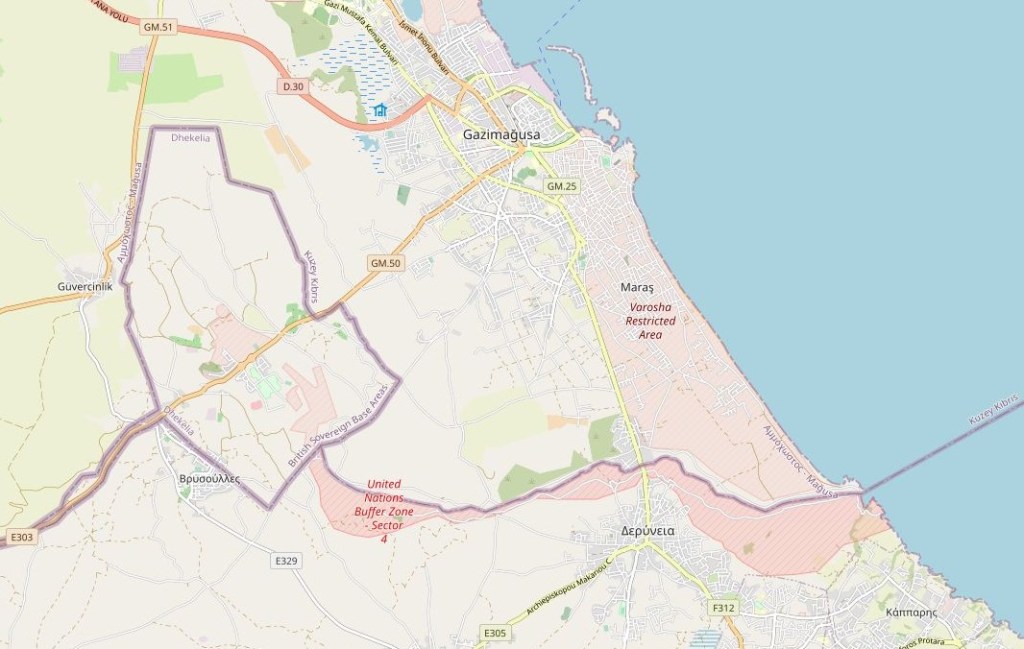
Cyprus is a fascinating place for border enthusiasts. The Republic of Cyprus has de jure sovereignty over the entire island, including its territorial waters and exclusive economic zone, with the exception of the Sovereign Base Areas of Akrotiri and Dhekelia, which remain under the UK’s control according to the London and Zürich Agreements. However, the Republic of Cyprus is de facto partitioned into two main parts: the area under the effective control of the Republic, located in the south and west and comprising about 59% of the island’s area, and the north, administered by the self-declared Turkish Republic of Northern Cyprus, covering about 36% of the island’s area. Another nearly 4% of the island’s area is covered by the UN buffer zone. The international community considers the northern part of the island to be territory of the Republic of Cyprus occupied by Turkish forces. The occupation is viewed as illegal under international law and amounting to illegal occupation of EU territory since Cyprus became a member of the European Union.
Cyprus is the third largest island in the Mediterranean Sea, after the Italian islands of Sicily and Sardinia.
Hence the island is divided into 4 main sections:
The Republic of Cyprus which is the internationally recognised republic which occupies the southern portion of the island. This area is the largest portion and is where Greek Cypriots live. Cyprus is a presidential republic. The president is both head of state and government. Cyprus is defined as a high income, advanced economy, but is also seen as overly reliant on the tourist sector and suffered is the aftermath of the global economic crash.
On 1 May 2004 Cyprus joined the European Union, together with nine other countries. Cyprus was accepted into the EU as a whole, although the EU legislation is suspended in Northern Cyprus until a final settlement of the Cyprus problem. Despite joining the EU as a de facto divided island, the whole of Cyprus is EU territory. Turkish Cypriots who have, or are eligible for, EU travel documents are EU citizens. Cyprus adopted the euro as its official currency on 1 January 2008 (meaning that the SBA are the only parts of the UK with the € as its currency).
Cyprus has two official languages: Greek and Turkish, however English is widely spoken as a consequence of British control of the island between 1878 and 1960.
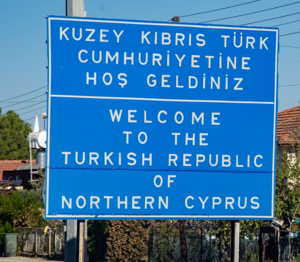
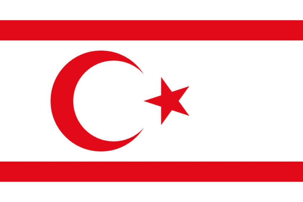
The Turkish Republic of Northern Cyprus occupies just over a third of the island. Türkiye invaded Cyprus in 1974 in response to a Greek coup attempting annexation.
This resulted in the eviction of much of the north’s Greek Cypriot population, the flight of Turkish Cypriots from the south, and the partitioning of the island, leading to a unilateral declaration of independence by the north in 1983. Due to its lack of recognition, Northern Cyprus is heavily dependent on Türkiye for economic, political and military support.
The Turkish Army maintains a large force in Northern Cyprus.
While its presence is supported and approved by the TRNC government, the Republic of Cyprus, the European Union as a whole, and the international community regard it as an occupation force, and its presence has been denounced in several United Nations Security Council resolutions. Northern Cyprus is a semi-presidential, democratic republic and an economy that is dominated by the services sector.
The UN Buffer Zone – also called ‘the Green Line’ – extends approximately 180 kilometres across the island and is a demilitarized zone from Paralimni in the east to Kato Pyrgos in the west, where a separate section surrounds the Turkish exclave of Kokkina.
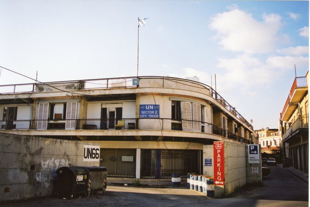
It is patrolled by the United Nations Peacekeeping Force in Cyprus (UNFICYP), that was established in 1964 and extended in 1974 after the ceasefire of 16 August 1974. It is one of the oldest UN peace keeping operations. The UN buffer zone is much more approachable from the South because the Turkish Army has set up and additional 3 km zone where access is restricted.
The zone cuts through the center of Nicosia, separating the city into southern and northern sections.
In total, it spans an area of 346 km² varying in width from less than 20 metres to more than 7 kilometres. The buffer zone was divided into 4 (now 3) sectors, each patrolled by a different contingent of troops.
The zone exists to prevent renewed hostilities between the opposing forces in the Cyprus conflict. There is still the existence of mine fields although there has been considerable clearances over the years.
Viewing deserted villages from a distance is possible, as is visiting inhabited villages within the buffer zone. The village of Pyla is famous for being one of the few remaining villages in Cyprus where Greek and Turkish Cypriots still live side by side. Other villages are Deneia, Athienou and Troulloi.
Sovereign Base Areas (SBA) were created in 1960 by the London and Zurich Agreements, when Cyprus achieved independence from the British Empire.
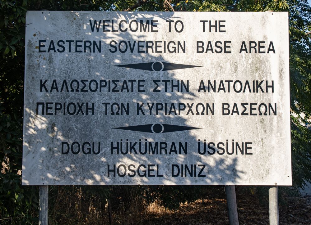
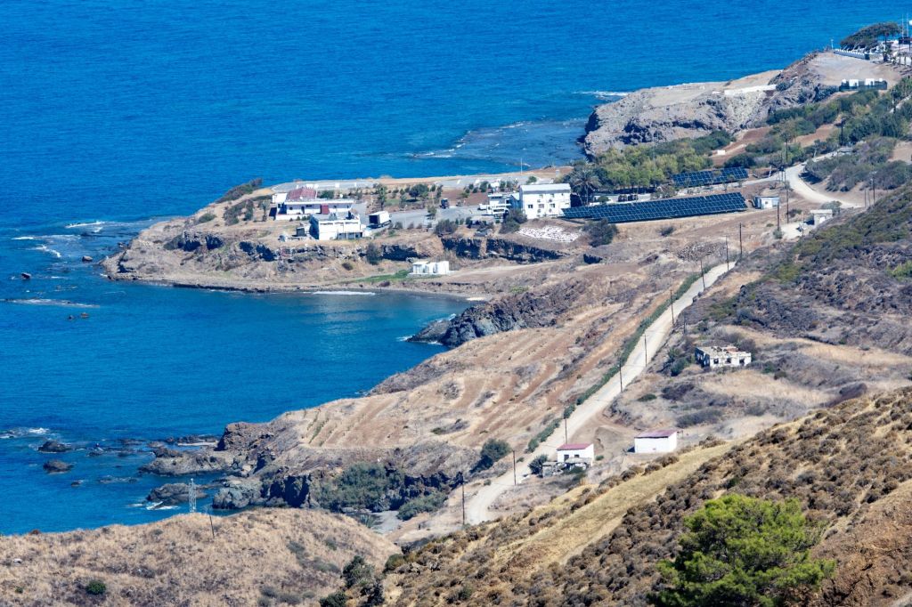
The United Kingdom desired to retain sovereignty over these areas, as this guaranteed the use of UK military bases on Cyprus, including RAF Akrotiri, and a garrison of the British Army. The importance of the bases to the British is based on the strategic location of the island, at the eastern edge of the Mediterranean, close to the Suez Canal and the Middle East; the ability to use the RAF base as staging post for military aircraft; and for training.
The Sovereign Base Areas (SBAs) of Akrotiri and Dhekelia, are usually referred to as Western Sovereign Base Area (WSBA) and Eastern Sovereign Base Area (ESBA) cover a total of 253,8 km² (123² km at Akrotiri and 130,8 Km² at Dhekelia. There has been a debate regarding the extent of sovereignty with the Republic of Cyprus contesting the UK soverignty over the seas adjacent to the SBA’s.
Enclaves and Exclaves
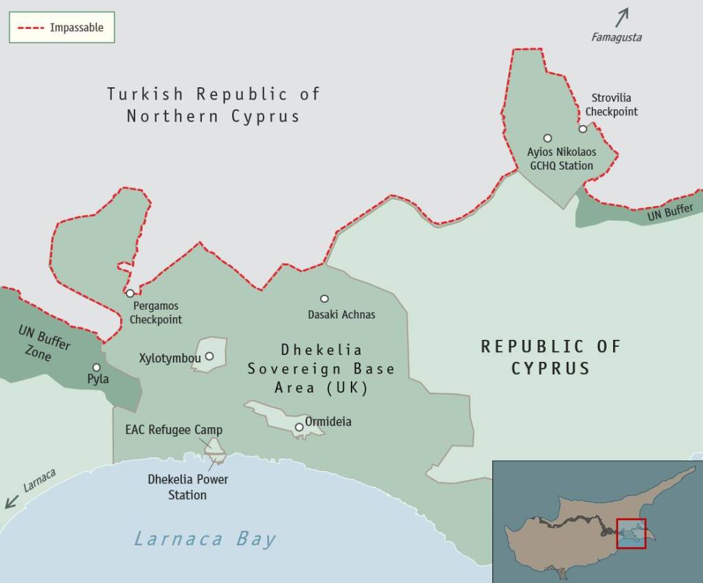
The boundaries of the SBAs were drawn to include the major military installations on the ground and to exclude villages and towns. There are four Cypriot exclaves within the Dhekelia SBA – Ormidhia, Xylotymbou, EAC Refugee Settlement and Dhekelia power station. The Four 4 exclaves are located completely surrounded by ESBA territory and are therefore British enclaves.
In addition, ESBA is bordered in the south by the Mediterranean Sea, in the east and west by Greek Cyprus, in the north by the UN buffer zone and by Turkish Cyprus.
It thus cuts the territory of Greek Cyprus in two parts. This effectively makes the small area east of the ESBA an exclave of Greek Cyprus. The final piece of the jigsaw adding to the overall complexity is there appears that Agios Nikolaos is the only part of the border between Greek and Turkish Cyprus which is not controlled by the UN. The border crossing of Strovilia is located there.
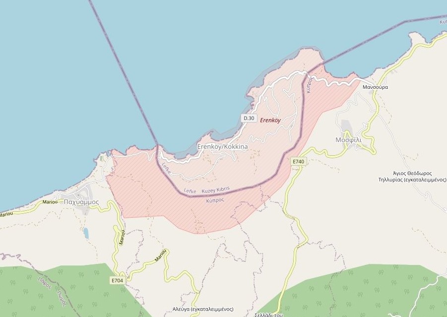
The final exclave is a Turkish one. Kokkina sits several kilometres west of the Northern Cyprus mainland and is a place with symbolic significance to Turkish Cypriots, because of the events of Battle of Tillyria in August 1964. In 1976, all Kokkina inhabitants were transferred to Gialousa (renamed Yeni Erenköy or “New Erenköy” in Turkish) and the exclave has since functioned as a North Cyprus Defence Force military camp.
It is not possible to access Kokkina but it can be viewed from the coastal road E740 as it detours into the hills around the exclave.
Border Crossings
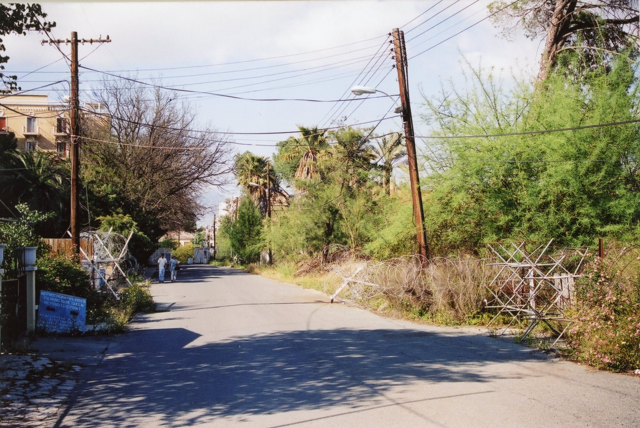
The de facto border between South and North was closed in 1974 until 2003. During this period only officials and SBA personnel were able to cross via 2 crossings; the Ledra Palace Crossing in Nicosia and the Famagusta Gate Crossing for SBA personnel only. In 2024 I crossed into the north by foot and by car. Photography was not encouraged outside Nicosia and I was challenged by TNRC officials.
2001


2024


Please click on the images above to access the reports on the individual border crossings.
The most famous closed border crossing was Ledra Street in Nicosia which led to the city being labelled the only divided capital after the fall of the Berlin Wall in 1989. Whereas other crossings were established after 2003, it was not until August 2008 that the Ledra Street roadblock crossing through the UN buffer zone was reopened after 34 years. This took place in the presence of Greek and Turkish Cypriot officials who cut a ribbon in Kykkou street, the road between Ledra Street and what is known as Lokmaci point in the Turkish controlled part of Nicosia. In 2024 I visited 6 of the 9 border crossings below.
| Name | Area | Borders Crossed | Notes/links |
|---|---|---|---|
| Astromerits/Zodhia | West | CY/UN/TRNC | |
| Limnitis/Kato Pyrgos | West | CY/UN/TRNC | |
| Lefka/Aplici | West | CY/UN/TRNC | |
| Agios Dometios/Kermia/Metehan | Nicosia | CY/UN/TRNC | |
| Ledra Palace 2001 2024 | Nicosia | CY/UN/TRNC | |
| Ledra Street 2001 2024 | Nicosia | CY/UN/TRNC | |
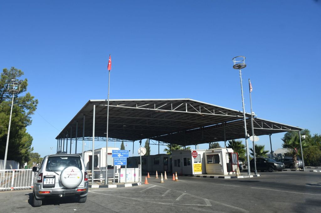
| Pergamos/Beyarmudu/Dhekylia | East | CY/UK/TRNC | |
| Agios Nikolaos | East | CY/UK/TRNC | |
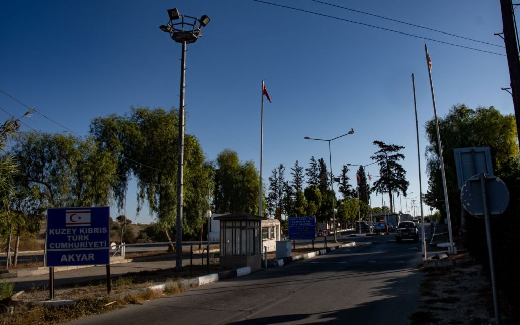
| Strovilia or Akyar | East | TRNC/UK | Krogh (2012) |
Cyprus Tripoints (de facto)
Unlike other tripoints reported on this website, the ones listed below are where differing jurisdictions meet. #5 is complex as currently it is a border crossing between WSBA (hence UK) and the TRNC. I need to explore the border arrangements up to 2000. Please click on the red text below to access my tripoint visit reports.
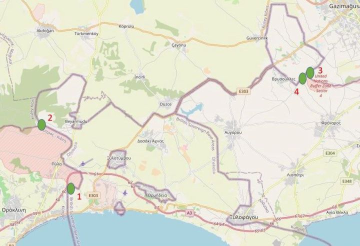
| Number | countries/Jurisdictions | coordinates | TYPE | NOTES/links |
|---|---|---|---|---|
| 1 | Cyprus– United Kingdom – United Nations (west) | 34° 59′ 53″N 33° 42′ 03″E | Dry | Krogh (2012) |
| 2 | TRNC- United Kingdom – United Nations (west) | 35°01’14.4″N 33°41’49.1″E | Dry | |
| 3 | TRNC-United Kingdom – United Nations (east) | 35°04’37.5″N 33°54’07.9″E | Dry | |
| 4 | Cyprus– United Kingdom – United Nations (east) | 35°04’28.0″N 33°53’57.7″E | Dry |
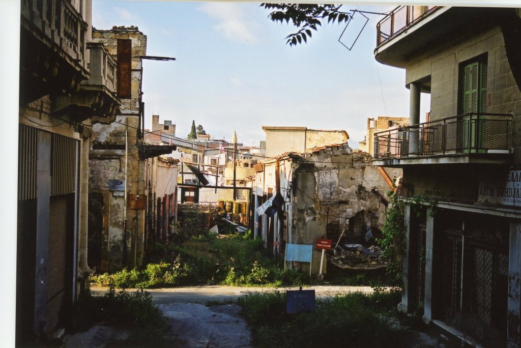
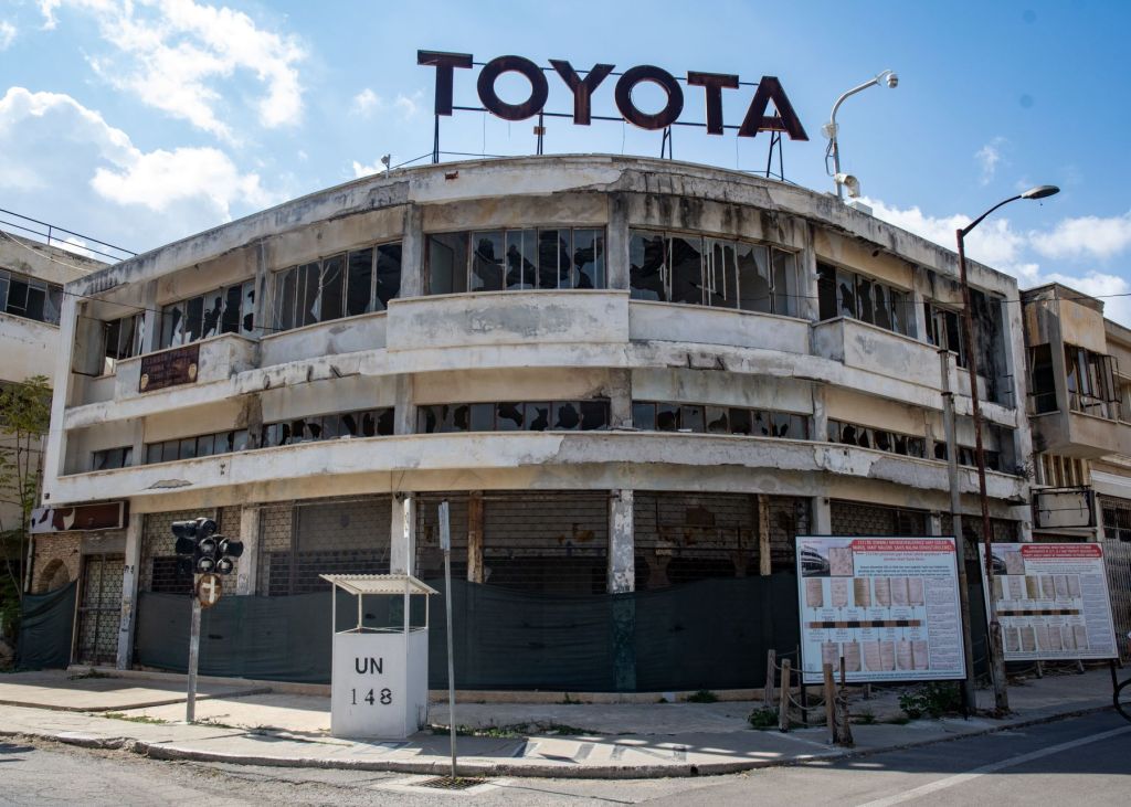
Varosha a deserted city.
Another interesting area for border enthusiasts is within Northern Cyprus.
Varosha is an abandoned southern quarter of the Turkish Cypriot city of Famagusta close to the UN buffer zone and visible from the South. Before 1974, it was the modern tourist area of the city. Its inhabitants fled during the Turkish invasion of Cyprus in 1974, when the city of Famagusta came under Turkish control, and it has remained abandoned ever since. I visited this area in 2001 but unfortunately was spotted taking photographs by TRNC Security forces and the film removed from my camera. In 2024 the situation was very different with parts of the area open to tourists, a process that began in 2020 but is opposed by the South. Photography is allowed in the designated areas.
Cyprus Registration Plates
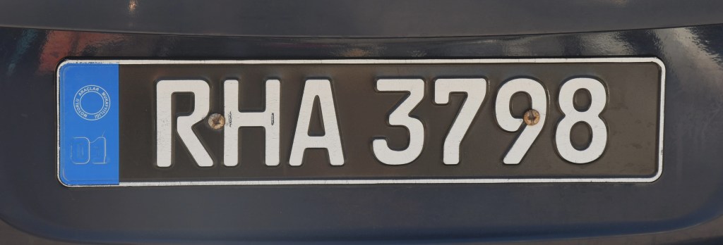
Republic of Cyprus
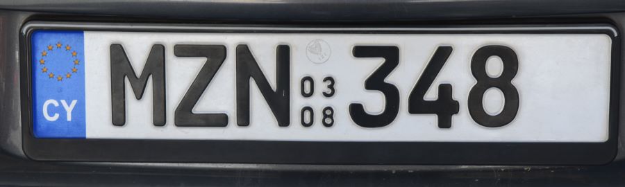
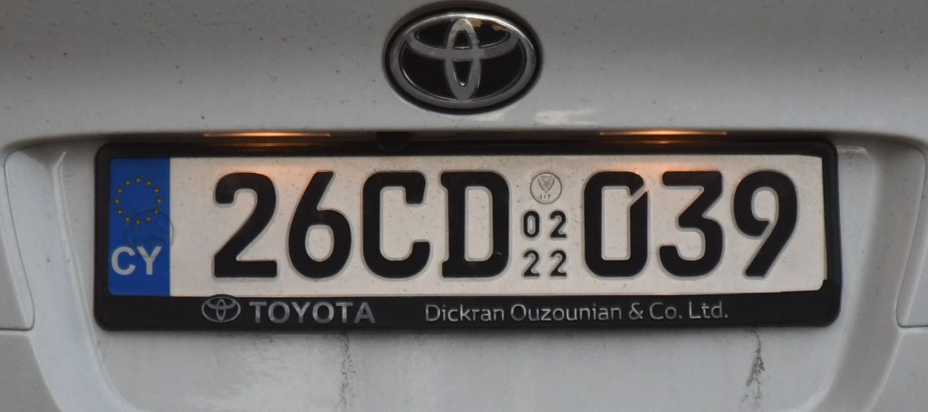
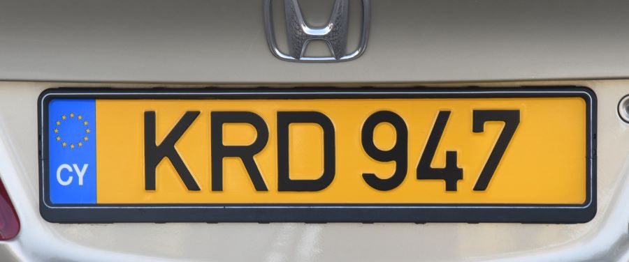
Pre 2013 the plates were similar to the UK ones with white in the front and yellow in the back. Now they are white both on the front and the rear with 3 letters, and 3 numbers. And, in addition, carry the month and year the vehicle was first registered in any country. Following Cyprus’ entry to the European Union in 2004, plates produced since have a blue band on the left edge with the Union’s circle and stars in the top half and the country’s international vehicle registration code CY in the bottom half and using German FE-Schrift as the typeface after 2013,

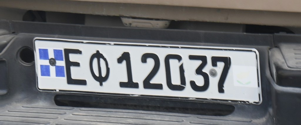
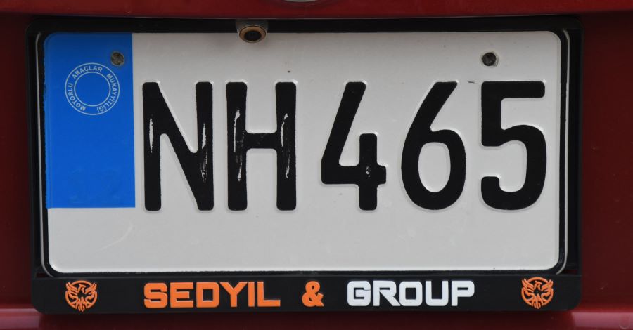
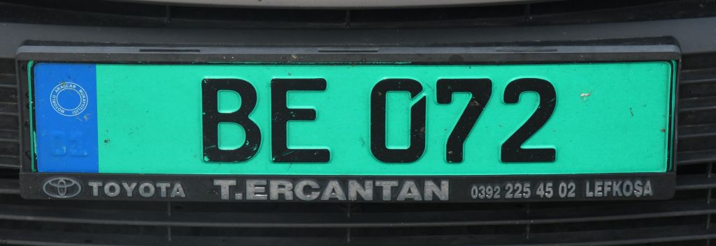
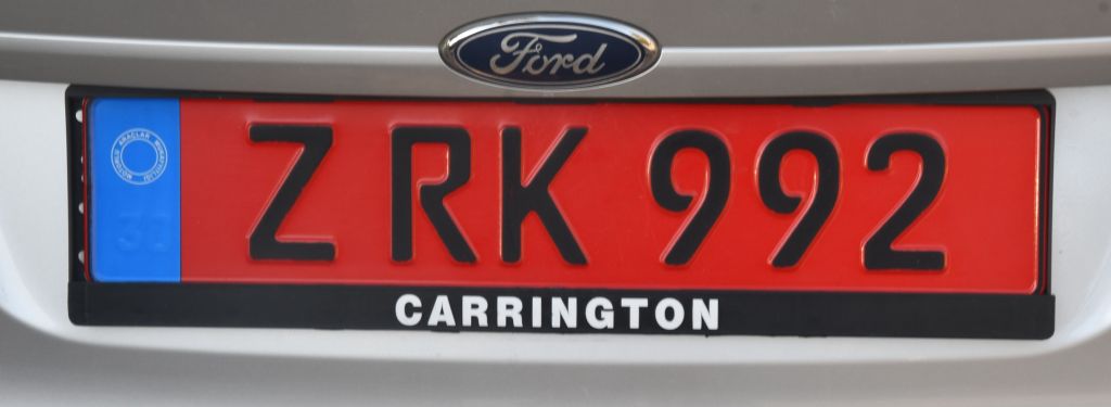
Turkish Republic of Northern Cyprus
Number plates in the north follow the old style pre 2013 format with 2 letters. From 2018 the letter format moved from UK to DE format and there is a blue strip down the left hand side. The stripe must contain the stamp of the Motor Vehicles Registrar (Motorlu araçlar mukayyıgı) and the registration number of the number plate manufacturers. There is no country code as the TRNC is not recognised internationally.

UN


SBA

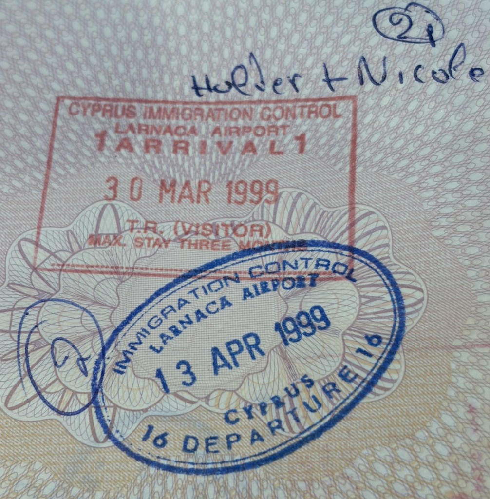
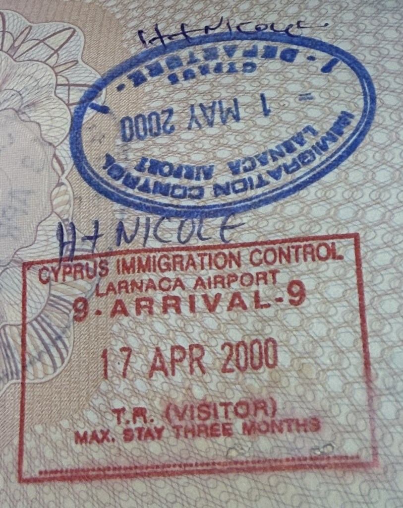
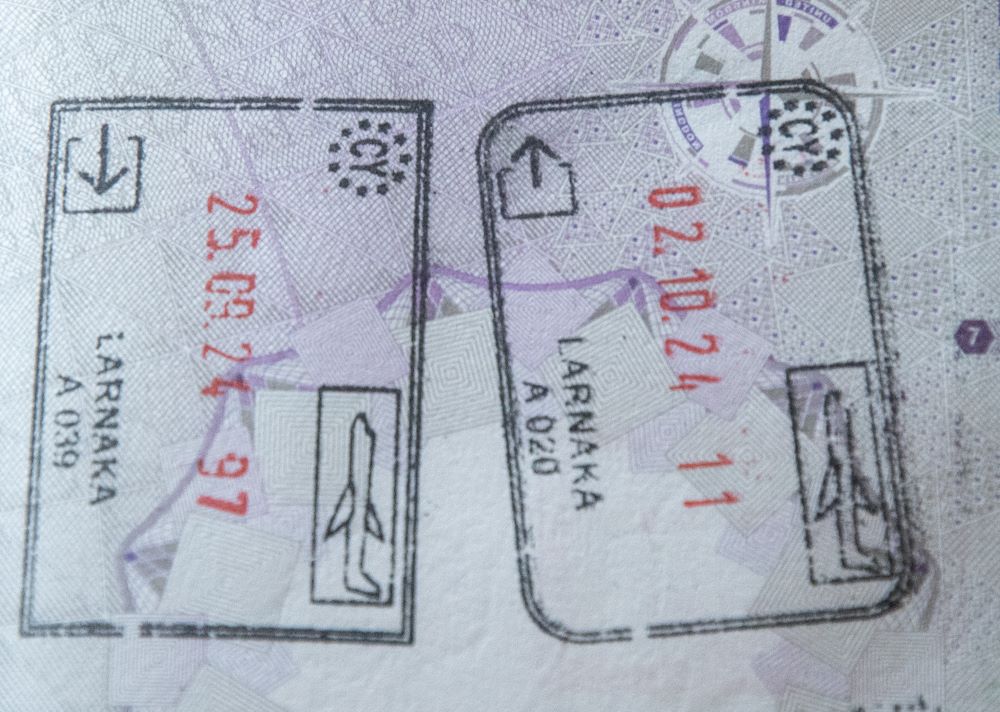
Cyprus Passport Stamps
Republic of Cyprus
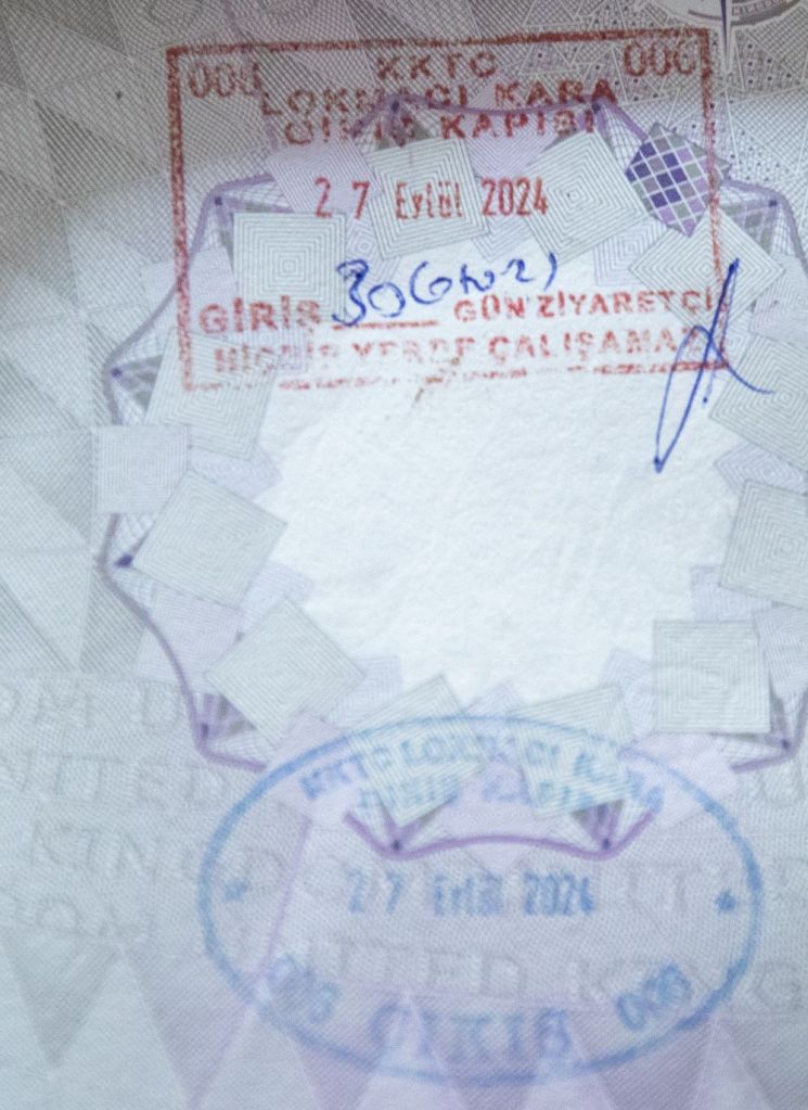
TRNC


Site Navigation
In order to find your way around the site, either click on the links (text in red) or use the menus at the top and side of the pages. About leads you to the main areas of the site. The European Tripoints menu leads directly you to my TP visits reports whereas the Country Visits page allows you to choose which country to look at first.
Mobile Advice
Tables display correctly when holding your mobile horizontally.
To access the links to other pages please click on the 3 horizontal dots at the bottom of the page.

References
Additional helpful and detailed research is available on these border and historical enthusiasts websites.

Hi Barry,
First of all, I’ve just discovered your page – great work all round!
My question is about the UN Buffer Zone in Cyprus. It’s not clear at all to me that this is a separate jurisdiction, as the Republic of Cyprus police conduct operations within the Buffer Zone, sometimes without the knowledge of the UN or the North Cyprus authorities.
So, my question is: have you ever found any evidence that the Buffer Zone exists as a separate jurisdiction legally? There are plenty of examples where RoC authorities have operated within the Buffer Zone, particularly for policing purposes, and even examples where joint RoC-TRNC police raids have taken place in Pyla while both sides denied any knowledge of the other one doing anything.
From what I understand, the Buffer Zone is administratively treated as if it’s part of the government-controlled areas. There’s no separate elected government for those areas, and civilians living in Pyla, Atheniou, etc are subject to RoC laws as far as I can ascertain.
LikeLiked by 1 person
An interesting question, after my recent visit I would suggest that the UN Buffer Zone is a geographical entity where the 2 respective parts of Cyprus are restricted in what they do. It is clear that services and taxes for example are provided and paid for by the RoC. The UN sees its role as reducing tension but also facilitating the development of civil society as a way of reducing tension.
LikeLike
I don’t think 5 is a tri- point at all, it is just a border with a road running through it.
LikeLike
I think you are right, I took this model from another border enthusiast and now I have visited this point there is no third jurisdiction.
LikeLike