
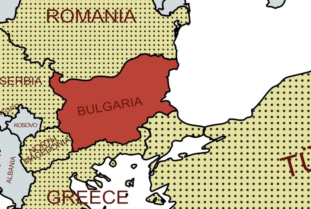
Bulgaria (Bulgarian: България), officially the Republic of Bulgaria, is a country in Southeast Europe. It is situated on the eastern flank of the Balkans, and is bordered by Romania to the north, Serbia and North Macedonia to the west, Greece and Turkey to the south, and the Black Sea to the east. Bulgaria covers a territory of 110,994 square kilometres, and is the sixteenth-largest country in Europe. Sofia is the nation’s capital. Emerging from centuries of Ottoman rule, Bulgaria gained its independence in the late 19th century. Bulgaria allied itself with Germany in both World Wars. In 1946, Bulgaria came under the Soviet-led Eastern Bloc and became a socialist state. The ruling Communist Party gave up its monopoly on power after the revolutions of 1989 and allowed multiparty elections. Bulgaria then transitioned into a democracy and a market-based economy. Since adopting a democratic constitution in 1991, Bulgaria has been a unitary parliamentary republic composed of 28 provinces, with a high degree of political, administrative, and economic centralisation.
Bulgaria is a developing country, with an upper-middle-income economy, ranking 68th in the Human Development Index. Its market economy is part of the European Single Market and is largely based on services, followed by industry—especially machine building and mining—and agriculture. Bulgaria is a member of the European Union, NATO, and the Council of Europe; it is also a founding member of the OSCE, and has taken a seat on the United Nations Security Council three times.
Border Facts
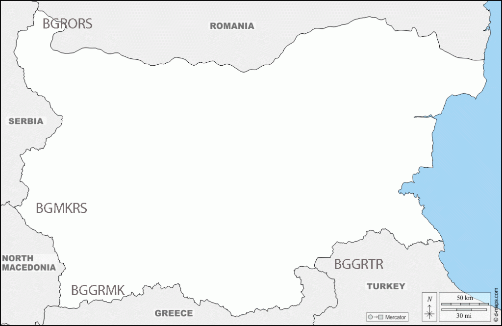
Bulgaria -Turkey border is 269 km long and was confirmed by the Treaty of Lausanne (1923) but was initially established by the Treaty of San Stefano in 1878 as an inner border within the Ottoman Empire.
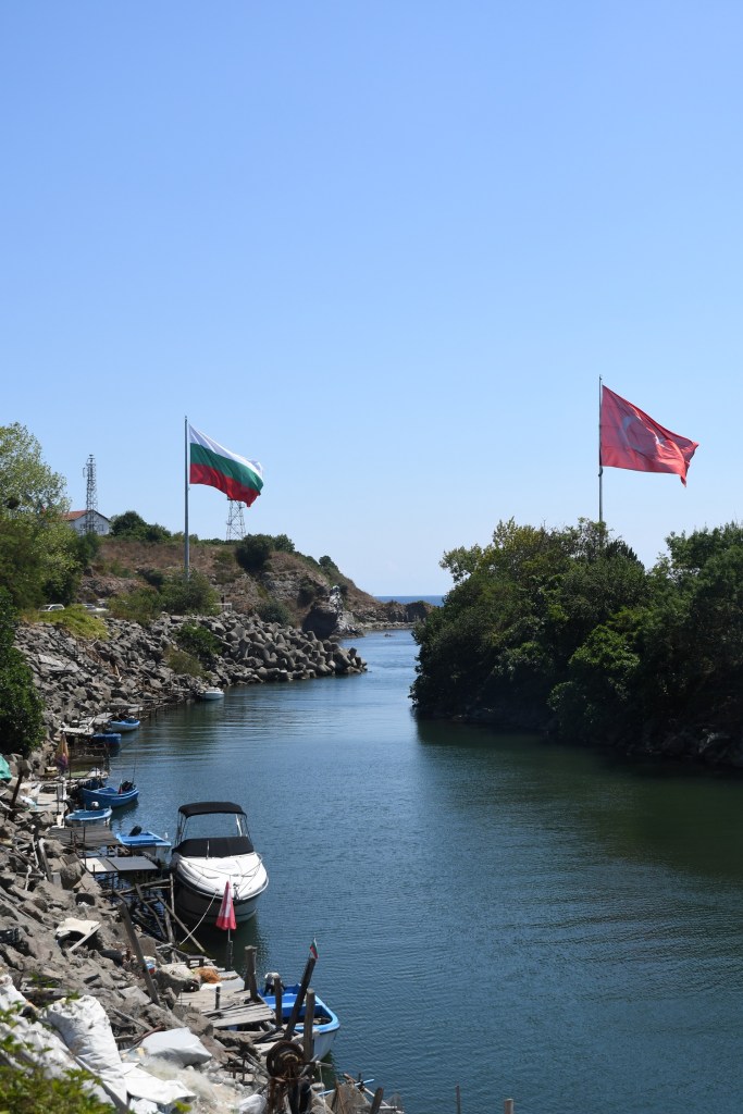
The Bulgaria–Turkey frontier runs from the mouth of the Rezovo River in the east through the Strandzha Mountains and the Dervent Heights, crosses the river Tundzha at the village of Matochina and ends at the river Maritsa at the village of Kapitan Andreevo and the BGGRTR tripoint.
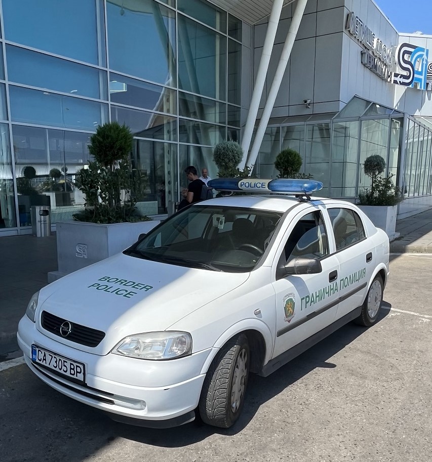
It is an external border of the EU. In response to the migration crisis Bulgaria, like Greece has built a highly fortified security fence. There are three crossings along the entire border, two for vehicular traffic and one for vehicular and rail traffic. The busiest of three, Kapıkule, is among the busiest border checkpoints in the world.
Bulgaria – Greece border is 475 km long, the border between Bulgaria and Greece begins in the west at the tripoint between the borders of
Bulgaria, Greece and Macedonia at BGGRMK. Treaty of Neuilly-sur-Seine (1919) established the current border, where Bulgaria lost various territories due to it being on the losing side in WW1. Although these territories were regained during WW2, after 1945 the 1919 border was restored. The border extends eastwards through the Nestos valley, up to the border tripoint between Greece, Bulgaria and Turkey (BGGRTR), where it crosses the river called “Maritsa” by the Bulgarians and “Evros” by the Greeks.
This border is in large part formed by the Rhodope mountain range. The busiest border crossing point is the Struma valley, the second busiest is close to the Turkish border, in the Maritsa/Evros valley. Greece has been a member of the European Union since 1981, with Bulgaria joining more recently in 2007.
Bulgaria – North Macedonia border is 148 km long. The frontier with North Macedonia runs from the Tumba Peak in the south through the mountains of Ograzhden, Maleshevo, Vlahina and Osogovo up to the summit of Shulep Kamak . There are three border crossings near the town of Petrich and at the villages of Logodazh and Gyueshevo.
Bulgaria – Serbia border is 341 km long. The border with Serbia runs from Kitka through the mountainous region Kraishte,
including the Ruy Mountain, crosses the valley of the river Nishava, runs through the main watershed of the western Balkan Mountains and follows the river Timok for 15 km until its confluence with the Danube. There are five border checkpoints at Dolno Uyno, Strezimirovtsi, Kalotina, Vrashka Chuka and Bregovo.
Bulgaria – Romania border is 630 km long with 21 border crossings. For most of its length, the border follows the course of the lower Danube River, up until the town of Silistra. From Silistra, the river continues north into the Romanian territory. East of that point, the land border passes through the historical region of Dobruja, dividing it into Northern Dobruja in Romania and Southern Dobruja in Bulgaria. The Bulgaria–Romania border is an internal border of the European Union. However, as of 2021 neither country is part of the Schengen Area. As a result, border controls are conducted between the two countries, albeit often jointly (once per crossing).
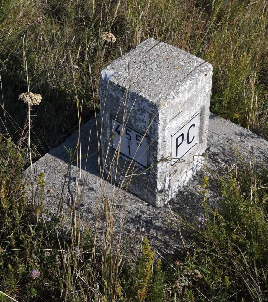
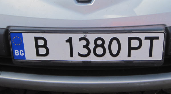
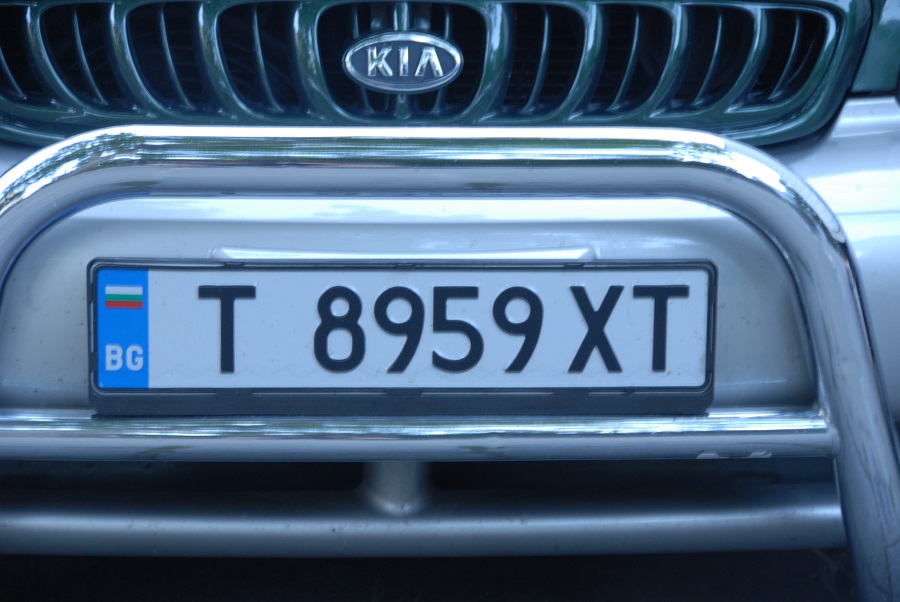
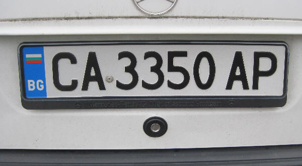
Bulgarian Registration Plates
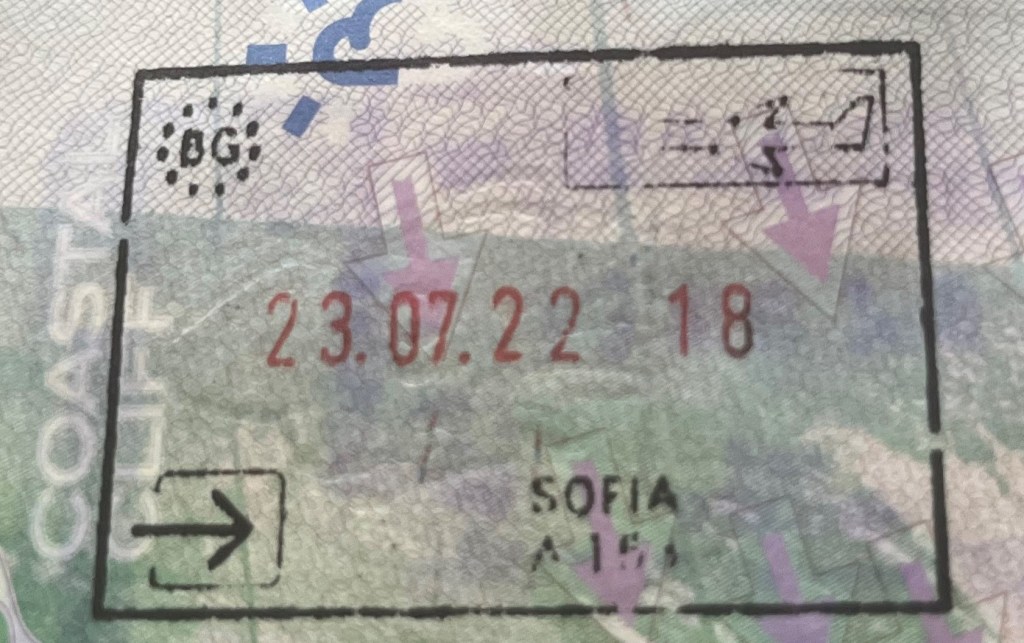
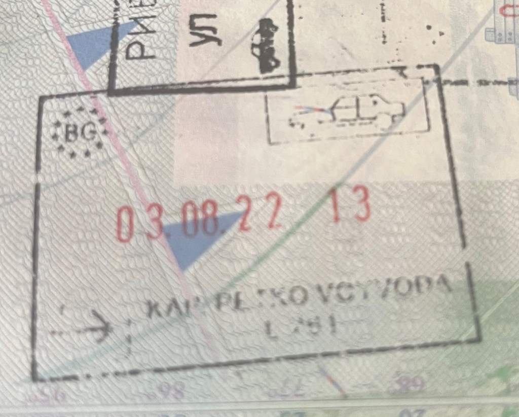
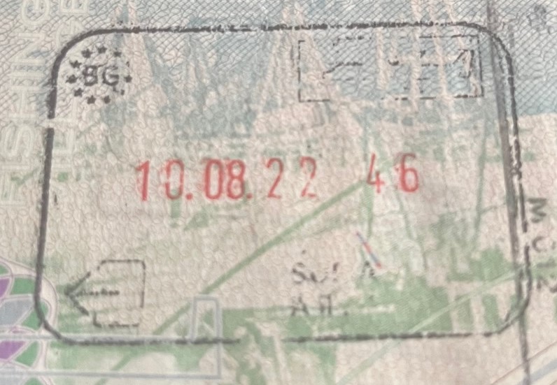
Bulgarian Passport Stamps
Bulgaria Tripoints
| NUMBER | NAME | COUNTRIES | COrdinates | TYPE | NOTES/LINKS |
|---|---|---|---|---|---|
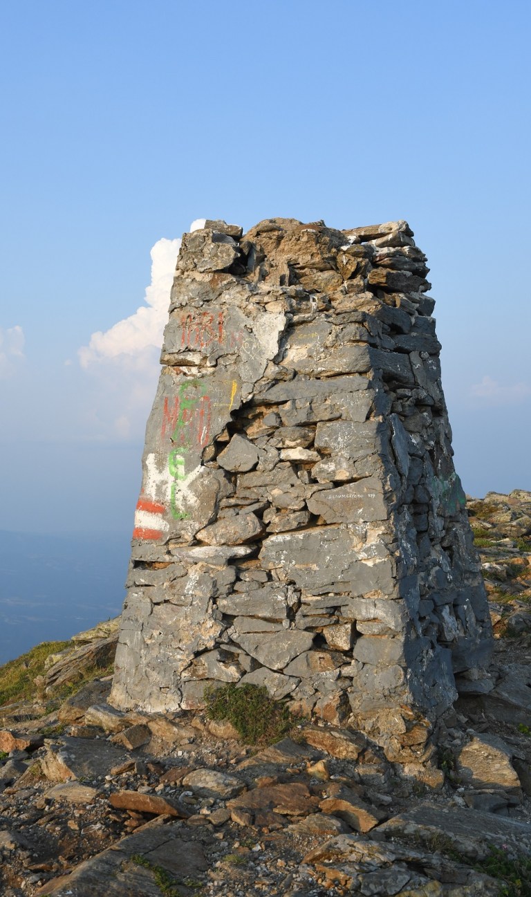
| 1 | BGGRMK | Bulgaria – Greece – Macedonia | 41°20’19″N 22°55’39″E | Dry | The tripoint on Mount Tumba (1880m) and is remote. Most hikers begin in the Bulgarian town of Zlatarevo and walk (approx 19 km) via a series of waterfalls onto the border ridge and then on to the tripoint (and then back again). This tripoint is unusual in terms of the border configuration of the Bulgarian – Greece border and the Bulgarian -North Macedonia border which form a salient or narrow corridor of Bulgarian territory that terminates at the tripoint. The borders are well demarcated and the summit monument impressive. |
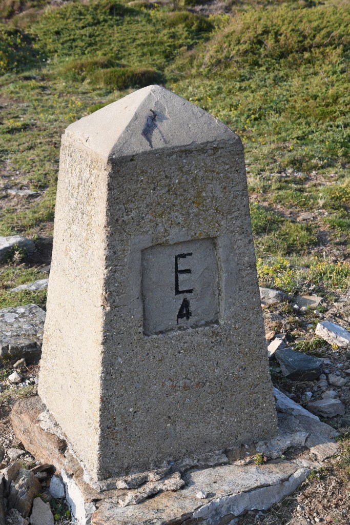
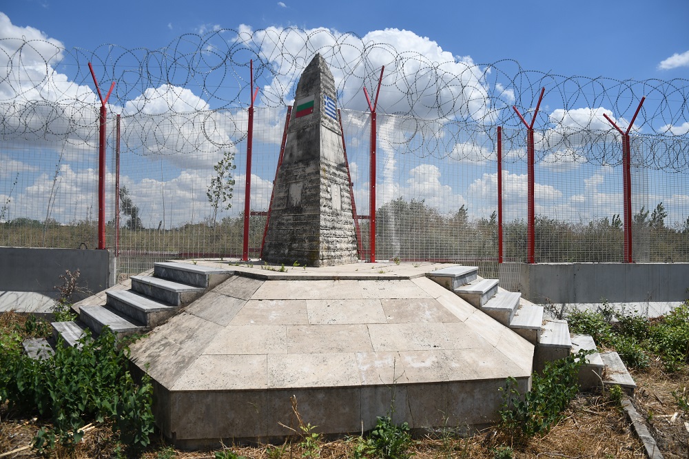
| 2 | BGGRTR | Bulgaria – Greece – Turkey | 41°42’40″N 26°21’28″E | Dry | The tripoint is located on an island adjacent to the Maritsa River. Access roads from BG and TR, or by boat from GR. Access to this point is difficult to arrange and within a secure border area. A TR border fence prevents a circular walk around the tripoint monument. |
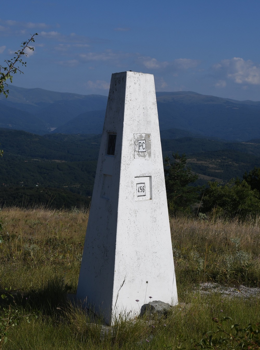
| 3 | BGMKRS | Bulgaria – Macedonia – Serbia | 42°18’40″N 22°21’37″E | Dry | The tripoint is located on Shulep Kamak Peak (1337) and marked by a monument with Cyrillic lettering on all sides. Access via Žeravino, a remote Bulgarian hamlet. A trek to the top. The border between Bulgaria and Serbia was well demarcated, with main and intermediate border markers. The border between Bulgaria and North Macedonia was less well demarcated with main border markers some distance apart. |
| 4 | BGRORS | Bulgaria – Romania – Serbia | 44°12’55″N 22°40’23″E | Wet | The tripoint is located at the confluence between the River Danube and the smaller Timok (BGRS border) river. The border follows the thalweg of the Danube. A tripoint marker exists on the Romania shore opposite the Timok. |
Tripoint Gallery


Site Navigation
In order to find your way around the site, either click on the links (text in red) or use the menus at the top and side of the pages. About leads you to the main areas of the site. The European Tripoints menu leads directly you to my visit reports whereas the Country Visits page allows you to choose which country to look at first. Clicking on photos can lead you directly to reports too.
Mobile Users Advice
Tables display correctly when holding your mobile horizontally.
To access the links to other pages please click on the 3 horizontal dots at the bottom of the page.


WOW! Impressive work! – sooo many changes at the BG borders – especially at the GRTR tp!
LikeLiked by 1 person