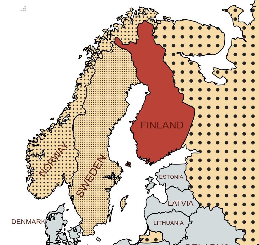
Finland (Finnish: Suomi; Swedish: Finland), officially the Republic of Finland is a Nordic country in Northern Europe. It borders Sweden to the northwest, Norway to the north, and Russia to the east, with the Gulf of Bothnia to the west and the Gulf of Finland to the south, across from Estonia. Its area includes the autonomous territory of Åland, an archipelago at the entrance to the Gulf of Bothnia. About one-third of the territory of Finland—most of the maakunta (region) of Lappi—lies north of the Arctic Circle.
Finland covers an area of 338,145 square kilometres with a population of 5.6 million. Helsinki is the capital and largest city. The vast majority of the population are ethnic Finns. Finnish and Swedish are the official languages, Swedish being the native language of 5.2% of the population.
Finland has been part of Sweden and Russia, from the 12th Century to 1809 as part of Sweden and then part of Russia until 1917. After the 1917 Russian Revolution, Finland declared independence from Russia. In 1918, the fledgling state was divided by the Finnish Civil War. During World War II, Finland fought the Soviet Union in the Winter War and the Continuation War, and Nazi Germany in the Lapland War. It subsequently lost parts of its territory, but maintained its independence.
In 1906, Finland became the first European state to grant universal suffrage, and the first in the world to give all adult citizens the right to run for public office. Finland largely remained an agrarian country until the 1950s. After World War II, it rapidly industrialized and developed an advanced economy, while building an extensive welfare state based on the Nordic model; the country soon enjoyed widespread prosperity and a high per capita income. During the Cold War, Finland adopted an official policy of neutrality. Finland joined the European Union in 1995, the Eurozone at its inception in 1999 and NATO in 2023. It is also a member of the United Nations, the Nordic Council, the Schengen Area, the Council of Europe, the World Trade Organization and the Organisation for Economic Co-operation and Development (OECD). Finland performs highly in metrics of national performance, including education, economic competitiveness, civil liberties, quality of life and human development. Following Russia’s invasion of Ukraine Finland applied for membership of NATO and became a full member in April 2023 which had the effect of doubling Russia’s borders with NATO countries.
Border Facts
Finland shares borders with its neighbouring countries of Norway, Russia and Sweden. The total length of land borders (incl. rivers) of Finland is 2,563 km, (Norway 736 km, Sweden 545 km and Russia 1309 km).
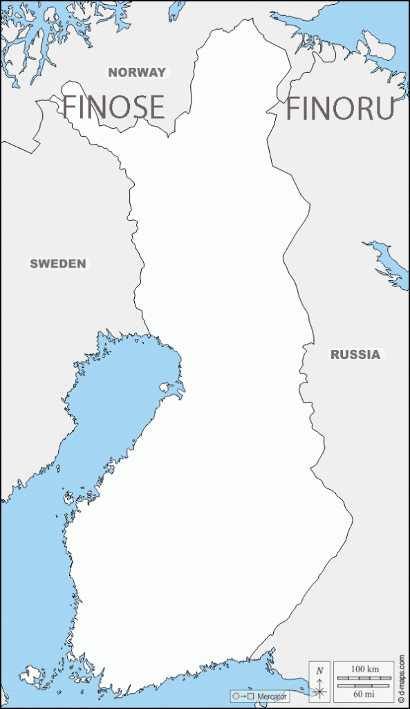
Finland – Norway Border is 736km long. It is a land and river border between two tripoints. The western tripoint FINOSE is marked by Treriksröset, a stone cairn where both countries border Sweden.
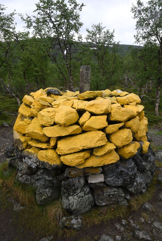
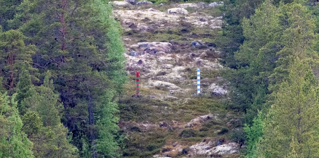
This is the most northern tripoint in the world. The eastern tripoint FINORU is marked by Treriksrøysa, a stone cairn where both countries border Russia. Almost half of the border follows the Tenojoki River or its tributary the Inarijoki River. Much of the border runs through unpopulated wilderness. There are six road border crossings with Kilpisjärvi the farthest west, Utsjoki the farthest north, and Näätämö the farthest east. The border was defined in a 1751 treaty and is clearly defined by border cairns. The Finland–Norway border is open, as both countries are part of the Schengen Area. It is legal to cross the border anywhere if no customs declaration or passport check is needed. An 8-meter wide clear-cut zone straddles the land border.
Finland – Russia Border
The international border between Finland and Russia runs approximately north to south and spans a length of 1,340 km, mostly through uninhabited taiga forests and sparsely populated rural areas without following any specific natural feature or river. It is an external border of the European Union and NATO. It is consequently well policed with increasing reliance on electronic surveillance. The is a restricted border zone on both sides and a permit is required to visit the border. The border can be crossed only at official checkpoints, major border checkpoints are located at Vaalimaa and Nuijamaa. Following the invasion of Ukraine by Russia, Russian citizens are no longer allowed to cross the border. In 2022 there is general agreement to build an anti migrant fence.
The northern endpoint of the border between Norway, Finland, and Russia forms a tripoint FINORU marked by Treriksrøysa, a stone cairn near Muotkavaara.
In the south, the boundary is on the shore of Gulf of Finland, in which there is a maritime boundary between the respective territorial waters, terminating in a narrow strip of international waters between Finnish and Estonian territorial waters.
The Finnish – Russian border has been subject to change. Initially an internal Russian border, following the Finnish declaration of independence in 1917, the border was established with the Treaty of Tartu in 1920. In 1939, the USSR invaded Finland in the Winter War, leading to the signing of the Moscow Peace Treaty the following year. The treaty had Finland cede several border areas to the USSR.
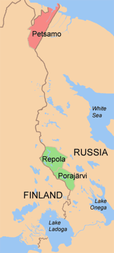
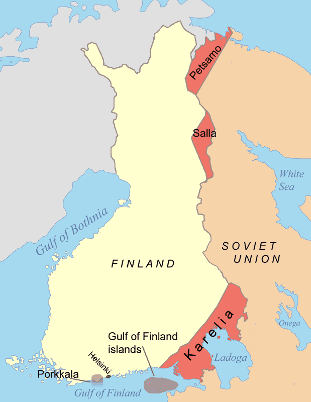
After the Continuation War (1941–44), the land border was demarcated in the Treaty of Paris (1947). As a result, approximately half of Finnish Karelia (including Finland’s fourth-largest city Vyborg), parts of Salla, and all of Petsamo were ceded to the Soviet Union. The new border cut through Finnish territory, severing many rail lines and isolating many Karelian towns from Finland. The Soviet Union demanded the territories be emptied, and Finns were subsequently evacuated from the area and resettled in Finland as almost no one was willing to stay. The areas were then resettled by Soviet immigrants. The Porkkala naval base was leased by the Soviet Union, but it was returned to the Finnish government in 1956. The naval border was established in 1940 and more accurately defined in 1965.
The current border is uncontested and accepted by both sides.
Finland – Sweden Border was created in 1809 by the Treaty of Fredrikshamn, as Sweden ceded Finland over to the Russian Empire. Almost the entire border runs through water: along the Tornio River and its tributaries, and in the Gulf of Bothnia. Only a few kilometres of the border are on dry land. Because of the Schengen treaty and the Nordic Passport Union, the border can be crossed mostly freely.
In the north, the Finnish–Swedish border begins from the Treriksröset tripoint FINOSE at the border of Norway, located in the Koltajärvi lake near Kilpisjärvi, which is also the northernmost point of Sweden. The first 230 m of the border are in straight lines and marked with border signs. The border continues as a river border: first along a small river to Kuohkimajärvi, then along Kuohkimajoki to Kilpisjärvi, then along the rivers Könkämäeno, Muonionjoki and Tornionjoki, a total of 555.5 km (345.2 mi) down to Tornio. The river border runs along the deepest parts of the rivers (the Thalweg), and is not marked with border signs; instead the border location is defined by the official maps of the border protocol. There are some border markers near Tornio where the border runs on land.
In the Bothnian Bay and the Bothnian Sea, the Finnish and Swedish territorial waters are separated by international waters. In the Norra Kvarken, the distance between land is down to 22.4 kilometres (12.1 nmi), giving less than the normal 12 nautical miles (22 km) to each country. Here a narrow channel of international water goes along an agreed path. The territorial waters meet again in the Sea of Åland, where the countries have a maritime border of 15 kilometres. The border crosses the island of Märket, which has a 470-metre long, complexly shaped border marked with border signs.
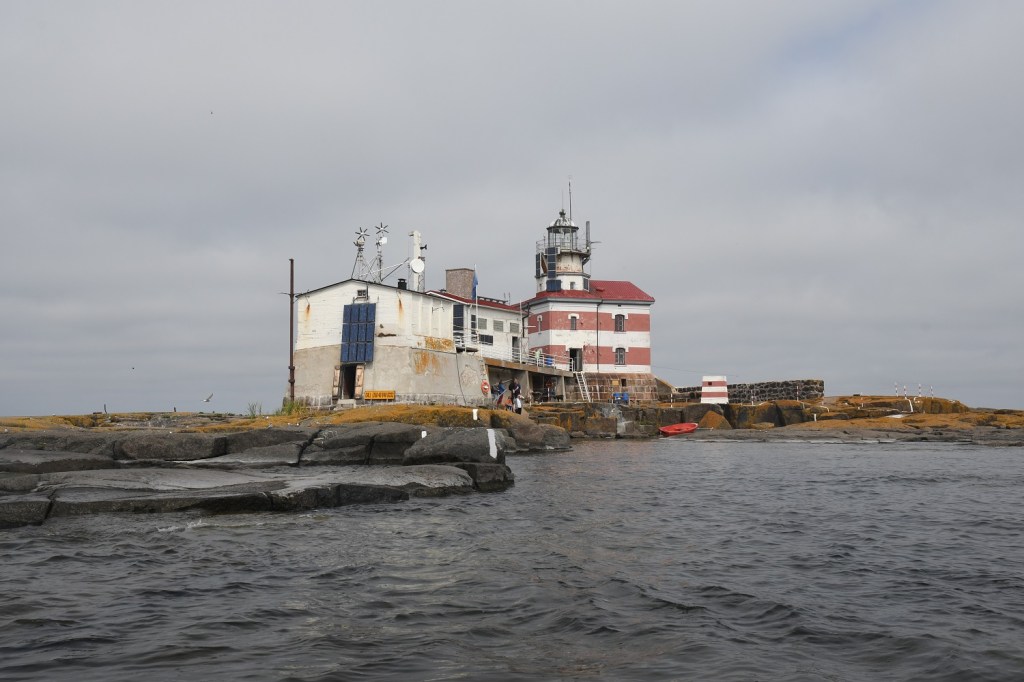
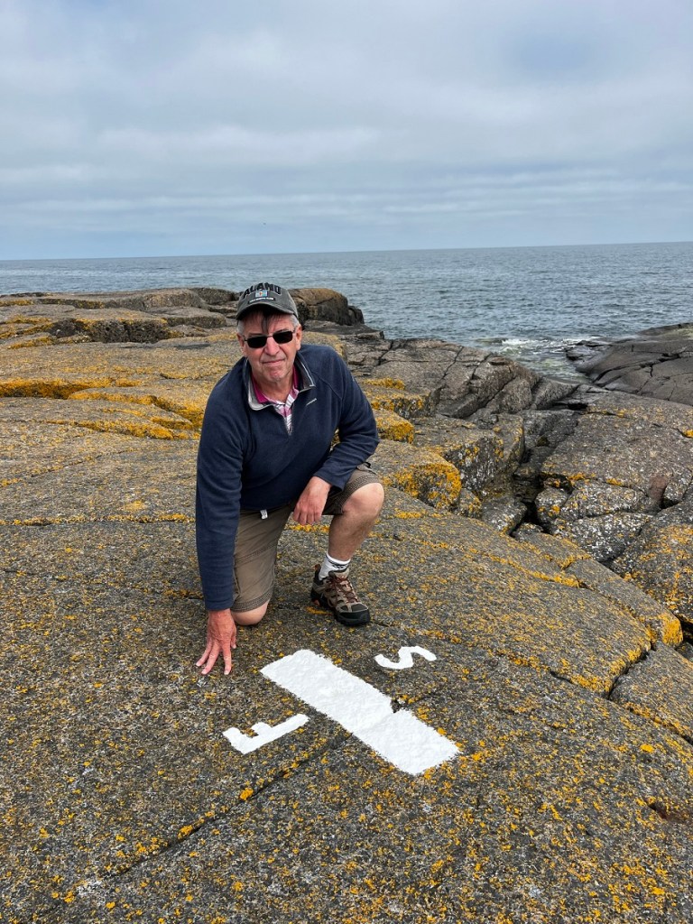
The island of Märket was decided to be split in two parts in a topographical description made in 1811. The border was decided to run through the geographical centre of the island (defined by coordinates) in the treaty of Åland in 1921 and in the treaty of continental plates in 1972. The Märket lighthouse, built in 1885 by Finland and operated by them, was left on the Swedish side. In 1981, the border on the island was modified so that the Lighthouse was within Finland. My Märket Island visit report is here.
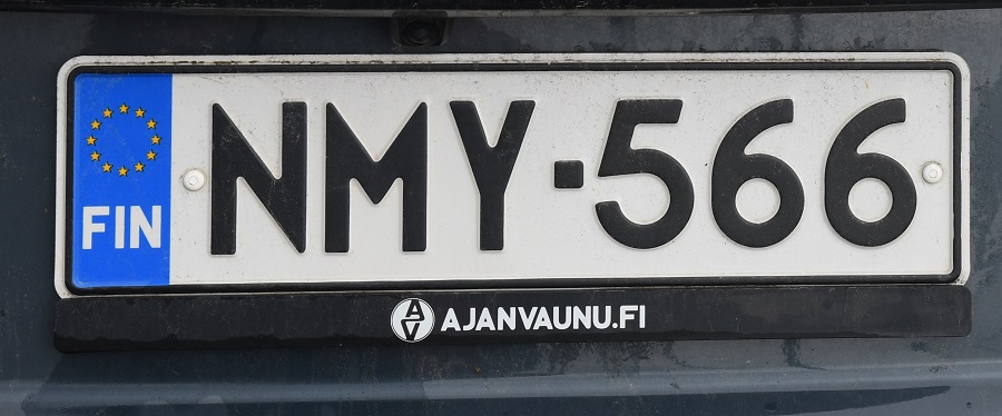
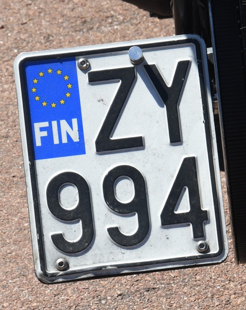
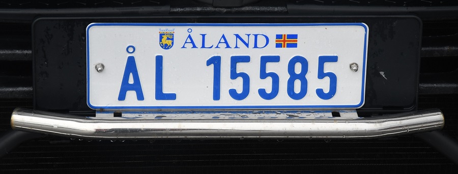
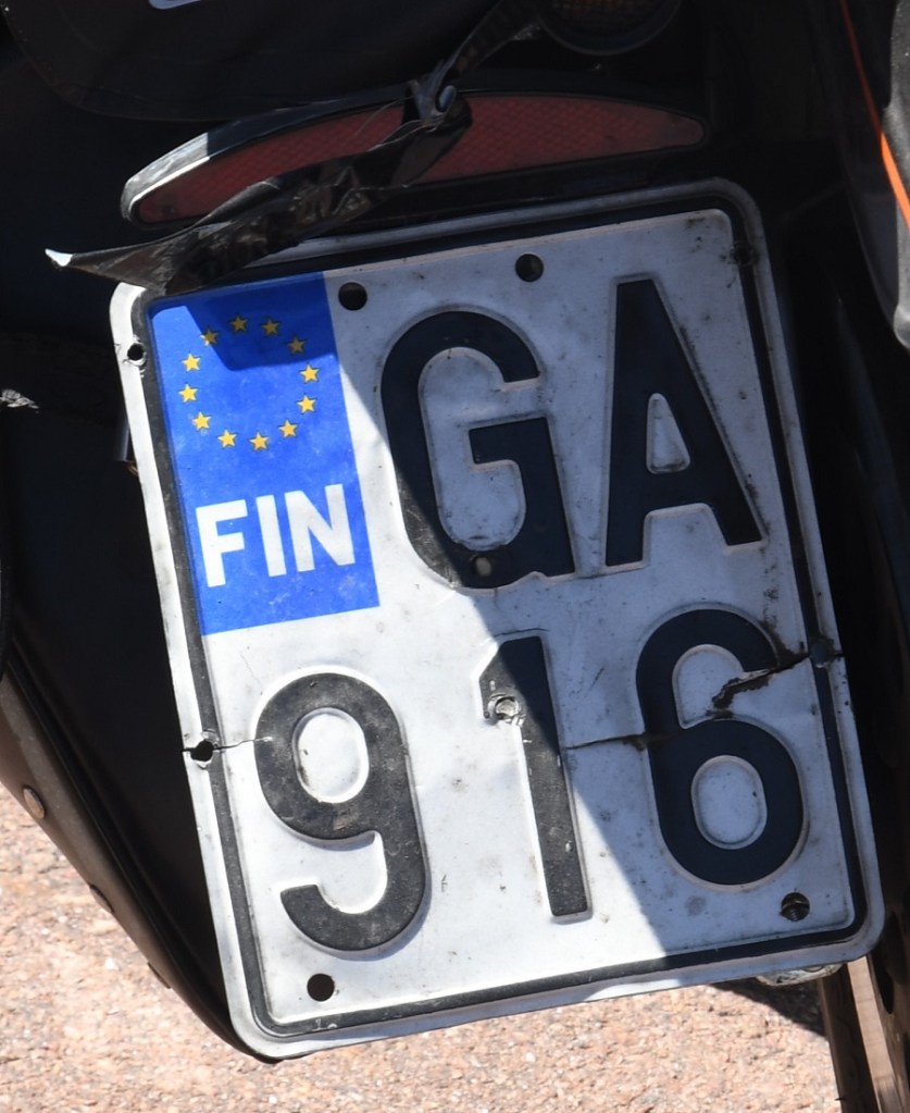
Finnish Registration Plates
Finnish Tripoints
| NuMBER | NAME | COUNTRIES | COORDINATES | TYPE | NOTES |
|---|---|---|---|---|---|
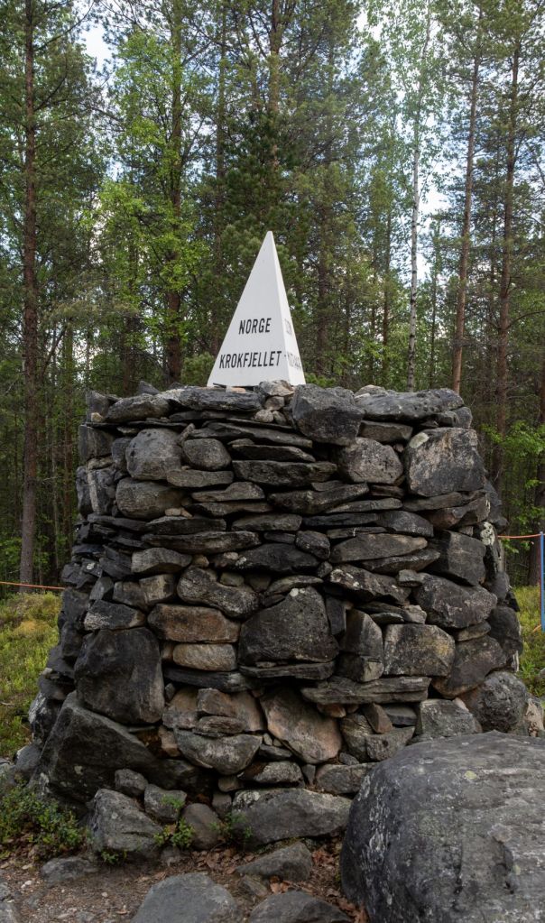
| 1 | FINORU | Finland – Norway – Russia | 69°03’07″N 28°55’44″E | Dry | Treriksrøysa (‘Three-Country Cairn’) is a cairn which marks the tripoint. The site is on a hill called Krokfjellet (Norwegian) or Muotkavarre (Finnish and Russian), in the Pasvikdalen valley. It is the only place in Europe where three time zones meet. The tripoint is marked by a cairn (which is unnumbered). There is a white pyramid on top with the respective countries names written on. Krogh (2012) Van der Giessen (2024) |
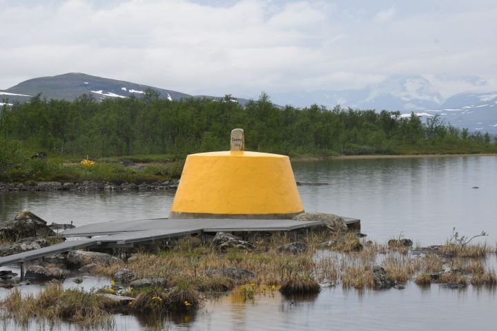
| 2 | FINOSE | Finland – Norway – Sweden | 69°03′35″N 20°32′49″E | Dry | The Three-Country Cairn marks the tripoint. The current tripoint monument was built in 1926 and was originally beige, conical frustum made of concrete, located about 10 metres out in Lake Goldajärvi. The monument is large and there are engraved headstones with symbols of each country. Technically walking around the monument on the platform means leaving Sweden, entering a small pene enclave of Norway and then entering Finland if you walk in a clockwise direction. The are several border markers in the vicinity. Krogh Van der Giessen (2024) |
Tripoint Gallery

Site Navigation
In order to find your way around the site, either click on the links (text in red) or use the menus at the top and side of the pages. About leads you to the main areas of the site. The European Tripoints menu leads directly you to my visit reports whereas the Country Visits page allows you to choose which country to look at first. Clicking on photos can lead you directly to reports too
Mobile Users Advice
Tables display correctly when holding your mobile horizontally.
To access the links to other pages please click on the 3 horizontal dots at the bottom of the page.