
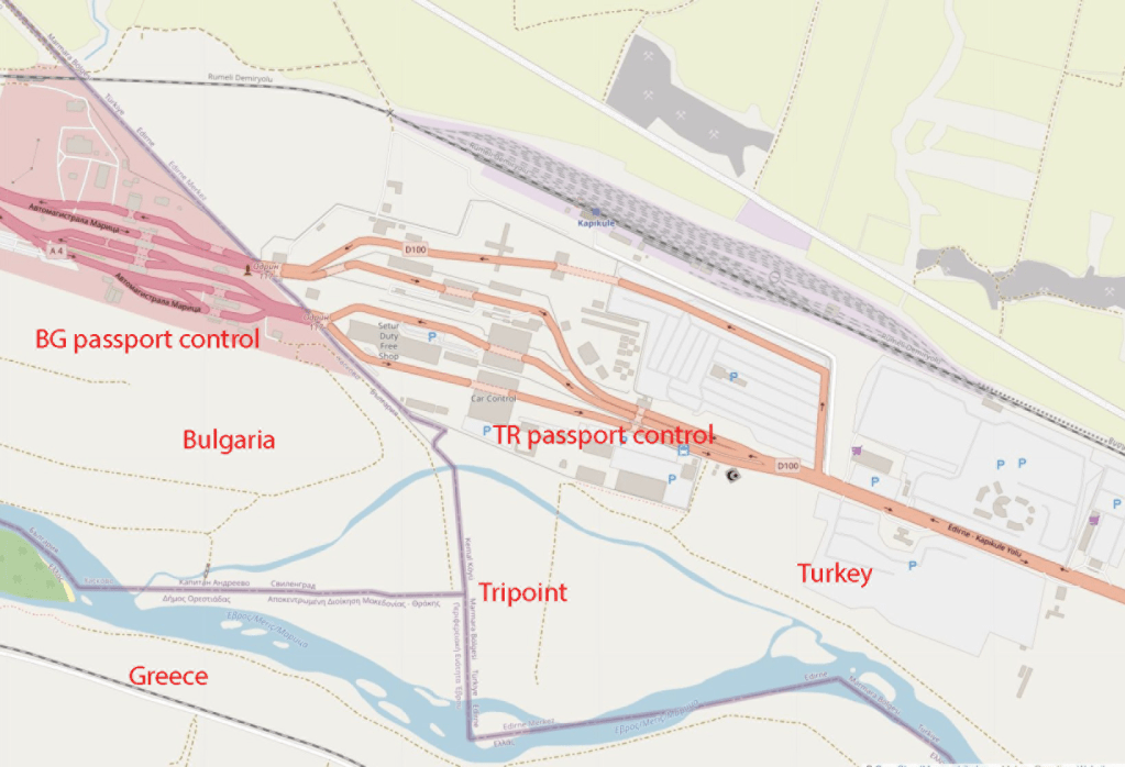
The tripoint between Bulgaria, Greece and Turkey was the third one I visited in the summer of 2022. The other 2 were remote points within the mountains bordering the respective countries, this one was in a restricted border zone where special permission was required. Other members of the International Border Research Group IBRG had visited the spot in 2005 and since that time no western border enthusiast had got near. The photos of this point were non existent on line or dated from that one visit. Although this was a drive in it was on an island and the access points were behind the respective border control booths. This was not a place you could simply turn up and hope to gain access.
Whereas my friends within the IBRG approached via Turkey, it made sense to me to contact the Bulgarian border authorities, an EU country and unlike either Greece or Turkey whose military controlled their borders, the Bulgarian Border Guard were an element of their police force. I had one further advantage, when I applied I had a teaching post in a top University within the UK, I therefore made a request as an academic to visit the tripoint as part of my research.
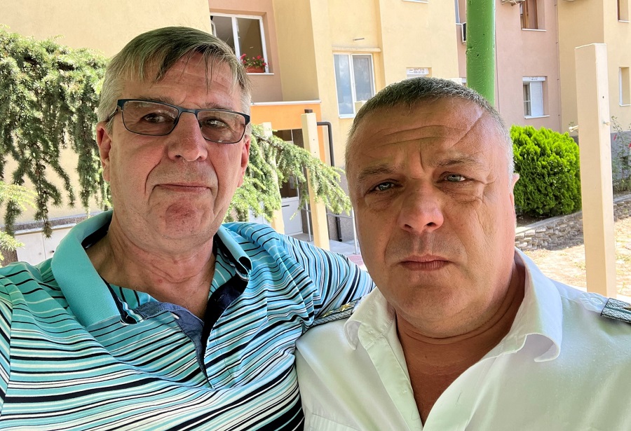
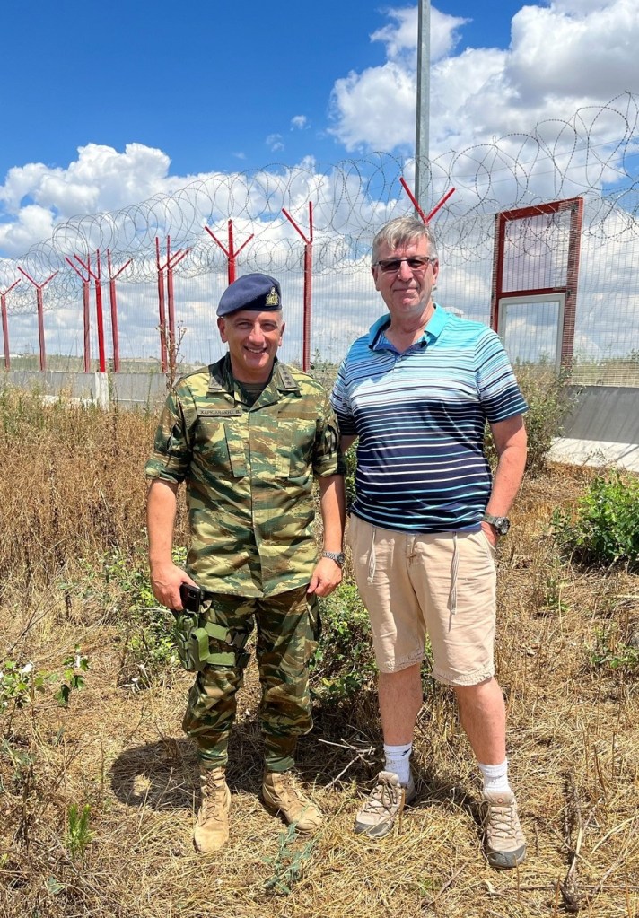
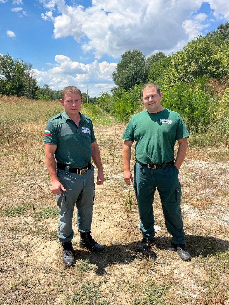
From the outset the Bulgarian authorities were helpful and supportive, my initial enquiries were handled by the Chief Directorate Border Police and then by the regional authorities RDBP Elhov. Several e mails later, permission was granted and I was to go to the BCU office in Svilengrad. The whole process took 6 months, upon arrival there was one further hurdle to overcome which was I needed final approval from the Chief of Police. This was granted after an interview and I am hugely grateful to him, his colleagues and especially the officer who accompanied to the tripoint who had oversight of the Frontex activities of the area. Without his approval and the colleague accompanying me it would not have been possible to got through the security checks prior to accessing the tripoint area.
Another border puzzle
The border between between Bulgaria and Turkey was confirmed with the Treaty of Constantinople in 1913. The Treaty of Neuilly 1921 agreed the demarcation of the border and yet another treaty, the Treaty of Lausanne in 1923 established the position of the tripoint with Greece which finally was fixed on the Maritsa River by a demarcation commission in 1926. So here is the puzzle, the treaty clearly places the tripoint in the river and looking at the above maps this would make sense. Differing maps give differing positions, but all in the river.
A wet tripoint?
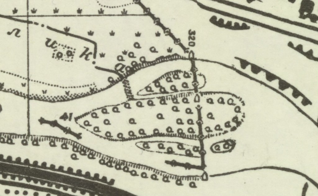
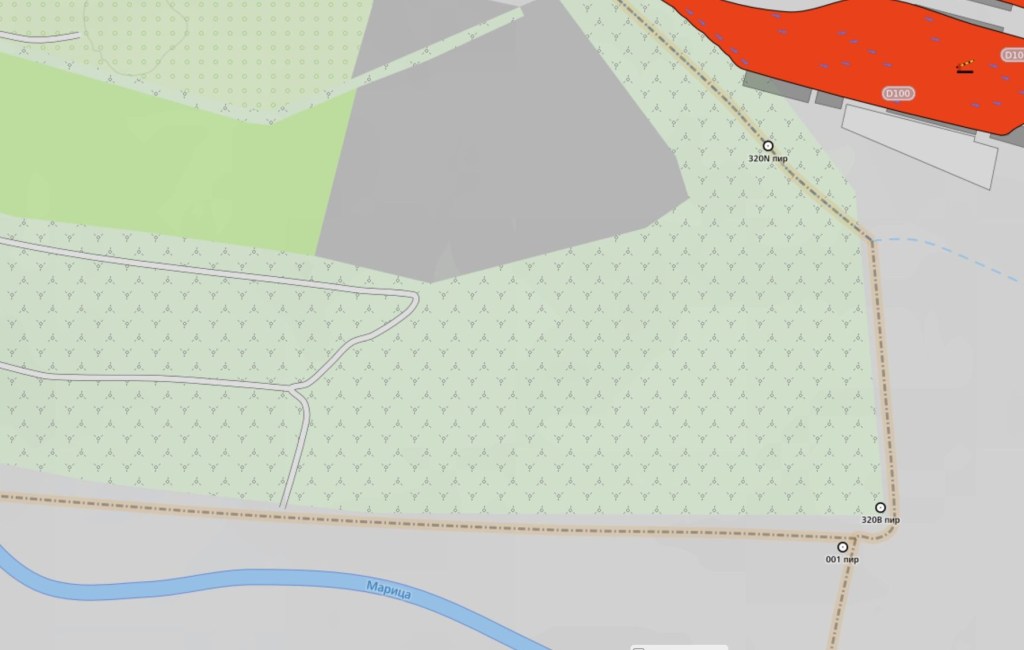
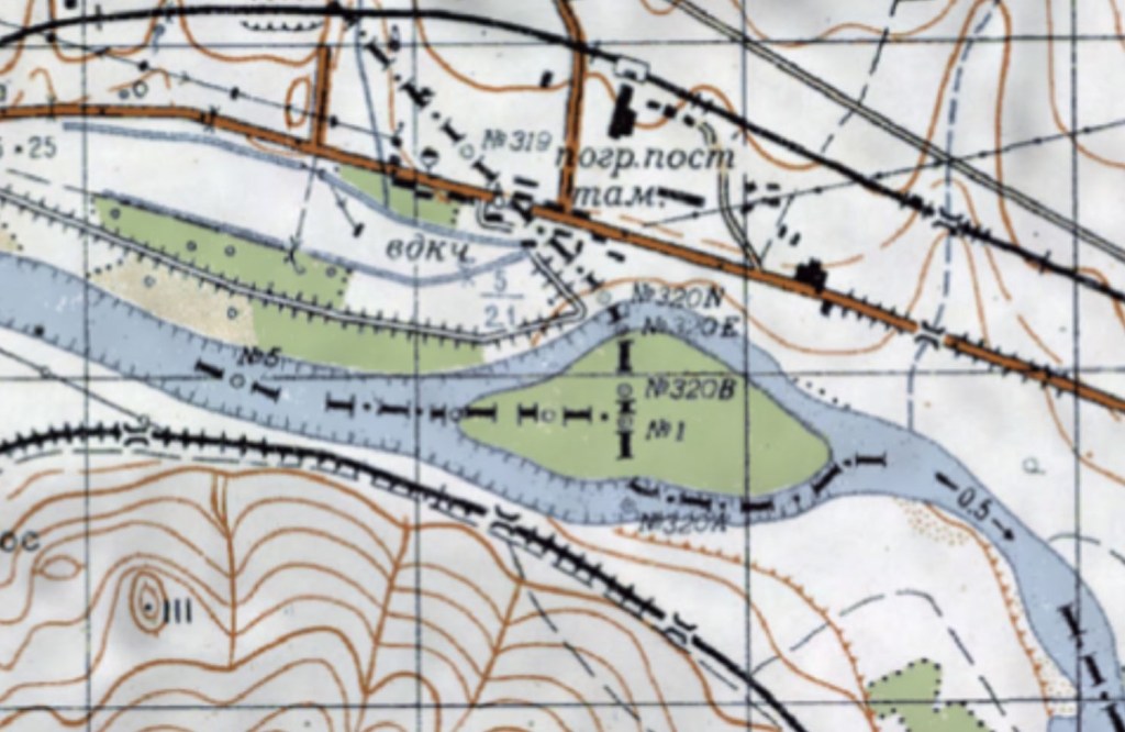
A Bulgarian topographical map has the border in the Maritsa river with the island being divided between Bulgaria and Turkey. The tripoint is wet, and there is no Greek territory north of the river. Other Bulgarian maps also have the tripoint in the river but at a different point.
A dry tripoint?
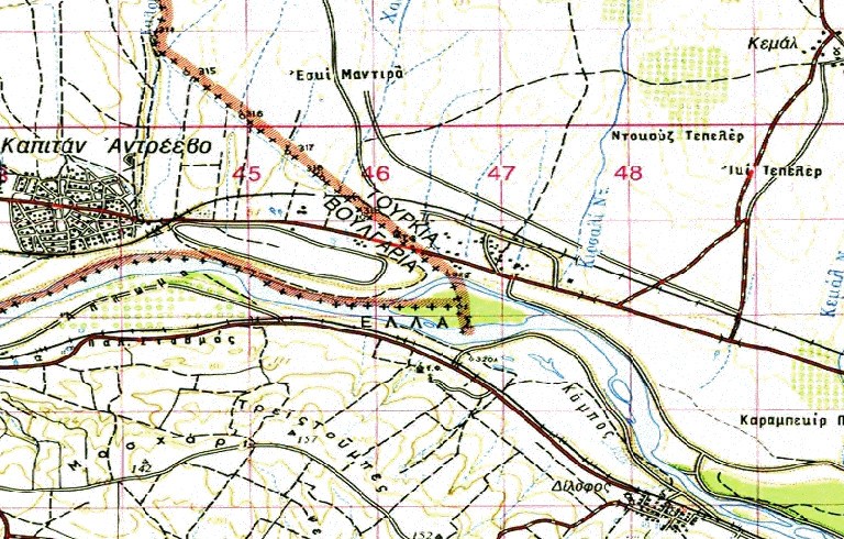
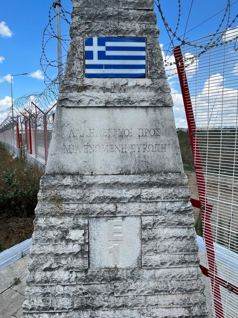
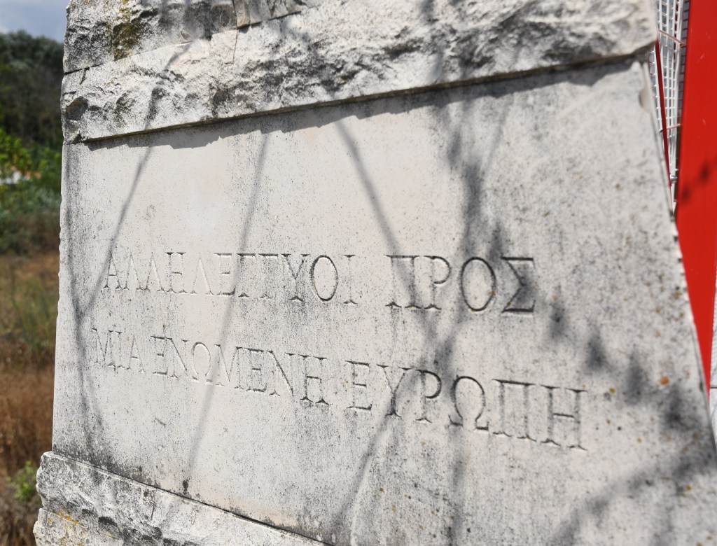
This Greek map has the tripoint in its current de facto position with the south western part of the island belonging to Greece. Both maps have the BG/TR border in the same position (above left)
Soviet topographical maps also have a divided island between the 3 countries (below left).
To date it has not been possible to discover when the border in this area was altered or by whom and how was this ratified by treaty. People I spoke to on my visit from both Bulgaria and Greece were not able to explain why we now have a dry tripoint when early maps and the treaty suggest otherwise.
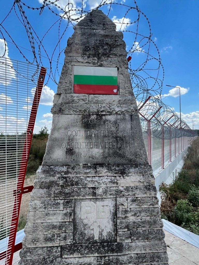
My best guess is that Bulgaria ceded a portion of the island to Greece so the tripoint was symbolically relocated. There is reference to the new tripoint monument being called the Peace Monument.
Photos from my visit
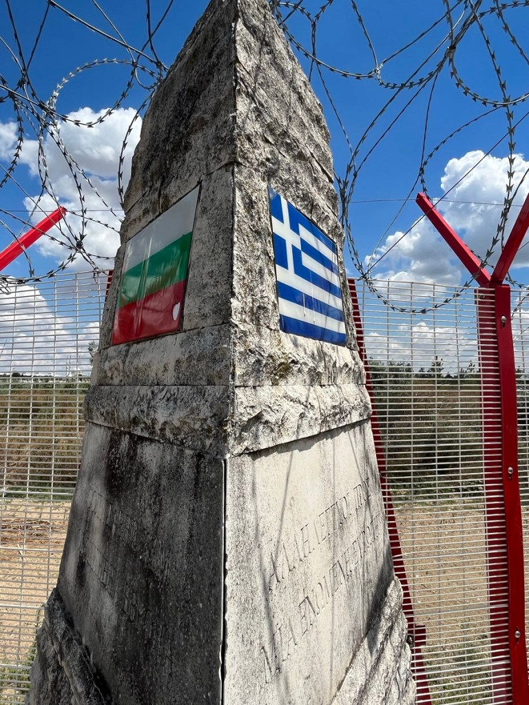
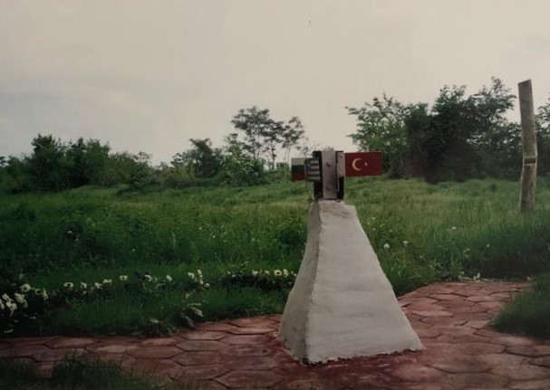
The Tripoint
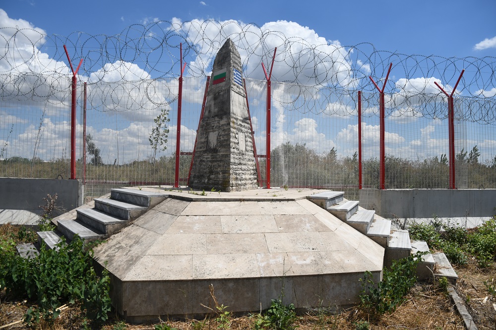
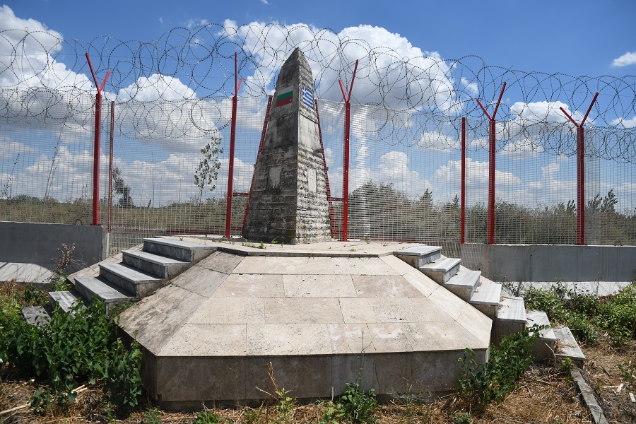
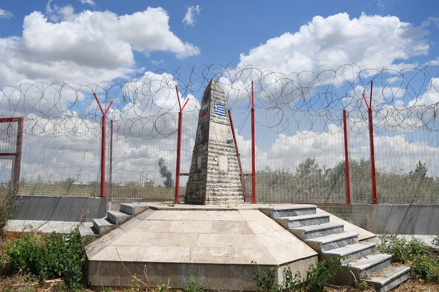
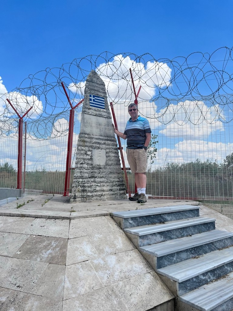
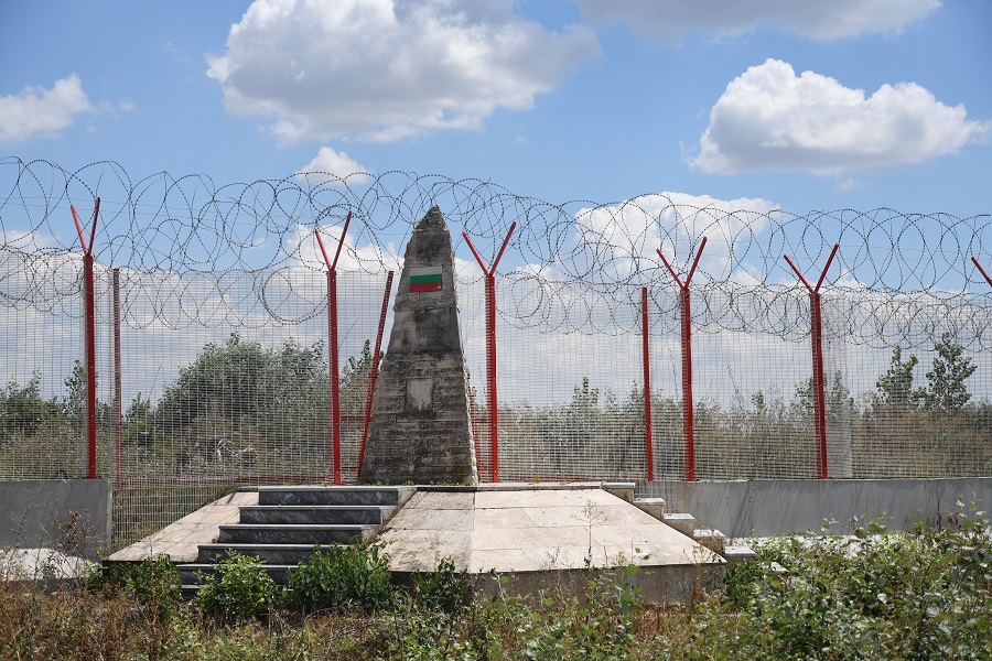
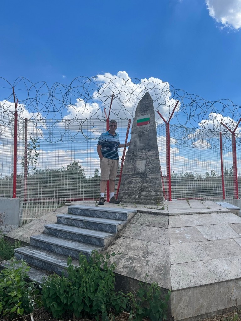
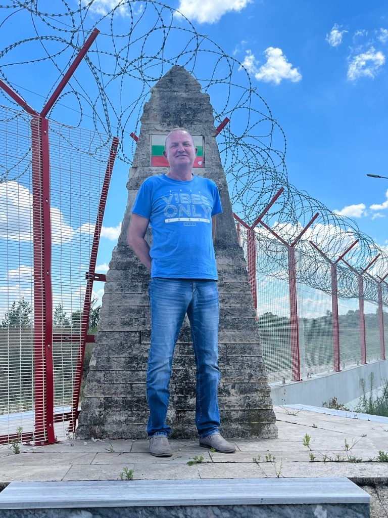
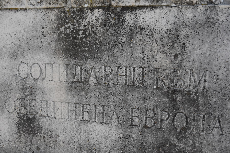
Monument Details
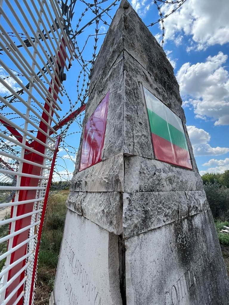
The monument had national flags and transcriptions on the 3 sides. Unfortunately due to the Turkish border fence which cut across the monument it was not possible to walk around the monument itself. Latin-Cyrillic-Greek script at a tripoint maybe unique.
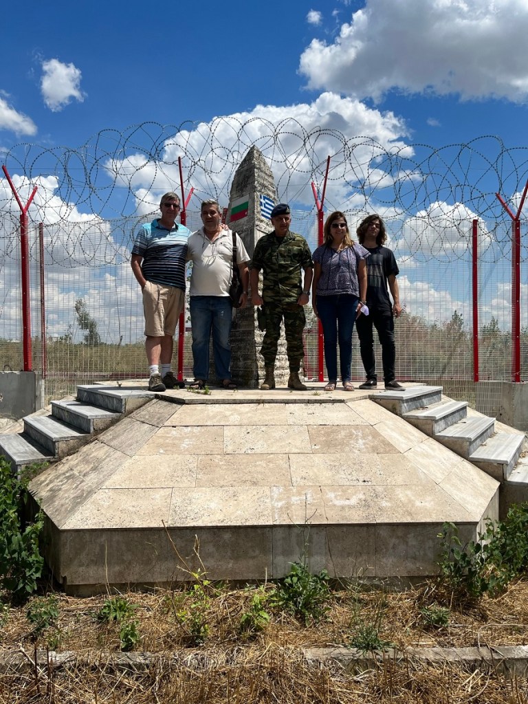
One of the highlights of my visit was whilst I was there, we were joined by a group from Greece who had crossed the Maritsa river by military launch. They were friendly and chatty, but somewhat surprised that a UK national was visiting the site. They all had links to the Greek military and were accompanied by a Greek Army officer, all of which suggests to me that this is also not an easy place to access from Greece either.
The Borders
Bulgaria – Greece border
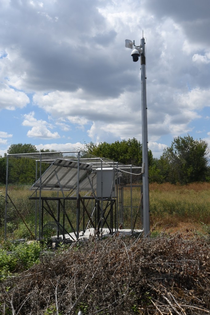
As the maps indicate above, the Bulgaria Greece border is a straight east- line from the tripoint. There are no signs or indication of Greece, although there are solar panels and CCTV surveillance along the border, the Greek group told me the vegetation is cleared once a year.
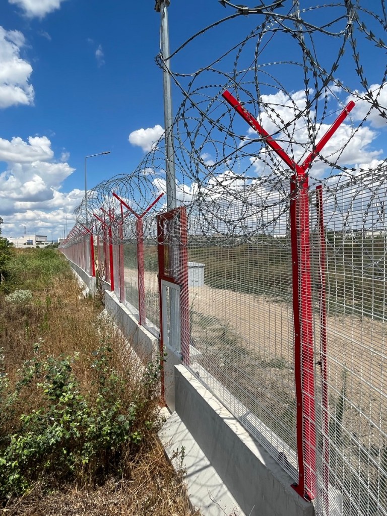
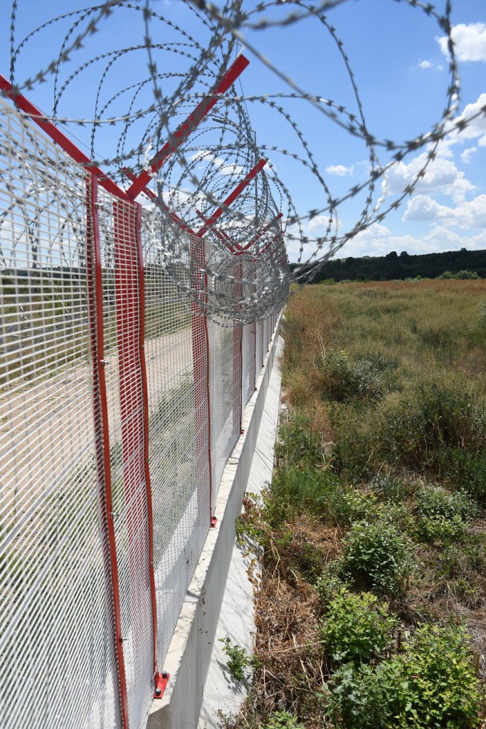
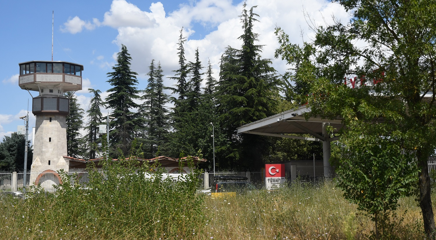
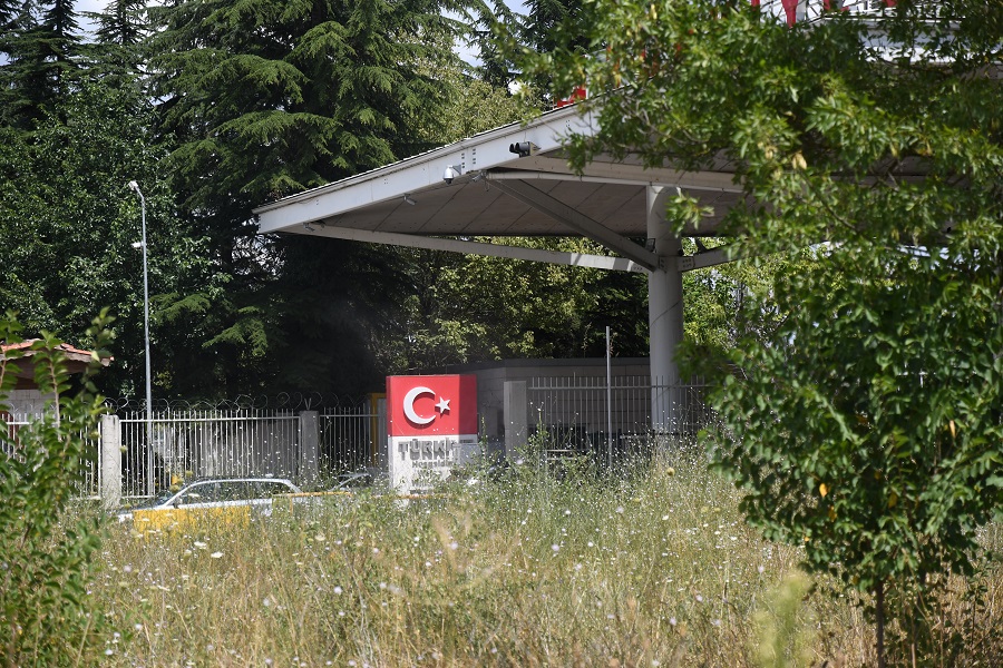
Turkish border with both other countries
It is very easy to identify this due to the Turkish fence which was constructed in 2009. This is separate to the Greek and Bulgarian anti migration fences built elsewhere along the border,
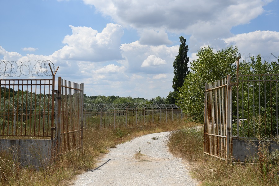
Accessing the Tripoint
Without my Bulgarian border official guide, I would have had no chance of accessing the secure area which was behind the Bulgarian passport control booths, driving straight through the booths, and then making a sharp right hand turn onto a small road moments before the Turkish border.
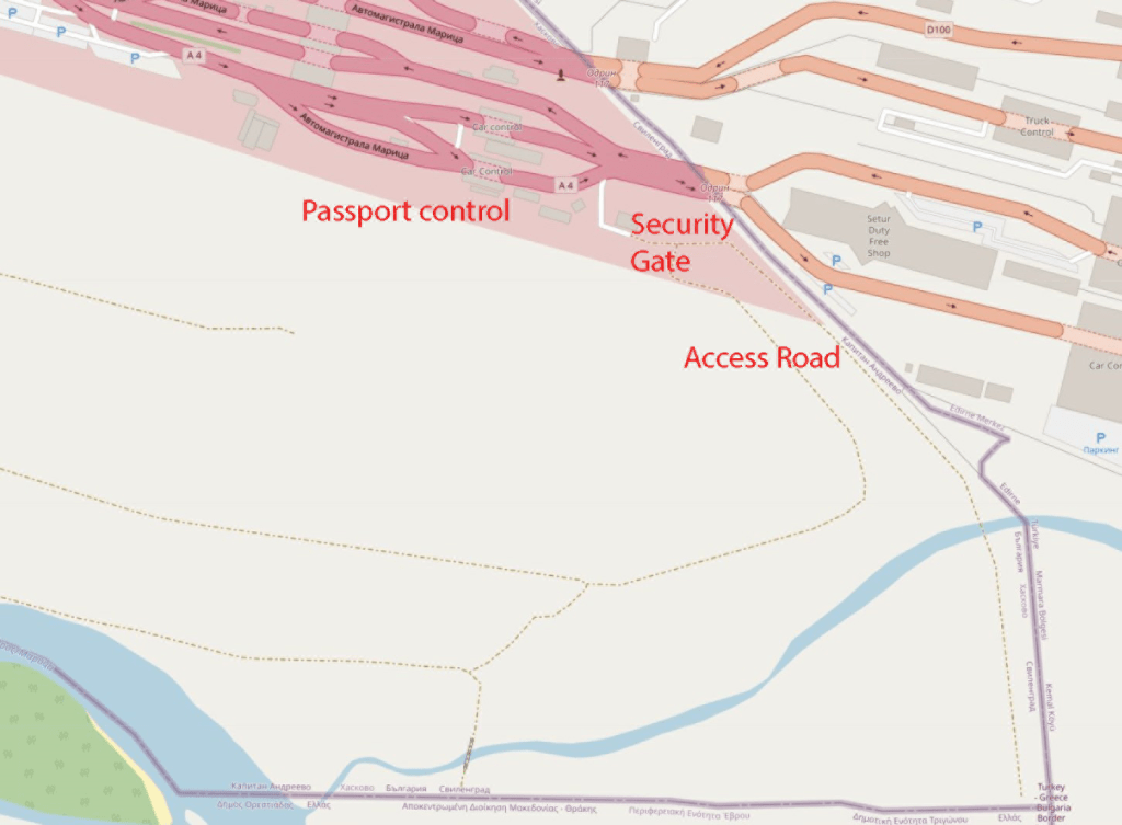
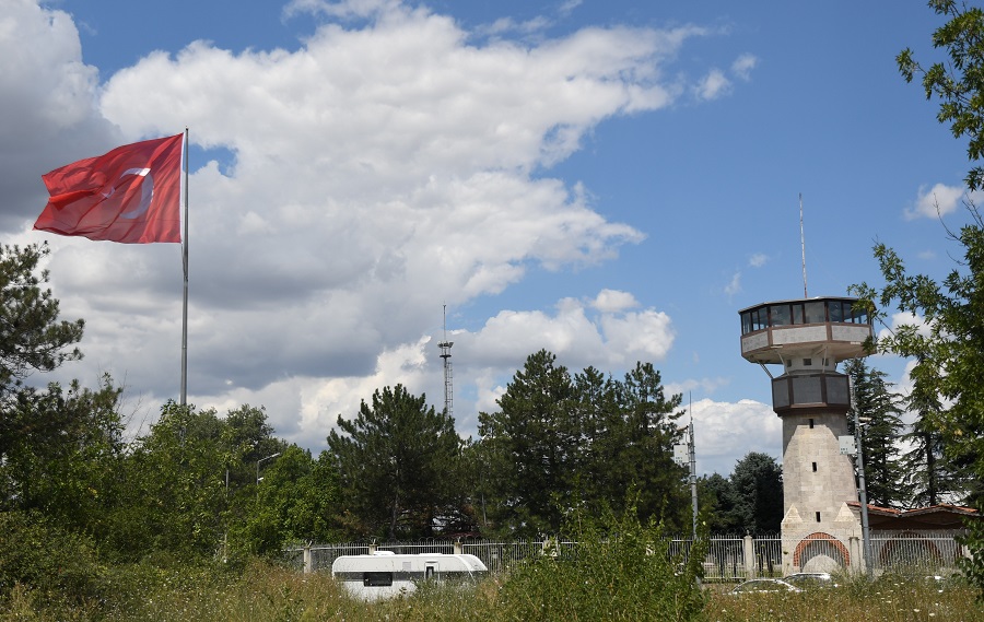
After turning right, I was confronted with a high security gate which was opened by 2 border officers who clearly knew my companion. Immediately on my left was a concrete wall and behind that the Turkish border facilities with watch tower flags and passport booths.
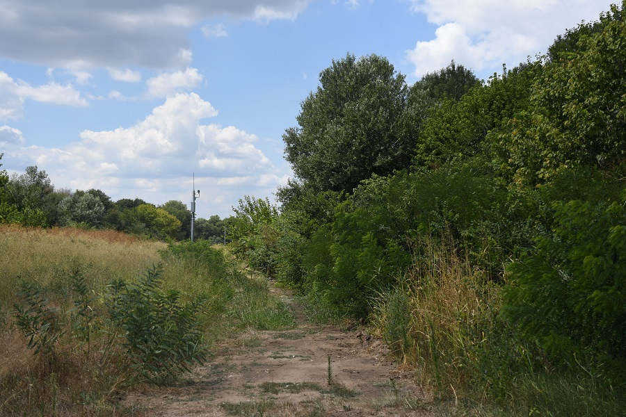
Driving slowly down the access road with high vegetation in the middle ant to my right took concentration, I never noticed any bridge as I was expecting, but then the tripoint monument awaited.
Security Gate
Access to the tripoint was via manned security gate.
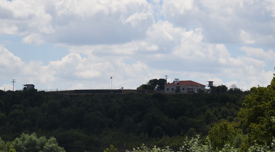
Turkey Border control facilities
Behind a fence and then concrete wall the Turkish border control facilities are very close.
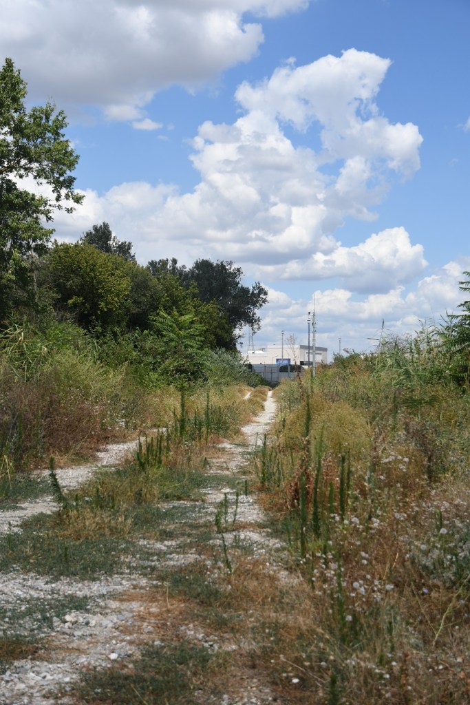
Access Road
IBRG Expedition 2005
I was not the first member of the International Border Research to have visited this point. Indeed 9 members visited in 2005 from the Turkish side. The monument was much smaller and the Turkish border fence had not been erected. For further information click the photo below or here.
Click on the flags above for country specific information and more border POI’s

Date of Visit: 2 August 2022

Great photos there, thanks for sharing!
Regarding the issue of the actual tripoint being ‘wet’ or ‘dry’ on different maps, it has to do with a later bilateral aggrement between Bulgaria and Greece when the precise river borders between the two countries have been settled.
The initial border treaty between the three countries, which was based on a survey of 1921, stated that the actual border is at the midpoint of the main branch of the river as it was at that time. The island did not exist then, it emerged after 1932 when the river formed a branch at its southern bank which now carries the main flow.
After a serious incident with casualties between greek and bulgarian army forces who both claimed for themselves a newly appeared islet west of the one with the tripont in 1956, a commitee was formed and agreed to split these islands -there were three large ones, the one at tripoint included- between the two countries, and as such the half of the island was equally split between the two countries according to the shape it then had.
Later, between 1972 and 1975, an alignment took place at the river banks between the greek and bulgarian sides and the new river border was finally precisely set and agreed..
Unfortunately, such an agreement has not been able so far to be signed between the turkish and greek river border also, in order to solve issues and claims that occasionally come up…
Nikos, Greece
LikeLiked by 1 person
Thank you this is very interesting, I have not been able to find any information about this, so this is new and very useful.
LikeLike
Is there any reference to the later bilateral agreement so I might be able to look at the document?
LikeLike
Hi Barry, this (https://www.researchgate.net/publication/361407613_The_Way_to_Conciliation_The_Greek-Bulgarian_Agreements_of_December_1953) outlines what happened.
I can’t believe I have found your page! I love this type of stuff, and believe it or not I was trying to work out how to get to the tripoint between Turkey, Bulgaria and Greece at the exact time you were there! Argh! I was in the north of Greece at that time (near Lake Kerkini, but I live in Athens). I also want to visit this tripoint and was not sure of the best way to go about it – I think there is a road you can take from Bulgaria that avoids the passport checks, but I intend to do what you did and contact the Bulgarians – are you able to provide me with any contact info?
I would also like to visit the tripoint with North Macedonia, Bulgaria and Greece (which is nearer to Lake Kerkini – I had realised I would not be able to reach the BGGRTR tripoint last summer without further planning), though I will likely approach it from the Greek side (I decided to give it a miss due to a lack of fitness last year… but I will get there one day!).
Anyway, hope the above helps re the Greek/Bulgarian agreement.
All the best
Paul
LikeLike
Hi Paul, this is really helpful, thank you. I will look up the contact information for you. I doubt there is any road that gets you onto the island as it is heavily monitored by CCTV and you will be picked up quite quickly. BG seemed the best choice for me EU, Police and not military. GR for example would need to approve you crossing the river in a military launch.
LikeLike