Singapore, officially the Republic of Singapore, is an island country and city-state in maritime Southeast Asia. It is located about one degree of latitude (137 kilometres) north of the equator, off the southern tip of the Malay Peninsula, bordering the Strait of Malacca to the west, the Singapore Strait to the south, the South China Sea to the east, and the Straits of Johor to the north. The country’s territory comprises one main island, 63 satellite islands and islets, and one outlying islet; the combined area of these has increased by approximately 25% since the country’s independence as a result of extensive land reclamation projects.
Singapore is an ex colony of the British Empire and echoes of that time are clearly visible in modern Singapore. During World War II, Singapore was occupied by Japan in 1942 and returned to British control as a separate Crown colony following Japan’s surrender in 1945. Singapore gained self-governance in 1959 and, in 1963, became part of the new federation of Malaysia, alongside Malaya, North Borneo, and Sarawak. Singapore became an independent sovereign country in 1965 after leaving the federation.
Singapore is a highly developed country, identified as a tax haven, it has the highest GDP per capita in the world. Singapore ranks highly in key social indicators: education, healthcare, quality of life, personal safety, infrastructure, and housing, with a home-ownership rate of 88 percent. Singaporeans enjoy one of the longest life expectancies, fastest Internet connection speeds, lowest infant mortality rates, and lowest levels of corruption in the world. Singapore is a unitary parliamentary republic and has a multi partly political system although the PAP in reality dominates. Singapore is also the headquarters of the Asia-Pacific Economic Cooperation Secretariat, the Pacific Economic Cooperation Council Secretariat, and is the host city of many international conferences and events. Singapore is also a member of the United Nations, the World Trade Organization, the East Asia Summit, the Non-Aligned Movement, and the Commonwealth of Nations.
English is the most common language spoken along with Malay, Mandarin and Tamil. All official agencies use English.
Border Facts
As an island city state Singapore has no land borders. It does however share maritime borders with 2 neighbouring countries: Indonesia and Malaysia.
The Malaysia–Singapore border is an international maritime border between the Southeast Asian countries of Malaysia, which lies to the north of the border, and Singapore to the south. The border was first established in 1824 and since that time has changed from being an international border to a sub national border on a number of occasions. The boundary is formed by straight lines between 72 maritime geographical coordinates running along or near the deepest channel of the Straits of Johor. The western portion of the border beyond that delimited by the 1995 agreement goes into the western section of the Straits of Singapore while the eastern portion of the border beyond the eastern terminus of the defined border continues into the eastern section of the straits. Outside the border defined by the 1995 agreement, there is still no formal agreement between the two countries to delimit their common borders and this has resulted in several overlapping claims.
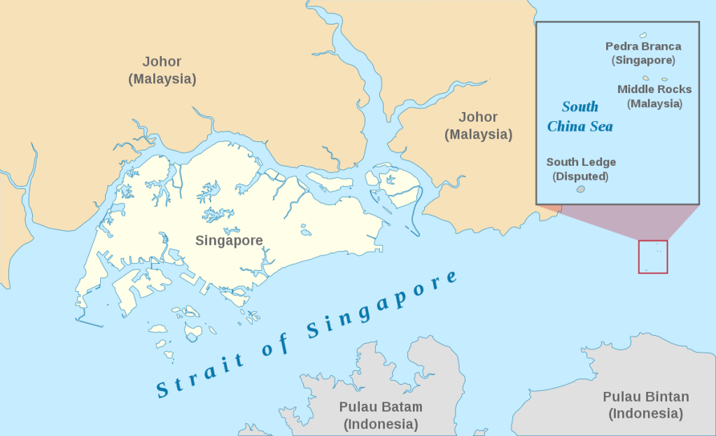
Following the International Court of Justice (ICJ) decision on 23 May 2008 over Pedra Branca which recognised Singapore’s sovereignty on the island, the new portion of the Malaysia–Singapore maritime eastern border around the island will also need to be determined. The island lies 24 nautical miles (44 km) from the next easternmost point of Singapore, and 7.7 nautical miles (14.3 km) southeast of the Malaysian coastline.
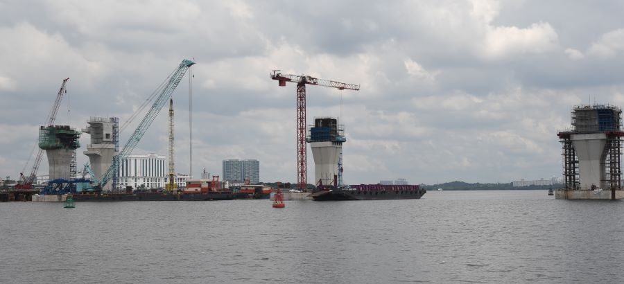
There are two structural crossings along the border. They are the Johor–Singapore Causeway and the Malaysia–Singapore Second Link (officially known as the Tuas Second Link in Singapore). There are also international ferry and bumboat services between Pengerang at the south eastern tip of Johor, Malaysia and Changi at the eastern end of Singapore. In 2023 there is a third physical link being built, the Johor Bahru-Singapore Rapid Transit System (RTS) Link is a light rail stretching 4km that will play a big role in connecting both places when it is ready by end-2026. It will replace the current rail link at Woodlands.
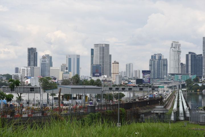
I visited the Johor–Singapore Causeway in 2023, it is a 1.056-kilometre causeway consisting of a combined railway and motorway bridge that links the city of Johor Bahru in Malaysia across the Straits of Johor to the district and town of Woodlands in Singapore. It was the only land connection between the two from 1928 until 1998, when the Tuas Second Link opened.
The distance between Singapore’s Woodlands Checkpoint and Malaysia’s Bangunan Sultan Iskandar is approximately 2.4 km (1.5 mi). The causeway also serves as a water pipeline between the two countries.
It is one of the busiest border crossings in the world, with 350,000 travellers daily. The border is handled by immigration authorities of both countries at the Southern Integrated Gateway (Malaysia) and Woodlands Checkpoint (Singapore).
Indonesia–Singapore Border is a maritime boundary in the Straits of Singapore between Indonesia’s Riau Islands which lie to the south of the border, and the islands of Singapore which lie to the north. The Straits of Singapore is one of the region’s busiest waterways as it is the main channel for Singapore’s ports. The Indonesia–Singapore border came into being as part of the imaginary line created by the 1824 treaty between Great Britain and the Netherlands which divided up the Malay archipelago into spheres of influence between the two colonial powers.
The Agreement Stipulating the Territorial Sea Boundary Lines between Indonesia and the Republic of Singapore in the Strait of Singapore signed by Indonesia and Singapore on 25 May 1973 determines the common territorial sea border as a series of straight lines connecting six coordinate points located in the Straits of Singapore. Indonesia ratified the agreement on 3 December 1973 while Singapore ratified the agreement on 29 August 1974. The distance of the border is 24.55 nautical miles (45.47 km). Three of the six coordinates lie equidistant from Indonesian and Singaporean shores while the remaining are negotiated points with two lying closer to the Indonesian shores. On 10 March 2009, Indonesia and Singapore signed the Treaty between the Republic of Indonesia and the Republic of Singapore Relating to the Delimitation of the Territorial Seas of the Two Countries in the Western Part of the Strait of Singapore 2009 in Jakarta.
The remaining parts, especially those lying to the east of the delimited boundary, may require the involvement of Malaysia as the country also possesses territorial waters in the area.
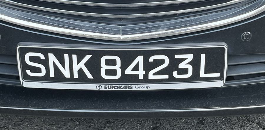
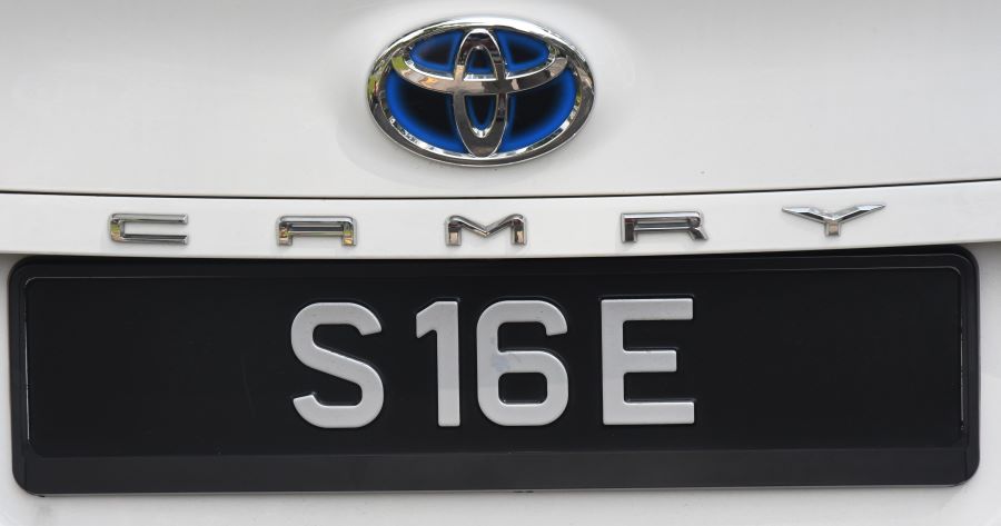
Singaporean Registration Plates


Site Navigation
In order to find your way around the site, either click on the links (text in red) or use the menus at the top and side of the pages. About leads you to the main areas of the site. The European Tripoints menu leads directly you to my TP visits reports whereas the Country Visits page allows you to choose which country to look at first
Mobile Advice
Tables display correctly when holding your mobile horizontally.
To access the links to other pages please click on the 3 horizontal dots at the bottom of the page.