


France, officially French Republic, (French: France or République Française), is located in north-western Europe. Bounded by the Atlantic Ocean and the Mediterranean Sea, the Alps and the Pyrenees, France acts as a bridge between the south and north of the continent. It is bordered by Belgium, Luxembourg and Germany to the northeast, Switzerland and Italy to the east, and Andorra and Spain to the south. France’s overseas territories include French Guiana in South America and several islands in the Atlantic, Pacific and Indian oceans. It covers an area of 643,801 square kilometres with a population of 67.08 million (March 2020).
France is a highly developed country with the world’s seventh-largest economy by nominal GDP. It scores highly on democratic and social indices. France is a permanent member of the UN council. It is a nuclear power. It is a leading member state of the European Union and the Eurozone, and a member of the Group of 7, North Atlantic Treaty Organization (NATO), Organisation for Economic Co-operation and Development (OECD), the World Trade Organization (WTO), and La Francophonie. France is one of the six founding countries of the European Union and the European parliament is located in Strasbourg (as well as Brussels.)
Border Facts: The largest country in Western Europe. Its lengthy borders touch Germany and Belgium in the north, the Atlantic Ocean in the west, and the Pyrenees mountains and Spain in the south. It also borders the Mediterranean sea in the southeast, and the Alps, Switzerland and Italy in the east.
France- Belgium border created in 1713, is 620 km long and stretches from the North Sea coast near De Panne and Bray-Dunes. I visited this point as part of the BELEX18 expedition, more details of the visit can be found here. The eastern end is at the Belgium–France–Luxembourg BEFRLU. The border is characterised by a very dense network of urban settlements as well as by major river, road and rail networks. Divided towns, common language and facilitated by political frameworks at both national and local levels means cross border collaboration is well developed.
France – Brazil border France and Brazil share a 730 km land border in South America, making it France’s longest land border, located between the French overseas department of French Guiana (Guyane) and the Brazilian state of Amapá. The border runs through the Amazon rainforest, primarily defined by the Oyapock River. The only bridge that crosses the border is the Oyapock River Bridge, connecting the town of Saint-Georges in French Guiana with Oiapoque in Brazil. This unusual situation exists because French Guiana is an integral part of France, not a separate territory. The basis of this border dates back to the Peace Treaty of Utrecht signed between France and Portugal in 1713, which established the border between both the colonial holdings of both kingdoms in South America.
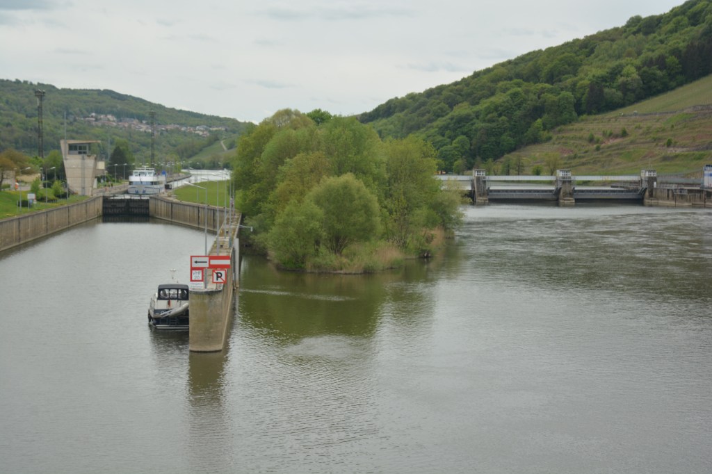
France – Luxembourg border is 73km long and characterised by a high degree of cross border cooperation with citizens of both countries working in the other. It begins in the west at the BEFRLU tripoint at the junction of the Belgian municipality of Aubange, the French commune of Mont-Saint-Martin and the Luxembourgish commune of Pétange. This point is located in the Chiers river. It then follows a general easterly direction to the DEFRLU Germany-France-Luxembourg tripoint, at the junction of the German municipality of Perl, the French commune of Apach and the Luxembourgish commune of Schengen. This point is located in the Moselle.
France – Germany Border is 451 km long and was initially established in 1648 (Treaty of Westphalia). The current demarcation stems from 1945. The border starts at the CHDEFR tripoint and ends at the DEFRLU tripoint. A significant portion of the border follows the river Rhine. Two areas have swapped between the countries: Alsace-Lorraine was French up to 1871 but was acquired by the German Empire in the aftermath of the Franco-Prussian War. The 1918 Treaty of Versailles saw the reverting of the sovereignty over Alsace-Lorraine back to France for it to annexed by Germany once more between 1941 and 1945 before it finally returned to France. The Saarland coal mines after World War I, were awarded to France, and Saarland was placed under the administration of the League of Nations for 15 years, it became part of Germany in 1935 following a plebiscite. Following WW2 the area was initially occupied by the French until 1947 when an autonomous area was set up. This was to be made permanent in 1954 following agreement between the 2 countries but was rejected following a plebiscite in 1954 leading to the area joining West Germany in 1957 as a federal state.
France – Switzerland Border is 573 km long and was established in 1815 with the Congress of Vienna. The border ends with 2 tripoints, in the north CHDEFR in the Rhine (with a monument nearby) and in the south CHFRIT on near Mont Dolent (3700m). The border is divided between rural and mountainous areas and urban conurbations around Basel and Geneva. 155000 French citizens commute to Switzerland to work each day.
Since Switzerland’s accession to the Schengen Area in 2008, there have been no permanent passport controls along this border, even if there can be customs controls.
There are two airports near the border which have both Swiss and French passport and customs control, where the passengers can choose one of them. These are the EuroAirport Basel Mulhouse Freiburg which is located in France, but passengers can go to Switzerland without going through French border controls, and the Geneva Airport which is located in Switzerland, but passengers can go to France without going through Swiss border controls.
France – Italy border is 515 km long established in 1860 by the Treaty of Turin. The line of the border between France and Italy has been modified more recently than that of any other French border: in 1860 with the incorporation of Savoy and the County of Nice into France, then in 1947 with the incorporation of the canton of Tende. This long border, extending from Mont-Blanc to Menton on the Mediterranean coast, is very difficult to cross due to its mountainous terrain. There are few valleys providing through routes across the border, and the transport of passengers and goods goes mainly through tunnels. Unlike the border with Switzerland there is limited cross border collaboration with limited linguistic penetration.
France – Monaco border. Monaco is a semi enclave and independent country on the Mediterranean coast. It is a Principality linked to the House of Grimaldi. It is small, 2 square Kilometres in area, with a land border of 5.7 km and a coastline of 3.83 km. Monaco has a population of 38000. It is nevertheless exceedingly wealthy. The state’s sovereignty was officially recognised by the Franco-Monegasque Treaty of 1861, with Monaco becoming a full United Nations voting member in 1993. Despite Monaco’s independence and separate foreign policy, its defence is the responsibility of France. Monaco is not formally a part of the European Union (EU), but it participates in certain EU policies, including customs and border controls.
France – Spain border is 656 km long but interrupted for 63.7 km by Andorra. The border is marked by 602 (main) border markers.

The France–Spain border was formally defined in 1659, with the signing of the Bayonne Treaties of 1856 and 1868. It separates the two countries from Hendaye and Irun in the west, running through the Pyrenees to Cerbère and Portbou on the Mediterranean Sea. Shortly after the start of the western border, following the course of Bidasoa River, Pheasant Island located in the middle of the river has a particular border regime: the island is a condominium whose sovereignty is shared between the two countries determined by if it is the first or the second half of a year. Another anomaly is Llívia, a town of Cerdanya, province of Girona, Catalonia, Spain. It is an exclave of Spain and an enclave of France, within the French territory (Pyrénées-Orientales département). In 1659, the Treaty of the Pyrenees ceded the comarques of Roussillon, Conflent, Capcir, Vallespir, and northern Cerdanya (“Cerdagne”) to the French crown.
Llívia did not become part of the French kingdom as the treaty stipulated that only villages were to be ceded to France, and Llívia was considered a city and not a village due to its status as the ancient capital of Cerdanya. My report on Llivia is here.
France – Andorra border extends for 63.7 km in southern France (Ariège and Pyrenees-Orientales départements) and northern and north-eastern Andorra. The border’s western extremity starts at the western Andorra–Spain–France tripoint ADESFRw, located at the summit of the Pic de Médécourbe. It then follows a general north-east direction before switching south-eastwards to the eastern Andorra–Spain–France tripoint ADESFRe.

Andorra is not a member of the EU, but enjoys a special relationship with it and uses the euro. There are full, stringent passport checks at the border, as Andorra is neither in the Schengen Area nor in the European Union. The first Andorran Constitution was passed in 1993, establishing parliamentary government. It then joined the United Nations and Council of Europe. Andorra is a principality with co-princes from other countries (the president of France and a bishop from a town just over the border in Spain).
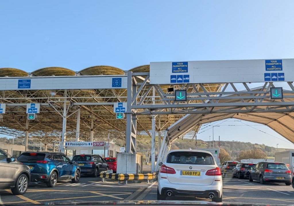
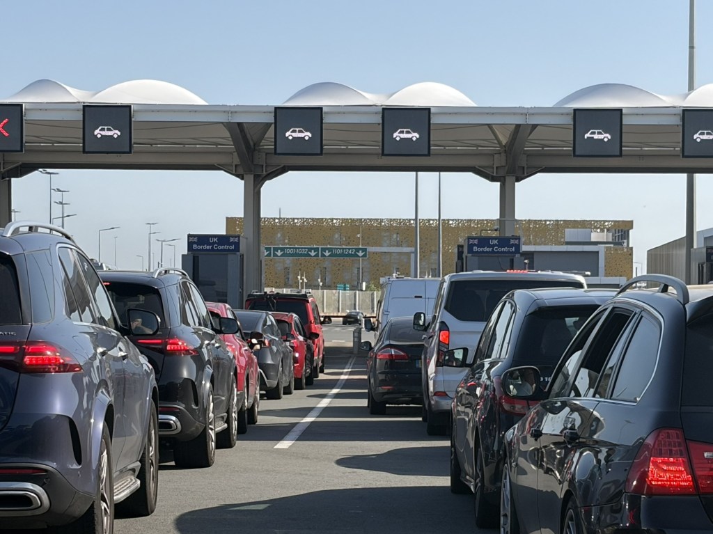
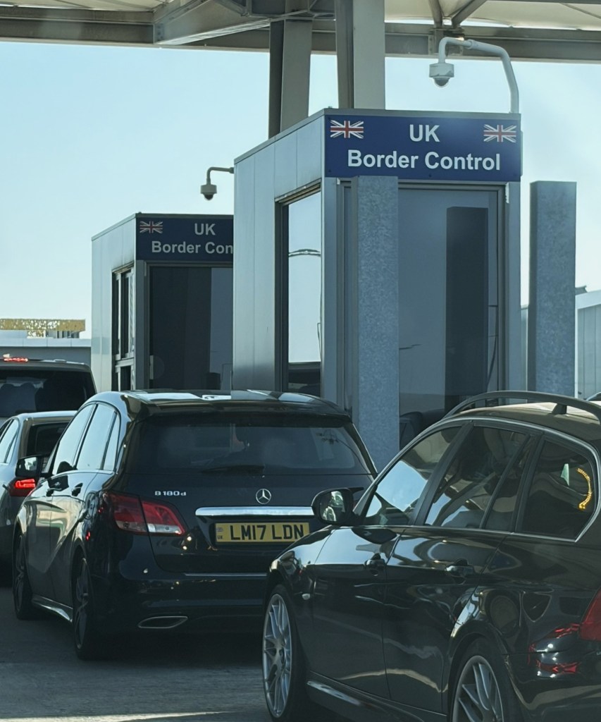
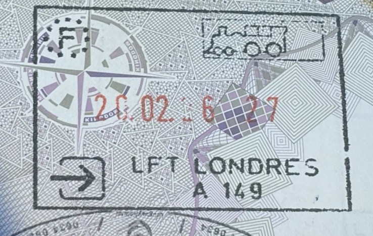
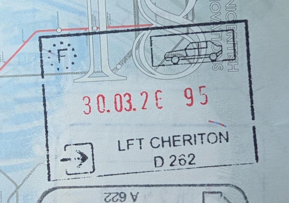
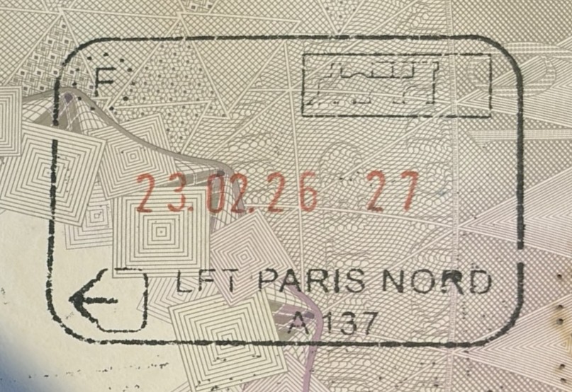
France – United Kingdom border is primarily a 563 km maritime boundary along the English Channel, featuring “juxtaposed” controls where officials operate on both sides. Post-Brexit (2021), strict passport checks, goods declarations, and impending digital EES systems are in place, with heavy security at Calais and the Channel Tunnel to prevent unauthorized crossings. Under the Treaty of Le Touquet, UK border officials operate in Calais, Dunkirk, and Paris (Gare du Nord), checking travellers before they board trains or ferries. Similarly, French officers operate in Dover and London. The border is a major point of focus for irregular migration via small boats, which, as of 2025, accounted for a significant portion of arrivals. The UK and France have implemented enhanced security measures, including drone technology and increased police presence to combat this. A key feature of the border between the 2 countries is the 50.5 km underwater Channel Tunnel connecting Coquelles, France, and Folkestone, UK. The 1986 Treaty of Canterbury defines the tunnel as a “land frontier which opened in 1994.
A small maritime border exists in the Caribbean between the French territory of Saint Martin and the British territory of Anguilla.
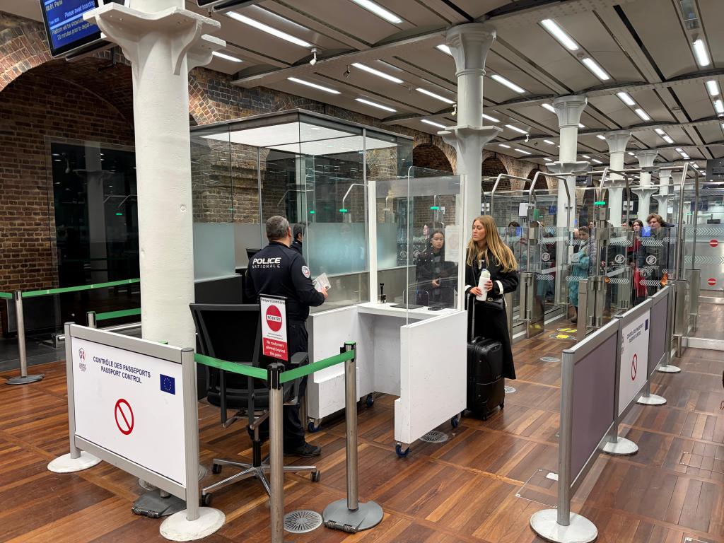
French Controls in the UK
St Pancras Railway Station
Dover Ferry Terminal
Folkestone Eurotunnel Terminal
UK controls in France
Calais Ferry Port
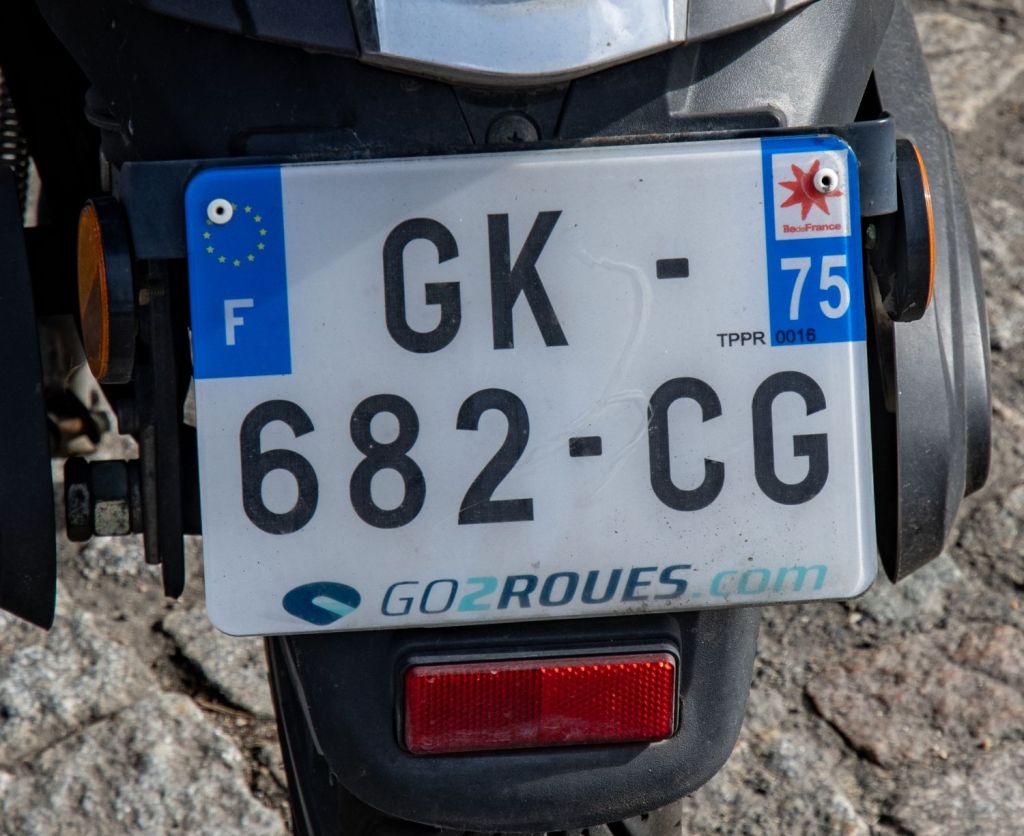
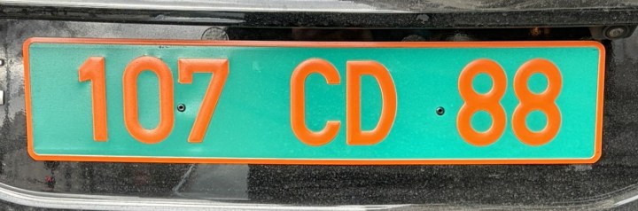
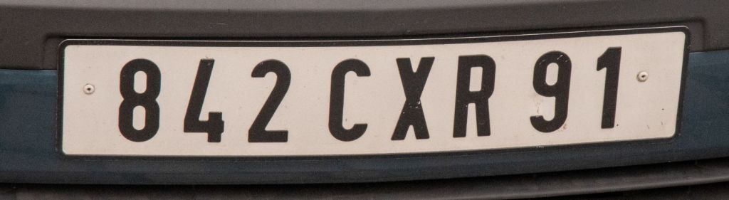
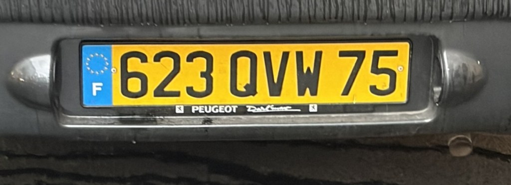
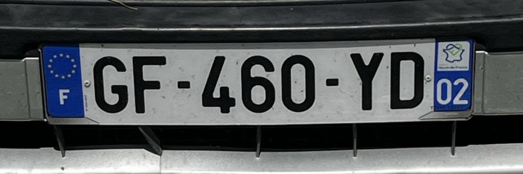
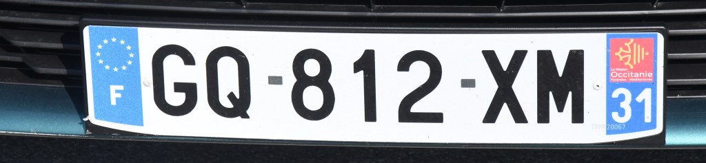
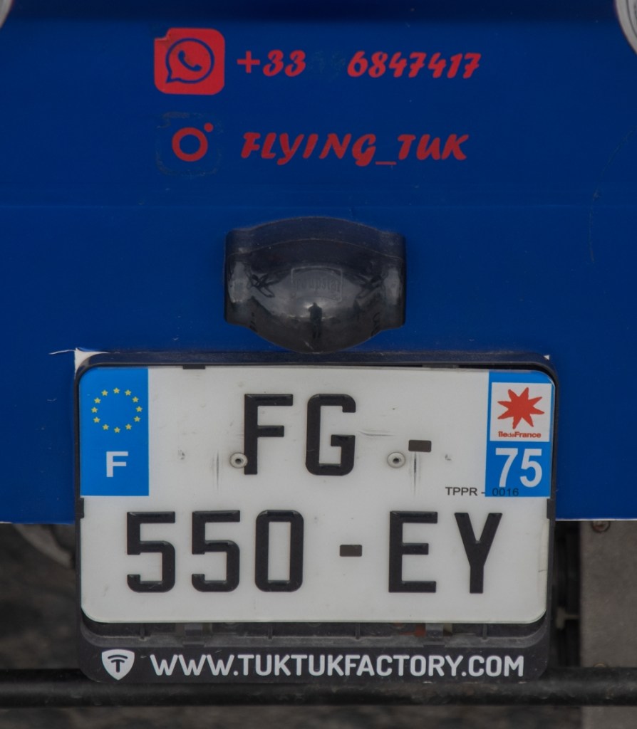
French Registration Plates

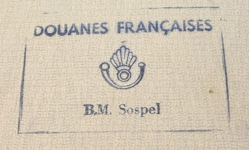
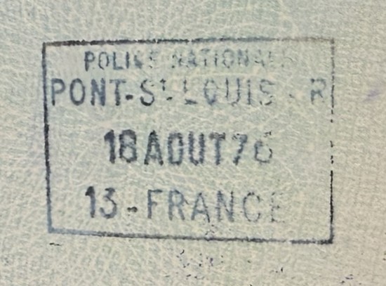
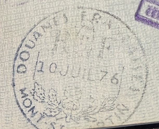
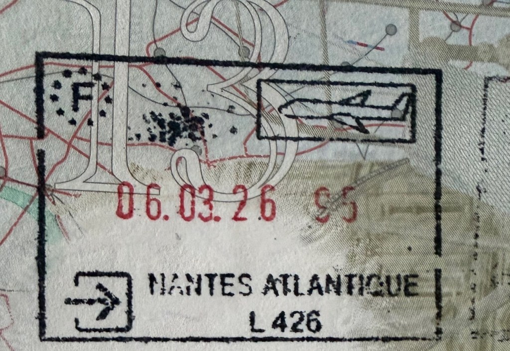
French Passport Stamps
French Tripoints

| Number | Name | Countries | TYPE | Coordinates | LINKS |
|---|---|---|---|---|---|
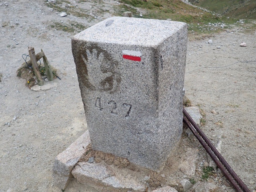
| 1 | ADESFRe | Andorra – France – Spain (E) | Dry | 42°30’09″N 01°43’28″E | The Portella Blanca d’Andorra or Coll d’Engaït (2515m) is a mountain pass where the boundaries of Andorra, Spain and France meet. It also forms the administrative boundary of Encamp , Lles de Cerdanya , and Porta. At the top of the pass there is border marker #427 which is taken to mark the tripoint. Both Andorra and Spain record the tripoint as being slightly further south at an unmarked col however. Berns (2004) |
| 2 | ADESFRw | Andorra – France – Spain | Dry | 42°36’07″N 01°26’32″E | The tripoint is located at the summit of Pic de Médecourbe (2914m). From the Collada dels Estanys Forcat (2745 m) there is a short but steep and faint path up to the narrow top. Berns (2004) |
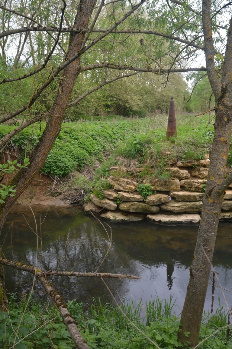
| 3 | BEFRLU | Belgium – France – Luxembourg | Wet | 49°32’47″N 5°49’7″E | The wet tripoint is situated in industrial wasteland near Radange (LU), Athus (BE) and Mont-Saint Martin (FR). BE and LU border markers. No FR marker, The TP is at the confluence of the Bruehl creek into the Chiers river. Van der Giessen (2024) Wallis (2008) |
| 4 | CHDEFR | France – Germany – Switzerland | Wet | 47°35’23″N 07°35’20″E | The Dreiländereck is located on the Rhine River, along the borders of Basel, Saint-Louis, and Weil-am-Rhein. It is marked indirectly by an impressive tripoint monument designed in 1957 by Wilhelm Münger (150m to the SE). The monument is a large iron pylon in the shape of a rocket with the flags of France, Germany and Switzerland on the tails. North of the tripoint there is a Three Countries Bridge for pedestrians and cyclists. Opened in 2007 and is the world’s longest span pedestrian bridge at 229m. Van der Giessen (2024) |
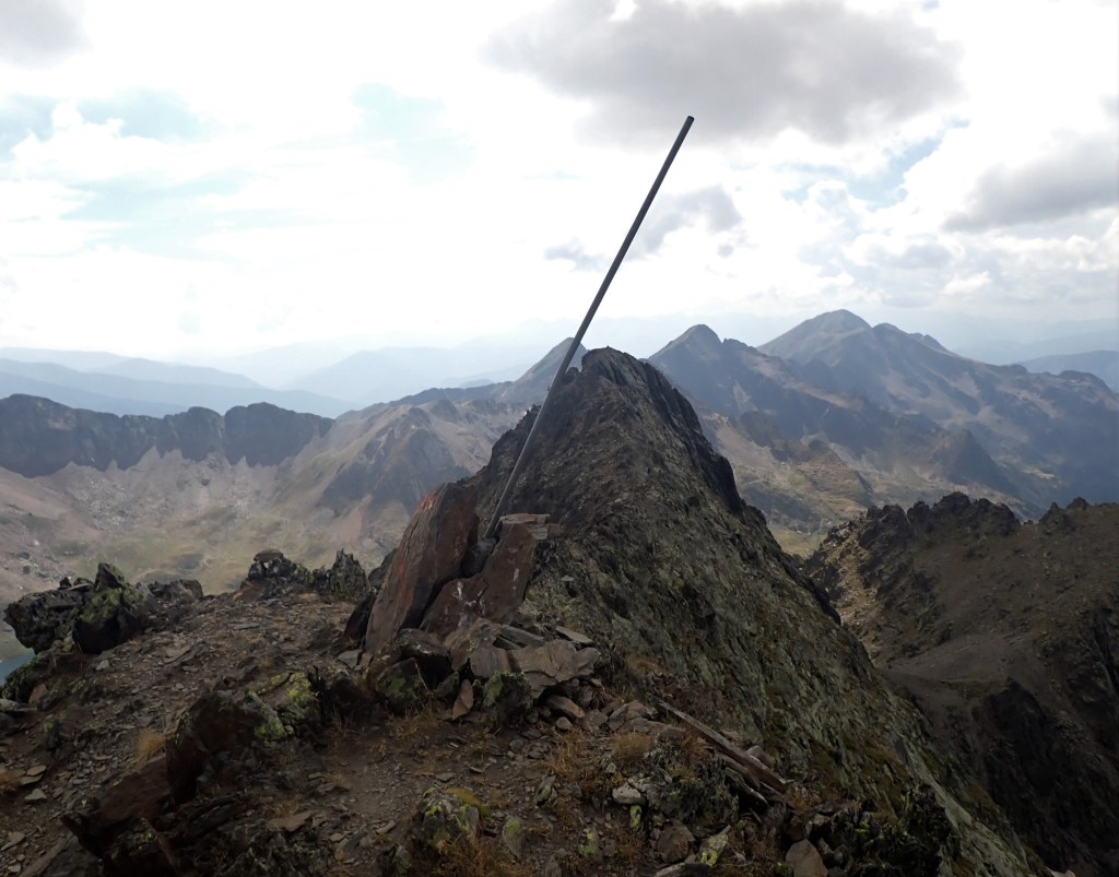
| 5 | CHFRIT | France – Italy – Switzerland | Dry | 45°55’21″N 07°02’39″E | This is the hardest European tripoint physically to reach. Mont Dolent is regarded as the tripoint. The tripoint is located at Pointes Supérieures de Pré de Bar (3658m), on the ridge that leads east (100m) to the summit of Mount Dolent (3749m). In 1954, a statue of the Virgin Mary was erected on Mont Dolent’s summit by the young people of Valais. A 2 day trek with an overnight in a mountain hut. Competency with glacier, ice and using ropes. A guide is recommended |
| 6 | DEFRLU | France – Germany – Luxembourg | Both | 49°28’10″N 6°22’6″E | Like BEDELU the borders at this triline (not tripoint) are complicated because of the condominium arrangements regarding the shared ownership of the Moselle between Germany and Luxembourg. Above the triline the river is shared, hence like BEDELU there are 3 points of interest along the 114m triline, 1 at each end and one in the middle. Schengen is also of interest Krogh (2003) Van der Giessen (2024) |
Tripoint Gallery
Please click on the images below to access the tripoint visit reports


Site Navigation
In order to find your way around the site, either click on the links (text in red) or use the menus at the top and side of the pages. About leads you to the main areas of the site. The European Tripoints menu leads directly you to my TP visits reports whereas the Country Visits page allows you to choose which country to look at first.

Mobile Advice
Tables display correctly when holding your mobile horizontally.
To access the links to other pages please click on the 3 horizontal dots at the bottom of the page.

