

Turkey (Turkish: Türkiye), officially the Republic of Turkey, is a country located mainly on the Anatolian peninsula in Western Asia, with a smaller portion on the Balkan peninsula in Southeastern Europe. Istanbul straddles the 2 continents which are divided by the Bosporus, the Sea of Marmara, and the Dardanelles. Turkey is bordered on its northwest by Greece and Bulgaria; north by the Black Sea; northeast by Georgia; east by Armenia, the Azerbaijani exclave of Nakhchivan and Iran; southeast by Iraq and Syria; south by the Mediterranean Sea; and west by the Aegean Sea. The area of Turkey is 789,962 km2 with 97% being in Asia and 3% in Europe.
The modern state of Turkey followed the Turkish War of Independence (1919–1923) which led to the abolition of the old Ottoman Empire and the establishment of a secular republic. The subsequent abolition of the Treaty of Sèvres 1920 which had begun the partitioning of the Ottoman Empire by the Allied powers and its replacement by the Treaty of Lausanne 1923 formed the basis of the modern Turkish state.
Turkey remained neutral during most of World War II, but entered the closing stages of the war on the side of the Allies on 23 February 1945. Turkey became a charter member of the United Nations in 1945 and a member of the Council of Europe in 1950, NATO in 1952. OECD in 1961 and an associate member of the EEC in 1963. Internally however the progress to a modern liberal democracy has not been straightforward with the military being actively involved in the political system through active coups and other interventions. Progress towards EU membership has stalled due to the restrictions on individual freedoms and human rights.
Border Facts: Eight countries border Turkey: Armenia, Azerbaijan, Bulgaria, Georgia, Greece, Iran, Iraq, and Syria. Surrounded by water on three sides and protected by high mountains along its eastern border, the country generally has well-defined natural borders. Its demarcated land frontiers were settled by treaty early in the twentieth century and have since remained stable.
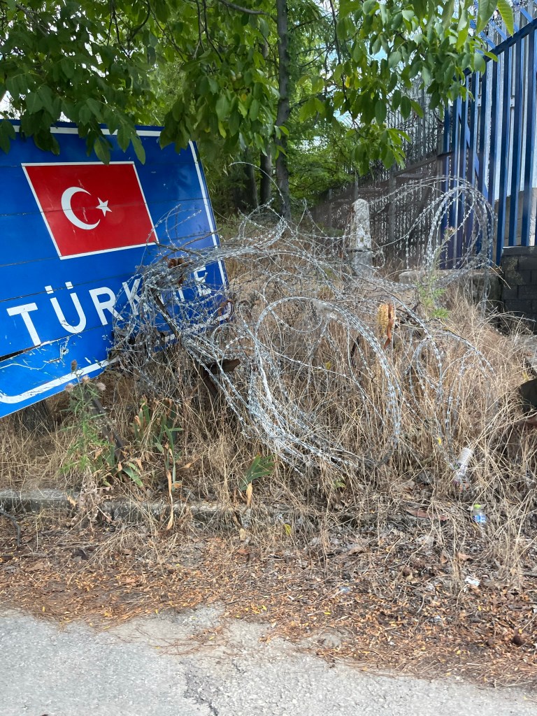
Turkey – Greek border is 206 km long, this boundary was confirmed by the Treaty of Lausanne (1923), which resolved persistent boundary and territorial claims involving areas in Thrace and provided for a population exchange. Under the agreement, most members of the sizable Greek-speaking community of western Turkey were forced to resettle in Greece, while the majority of the Turkish-speaking residents of Thrace who were not forced out during the Balkan wars were removed to Turkey. It mostly follows the river Evros. It is the external border of the European Union.
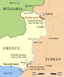
In 2012, a high border fence was erected along the land border where it is not separated by the river, because of the European migrant crisis. In 2020 there have been ongoing clashes between migrants and Greek security forces, leading in some cases to death. Turkey has used the crisis as lever in international negotiations for aid and bilateral agreements.
Relationships between the 2 counties is strongly influenced by the situation in Cyprus. Turkey invaded Cyprus on 20 July 1974 by unilaterally exercising Article IV in the Treaty of Guarantee (1960), but without restoring the status quo ante at the end of the military operation.
Turkey’s justification for military intervention was due to Greek nationalists removing the President and replacing him with a pro union with Greece politician. In 1983 the Turkish Republic of Northern Cyprus, which is recognised only by Turkey, was established. Since then there have been several attempts to resolve the issues none of which have been successful. Recently there has been improvements from the 2 sides with increasing cooperation and the opening of several border crossings.
Turkey – Bulgaria border is 269 km long and was confirmed by the Treaty of Lausanne (1923)
but was initially established by the Treaty of San Stefano in 1878 as an inner border within the Ottoman Empire. The Bulgaria–Turkey frontier runs from the mouth of the Rezovo River in the east through the Strandzha Mountains and the Dervent Heights, crosses the river Tundzha at the village of Matochina and ends at the river Maritsa at the village of Kapitan Andreevo.
It is an external border of the EU. In response to the migration crisis Bulgaria, like Greece has built a highly fortified security fence.
Turkey – Georgia border since 1991 the more than 500 km boundary with the former Soviet Union, which was defined in the 1921 Treaty of Moscow (1921) and Treaty of Kars, has formed Turkey’s borders with the independent countries of Armenia, Azerbaijan, and Georgia. The Georgia–Turkey border is 273 km in length and runs from the Black Sea coast just north of Sarp in the west and then proceeds overland eastwards via a series of irregular lines; it then arcs broadly south-eastwards, cutting across Kartsakhi Lake, to the tripoint AMGETR in the east. Both countries enjoy good relations and the border is open to citizens of both countries. I visited Sarp in 1983, details of my visit are here.
Turkey -Armenia border is 311 km in long and runs from the tripoint with Georgia (AMGETR) in the north near Lake Arpi and proceeds southwards via series of irregular lines through the Armenian Highlands. Upon reaching the Akhurian River it follows the river south down to the confluence with the Aras river, and then follows the Aras as it flows east and then south-east, down to the tripoint with Azerbaijan in the south (AMAZTR). The border (along with the other 2 countries) was demarcated on the ground in March 1925-July 1926 by a joint Soviet-Turkish commission
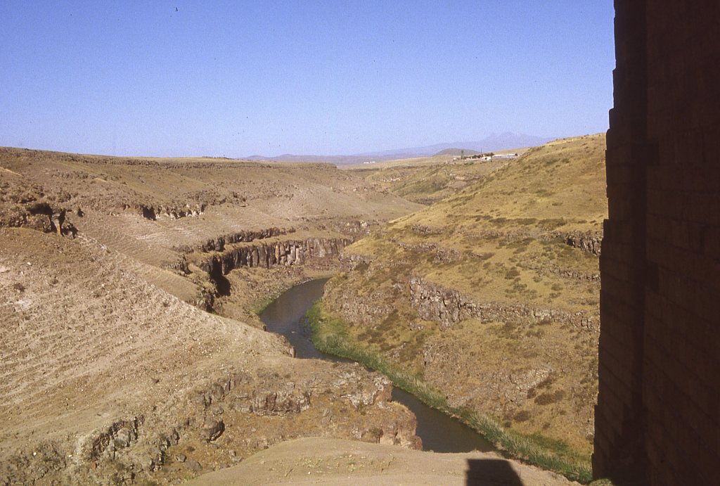
The ancient ruins of Ani lie directly adjacent to the border on the Turkish side. I visited this area in 1983. Details of my visit are here.
The border between the 2 countries is closed. Although Turkey recognised Armenian independence after the dissolution of the USSR the 2 countries have never enjoyed good relations. Turkey feared territorial claims to eastern Turkey by Armenian nationalists championing a ‘United Armenia’, and opposed Armenia’s efforts to achieve international recognition of the Armenian Genocide; Turkey also supported its close ally Azerbaijan in the war over Nagorno Karabakh an Armenian enclave within Azerbaijan (recognised internationally as being part of Azerbaijan).
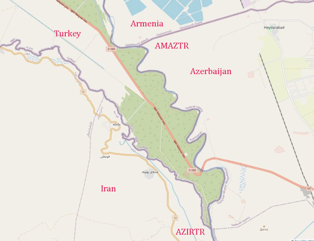
Turkey – Azerbaijan border is a short 17 km located at the southeastern tip of the Iğdır Province on the Turkish side and at the northwestern tip of the Nakhchivan Autonomous Republic on the Azerbaijani side. The Aras river marks the border for its entire length. The land in the immediate vicinity is flat and undeveloped, with the exception of a four-lane highway and two customs checkpoints. The nearest settlement is the village of Sadarak, located approximately 7 km east on the Azerbaijani side, while the nearest settlement on the Turkish side is the village of Aralık, located approximately 28 km northwest.
Turkey -Iran border was confirmed by the Treaty of Kasr-ı Şirin in 1639. is 534 km in length and runs from the tripoint with Azerbaijan in the north (AZIRTR) on the Aras river and then proceeds to the north-west along the Karasu Çayı river, forming its border with Azerbaijan. The border then proceeds south-west and then south via a series of irregular lines, down to the tripoint with Iraq (IQSYTR) in the south. The geography of the region is mountainous and the population is mainly Kurdish on both sides. The Turkish government has ongoing internal security challenges with the PKK and Kurdish separatists. More recently there have been moderated requests for more regional autonomy.
Turkey – Iraq border was confirmed by the Treaty of Angora (Ankara) in 1926. Iraq and Syria, had been part of the Ottoman Empire up to 1918. According to the terms of the Treaty of Lausanne (1923), Turkey ceded all its claims to these two countries, which had been organized as League of Nations mandates under the governing responsibility of Britain and France, respectively. Turkey and Britain agreed the boundary in the Treaty of Angora (Ankara). The Turkey – Iraq border is 367 km long. The border starts from the tripoint with Syria (IQSYTR) at the confluence of Tigris river and Little Khabur river. It then follows the latter river eastwards, and then the Hezil Suyu river to the north-east. The border then turns eastwards overland, eventually turning southwards to connect to the Hajji Bak (Hacibey Suyu) river. It then follows this river north-eastwards to the Iranian tripoint (IQIRTR). The border region is extremely mountainous and is populated almost exclusively by Kurds on both sides.
Turkey – Syria border is is approximately 909 kilometres and runs from the Mediterranean Sea in the west to the tripoint with Iraq in the east (IQSYTR). Most of the border is simply a line broadly following the 37th parallel. For the final 30 km in the east the border follows the course of the Tigris.
This border has not been accepted by Syria. As a result of the Treaty of Lausanne, the former Ottoman Sanjak (province) of Alexandretta (present-day Hatay Province) was ceded to the French which administered it on behalf of the League of Nations. However, in June 1939 the people of Hatay had formed a new independent State and immediately after, the parliament voted to unite with Turkey. Since gaining independence in 1946, Syria has remained concerned about the loss of this territory and it has remained an ongoing issue between the 2 countries.
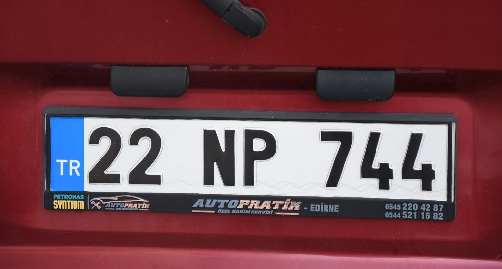
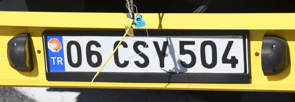
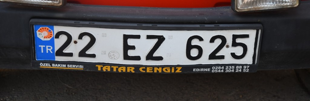
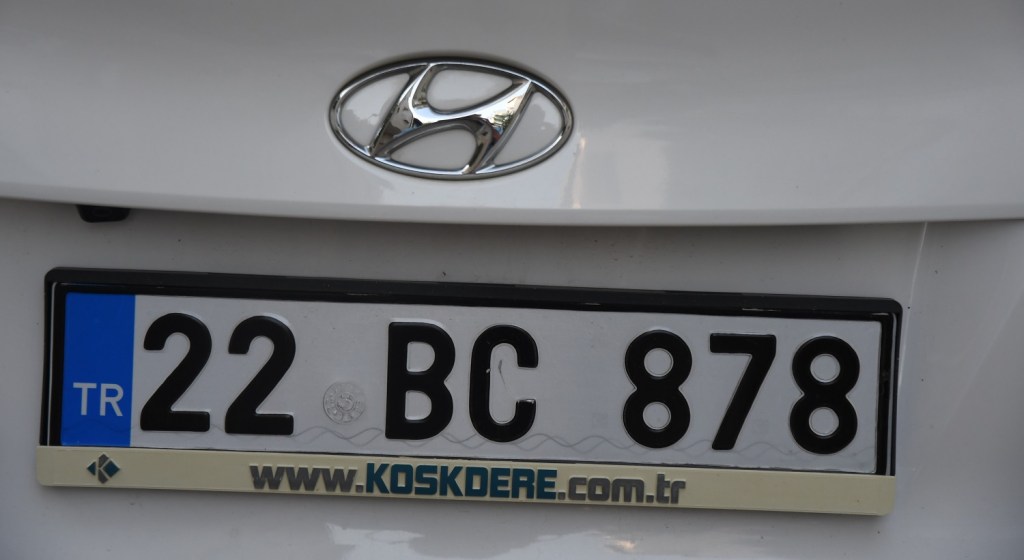
Turkish Registration Plates
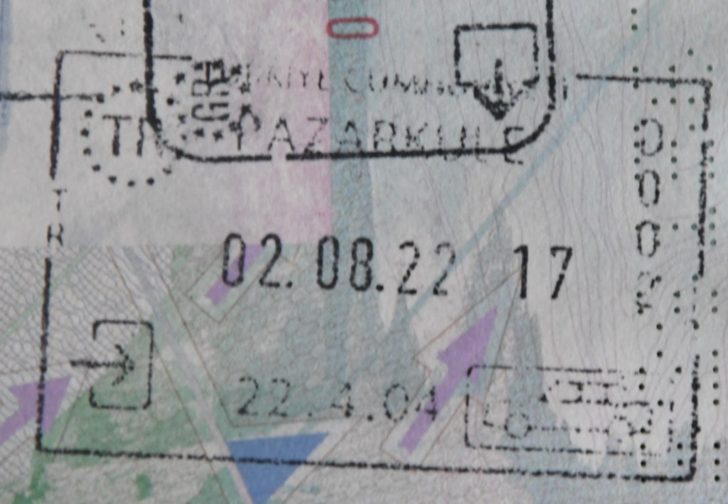
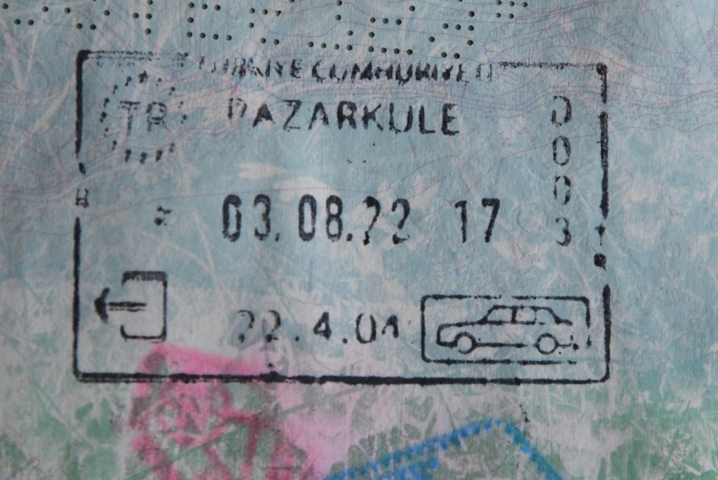
Turkish Passport Stamps
Turkish Tripoints

| Number | name | countries | Coordinates | Type | notes/links |
|---|---|---|---|---|---|
| 1 | AMAZTR | Armenia – Azerbaijan – Turkey | 39°43′N 44°46′E | Wet | The tripoint is located in the Aras river. BM#04 SUTR. |
| 2 | AMGETR | Armenia – Georgia – Turkey | 41°8′N 43°28′E | Dry | The tripoint is at the secondary summit of Mount Erakatar. BM#148 SUTR 1926. Ascent, due to the closed Armenian-Turkish border, is not allowed without prior agreement with the border guards. The nearest villages are Shaghik and Garnarich. |
| 3 | AZIRTR | Azerbaijan – Iran – Turkey | 39°38′N 44°49′E | Wet | Disputed. The tripoint is located in the Aras river at its confluence with the Kara river. BM#1 IRSU. |
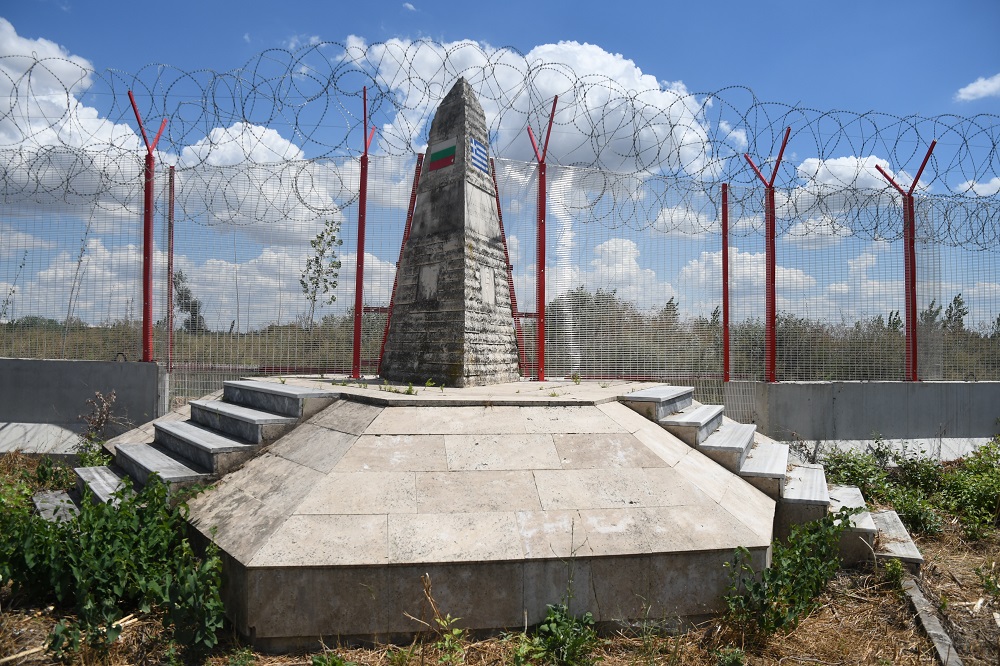
| 4 | BGGRTR | Bulgaria – Greece – Turkey | 41°42′43″N 26°21′03″E | Dry | The tripoint is located on an island adjacent to the Maritsa River. Access roads from BG and TR, or by boat from GR. Access to this point is difficult to arrange and within a secure border area. A TR border fence prevents a circular walk around the tripoint monument. |
| 5 | IQIRTR | Iran – Iraq – Turkey | 37°9′N 44°47′E | Dry | The tripoint is marked by BM#125/12 at the source of the Hajji Bak river. Approximately 2km south of the Dalamper summit. |
| 6 | IQSYTR | Iraq – Syria – Turkey | 37.1116°N 42.3633°E | Wet | The tripoint is located at the confluence of Tigris river and Little Khabur river. |
Tripoint Gallery
Please click on the images below to access the tripoint visit reports

Site Navigation
In order to find your way around the site, either click on the links (text in red) or use the menus at the top and side of the pages. About leads you to the main areas of the site. The European Tripoints menu leads directly you to my TP visits reports whereas the Country Visits page allows you to choose which country to look at first.

Mobile Advice
Tables display correctly when holding your mobile horizontally.
To access the links to other pages please click on the 3 horizontal dots at the bottom of the page.

