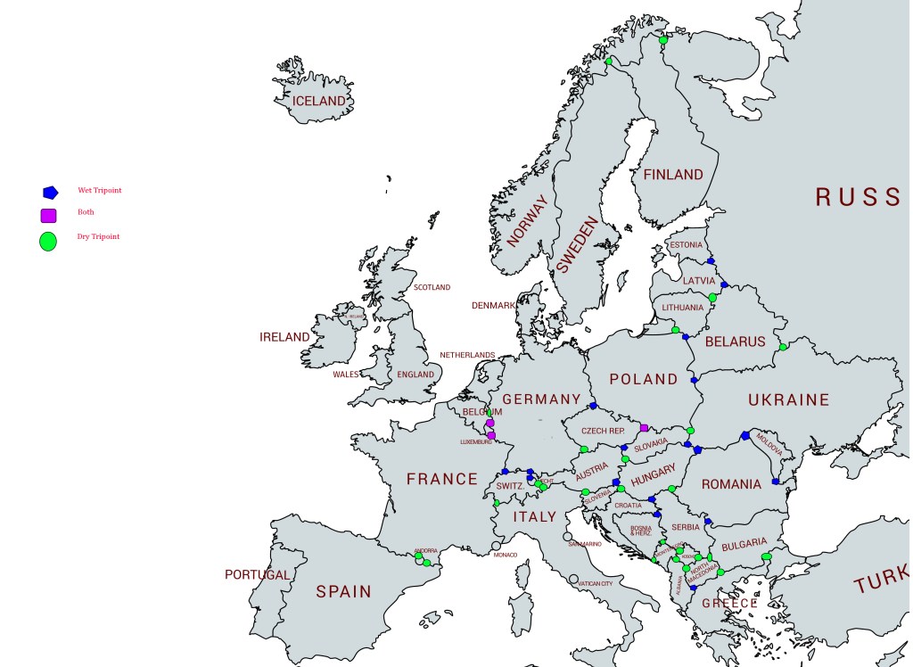
A tripoint, is a geographical point at which the boundaries of three countries meet. These can be on land (dry) or demarcated by rivers or lakes (wet). Tripoints can be easy to access or isolated, they can be marked with large monuments or not easily identifiable at all. There are 48 European Tripoints
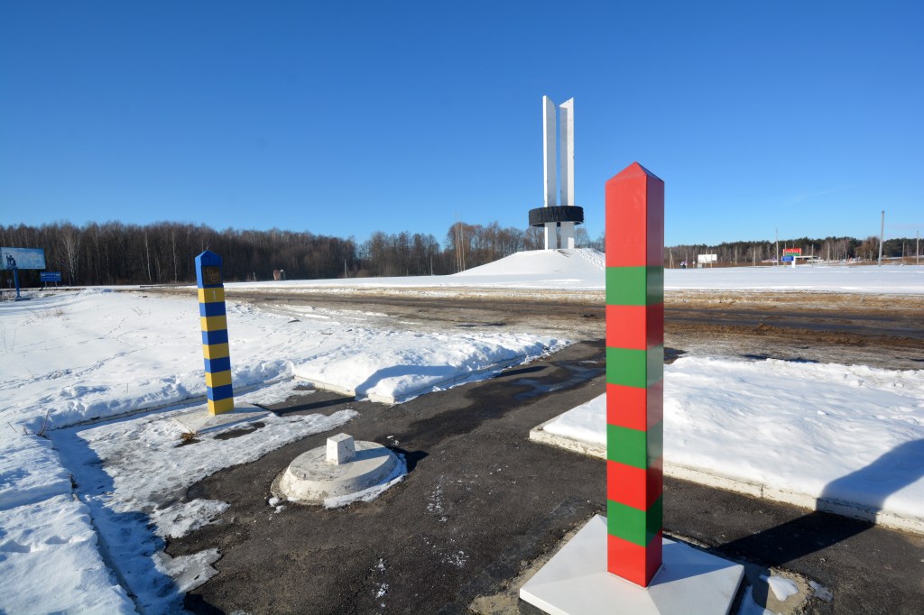
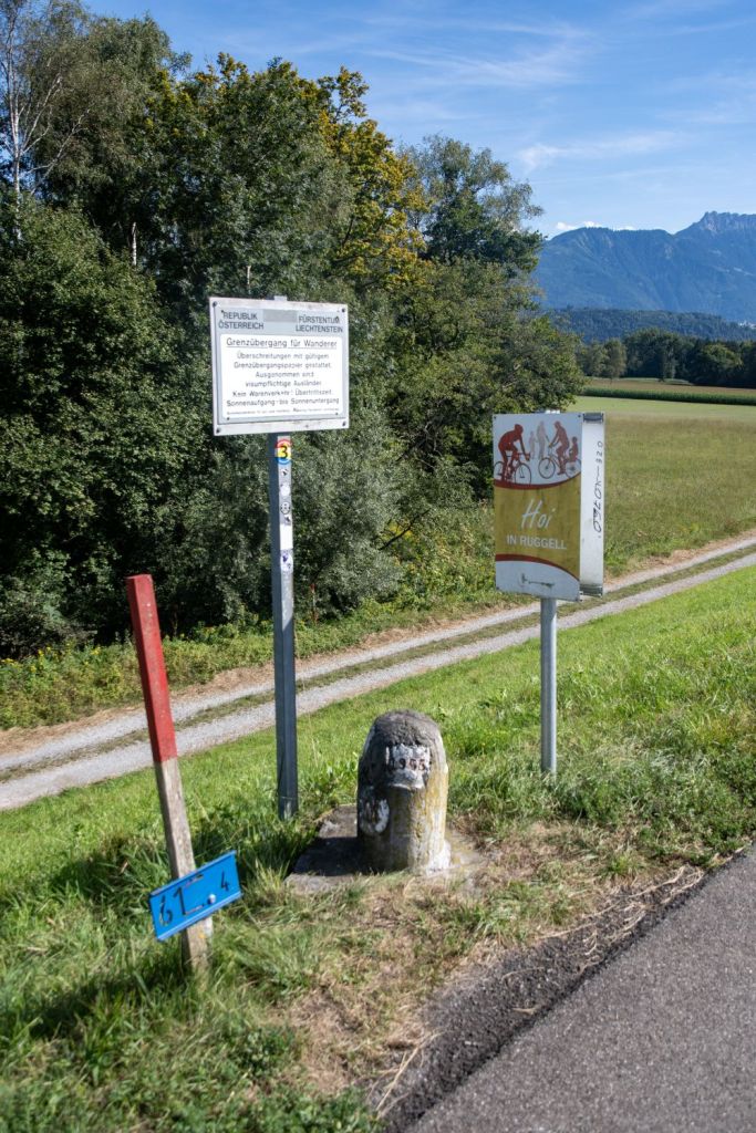
The Belarus – Russia – Ukraine Tripoint
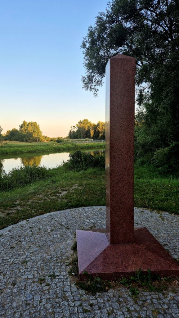
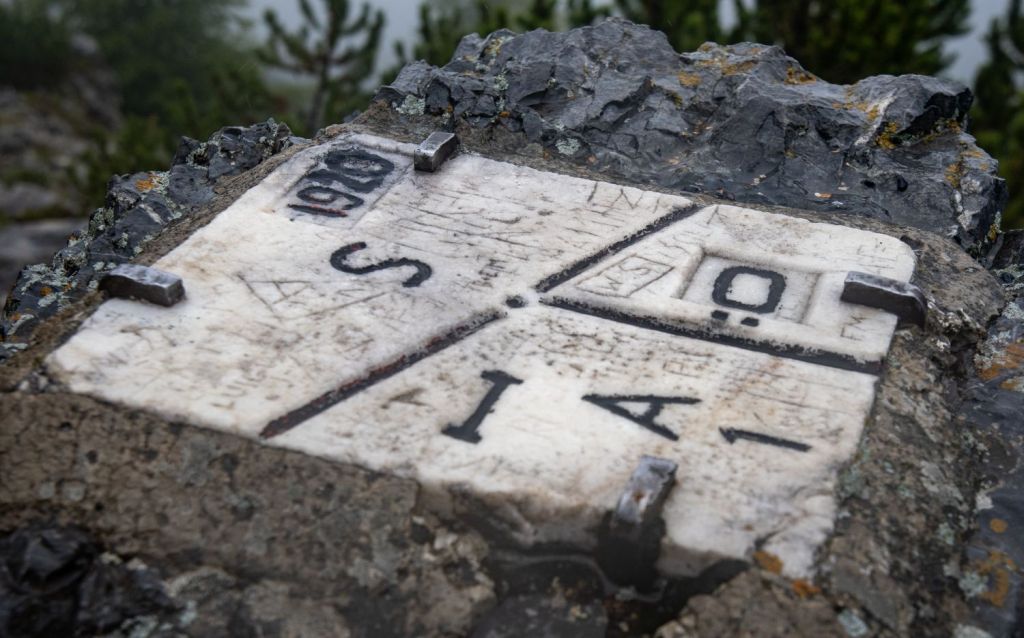
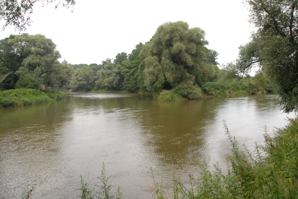
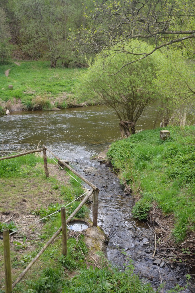
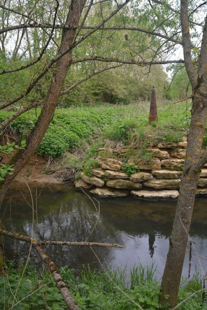
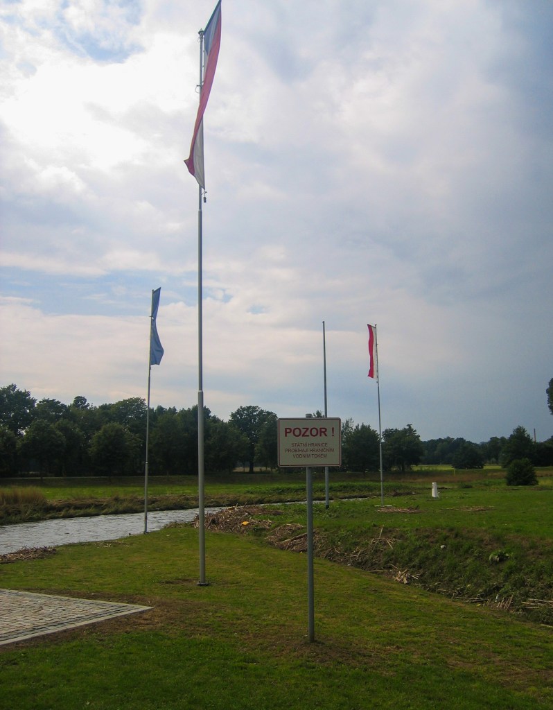
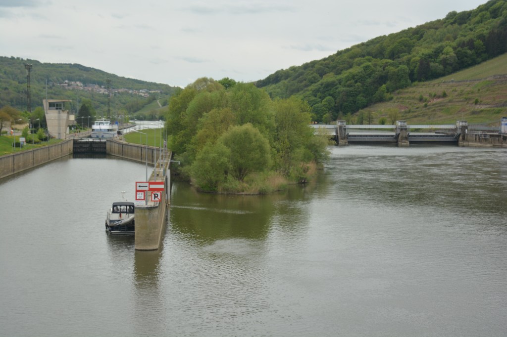
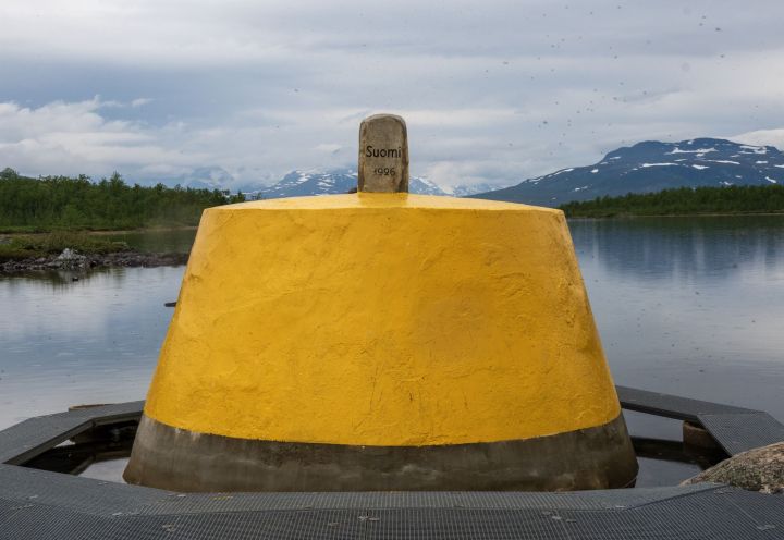
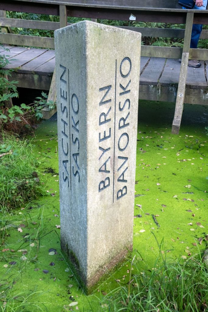
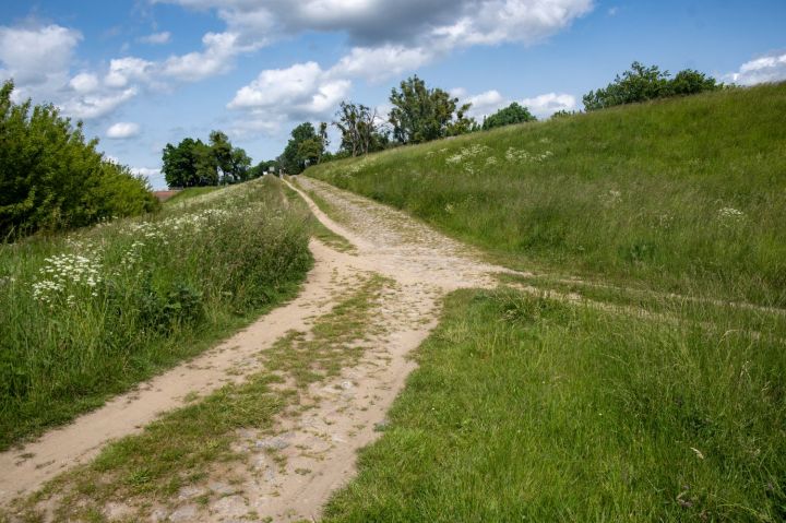
Example of a Wet Tripoint
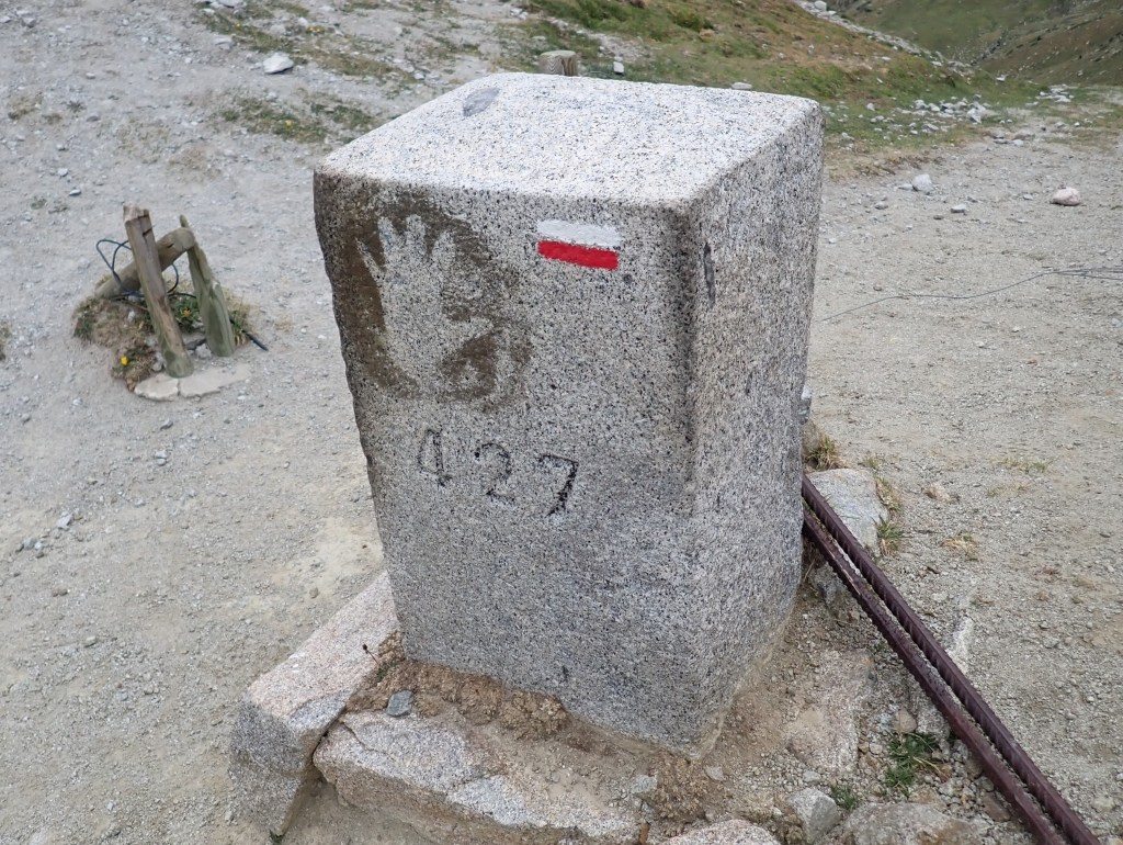
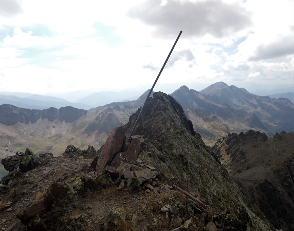
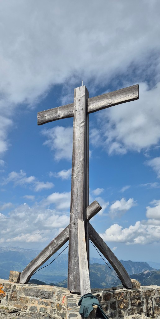
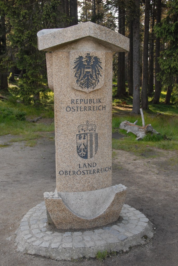
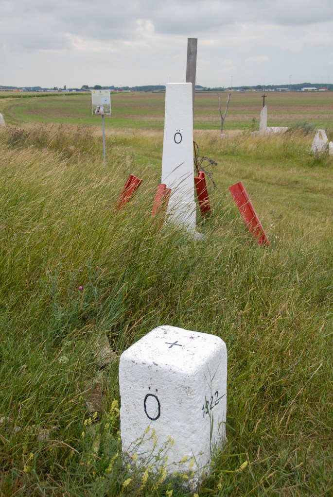
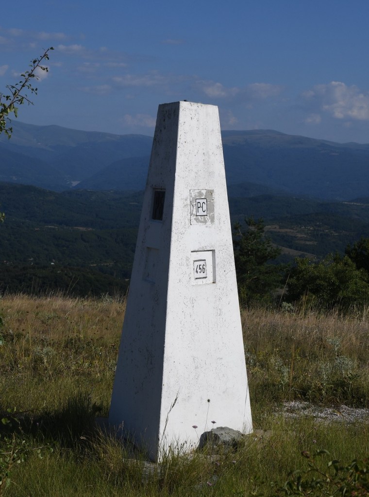
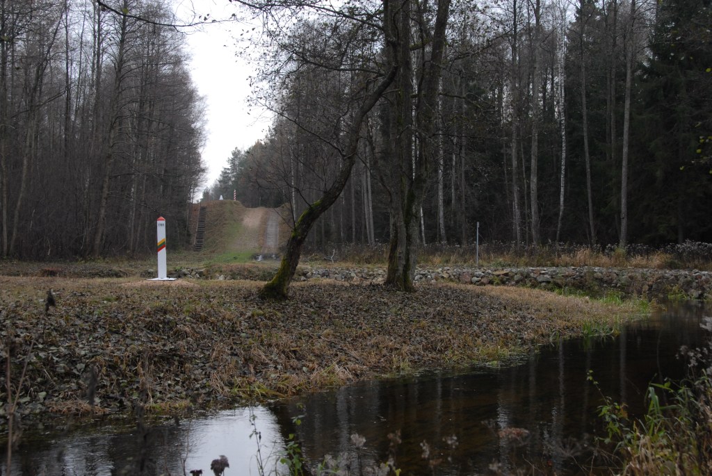
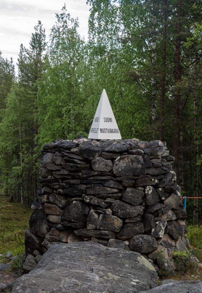
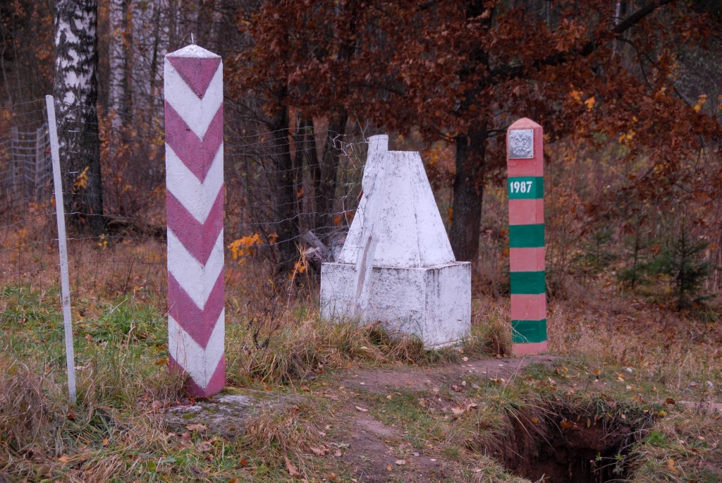
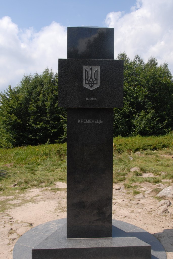
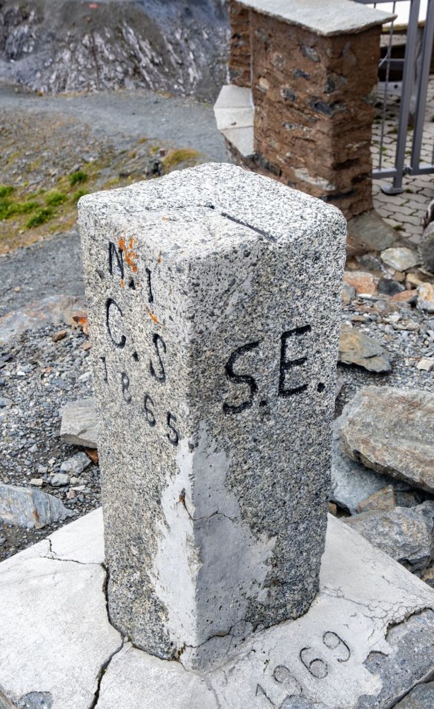
Example of a Dry Tripoint
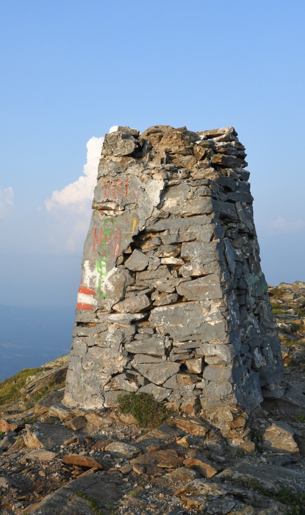
Table: European Tripoints
| Number | Name | Countries | Coordinates | Type | Links/Notes |
| 1 | ADESFRe | Andorra – France – Spain (East) | 42°30’09″N 01°43’28″E | Dry | The Portella Blanca d’Andorra or Coll d’Engaït (2515m) is a mountain pass where the boundaries of Andorra, Spain and France meet. It also forms the administrative boundary of Encamp , Lles de Cerdanya , and Porta. At the top of the pass there is border marker #427 which is taken to mark the tripoint. Both Andorra and Spain record the tripoint as being slightly further south at an unmarked col however. Berns (2004) |
| 2 | ADESFRw | Andorra – France – Spain (West) | 42°36’07″N 01°26’32″E | Dry | The tripoint is located at the summit of Pic de Médecourbe (2914m). From the Collada dels Estanys Forcat (2745 m) there is a short but steep and faint path up to the narrow top. Berns (2004) |
| 3 | ALGRMK | Albania – Greece – Macedonia | 40°51’06″N 20°59’00″E | Wet | The tripoint is located in Lake Prespa, a protected ecological area. The tripoint maybe marked with a buoy. Approx. 1300m SSW of Golem Island. |
| 4 | ALKVME | Albania – Kosovo – Montenegro | 42°33’22″N 20°04’43″E | Dry | The tripoint of Albania, Kosovo, and Montenegro is located at the summit of Trekufiri, a mountain in the Albanian Alps. There is a tall stone cairn at the summit and several border markers (BM#b28 ALYU 1925). The area is part of the Nacionalni park Prokletije. |
| 5 | ALKVMK | Albania – Kosovo – Macedonia | 41°52’39″N 20°35’40″E | Dry | The tripoint is located on the summit of Sherupa (2092m) in the Sharr mountains. There is a tripoint monument similar to BGMKRS. There’s a trail leading to the summit. |
| 6 | ATCHDE | Austria – Germany – Switzerland | 47°31’45″N 09°36’41″E | Wet | In theory the tripoint is located in Lake Constance, in practice there has never been any agreement between the three parties involved on how to “divide” the lake. CH regards the mid-line between DE/CH as the natural borderline, Austria’s opinion is that the Eastern part of the lake should be governed by all states, and Germany’s point of view is not really known.. These different points of view haven’t yet had any consequences of any practical sort, since matters of fishing rights and navigation on the lake have been agreed upon by all parties. |
| 7 | ATCHIT | Austria – Italy – Switzerland | 46°51’16″N 10°28’08″E | Dry | The tripoint is located at the Resia Pass (2174m) near Piz Lad. The tripoint is marked by a border marker placed flat on top of a rock. The Dreiländergrenzstein is usually reached by taking the Mutzkopfbahn chair lift from Nauders (AT), walking in direction of Schwarzer See, and then the Grünsee Lake. A steep climb up the ATIT border leads to the tripoint. Van der Giessen (2024) |
| 8 | ATCHLIn | Austria – Liechtenstein – Switzerland (north) | 47°16’11″N 09°31’49″E | Wet | The tripoint is located in the river Rhine, south of the Bangs-Lienz (ATCH) border crossing. The ATLI border is demarcated and there are border markers on each side of the Rhine with BM#135 in AT commonly described as marking the westernmost point of Austria. BM#136 in CH is the tripoint marker. Van der Giessen (2024) |
| 9 | ATCHLIs | Austria – Liechtenstein – Switzerland (south) | 47°03’35″N 09°36’24″E | Dry | The tripoint is located on the summit of the Naafkopf, a mountain in the Rätikon Alps. The tripoint is marked by a large wooden cross on a brick base that extends in three directions. Naafkopf is the third highest peak in Liechtenstein. Most people approach on the northeastern ridge which marks the Austrian-Liechtenstein border via the Pfälzerhütte, one of the two refuges operated by the Liechtenstein Alpine club. |
| 10 | ATCZDE | Austria – Czech Republic – Germany | 48°46’18″N 13°50’22″E | Dry | The tripoint is located in the Šumava National Park and the Bayrischer Wald nature area. Accessible from a car park near the Berggasthof Dreisessel and then walk along the Czech – German Border path to the tripoint, taking in the Bayerischer Plöckenstein on the way. The tripoint is marked by a three sided monument with national symbols on each side. Van der Giessen (2024) |
| 11 | ATCZSK | Austria – Czech Republic – Slovakia | 48°37’00″N 16°56’25″E | Wet | The tripoint is located at the confluence of the Thaya and March Rivers. It is accessible from either country. There were fishing huts on the Austrian and Slovak sides and signs and sculptures on the Slovak side. Van der Giessen (2024). |
| 12 | ATHUSI | Austria – Hungary – Slovenia | 46°52’9″N 16°06’50″E | Dry | The tripoint is located on small hill near the village of Trdkova. Located on the Raab-Mura watershed divide. A 4 sided tripoint monument was built in 1924. Prior to 1991 this point was on the Iron curtain. Now it is accessible from all 3 countries. It is the westernmost point of Hungary. Van der Giessen (2024) |
| 13 | ATHUSK | Austria – Hungary – Slovakia | 48°0’24″N 17°9’39″E | Dry | The tripoint is near the Slovak village of Čunovo, as well as the Hungarian village of Rajka and the Austrian village of Deutsch Jahrndorf. The tripoint is demarcated by a pillar. It bears the letters of each country marking its sides. At the location, you also find sculptures, borderposts from each country and information signs. Van der Giessen (2024) |
| 14 | ATITSI | Austria – Italy – Slovenia | 46°31’22″N 13°42’41″E | Dry | The tripoint is located at the summit of Peč Mountain (1509 m). Known in Slovenian as Tromeja, in German as Dreiländereck, and in Italian as Monte Forno. The three border area is seen as a symbol of peace and friendship among nations that, in the past, were politically divided. Large border stone as the tripoint monument and many other markers and monuments. Van der Giessen (2024) Wallis (2007) |
| 15 | BAHRME | Bosnia and Herzegonia – Croatia – Montenegro | 42°33’32″N 18°26’15″E | Dry | The tripoint is located very close to the Sitnica (ME) border crossing control post. The is no evidence that it has been demarcated, although the border might have cairns (rather than border markers). |
| 16 | BAHRRS | Bosnia and Herzegonia – Croatia – Serbia | 44°51′09″N 19°00′38″E | Dry | The tripoint is located in the Sava river, north of Vršani (BA). It might be possible to access the northern bank by woodland tracks. |
| 17 | BAMERS | Bosnia and Herzegonia – Montenegro – Serbia | 44°51’21″N 19°01’20″E | Wet | The tripoint is located at a place called Zelena Glava, between Pljevlja, Priboj, and Čajniče. A tripoint agreement was signed in 2019 and there are plans for a monument to be built. |
| 18 | BEDELU | Belgium – Germany – Luxembourg | 43°31’33″N 19°13’15″E | Wet | The Belgium, Germany and Luxembourg tripoint is complex because it technically is not a single point but actually 3. This is because the river Our south of the point where the borders meets is jointly owned and administered by Germany and Luxembourg. BEDELU is in the center of the river, with 2 technical tripoints on either side. South of the triline the condominium jointly exists between Germany and Luxembourg. North of the triline the Belgium – Germany border follows the Thalweg. Krogh (2012) |
| 19 | BEDENL | Belgium – Germany – Netherlands | 50°45’15″N 6°1’16″E | Dry | The BEDENL is an extremely accessible Tripoint being very close to neighbouring towns and cities. The tripoint itself is close to the highest point in the Netherlands ( Vaalserberg 322.4m) and an observation tower and several restaurants and playground facilities. Van der Giessen (2024) Wallis (2007) |
| 20 | BEFRLU | Belgium – France – Luxembourg | 49°32’47″N 5°49’7″E | Wet | The wet tripoint is situated in industrial wasteland near Radange (LU), Athus (BE) and Mont-Saint Martin (FR). BE and LU border markers. No FR marker, The TP is at the confluence of the Bruehl creek into the Chiers river. Van der Giessen (2024) Wallis (2008) |
| 21 | BGGRMK | Bulgaria – Greece – Macedonia | 41°20’19″N 22°55’39″E | Dry | The tripoint on Mount Tumba (1880m) and is remote. Most hikers begin in the Bulgarian town of Zlatarevo and walk (approx 19 km) via a series of waterfalls onto the border ridge and then on to the tripoint (and then back again). This tripoint is unusual in terms of the border configuration of the Bulgarian – Greece border and the Bulgarian -North Macedonia border which form a salient or narrow corridor of Bulgarian territory that terminates at the tripoint. The borders are well demarcated and the summit monument impressive. |
| 22 | BGGRTR | Bulgaria – Greece – Turkey | 41°42’40″N 26°21’28″E | Dry | The tripoint is located on an island adjacent to the Maritsa River. Access roads from BG and TR, or by boat from GR. Access to this point is difficult to arrange and within a secure border area. A TR border fence prevents a circular walk around the tripoint monument. |
| 23 | BGMKRS | Bulgaria – Macedonia – Serbia | 42°18’40″N 22°21’37″E | Dry | The tripoint is located on Shulep Kamak Peak (1337) and marked by a monument with Cyrillic lettering on all sides. Access via Žeravino, a remote Bulgarian hamlet. A trek to the top. The border between Bulgaria and Serbia was well demarcated, with main and intermediate border markers. The border between Bulgaria and North Macedonia was less well demarcated with main border markers some distance apart. |
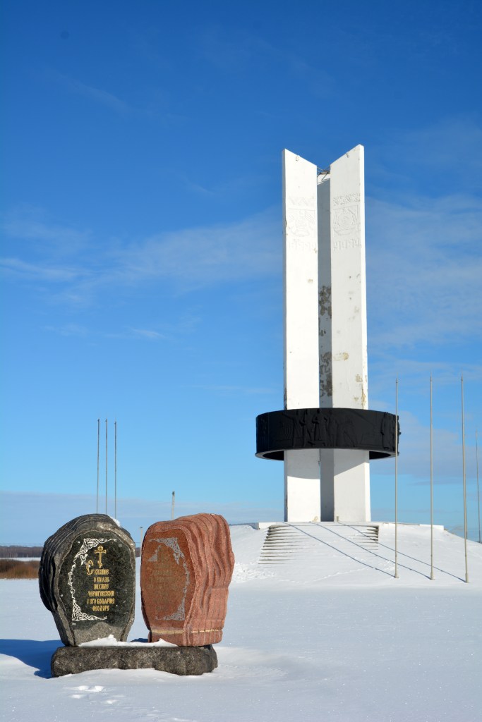
| 24 | BGRORS | Bulgaria – Romania – Serbia | 44°12’55″N 22°40’23″E | Wet | The tripoint is located at the confluence between the River Danube and the smaller Timok (BGRS border) river. The border follows the thalweg of the Danube. A tripoint marker exists on the Romania shore opposite the Timok. |
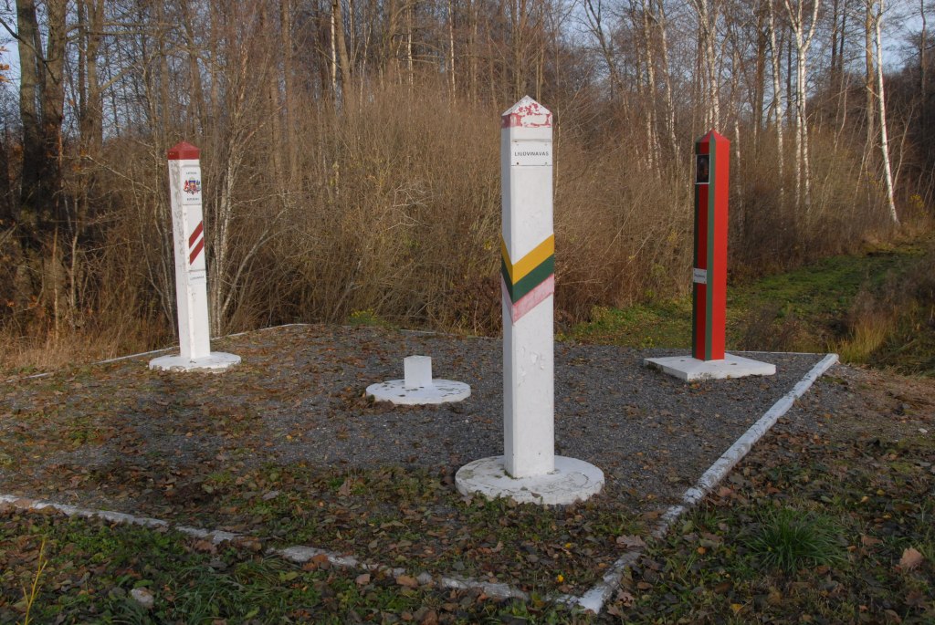
| 25 | BYLTLV | Belarus – Lithuania- Latvia | 55°40’50″N 26°37’49″E | Dry | The tripoint is named Liudevinova (BY), Ludvinova (LV) and Liudvinavas (LT) and is situated in a park on the Lithuanian side with sculptures and other artefacts. The tripoint itself is a 6 meter square platform with the 3 border markers (at approximately 45 degrees from the central marker representing the tripoint itself. On the platform is possible to walk between each country. Off the platform it is possible to walk between Latvia and Lithuania but not Belarus. Deeleman (2015) Krogh (2003) Wallis (2007) |
| 26 | BYLTPL | Belarus – Lithuania – Poland | 53°57’22″N 23°30’54,1″E | Wet | The tripoint is south of the Polish village of Stanowisko and can be approached from either Poland or Lithuania. The Mara river which marks the border curves at this point with a portion of Lithuania protruding towards the other 2 countries. There are 3 BM#1789, 1 in each country. Deeleman (2015) Krogh (2003) Wallis (2007) |
| 27 | BYLVRU | Belarus – Latvia – Russia | 56°10’12″N 28°09’04″E | Wet | The tripoint is located at the confluence between a small creek and the Zilupe river. The are border markers in each country each marked with Neverica. There is a bridge crossing the river into Russia> BM#001 LVRU are on either side of the bridge. Slightly to the west there is a similar bridge leading from Latvia to Belarus. BM#001 BYLV are on either side. All the borders are well demarcated. Prior to Latvia becoming independent this was a joint festival area, and there are many monuments situated on either side. Since the invasion of Ukraine these bridges have been removed. Deeleman (2015) Krogh (2003) |
| 28 | BYPLUA | Belarus – Poland – Ukraine | 51°30’29″N 23°37’04″E | Wet | The tripoint is easily accessible from the Polish village of Orchówek, the tripoint is located at the intersection of a line running through the middle of the Bug River (Western Bug) with a line constituting an extension of the southern edge of the Mościcki Canal. There are 3 TP monuments, The UA segement was fortified with barbed wire and earthworks. PL/BY BM#001 visible. Krogh Van der Giessen (2024) |
| 29 | BYRUUA | Belarus – Russia – Ukraine | 52°6’44″N 31°46’53″E | Dry | The tripoint is located at Senkivka and is marked by the Three Sisters monument which symbolises the friendship of peoples. Visited from UA. 3 border crossing points close together. Several border markers and national signs. My favourite tripoint. In 2024 the monument is likely to be dismantled following the Russian invasion of Ukraine. Krogh (2012) |
| 30 | CHDEFR | France – Germany – Switzerland | 47°35’23″N 07°35’20″E | Wet | The Dreiländereck is located on the Rhine River, along the borders of Basel, Saint-Louis, and Weil-am-Rhein. It is marked indirectly by an impressive tripoint monument designed in 1957 by Wilhelm Münger (150m to the SE). The monument is a large iron pylon in the shape of a rocket with the flags of France, Germany and Switzerland on the tails. North of the tripoint there is a Three Countries Bridge for pedestrians and cyclists. Opened in 2007 and is the world’s longest span pedestrian bridge at 229m. Van der Giessen (2024) |
| 31 | CHFRIT | France – Italy – Switzerland | 45°55’21″N 07°02’39″E | Dry | This is the hardest European tripoint physically to reach. Mont Dolent is regarded as the tripoint. The tripoint is located at Pointes Supérieures de Pré de Bar (3658m), on the ridge that leads east (100m) to the summit of Mount Dolent (3749m). In 1954, a statue of the Virgin Mary was erected on Mont Dolent’s summit by the young people of Valais. A 2 day trek with an overnight in a mountain hut. Competency with glacier, ice and using ropes. A guide is recommended. |
| 32 | CZDEPL | Czech Republic – Germany – Poland | 50°52’14″N 14°49′ 24″E | Wet | The tripoint lies at the confluence between the Neisse river and the Ullersforfer Creek in the centre of the Neisse. The bordering towns are Hrádek nad Nisou (Czech Republic), Zittau (Germany) and Bogatynia (Poland). The tripoint is marked by individual grand border markers in each country plus additional monuments and flags. There are plans for a tripoint monument linking the 3 countries by a 3 way bridge. Krogh (2012) |
| 33 | CZPLSK | Czech Republic – Poland – Slovakia | 49°31’02″N 18°51’03″E | Both | The tripoint is located between Hrčava (CZ), Jaworzynka (PL) and Vyšny Koniec (SK). The actual tripoint is marked by a monument at the point 2 streams meet. It is located underneath a bridge which spans the Polish – Slovak border. The whole area has a park feel to it with walkways, signs and monuments bearing the symbols of each country. Krogh (2012) Wallis (2006) |
| 34 | DEFRLU | France – Germany – Luxembourg | 49°28’10″N 6°22’6″E | Both | Like BEDELU the borders at this triline (not tripoint) are complicated because of the condominium arrangements regarding the shared ownership of the Moselle between Germany and Luxembourg. Above the triline the river is shared, hence like BEDELU there are 3 points of interest along the 114m triline, 1 at each end and one in the middle. Schengen is also of interest Krogh (2003) Van der Giessen (2024) |
| 35 | EELVRU | Estonia – Latvia – Russia | 57°31’05″N 27°21’05″E | Wet | The tripoint is between the towns of Misso (Estonia), Pededze (Latvia) and Palkino (Russia. The tripoint is located in the Pededze river where the LVRU border intersects with the EERU border. 70m north of the its confluence with the Laikupe river (EELV border). It is accessible from EE and LV (permit required). The Estonians have demarcated their side of the border and BM#001 is located there. Deeleman (2015) Krogh (2003) Wallis (2007) |
| 36 | FINORU | Finland – Norway – Russia | 69°03’07″N 28°55’44″E | Dry | Treriksrøysa (‘Three-Country Cairn’) is a cairn which marks the tripoint. The site is on a hill called Krokfjellet (Norwegian) or Muotkavarre (Finnish and Russian), in the Pasvikdalen valley. It is the only place in Europe where three time zones meet. The tripoint is marked by a cairn (which is unnumbered). There is a white pyramid on top with the respective countries names written on. Krogh (2012) Van der Giessen (2024) |
| 37 | FINOSE | Finland – Norway – Sweden | 69°03′35″N 20°32′49″E | Dry | The Three-Country Cairn marks the tripoint. The current tripoint monument was built in 1926 and was originally beige, conical frustum made of concrete, located about 10 metres out in Lake Goldajärvi. The monument is large and there are engraved headstones with symbols of each country. Technically walking around the monument on the platform means leaving Sweden, entering a small pene enclave of Norway and then entering Finland if you walk in a clockwise direction. The are several border markers in the vicinity. Krogh Van der Giessen (2024) |
| 38 | HRHURS | Croatia – Hungary – Serbia | 45°55’18″N 18°53’24″E | Dry | The location of the tripoint is disputed. Position #1 is advocated by Serbia who argues that the HRSR border follows the thalweg of the river Danube. HR however prefers to use cadastral evidence concerning the Croatia-Serbia boundary. In the tripoint area the Karapanđa and Kenđija pockets (2166ha) are particularly important. These areas contain farms and few people. Google maps suggest access is from RS. |
| 39 | HRHUSI | Croatia – Hungary – Slovenia | 46°28’09″N 16°36’37″E | Wet | The tripoint is located near the Krka and Ledava, rivers The is a BM at the tripoint. The HUSI border is demarcated. Easternmost point of SI. Access from Benica (10km). Van der Giessen (2024) |
| 40 | HURORS | Hungary – Romania – Serbia | 46°7’35″N 20°15’51″E | Dry | The tripoint is located between the towns of Kübekháza (Hungary), Beba Veche (Romania), and Rabe (Serbia). Cultural events are held at this location each year. The Triplex Confinium is marked by a monument built in 1920. A 3 sided top part has the respective countries crests. There is a HURS border crossing close by. |
| 41 | HUROUA | Hungary – Romania – Ukraine | 47°57’14″N 22°53’45″E | Wet | The tripoint is located in the river Tur. There are 3 large tripoint monuments, one in each country and border markers in HU and UA. A small (blocked) track links the HU and UA monuments. The RO monument is across the river. |
| 42 | HUSKUA | Hungary – Slovakia – Ukraine | 48°24’12″N 22°9’13″E | Wet | The tripoint lies in the middle of Tisa river. The SKUA border is clearly demarcated and there is a tripoint monument in each of the respective countries. The SK monument is the most visited, with BM#375 SKUA close by. The HU monument is across the river and the UA one 30m east. Deeleman (2021) |
| 43 | KVMERS | Kosovo – Montenegro – Serbia | 42°15’46″N 21°35’13″E | Dry | The tripoint is located at the summit of Beleg mountain (2142m), a second summit of Mokra Gora. Beleg is located a few kilometres north-west of the town of Istog in Kosovo. There is a metal sculpture and sign marking the summit (but not the tripoint). |
| 44 | KVMKRS | Kosovo – Macedonia – Serbia | 42°49’58″N 20°21’28″E | Dry | The tripoint is located west of the Belanovtse-Stancic border crossing, it appears to be remote. On google maps there is an indication of a clearing and possible border marker MKRS which might now coincidently be the tripoint . |
| 45 | LTPLRU | Lithuania – Poland – Russia | 54°21’48″N 22°47’31″E | Dry | This tripoint has added interest not only because of the proximity to the Russian exclave of Kaliningrad but that the point also forms the division between 2 Polish administrative divisions: Podlaskie Voivodeship and Warmian-Masurian Voivodeship, a quadripoint of sorts. In 2009 when I visited the old style tripoint monument, in 2010 a new granite monument was built and the area landscaped. In 2024 there are fortification to separate the RU section. Deeleman (2015) Krogh (2011) Wallis (2007) |
| 46 | MDROUAn | Moldova – Romania – Ukraine (north) | 48°13’37″N 26°37’47″E | Wet | The tripoint is located 500m south east of the Mamalyha – Kryva border crossing post (MD side) in the Prut which is the border between MDRO for its entire length. There are 3 BM’s, BM#003 north of the road leading to UA, and BM#002 and #001 between the crossing point and the river. |
| 47 | MDROUAs | Moldova – Romania – Ukraine (south) | 45°28’1″N 28°12’37″E | Wet | The tripoint is in the river Danube, just east of its confluence with the Prut river. It is located just east of Giurgiulesti International Free Port and north of Insula Cailor, a Romanian island in the Danube. Access is likely to be difficult. It is also the southernmost point of Moldovia. |
| 48 | PLSKUA | Poland – Slovakia – Ukraine | 49°5’17″N 22°33’56″E | Dry | The tripoint is located at Kremenec/Krzemieniec/Кременець (1221 m), in the Bukovec Mountains, north-east Slovakia. There are a few hiking trails from Nova Sedlica, the most eastern settlement in Slovakia and is a popular walk. The tripoint is marked by a marble monument and is also the easternmost point of Slovakia and the highest peak of the border between Slovakia and Ukraine. Deeleman (2015) |

Supplementary information including treaties and maps Details here or click on the image above.
Map of European Tripoints
Tripoint Visit Classes
The table below attempts to classify a tripoint visit into a number of classes. Could you touch the actual spot where the countries join? If so that is a Class A, a visit to a wet tripoint is almost always a Class C. Some monuments such as FINOSE the tripoint between Finland – Norway and Sweden is too large to touch the stone on the top, hence a Class B. Not everyone uses this classification and it is offered here as a bit of fun to stimulate discussion.
| Tripoint VISIT Classes | |
|---|---|
| Class A | Touched |
| Class B | Basically there. Successful attempt to reach wet tripoint by wading, swimming or canoeing. Very close to a dry tripoint but unable to touch due to a physical barrier/obstacle. |
| Class C | Within 500m, visible |
| Class D | Distant. visible |
| Class E | Tripoint area visited but Tripoint not observed. |
| Source: Acroorca (2002) Published on Boundarypoint 12/07/2003. Edited Arnold (2024) |
My Tripoint Gallery (28 out of 48 visited so far) plus 4 historical tripoints.
The International Standard for country codes and codes for their subdivisions is ISO 3166 this allocates a 2 letter designation to each country. When identifying a tripoint it is necessary to collate the 3 country codes in alphabetical order, hence the tripoint between Austria, Germany and the Czech Republic becomes ATCZDE. The US and Canada often use 2 letters to denote states and provinces e.g. Alabama AL which is technically incorrect as all sub national territories according to ISO 3166 should have the initial 2 letter country designation followed by up to 3 further letters. Alabama ought therefore be US- AL. Delaware has the same 2 letter code as Germany: DE which has the potential for confusion.
Please click on the photos below to access the reports of my visits, or the red highlighted text above.
Tripoints 1-16
Tripoints 17-32
Tripoints 33-48
Historical Tripoints
Please click on the images below to access reports on visits to European historical tripoints which no longer exist due to boundary changes or countries no longer existing.
Site Navigation
In order to find your way around the site, either click on the links (text in red) or use the menus at the top of the page. About leads you to the country pages, with links to individual borders. The about menu leads you to my visit reports by country.

Mobile Users Advice
Tables display correctly when holding your mobile horizontally.
To access the links to other pages please click on the 3 horizontal dots at the bottom of the page.