
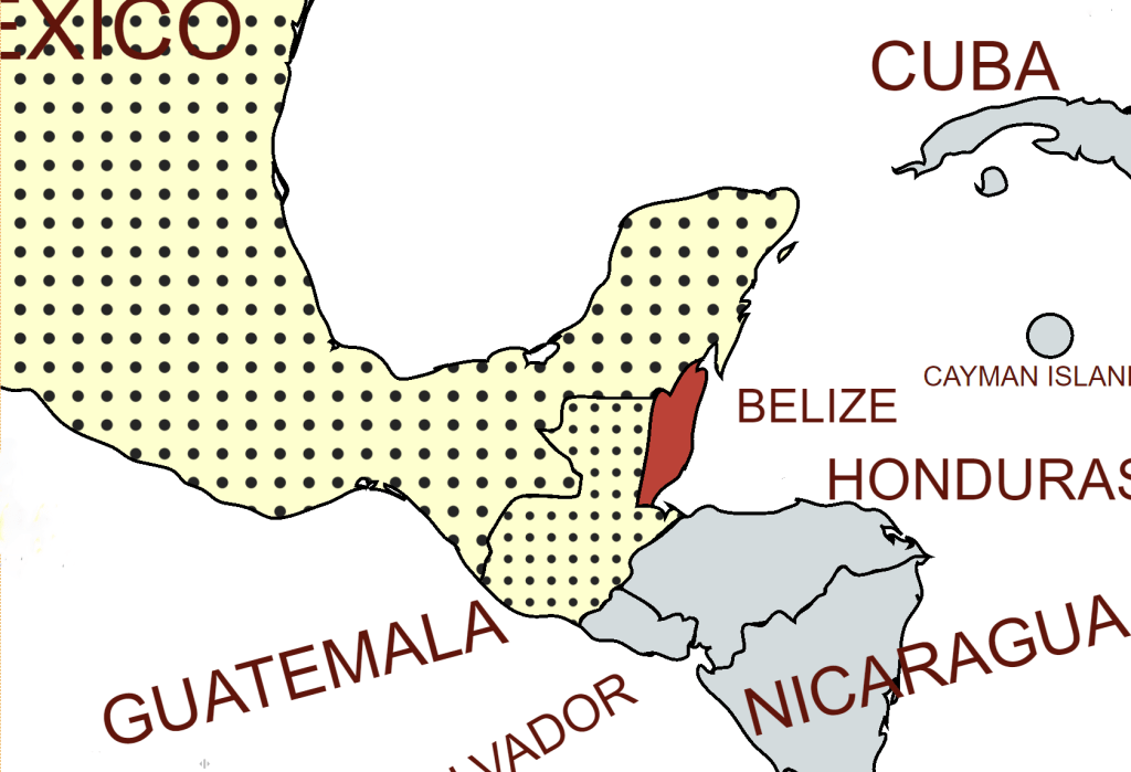
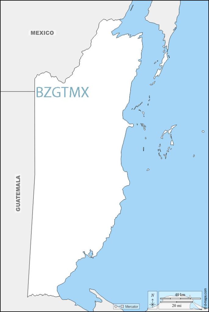
Belize is a country on the north-eastern coast of Central America. It is bordered by Mexico to the north, the Caribbean Sea to the east, and Guatemala to the west and south. It also shares a water boundary with Honduras to the southeast. Belize is a member of the Caribbean Community (CARICOM), and is considered part of the Caribbean region and the historical British West Indies. After the British defeated. the Spanish in 1798 Belize became a British colony in 1840, and a Crown colony in 1862. Belize achieved its independence from the United Kingdom on 21 September 1981. Belize is therefore an anomaly, being a member of the Commonwealth, having a British monarch as Head of State and English as an official language. The British military have forces based in the country.
Belize is a parliamentary constitutional monarchy. The structure of government is based on the British parliamentary system, and the legal system is modelled on the common law of England. The head of state is Charles III, who is the King of Belize. The bicameral National Assembly of Belize comprises a House of Representatives and a Senate. The Judiciary is independent.
Belize is a full participating member of the United Nations; WTO; the Commonwealth of Nations; the Organization of American States (OAS); the Central American Integration System (SICA); the Caribbean Community (CARICOM); the CARICOM Single Market and Economy (CSME); the Association of Caribbean States (ACS); and the Caribbean Court of Justice (CCJ), which currently serves as a final court of appeal for only Barbados, Belize, Guyana and Saint Lucia.
Belize scores highly on the freedom index and human rights are respected.
Border Facts
Belize is bordered by Mexico, Guatemala, and the Caribbean Sea, and shares a water boundary with Honduras:
Belize – Mexico border is 250 km and almost exclusively follows the course of the Hondo River. It separates Belize from the Mexican state of Quintana Roo. The border was established through a treaty in 1893. In early 2007, the Ministry of Foreign Affairs of Mexico announced an agreement with Belize for the delimitation of the maritime boundary in the Bay of Chetumal.
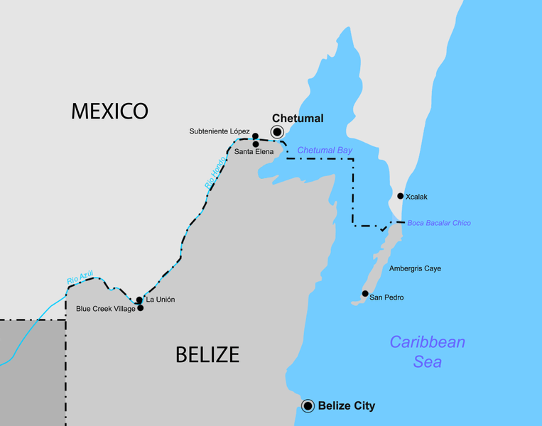
Under the treaty, the border starts at Boca Bacalar Chico, a narrow channel that separates the southern tip of the Caribbean coast of the Yucatan Peninsula and Ambergris Caye. It then runs through Chetumal Bay in a broken line up to the mouth of the Hondo River. The border follows the Hondo River through its deepest channel and then along its tributary, Blue Creek, until it reaches the meridian of Garbutt’s Falls (approximately 89° 9′ W). From this point, it runs directly south to 17° 49′ N latitude, the border established between Mexico and Guatemala and the tripoint at BZGTMX.
There are currently 2 border crossings between the 2 countries, firstly via the Puente Internacional Santa Elena between Subteniente López (MX) and Sta Elena (BZ) and secondly via the nearby Chac-Temal International Bridge. Smaller crossing points exist for example between La Union (MX) and Blue Creek Village (GT). There are unofficial crossing points elsewhere on the border.
Belize – Guatemala border is an almost straight line 266 km long, close to the 89th meridian west, The border between Belize and Guatemala is defined in Article I of the Wyke–Aycinena Treaty of 1859:
Beginning at the mouth of the River Sarstoon in the Bay of Honduras, and proceeding up the mid-channel thereof to Gracias a Dios Falls; then turning to the right and continuing by a line drawn direct from Gracias a Dios Falls to Garbutt’s Falls on the River Belize, and from Garbutt’s Falls due north until it strikes the Mexican frontier.
The border has been disputed by Guatemala, which claims that the treaty is void since Britain failed to comply with economic assistance provisions found in Article VII. The situation was partially resolved in 1991 when Guatemala officially recognized Belize’s independence and diplomatic relations were established.
Guatemala – Belize border dispute is unresolved, although the treaty stated that Guatemala would recognise British sovereignty over the region and formed the modern-day boundary lines of Belize. The treaty also had an article about building a mutually beneficial road though it was never built. Guatemala used this failure to claim all, or part of Belize at various times.
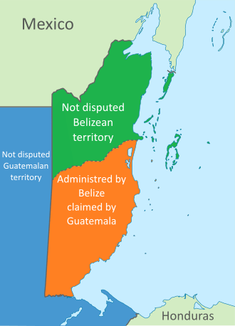
The situation was partially resolved in 1991 when Guatemala officially recognized Belize’s independence and diplomatic relations were established.
In 1999 in an attempt to reduce the chances of military conflict a 1 km “adjacency zone” drawn on either side of the 1859 treaty borders. In 2008, Guatemala and Belize made a pact to have simultaneous referendums for their voters to send the issue to the International Court of Justice. The referendums passed in both countries by May 2019. As of June 2022, both countries are now settling the dispute at the International Court of Justice, with both countries confirmed to have submitted their initial briefs to the organisation. The court is not expected to rule until 2025 at the earliest.
There is one main highway crossing of the border, at Benque Viejo del Carmen, Cayo District, Belize and Melchor de Mencos, Peten, Guatemala, where Guatemala Highway CA-13 meets the George Price (Western) Highway, connecting to Belize City and Belmopan.
About four kilometres south of this crossing is the village of Arenal, which has homes on both sides of the border, and a football field directly on the border.
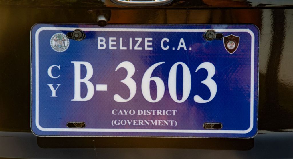
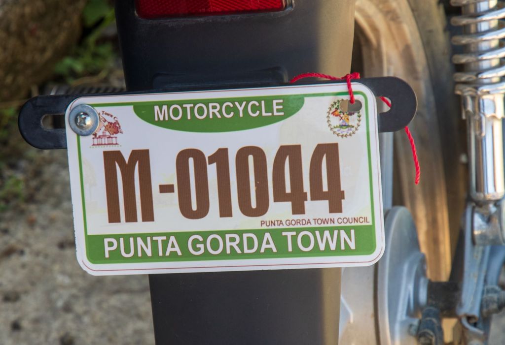
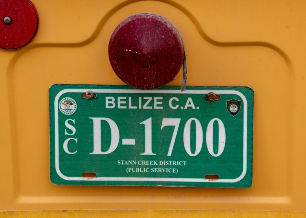
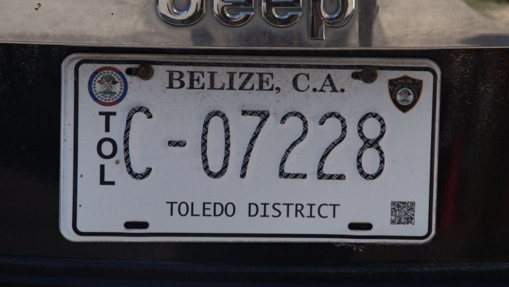
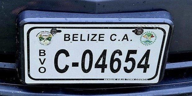
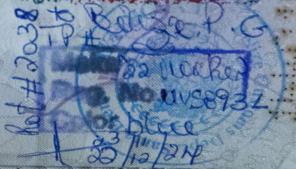
Belizean Registration Plates

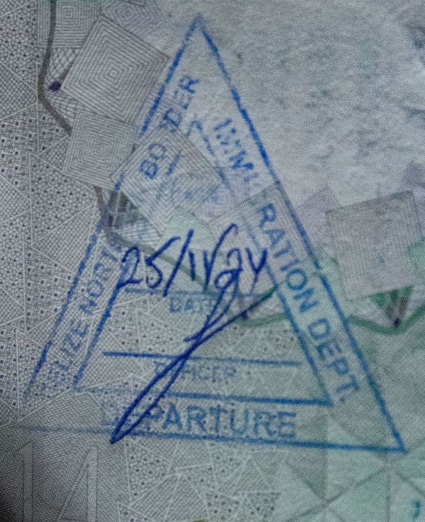
Belizean Passport Stamps

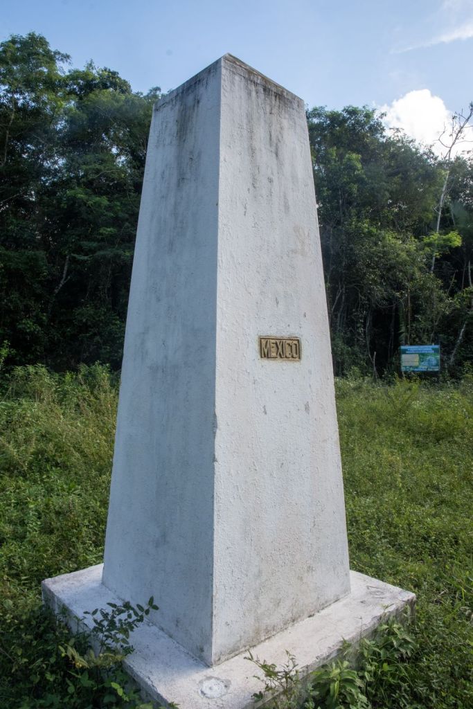
Belizean Tripoints
| number | name | country | coordinates | type | links/notes |
|---|---|---|---|---|---|
| 1 | BZGTMX | Belize – Guatemala – Mexico | 17°48′56″N 89°9′7″W | Dry | Tripoint is situated at the Aguas Turbias monument. BZGT (2002) surveying of the border has led to no change. |
Tripoint Gallery

Site Navigation
In order to find your way around the site, either click on the links (text in red) or use the menus at the top and side of the pages. About leads you to the main areas of the site. The European Tripoints menu leads directly you to my visit reports whereas the Country Visits page allows you to choose which country to look at first. Clicking on photos can lead you directly to reports too.

Mobile Users Advice
Tables display correctly when holding your mobile horizontally.
To access the links to other pages please click on the 3 horizontal dots at the bottom of the page

