
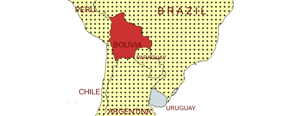
Bolivia, officially the Plurinational State of Bolivia, is a landlocked South American country. The country features a diverse geography, including the vast Amazonian plain, the Gran Chaco, temperate valleys, the high-altitude Altiplano plateau, snow-capped peaks and mountains. It includes part of the Pantanal, the largest tropical wetland in the world, along its eastern border. It is bordered by Brazil to the north and east, Paraguay to the southeast, Argentina to the south, Chile to the southwest, and Peru to the west. Bolivia is very geologically rich, with mines producing tin, silver, lithium, and copper. The country is also known for its production of coca plants and refined cocaine.
Bolivian independence from Spain was achieved in 1825, which followed a war of independence between 1809 and 1825 led by Simón Bolívar and Antonio José de Sucre. Since independence Bolivia was ruled by an oligarchy composed of land-owning and mining interests until the Bolivian National Revolution of 1952 that established universal suffrage, nationalized tin mining and made a limited land reform. 20th century Bolivia experienced a succession of military and civilian governments with the last non-elected military ruler leaving office in 1982. Under the 2006–2019 presidency of Evo Morales, the country saw significant economic growth and political stability but was also accused of restricting democratic freedoms and was described as a competitive authoritarian regime. Bolivia is a constitutionally unitary state divided into nine departments. The seat of government is La Paz, which contains the executive, legislative, and electoral branches of government, while the constitutional capital is Sucre, the seat of the judiciary.
Modern Bolivia is a member of the Non-Aligned Movement (NAM), Organization of American States (OAS), Amazon Cooperation Treaty Organization (ACTO), Bank of the South, ALBA, the Union of South American Nations (USAN), and Southern Common Market (Mercosur). Bolivia remains a developing country, and the second-poorest in South America.
Border Facts
Bolivia is bordered by Brazil to the north and east, Paraguay to the southeast, Argentina to the south, Chile to the southwest, and Peru to the west. Bolivia is the fifth-largest country in South America after Brazil, Argentina, Peru and Colombia, and, alongside Paraguay, is one of two landlocked countries in the Americas. Over the course of the 19th and early 20th centuries, Bolivia lost control of several peripheral territories to neighbouring countries, such as the Acre territory after Brazil’s 1899–1903 takeover, and the country’s Pacific coastal region which Chile seized in 1879 .
Bolivia – Argentina border extends for approximately 832 kilometres between the ARBOCL tripoint with Chile on Cerro Zapaleri and the ARBOPY tripoint on the thalweg of the Rio Pilcomayo. The border transitions from Andean highlands (Altiplano) with volcanic peaks near Chile, through river valleys (Rio Pilcomayo, Bermejo), down to the tropical Chaco lowlands, following lines of latitude (22nd parallel) and rivers, defined by pillars and natural features, connecting Bolivia’s Potosí/Tarija with Argentina’s Jujuy/Salta regions, creating distinct geographic zones from high-altitude deserts to humid plains. Major crossings include La Quiaca (Argentina) into Villazón (Bolivia).
Bolivia- Chile border is approximately 1500 kilometres long. It runs along the Cordillera Occidental (Andes) from the ARBOCL tripoint, featuring volcanoes (Licancabur), salt flats, geysers (Sol de Mañana), and lagoons (Laguna Verde) and finishing at the BOCLPE tripoint. The border was established through treaties in 1866 and 1874. The War of the Pacific (1879-83): resulted in Chile annexing the disputed coastal territory, making Bolivia landlocked, and in 2018 the International Court of Justice ruled Chile had no obligation to negotiate sea access for Bolivia. Border Crossings are through isolated high altitude passes.
Bolivia – Peru border is 1075 kilometres long across diverse South American terrains, ranging from high-altitude Andean plateaus to tropical Amazonian lowlands. It begins at the BOCLPE tripoint on the Ancomarca Plateau and ends at the BOBRPE tripoint at the confluence of the Acre and Yaberija rivers. The border was largely defined by the 1909 Polo-Bustamante Treaty, which settled territorial disputes, especially concerning Amazonian territories, with Bolivia recognizing Peruvian control over certain Amazonian basins in exchange for land in the Acre region.
Bolivia – Brazil border is 3,423 kilometres long and is Latin America’s second-longest border and the eighth-longest worldwide. The border is primarily defined by rivers and wetlands, stretching from the Pantanal wetlands in the south-east to the Amazon rainforest in the north-west, featuring diverse terrains like tropical forests, savannas, and major rivers such as the Guaporé, Acre, Madeira, and Abunã. This border has changed over time, the Treaty of Petrópolis (1903) signed after the Acre War ceded Acre to Brazil.
Near the BOBRPY tripoint there is the “Dioniso Foyani” (or Foianini). Triangle, the above 1903 treaty with Brazil ceded this triangle to Bolivia so that Bolivia could build a port on the Paraguay River, ensuring a sovereign and direct river connection to the Atlantic Ocean via the Paraguay-Paraná Waterway and the Río de la Plata.
A current minor border dispute exists over Isla Suárez (Guajará-Mirim Island) on the Mamoré River, where both nations claim sovereignty, though a 1958 treaty maintains status quo, with Brazil de facto controlling it albeit Bolivia being geographically closer.
Bolivia and Brazil are building the Mamoré River International Bridge (or Rio Mamoré Bridge) connecting Guayaramerín (Bolivia) and Guajará-Mirim (Brazil), a major project over 1.2 km long, replacing a ferry, and fulfilling a long-delayed promise from the Treaty of Petrópolis (1903) to boost South American trade, particularly for landlocked Bolivia. Tender processes began in late 2023, with construction aiming for completion in 2027, integrating the region and offering a crucial export corridor to Asia.
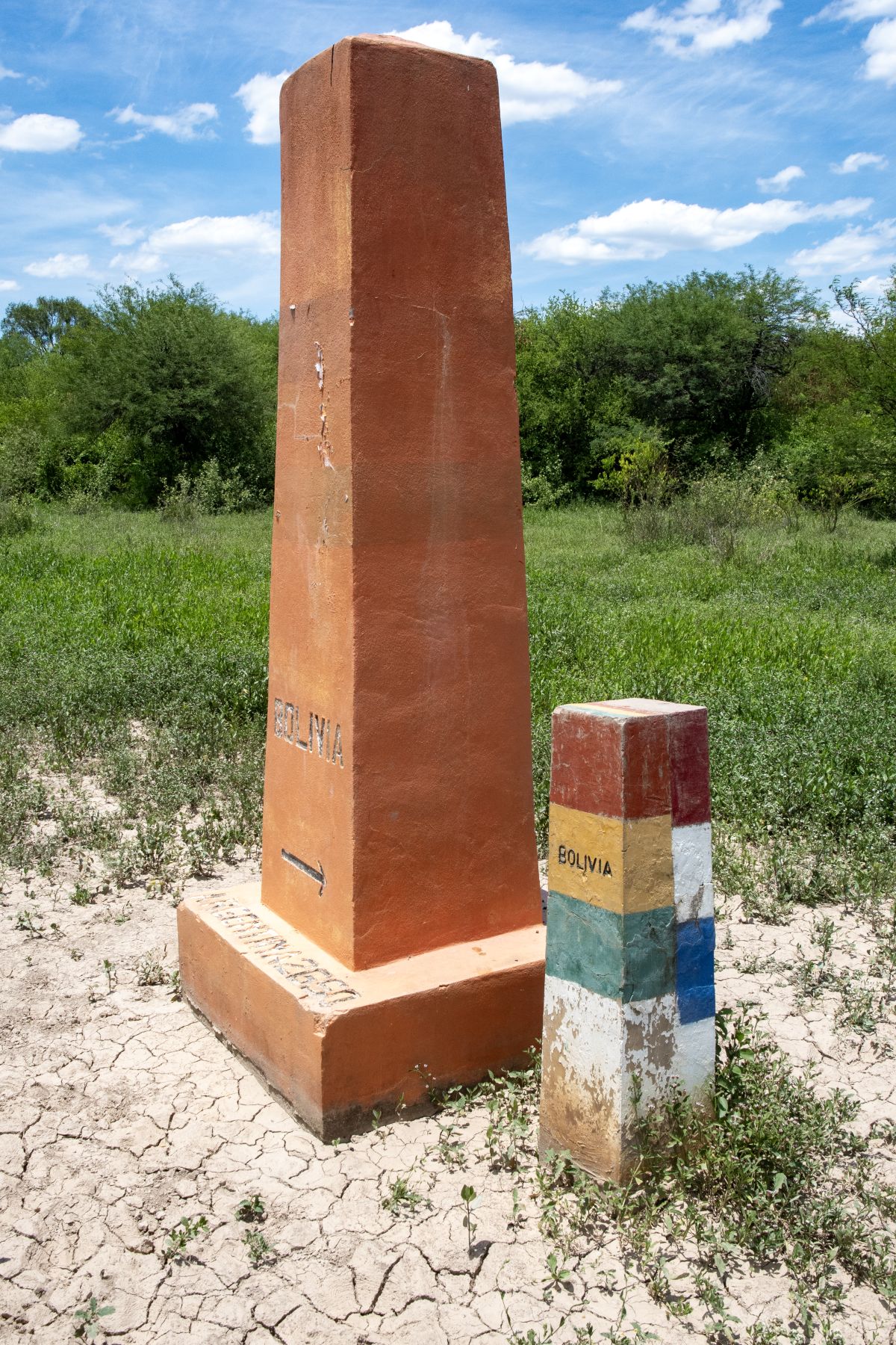
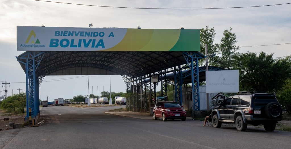
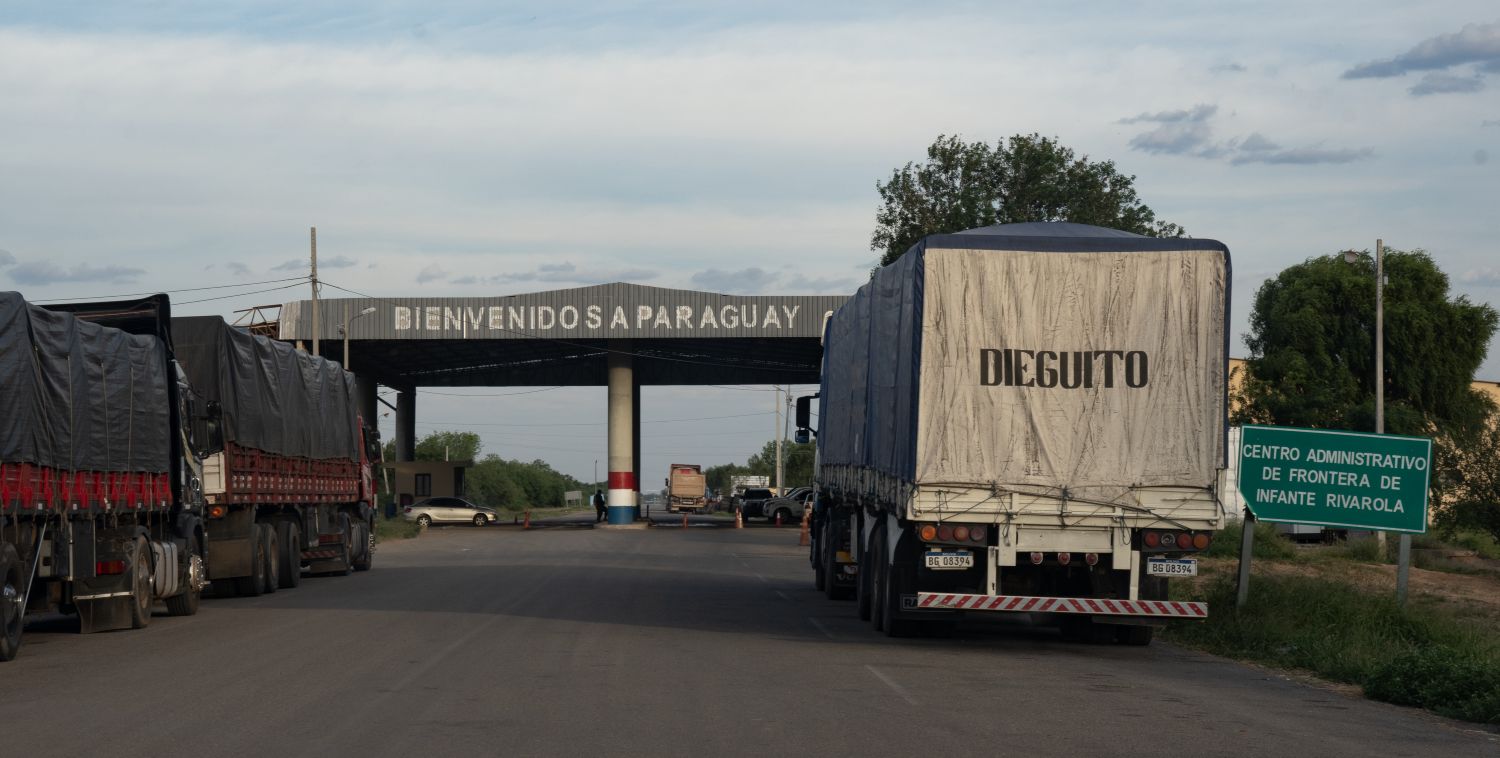
Bolivia – Paraguay border is 742 km long. It begins in the east at the ARBOPY tripoint near the town of La Esmeralda on the Pilcomayo River, it then moves in a north-northeast direction towards the summit of Cerro Capitán Ustares, where it turns east to the town of Fortín Galpón , where it follows a line south along the Paraguay River , ending at the BOBRPY tripoint. It is demarcated by 11 markers ( Marker I to Marker X plus the tripoint marker at BOBRPY). Markers I to X are connected to each other by straight lines, while Marker X is connected to the tripoint marker by a watercourse
There is a border post near the Paraguayan town of Infante Rivarola.
Please click on the images below to access visit reports with further information, maps and photos.
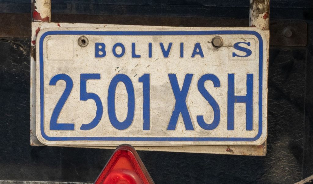
Bolivian Number Plates


Bolivian Tripoints
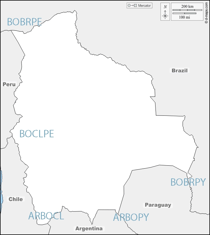
| NUmber | name | country | coordinates | Type | Notes/Links |
|---|---|---|---|---|---|
| 1 | ARBOCL | Argentina – Boliva – Chile | 22°48′30″S 67°10′40″W | Dry | The tripoint is located on the summit of the Zapaleri extinct volcano (5600m). Marked with a metal monument indicating the 3 countries. The Bolivian Instituto Geográfico Militar installed a triangulation station marker and an associated reference marker in 1965, and the Chilean Instituto Geográfico Militar installed a triangulation station marker in 1970. |
| 2 | ARBOPY | Argentina – Boliva – Paraguay | 22°14′S 62°39′W | Wet | Hito Esmeralda is at the edge of the Pilcomayo River. Marked by a concrete pillar, Names and flags of respective countries. Now dry due to alluvial deposits. |
| 3 | BOBRPE | Boliva – Brazil – Peru | 10°56′27″S 69°34′1″W | Wet | At the confluence of the Acre and Yaberija rivers. |
| 4 | BOBRPY | Boliva – Brazil – Paraguay | 20°10′S 58°10′W | Wet | At the confluence of the Negro and Paraguay rivers. |
| 5 | BOCLPE | Boliva – Chile – Peru | 17°30′S 69°29′W | Dry | Tripartito The Bolivia–Chile–Peru tripoint lies in the Ancomarca Plateau near the village of Visviri (CL) and Charaña (BO). Marked with a concrete monument. |
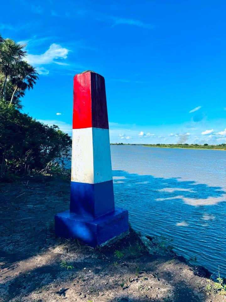
Tripoint Gallery


Site Navigation
In order to find your way around the site, either click on the links (text in red) or use the menus at the top and side of the pages. About leads you to the main areas of the site. The Americas Tripoints menu leads directly you to my visit reports whereas the Country Visits page allows you to choose which country to look at first. Clicking on photos can lead you directly to reports too.
Mobile Users Advice
Tables display correctly when holding your mobile horizontally.
To access the links to other pages please click on the 3 horizontal dots at the bottom of the page

