
A pene exclave
Kokkina is a coastal exclave (pene-exclave) of the de facto Northern Cyprus, and a former Turkish Cypriot enclave in Cyprus. It is surrounded by mountainous territory, with the Morphou Bay on its northern flank. Kokkina sits several kilometres west of mainland Northern Cyprus and is a place with symbolic significance to Cypriots ,because of the Battle of Tillyria August 1964. Kokkina’s status as an exclave stems from 1964 and pre dates the invasion 10 years later. UNFICYP forces have been stationed around the exclave since the earlier date as inter communal conflict forced Turkish Cypriots to live in clusters for protection.
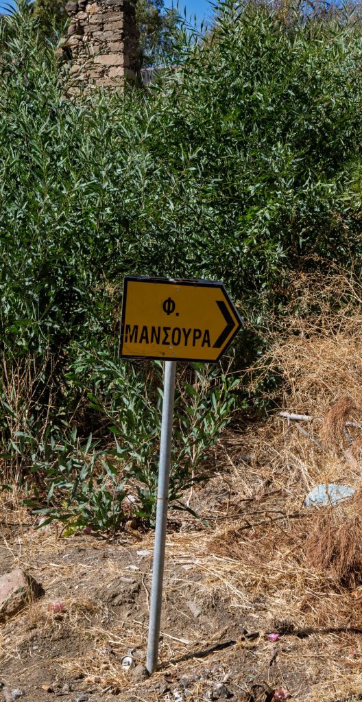
Following the 1974 war and the division of the island, Kokkina continued as an exclave, since the Turkish army never reached the village. The village was cut off by the Greek Cypriot village of Pyrgos, which geographically prevented it from uniting with the rest of Turkish-controlled north Cyprus. In 1976, all Kokkina inhabitants were transferred to Yialousa (renamed Yeni Erenköy or “New Erenköy” in Turkish) and the exclave has since functioned as a North Cyprus Defence Force military camp for the Turkish forces. A visit to the exclave itself was impossible and the coastal road is blocked at both ends, we therefore detoured via the E704 some distance inland around the buffer zone stopping at different POI’s along the route. I visited this point as part of the IBRG CYBEX-24

Click on the image above for location on Google Maps
Access Point (E)
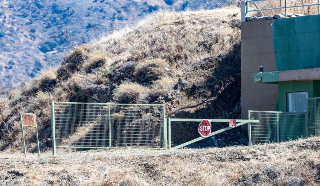
Driving west the first point we reached was the old coastal road which now leads into the buffer zone. After a short distance we were stopped by Greek Cypriot soldiers who would not allow us to walk to the barrier across the road, “you cannot go any further, they will shoot you”, was the advice given.


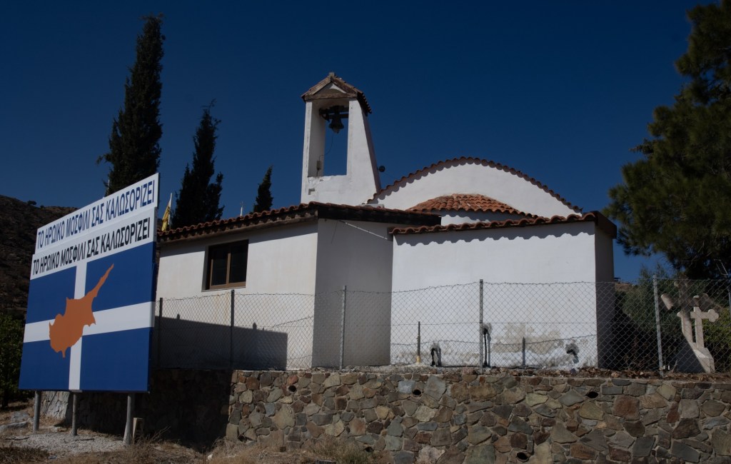
Mosfili
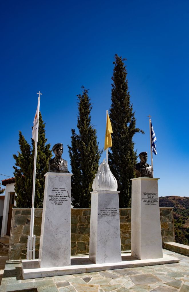
Mosfileri is a small village in the Nicosia District of Cyprus, just east of the Kokkina exclave. It is part of the Pigenia municipality. It is also known as Mosfili. It recognises those who died defending the village during the Turkish invasion.

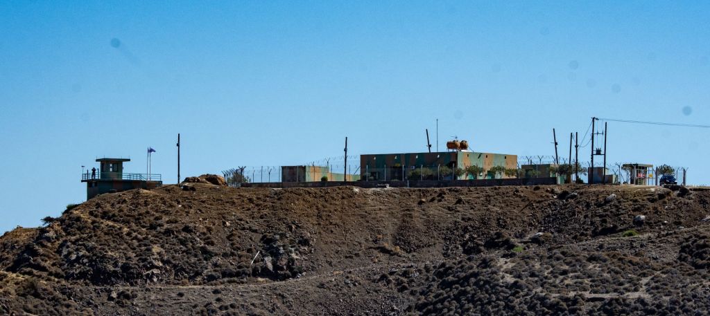
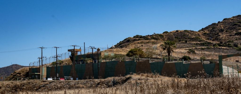
Observation Posts & Fortifications #1
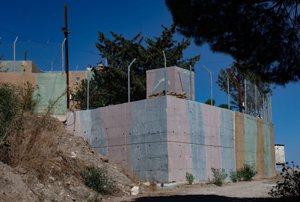
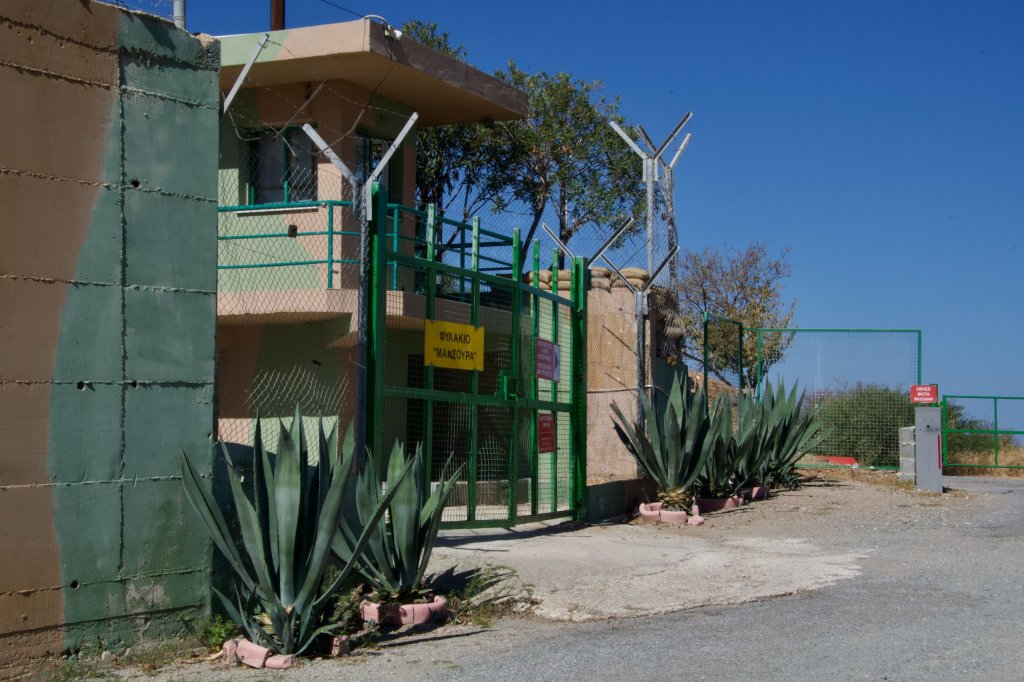
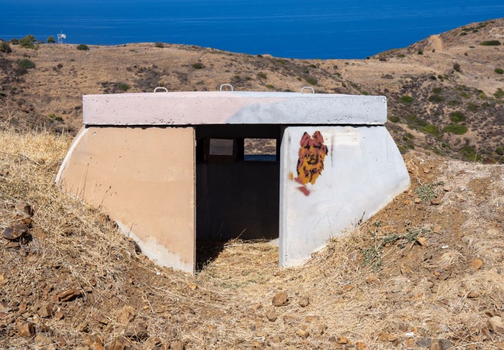
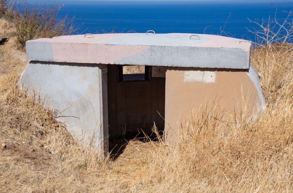
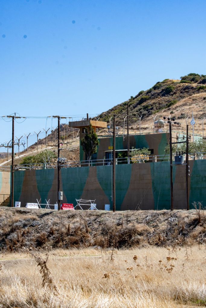
Travelling clockwise around the exclave there are many TRNC, UN and Greek Cypriot bases facing one another. There are old fortifications too. This place is a microcosm for the futility of the conflict and the entrenched nature of both sides.


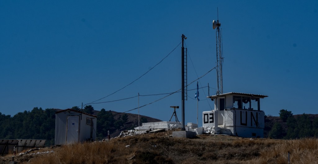
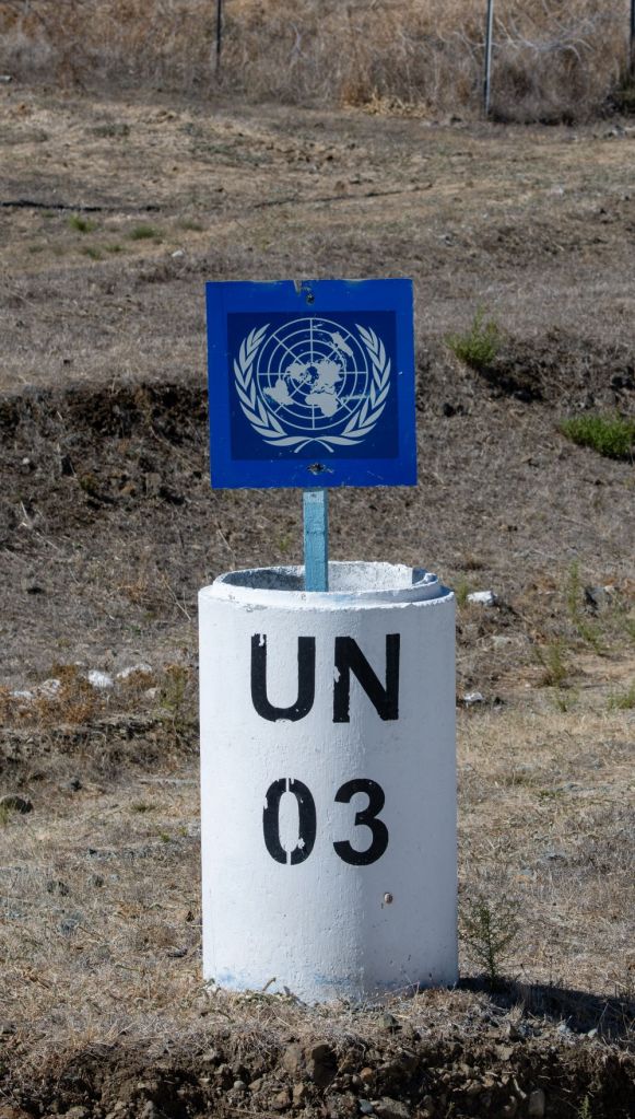
UN OP #3
A large UN OP #3 with the national flags of the allocated troops was visible from the road. Since 1993, Argentina has contributed almost 13,000 troops to UNFICYP, including personnel from the army, navy, and air force. Chile & Paraguay have contributed over 600 troops to UNFICYP since 2001.


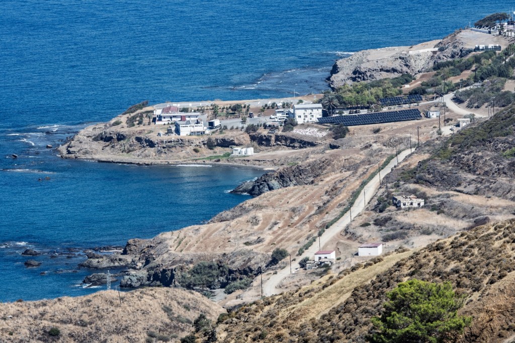
The TRNC exclave
There was a viewpoint which provided good views over the Turkish occupied area. Additionally, there were good views from Pomos village 5km across the bay.


Observation Posts & Fortifications #2
The reality that the conflict is not over comes with the number of OP’s along this stretch of the buffer zone. The cost each year by the 3 parties must be considerable, although the UN are using much more remote monitoring and fast response units to deal with issues as they arise. The abandoned village in this section, shows the population displacement that occurred.


Access Point 
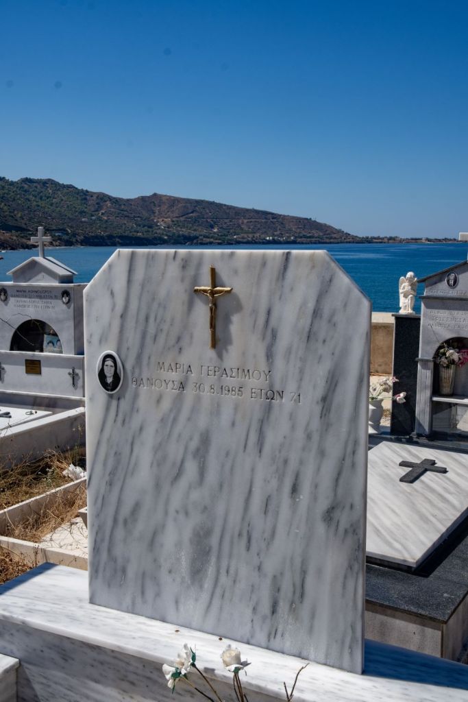
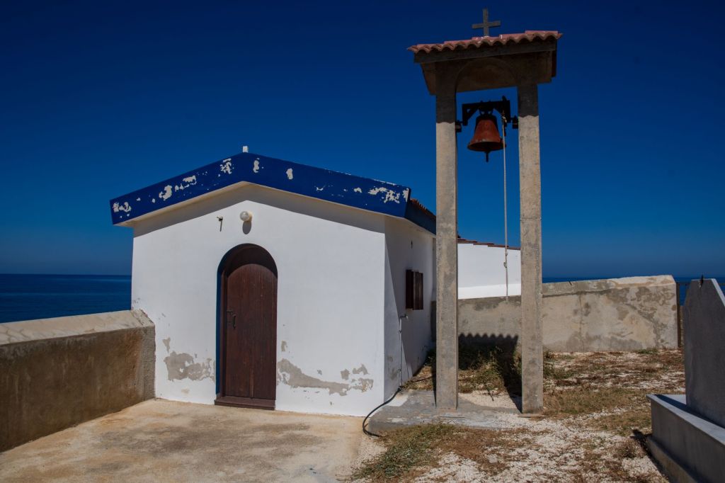
Our last POI on this circuit was the access road from the west. Another Greek base was there, but we were able to get close as there was a chapel and cemetery close by.


Date of Visit: 28 September 2024
