
Akrotiri and Dhekelia, is a British Overseas Territory on the island of Cyprus. The areas, which include British military bases and installations that were formerly part of the Crown colony of Cyprus, were retained by the British under the 1960 treaty of independence signed by the United Kingdom, Greece, Türkiye and representatives from the Greek and Turkish Cypriot communities. The territory serves as a station for signals intelligence and is thereby part of the United Kingdom’s surveillance-gathering work in the Mediterranean and the Middle East


The Sovereign Base Areas (SBAs) of Akrotiri and Dhekelia in Cyprus are marked by international boundaries that were precisely defined when Cyprus gained independence in 1960:
- Akrotiri: The border of Akrotiri is 48 km long.
- Dhekelia: The border of Dhekelia is 108 km long. Dhekelia is also bordered by the UN Buffer Zone and the state of Northern Cyprus.
- Land boundary crossing points: The Eastern Sovereign Base Area (ESBA) has two land boundary crossing points with the Turkish-controlled area of northern Cyprus. These crossing points are staffed 24/7 to control the movement of people and goods.
The SBAs are British Overseas Territories that are run as military bases. The SBAs are administered by the Sovereign Base Area Administration (SBAA), which reports to the British Ministry of Defence.
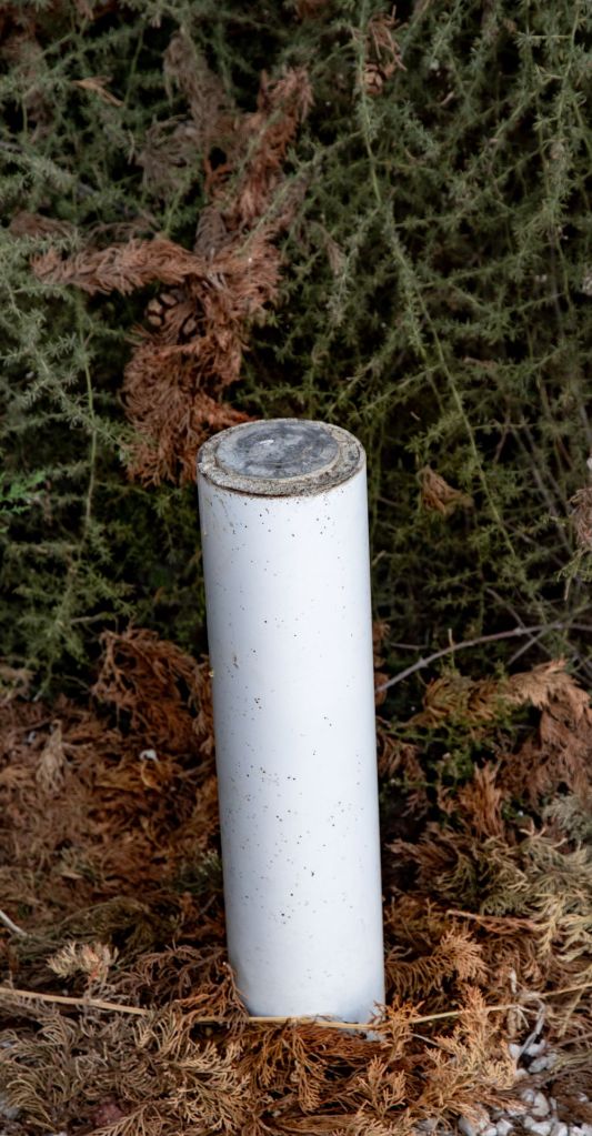
All British SBA boundaries are demarcated with border markers; usually white poles of various lengths, but also other types are found. Their top plates are either military and have English or Greek markings. Some markers are numbered, although more often or not the paint has been eroded. There were originally over 700 border markers, although some have been damaged, destroyed and not replaced.
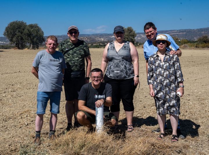
During the IBRG CYBEX-24 expedition there was no systematic plan to record a large number of border markers, instead we focused a few POI’s. A future trip is required to be more systematic.
SBA (West)
F606
Driving south along the F606 towards the coast we spot our first SBA border marker, lots of excitement ensued. The marker was in the middle of a field, suggesting the farmer cultivated across the border.


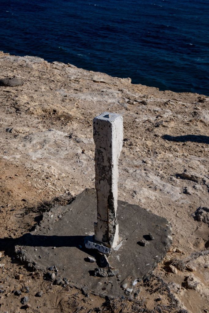
Melanda Beach
Heading further south towards the coast we found an eroded border marker on the cliffs edge. It was quiet here in contrast to the busy beach and fish restaurant. Our phones began acting strangely at this point with the mapping apps putting us in Jordan. A likely explanation was Israeli electronic interference in the region.


Kolossi Castle
Kolossi Castle is a former Crusader stronghold on the south-west edge of Kolossi village 14 kilometres west of the city of Limassol. The present castle was built in 1454. The border between the Republic of Cyprus and the SBA crosses roads and cuts through buildings, we were hunting for any markers we could find.


Asomatos
Asomatos is a village located in the Limassol District of Cyprus, 7 km west of Limassol directly adjacent to the Akrotiti Sovereign Base Area, and lying partly within the British Overseas Territory of Akrotiri and Dhekelia. We travelled here do view some border markers and see how the border had changed since the visits of other members of the IBRG. (Krogh 2012)


SBA (East)
Ormideia
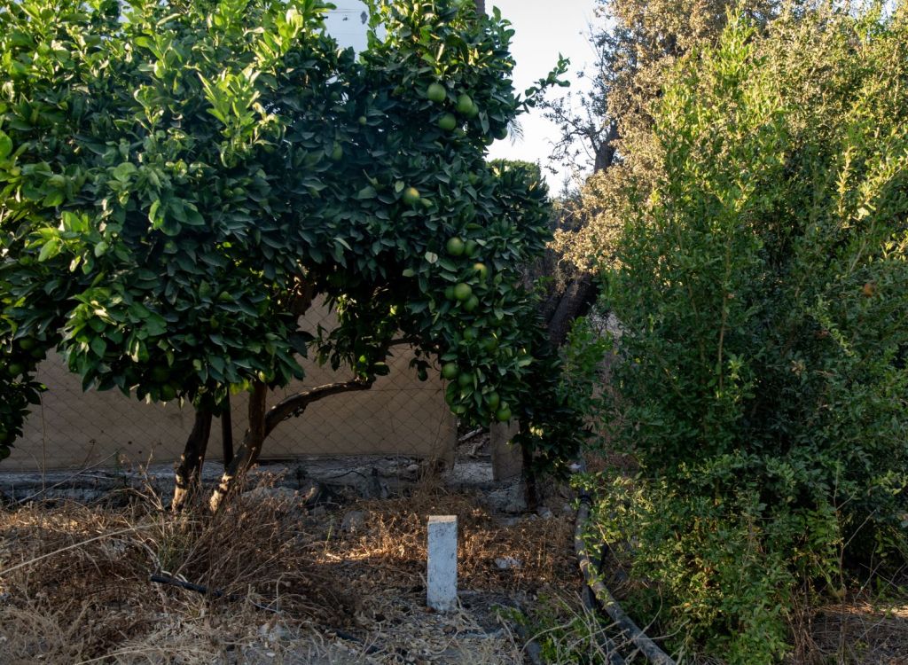
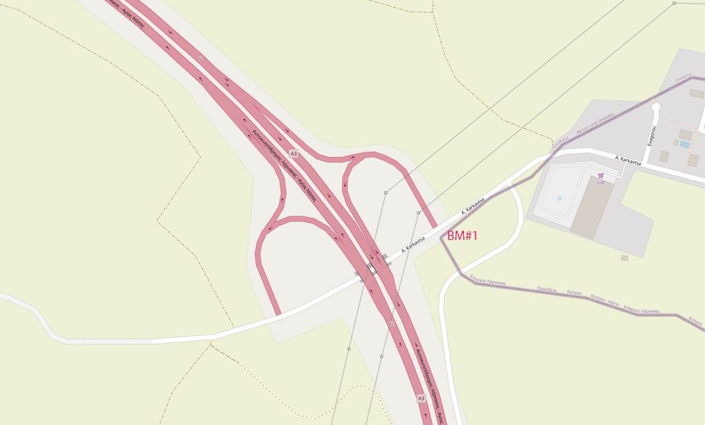
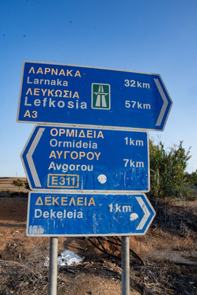
Ormideia is a village in Larnaca District in south-eastern Cyprus. It is one of the four exclaves surrounded by the Eastern Sovereign Base Area of Akrotiri and Dhekelia, a British Overseas Territory administered as a Sovereign Base Area. The others are the village of Xylotymbou and two separate parts of Dhekelia Power Station. It is administered by the Republic of Cyprus. Due to shortage of time, we were only able to explore one POI here. The border marker is located at the roadside near a motorway exit ramp.


SBA Border markers in other locations.
Please click on the images below to access reports on other places visited where SBA border markers were also observed as part of a wider and more detailed visit.
Pyla

Pergamos

Xylotymbo
.
Dhekeleia
Düzce


Dates of Visit: 29/30 September 2024
