
Views from the South
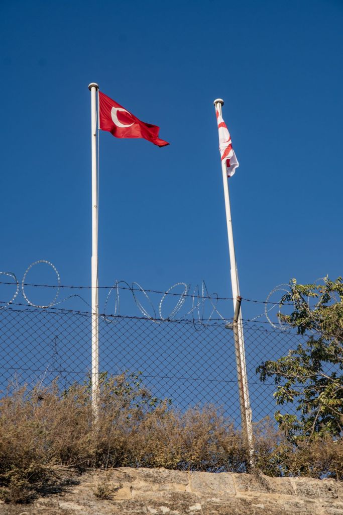
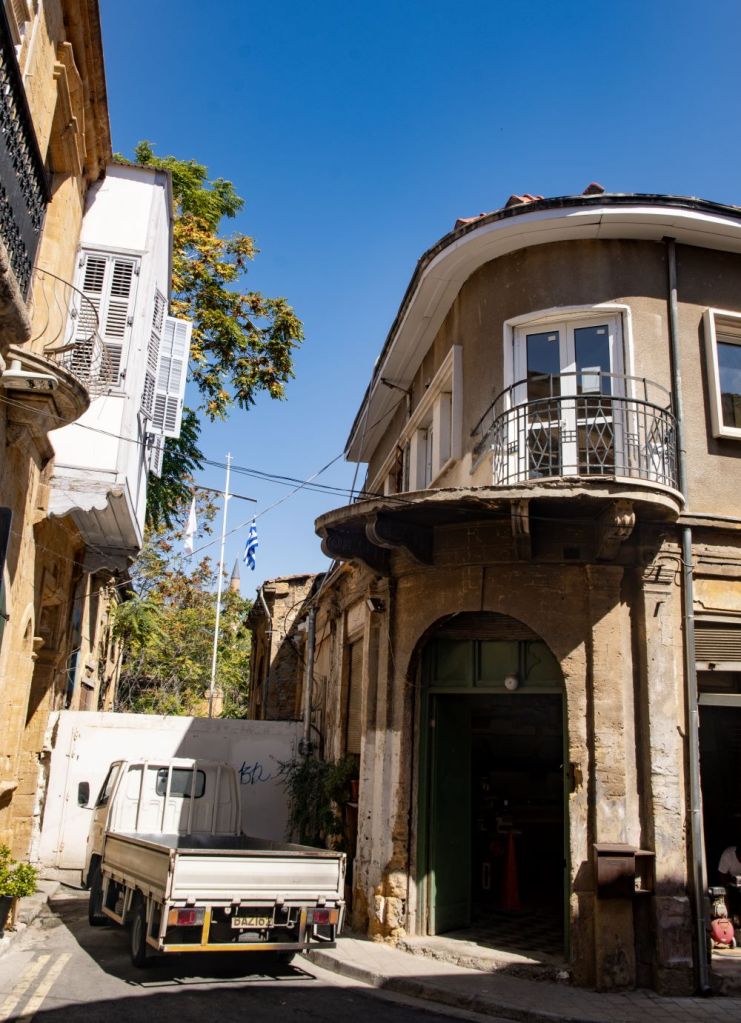
After 1974, most of Cyprus’s Greek and Turkish Cypriots have lived separately in northern and southern regions of the island that are currently divided by a UN-controlled Buffer Zone. The Buffer Zone – also called ‘the Green Line’ – extends approximately 180 km across the island. It is most visible within Nicosia where it is only a few metres wide. In the areas where the demilitarized line cuts through the capital, the zone is strewn with abandoned buildings, gardens, vehicles, and includes the decaying Nicosia International Airport. In the planning phase of IBRG CYBEX-24 we had hoped to visit the airport, a CWWG cemetery in the buffer zone and take part in a tour through the buffer zone in Nicosia. None of that unfortunately was possible due to heightened tensions surrounding the 50th anniversary of the conflict which led to all such activities being cancelled.
We spent a whole day travelling along the buffer zone in Nicosia, mainly from the south but also from the north too. My impression was compared to 2001, some areas of the buffer zone had been brought back into normal use, with a number of coffee shops and restaurants emerging over the years along the edges of the division, seeing the greatest mixing of the two peoples as both cross from either side for work and leisure, the number of UN checkpoints had reduced and importantly, Ledra Street was open.

We walked from UN OP 65 to UN OP 75 and crossed over from the south to the north via the Ledra Palace Crossing and the Ledra Street Crossing.

Buffer Zone west of Ledra Street

Point A – Paphos Gate and surrounds

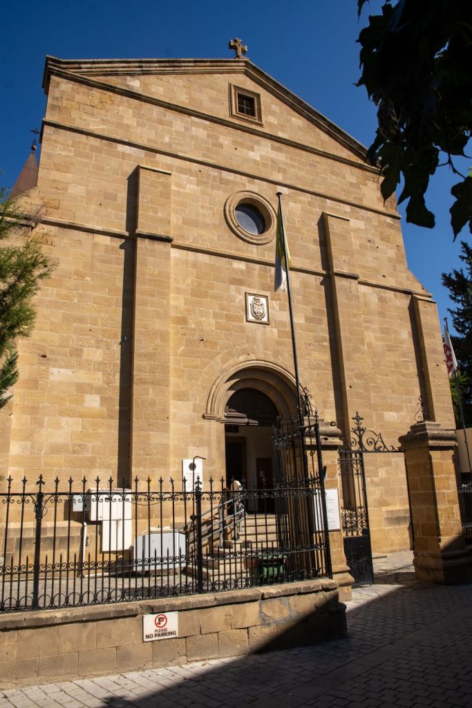
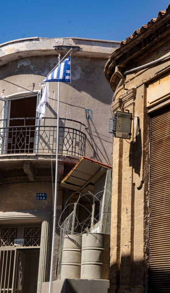
Our hotel was very close to the buffer zone, we walked up to UN OP 65, and viewed the old walls which marked the border with TRNC and began our walk along the buffer zone. There was a lot to see at this point, he Venetian Walls which mark the border between north and south, the UN OP, the Paphos gate and Pafou Street with its barricades and the Holy Cross Catholic Church which is situated within the buffer zone.


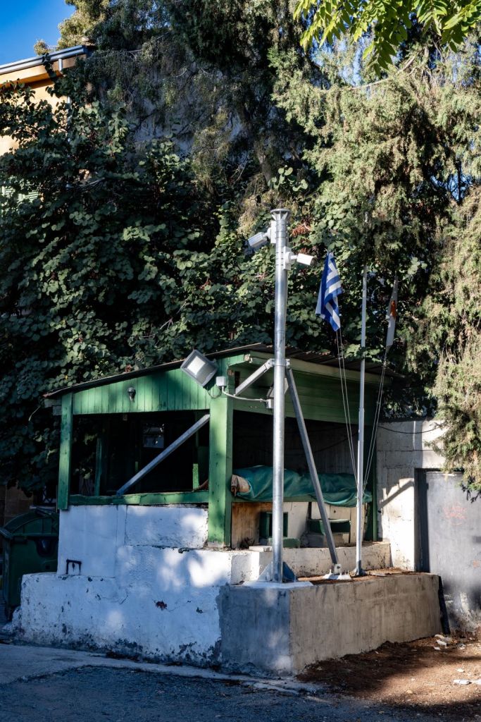
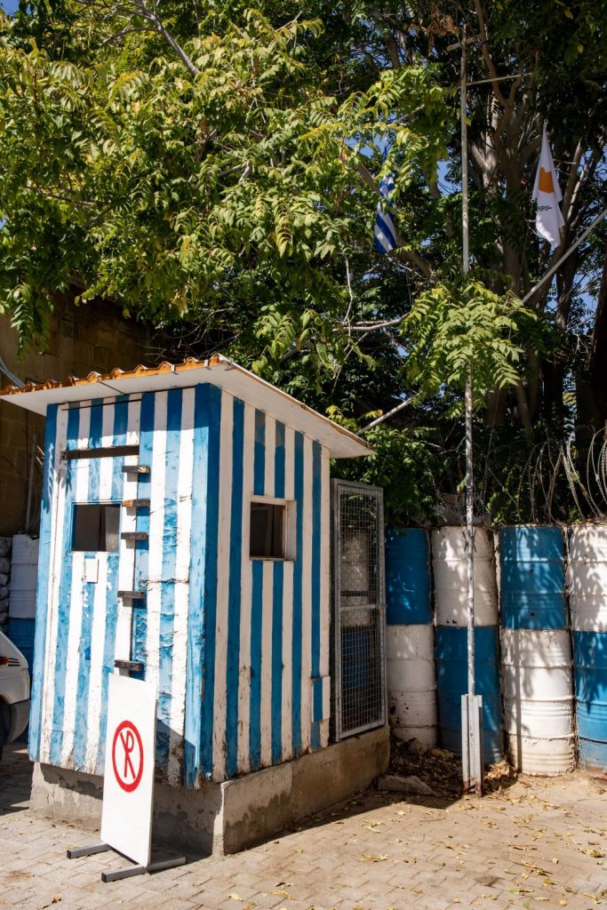
Point B- the Green Line Hut

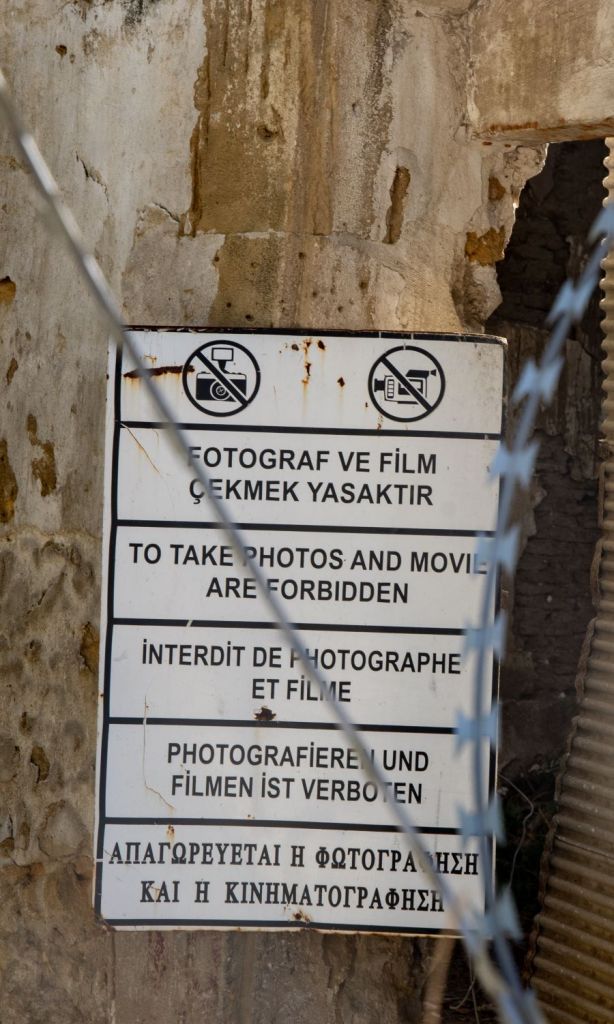
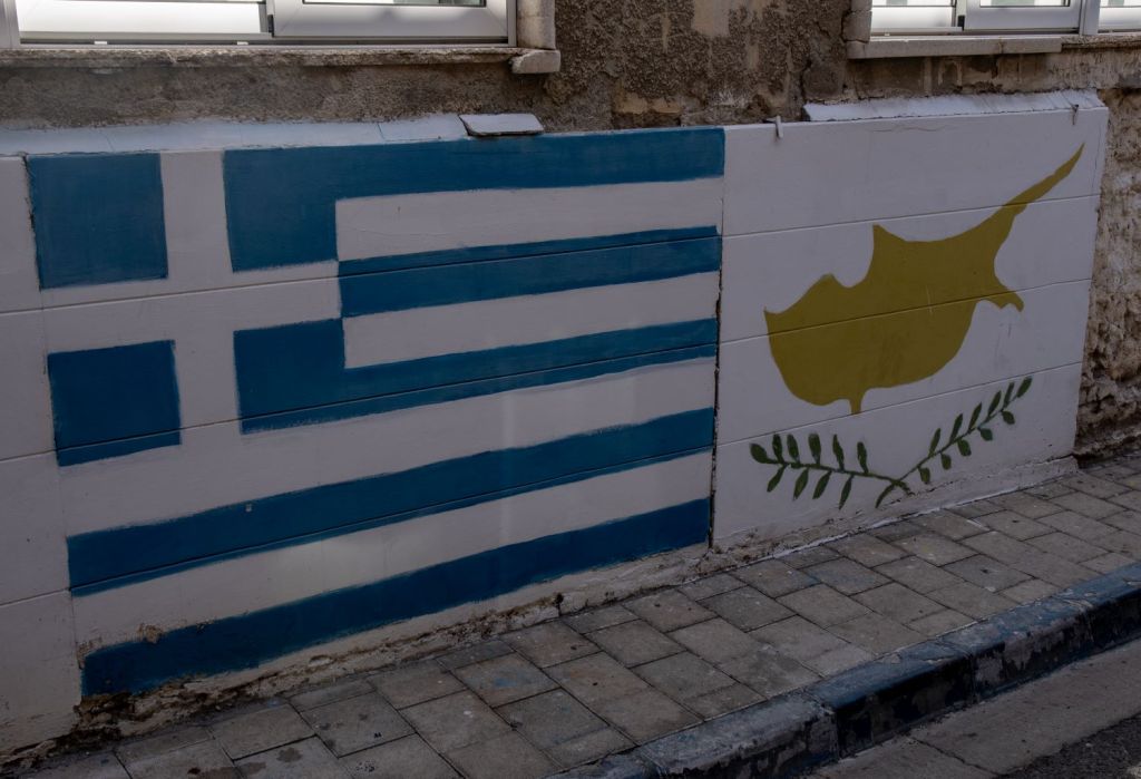
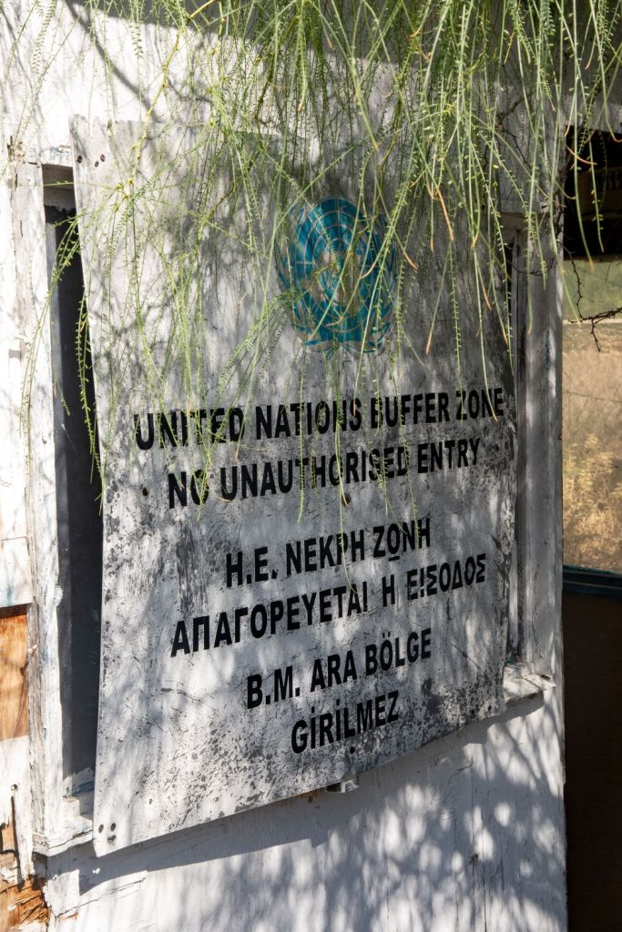
Our next stop was the Green Line Hut, an abandoned security checkpoint situated close to the buffer zone. A Greek flag painted on a nearby wall and a series of ‘Stop’ signs were visible reminders of its previous function. These were overshadowed by an even larger warning sign telling tourists that photos were forbidden. The hut overlooks an access gate into the buffer zone to be used by UN forces only


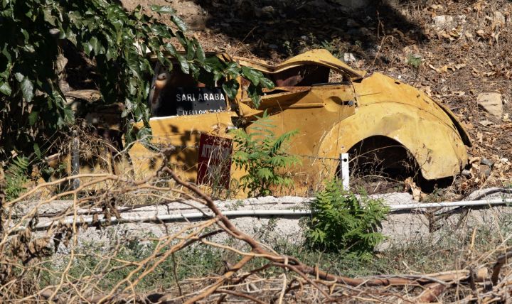
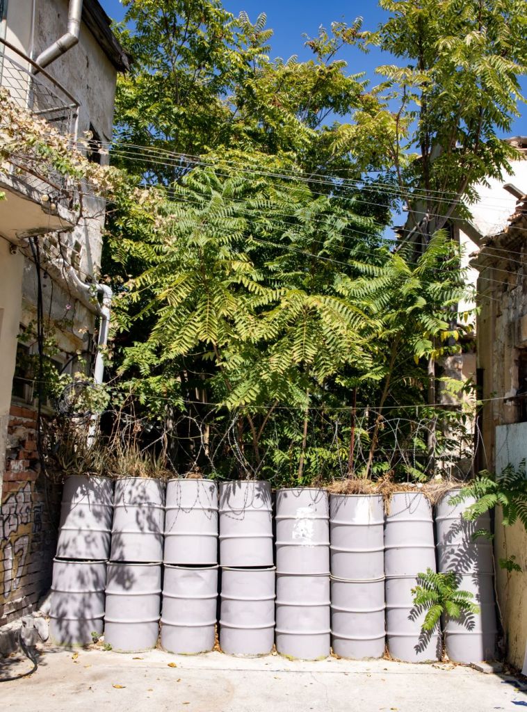
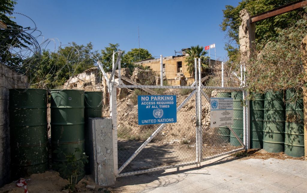
Point C – Ten Minute Yard & the Yellow Car
Our next stop was the Ten Minute Yard which is overlooked by UN OP 66A, the open space due to its sensitive location led to a number of protests about the amount of time Turkish sentries spent in the area of this yard. It was agreed with the UN that Turkish soldiers would only be visible in the yard for ten minutes in each hour.
However, to ‘make a point’ the Turkish soldiers would appear at 10 minutes ‘to’ the hour and then continue to stay for 10 minutes of the next hour…..thereby visible in the yard for 20 minutes. This was obviously seen as an important gesture of defiance. During my visits to this point no Turkish solders were visible. The area is overlooked by a Greek OP. I visited this point as part of the IBRG CYBEX-24 expedition.


From UNFICYP website: “A Morris Minor known as “yellow car”, abandoned during the events of 1974. Nobody has come forward to claim the car, which lies inside the Buffer Zone in old Nicosia. Over the years, UNFICYP soldiers have repainted the fading colours, giving the car its distinctive appearance. The car is used as a reference point by UNFICYP for operations in the Buffer Zone and during discussions with the opposing forces.”
From a border perspective the Yellow car, creates a buffer zone within the buffer zone, as the respective sides could not agree where the border was. The UN drew 2 lines, 1 to the north and the other to the south.
Point D – Eleftherias street & Ariadne Street
Continuing east along the southern edge of the buffer zone, Eleftherias street is closed at its northern end, with the UN controlled buffer zone behind and inaccessible. Photography was allowed as long as Greek Cypriot personnel were not visible. A short distance away is Ariadne Street with another blocked off road.

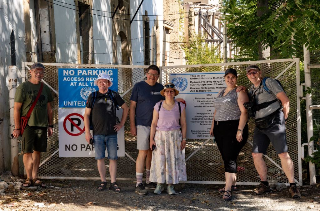
Ledra Street Checkpoint
Ledra Street is a crossing point in the UN buffer zone – known as the Green Line – between the northern Turkish Cypriot part of the city and the southern Greek Cypriot part. It is the site of the former Ledra Street barricade which I visited in 2001 (details here), across the United Nations buffer zone. The barricade symbolised the division of Nicosia between the Greek south and Turkish north. It was removed in April 2008 and Ledra Street became the sixth crossing between the southern and northern parts of Cyprus. The Republic of Cyprus does not maintain any immigration checkpoint at Ledra Street or any other Green Line crossing. It however conducts identification checks on people entering the South from the North. It feels however very like a normal crossing.

Click on the image above for my longer report on the border crossing.
Buffer Zone east of Ledra Street
After popping into the north for a drink, we then returned to complete our walk along the southern edge of the buffer zone.
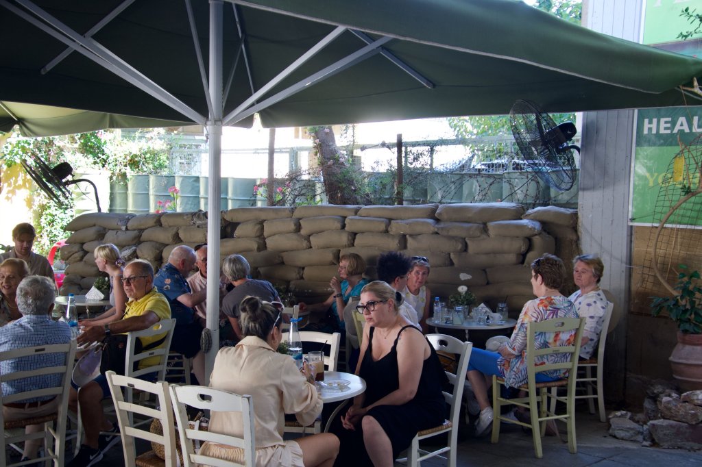
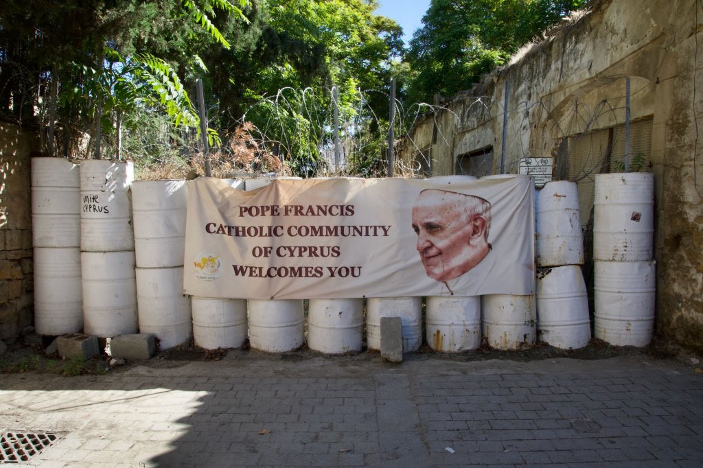
Immediately to the right of the checkpoint is a cafe that is right up against the buffer zone, an example of how Greek Cypriot civil society is taking back land into communal use. The POI’s east of the crossing point are more spread out and perhaps more authentic.
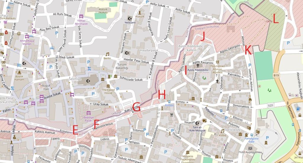
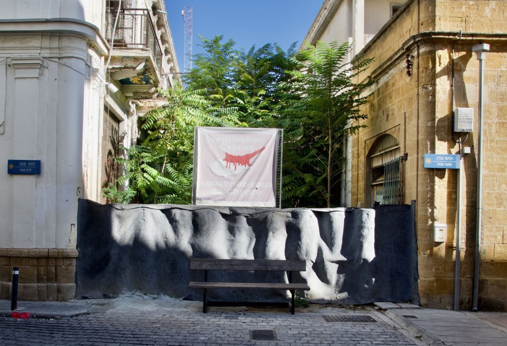
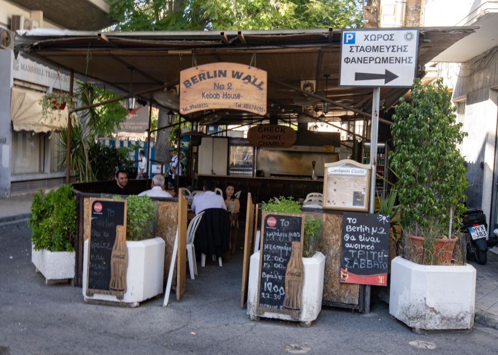
Point E – Fanairomenis Street
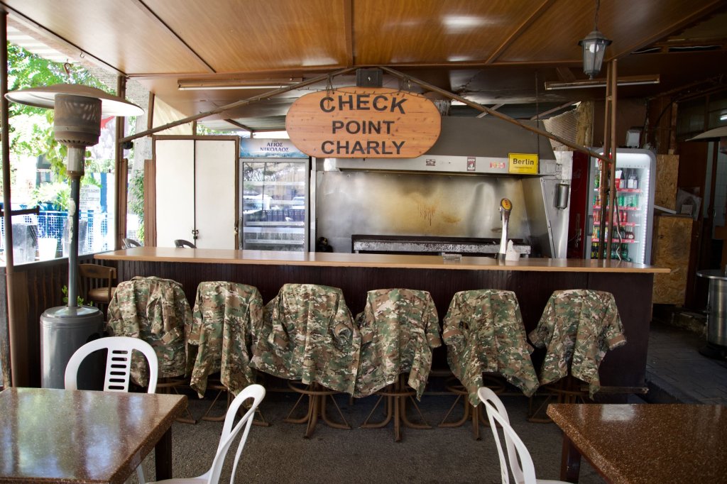
A short distance east from the Ledra Palace checkpoint there is the next POI. This point has a lot of interest, there is a clear view of the buffer zone, the Greek Cypriot fortifications are impressive and there is a kebab/coffee house run on a “Berlin Wall” theme. When we were there there were several CY soldiers who reminded us not to take photos.


Point F – Alexandrou Ypsilanti & Dionisou Streets
Continuing our walk east along the southern edge of the buffer zone, these 2 streets have several POI’s including road barriers, barricaded balconies and an edge of the world feel.


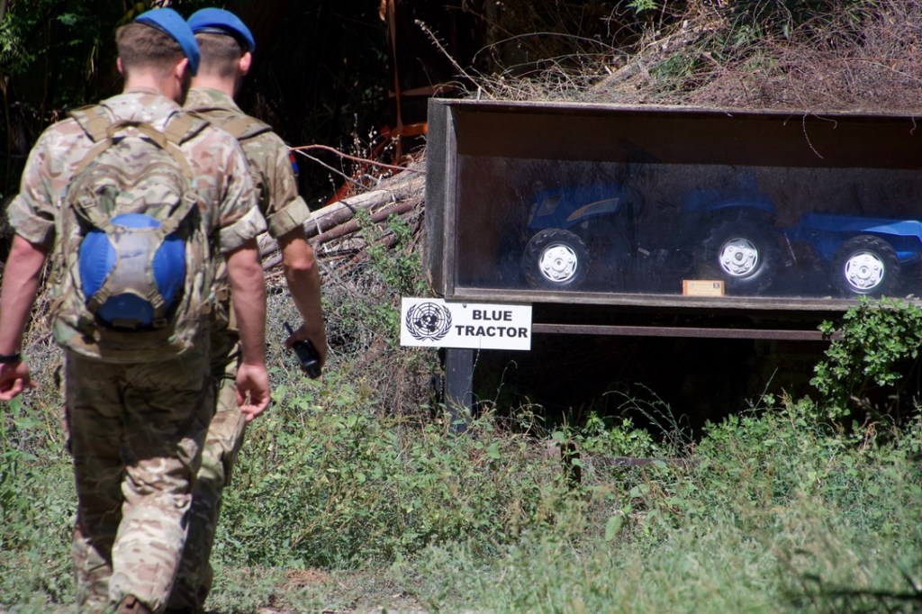
Point G – The Blue Tractor
Each side used certain features of the Buffer Zone to demarcate different sectors. One of these landmarks was a blue tractor left behind during the fighting in 1974. After 11 years of negotiating its return, the Greek owner was allowed into the Buffer Zone for 24 hours to recover his property. He had to be alone, he couldn’t use any other vehicle and the tractor had to be driven out. After 16 hours of work, the tractor was started and driven out to the Greek side.
The UN had to replace the blue tractor which they did with a plastic one purchased from a local toyshop. Now the toy blue tractor is in a wooden case to protect it from the elements. This was a surprise find on our visit. We were lucky to see 2 UN soldiers on patrol in the buffer zone at this point.


Point H – Tritonus street to Ermou street,
After leaving the blue tractor we headed further to Ermou Street, the road runs immediately along the southern edge of the buffer zone with several barriers. In Tritonus Street there is a UN access point with clear views of the buffer zone.


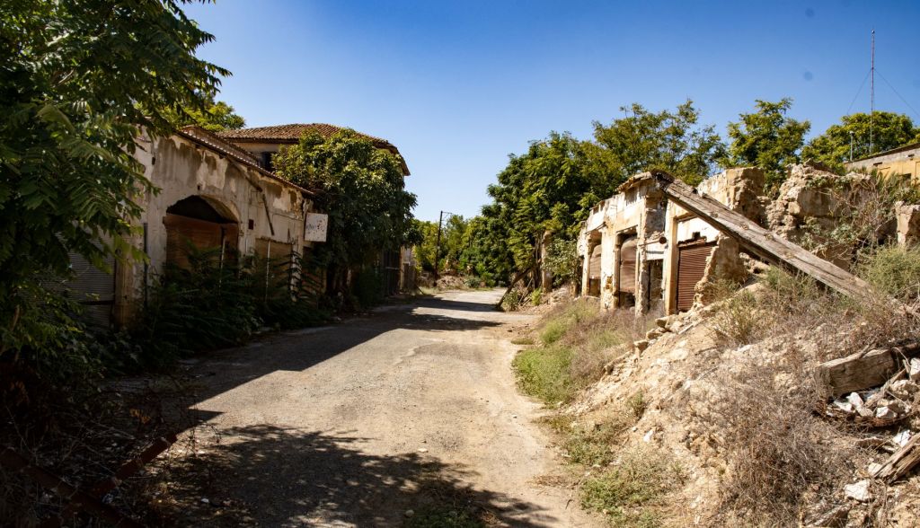
Point I – Minoos Street
As we walked further east the there was a division between renewed and regenerated buildings containing small buildings and craft workshops and areas that still look like a war zone. It was easy to get to the edge of the buffer zone. At this point there were old cars which had been there since the conflict. We had been unable to visit the showroom within the buffer zone but this was the next best thing.


Point J – Kadeiras Theodora Street
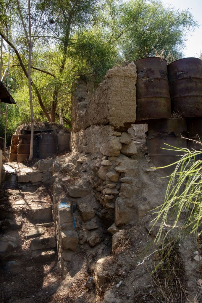
Continuing further east the defences on the edge of the buffer zone were accessible with care. No renovation has occurred here and this area is in stark contrast to the renovated areas just a few hundred meters away. We did not try to enter the UN controlled area.


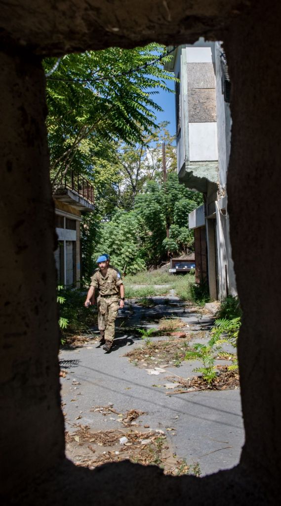
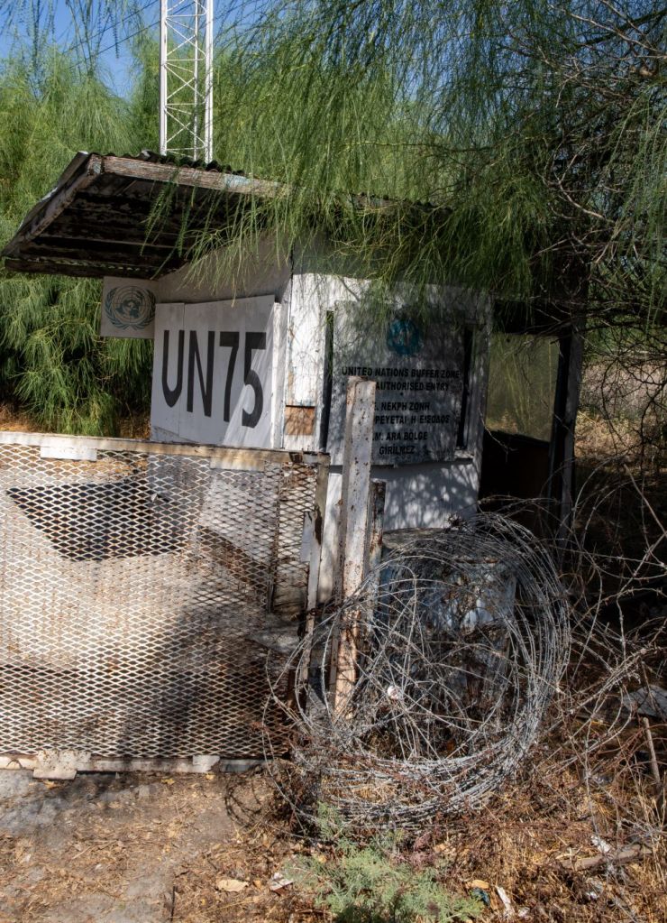
Point K – UN OP 75
The penultimate point of our walk along the southern edge of the buffer zone was UN OP 75 which is another UN access point and provides a clear view of the bullet and shell damage caused in the initial conflict, 50 years ago


Point L – UN OP 76
Click above for Google map location
As we turned away from the UN access gate and headed south to find a well earned drink we noticed in the distance our final POI – the UN OP 76 which stands on the top of the walls and overlooks a football pitch. This OP was manned. This was the buffer zone from the south completed.

The Buffer Zone – from the northern side
We also explored the northern edge of the buffer zone, which had a different feel and access issues.

Click on the image above to access the report of our visit to the northern side of the buffer zone.

Date of Visit: 27 September 2024
