
Views from the North
After 1974, most of Cyprus’s Greek and Turkish Cypriots have lived separately in northern and southern regions of the island that are currently divided by a UN-controlled Buffer Zone. The Buffer Zone – also called ‘the Green Line’ – extends approximately 180 km across the island. It is most visible within Nicosia where it is only a few metres wide. In the areas where the demilitarized line cuts through the capital, the zone is strewn with abandoned buildings, gardens, vehicles, and includes the decaying Nicosia International Airport. In the planning phase of IBRG CYBEX-24 we had hoped to visit the airport, a CWWG cemetery in the buffer zone and take part in a tour through the buffer zone in Nicosia. None of that unfortunately was possible due to heightened tensions surrounding the 50th anniversary of the conflict which led to all such activities being cancelled.
We spent a whole day travelling along the buffer zone in Nicosia, mainly from the south but also from the north too. My impression was compared to 2001, some areas of the buffer zone had been brought back into normal use, with a number of coffee shops and restaurants emerging over the years along the edges of the division, seeing the greatest mixing of the two peoples as both cross from either side for work and leisure, the number of UN checkpoints had reduced and importantly, Ledra Street was open. I visited this point as part of the IBRG CYBEX-24 expedition.


Buffer Zone west of Ledra Street
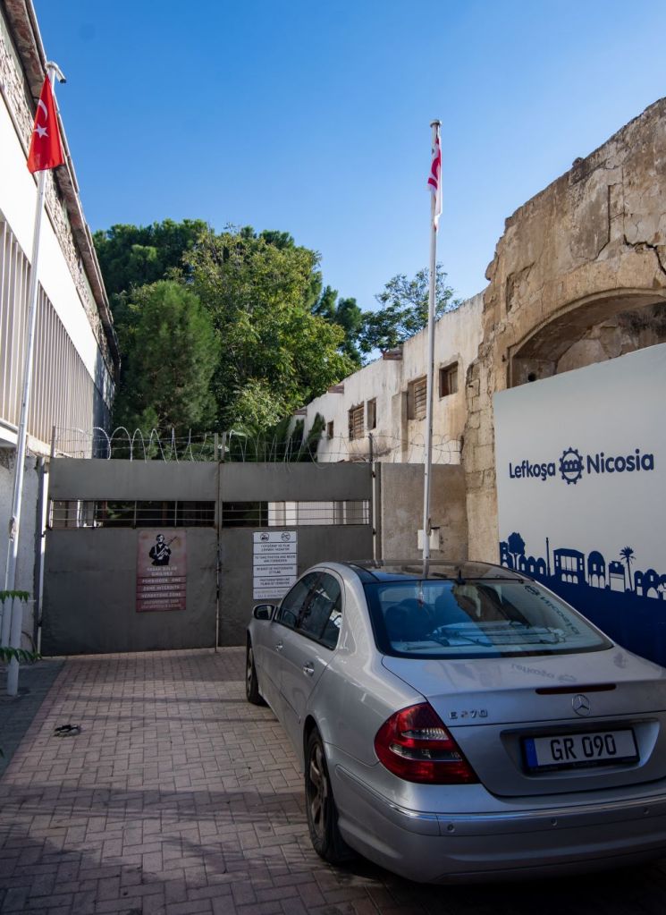
In order to access the buffer zone, it was necessary to cross into the TRNC this time from the Ledra Palace Crossing Point which is just outside the walled city to the west. This checkpoint allows for pedestrian and vehicle traffic (Diplomatic only). In order to access the buffer zone it is necessary to pass through the Greek Cypriot checkpoint. I visited this point in 2001. Details here.
Ledra Palace Checkpoint

Click on the image above to access the full report on this checkpoint.
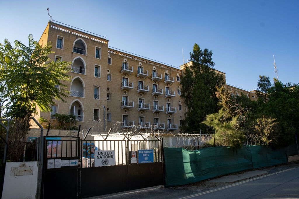
Point A – the Ledra Palace Hotel

Ledra Palace Hotel until 1974 was one of the largest and most glamorous hotels of the capital. The hotel was designed by the German Jewish architect Benjaminr Günsberg and was built between 1947 and 1949 and was opened in the presence of the British Governor. It was a deluxe hotel with a swimming pool and conference rooms. During the invasion, the Turkish Military attempted to take the hotel however were unsuccessful.
Following the announcement of the truce it fell within the boundaries of the UN Buffer Zone and from 1974 to 2019 served as the headquarters for Sector 2 United Nations Roulement Regiment (URR) part of UNFICYP.
The Ledra Palace Hotel has played host to many high level meetings between Greek Cypriot and Turkish Cypriot leaders,[10] as well as hundreds of structured conflict resolution workshops between Greek Cypriot and Turkish Cypriot peace builders. It is also used as the venue for cultural events aiming at bringing the two communities closer together.


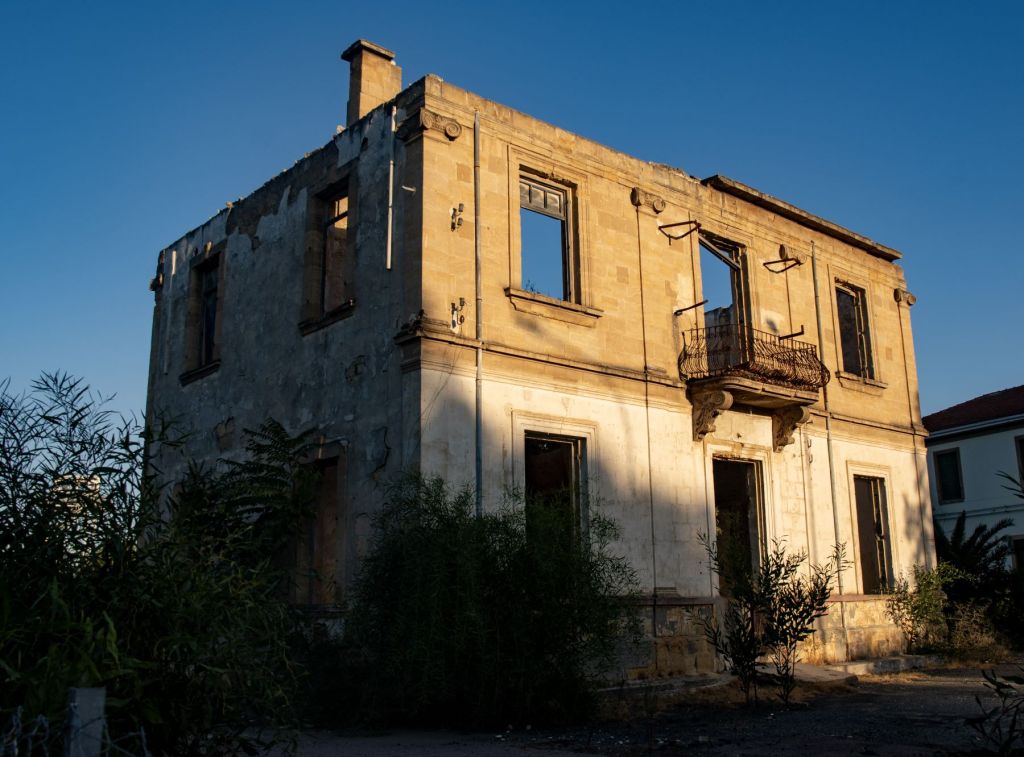
Immediately opposite the hotel, and next door to the Home For Cooperation (which is on the southern side of the buffer zone), is a disused and decaying building which sits within the buffer zone.
Point B – between Markou Drakou Street (RoC) and Zahra Sk (TRNC)
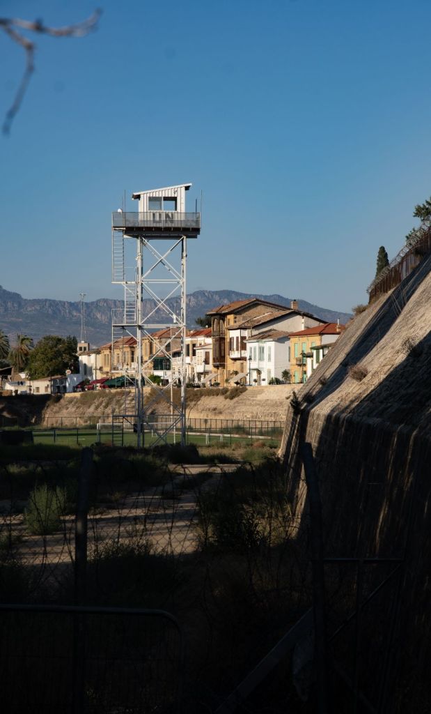
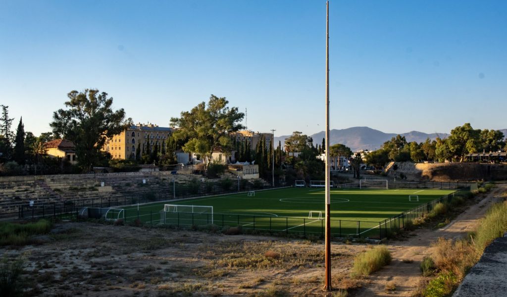
Walking north towards the TRNC checkpoint there a large open space between the north and south parts of Nicosia. Passing the checkpoint and walking on the northern side there are clear views of the Nicosia walls, UN watchtowers and a shared football pitch.
A UN vehicle was in the buffer zone as we passed.


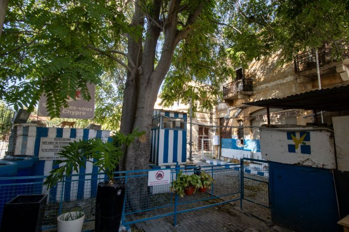
Point C – Sınır Parkı (Yiğitler Burcu Parkı)
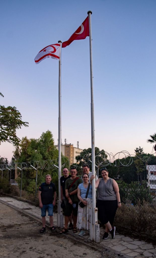
Walking around the shared communal football pitch which is in the centre of the buffer zone, it is a short distance to a park and pay area, there are lots of the normal frontier signs but there was an open gate that led to the top of the walls where we had observed the flags from the south in the morning.


Point D – Baf Caddesi
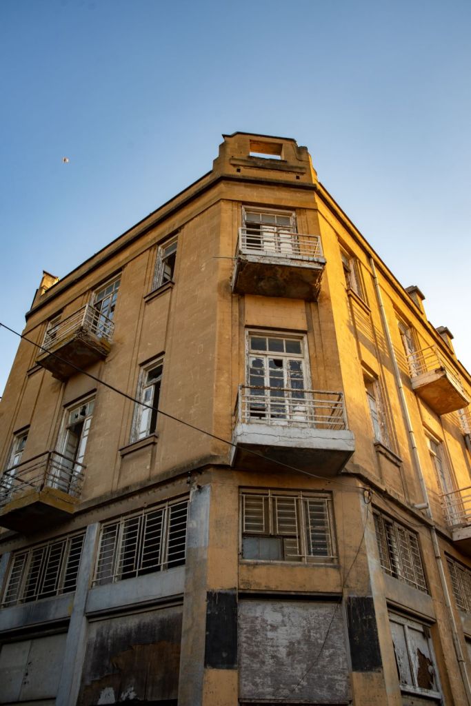
We continued walking along the narrow streets separated from the buffer zone by high walls and the occasional gate suitably signed with dire warnings for those who might transgress. The branding by country colours was lacking here.


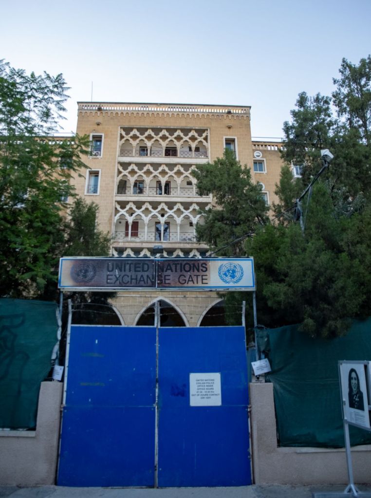
Ledra Street Checkpoint
Ledra Street is a crossing point in the UN buffer zone – known as the Green Line – between the northern Turkish Cypriot part of the city and the southern Greek Cypriot part. It is the site of the former Ledra Street barricade which I visited in 2001 (details here), across the United Nations buffer zone. The barricade symbolised the division of Nicosia between the Greek south and Turkish north. It was removed in April 2008 and Ledra Street became the sixth crossing between the southern and northern parts of Cyprus. The Republic of Cyprus does not maintain any immigration checkpoint at Ledra Street or any other Green Line crossing. It however conducts identification checks on people entering the South from the North. It feels however very like a normal crossing.

Click on the image above for my longer report on the border crossing.
Buffer Zone east of Ledra Street
The narrow streets continue on after the crossing and the roads that head towards the buffer zone are all blocked. No derelict buildings outside the buffer zone, with workshops and shops right against the zone. Time was short so only a couple of examples were identified.

The Buffer Zone – from the southern side
We also explored the southern edge of the buffer zone, which had a different feel and access issues.
Click on the image above to access the report of our visit to the southern side of the buffer zone.

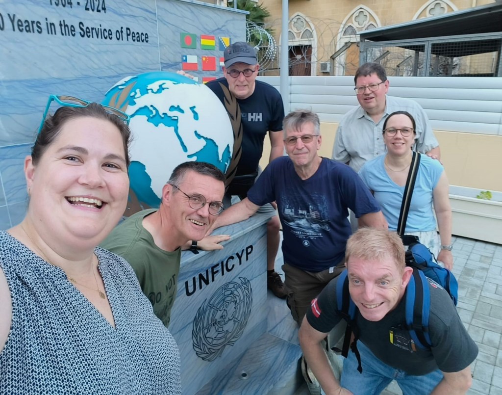
Date of Visit: 26 -27 September 2024
