
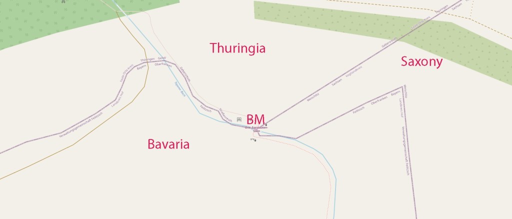
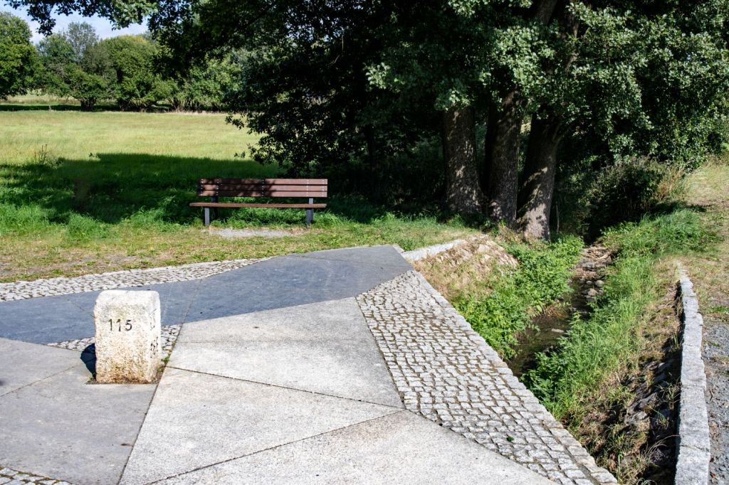
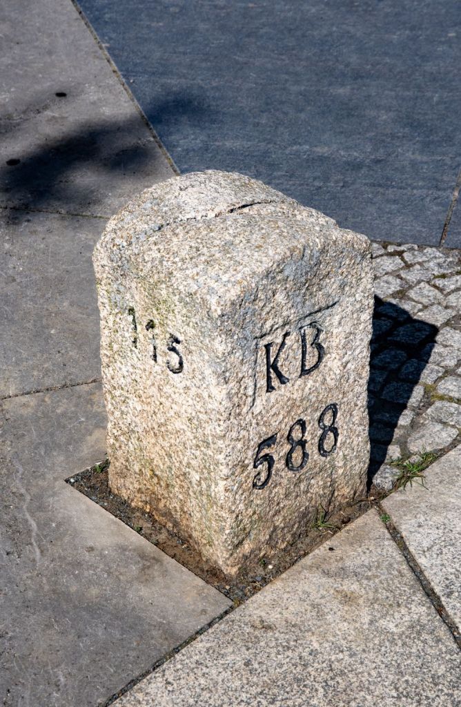
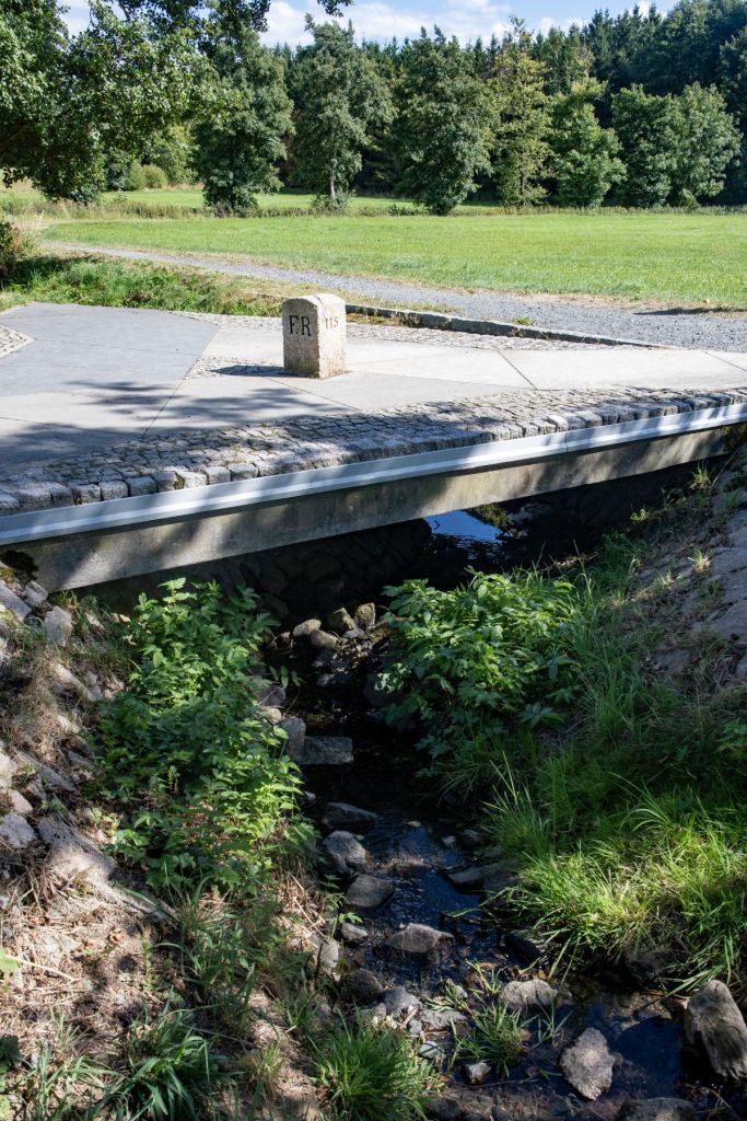
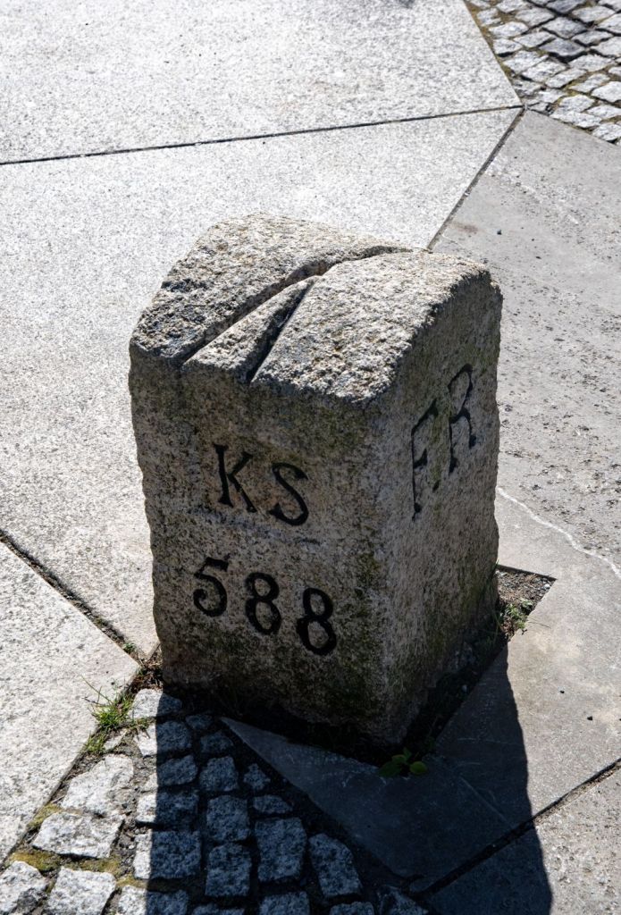
The Drei-Freistaaten-Stein is the border marker that marks the tripoint of the German states of Bavaria , Saxony , and Thuringia . These three are the only states that officially bear the designation ” Free State “, and therefore this internal tripoint is unique out of the 15 that exist within Germany. The stone is located at the point where the boundaries of Münchenreuth (municipality of Feilitzsch , district of Hof , Bavaria), Grobau (municipality of Weischlitz , Vogtland district , Saxony), and Gebersreuth (town of Gefell , Saale-Orla district , Thuringia) meet. This point was designated as a tripoint by the border conventions of the Kingdom of Saxony and the Kingdom of Bavaria on August 13, 1840, and with the Principality of Reuss-Gera on October 23, 1854. Therefore, the abbreviations of these states – KB, KS, and FR – are engraved on the sides of the stone. Since the opening of the inner-German border, it has been freely accessible from all sides and was inaugurated as a cultural monument on May 11, 2007. The stone was placed on a triangular slab above the Kupferbach stream and is accessible via a hiking trail. The base is divided into three sections, each covered with a natural stone representing a characteristic building rock of the surrounding regions: Fichtelgebirge granite, Thuringian shell limestone , and Theuma slate .
A few kilometers before this point, the “Green Belt” begins. Unfortunately, this beautiful area (nature reserve) has been dotted with wind turbines against the wishes of environmentalists. I visited this point as part of the IBRG LIVCO-25 expedition.


Date of Visit: 22/08/2025
