
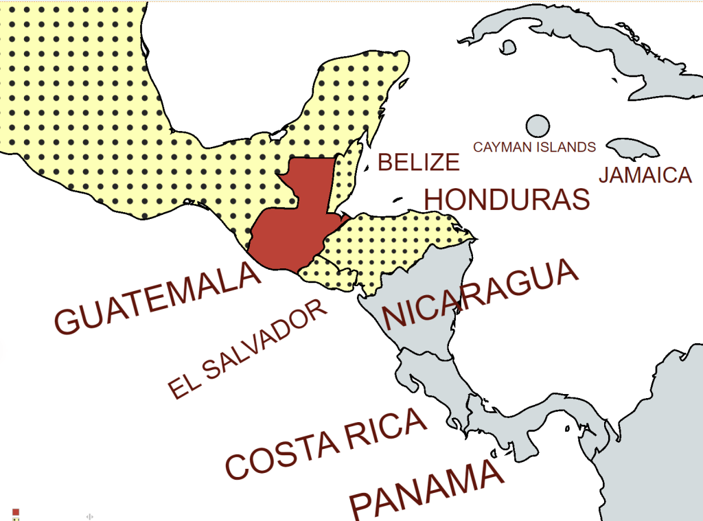
Guatemala, officially the Republic of Guatemala, is a country in Central America. It is bordered to the north and west by Mexico, to the northeast by Belize, to the east by Honduras, and to the southeast by El Salvador. It also is bordered to the south by the Pacific Ocean and to the northeast by the Gulf of Honduras.
Guatemala was the centre of Mayan civilisation. Following the colonisation of the country by Spain in the 16th century, Guatemala attained independence from Spain and Mexico in 1821. Post colonial Guatemala suffered from a series of autocratic governments supported by the United States. In 1944, authoritarian leader Jorge Ubico was overthrown by a pro-democratic military coup, initiating a decade-long revolution that led to social and economic reforms. In 1954, a US-backed military coup ended the revolution and installed a dictatorship. From 1960 to 1996, Guatemala endured a bloody civil war fought between the US-backed government and leftist rebels, including genocidal massacres of the Maya population perpetrated by the Guatemalan military. The United Nations negotiated a peace accord, resulting in economic growth and successive democratic elections.
Guatemala is a constitutional democratic republic whereby the President of Guatemala is both head of state and head of government, and of a multi-party system. Executive power is exercised by the government. Legislative power is vested in both the government and the Congress of the Republic. The judiciary is independent of the executive and the legislature.
Guatemala is a member of several international organisations, including the United Nations, Organization of American States, International Monetary Fund, World Bank, and World Trade Organization and GATT.
Border Facts
Guatemala is bounded to the north and west by Mexico, to the northeast by Belize and (along a short coastline) by the Gulf of Honduras, to the east by Honduras, to the southeast by El Salvador, and to the south by the Pacific Ocean.
Guatemala – Mexico border is 871 km long. It marks the division between northern and central America. It runs between north and west Guatemala (the Guatemalan departments of San Marcos, Huehuetenango, El Quiché and El Petén) and the Mexican states of Campeche, Tabasco and Chiapas.
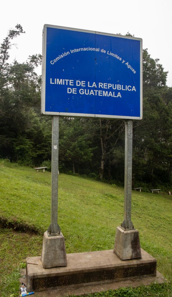
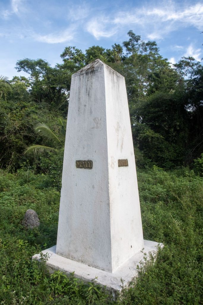
The border includes stretches of the Usumacinta River, the Salinas River, and the Suchiate River. The border was established by treaty in 1882. Mexico and Guatemala agreed to use straight lines between key points known and accepted by both countries. Two such points are the tripoint BZGTMX with Belize at the Aguas Turbias monument, and Volcán Tacaná (4060m). The measurement and demarcation work was completed in 1899.
Mexico has some fencing along its southern border with Guatemala to restrict illegal migration and the drug trade. Mexico’s border with Guatemala has 10 border crossings.
Guatemala – Belize border is an almost straight line 266 km long, close to the 89th meridian west, The border between Belize and Guatemala is defined in Article I of the Wyke–Aycinena Treaty of 1859:
Beginning at the mouth of the River Sarstoon in the Bay of Honduras, and proceeding up the mid-channel thereof to Gracias a Dios Falls; then turning to the right and continuing by a line drawn direct from Gracias a Dios Falls to Garbutt’s Falls on the River Belize, and from Garbutt’s Falls due north until it strikes the Mexican frontier.
The border has been disputed by Guatemala, which claims that the treaty is void since Britain failed to comply with economic assistance provisions found in Article VII. The situation was partially resolved in 1991 when Guatemala officially recognized Belize’s independence and diplomatic relations were established.
Guatemala – Belize border dispute is unresolved, although the treaty stated that Guatemala would recognise British sovereignty over the region and formed the modern-day boundary lines of Belize. The treaty also had an article about building a mutually beneficial road though it was never built. Guatemala used this failure to claim all, or part of Belize at various times.
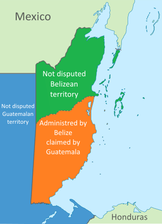
The situation was partially resolved in 1991 when Guatemala officially recognized Belize’s independence and diplomatic relations were established.
In 1999 in an attempt to reduce the chances of military conflict a 1 km “adjacency zone” drawn on either side of the 1859 treaty borders. In 2008, Guatemala and Belize made a pact to have simultaneous referendums for their voters to send the issue to the International Court of Justice. The referendums passed in both countries by May 2019. As of June 2022, both countries are now settling the dispute at the International Court of Justice, with both countries confirmed to have submitted their initial briefs to the organisation. The court is not expected to rule until 2025 at the earliest.
There is one main highway crossing of the border, at Benque Viejo del Carmen, Cayo District, Belize and Melchor de Mencos, Peten, Guatemala, where Guatemala Highway CA-13 meets the George Price (Western) Highway, connecting to Belize City and Belmopan.
About four kilometers south of this crossing is the village of Arenal, which has homes on both sides of the border, and a football field directly on the border.
Guatemala – El Salvador border is 203 km long.

From north to south, it starts in the tripoint GTHNSV of the two countries with Honduras, near the peak Monte Cristo in Volcanoes National Park, It separates the department of Jutiapa in Guatemala from Ahuachapan (north) and Santa Ana departments in El Salvador. It runs along 169 km of rivers, 31 km of straight-line segments and 2 mi 3.2 km in Lake Güija.
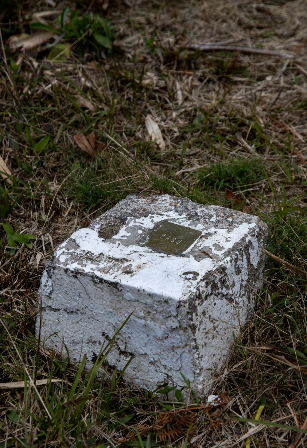
It finished in the Rio Paz before reaching the Pacific Ocean. 530 boundary pillars were erected in 1940
There are several border crossings between the 2 countries.
Guatemala – Honduras border is 256 km long. The border begins at the mouth of the Motagua River in the Gulf of Honduras, then proceeds upstream.
It continues towards the southwest, following several straight lines between geographic landmarks, divides between watersheds, and rivers and streams to its end at the tripoint GTHNSV with El Salvador at the summit of the Montecristo Massif. The border was fixed in 1933 by an arbitration tribunal in the United States after Nicaragua and Guatemala signed an arbitration treaty in 1930. A demarcation commission headed by Sidney H. Birdseye conducted an areal survey and erected 1,028 boundary markers between 1933 and 1936.
Not withstanding the demarcation the 2 countries are in dispute with Guatemala claiming sovereignty over the Sapodilla Cays or Cayes, a cluster of islands in the Gulf of Honduras. The border dispute is being adjudicated in the ICJ as of 2019.
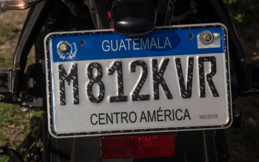
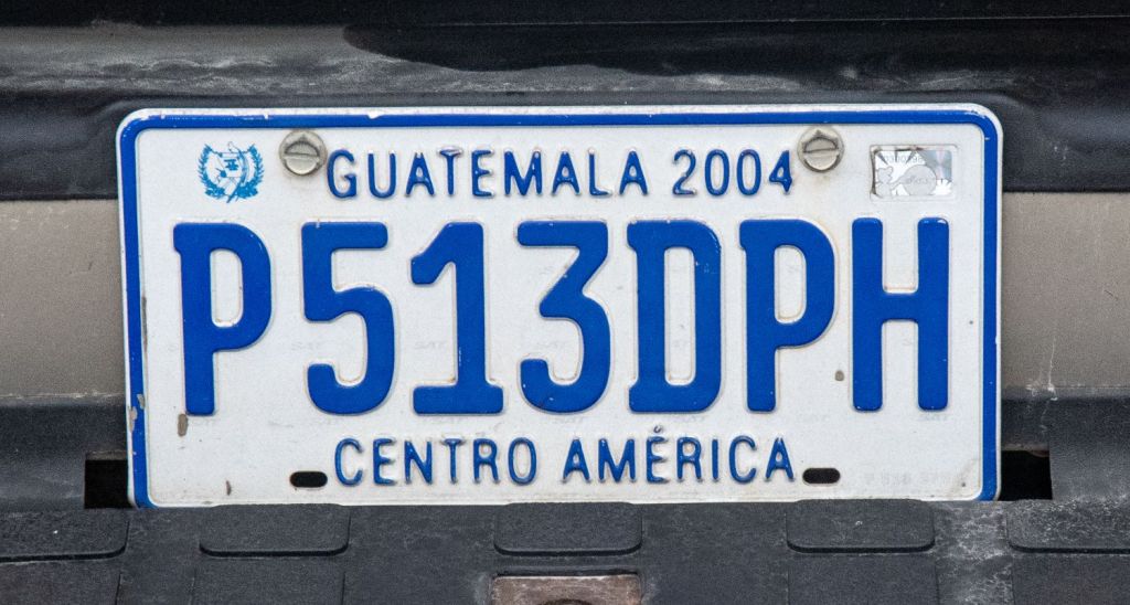
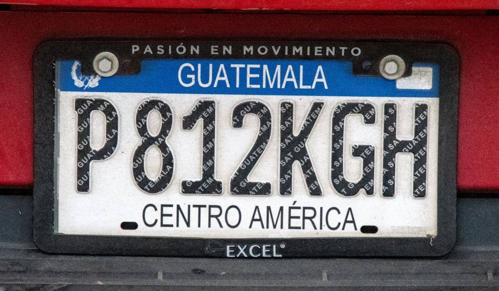
Guatemalan Registration Plates

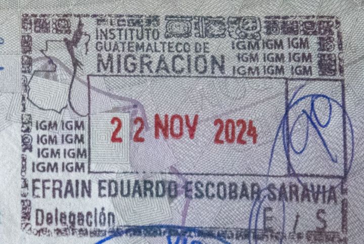
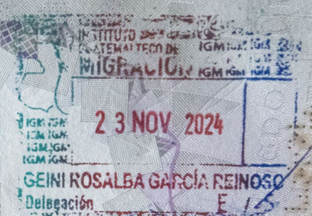
Guatemalan Passport Stamps
Guatemalan Tripoints
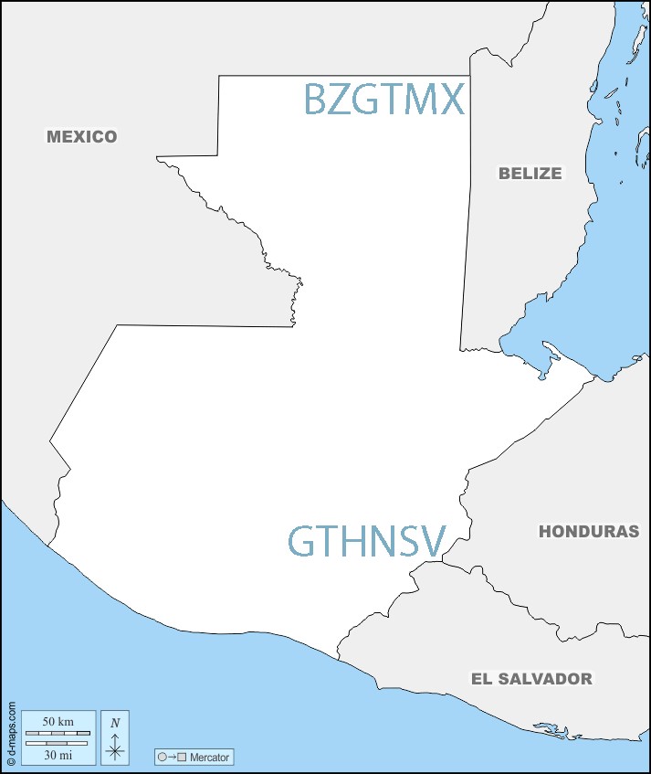
| number | name | country | coordinates | type | links/notes |
|---|---|---|---|---|---|
| 1 | BZGTMX | Belize – Guatemala – Mexico | 17°48′56″N 89°9′7″W | Dry | Tripoint is situated at the Aguas Turbias monument. BZGT (2002) surveying of the border has led to no change. |
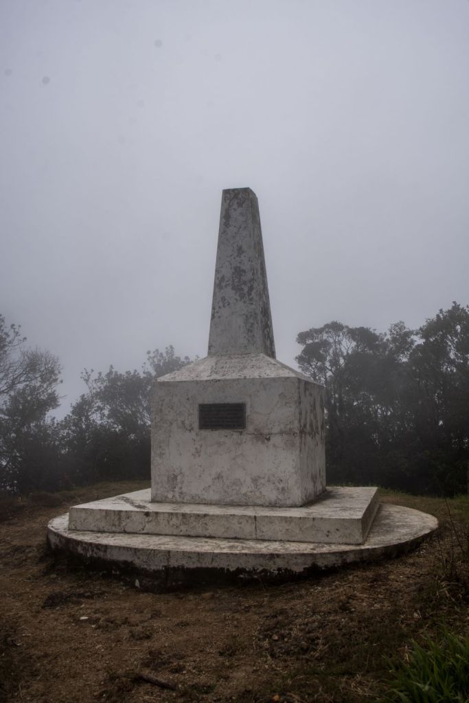
| 2 | GTHNSV | El Salvador – Guatemala – Honduras | 14°25′18″N 89°21′2″W | Dry | Cerro Montecristo (2418m). Westernmost tripoint in the world |
Tripoint Gallery

Site Navigation
In order to find your way around the site, either click on the links (text in red) or use the menus at the top and side of the pages. About leads you to the main areas of the site. The European Tripoints menu leads directly you to my visit reports whereas the Country Visits page allows you to choose which country to look at first. Clicking on photos can lead you directly to reports too.

Mobile Users Advice
Tables display correctly when holding your mobile horizontally.
To access the links to other pages please click on the 3 horizontal dots at the bottom of the page

