
Honduras, officially the Republic of Honduras, is a country in Central America. It is bordered to the west by Guatemala, to the southwest by El Salvador, to the southeast by Nicaragua, to the south by the Pacific Ocean at the Gulf of Fonseca, and to the north by the Gulf of Honduras, a large inlet of the Caribbean Sea.
Following Spanish colonisation Honduras became independent in 1821 and has since been a republic, although it has consistently endured much social strife and political instability, and remains one of the poorest countries in the Western Hemisphere. In 1960, the northern part of what was the Mosquito Coast was transferred from Nicaragua to Honduras by the International Court of Justice. Honduras is classified as a nation with medium development.
Politics of Honduras takes place in a framework of a multi-party system presidential representative democratic republic. The President of Honduras is both head of state and head of government. Executive power is exercised by the government. Legislative power is vested in the National Congress of Honduras.
A major political issue in Honduras since about 1990 has been the high level of violent crime associated with drug trafficking.
Honduras is a member of the United Nations, the World Trade Organization (WTO), the Central American Parliament (PARLACEN), the Central American Integration System (SICA), and the Central American Security Commission (CASQ).
Border Facts
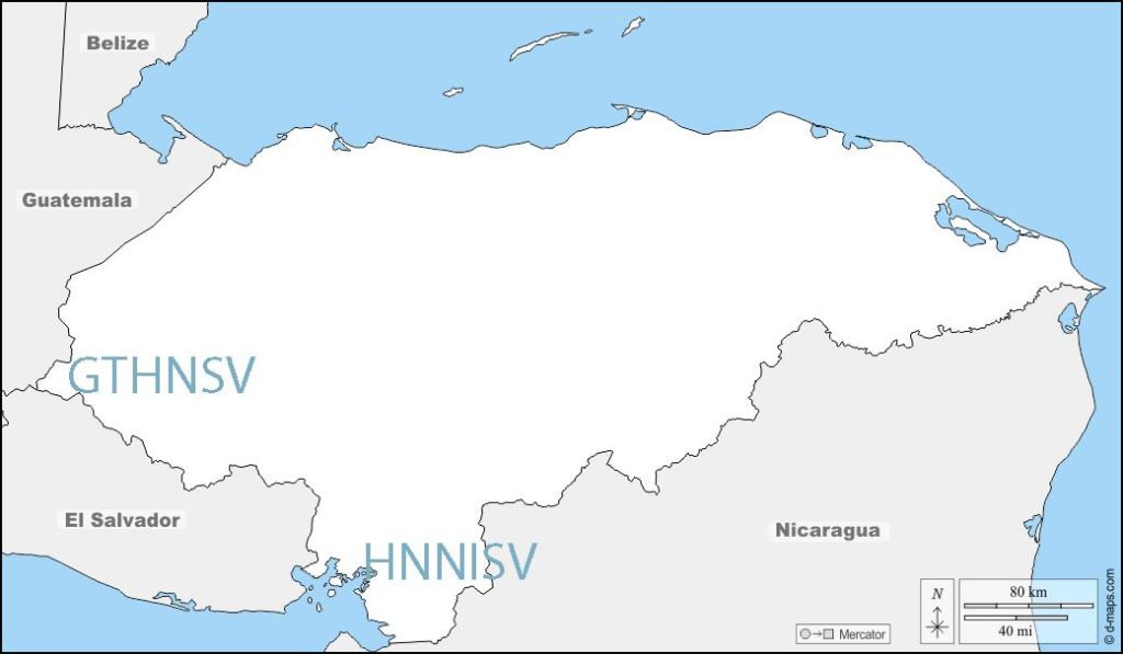
Honduras is bordered to the west by Guatemala, to the southwest by El Salvador, to the southeast by Nicaragua, to the south by the Pacific Ocean at the Gulf of Fonseca
Honduras – Guatemala border is 256 km long. The border begins at the mouth of the Motagua River in the Gulf of Honduras, then proceeds upstream. It continues towards the southwest, following several straight lines between geographic landmarks, divides between watersheds, and rivers and streams to its end at the tripoint GTHNSV with El Salvador at the summit of the Montecristo Massif.
The border was fixed in 1933 by an arbitration tribunal in the United States after Nicaragua and Guatemala signed an arbitration treaty in 1930. A demarcation commission headed by Sidney H. Birdseye conducted an areal survey and erected 1,028 boundary markers between 1933 and 1936.
Not withstanding the demarcation the 2 countries are in dispute with Guatemala claiming sovereignty over the Sapodilla Cays or Cayes, a cluster of islands in the Gulf of Honduras. The border dispute is being adjudicated in the ICJ as of 2019.
Honduras border– El Salvador 256 km long, to the east and north of the country. It runs in a south–north direction, running from the coast of Pacific Ocean and the tripoint configuration HNNISV in the Gulf of Fonseca, going to the beginning of the east–west stretch which heads towards the tripoint GTHNSV linking El Salvador – Honduras – Guatemala at Cerro Montecristo (2418m). The border was first established in 1841 when the two countries were part of the Federal Republic of Central America along with Nicaragua. In 1856, the three countries separated by setting the current international borders.
There are two official border crossing points – El Poy in the north and El Amatillo in the east.
Isla Conejo (rabbit island), lies in the Gulf of Fonseca and is disputed between El Salvador and Honduras. In 1992 the ICJ arbitrated over the islands in the Gulf but Isla Conejo was omitted. it is 600m from the Honduras coastline and the case being arbitrated by the ICJ.
Honduras – Nicaragua border runs from the Gulf of Fonseca on the Pacific Ocean to the Caribbean Sea. The Coco River, which flows generally northeast to the Caribbean, forms more than half of the border. The boundary between Honduras and Nicaragua was established during the colonial era and mainly extends along a series of winding rivers. The straight line distance between the Atlantic and Pacific coasts is only 510 kilometres, but due to the sinuous nature of the mostly riverine boundary, its actual length is 1,033 kilometres. International arbitration has resolved several historic territorial disputes between the two States, with the 2007 International Court of Justice Judgment serving as the most recent series of proceedings concerning the boundary.
Despite the numerous issues related to the border, Honduras and Nicaragua completed joint demarcation efforts from 1900–1904 and during the early 1960s. It does not appear that any disputes currently exist between the two States
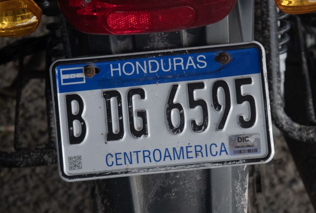
Honduras Registration Plates


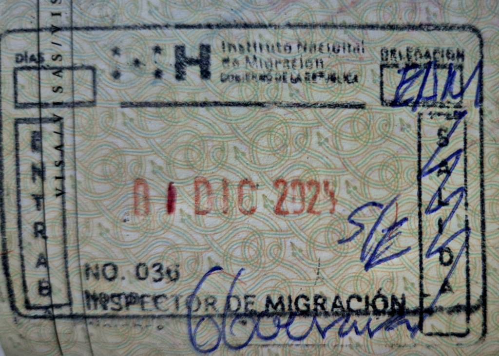
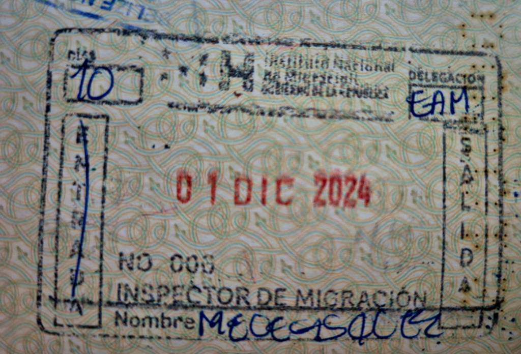
Honduras Passport Stamps
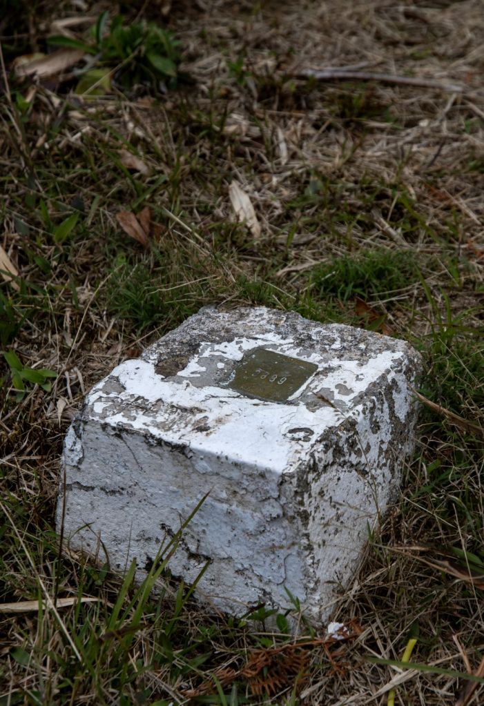
Honduras Tripoints
| number | name | country | coordinates | type | links/notes |
|---|---|---|---|---|---|
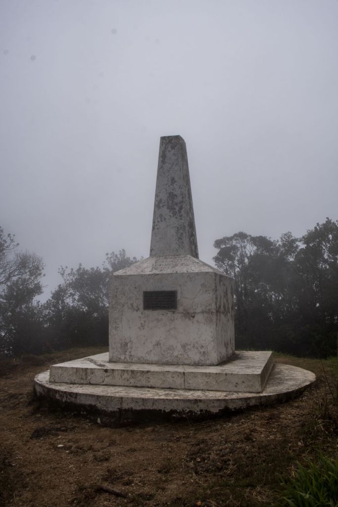
| 1 | GTHNSV | El Salvador – Guatemala – Honduras | 14°25′18″N 89°21′2″W | Dry | Cerro Montecristo (2418m). Westernmost tripoint in the world |
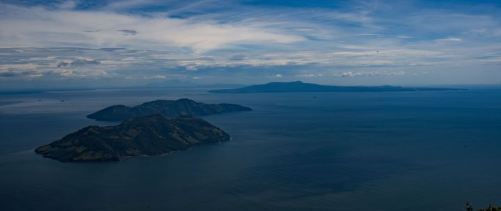
| 2 | HNNISV | El Salvador – Honduras – Nicaragua | 13°07’30″N 87°33’01″W | Wet | Golfo de Fonsca is jointly shared by the 3 countries. It is a historic bay with the characteristics of an enclosed sea, with a strip of territorial waters for each State and the remainder in the central part as condominium waters. The Gulf is divided into: 1) Territorial waters of each coastal State up to 3 miles from its continental coast. 2) Condominium waters (Joint Maritime Zone), formed as residues of the non-territorial body of water in the Gulf of Fonseca. Isla Conejo is contested between HNNI. |
Tripoint Gallery

Site Navigation
In order to find your way around the site, either click on the links (text in red) or use the menus at the top and side of the pages. About leads you to the main areas of the site. The European Tripoints menu leads directly you to my visit reports whereas the Country Visits page allows you to choose which country to look at first. Clicking on photos can lead you directly to reports too.

Mobile Users Advice
Tables display correctly when holding your mobile horizontally.
To access the links to other pages please click on the 3 horizontal dots at the bottom of the page

