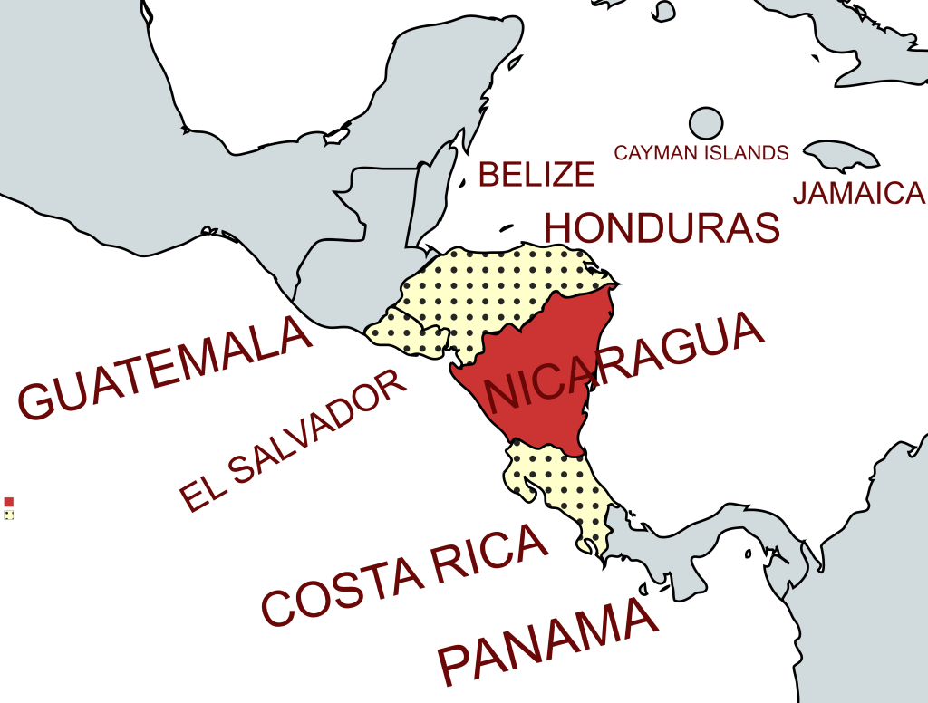
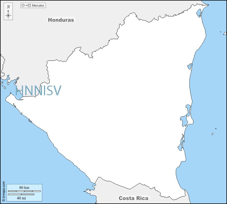
Nicaragua, officially the Republic of Nicaragua,[c] is the geographically largest country in Central America. The country is bordered by Honduras to the north and Costa Rica to the south. The Pacific Ocean provides the border to the west, and the eastern border of the country is on the Caribbean Sea. It has no land border with El Salvador but shares ownership of the Gulf of Fonsca with both El Salvador and Honduras. The region was conquered by the Spanish Empire in the 16th century. Nicaragua gained independence from Spain in 1821. The Mosquito Coast followed a different historical path, being colonized by the English in the 17th century and later coming under British rule. It became an autonomous territory of Nicaragua in 1860 and its northernmost part was transferred to Honduras in 1960.
Since its independence, Nicaragua has undergone periods of political unrest, dictatorship, occupation and fiscal crisis, including the Nicaraguan Revolution of the 1960s and 1970s and the Contra War of the 1980s. In theory Nicaragua is a presidential republic, in which the President of Nicaragua is both head of state and head of government, and there is a multi-party system. Executive power is exercised by the government. Legislative power is vested in both the government and the National Assembly. The judiciary is independent of the executive and the legislature.. In practice Nicaragua is the least democratic country in Central and South America. Daniel Ortega has been president since 2007. There has been wide spread repression and crack down on opposition groups. Political rivals are arrested, Universities closed, and the media curtailed. The country is subject to international sanctions.
Border Facts
The country is bordered by Honduras to the north and Costa Rica to the south.
Nicaragua – Costa Rica border The border is based on the Cañas-Jerez Treaty of 1858 and the Cleveland Award of 1888. It is 309 kilometres long extending east–west, between the Caribbean Sea (E) and the Pacific Ocean ![]() it separates the northern part of Costa Rica from the Southern part of Nicaragua. It passes near Lake Nicaragua. The southern bank of the River San Juan lies on the border for much of its length. It was established after the collapse of the Federal Republic of Central America in 1839. There is only one main border crossing between Costa Rica and Nicaragua. It is called Penas Blancas, and it is on the west side of each country.
it separates the northern part of Costa Rica from the Southern part of Nicaragua. It passes near Lake Nicaragua. The southern bank of the River San Juan lies on the border for much of its length. It was established after the collapse of the Federal Republic of Central America in 1839. There is only one main border crossing between Costa Rica and Nicaragua. It is called Penas Blancas, and it is on the west side of each country.
Nicaragua – El Salvador border do not share a land border. They do however do meet in the Gulf de Fonsca which is is jointly shared by 3 countries (including Honduras). HNNISV is a complex dual condominium of shared waters. The ICJ in 1992 determined that Nicaragua, Honduras and El Salvador were to share control of the remaining water area in the gulf as a “tridominium” shared in common. The littoral zones abut each other in a way that forms two separate areas of tridominium waters in the gulf.
Nicaragua – Honduras border runs from the Gulf of Fonseca on the Pacific Ocean to the Caribbean Sea. The Coco River, which flows generally northeast to the Caribbean, forms more than half of the border. The boundary between Honduras and Nicaragua was established during the colonial era and mainly extends along a series of winding rivers. The straight line distance between the Atlantic and Pacific coasts is only 510 kilometres, but due to the sinuous nature of the mostly riverine boundary, its actual length is 1,033 kilometres. International arbitration has resolved several historic territorial disputes between the two States, with the 2007 International Court of Justice Judgment serving as the most recent series of proceedings concerning the boundary.
Despite the numerous issues related to the border, Honduras and Nicaragua completed joint demarcation efforts from 1900–1904 and during the early 1960s. It does not appear that any disputes currently exist between the two States
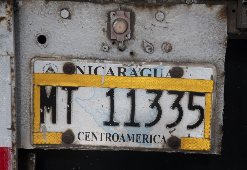
Nicaraguan Registration Plates

Nicaraguan Passport Stamps
Nicaraguan Tripoints
| number | name | country | coordinates | type | links/notes |
|---|---|---|---|---|---|
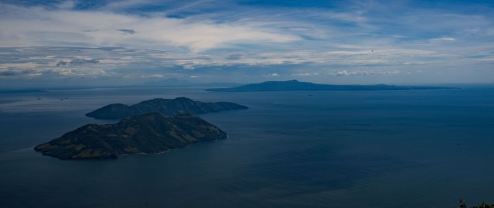
| 1 | HNNISV | El Salvador – Honduras – Nicaragua | 13°07’30″N 87°33’01″W | Wet | Golfo de Fonsca is jointly shared by the 3 countries. It is a historic bay with the characteristics of an enclosed sea, with a strip of territorial waters for each State and the remainder in the central part as condominium waters. The Gulf is divided into: 1) Territorial waters of each coastal State up to 3 miles from its continental coast. 2) Condominium waters (Joint Maritime Zone), formed as residues of the non-territorial body of water in the Gulf of Fonseca. Isla Conejo is contested between HNNI. |
Tripoint Gallery

Site Navigation
In order to find your way around the site, either click on the links (text in red) or use the menus at the top and side of the pages. About leads you to the main areas of the site. The European Tripoints menu leads directly you to my visit reports whereas the Country Visits page allows you to choose which country to look at first. Clicking on photos can lead you directly to reports too.

Mobile Users Advice
Tables display correctly when holding your mobile horizontally.
To access the links to other pages please click on the 3 horizontal dots at the bottom of the page

