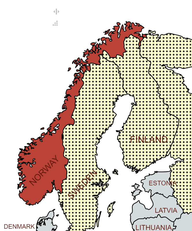
Norway, formally the Kingdom of Norway, is a Nordic country in Northern Europe, situated on the Scandinavian Peninsula. The remote Arctic island of Jan Mayen and the archipelago of Svalbard also form part of Norway. Bouvet Island, located in the Subantarctic, is a dependency; Norway also claims the Antarctic territories of Peter I Island and Queen Maud Land. Norway has a total area of 385,207 square kilometres. Norway shares a long eastern border with Sweden. It is bordered by Finland and Russia to the northeast and the Skagerrak strait to the south. Norway has an extensive coastline facing the North Atlantic Ocean and the Barents Sea. The west coast of southern Norway and the coast of northern Norway present some of the most visually impressive coastal sceneries in the world. National Geographic has listed the Norwegian fjords as the world’s top tourist attraction.
Norwegians enjoy the second-highest GDP per capita among European countries (after Luxembourg), and the sixth-highest GDP (PPP) per capita in the world. The standard of living in Norway is among the highest in the world.
Norway is a unitary constitutional monarchy with a parliamentary system of government, wherein the King of Norway is the head of state and the prime minister is the head of government. Norway maintains the Nordic welfare model with universal health care and a comprehensive social security system, and its values are rooted in egalitarian ideals. Norway is considered to be one of the most developed democracies and states of justice in the world. Since 2010, Norway has been classified as the world’s most democratic country by the Democracy Index. Norway maintains close ties with the European Union and the United States. Norway is a founding member of the United Nations, NATO, the European Free Trade Association, the Council of Europe, the Antarctic Treaty, and the Nordic Council; a member of the European Economic Area, the WTO, and the OECD; and a part of the Schengen Area.
Border Facts
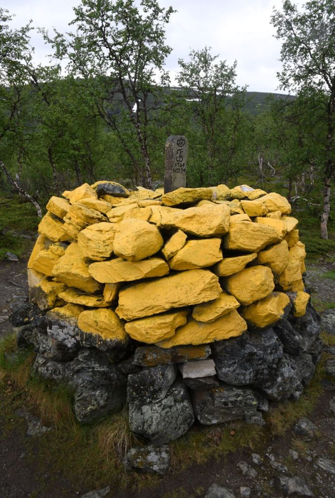
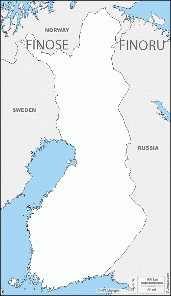
Norway – Finland Border is 736km long. It is a land and river border between two tripoints. The western tripoint FINOSE is marked by Treriksröset, a stone cairn where both countries border Sweden.
This is the most northern tripoint in the world. The eastern tripoint FINORU is marked by Treriksrøysa, a stone cairn where both countries border Russia. Almost half of the border follows the Tenojoki River or its tributary the Inarijoki River. Much of the border runs through unpopulated wilderness. There are six road border crossings with Kilpisjärvi the farthest west, Utsjoki the farthest north, and Näätämö the farthest east. The border was defined in a 1751 treaty and is clearly defined by border cairns. The Finland–Norway border is open, as both countries are part of the Schengen Area. It is legal to cross the border anywhere if no customs declaration or passport check is needed. An 8-meter wide clear-cut zone straddles the land border.
Norway – Russia Border consists of a 195.7-kilometer land border between Sør-Varanger, Norway, and Pechengsky District, Russia, and a 23.2-kilometer marine border in the Varangerfjord. The border line was defined by a treaty in 1826 and essentially remains the same border today.
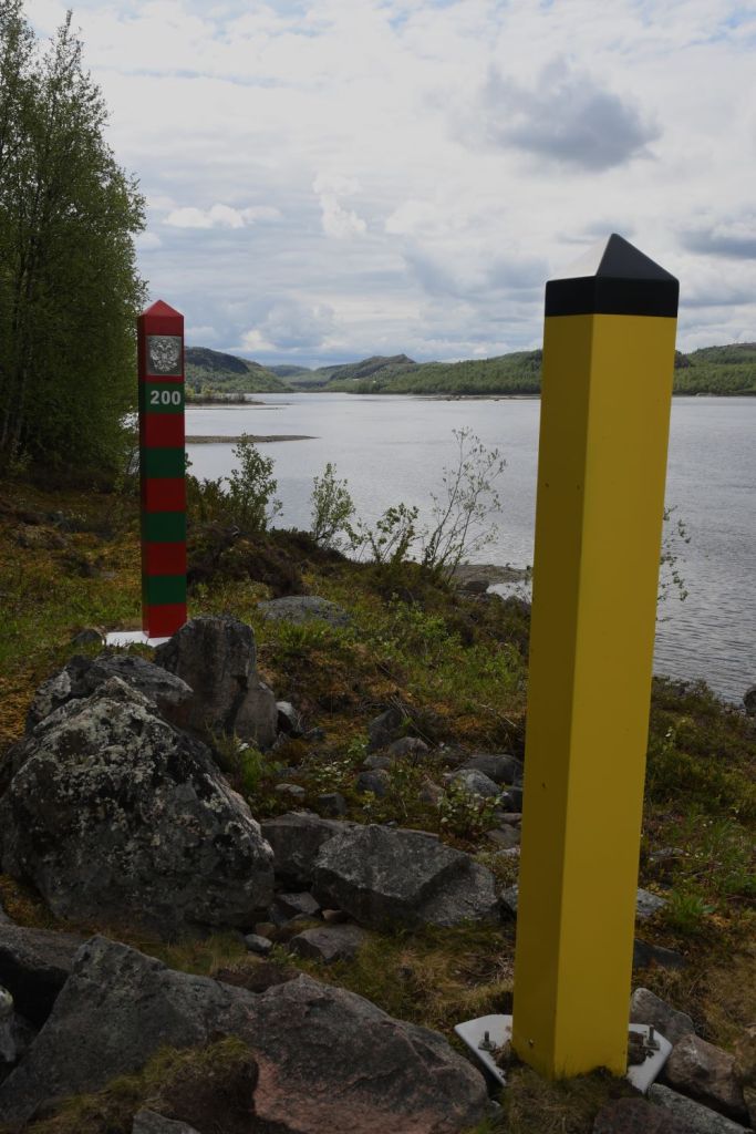
It further consists of a border between the two countries’ exclusive economic zones (EEZ) in the Barents Sea and the Arctic Ocean. Between 1944 and 1991 the border was between Norway and the Soviet Union. From 1991 to 1999 it was the only border between Russia and NATO. There is one legal border crossing point, with stations on both sides, at Storskog in Norway and Borisoglebsky in Russia, located on the E105 highway some 15 km east of Kirkenes. Since 2016 with this route being used by migrants there has been a fence built to deter migrants on the Norwegian side.
Prior to the recent Ukrainian invasion by Russia there were cross border arrangements to allow residents easier travel. Crossing the border unofficially is strictly forbidden and subject to fines and possible imprisonment. Following the invasion of Ukraine by Russia, Russian citizens are no longer allowed to cross the border.
Norway – Sweden Border runs from the western shore of Idefjorden in Bohuslän up to Treriksröset. This border is the longest land border in Europe. It is approximately a total of 1620 kilometres long and runs through very varied landscapes. It is the longest border for both countries. It was established by the Treaty of Brömsebro (1645), the Treaty of Roskilde (1658) and the Treaty of Copenhagen (1660). During the boundary demarcation that followed after the Strömstad Treaty (1751), 293 boundary markers were erected. These have during boundary reviews over the centuries been supplemented with new markers, and some have also been removed. After the review 1984–1987, there are 642 markers and 11 unmarked breakpoints in the official designation series. Of the 642 markers, 612 are cairns, some of which are more or less constantly under water. The other 30 markers are mainly marked by natural stones, memorial monuments and wooden poles (with sign). A review of the national boundary between Sweden and Norway 2020–2024 is currently underway.
In Dalarna and north of it, the border usually follows the drainage divide in the Scandinavian Mountains between rivers that flow to the Norwegian Sea or Skagerrak and rivers flowing to the Baltic Sea. Exceptions to this are Rogen and Lierne which are not located on the same side of the border as the drainage divide. South of Dalarna, the border in part follows local drainage divides, but also across lakes and along rivers. Some border marks were placed on small islands which got divided by the border.
Both countries are members of the Schengen Area and Nordic Union, and there are therefore no immigration controls. However, only Sweden is part of the European Union (and crucially the European Union Customs Union) and there are customs checks between the two countries.
Each side of the border forms a zone where officers from each country can act irrespective of the border.
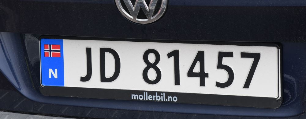
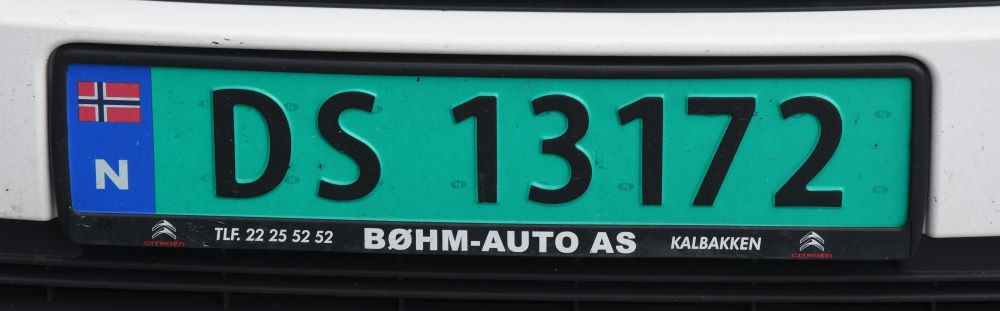
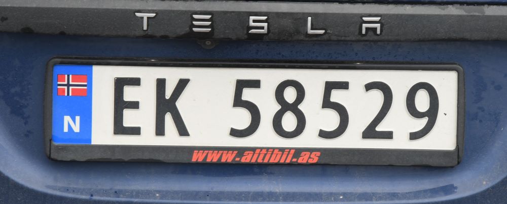
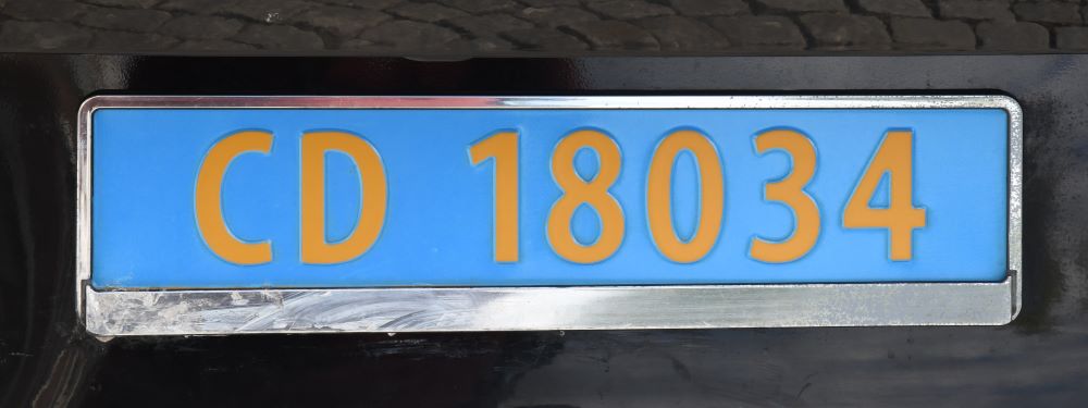
Norwegian Registration Plates
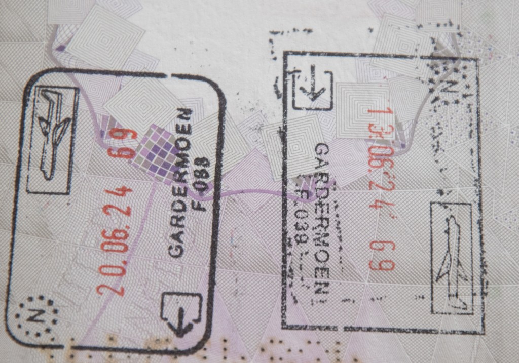
Norwegian Passport Stamps
Norwegian Tripoints
| NuMBER | NAME | COUNTRIES | COORDINATES | TYPE | NOTES |
|---|---|---|---|---|---|
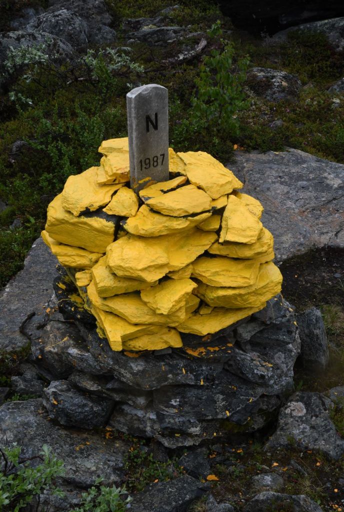
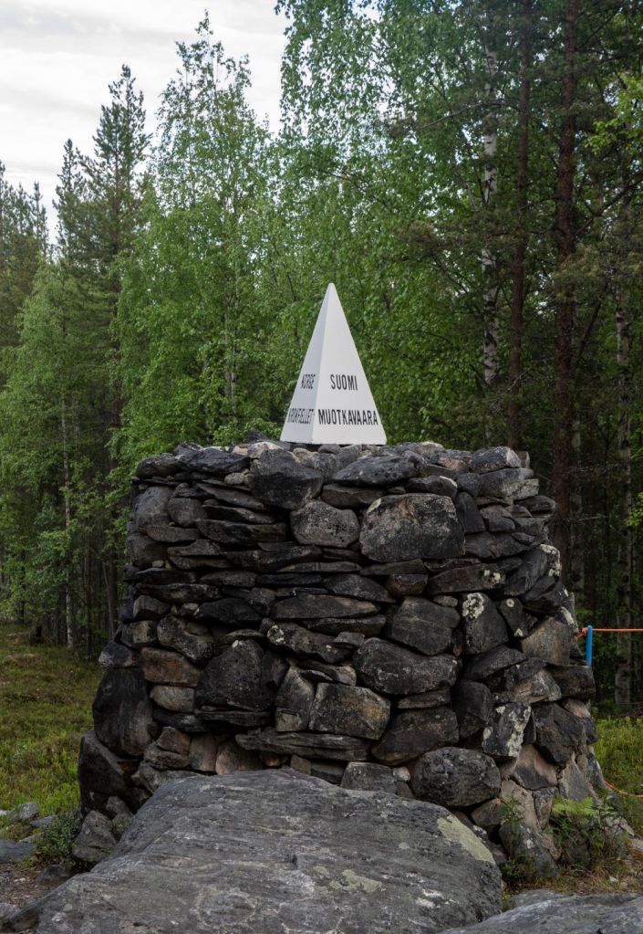
| 1 | FINORU | Finland – Norway – Russia | 69°03’07″N 28°55’44″E | Dry | Treriksrøysa (‘Three-Country Cairn’) is a cairn which marks the tripoint. The site is on a hill called Krokfjellet (Norwegian) or Muotkavarre (Finnish and Russian), in the Pasvikdalen valley. It is the only place in Europe where three time zones meet. The tripoint is marked by a cairn (which is unnumbered). There is a white pyramid on top with the respective countries names written on. Krogh (2012) Van der Giessen (2024) |
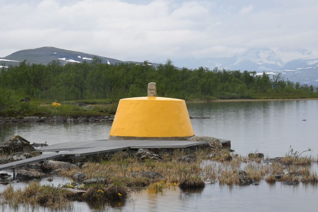
| 2 | FINOSE | Finland – Norway – Sweden | 69°03′35″N 20°32′49″E | Dry | The Three-Country Cairn marks the tripoint. The current tripoint monument was built in 1926 and was originally beige, conical frustum made of concrete, located about 10 metres out in Lake Goldajärvi. The monument is large and there are engraved headstones with symbols of each country. Technically walking around the monument on the platform means leaving Sweden, entering a small pene enclave of Norway and then entering Finland if you walk in a clockwise direction. The are several border markers in the vicinity. Krogh Van der Giessen (2024) |
Tripoint Gallery

Site Navigation
In order to find your way around the site, either click on the links (text in red) or use the menus at the top and side of the pages. About leads you to the main areas of the site. The European Tripoints menu leads directly you to my visit reports whereas the Country Visits page allows you to choose which country to look at first. Clicking on photos can lead you directly to reports too
Mobile Users Advice
Tables display correctly when holding your mobile horizontally.
To access the links to other pages please click on the 3 horizontal dots at the bottom of the page.