
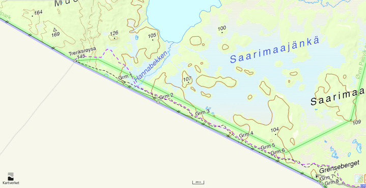
The ultimate goal when leaving the car park is to walk to the Treriksrøysa, the FINORU tripoint between Finland, Norway and Russia. The walk is along a marked track which follows the Norway – Russian border and in some places is very close to it. With some planning, and by using the cleared border corridor it is possible to combine a visit to the tripoint with an opportunity to bag the border markers BM#1 to BM#6.
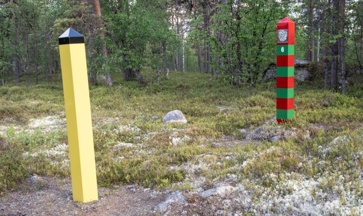
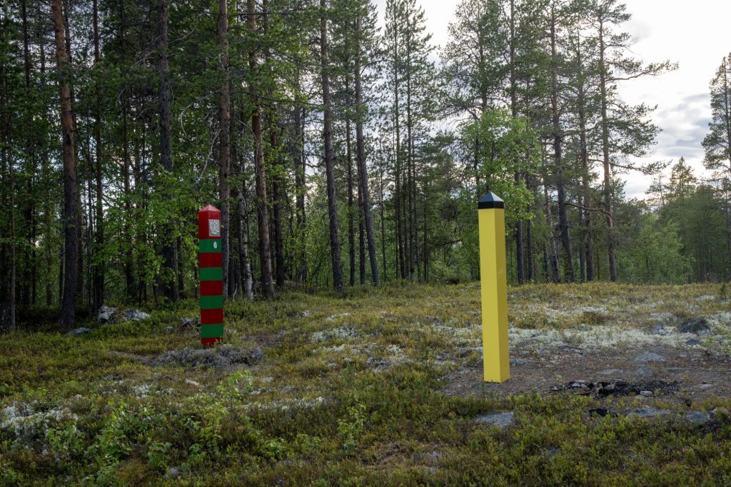
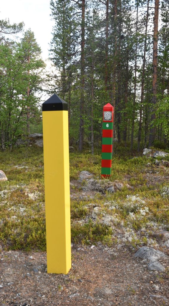
The border line was defined by a treaty in 1826 and essentially remains the same border today. Between 1920 and 1944 this was the border with Finland until Petsamo was ceded to the Soviet Union. The border is marked with 415 border markers, consisting of 387 pairs of poles, 25 cairns, two lead markers and one stake. It is allowed to go as far as the Norwegian marker.
The Norwegian markers are yellow with a 18 centimetres tall black top—this was chosen because it would be most visible in all types of weather and lighting. The Russian markers have a pattern of alternating red (19cm wide) and green (17cm wide) bands. The red was chosen to symbolize the Flag of the Soviet Union, while the green symbolized the colour of the border guards’ uniforms. Both poles have the respective country’s coat of arms on the side facing the border. While originally made of wood, the border markers are now made of composite materials. On land border markers are 4m apart.
I visited this point as part of the IBRG ARTEX-24 expedition.


Date of Visit: 16 June 2024
