
The Free City of Danzig was a city-state under the protection and oversight of the League of Nations between 1920 and 1939, consisting of the Baltic Sea port of Danzig (now Gdańsk, Poland) and nearly 200 other small localities in the surrounding areas. It was established on November 15, 1920 through the Treaty of Versailles which transferred it from Germany to Poland’s special protection. . The city state bordered the Polish corridor to the west and East Prussia to the east. In 1928, its territory covered 1,952 km2, including 58 square kilometres of freshwater surface. The border had a length of 290.5 km, of which the coastline accounted for 66.35 km
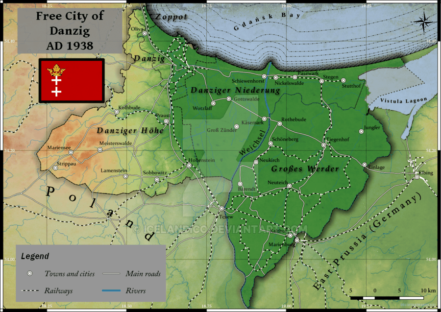
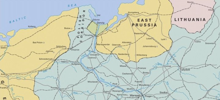
Map showing the border of Northern Poland between 1920-1939, with the Free City of Danzig (green) and the Polish Corridor to the west, effectively divided Germany from its East Prussian territory.
The population was predominantly German, but the territory was in a union with Poland, which covered foreign policy, defense, customs, railways, and post, and remained distinct from both the post-war Weimar Republic and the newly independent Polish Republic. In 1921, Poland began developing the city of Gdynia, a mid-sized fishing town. This new port, located north of Danzig, was established on territory awarded in 1919, known as the Polish Corridor. After the German invasion of Poland in 1939, the Nazis abolished the Free City and incorporated the area into the newly formed Reichsgau of Danzig-West Prussia. The city was fully integrated into Poland due to the Potsdam Agreement, with subsequent population movement.
Remnants of a lost border
Inspired by members of the IBRG I spent 2 days exploring points of interest on the historic borders of the city state
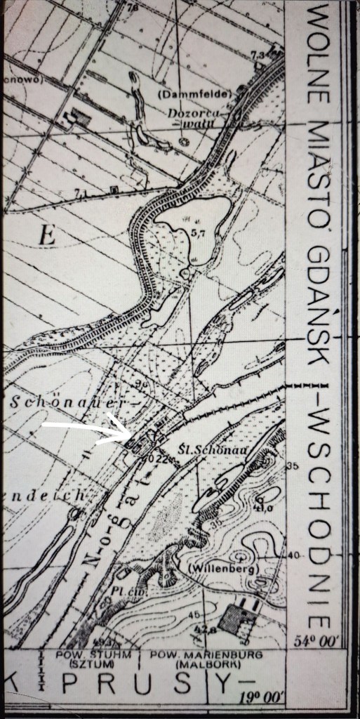
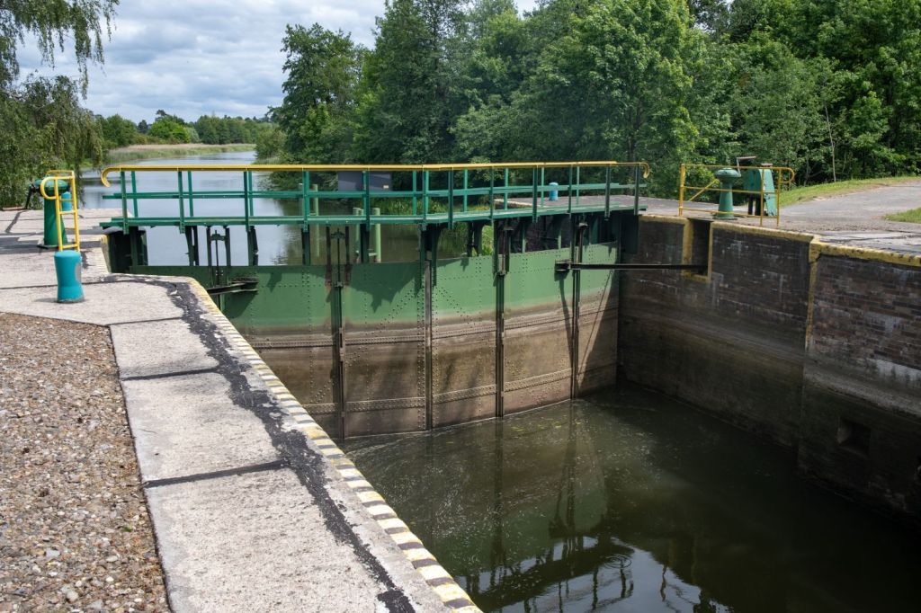
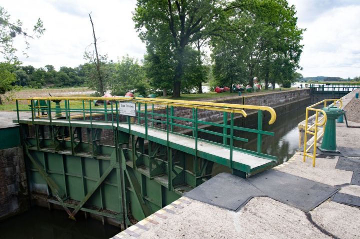
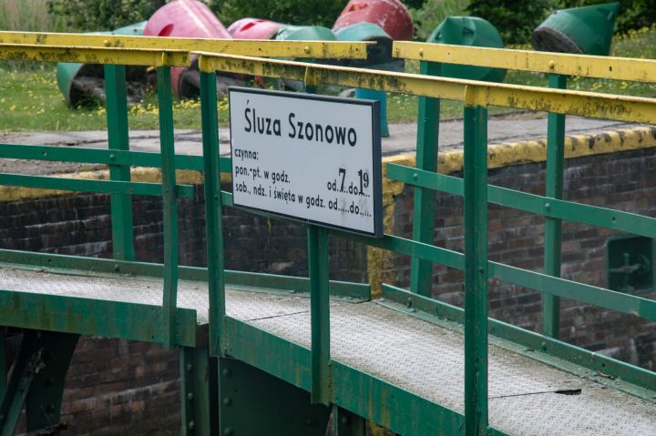
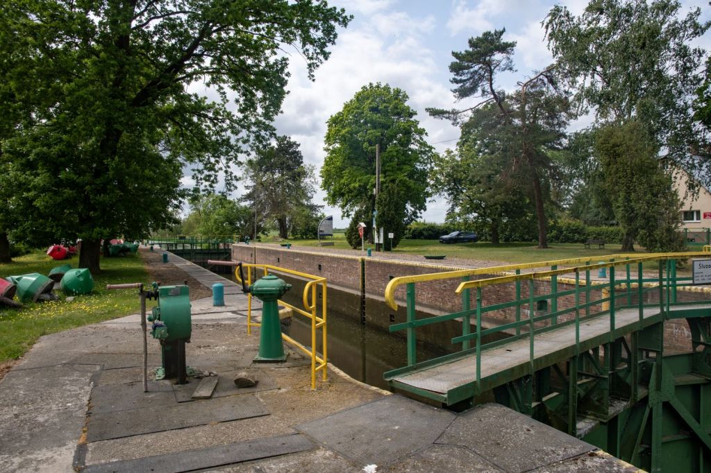
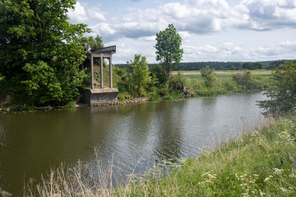
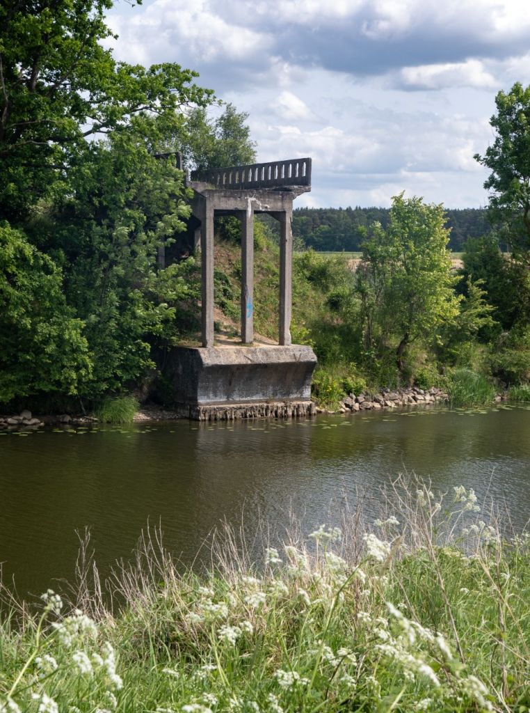
Schönau/Szonowo Lock
Schönau Lock, through which the Gdańsk-East Prussia border passed. The Szonowo Lock is is a historic, manually-operated single-chamber lock located on the Nogat River, an eastern branch of the Vistula River estuary, in northern Poland. It is a popular destination for tourists and boaters in the Pomeranian Voivodeship area. It is one of three locks (Szonowo, Rakowiec, and Michałowo) on the lower, canalized section of the Nogat river, which connects the Vistula river to the Vistula Lagoon. The lock is manually operated, featuring a design typical of late 19th/early 20th-century hydraulic engineering in the region. Today, it serves recreational and touring boat traffic, forming part of the popular Żuławy Loop (Pętla Żuławska) waterway route.


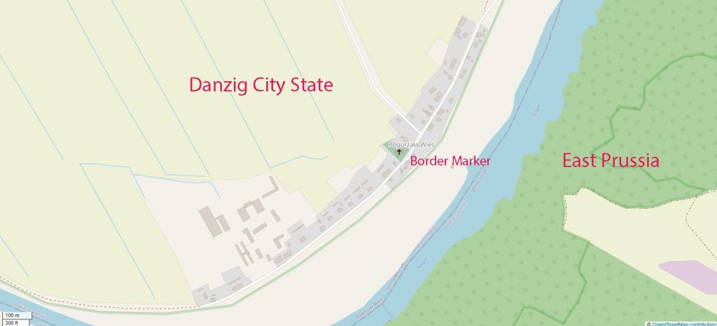
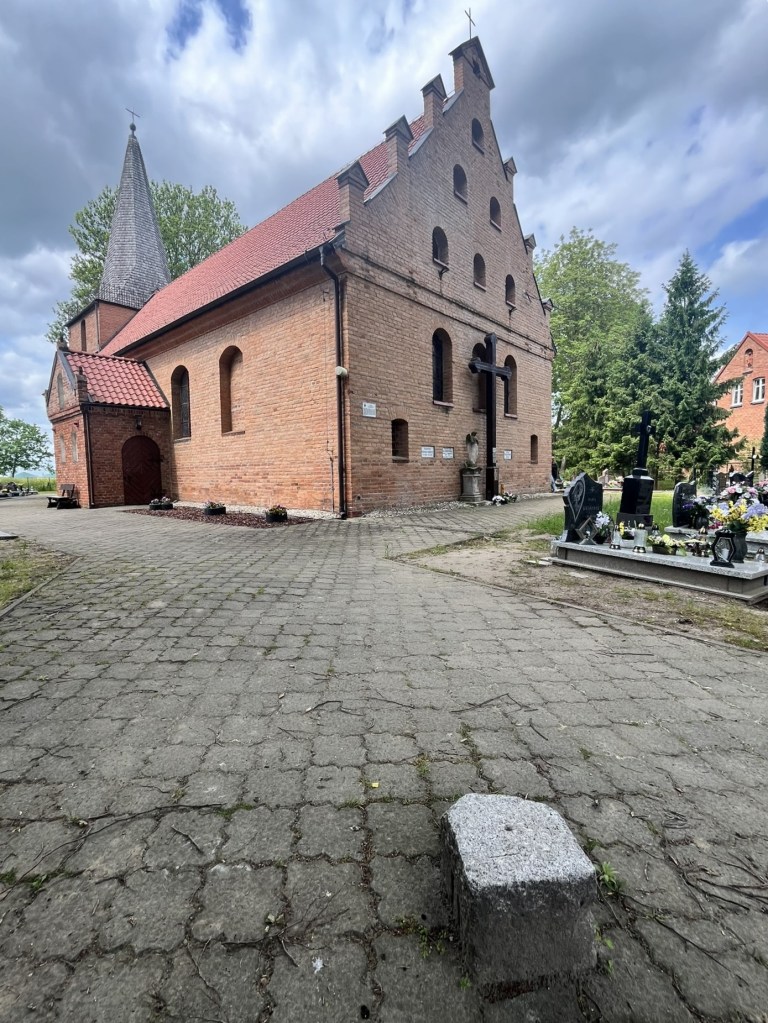
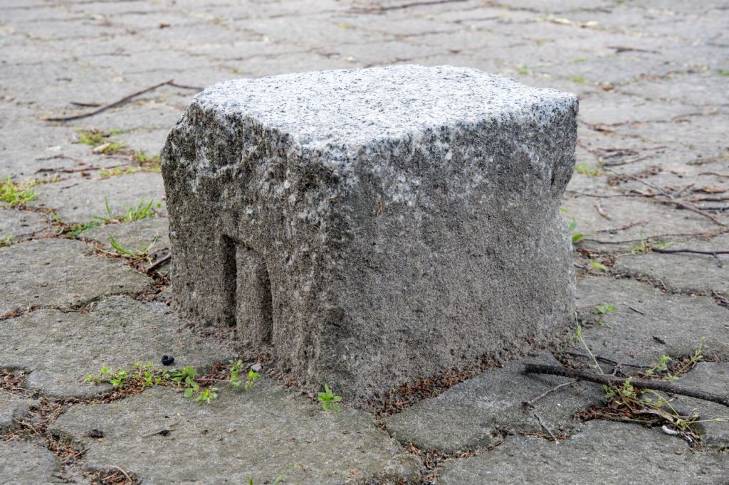
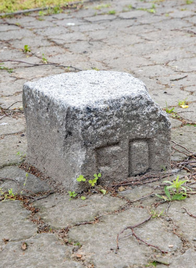
Pogorzała Wieś
Pogorzała Wieś is a picturesque village in Żuławy Malborskie, located on the Nogat River. In the grounds of the impressive historic St. Nicholas Church from the 14th century is a border marker
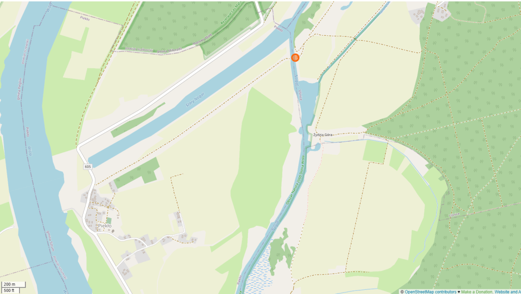
Jagow Brücke
A bridge built in the early 20th century over the Nogat River. During the interwar period, it served as a border bridge between the Free City of Danzig and Germany. In Uśnice, on the Prussian side, lived a peasant who owned fields and meadows in Piekło, which remained within the Free City of Gdańsk. He frequently crossed the border to drive his cows to pasture or to gather hay. Accessing the bridge involves driving along a raised river bank from the closest road near the village of Piekło.


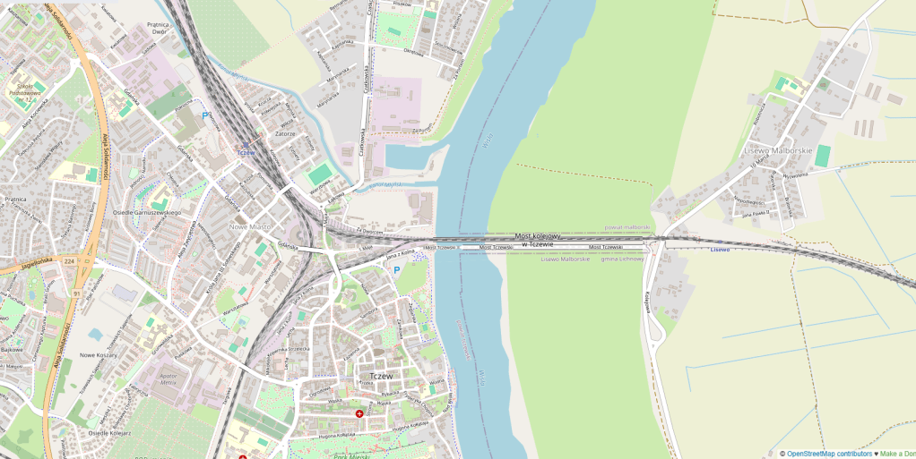
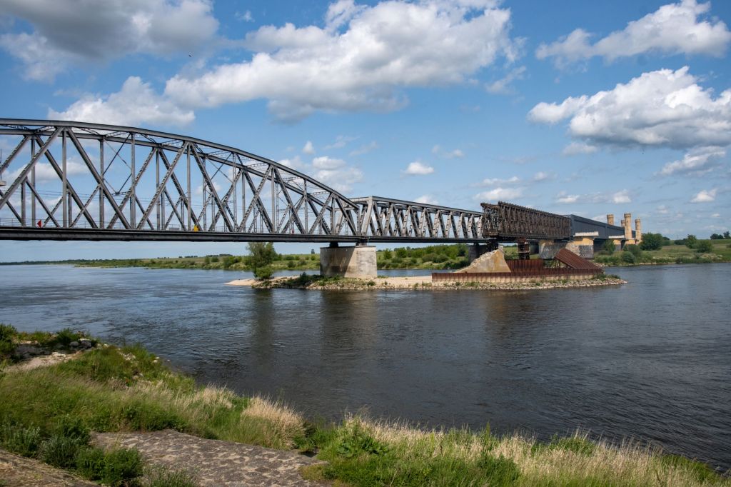
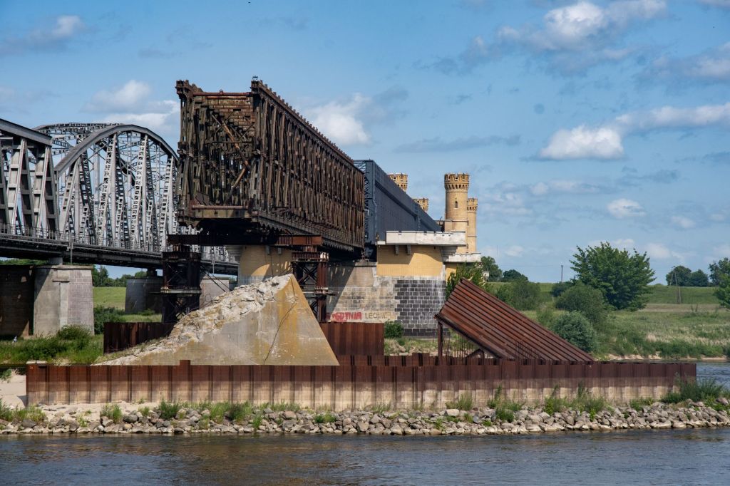
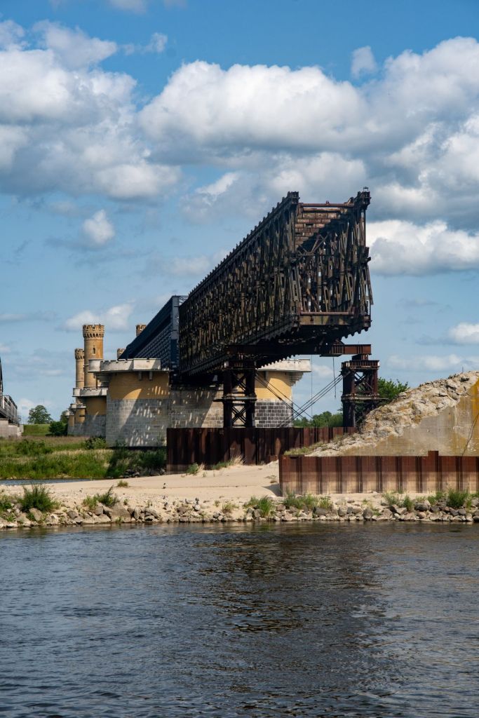
Tczew Bridge
Tczew, railway and road bridges on the Vistula River. The border, which ran in the middle of the river, passed these bridges in such a way that they belonged entirely to Poland. It was built in 1851–1857 as a road-rail bridge and when built, it was the longest bridge in Europe. The first train crossed the bridge on October 12, 1857. The completion of the bridges enabled direct rail travel from Berlin to Königsberg. Between 1852 and 1857, passengers had to change trains in Tczew and Malbork. The bridge in Tczew was single-track. With the development of the railway and the opening of new railway lines, it became a bottleneck on their route, this led to the construction of a second bridge and the conversion of the first into a road bridge. The bridges were destroyed in WW2 and restored afterwards. The partially renovated bridge is one of the earliest large iron girder bridges and is a historical monument.
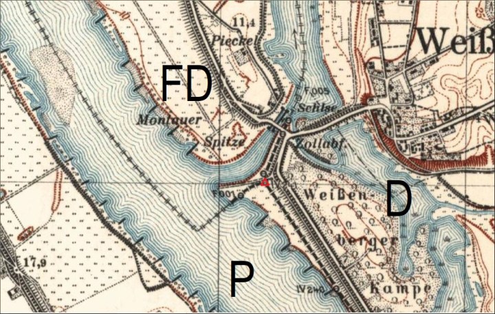
DEFLPL Tripoint
The specific location of the tripoint between Germany, Poland, and the Free City of Danzig was situated near the junction of the Vistula and Nogat rivers, close to the modern Polish town of Biała Góra. Please click on the image below to access my visit report with additional photos and maps.

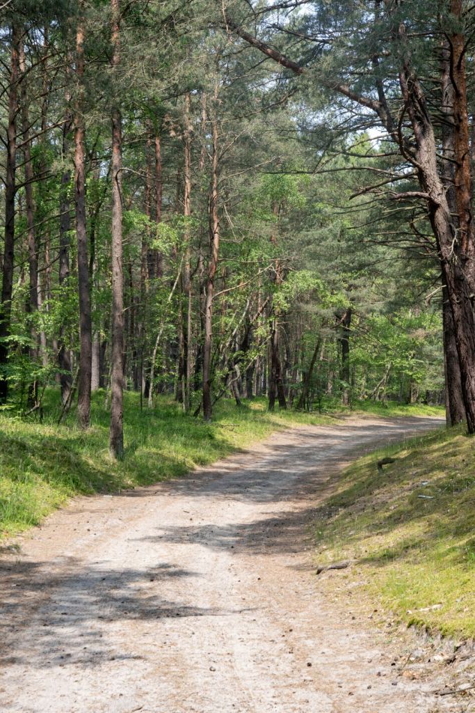
Vistula Split
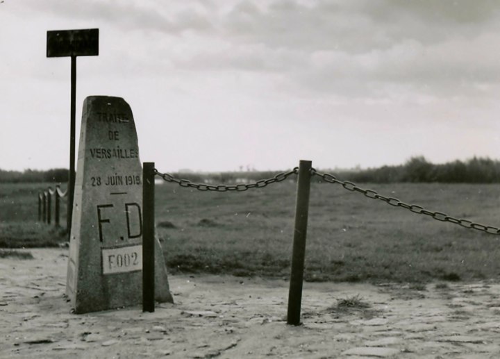
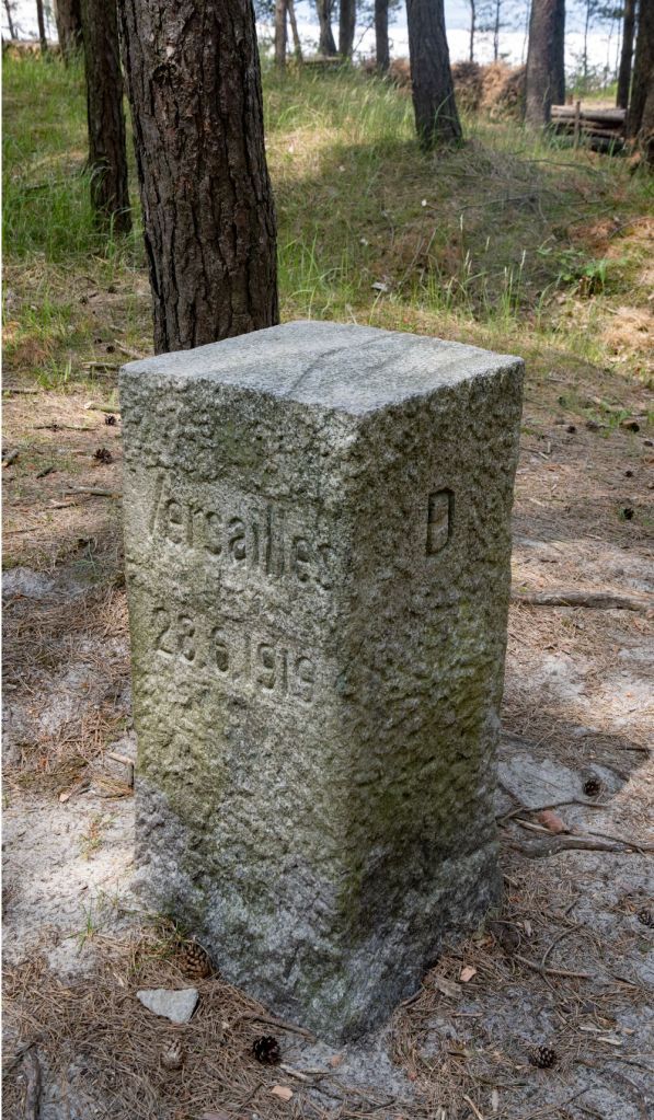
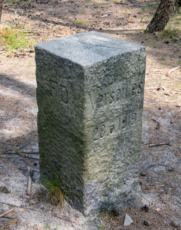
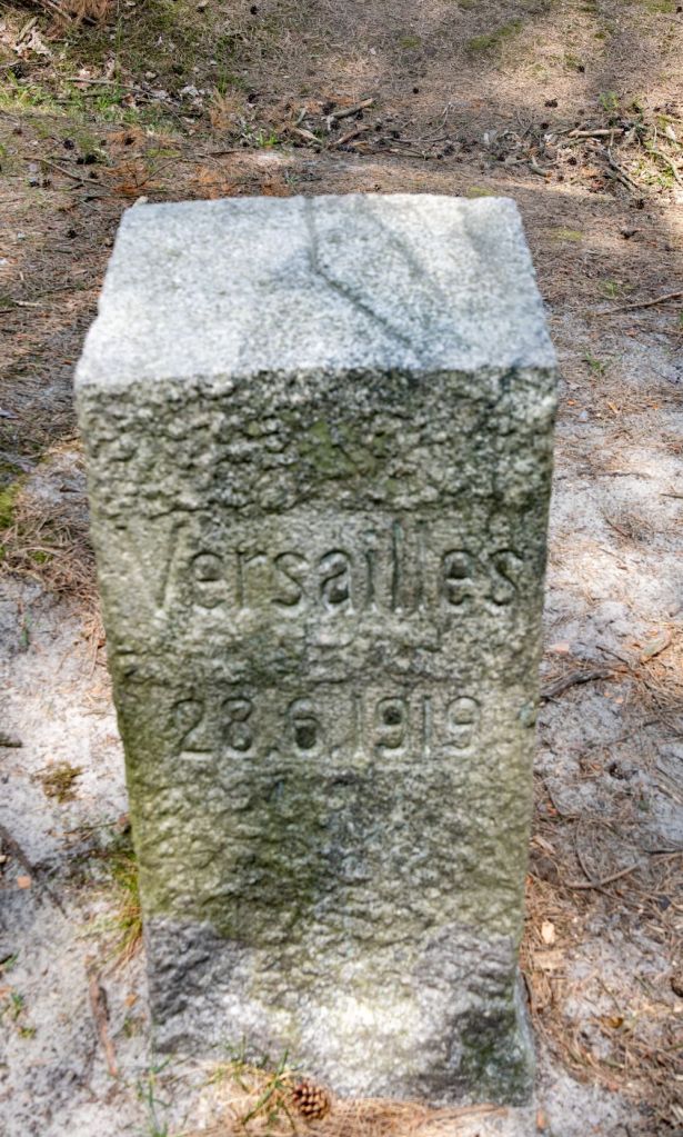
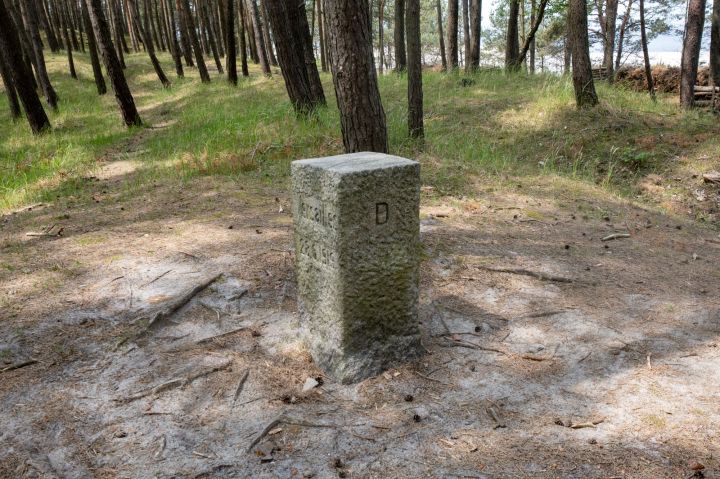
After discussions with fellow members of IBRG it was straightforward to find several well preserved border markers which were located north of the main 501 road 10 km before Krynica Morska.
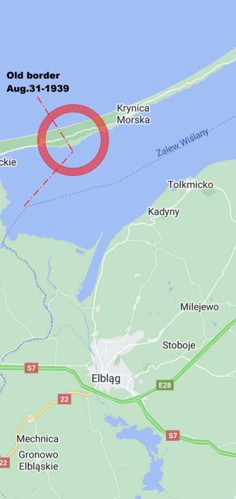
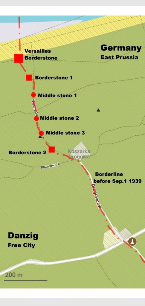
After parking the car it was a pleasant walk along a woodland track, that followed the border, the markers are easily accessible and consist of 3 markers and 3 intermediate stones. The final marker with its Treaty of Versailles inscription is the most impressive.
For additional information regarding my visit to the Vistula Split and the modern border between Poland and Russia click here
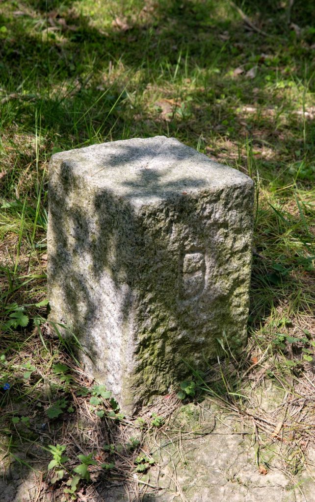
Border Stone 2

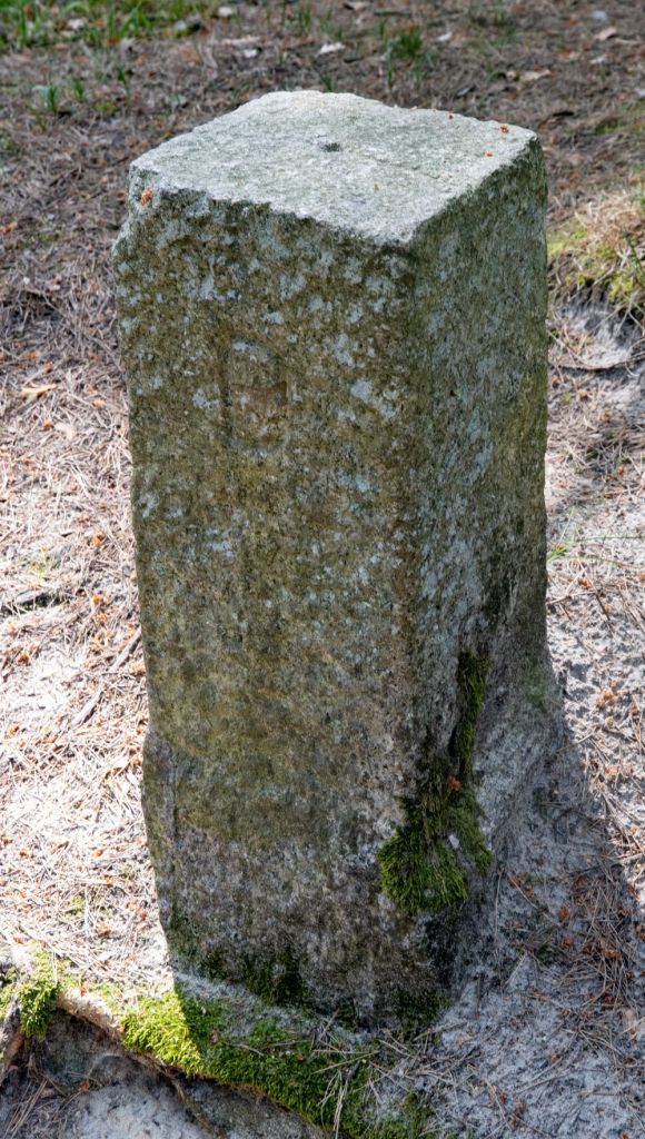
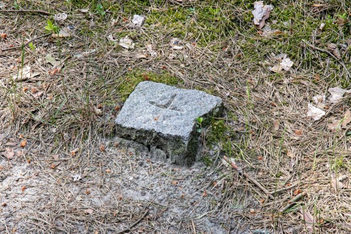
Middle Stones


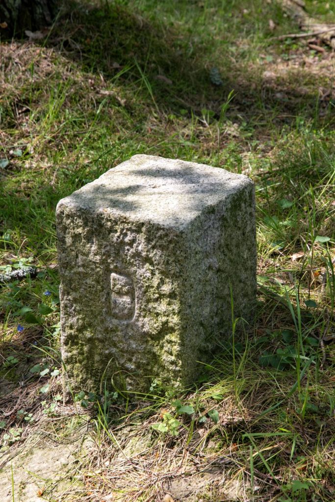
Border Stone 1

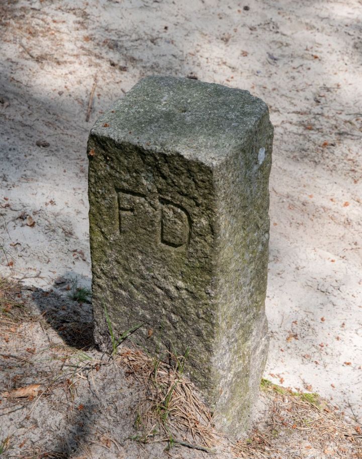
Versailles Border Marker G-0017
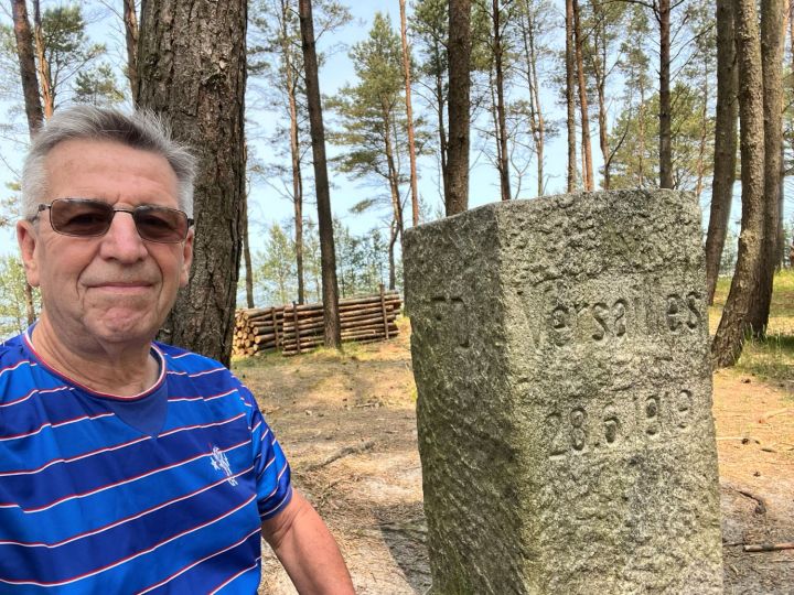

Dates(s) of Visit: 31 May 2025 – 01 June 2025
