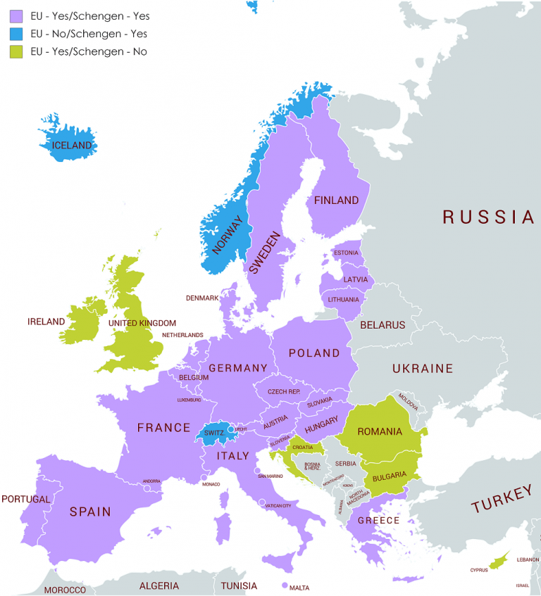
With an area of 238,391 square kilometers, Romania is the 12th largest country in Europe. It is roughly the same size as the United Kingdom and slightly smaller than the U.S. state of Oregon. Romania has membership in several international organizations, including the United Nations, NATO, and the European Union Romania has 3,195 kilometers of border. Republic of Moldova and Ukraine lie to the east, Bulgaria lies to the south, and Serbia and Hungary to the west. Whilst being a member of the EU, Romania is currently not a member of the Schengen zone.
Border Facts
1) Romania–Bulgaria border is 630 km long with 21 border crossings. For most of its length, the border follows the course of the lower Danube River, up until the town of Silistra. From Silistra, the river continues north into the Romanian territory. East of that point, the land border passes through the historical region of Dobruja, dividing it into Northern Dobruja in Romania and Southern Dobruja in Bulgaria. The Bulgaria–Romania border is an internal border of the European Union. However, as of 2019 neither country is part of the Schengen Area. As a result, border controls are conducted between the two countries, albeit often jointly (once per crossing).
2) The Romania – Serbia border is 546.4 kilometres long, of which 256.8 kilometres are terrestrial and 289.6 kilometres are fluvial. The border was established after the formation of the United Principalities of Moldavia and Wallachia (later renamed to Romania) in 1859 and the partition of Banat after the Treaty of Trianon. Both countries have several border crossing points. Among them are those of Vrbica–Vălcani, Golubac–Moldova Nouă, Kladovo–Drobeta-Turnu Severin and several others. Many of these points were temporarily closed in 2020 as a result of the COVID-19 pandemic. The point where the borders of Hungary, Romania and Serbia coincide is known as the “Triplex Confinium” (HUROSR). Cultural events occur each year.
3) The Romania–Hungary border is estimated to be 447 km long with 11 border crossings. The Hungarian–Romanian border begins at a tripoint located in the historical region of the Banat, 15 km south-east of the Hungarian town of Szeged, where the border between Hungary and Serbia intersects the land border between Romania and Serbia. It generally runs south-south-westwards/north-north-eastwards across the Pannonian Basin to another tripoint located on the Tur river.
4) The Romania–Moldova border is 681 km long. It is a river border following the course of the Prut and Danube. Along this border there are 9 crossing points – 6 by road and 3 by rail.
5) The Romania -Ukraine border is approximately 613 km long. The land border consists of two parts: the northern part stretches across Carpathian Mountains region roughly west–east from the Hungary-Romania-Ukraine tripoint to the northern Moldova-Romania-Ukraine tripoint. It starts along the Tisza River (through Maramureș) and runs across the historical region of Bukovina in the Eastern Carpathians. The southern part stretches between Budjak and Dobrudja regions roughly west–east from the southern Moldova-Romania-Ukraine tripoint to the maritime Romania-Ukraine boundary. It runs along the Danube River to the Black Sea.
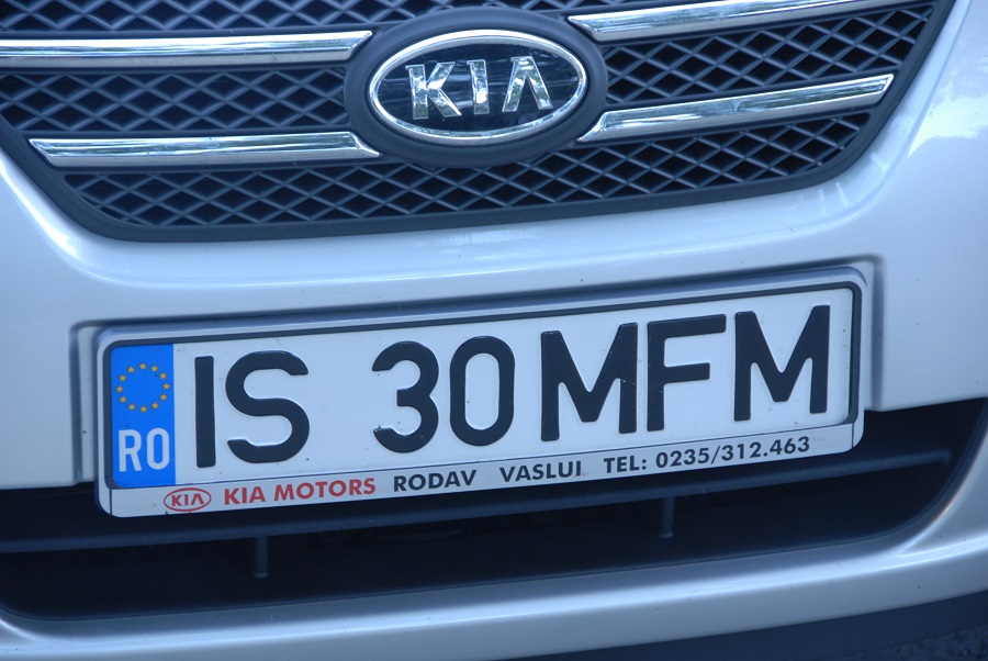
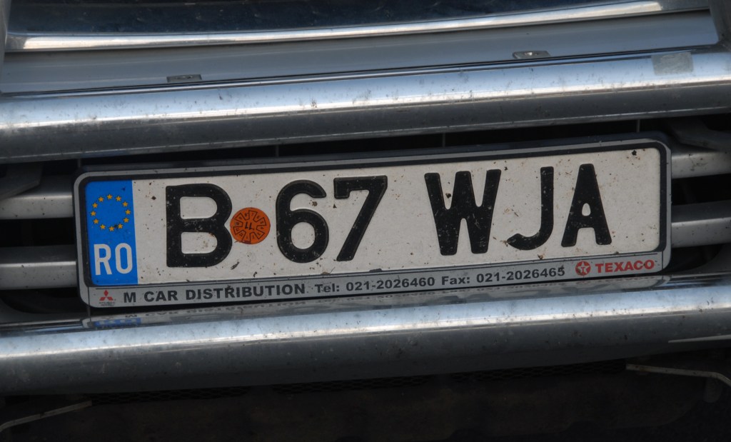
Romanian Registration Plates
Romanian Tripoints
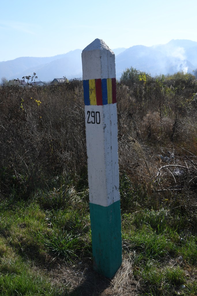
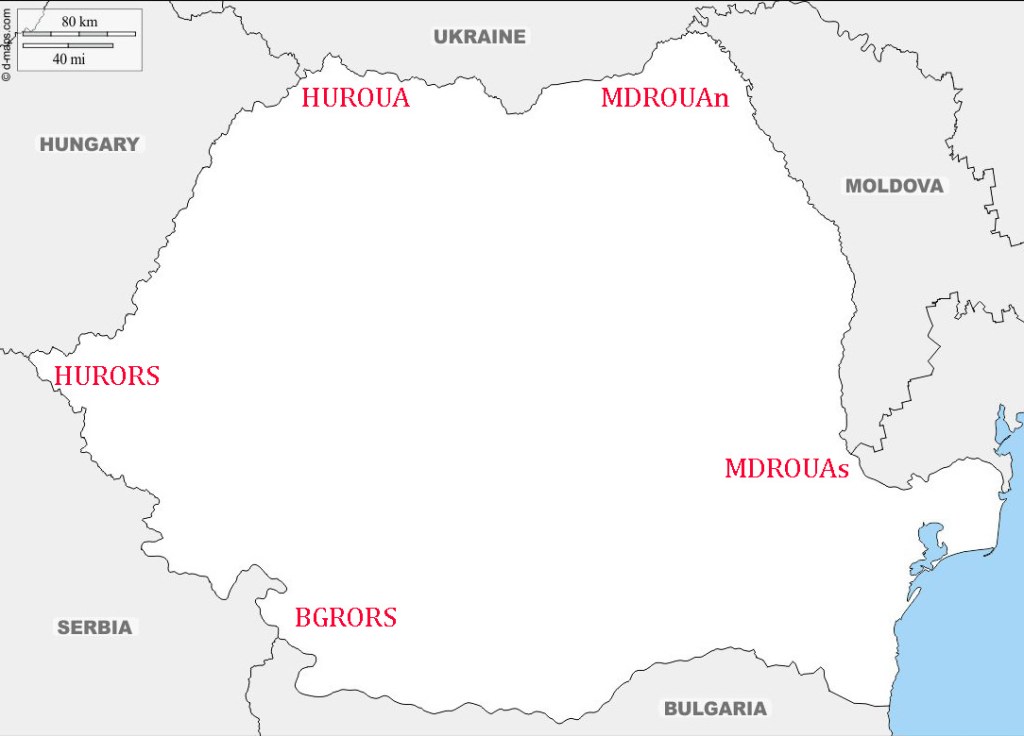
Romania has 5 Tripoints:
| NumbeR | Countries | COORDINATES | Type | Links | |||
|---|---|---|---|---|---|---|---|
| 1 | BGRORS | Bulgaria Romania Serbia | 44° 13′ 0″ N 22° 41′ 0″ E | Wet | The tripoint is located at the confluence between the River Danube and the smaller Timok (BGRS border) river. The border follows the thalweg of the Danube. A tripoint marker exists on the Romania shore opposite the Timok. | ||
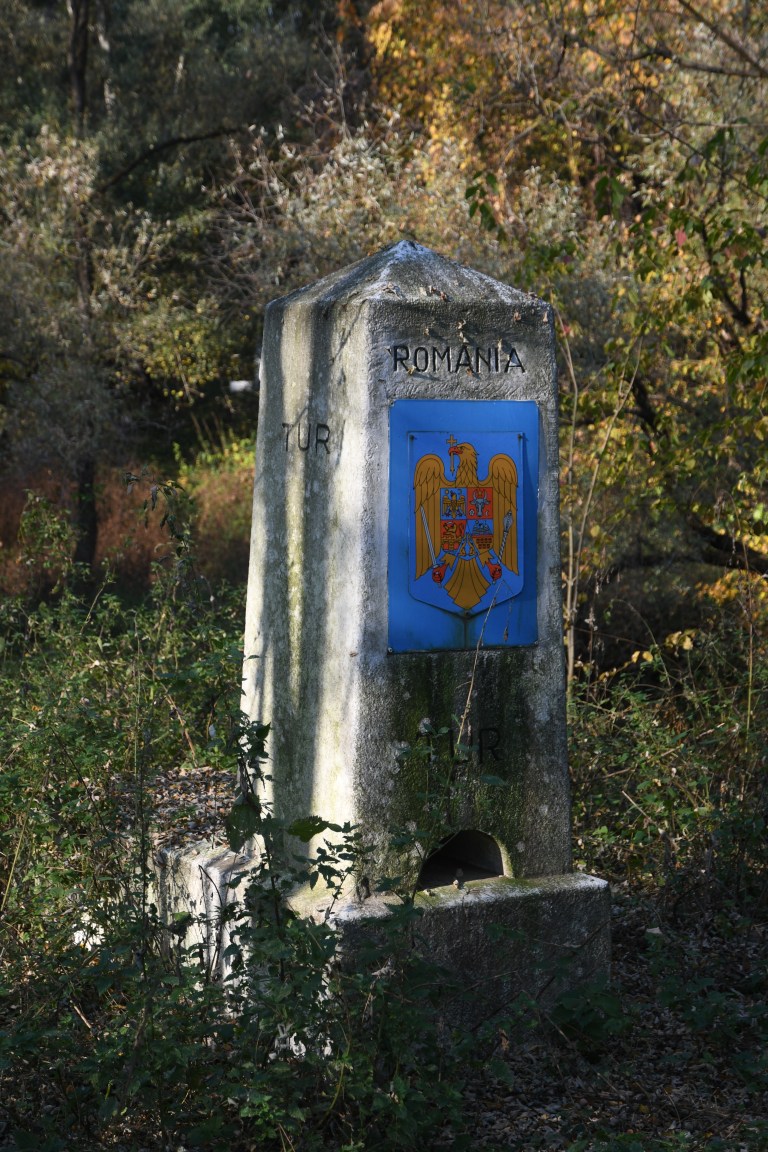
| 2 | HURORS | Hungary Romania Serbia | 46° 7′ 0″ N 20°15′ 0″ E | Dry | The tripoint is located between the towns of Kübekháza (Hungary), Beba Veche (Romania), and Rabe (Serbia). Cultural events are held at this location each year. The Triplex Confinium is marked by a monument built in 1920. A 3 sided top part has the respective countries crests. There is a HURS border crossing close by. | ||
| 3 | HUROUA | Hungary Romania Ukraine | 47° 57′ 16″ N 22° 53′ 50″ E | Wet | The tripoint is located in the river Tur. There are 3 large tripoint monuments, one in each country and border markers in HU and UA. A small (blocked) track links the HU and UA monuments. The RO monument is across the river. | ||
| 4 | MDROUAn | Moldova – Romania – Ukraine (north) | 48° 15′ 50″ N 26° 37′ 31″ E | Wet | The tripoint is located 500m south east of the Mamalyha – Kryva border crossing post (MD side) in the Prut which is the border between MDRO for its entire length. There are 3 BM’s, BM#003 north of the road leading to UA, and BM#002 and #001 between the crossing point and the river. | ||
| 5 | MDROUAs | Moldova – Romania – Ukraine (south) | 45° 28′ 0″ N 28° 12′ 48″ E | Wet | The tripoint is in the river Danube, just east of its confluence with the Prut river. It is located just east of Giurgiulesti International Free Port and north of Insula Cailor, a Romanian island in the Danube. Access is likely to be difficult. It is also the southernmost point of Moldovia. |
Tripoint Gallery
Please click on the images below to access the tripoint visit reports.

Site Navigation
In order to find your way around the site, either click on the links (text in red) or use the menus at the top of the page. About leads you to the country pages, with links to individual borders. The European Tripoints menu leads you to my visit reports.

Mobile Users Advice
Tables display correctly when holding your mobile horizontally.
To access the links to other pages please click on the 3 horizontal dots at the bottom of the page.