
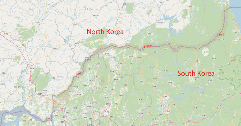
The Korean Demilitarized Zone (Korean: 한반도 비무장 지대) is a heavily militarized strip of land running across the Korean Peninsula near the 38th parallel north. The demilitarized zone (DMZ) is a border barrier that divides the peninsula roughly in half. It was established to serve as a buffer zone between the countries of North Korea and South Korea under the provisions of the Korean Armistice Agreement in 1953, an agreement between North Korea, China, and the United Nations Command.
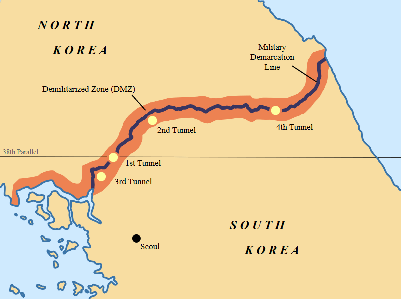
The DMZ is 250 kilometers long and about 4 kilometers wide. There have been various incidents in and around the DMZ, with military and civilian casualties on both sides. Within the DMZ is a meeting point between the two nations, where negotiations take place: the small Joint Security Area (JSA) near the western end of the zone. In April 2024, the JSA was closed due to an incursion by a US serviceman. Another POI, Dorasan Station has not reopened since 2019.
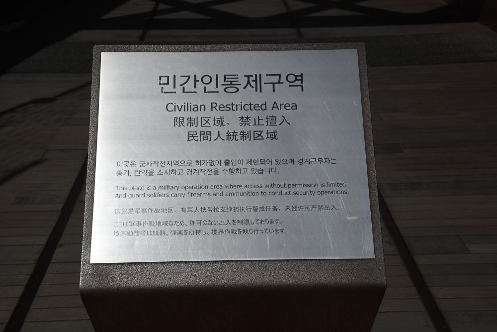
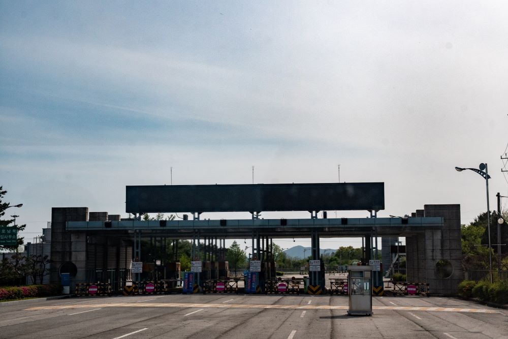
The only way to visit the DMZ is by an organised tour, all of which follow a similar format. Tour participants need to bring their passports and are subject to security checks by South Korean military points at access points through the Civilian Control Line. Most of the tourist and media photos of the “DMZ fence” are actually photos of the CCL fence. The actual DMZ fence on the Southern Limit Line is completely off-limits to everybody except soldiers, and it is illegal to take pictures of the DMZ fence.
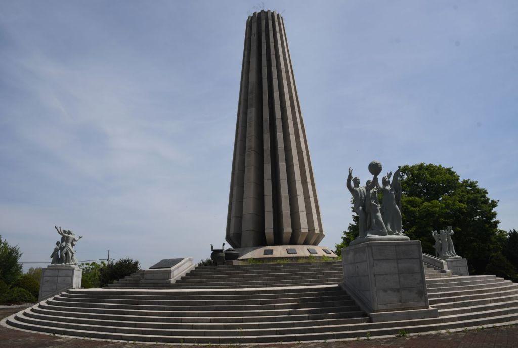
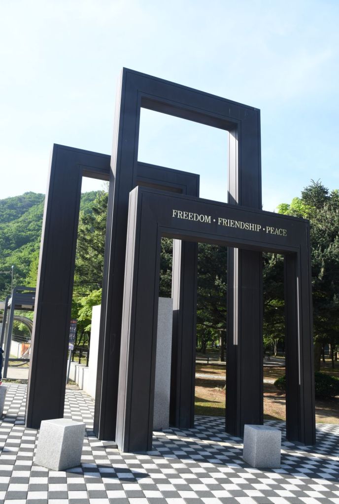
Imjingak Pyeonghwa-Nuri Park
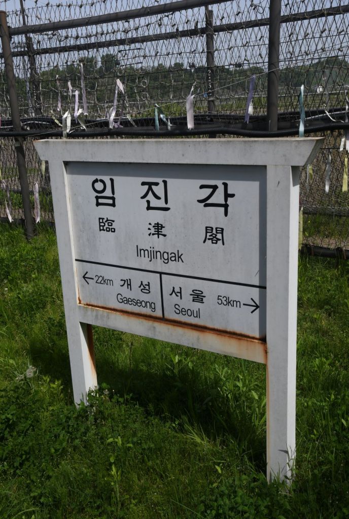
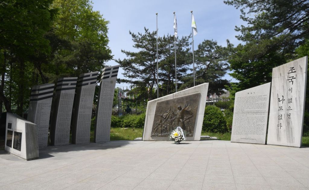
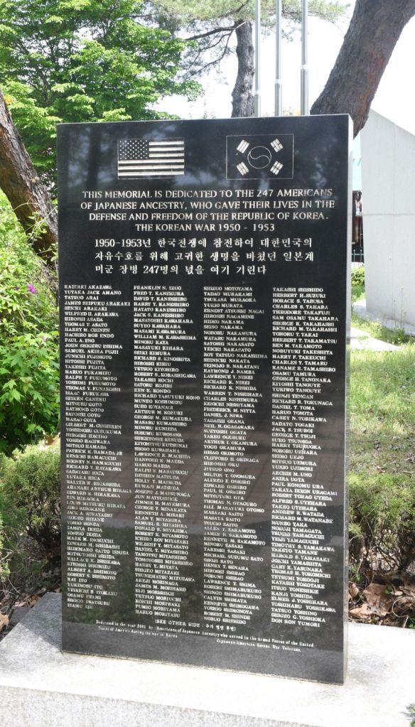
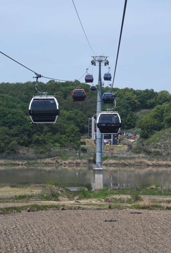
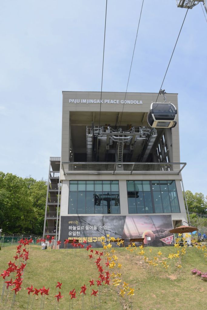
Located approximately 56 kilometers from Seoul and 7 kilometers from DMZ, Imjingak is an important part of Korean history. Imjingak Resort has various war-related artifacts as well as spacious Pyeonghwa Nuri Park. The resort preserves the Freedom Bridge and Imjingang rail bridge from the Korean War to remind people of the past, along with a Memorial Hall, memorial monuments, and recreational areas. It was built in 1972 as a security tourist site with a view to reflecting upon the painful history of national division and showing aspirations to national reunification. One of the main highlights of the park is the Imjingak Observatory, which offers panoramic views of the surrounding area, including the North Korean border. From this vantage point, visitors can see the barbed wire fences, guard towers, and the Bridge of Freedom, which symbolizes the hopes for reunification. It is possible to take a Gondola across the Civilian Control Line to a point 2 km from the border proper.
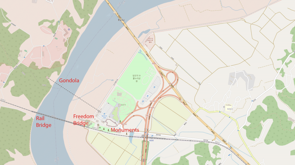
Freedom Bridge
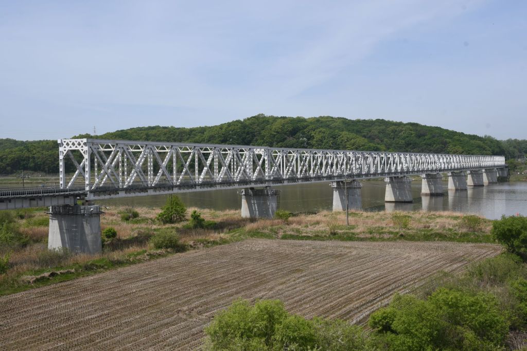
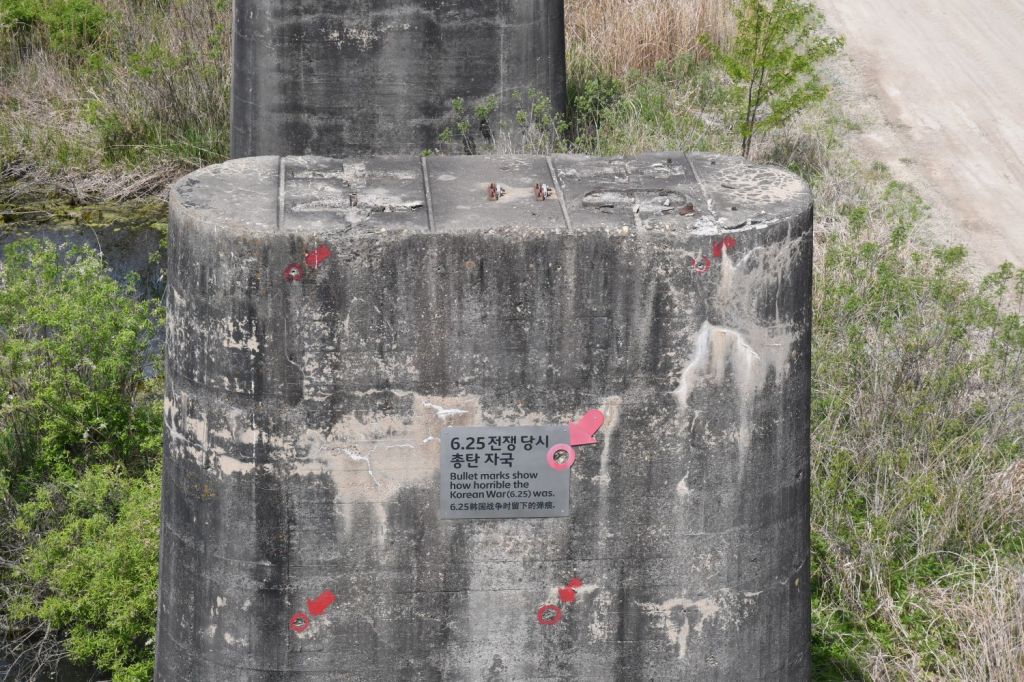
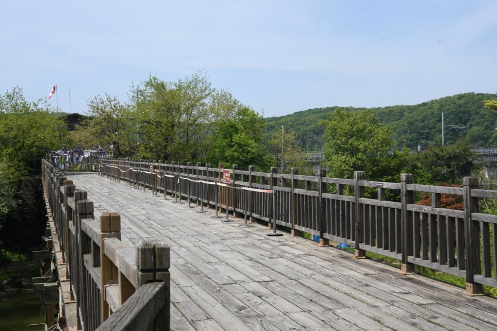
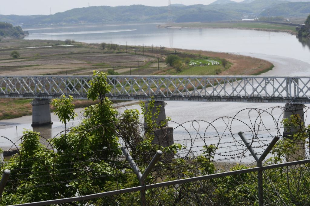
My initial focus was the 2 bridges (one complete, one damaged) across the Imjin River. The former railroad bridge which was used by repatriated POWs/soldiers returning from the North.
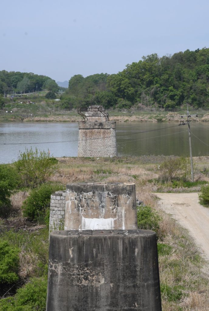
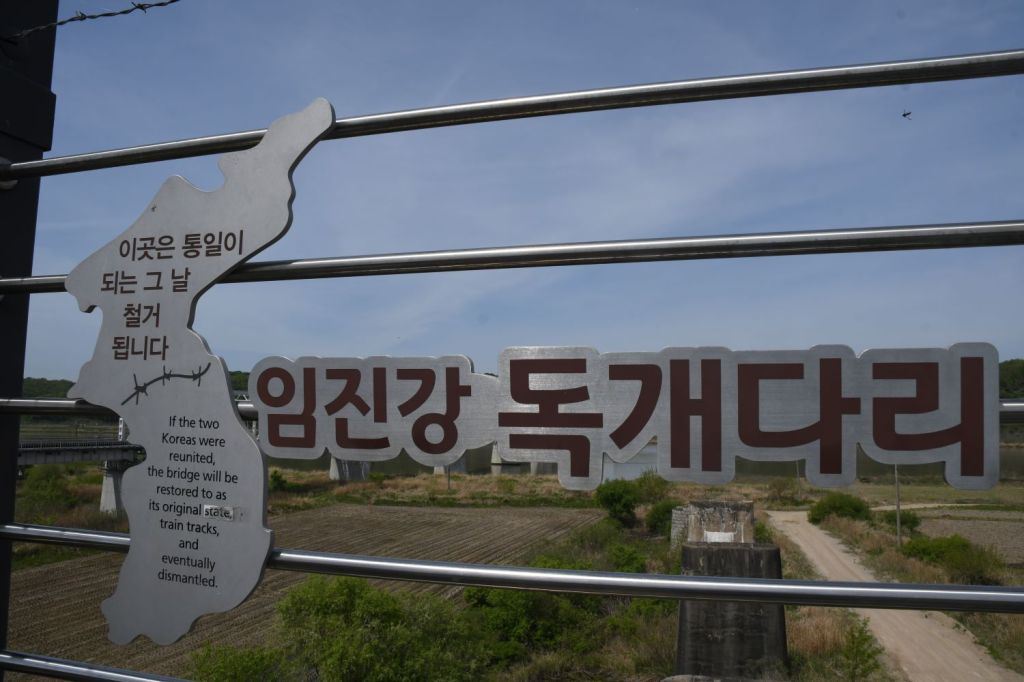
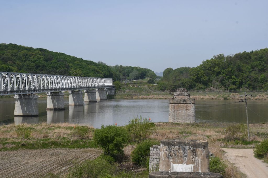
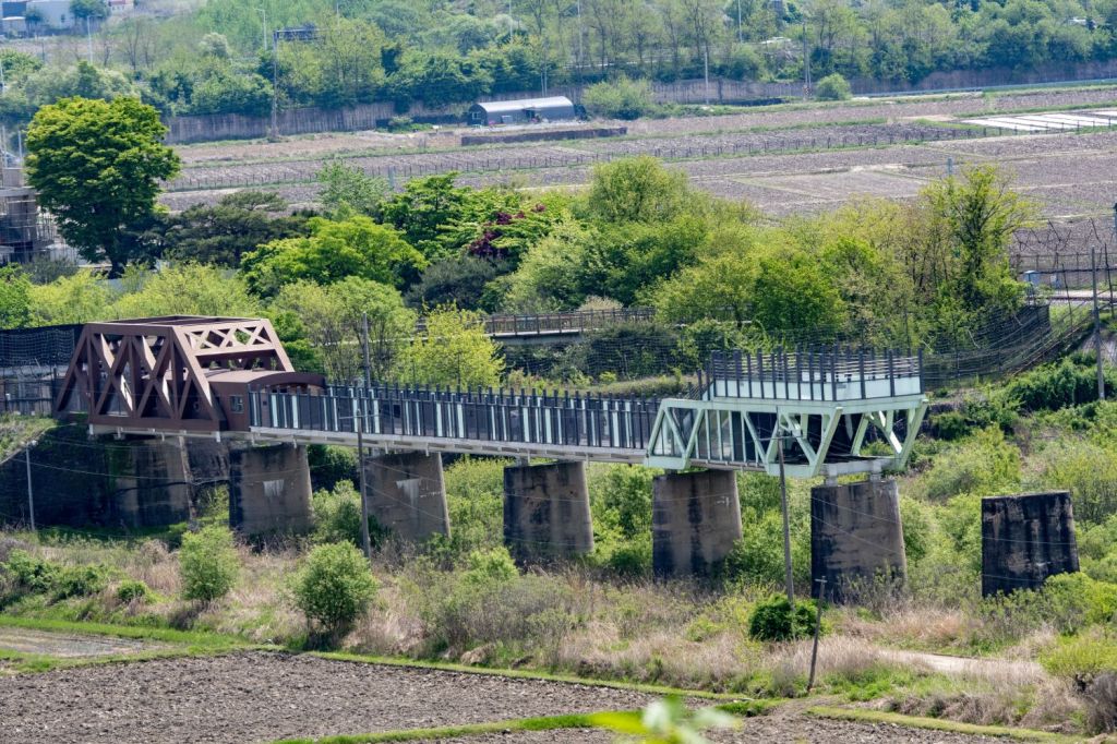
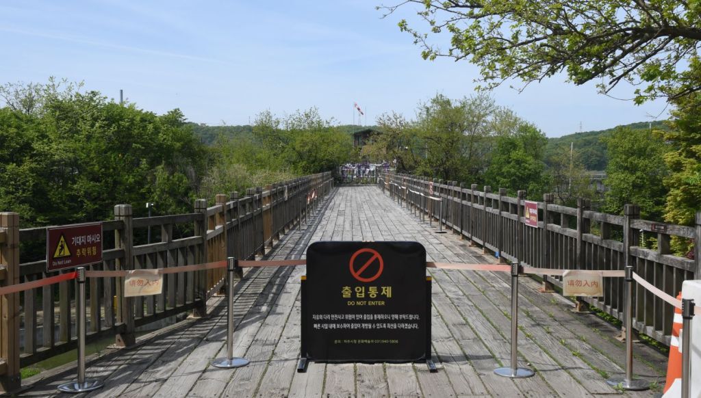
Bridge of Freedom
Originally, the Gyeongui Line Railroad Bridge had two bridges that headed north and south, but they were destroyed via bombing and only the pier remained. Later, the west bridge was restored for the purpose of exchanging prisoners of war, and a temporary bridge was installed at the south end. The Bridge of Freedom, is a 83m temporary wooden bridge which is a symbol of the tragedies of the Korean War, and over which POW’s repatriated from the north literally walked to freedom.
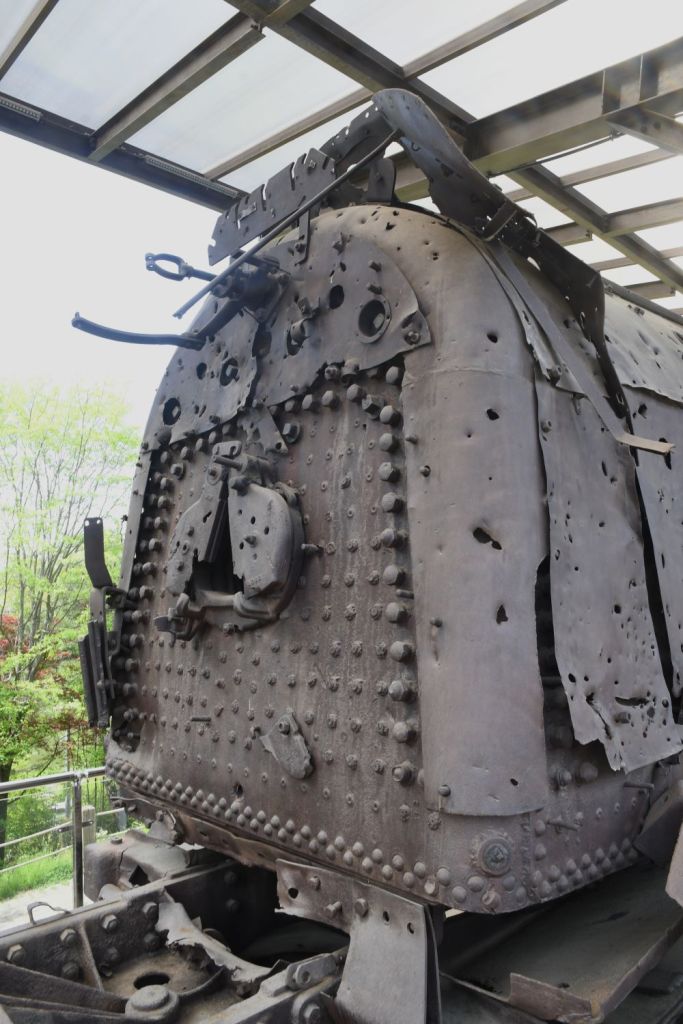
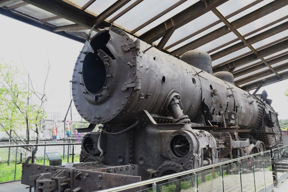
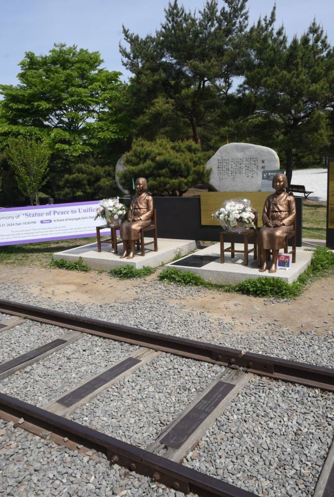
Peace Train
The last train to cross the border between North and South Korea, a military transport delivering supplies to UN forces following MacArthur’s inland push in 1950, became stuck Hanpo Station in Hwanghe-do in what is now North Korea on December 31, 1950 due to Chinese troops ahead. Unable to turn around, the conductor attempted to back the train back down to Munsan but was stopped by US troops who decided that rather than risk the train falling into North Korean hands, were ordered to destroy the train. The locomotive was a KNR Mateo1 Class. In 2004 the rusted locomotive was registered as a Cultural Heritage site and is a visual reminder of the length of time the border has been closed in the hope trains will once again cross freely.

Prayers for unification
At the Freedom Bridge is located there are millions of prayer ribbons tied to the fence which I’m told have messages of hope, dreams and wishes for unification between North and South Korea.
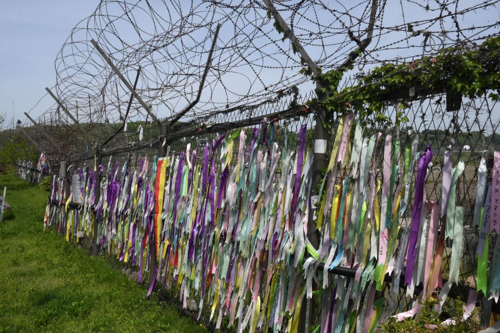
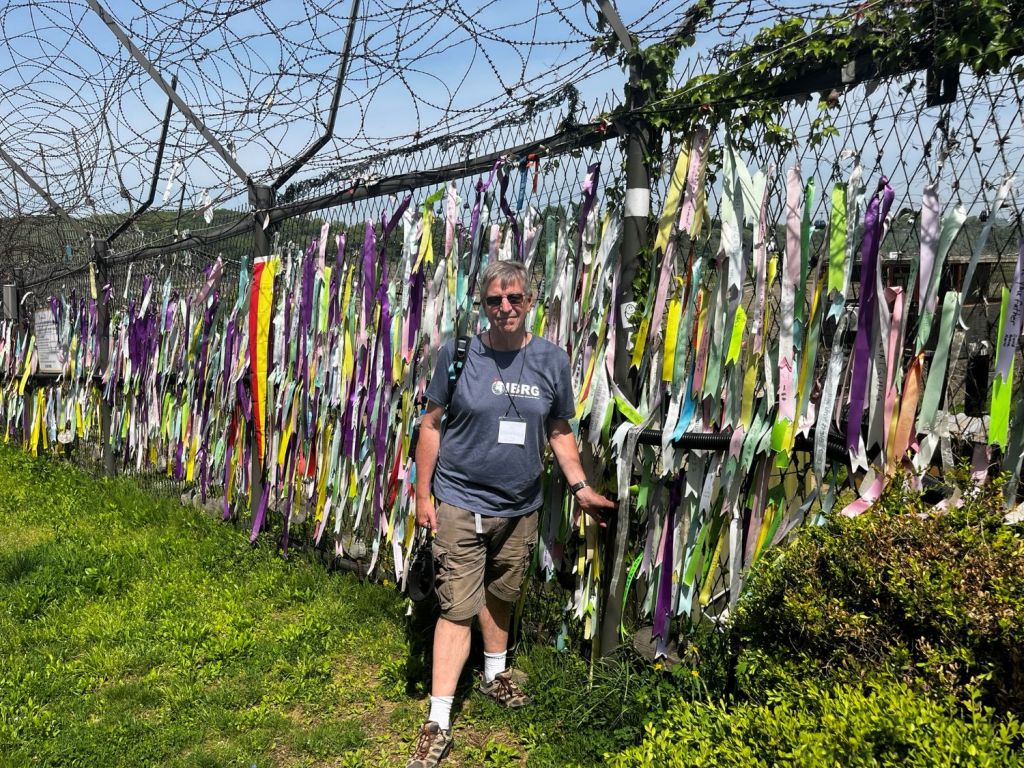
The collection of prayers had a powerful symbolic effect and no one can doubt the desire for reunification amongst the Korean people in the South.
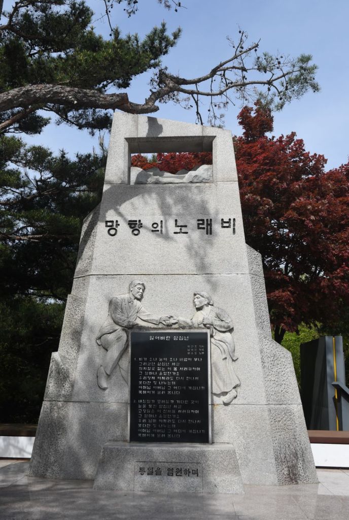
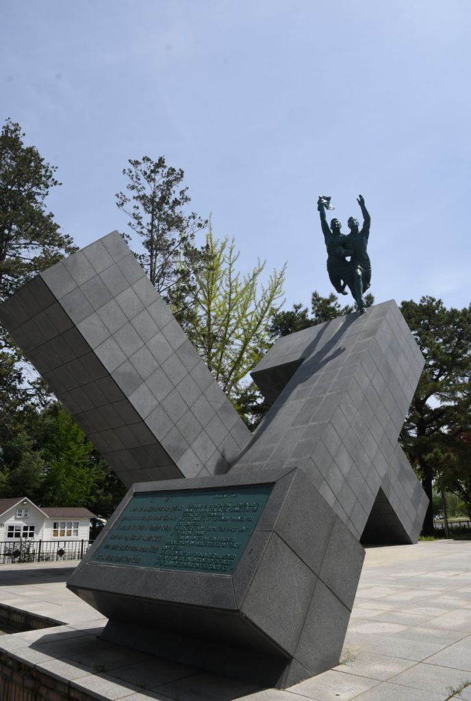
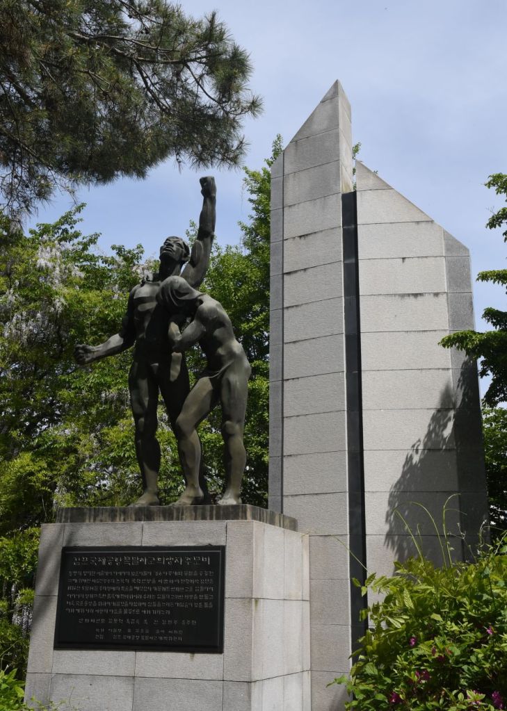
Monuments
Moving away from the bridges along the reinstated and symbolic rail tracks there are several monuments, some of them with a national significance.
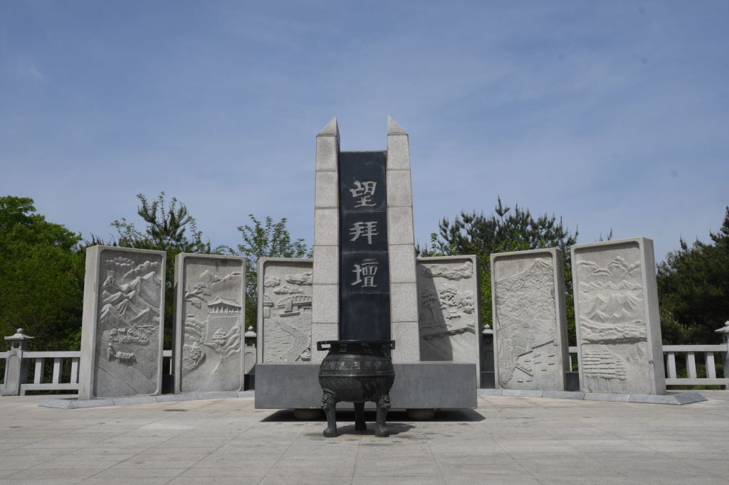
Mangbaeddan is a memorial, which enables displaced people whose hometowns are located within North Korea to bow down to their parents or family in North Korea as a sign of respect during cultural events such as New Years and Chuseok (the Korean Mid Autumn Festival, which usually entails paying respect to your elders and ancestors). This memorial holds many sorrowful memories of separated families during the Korean War.

The Gondola
The peace gondola at Imjingak Park is the world’s only gondola that travels through a Civilian Controlled Zone (CCZ) so this is your chance to ride a cable car through the DMZ. The gondola is 1.7 kms (1.0 mile) long traveling between the Imjingak Station and DMZ Station over the Imjin River.
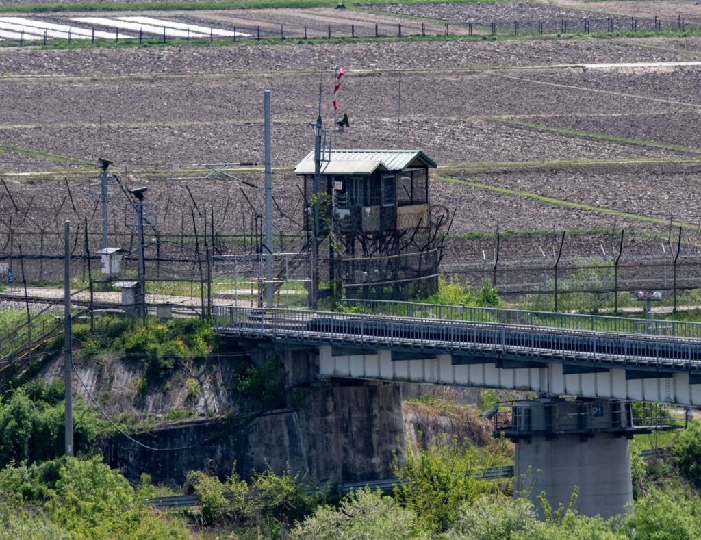
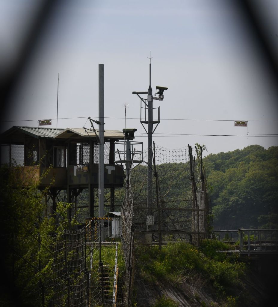
“The border”
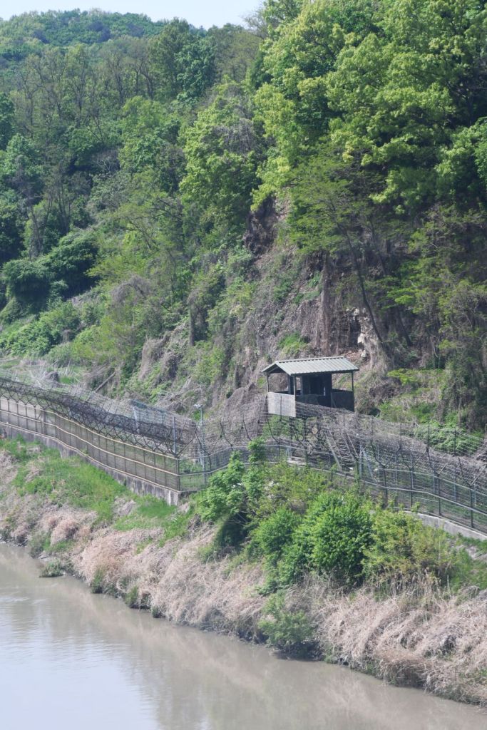
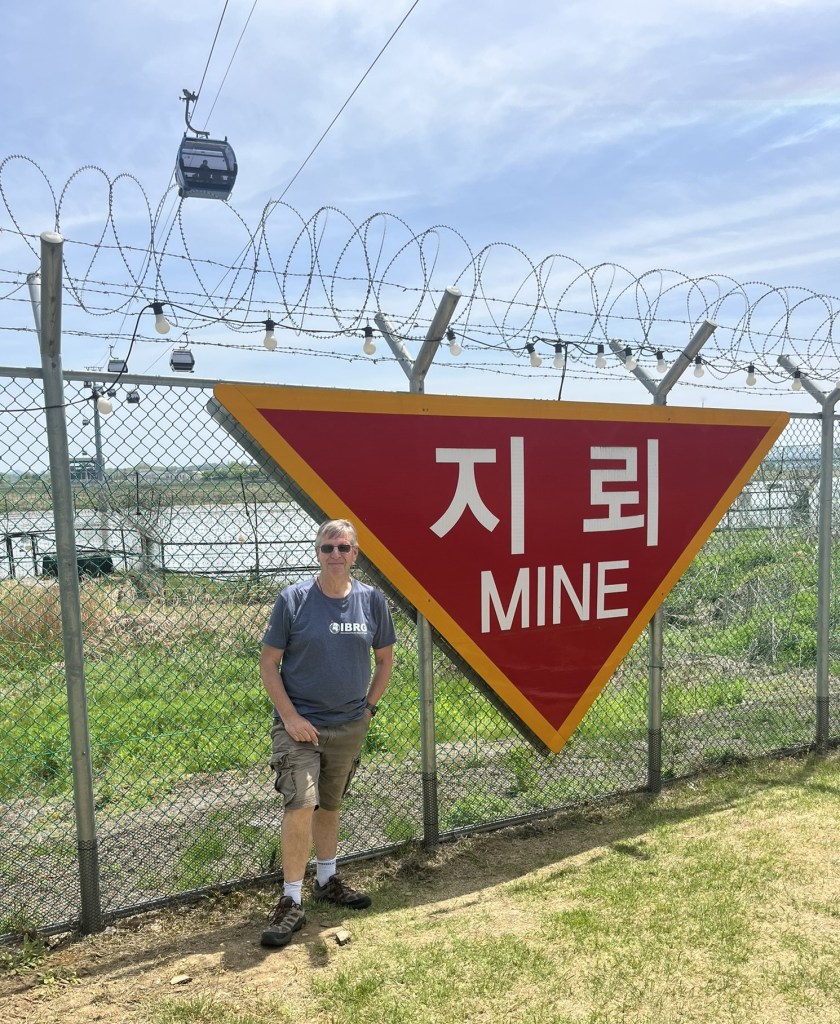
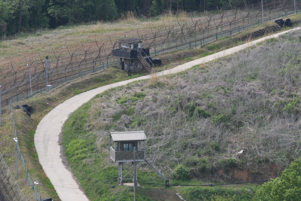
The border between the ROK and the Civilian Control area is dramatic with double fences, watchtowers and barbed wire. Still 2 km from the border with the north this barrier is the one which is most photographed due to access issues.
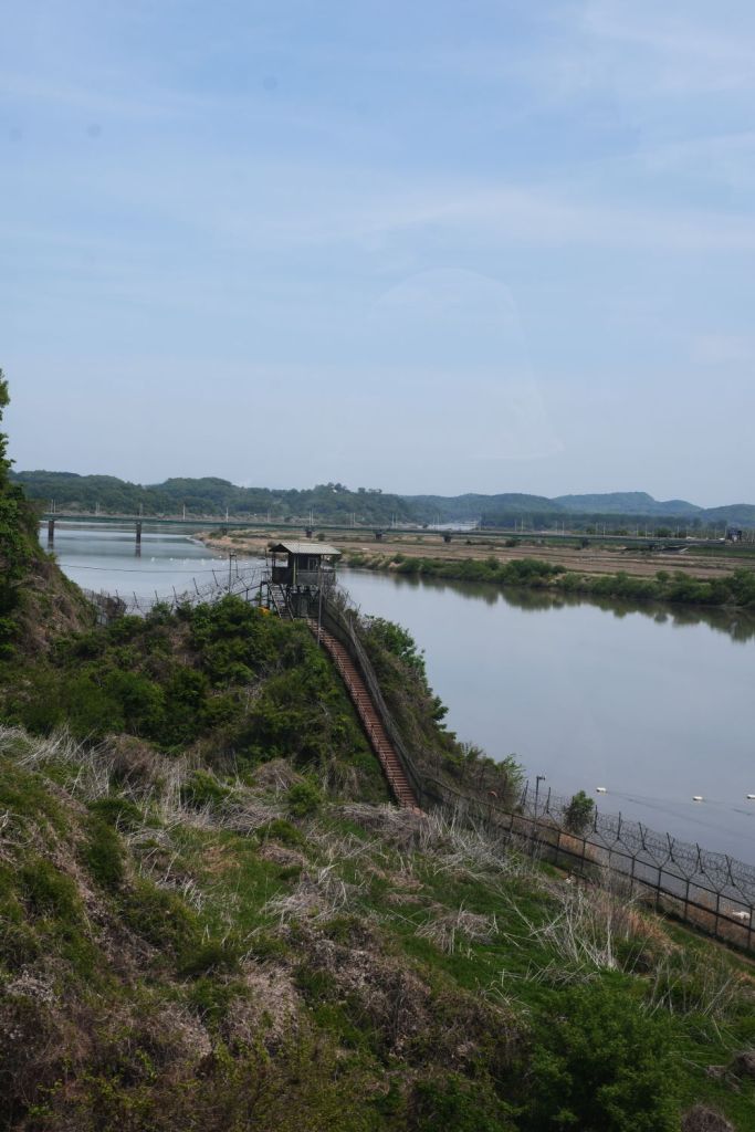
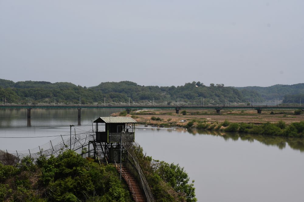
I visited this POI as part of an organised tour, the time on the northern bank is limited and I chose to walk up the hill to the observatory which provides a vantage point to overlook the Imjin River valley.


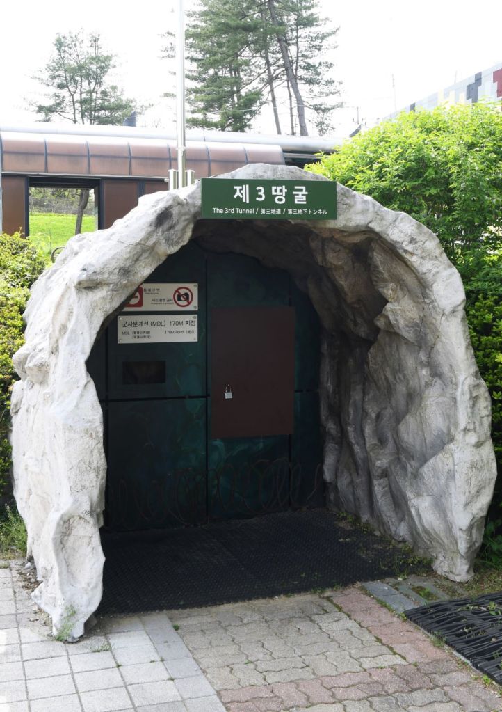
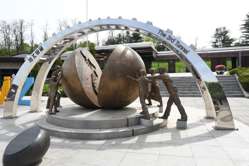
The Third Infiltration Tunnel
The incomplete tunnel was discovered in October 1978. The incomplete tunnel is 1,635 metres long, 1.95 m at its maximum height and 2.1 m wide. It runs through bedrock at a depth of about 73 m below ground. It was apparently designed for a surprise attack on Seoul from North Korea, and could, according to visitor information in the tunnel, accommodate 30,000 men per hour along with light weaponry. The tunnel is now a tourist attraction and the area around its entrance has several sculptures. It is not possible to take any photos in the tunnel and cameras need to be deposited in lockers at the entrance. Visitors enter either by walking down a long steep incline that starts in a lobby with a gift shop or via a rubber-tyred train that contains a driver at the front or the back (depending on the direction as there is only one set of rails) and padded seats facing forward and backwards in rows for up to three passengers each. The South Koreans have blocked the actual Military Demarcation Line in the tunnel with three concrete barricades. Tourists can walk as far as the third barricade, and the second barricade is visible through a small window in the third. There are many model displays of the tunnel and other areas of the DMZ.

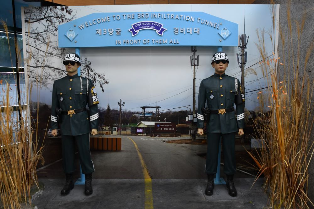

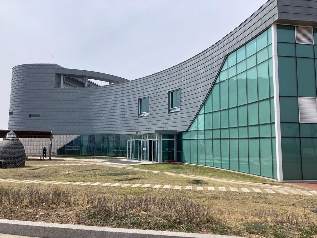
The Joint Services Area Model (JSA)
Panmunjeom is the site of the Armistice Agreement that signaled the ceasefire of the Korean War (1950-1953) and is located in the Demilitarized Zone (DMZ), just 50 kilometers north of Seoul. It remains a venue for talks between South Korea and North Korea, allowing visitors to observe North Korean troops up close. It is a highlight of any trip to the DMZ. Sadly in April 2024 no tours were allowed due to a US soldier Travis King crossed the border without permission, this was as close as I got, no entering North Korea via the huts for me this time. He was returned to US authorities.

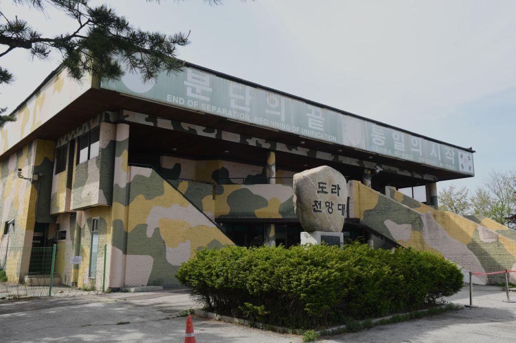
Dora Observatory
Dora Observatory is on the South Korean side of the 38th parallel. Situated on top of Dorasan (Mount Dora) in Paju, the observatory provides scenic views across the Demilitarized Zone. Visitors can see the North Korean territory through binoculars from the 304 square feet, 500-person capacity observatory. They are able to see the North Korean propaganda village situated in the DMZ, and can also see the city of Kaesong. As the JSA was out of bounds this was the closest possible point to the border proper being only 1.6km away. Reading reviews sometimes it is not possible to see very much due to cloud and mist. On my visit there was strong sun and haze. It was however possible to see North Korean citizens on the fields as well as the competing flags and well as several North Korean settlements. For border enthusiasts this was the most exciting part of the day.
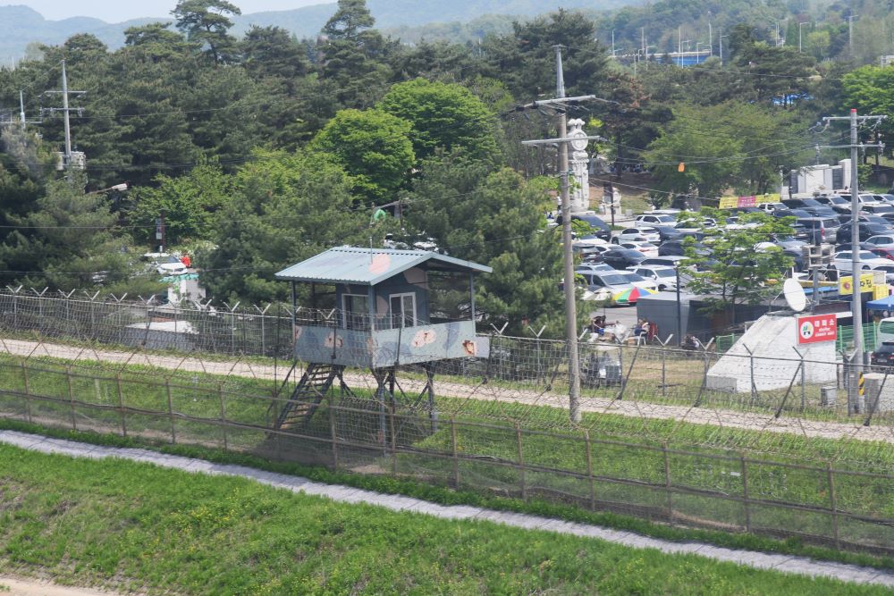
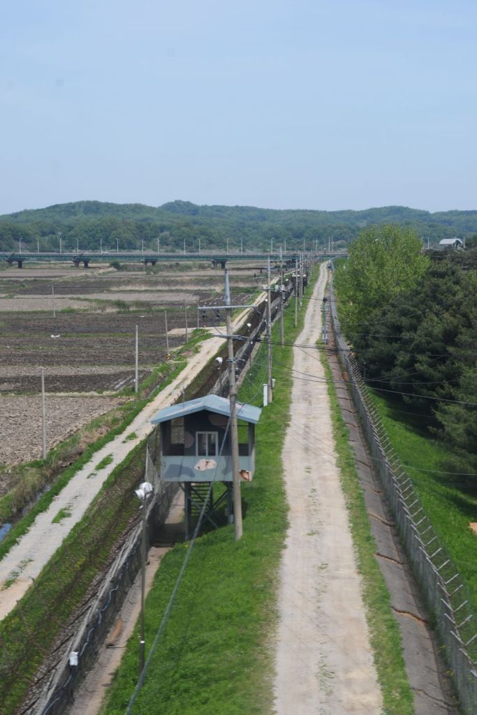
“The Border” – again.
Being close to the actual border there were several fences and security facilities that were nearby.


The Flags
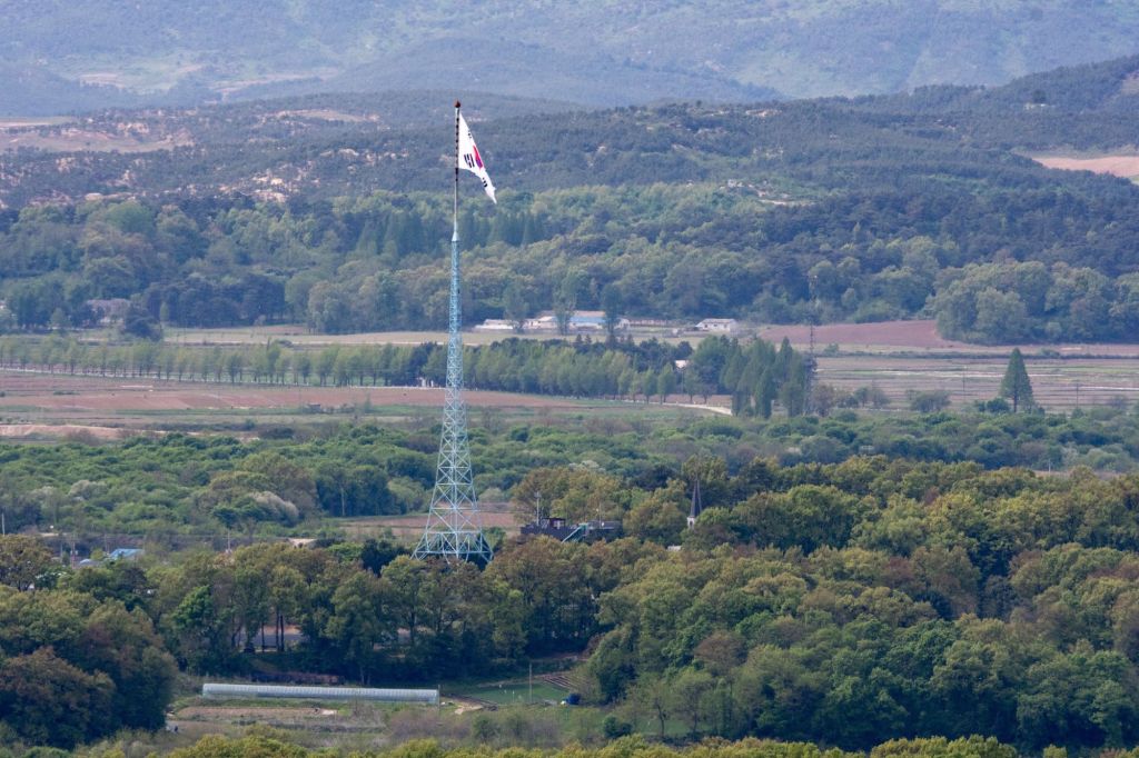
In the 1980s, the South Korean government built a 100 m flagpole in Daeseong-dong, which flies a South Korean flag weighing 130 kilograms . In what some have called the “flagpole war”, the North Korean government responded by building the 160 m Panmunjeom flagpole in Kijŏng-dong, only 1.2 km west of the border with South Korea. It flies a 270 kg flag of North Korea. Daeseong-dong is a village in South Korea close to the North Korean border. Daeseong-dong is only 1.6 km from Kijong-dong, a village in North Korea’s portion of the DMZ. Here Korea’s division is starkly apparent: rival national flags can be seen on gigantic flagpoles that have been erected in the two villages.
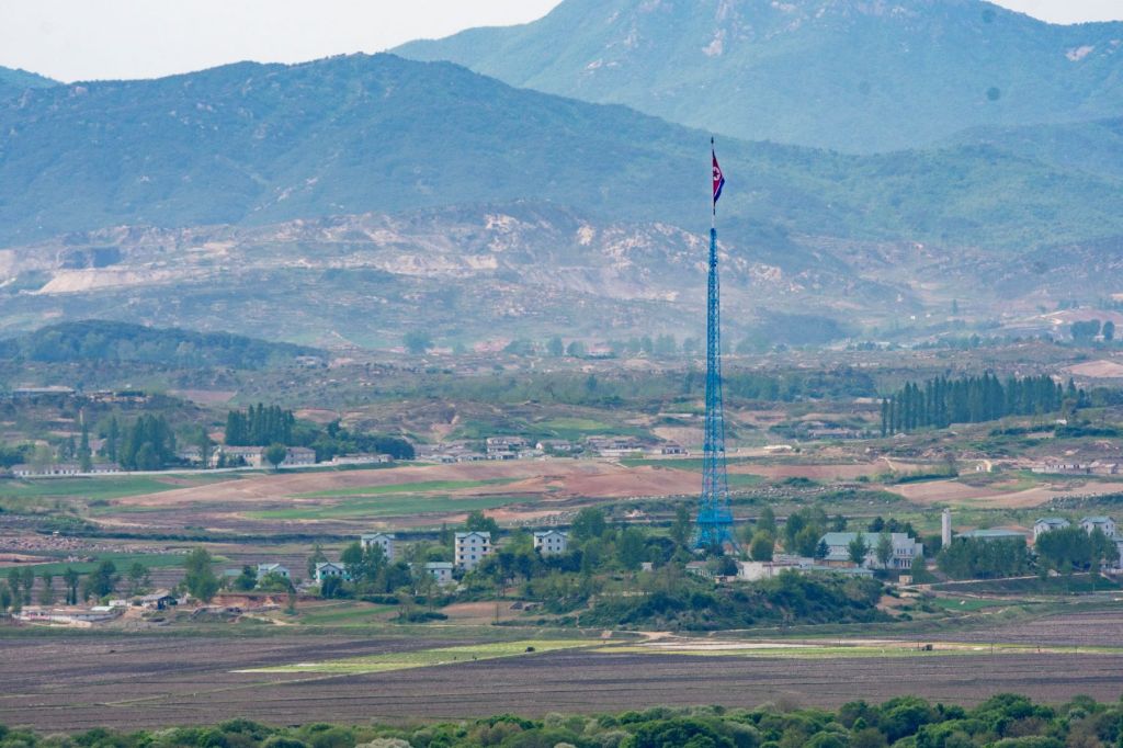
Kijŏng-dong known in North Korea as Peace Village is known as a Propaganda Village elsewhere. The North Korean government says the village contains a 200-family collective farm, serviced by a child care center, kindergarten, primary and secondary schools, and a hospital. The village features a number of brightly painted, poured-concrete multi-story buildings and apartments, many apparently wired for electricity. The town was oriented so that the bright blue roofs and white sides of the buildings next to the massive DPRK flag would be the most distinguishing features when viewed from across the border. Scrutiny with modern telescopic lenses, however, has led to the conclusion that the buildings are concrete shells lacking window glass or even interior rooms, with building lights turned on and off at set times and empty sidewalks swept by caretakers in an effort to preserve the illusion of activity.
Images of North Korea
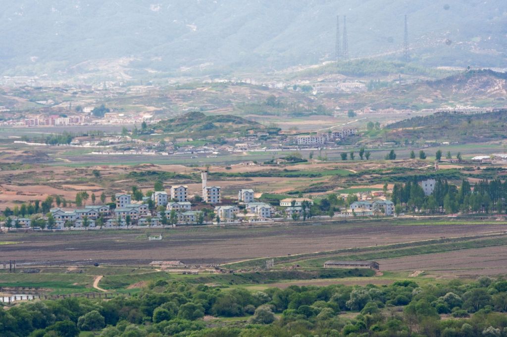
There was strong sunshine and haze on the day of my visit which made identifying details difficult. There are however many North Korean citizens in this photo. The border is marked by the river in the foreground.

The watchtower in the foreground is the last South Korean watchtower before the border. The dark green line at the same level of the tower marks the northern bank of the river which marks the border. In the background is the city of Kaesong.

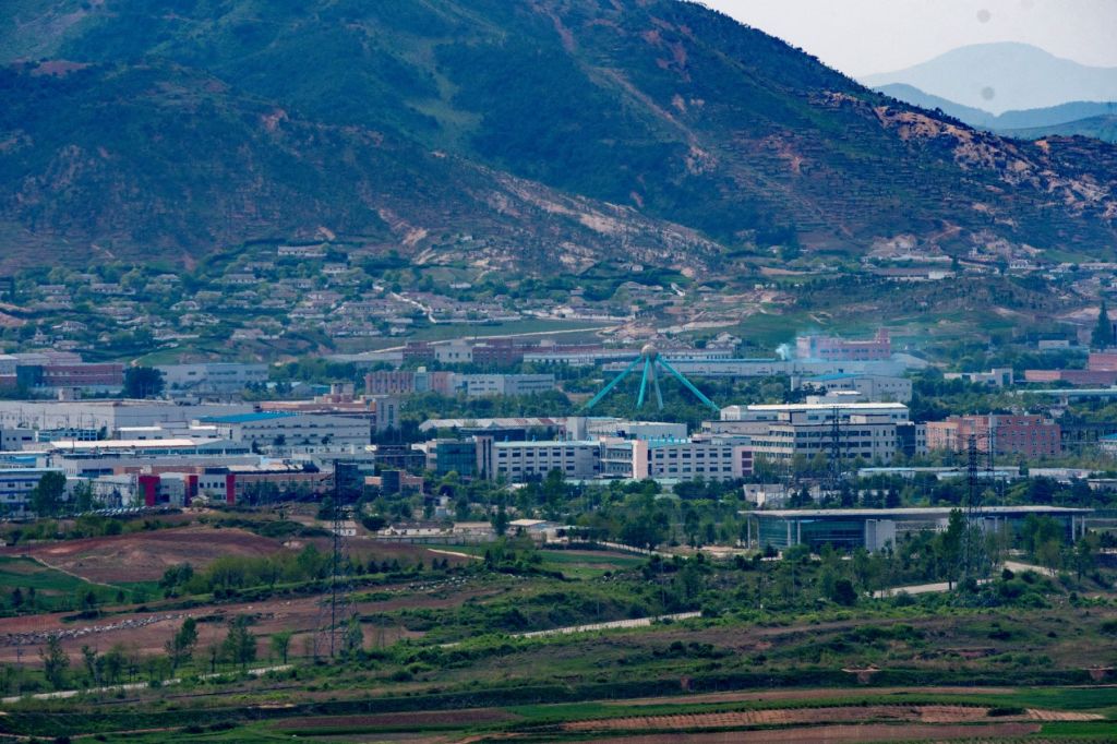
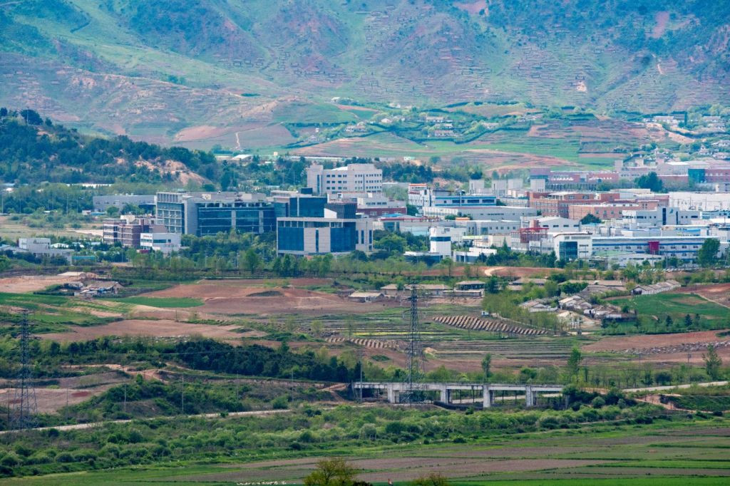
The Kaesŏng Industrial Region is a special administrative industrial region of North Korea which operated from 2004 to 2016 as a collaborative economic development with South Korea (ROK). The park is located ten kilometres north of the Korean Demilitarized Zone, an hour’s drive from Seoul, with direct road and rail access to South Korea. The park allows South Korean companies to employ cheap labour that is educated, skilled, and fluent in Korean, whilst providing North Korea with an important source of foreign currency.
In April 2013, 123 South Korean companies were employing approximately 53,000 DPRK workers and 800 ROK staff. On 10 February 2016, the South Korean Ministry of Unification announced that the industrial park would be “temporarily” closed down and all staff recalled, partly in protest over continued North Korean provocations, including a satellite launch and a claimed hydrogen bomb test in January 2016
The next day, the North announced it was expelling all South Korean workers and said it will freeze all South Korean assets and equipment at the jointly run factory park. All 280 South Korean workers present at Kaesŏng left hours after the announcement by the North. It has not reopened.
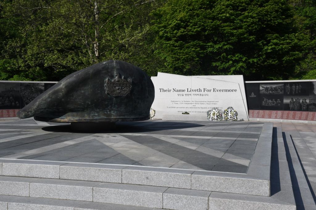
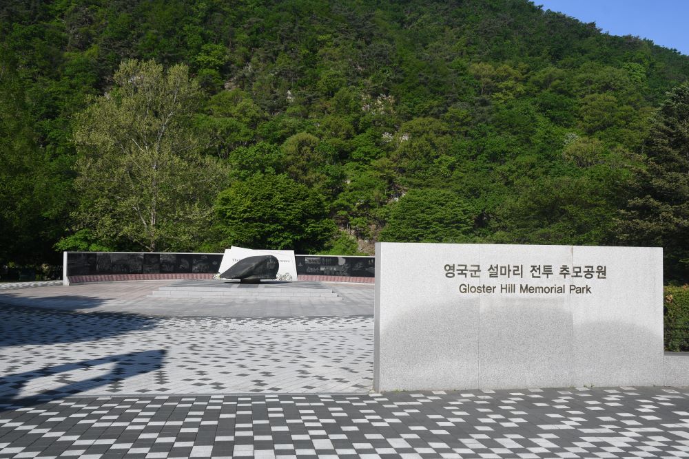
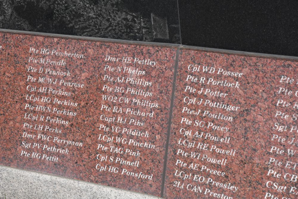
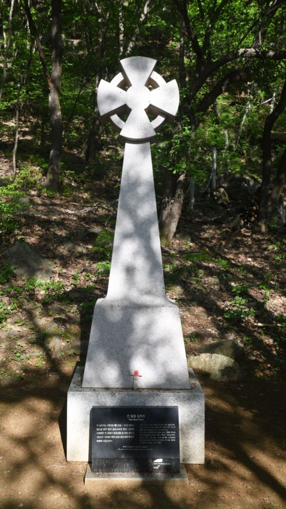
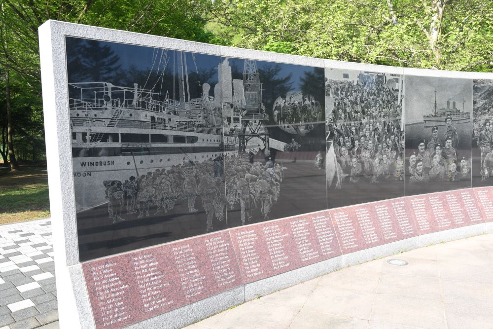
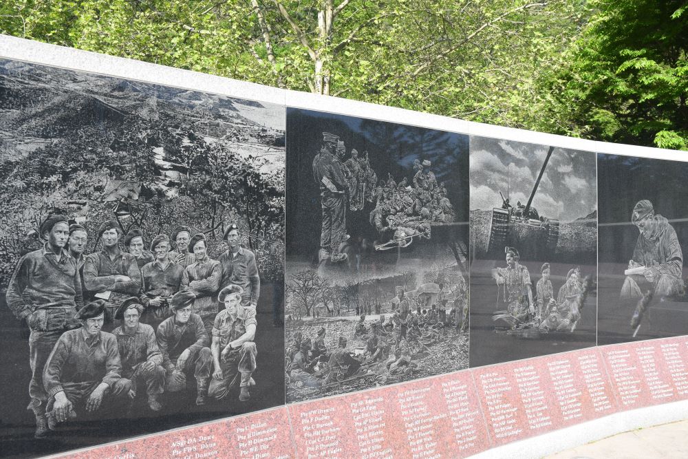
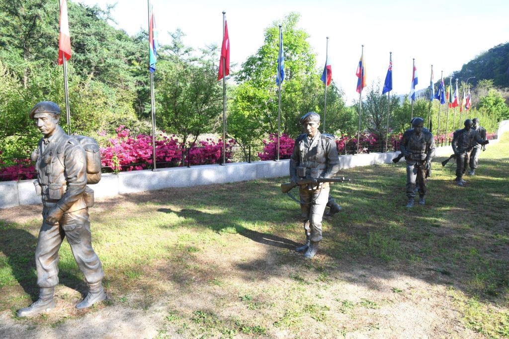
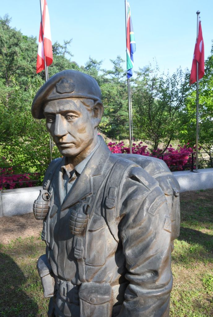
Gloucester Hill Battle Monument
I was really looking forward to visiting this memorial being a history geek. The Gloucester Hill Battle Monument is a memorial in South Korea that commemorates the actions of the Gloucestershire Regiment and C Troop, 170th Mortar Battery, Royal Artillery, of the British Army during the Battle of the Imjin River in 1951. This battle remains as the bloodiest battle fought by the British Forces since World War II.
Between April 22-25, 1951, the British courageously fought against the opposing Chinese forces. The 1st Battalion of the Gloucestershire Regiment held off the Chinese Spring Offensive 35 miles from the South Korean capital Seoul. With only 650 soldiers, supported by Royal Artillery and a Belgian contingent, the 1st Battalion halted the invading Chinese force of 27,000 against overwhelming odds for 3 days. The Gloucestershire Regiment inflicted an estimated 10,000 Chinese casualties. Only 40 men from 650 escaped the hill.
By the time it was all over, casualties included 141 British soldiers killed and 1,169 wounded, missing or captured.
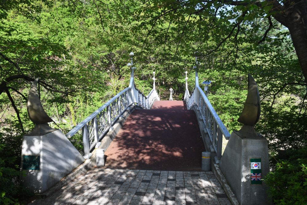

Gamaksan Chulleong Bridge
This new suspension bridge opened in Paju in March 2018. The bridge which is over 220m long and 10m high is was the longest suspension bridge in South Korea until the building of the Wonju Suspension Bridge. The suspension bridge is accessible to get to with a short uphill walk to the start. Also, do check out the stunning scenery including the wooden broad walk along the beautiful lake.
The official name of the bridge is “Gloucester Heroes Bridge” and is dedicated to the 1st Battalion Gloucester Regiment of the British Army who fought in the Korean War.
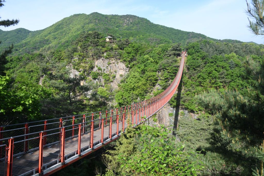
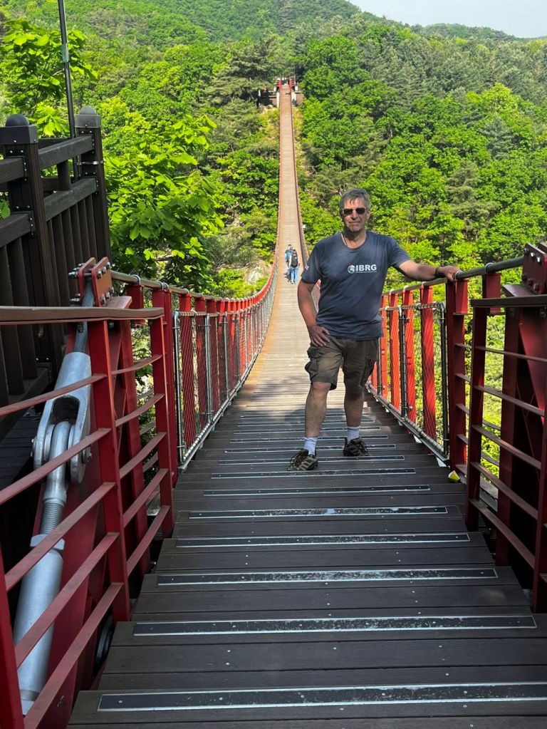
Only a short distance from the memorial park. The bridge is located in a popular hiking area. . Gamaksan is close to the ceasefire line so, once you climb up to the peak, you will be able to see the Imjingang River and Songaksan Mountain in Gaesong.
If you have enough time the trail goes on, firstly the top of a waterfall and then to an observation point.
Unification Village
The final stop on the tour was simply a shopping stop. I bought border related paraphnalia: DMZ branded mug, tee shirt, fridge magnet and hat.
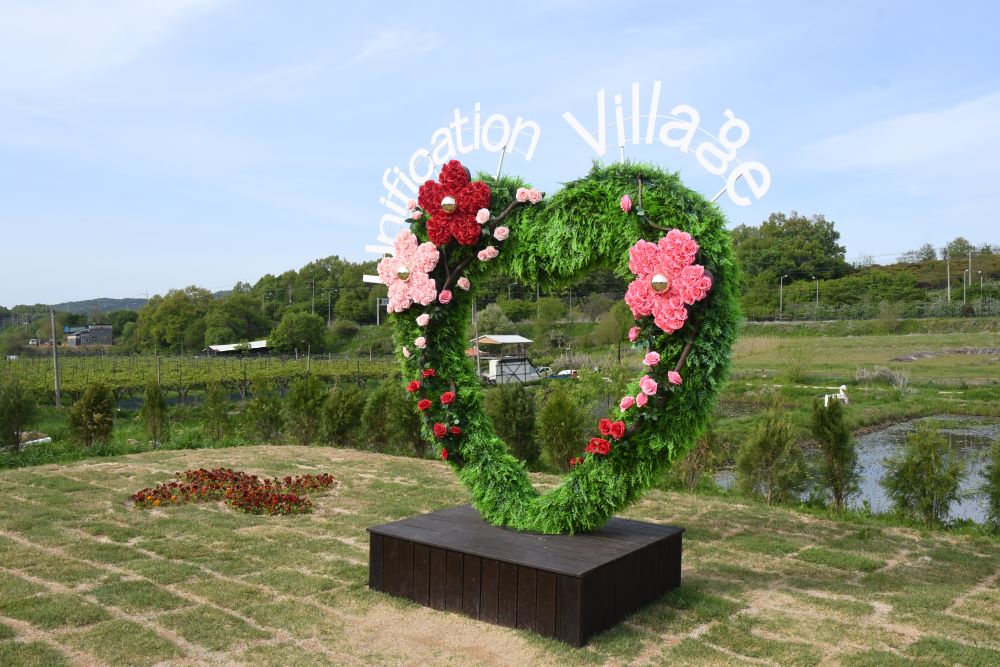
Tongilchon-gil aka the Unification Village is a small farming community that specialised in creating soybean milk, traditional soy sauce and corn goods. It was a short stop so little opportunity to see much more than the shop.
The end to a long day. I saw as much of the border as is allowed currently.

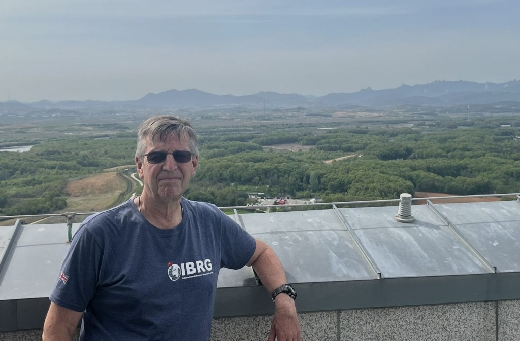
Date of Visit: 28 April 2024

What a great, comprehensive report this is !!Congrats ! So impressive !
LikeLiked by 1 person