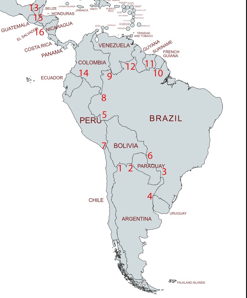
A tripoint, is a geographical point at which the boundaries of three countries meet. These can be on land (dry) or demarcated by rivers or lakes (wet). Tripoints can be easy to access or isolated, they can be marked with large monuments or not easily identifiable at all. There are 16 tripoints in Central and South America. There are no international tripoints in North America.
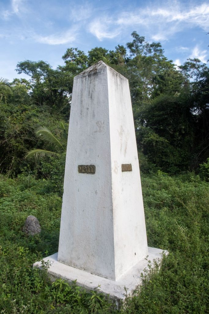
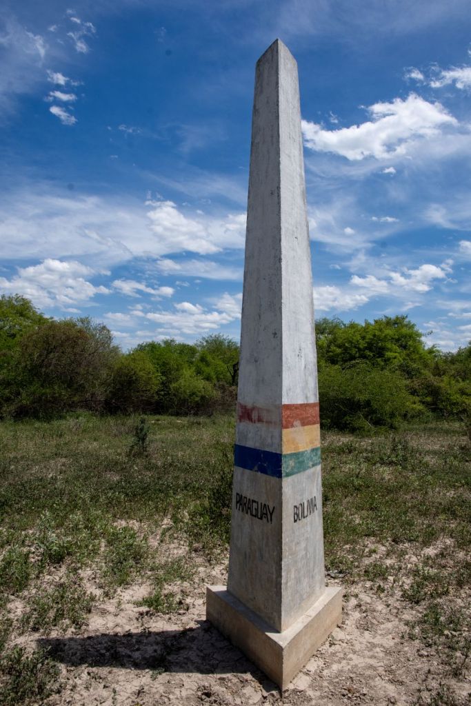
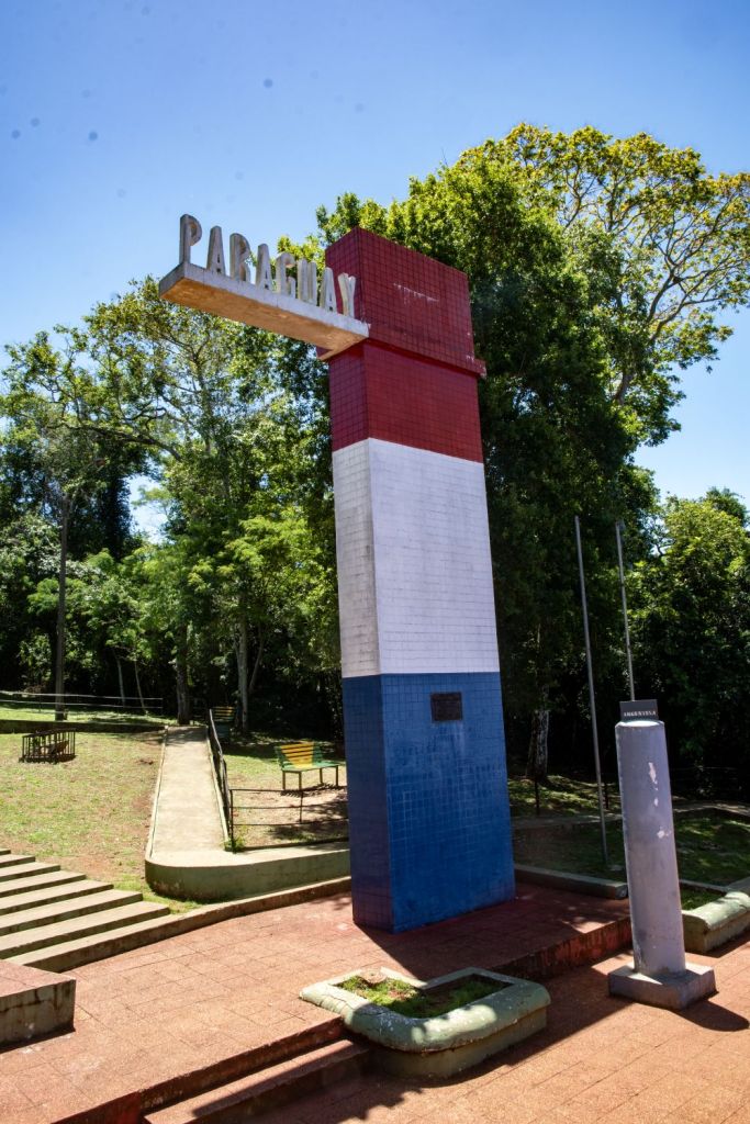
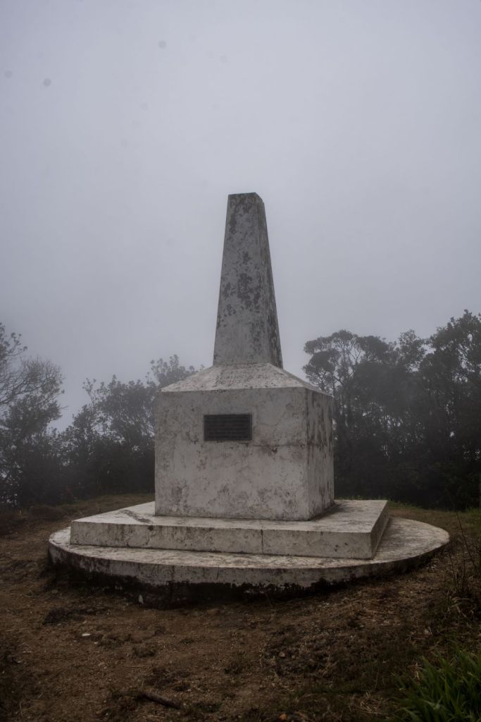
Example of a Dry tripoint
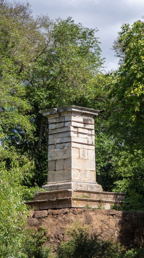
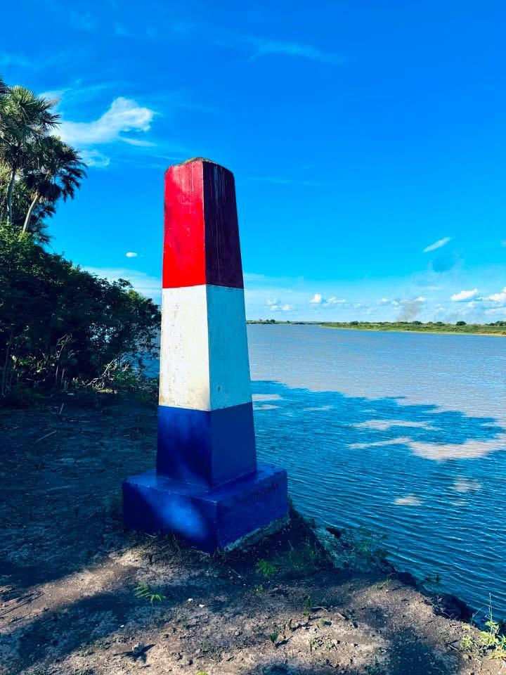
Example of a Wet tripoint
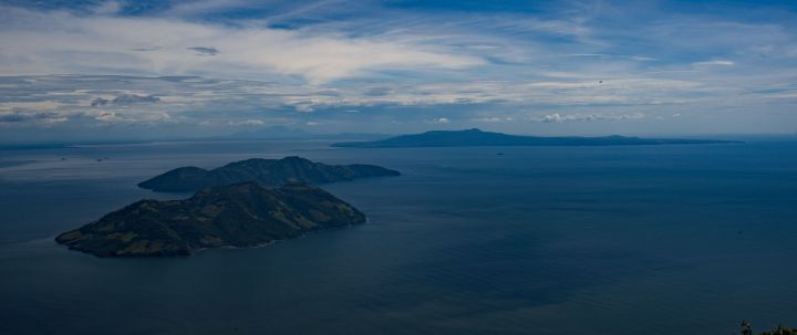
Table: Americas Tripoints
| Number | Name | Countries | Coordinates | Type | Links/Notes |
| 1 | ARBOCL | Argentina – Boliva – Chile | 22°48′30″S 67°10′40″W | Dry | The tripoint is located on the summit of the Zapaleri extinct volcano (5600m). Marked with a metal monument indicating the 3 countries. The Bolivian Instituto Geográfico Militar installed a triangulation station marker and an associated reference marker in 1965, and the Chilean Instituto Geográfico Militar installed a triangulation station marker in 1970. |
| 2 | ARBOPY | Argentina – Boliva – Paraguay | 22°14′S 62°39′W | Dry | Marked by a concrete pillar, at the edge of the Pilcomayo River on alluvial deposits. Names and flags of respective countries. Hito Esmeralda refers to BM #1 BO/PY. 2650m distant. |
| 3 | ARBRPY | Argentina – Brazil – Paraguay | 25°35′33″S 54°35′37″W | Wet | 3 Fronteiras is where the where the Iguazú and Paraná rivers converge. A new bridge across the Paraná river has been bult just north of the tripoint. |
| 4 | ARBRUY | Argentina – Brazil – Uruguay | 30°12′S 57°39′W | Wet | Disputed with the ownership of Brasilera Island contested between Brazil and Uruguay. 2 monuments, one on BR mainland and one on the island close to the TP. Southernmost tripoint in the world |
| 5 | BOBRPE | Boliva – Brazil – Peru | 10°56′27″S 69°34′1″W | Wet | At the confluence of the Acre and Yaberija rivers. |
| 6 | BOBRPY | Boliva – Brazil – Paraguay | 20°10′S 58°10′W | Wet | At the confluence of the Negro and Paraguay rivers. |
| 7 | BOCLPE | Boliva – Chile – Peru | 17°30′S 69°29′W | Dry | Tripartito The Bolivia–Chile–Peru tripoint lies in the Ancomarca Plateau near the village of Visviri (CL) and Charaña (BO). Marked with a concrete monument. |
| 8 | BRCOPE | Brazil – Colombia – Peru | 04°13′00″S 69°56′00″W | Wet | Tres Fronteras is a in the upper Amazon river. Tabatinga (BR), Leticia (CO), and Santa Rosa de Yavari (PE) on an island in the Amazon River are the closest towns. |
| 9 | BRCOVE | Brazil – Colombia – Venezuela | 1°14′N 66°51′W | Wet | The tripoint is located between the Rock of Cocuy situated on east bank & San Jose island situated near west bank. |
| 10 | BRFRSR | Brazil – French Guiana – Suriname | 2°20′N 54°33′W | Wet | Disputed. There has been a history of conflict over which tributary of the Lawa River the boundary follows to the tripoint with Brazil. The Netherlands, and now Suriname, contends that the boundary follows the Marowini River to the east, while France asserts that the border follows the Litani River and Coulé-Coulé Creek to the west. Currently being negotiated by the bilateral boundary commission |
| 11 | BRGYSR | Brazil – Guyana – Suriname | 1°57′N 56°29′W | Wet | Disputed. Guyana became independent with its borders unresolved. The issue stems from competing claims about where the source of the Courantyne river which was to be the border between GYSR. It was either the Kutari River (1840) or the New River or Upper Courantyne (1871), This led to the New River triangle dispute. Currently GY has de facto control over the area. |
| 12 | BRGYVE | Brazil – Guyana – Venezuela | 5°12′N 60°44′W | Dry | Monte Roraima (2734m) A white monument with the names of the 3 countries, accessible only from VE. |
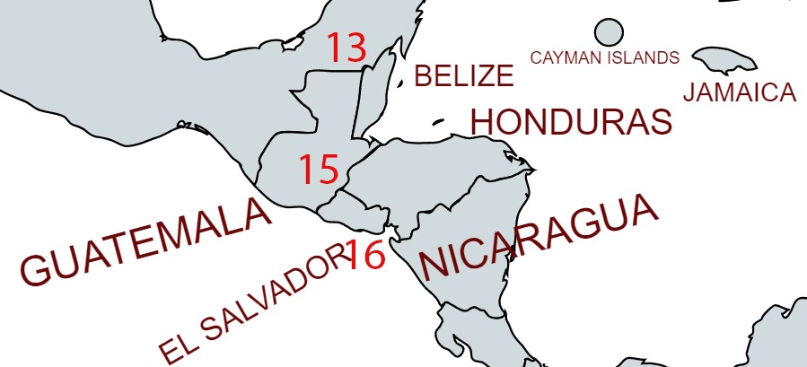
| 13 | BZGTMX | Belize – Guatemala – Mexico | 17°48′56″N 89°9′7″W | Dry | Tripoint is situated at the Aguas Turbias monument. BZGT (2002) surveying of the border has led to no change. |
| 14 | COECPE | Colombia – Ecuador – Peru | 0°7′S 75°15′W | Wet | The tripoint is at the confluence of the Guepi and Putumayo rivers. |
| 15 | GTHNSV | El Salvador – Guatemala – Honduras | 14°25′18″N 89°21′2″W | Dry | Cerro Montecristo (2418m). Westernmost tripoint in the world |
| 16 | HNNISV | El Salvador – Honduras – Nicaragua | 13°07’30″N 87°33’01″W | Wet | Golfo de Fonsca is jointly shared by the 3 countries. It is a historic bay with the characteristics of an enclosed sea, with a strip of territorial waters for each State and the remainder in the central part as condominium waters. The Gulf is divided into: 1) Territorial waters of each coastal State up to 3 miles from its continental coast. 2) Condominium waters (Joint Maritime Zone), formed as residues of the non-territorial body of water in the Gulf of Fonseca. Isla Conejo is contested between HNNI. |
Supplementary information including treaties and maps Details here or click on the image above.
Map of the Americas Tripoints
Central American Tripoints
Tripoint Visit Classes
The table below attempts to classify a tripoint visit into a number of classes. Could you touch the actual spot where the countries join? If so that is a Class A, a visit to a wet tripoint is almost always a Class C. Some monuments such as ARBOPY the tripoint between Argentina – Bolivia and Paraguay are too large or tall to touch the stone on the top, hence a Class B. Not everyone uses this classification and it is offered here as a bit of fun to stimulate discussion.
| Tripoint VISIT Classes | |
|---|---|
| Class A | Touched |
| Class B | Basically there. Successful attempt to reach wet tripoint by wading, swimming or canoeing. Very close to a dry tripoint but unable to touch due to a physical barrier/obstacle. |
| Class C | Within 500m, visible |
| Class D | Distant. visible |
| Class E | Tripoint area visited but Tripoint not observed. |
| Source: Acroorca (2002) Published on Boundarypoint 12/07/2003. Edited Arnold (2024) |
My Tripoint Gallery (7 out of 16 visited so far)
The International Standard for country codes and codes for their subdivisions is ISO 3166 this allocates a 2 letter designation to each country. When identifying a tripoint it is necessary to collate the 3 country codes in alphabetical order, hence the tripoint between Argentina – Boliva – Chile becomes ARBOCL. The USA and Canada often use 2 letters to denote states and provinces e.g. Alabama AL which is technically incorrect as all sub national territories according to ISO 3166 should have the initial 2 letter country designation followed by up to 3 further letters. Alabama ought therefore be US- AL. Delaware has the same 2 letter code as Germany: DE which has the potential for confusion.
Please click on the photos below to access the reports of my visits, or the red highlighted text above.
Tripoints 1-8
Tripoints 9-16
Site Navigation
In order to find your way around the site, either click on the links (text in red) or use the menus at the top of the page. About leads you to the country pages, with links to individual borders. The about menu leads you to my visit reports by country.

Mobile Users Advice
Tables display correctly when holding your mobile horizontally.
To access the links to other pages please click on the 3 horizontal dots at the bottom of the page.