
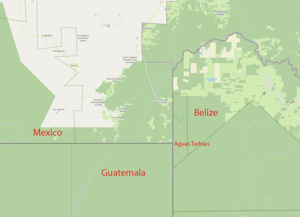
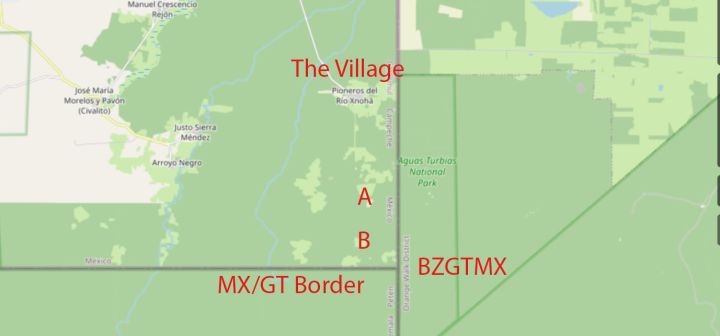
The tripoint between Belize, Mexico and Guatemala is most easily accessible from Mexico and the small village of Pioneros del Río Xnohá. The nearest Belizean village is Tres Leguas whilst there is no nearby Guatemalan village.
The tripoint was formally established with the independence of Belize in 1981, its location determined by the GTMX 1882 and GBGT 1859 accords that informed the GBMX agreement 1893. BZGTMX lies at the intersection of the GTMX border and the BZGT border.
- Guatemala–Mexico border is undisputed and is located on the parallel of 17°49′ from BM#65 GTMX ‘Usumacinta Vertex’ to Vertice de Aguas Turbias BM#107 GTMX.
- The Guatemala – Belize border is defined in Article I of the Wyke–Aycinena Treaty of 1859 and confirmed by an exchange of notes in 1931:
- Beginning at the mouth of the River Sarstoon in the Bay of Honduras, and proceeding up the mid-channel thereof to Gracias a Dios Falls; then turning to the right and continuing by a line drawn direct from Gracias a Dios Falls to Garbutt’s Falls on the River Belize, and from Garbutt’s Falls due north until it strikes the Mexican frontier.
- There are 3 border markers on the BZGT border: Gracias Adios, Garbutt’s Falls and Aguas Turbias. Close to to the 89th meridian west, Map 1 Map 2 Treaty 1 Treaty 2 provide context regarding the location of the tripoint.
A Question of Location
Although both Guatemala and Belize have traditionally accepted the three border monuments as marking the line between the two countries, they have not agreed as to the actual coordinates of the three sites and by extension the true location of the borderline.
There was an OAS survey of the GTMX border in 2002 undrtaken by the Pan American Institute of Geography and History undertook the survey, and the lead cartographer was Paul Peeler. Its focus was to resurvey the border and the adjacency lines and determine the status of the squatter communities of Machaquila, Rio Blanco and Valentin Camp. Although it was confirmed that the squatter communities were in Belize (east of the Adjacency line), there has been no confirmation of the coordinates of Aguas Turbias, although the OAS map above confirms the current position and GT/MX border was confirmed again in 2009. As such the monument is seen as the current de facto and de jure location.
It is likely that the survey has been subsumed into the wider ICJ case that is considering the territorial dispute between the 2 countries. The initial submissions were in 2008 and oral testimony from the two parties is due in 2024. An outcome maybe due in 2025 – 23 years after the survey!
Our Visit
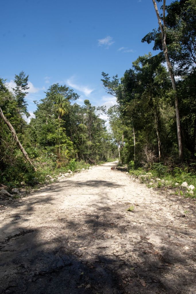
The first thing to stress is the remoteness of this tripoint. There were no prior trip reports apart from some newspaper articles which I include in the Reference section. The Belize group approached the tripoint in vehicles from their side of the border. That option was not available to us so we choose the small village of Pioneros del Río Xnohá as our start point. Getting there (and back) was a challenge in itself with over a 2 hour drive from our hotel in Xpujil. The final 12 km was on an increasingly narrow and rough road. I visited this tripoint as part of the IBRG CATEX-24 expedition. On reflection this tripoint was even harder that BGGRMK on Mount Tumba. This is Tripoint #28 for me. My other Americas tripoint visits are reported here
The Village
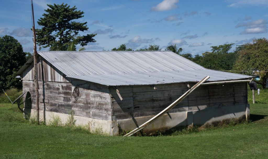
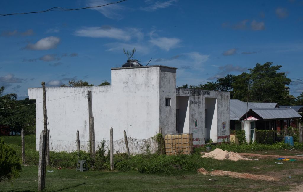
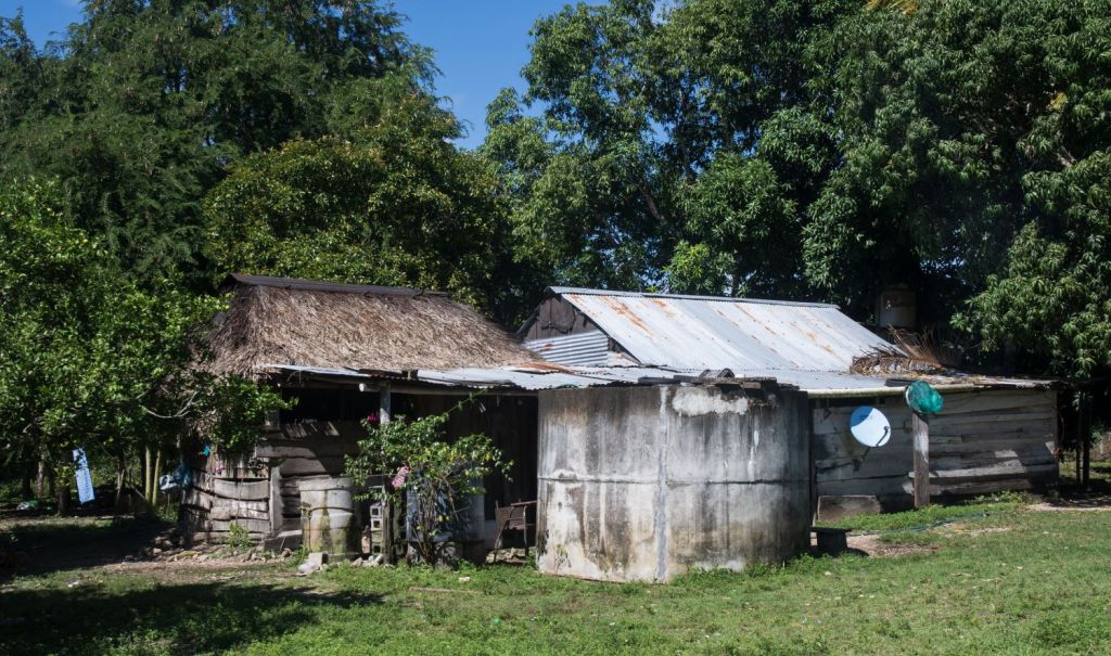
The town of Pioneros del Río Xnohá is within the Municipality of Calakmul (State of Campeche). it is small with only 326 inhabitants, it is laid out on the common grid pattern with many roads unpaved. We would have liked to have taken more photos but our focus was on starting the hike, and returned when it was dark. Most people were involved in farming.

The hike (in and out).
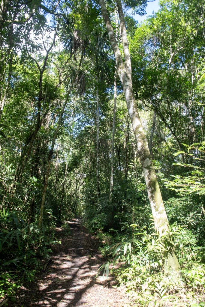
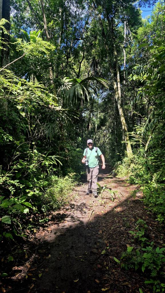
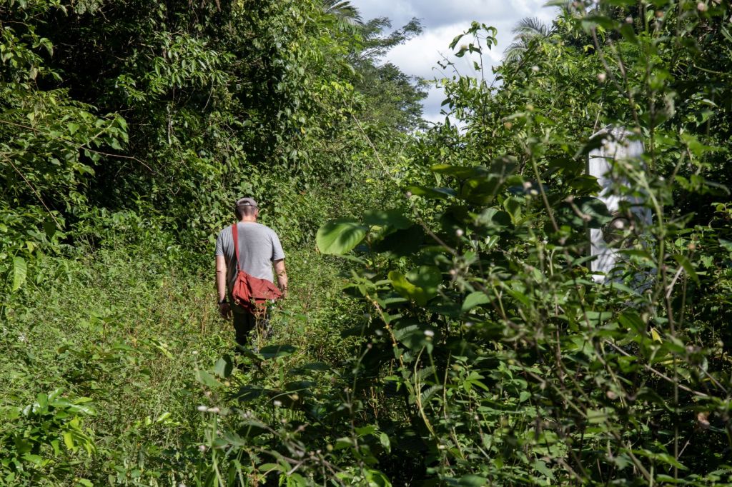
Throughout the whole hike to the tripoint we were unsure we would make it. Google maps indicated a track up to the jungle where it disappeared. We hoped there would be access routes used by Mexican border guards but could not be sure. The first part of the hike was straightforward, and we actually got a lift on the back of a couple of motorbikes part of the way which was great. It was hot and humid, with a temperature of 33C. After 7 km the trail ended and we entered the jungle, immediately it was damp and enclosed. The trail became narrower and in parts flooded but we headed south towards the frontier. One moment of concern (amongst many) was when the trail which appeared to be used by Quad bikes ended, and there seemed to be no way forward.
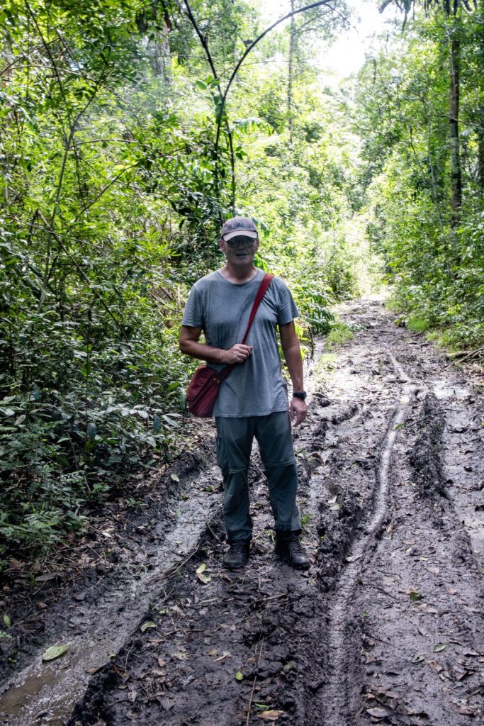
Retracing our steps we found a fence and gate, we headed south initially on the west (right) of the fence and then when that section became impassible on the east (left) of the fence – achieved by crawling underneath the barbed wire. We deposed of much of our clothing after the trek as it was trashed. The path disappeared into the swamp and a long brown snake crossed our path.
After 2.5 hours of walking we reached the border, and BM# M901 – the sequence of numbering of the GT/MX border markers changed by letter. It was only then that we realised that we were going to make the tripoint.
The walk along the borderline.
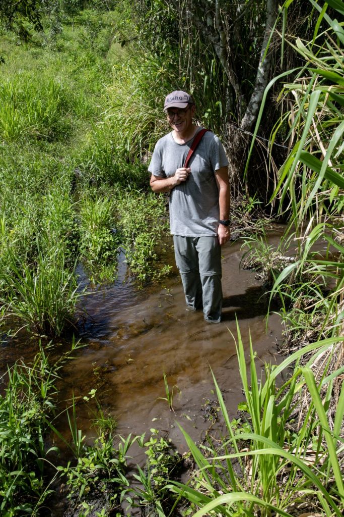
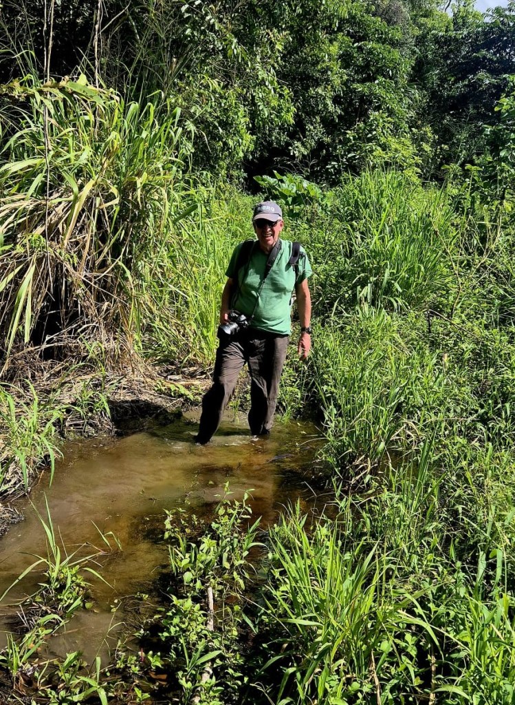
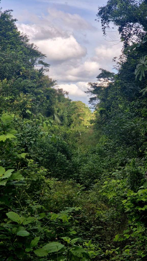
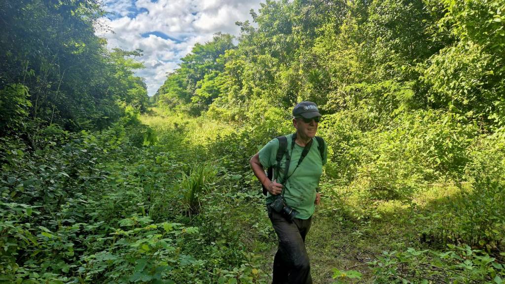
Coming out of the relative gloom of the jungle it seems very bright on the border line. Although some of the GT/MX border strips we have seen on this trip had been well maintained this was not the case here. The strip was overgrown and in parts flooded. It was necessary to reestablish a path by pushing through the vegetation. A machete would have been useful here! It was at this moment however that we realised that we were after all going to bag this tripoint.
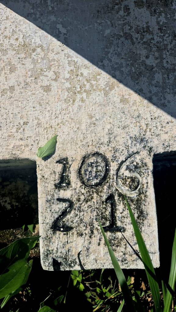
There were several border markers to note along the 2 km border to the tripoint monument. If we had more time we would have recorded each BM and its number, but with time passing we took as many photos as we could as we waded and squelched towards the tripoint. This section took is 30 minute to complete, slightly faster on the way back as the trail had been partially cleared by us walking through. The heat and humidity remained an issue.
The BM’s appeared to be numbered in sections #106 for example. individual markers are distinguished by letters.
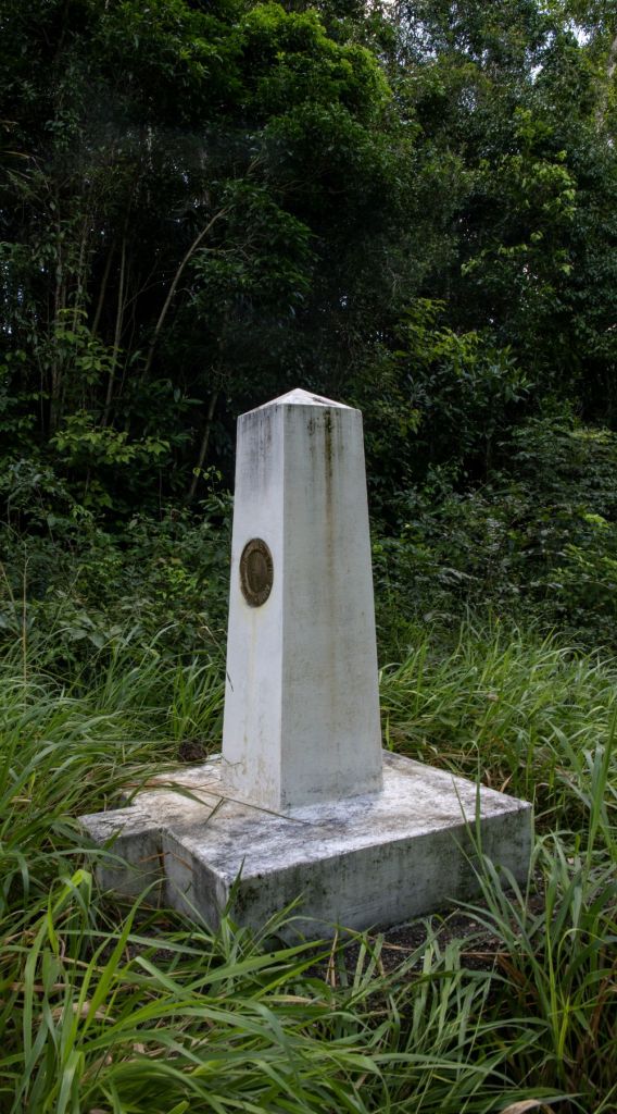
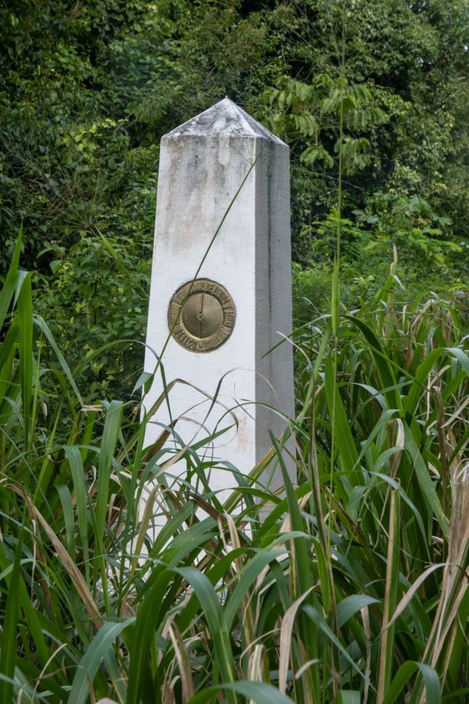
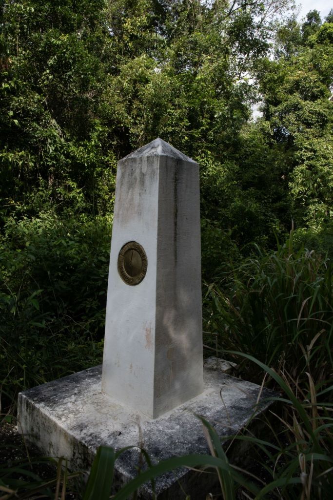
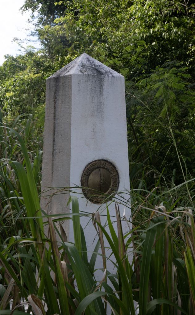
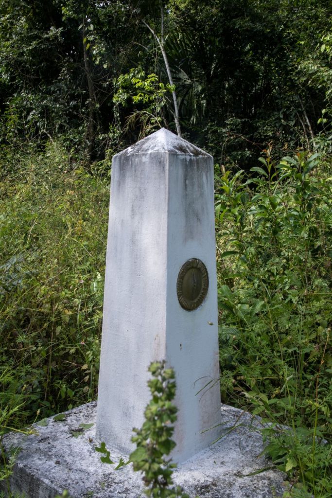
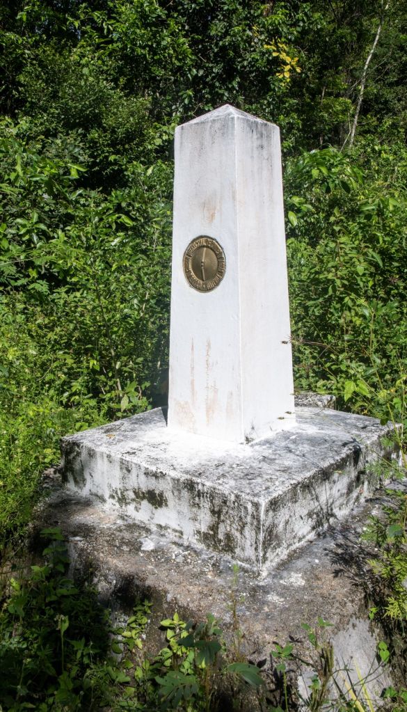
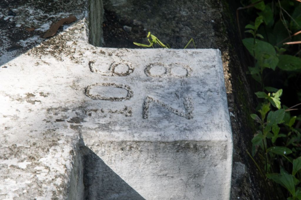
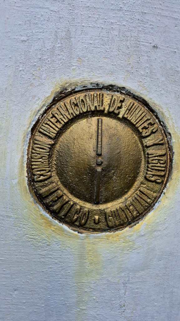
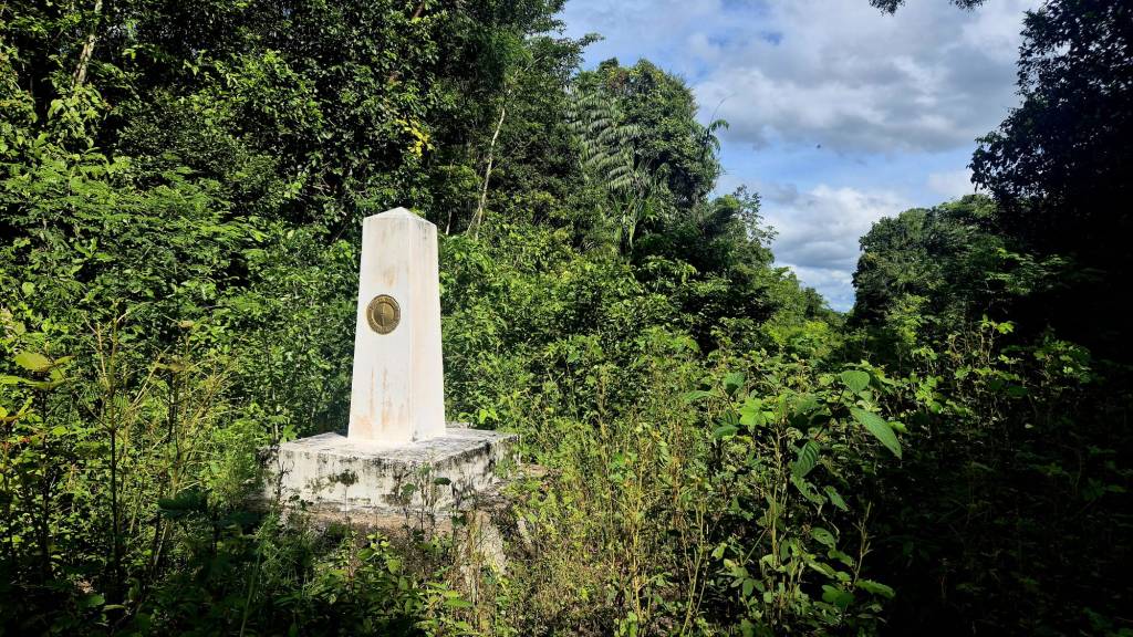
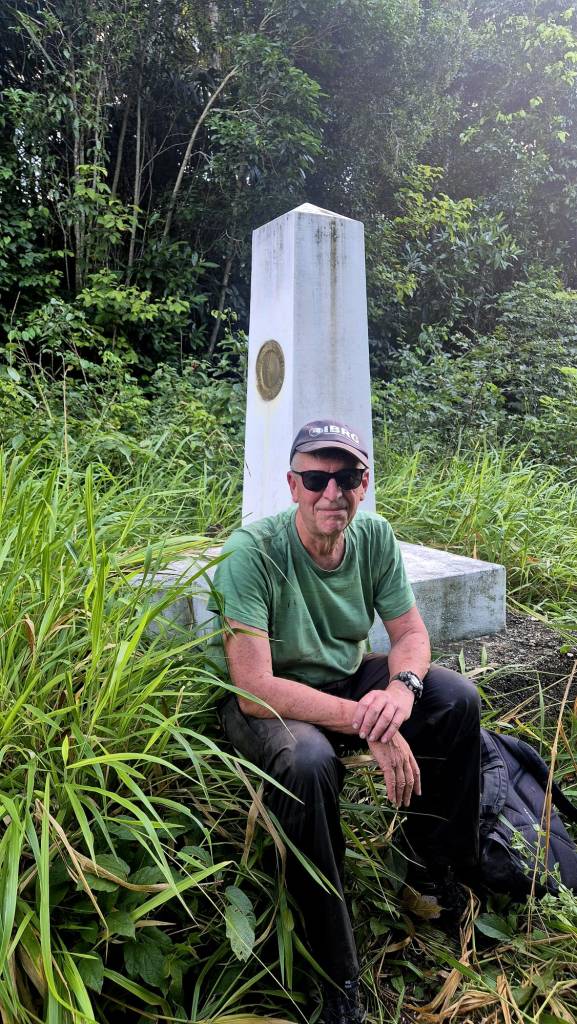
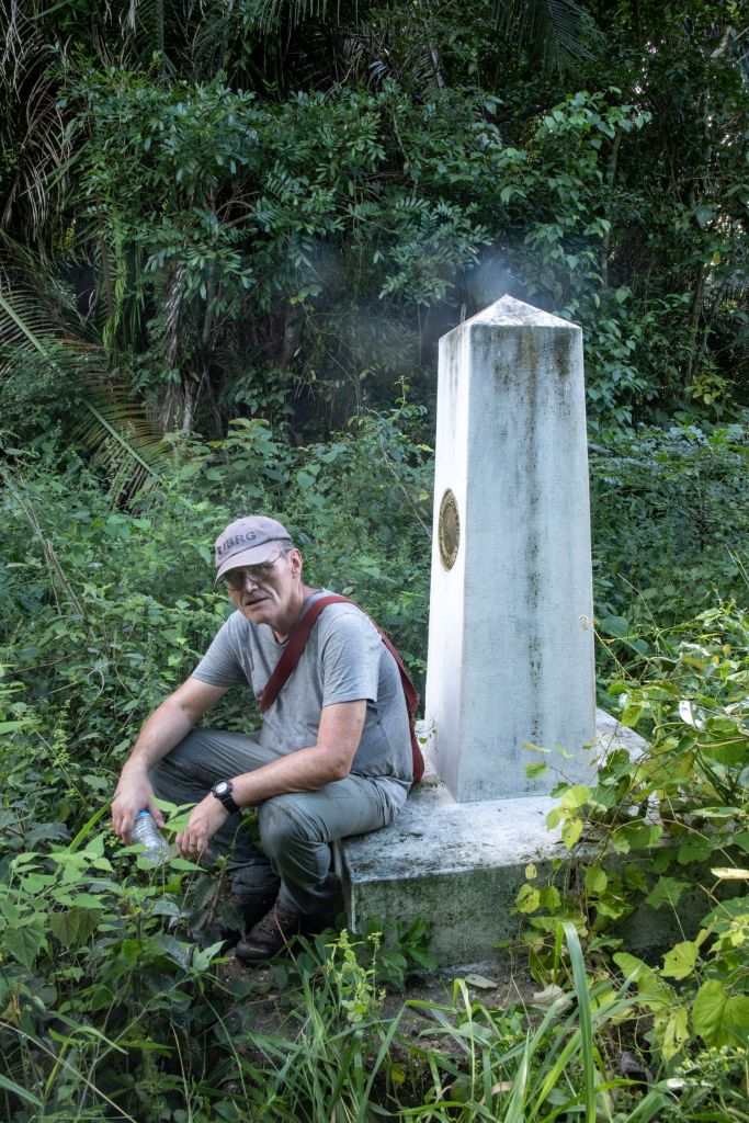
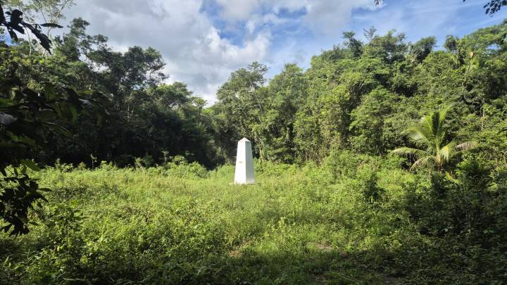
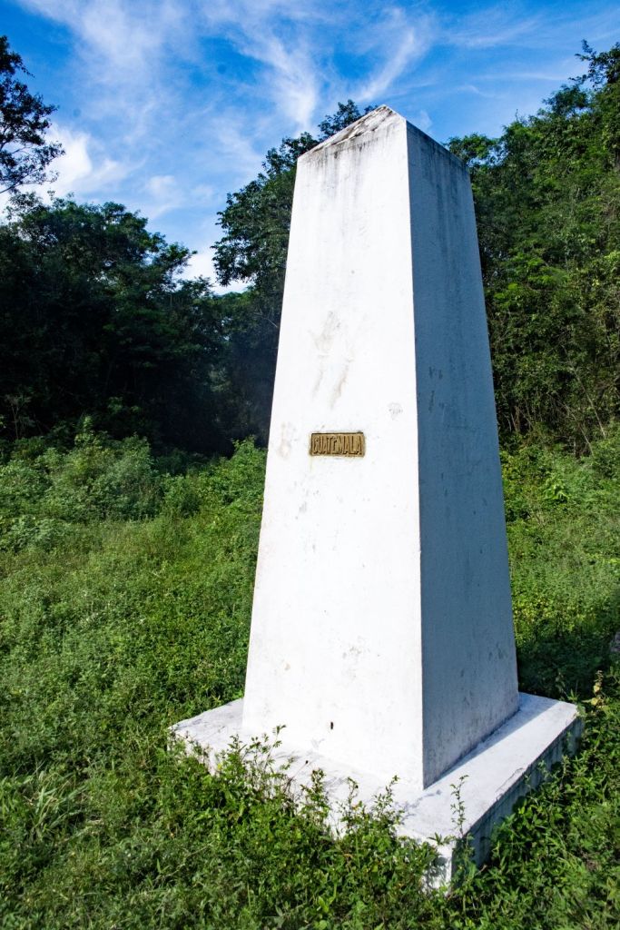
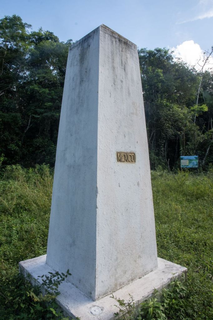
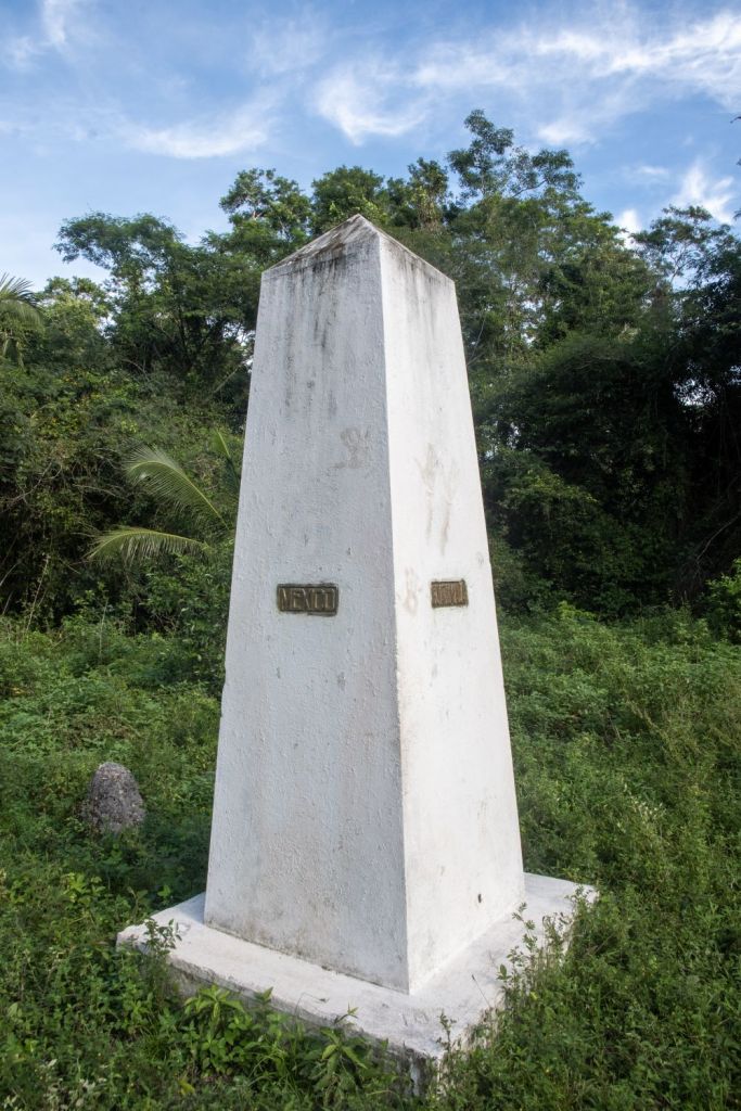
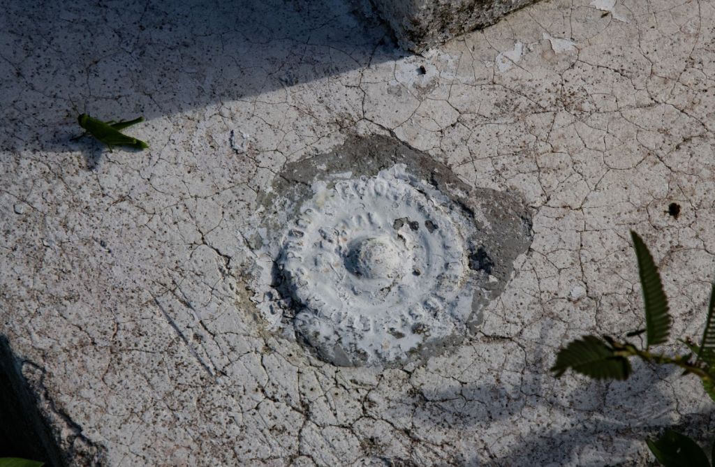
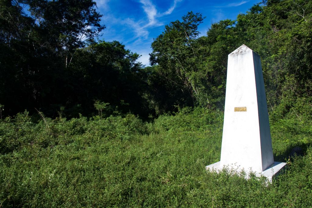
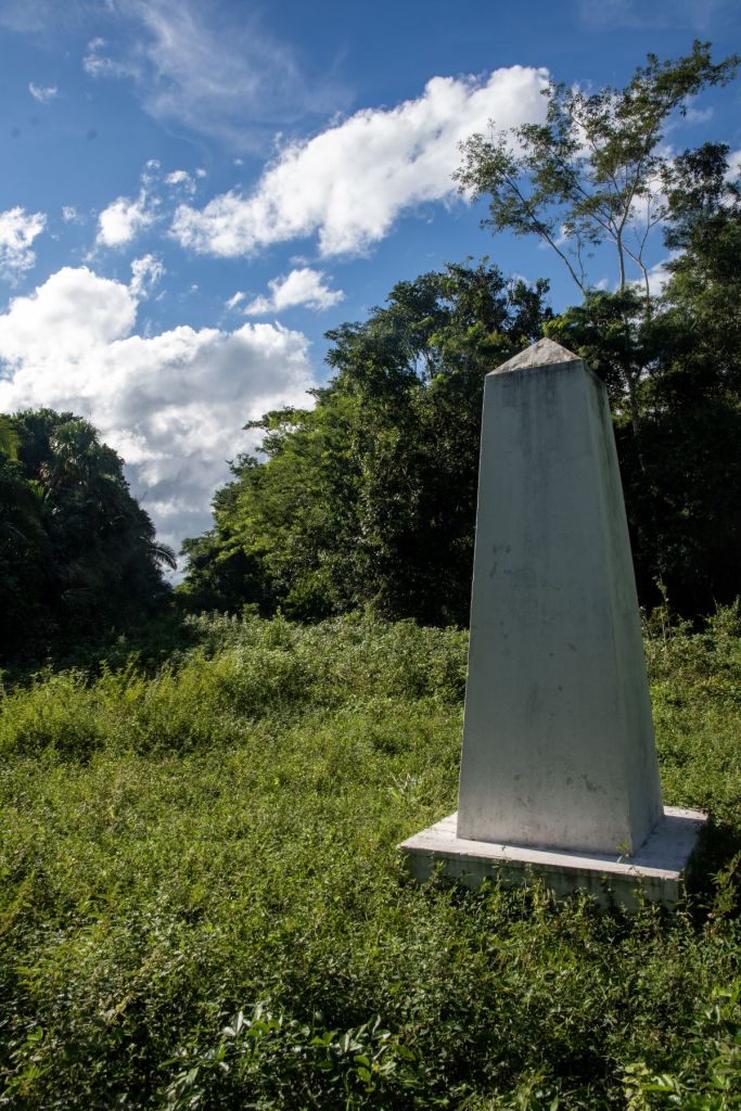
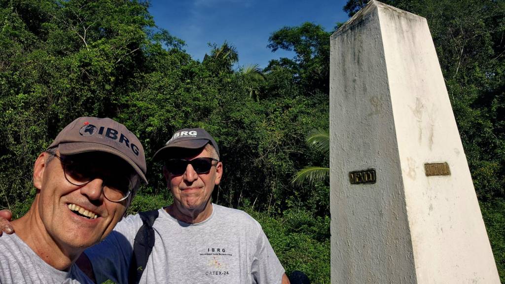
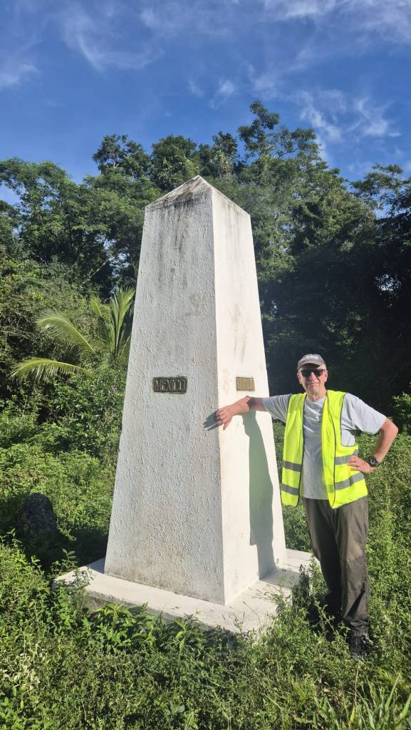
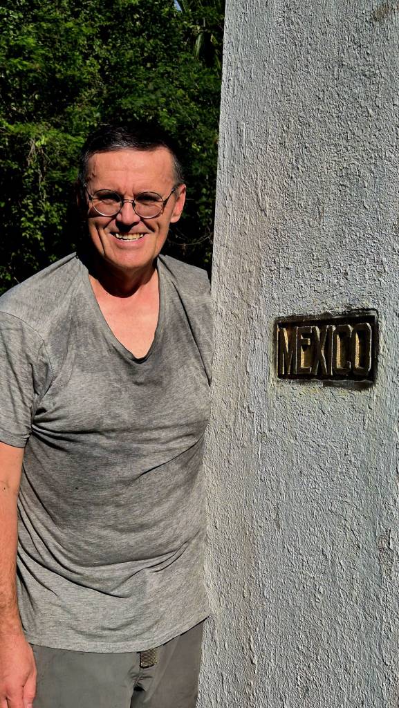
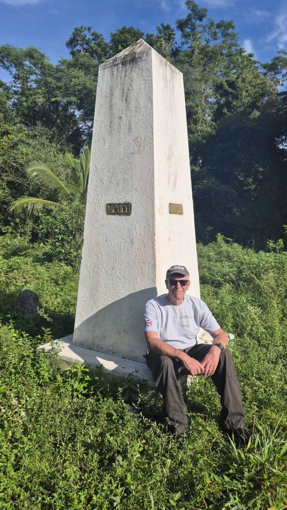
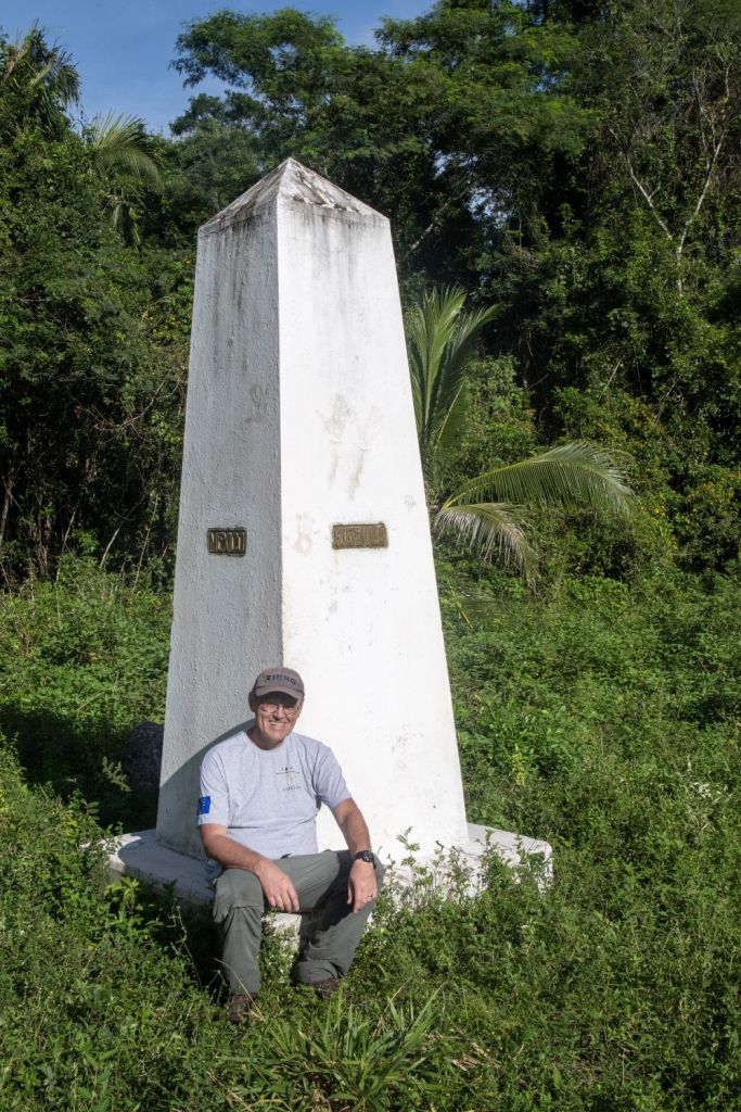
The Tripoint monument – Aguas Turbias
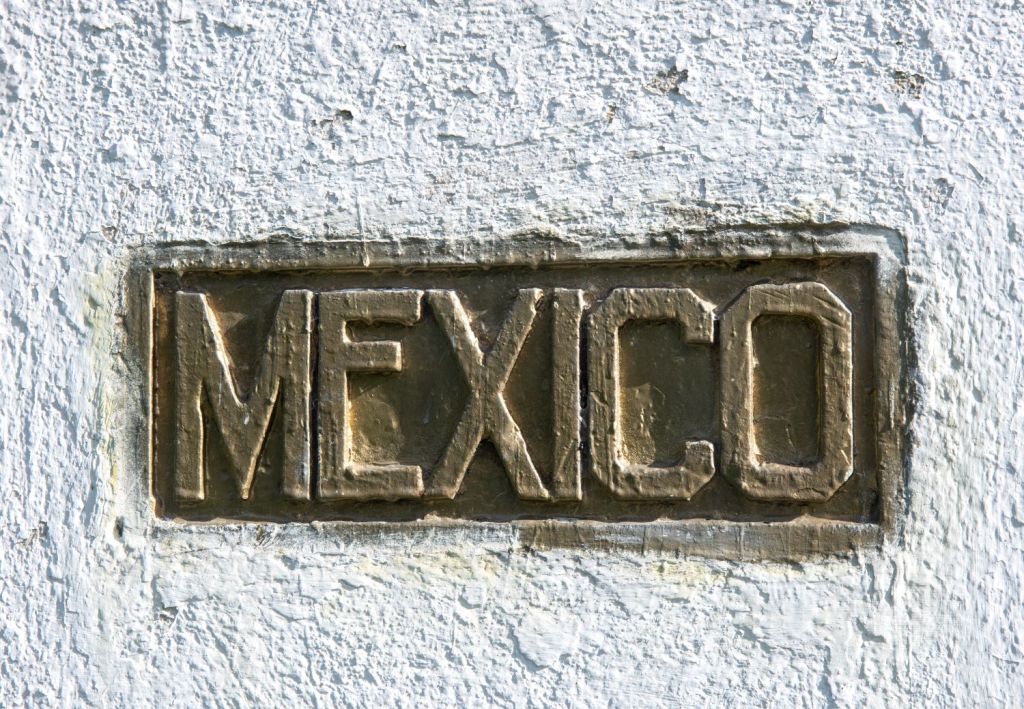
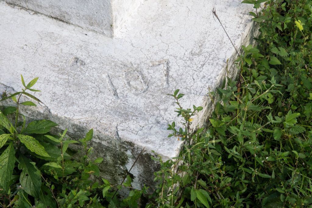
Finally, we pushed through that last of the vegetation and reached a large open area, vegetation was lower here and it was easier to note the respective borders: GT/MX, BZ/MZ and the one between BZ /GT. The monument was tall, at least 2.5 m and so it was a Class B visit as we were unable to reach the very top. The border marker was #107 on the GT/MX border. It also had a MX geodesic mark which we had not known about prior to the visit. Only 2 country signs are on the monument with the Belize one missing. One had been fixed on (there were clear marks indicating its location) but had been removed, probably by Guatemala.

it was soon time for us to leave, with some regret there was not enough time simply to sit and reflect. Time however was passing and we knew we had to be out of the jungle and onto the wider track before sunset.
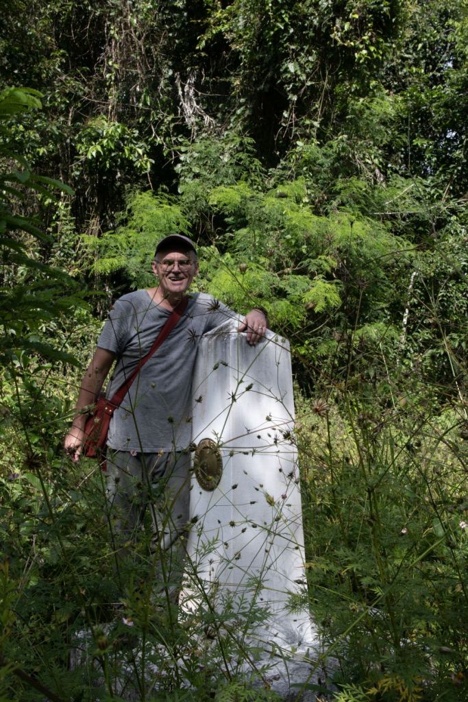
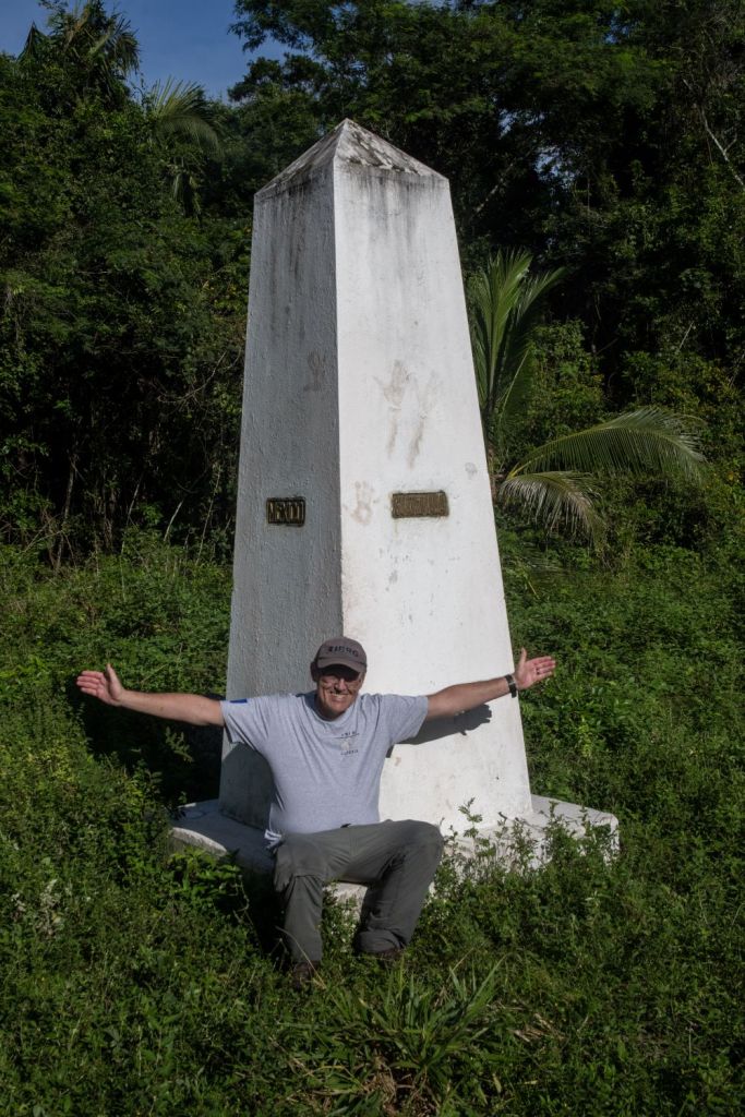
Celebrations
All that remained for us to take the obligatory group and individual photos at the monument, remembering to try to smile and not look shattered. A change of tee shirt helped us look more presentable.
Recommendations
This was the toughest of any tripoint I have visited. The terrain, distance and climate all contributed to a long tough day. Here are a few points (some but not all we did) that would make your effort easier than ours.
- Start as early as possible, we stayed in Xpujil which meant a 2 hour start to the beginning of the trek. Even starting early meant an 11.00 start, and a finish in the dark. Consider sleeping in the car at the village.
- Have appropriate kit, but don’t buy anything new. We threw away some clothing because it was trashed with the mud, thorns and barbed wire fences. Walking poles and a head torch would help.
- Take plenty of water and food. We could have taken more. 2.5 ltrs would help with the heat and humidity. When we returned to the village we went and asked for water at the first house we passed.
- Take the road #269 there and back there are other roads but they are in worse condition and take much longer.
- We used Maps.Me which although it did not indicate tracks, will show you your relative position to the border and tripoint.
- This is not a walk to do alone.
If you do choose to do it please let me know how you get on.
Video
References
- Aguas Turbias – how national borders can be maintained. Amandala Newspaper (November 2024) Details here
- The Road Less Travelled…to Aguas Turbias 7 News Belize (April 2013). Details here.

Date of Visit: 18 November 2024
