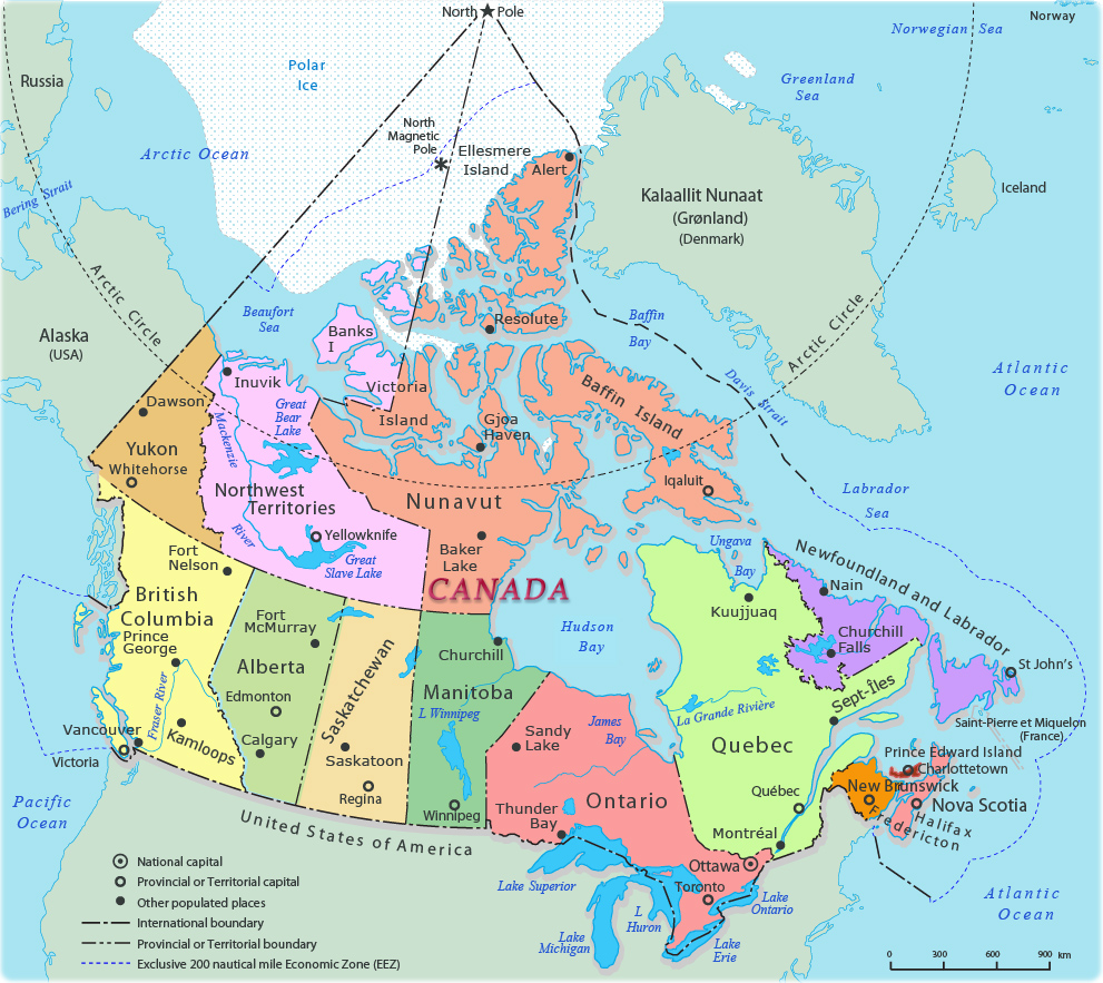
Canada is a country in North America. Its ten provinces and three territories extend from the Atlantic Ocean to the Pacific Ocean and northward into the Arctic Ocean, making it the world’s second-largest country by total area, with the world’s longest coastline. Its border with the United States is the world’s longest international land border. Canada also shares a land border with Greenland (and hence the Kingdom of Denmark) to the northeast, on Hans Island, and a maritime boundary with France’s overseas territory of Saint Pierre and Miquelon to the southeast.
Canada is officially bilingual in English and French. Formally, Canada is a constitutional monarchy. The titular head is the reigning monarch of the United Kingdom (locally called the king or queen of Canada), who is represented locally by a governor-general (now always Canadian and appointed by the Canadian prime minister). In practice, however, Canada is an independent federal state established in 1867 by the British North America Act. All vestiges of British control ended in 1982, when the British Parliament passed the Canada Act, which formally made Canada responsible for all changes to its own constitution. That said, the links with the UK are strong with considerable shared history and shared conflict with many Canadians fighting and indeed dying in the 2 World Wars.
Canada has a highly developed mixed-market economy, with the world’s ninth-largest economy as of 2023, and a nominal GDP of approximately US$2.221 trillion. It is one of the world’s largest trading nations, with a highly globalized economy. According to a 2019 report by the OECD, Canada is one of the most educated countries in the world; the country ranks first worldwide in the percentage of adults having tertiary education. Canada was a founding member of the United Nations and has membership in the World Trade Organization, the G20, and the Organisation for Economic Co-operation and Development (OECD). Canada is also a member of various other international and regional organizations and forums for economic and cultural affairs. Canada is also a member of the British Commonwealth. Militarily, Canada is a member of NATO and NORAD.
Culturally, the significance of its southern neighbour is difficult to ignore, especially in terms of media and sport. Canada is different however, both in terms of social norms, its political system (constitutional monarchy versus Republic, multi party system versus dual, role of the second chamber and the relationship between federal and state), perception of the role of the state in areas such as healthcare and education. Canada is often seen as the politer of the 2 counties.
Border Facts
Canada has a vast geography that occupies much of the continent of North America, sharing a land border with the contiguous United States to the south and the U.S. state of Alaska to the northwest. Canada stretches from the Atlantic Ocean in the east to the Pacific Ocean in the west; to the north lies the Arctic Ocean. Greenland is to the northeast with a shared border on Hans Island. To the southeast Canada shares a maritime boundary with France’s overseas collectivity of Saint Pierre and Miquelon.
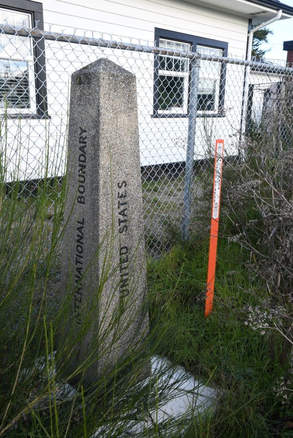
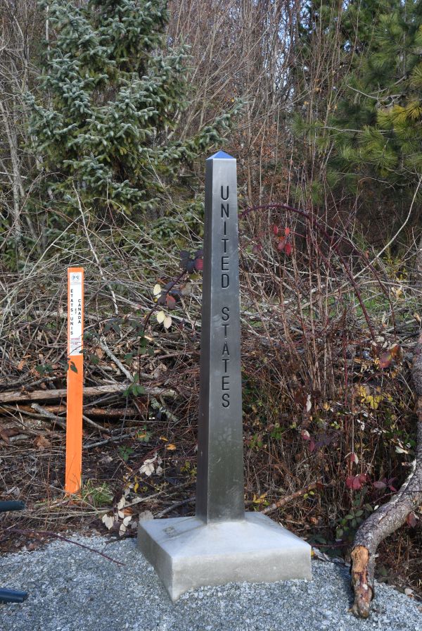
Canada – US Border is the longest international border in the world. The terrestrial boundary (including boundaries in the Great Lakes, Atlantic, and Pacific coasts) is 8,891 km long. The land border has two sections: Canada’s border with the contiguous United States to its south, and with the U.S. state of Alaska to its west. The bi-national International Boundary Commission deals with matters relating to marking and maintaining the boundary, and the International Joint Commission deals with issues concerning boundary waters. The agencies responsible for facilitating legal passage through the international boundary are the Canada Border Services Agency (CBSA) and U.S. Customs and Border Protection (CBP).
The length of the terrestrial boundary is 8,891 km, of which 6,416 km is with the contiguous 48 states, and 2,475 km with Alaska. Eight out of thirteen provinces and territories of Canada and thirteen out of fifty U.S. states are located along this international boundary.
The Treaty of Paris of 1783 was the first treaty that established the boundary between the 2 countries, whereas the London Convention of 1818 established the border very much as it exists today. The International Boundary Survey (or, the “Northern Boundary Survey” in the US) role is maintaining the survey and mapping of the border; maintaining boundary monuments and buoys; and keeping the border clear of brush and vegetation for 6 m.
The 49th Parallel is the single fact most closely associated with the Canada – US border. This part of the border from the Lake of the Woods to the Rockies was set in October 1818, and was later extended all the way to the Pacific Coast. East of Minnesota’s Northwest Angle the border is more complex following lakes and rivers and other physical features until it reaches the Atlantic Ocean.
Currently there are 119 legal land border crossings between the United States and Canada, 26 of which take place at a bridge or tunnel. Only 2 of the 119 crossings are one-way.
There are 39 railroads that cross the U.S.–Canada border, nine of which are no longer in use. Eleven of these railroads cross the border at a bridge or tunnel.
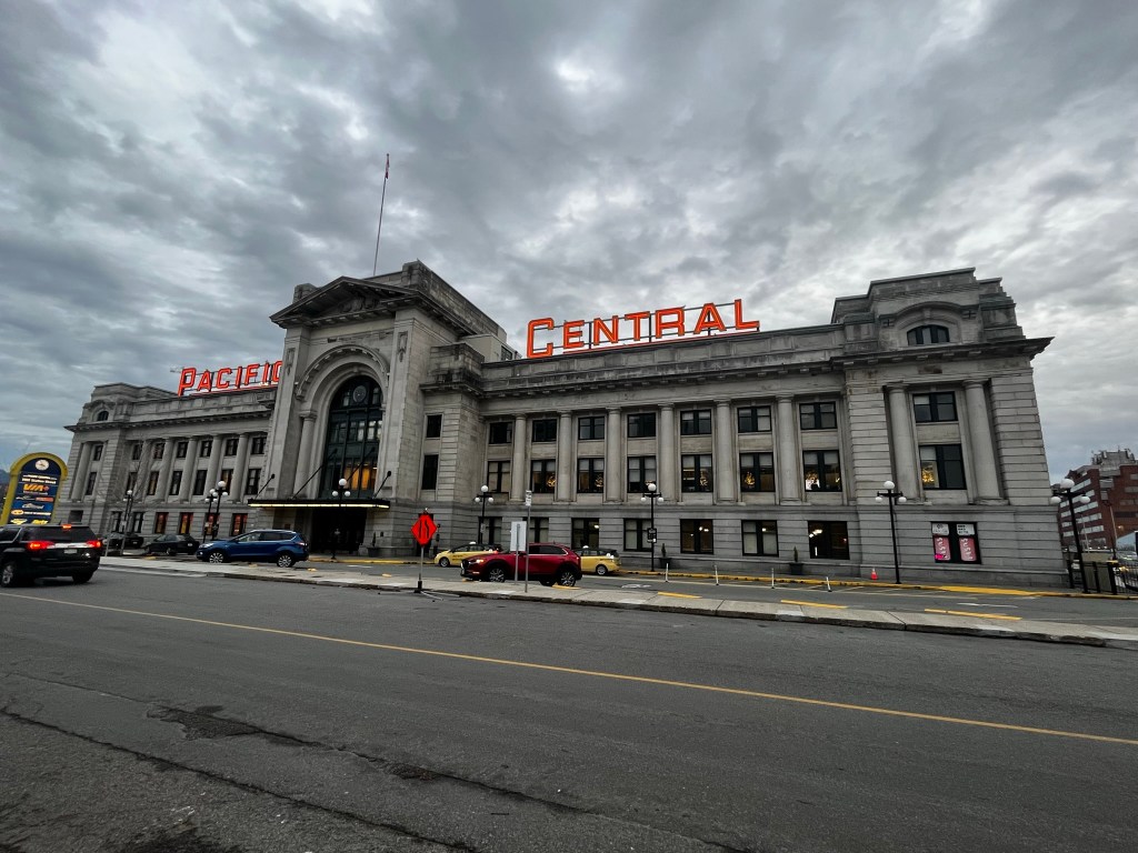
Only three international rail lines currently carry passengers between the U.S. and Canada. At Vancouver’s Pacific Central Station, passengers are required to pass through U.S. partial pre-clearance and pass their baggage through an X-ray machine before being allowed to board the Seattle-bound Amtrak Cascades train, which makes no further stops before crossing the border at Blaine, Washington, where the train stops for another CBP inspection.

Pre-clearance facilities are not available for the popular Adirondack (New York City to Montreal) or Maple Leaf (New York City to Toronto) trains, since these lines have stops between Montreal or Toronto and the border. Instead, passengers must clear customs at a stop located at the actual border. It is often written that this is the longest undefended border. The border is however controlled remotely and by border officers.
With a border of this length, there are bound to be a number of oddities such as cross border airfields and golf courses. At some points houses are divided by the border. Given the inaccuracy of early surveying techniques and mapping there are geographical oddities. The 2 most well known ones are Point Roberts and the Northwest Angle.
Canada and the United States have one land dispute over Machias Seal Island (off the coast of Maine), and four other maritime disputes in the Arctic and Pacific. In addition there is a dispute over the status of the Northwest passage. Canada has long claimed the Northwest Passage as internal territorial waters, on the basis of a long history of native Inuit use of the waters, as well as legal arguments stemming from decades-old cases settled by the the International Court of Justice. The U.S. has long countered this claim on the basis of its interpretation of the UN Convention on the Law of the Sea (UNCLOS), a treaty which it accepts as international law but has never been ratified by Congress. Under this view, the U.S. sees the passage as an international strait connecting two large bodies of water. However, the “international strait” designation is usually only used in cases where there is a large volume of traffic transiting the strait. Currently, there is not much traffic, but traffic will likely increase as ice continues to melt. Under this international strait framework, Canada has the right to regulate most aspects of traffic in the waterway, yet cannot prohibit or restrict international shipping traffic.
Canada – Greenland (Denmark) Border the maritime boundary between Canada and Greenland originates in the North Atlantic Ocean and follows a northerly course through Davis Strait and Baffin Bay until it reaches the Arctic Ocean. The boundary was established through a bilateral agreement that was finalized in 1973. A territorial sovereignty dispute (now solved) over tiny Hans Island briefly interrupts what is otherwise the longest maritime boundary in the world at 2,646 kilometres.
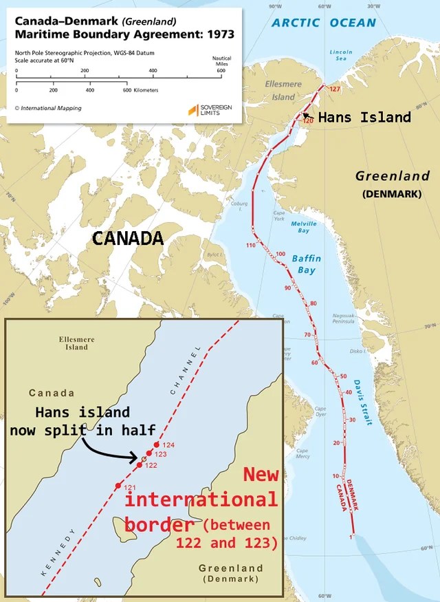
Hans Island is an island in the centre of the Kennedy Channel of Nares Strait in the high Arctic region, split between the Canadian territory of Nunavut and the Danish autonomous territory of Greenland. The island itself is barren and uninhabited with an area of 130 hectares, measuring 1,290 by 1,199 metres, and a maximum elevation of 168.17 m. It was the location for the most friendly border dispute ever – the so called “Whisky Wars”. In 1984, Canadian soldiers visited the island and planted a Canadian flag, also leaving a bottle of Canadian whisky. The Danish Minister of Greenland Affairs came to the island himself later the same year with the Danish flag, a bottle of Schnapps, and a letter stating “Welcome to the Danish Island” (Velkommen til den danske ø). The two countries proceeded to take turns planting their flags on the island and exchanging alcoholic beverages.
Hans Island is the smallest of three islands in Kennedy Channel off the Washington Land coast; the others are Franklin Island and Crozier Island. The strait at this point is 35 km wide, placing the island within the territorial waters of both Canada and Denmark (Greenland). A 1,280-metre-long border traverses the island. In 2022 the respective governments agreed to delimit the island which therefore adds an additional land border to each of them. Further details are here. Many thanks to fellow IBRG member Lars Hole for sharing this.
Canada – France Border Perhaps surprisingly Canada shares a maritime border with France. Under the terms of the 1763 Treaty of Paris, which put an end to the Seven Years’ War, France ceded all its North American possessions to Britain, though the British granted fishing rights to French fishermen along the Newfoundland coast, and as part of that arrangement returned Saint Pierre and Miquelon to France’s control. The islands changed hands several times with Britain invading, occupying and destroying. The islands were resettled in 1816 and became a French Overseas territory in 1946. In 1958 this status was confirmed through a referendum.
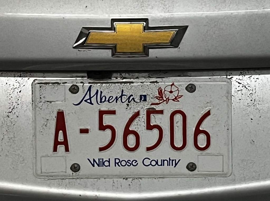
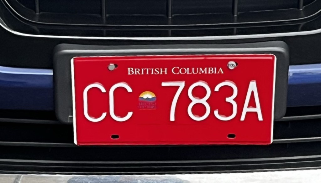
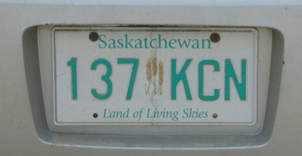
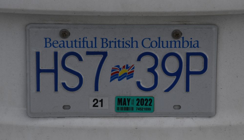
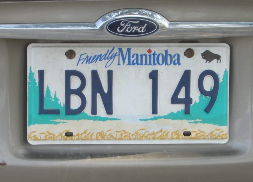
Canadian Registration Plates
Vehicle registration plates of Canada, also known as licence plates, are issued by provincial or territorial government agencies. British Columbia, Manitoba, and Ontario are the only Canadian jurisdictions that require both front and rear registration plates. The remaining jurisdictions do not require front registration plates.

Site Navigation
In order to find your way around the site, either click on the links (text in red) or use the menus at the top and side of the pages. About leads you to the main areas of the site. The European Tripoints menu leads directly you to my visit reports whereas the Country Visits page allows you to choose which country to look at first. Many photos are also links to further information, reports and analysis.
Mobile User Advice
Tables display correctly when holding your mobile horizontally.
To access the links to other pages please click on the 3 horizontal dots at the bottom of the page.