
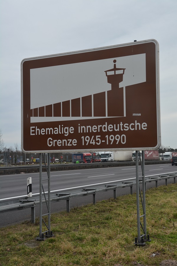
The inner German border (German: Innerdeutsche Grenze or Deutsch-deutsche Grenze; initially also Zonengrenze was the border between the German Democratic Republic (GDR, East Germany) and the Federal Republic of Germany (FRG, West Germany) from 1949 to 1990. Not including the similar and physically separate Berlin Wall, the border was 1,393 kilometres long and ran from the Baltic Sea to Czechoslovakia.
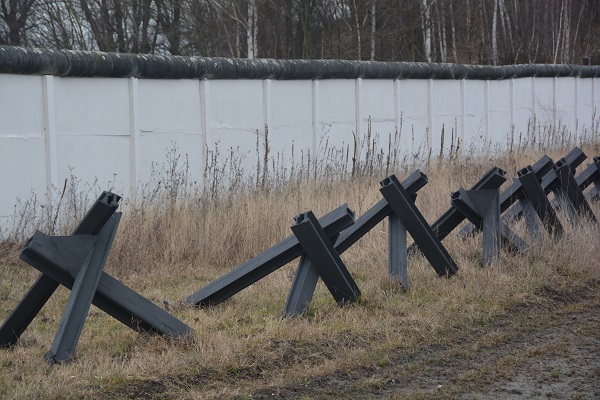
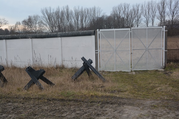
It was formally established on 1 July 1945 as the boundary between the Western and Soviet occupation zones of former Nazi Germany. On the eastern side, it was made one of the world’s most heavily fortified frontiers, defined by a continuous line of high metal fences and walls, barbed wire, alarms, anti-vehicle ditches, watchtowers, automatic booby traps, and minefields. It was patrolled by fifty thousand armed East German guards who faced tens of thousands of West German, British, and U.S. guards and soldiers. In the frontier areas on either side of the border were stationed more than a million North Atlantic Treaty Organisation (NATO) and Warsaw Pact troops.
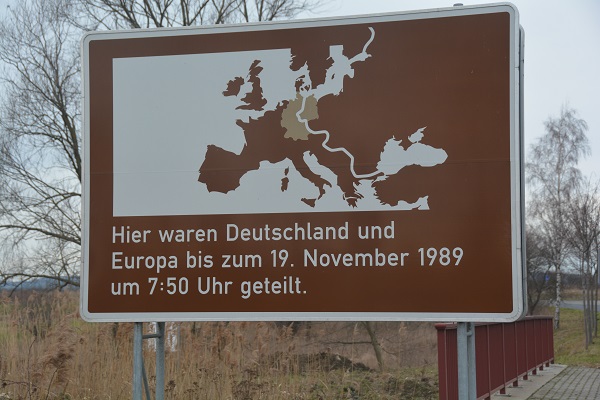
The border was a physical manifestation of Sir Winston Churchill’s metaphorical Iron Curtain that separated the Soviet and Western blocs during the Cold War, marking the boundary between two economic systems – capitalism and communism. Built by East Germany in phases from 1952 to the late 1980s, the fortifications were constructed to stop the large-scale emigration of East German citizens to the West, about 1,000 of whom are said to have died trying to cross it during its 45-year existence. It caused widespread economic and social disruption on both sides; East Germans living in the region suffered from a large number of restrictions on movement and activity.


The DDR emerged from the Soviet Zone and matched the five states (Länder) of Mecklenburg-Vorpommern, Brandenburg, Saxony, Saxony-Anhalt, and Thuringia. In reality however the States were superseded by administrative districts for purposes of regional government.
The inner German border was where the Soviet Zone met the varied zones of the western allies. Initially it was not fortified at all. From 1945 to 1952 there were simple barriers or no barriers at all, it was easy to cross and people passed backwards and forwards each day. From 1952 to 1967 there was an increasing militarisation of the border zone on both sides to match the increasing tensions arising from the cold war.
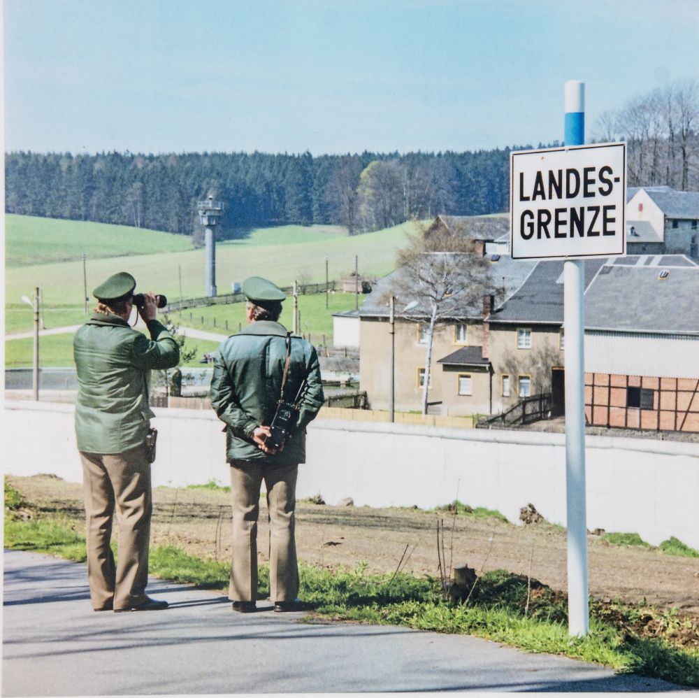
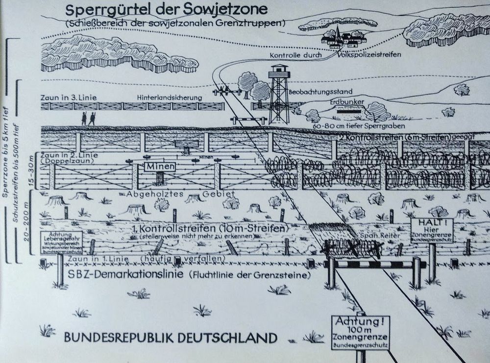
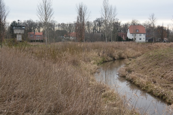
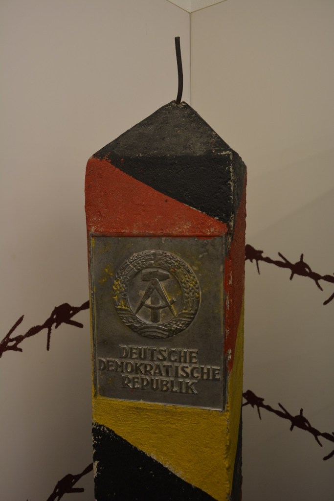
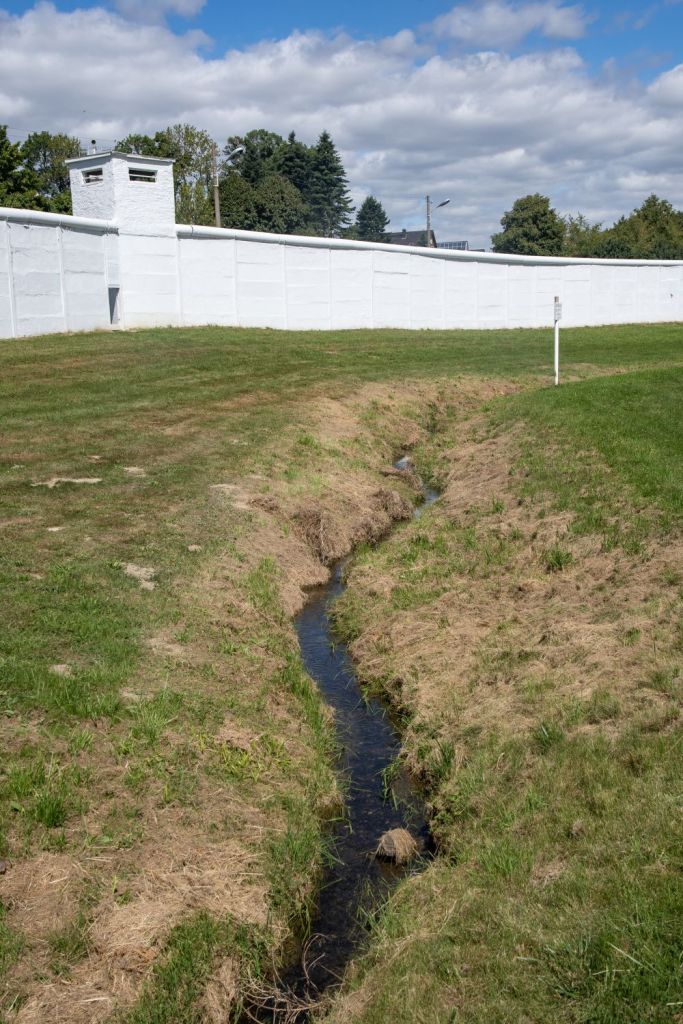
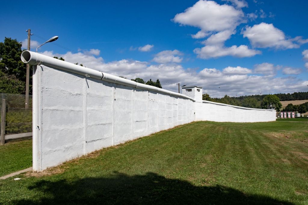
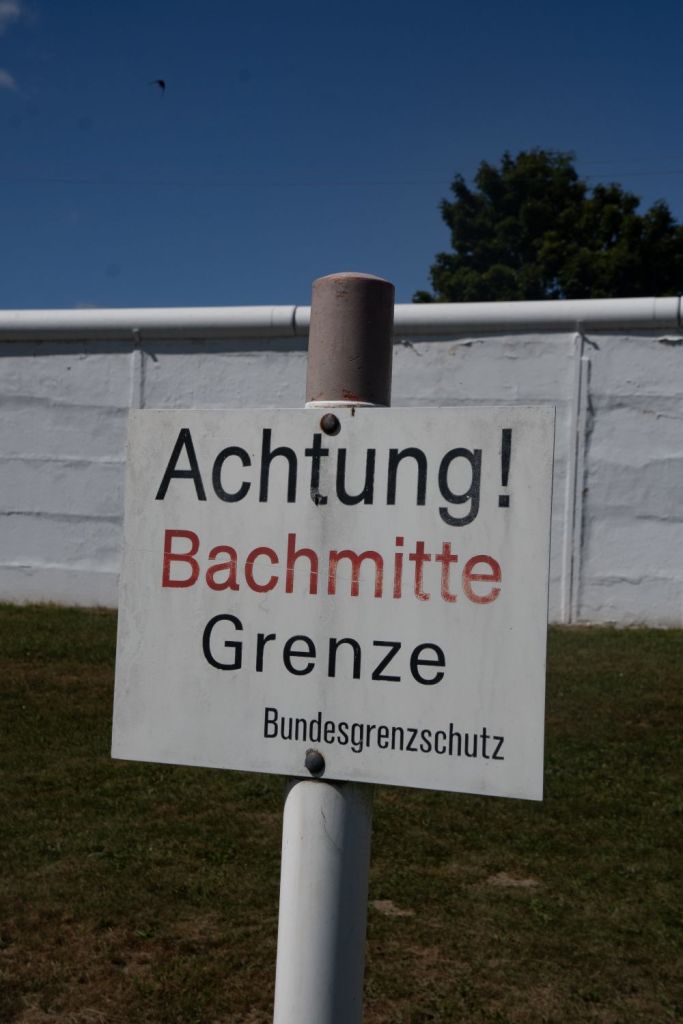
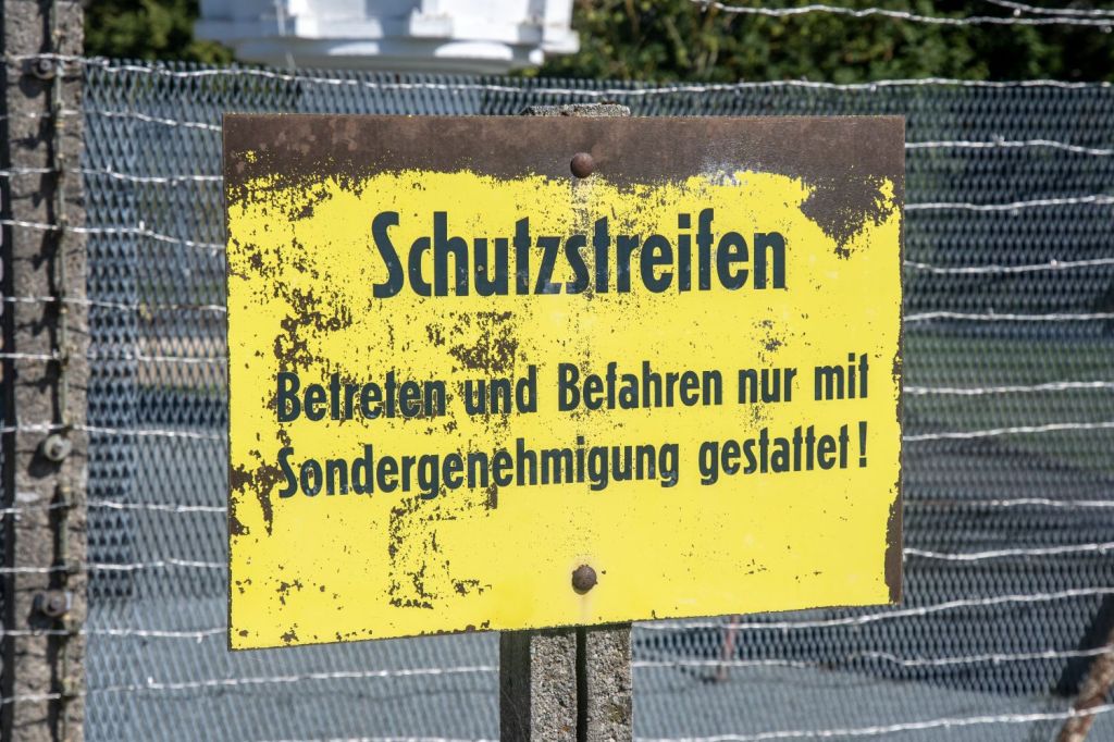
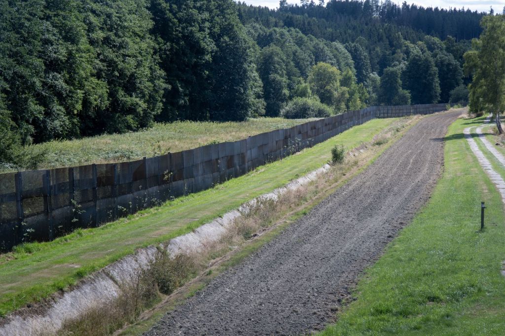
A ploughed strip 10 m wide was created along the entire length of the inner German border. An adjoining “protective strip” (Schutzstreifen) 500 m wide was placed under tight control. A “restricted zone” (Sperrzone) a further 5 km wide was created in which only those holding a special permit could live or work. Trees and brush were cut down along the border to clear lines of sight for the guards and to eliminate cover for would-be crossers. Houses adjoining the border were torn down, bridges were closed, and barbed-wire fencing was put up in many places. Farmers were permitted to work their fields along the border only in daylight hours and under the watch of armed guards, who were authorised to use weapons if their orders were not obeyed.
Border communities on both sides suffered acute disruption. Farms, coal mines, and even houses were split in two by the sudden closure of the border. More than 8,300 East German civilians living along the border were forcibly resettled in a programme codenamed “Operation Vermin” (Aktion Ungeziefer). Another 3,000 realised they were about to be expelled from their homes and fled to the West. The restrictions around the country was expanded in July 1962, when East Germany declared its entire Baltic coast a border zone subject to closures and restrictions. The fortification of the border resulted in the severing of 32 railway lines, three autobahns, 31 main roads, eight primary roads, about 60 secondary roads and thousands of lanes and cart tracks. The number of crossing points was reduced to three air corridors, three road corridors, two railway lines and two river connections giving transit access to Berlin, plus a handful of additional crossing points for freight traffic
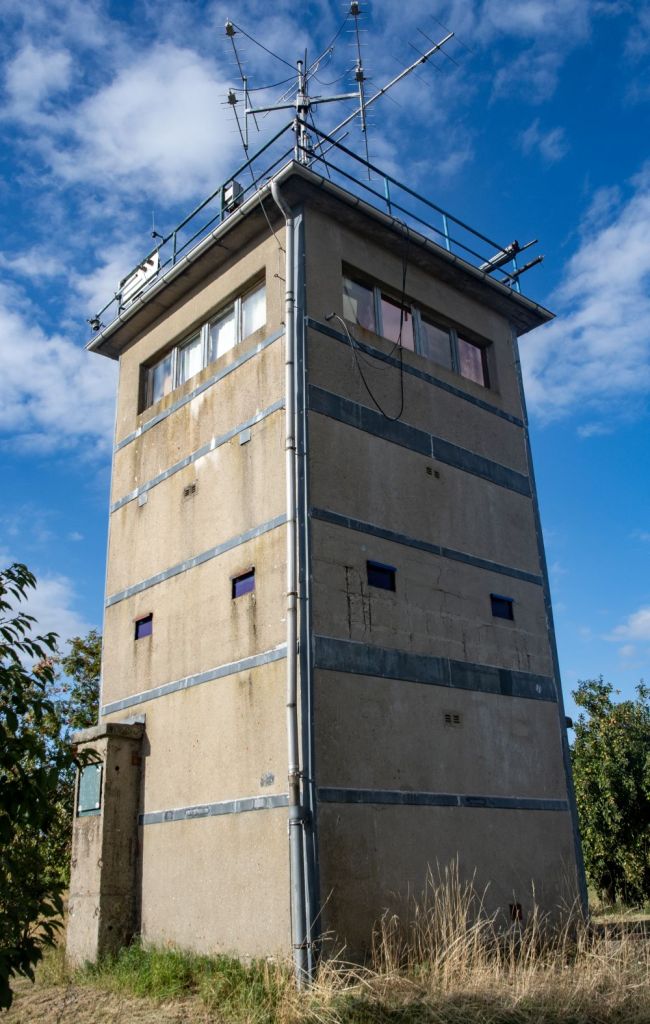
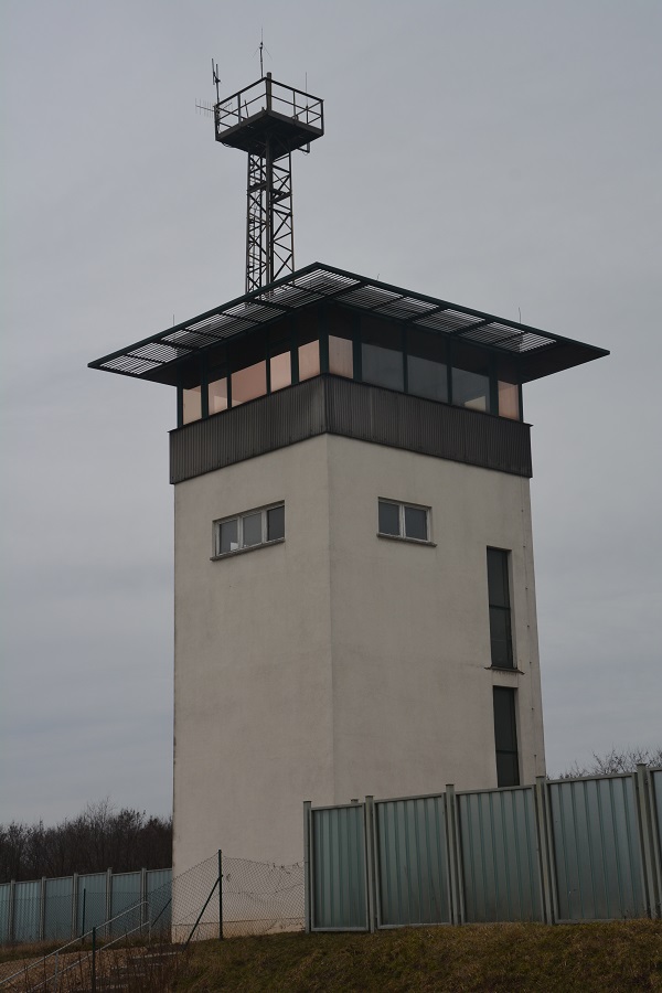
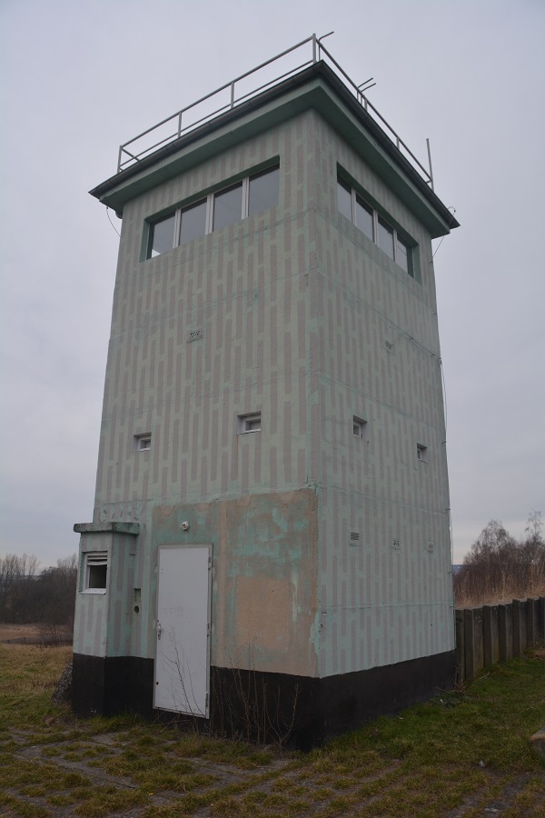
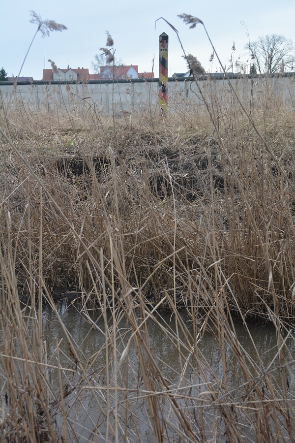
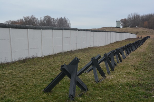
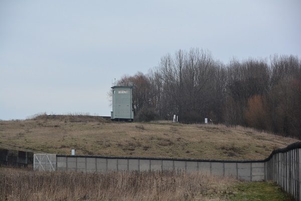
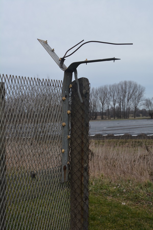
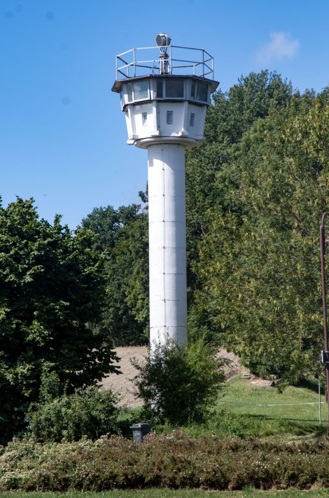
East Germany decided to upgrade the fortifications in the late 1960s to establish a “modern frontier” that would be far more difficult to cross. Barbed-wire fences were replaced with harder-to-climb expanded metal barriers; directional anti-personnel mines and anti-vehicle ditches blocked the movement of people and vehicles; tripwires and electric signals helped guards to detect escapees; all-weather patrol roads enabled rapid access to any point along the border; and wooden guard towers were replaced with prefabricated concrete towers and observation bunkers.
Construction of the new border system started in September 1967. Nearly 1,300 kilometres of new fencing was built, usually further back from the geographical line than the old barbed-wire fences. The upgrade programme continued well into the 1980s. The new system immediately reduced the number of successful escapes from around a thousand people per year in the mid-1960s to only about 120 per year a decade later.
The GDR bore a huge economic cost for its creation of the border zone and the building and maintenance of its fortifications. The zone consumed around 6,900 square kilometres – more than six per cent of the East’s territory, within which economic activity was severely curtailed or ceased entirely. In 1983 the estimated cost was 1 billion marks annually. In reality the cost was economically destructive to the GDR economy.
It is still not certain how many people died on the inner German border or who they all were, as the GDR treated such information as a closely guarded secret. But estimates have risen steadily since unification, as evidence has been gathered from East German records. As of 2009, unofficial estimates are up to 1,100 people, though officially released figures give a count from 270 up to 421 deaths
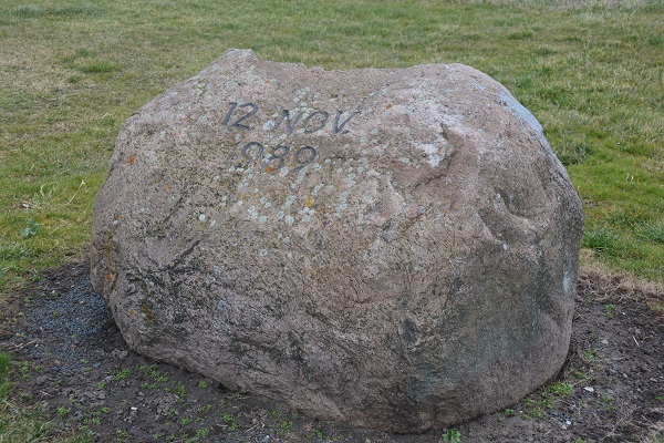
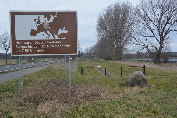
The fall of the inner German border came rapidly and unexpectedly in November 1989, along with the fall of the Berlin Wall. Its integrity had been fatally compromised in May 1989 when the Hungarian government began dismantling its border fence with Austria. This border and its significance in destroying the iron curtain is a place I visited in 2008. Details of my report are here. This event coupled increasing demonstrations within the GDR , large numbers of East German citizens seeking refuge within West German embassies abroad, meant the legitimacy of the regime became increasingly weak. Changes in the GDR leadership did little to diffuse the demands for travel restrictions to be lifted. The border collapsed following a chaotic news conference on 9 November 1989 where the politburo member misunderstood the note being passed to him and announced the immediate opening of the border between east and west. Existing crossings were opened immediately. Within the first four days, 4.3 million East Germans – a quarter of the country’s entire population – poured into West Germany. At the Helmstedt crossing point on the Berlin–Hanover autobahn, cars were backed up for 65 km; some drivers waited 11 hours to cross to the West. The border was opened in stages over the next few months. Many new crossing points were created, reconnecting communities which had been separated for nearly 40 years.
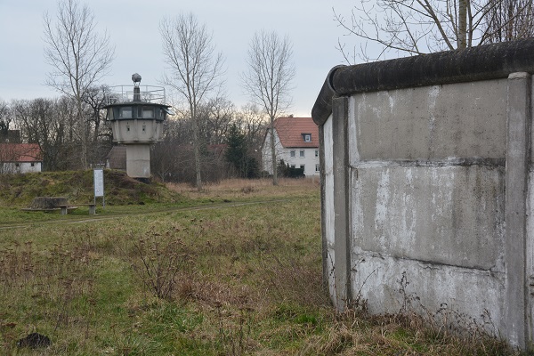
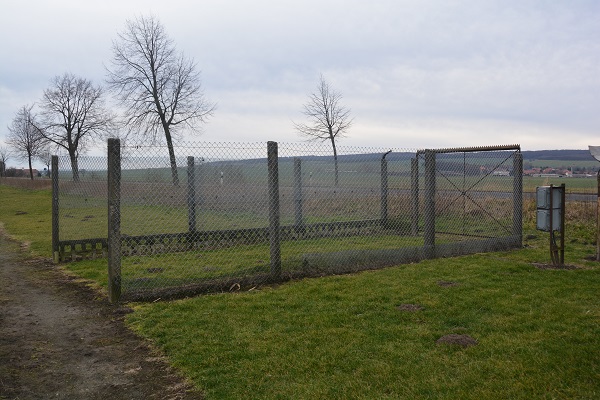
The border fortifications were progressively torn down and eventually abandoned in the months following its opening. Dozens of new crossings were opened by February 1990, the border zone was increasingly demilitarised, and the various border units disbanded. Road and railway lines were restored, fences and more importantly mines removed. A process that was going to take several years. Very little remains of the installations along the former inner German border. At least thirty public, private and municipal museums along the old line present displays of equipment and other artifacts relating to the border. Among the preserved sites are several dozen watchtowers, short stretches of the fence and associated installations (some of which have been reconstructed), sections of the wall still in situ at Hötensleben and Mödlareuth, and a number of buildings related to the border, such as the GDR crossing point at Marienborn. Elsewhere there are remnants of the border inspection roads and ditches. A lasting legacy is the creation of a Green German belt of protected environment which aims to protect the flora and fourna of the areas closed for 40 years.
The inner German border today
I never visited the border when it was separating the 2 parts of Germany, but in 2014 I visited several sections of the border in the Harz region of Germany.
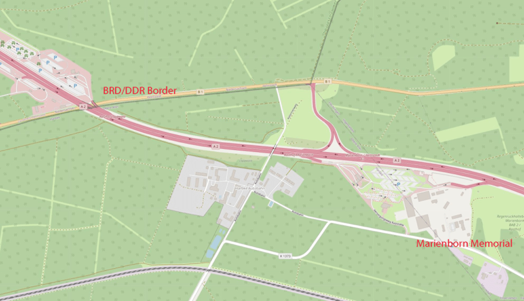
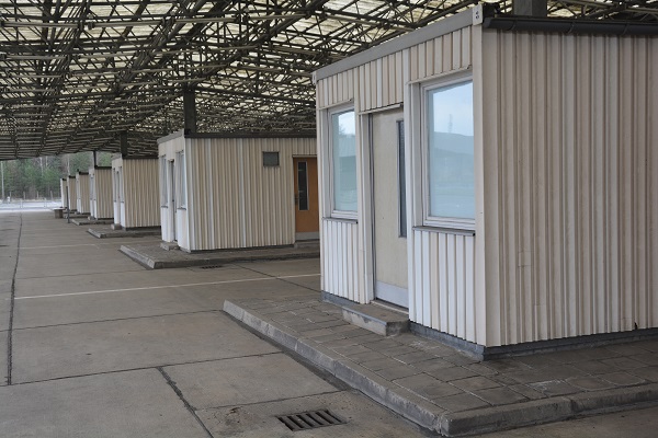
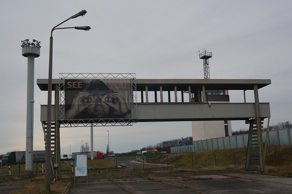
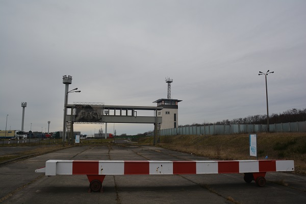
The Border checkpoint Helmstedt–Marienborn aka Checkpoint Alpha
This border crossing was the largest and most important border crossing on the Inner German border during the division of Germany. Due to its geographical location, allowing for the shortest land route between West Germany and West Berlin, most transit traffic to and from West Berlin used the Helmstedt-Marienborn crossing. Most travel routes from West Germany to East Germany and Poland also used this crossing. The border crossing existed from 1945 to 1990.
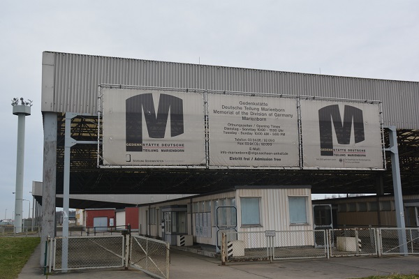
On the grounds of the former East German border control buildings, the “Gedenkstätte Deutsche Teilung Marienborn” was opened on August 13, 1996. The memorial is operated by the state of Saxony-Anhalt and features exhibitions and guided tours. The memorial site is accessible via the nearby rest stop’s exit and can only be explored on foot. The West German buildings near Helmstedt have either been demolished or are now used for other purposes.


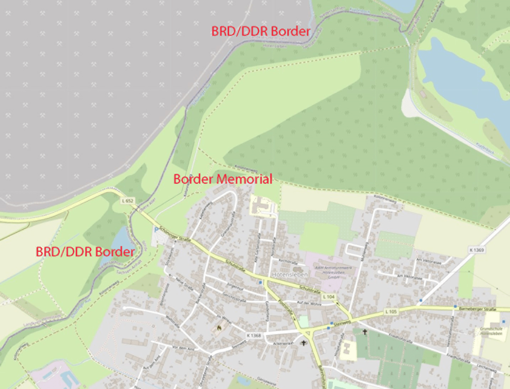
Hötensleben Monument
The border monument is looked after by the Border Monument Association Hötensleben eV and has been part of the Marienborn Memorial to the German Division of Marienborn since January 2004. It is sponsored by the state of Saxony-Anhalt. Since 1990 the memorial has been preserved to remind visitors of the reality of the inner German border. There is a lot to see at the memorial because given the closeness of the town to the border, there were large walls with intermediate strips and towers constructed to ensure there was no possibility of escape. Border markers add to the drama and it is easy to imagine how oppressive the border regime would have been.

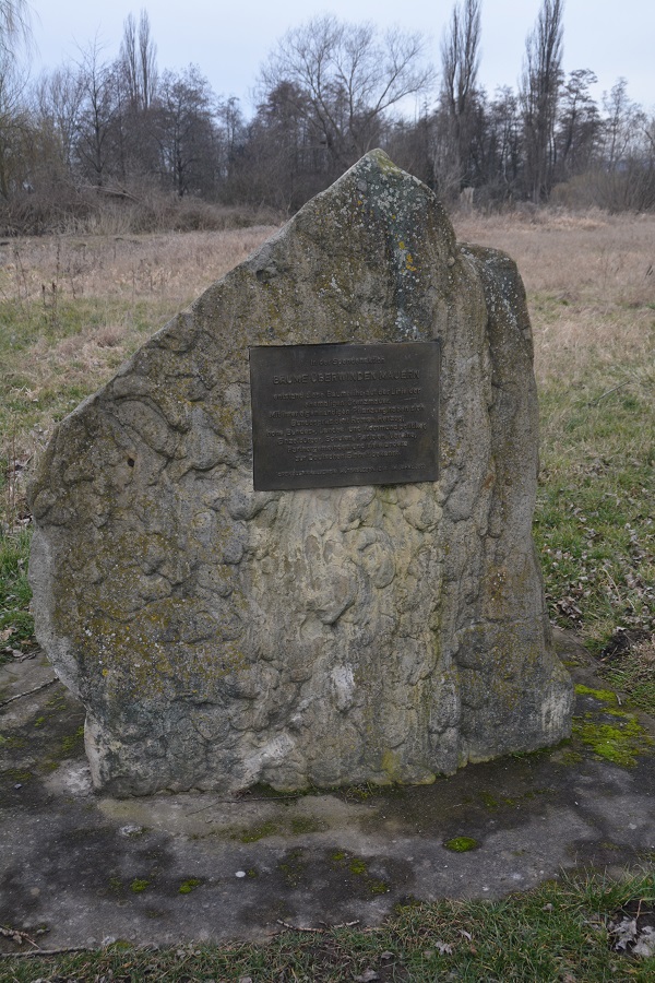


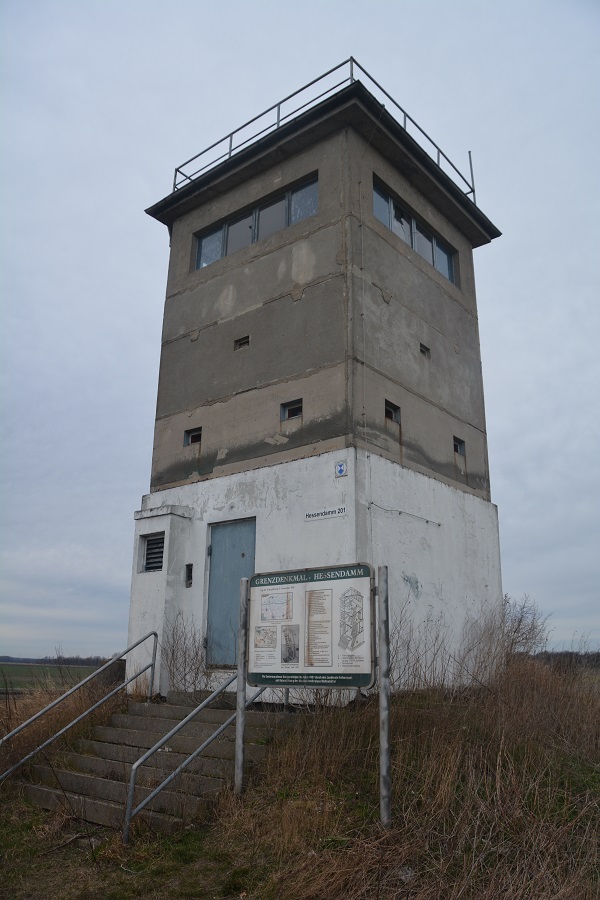
Hessendamm and Mattierzoll Memorials
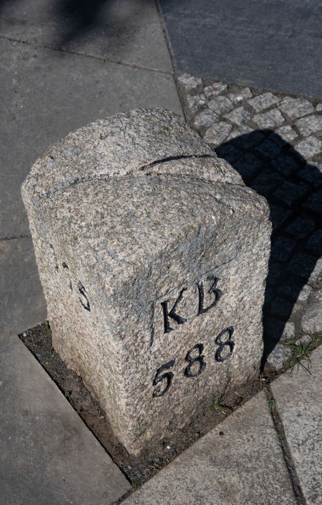
Another set of memorials on the site of the inner German border. Here the states of Lower Saxony (BRD) and Saxony Anhalt (DDR) meet and nowadays the L79 peacefully crosses the regional border marked by the Großer Graben and the Schiffgraben which are artificial rivers in the Großer Bruch. Signs and information boards are evident plus a historical Prussian mile stone which survived more recent history.


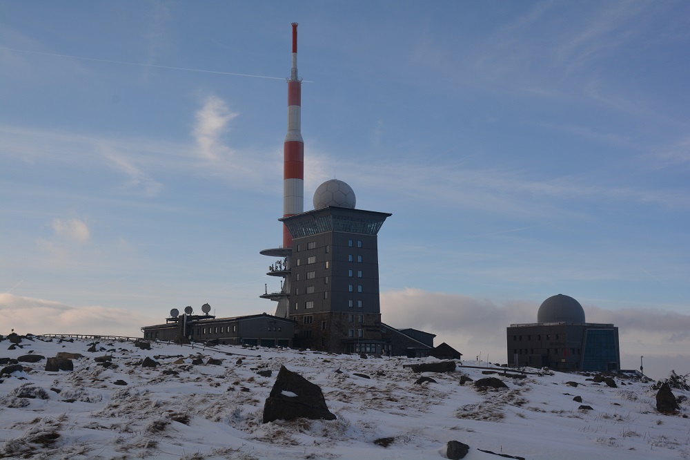
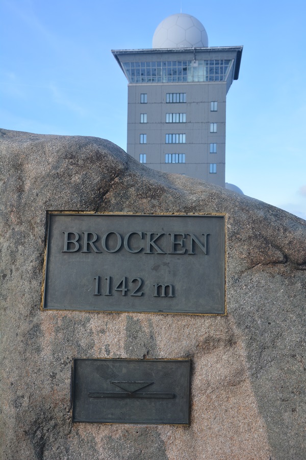
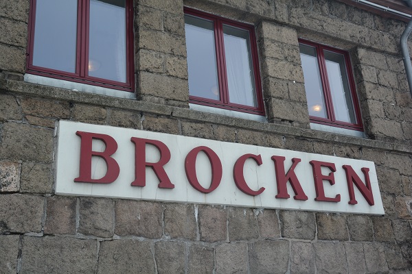
Brocken (1,141 metres)
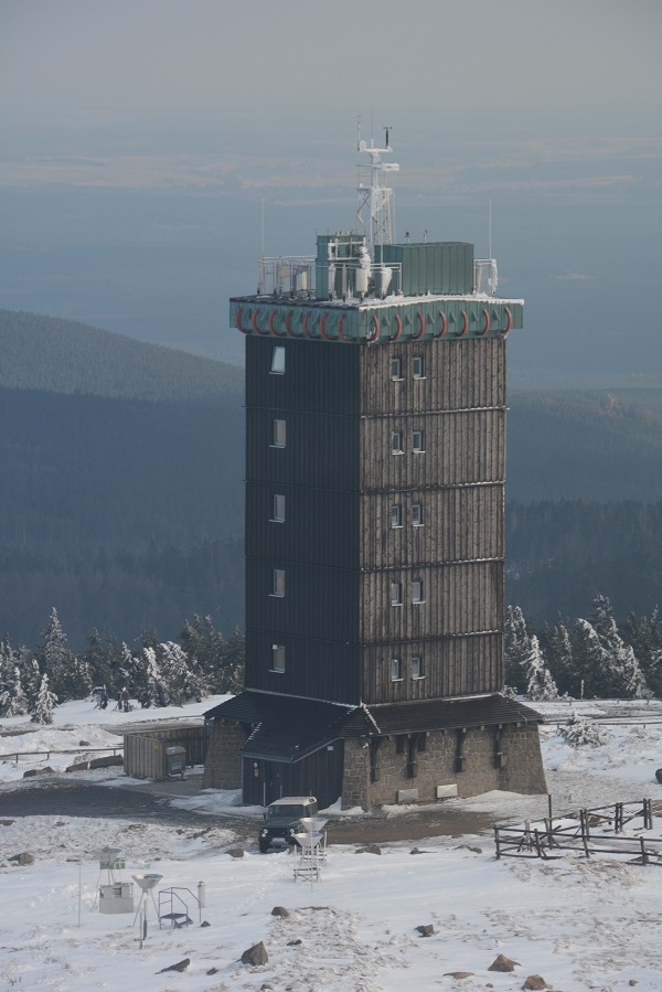
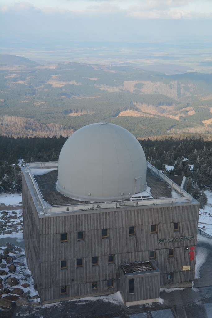
The Brocken, also sometimes referred to as the Blocksberg, is the highest peak in the Harz mountain range and also the highest peak in Northern Germany; it is the easternmost mountain in northern Germany. From 1945 until April 1947, the Brocken was occupied by US troops. As part of the exchange of territory (specified at the Yalta Conference) the mountain was transferred to the Soviet occupation zone. Before the Americans left the Brocken in 1947, however, they disabled the rebuilt weather station and the television tower. From August 1961 the Brocken, which lay in East Germany’s border zone, immediately adjacent to West Germany, was declared a military exclusion zone and was therefore no longer open to public access. Extensive military installations were built on and around the summit with DDR border troops and Soviet troops permanently stationed on the summit which acted as a listening post for western communications. TV towers were also constructed on the summit initially for East German TV but today for ZDF. The East German secret police the Stasi were also stationed there. The entire summit was sealed with a concrete wall. The whole area was not publicly accessible until 3 December 1989. The wall has since been dismantled, as have the Russian barracks and the domes of their listening posts. Today the old tower beside the lodge again is home to a weather station of the Deutscher Wetterdienst.
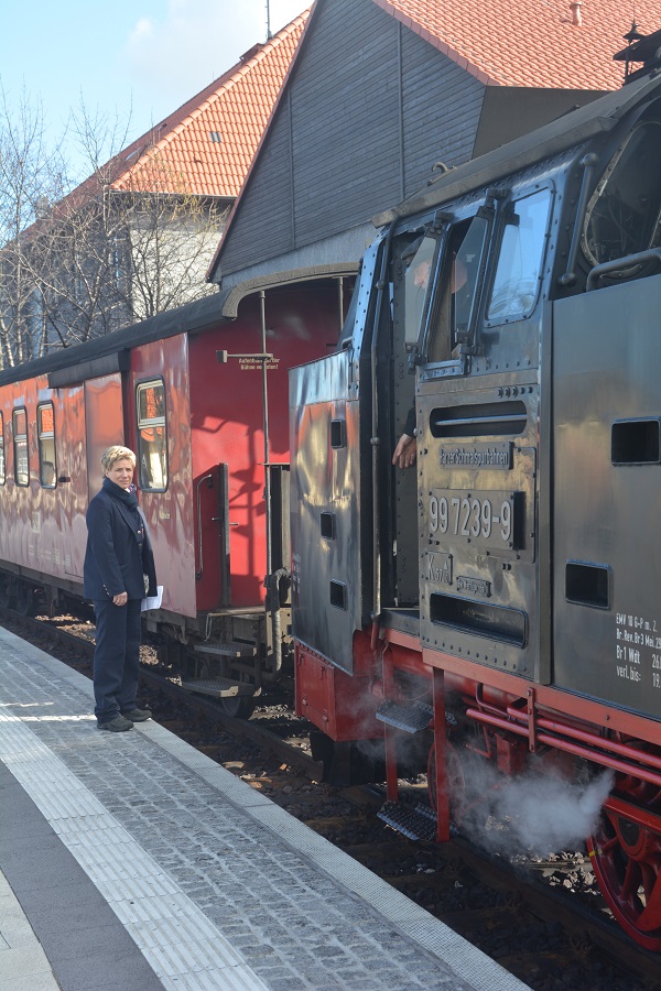
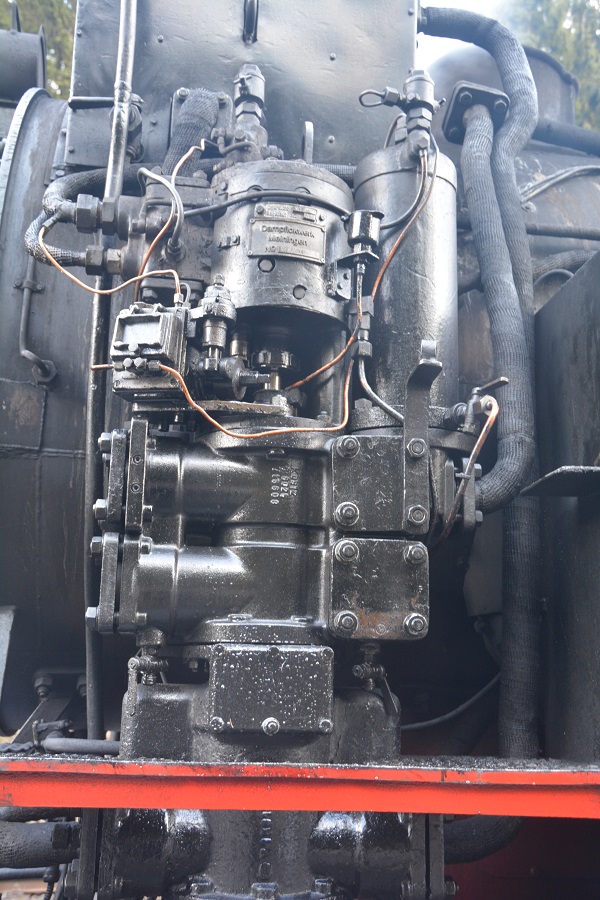
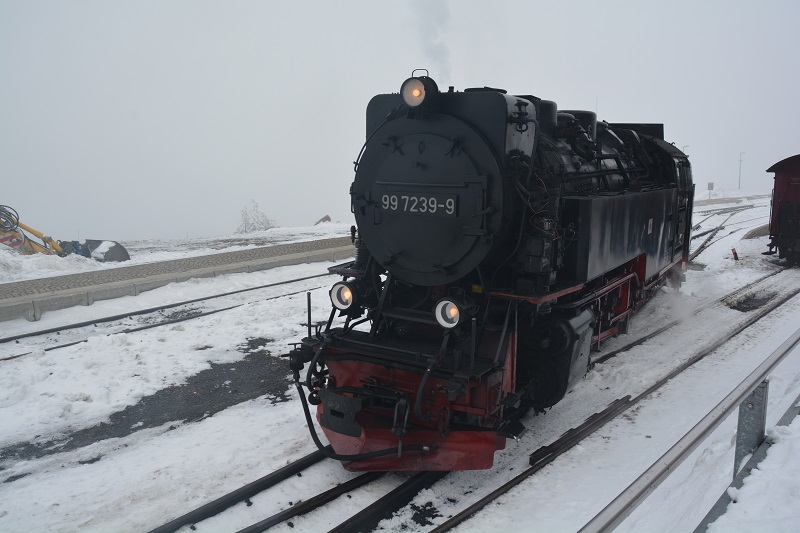
Following the fall of the Berlin Wall beginning on 3 December 1989 the Brocken was again open to the public during a demonstration walk. With German reunification there was a gradual reduction in border security facilities and military installations from 1990. The last Russian soldier left the Brocken on 30 March 1994. The Brocken summit was renaturalised at a cost of millions of euros. It is now a popular tourist destination for visitors to the Harz. Today a narrow gauge railway, the Brocken Railway, once more shuttles between Wernigerode, Drei Annen Hohne, Schierke and the Brocken. The trains are regularly hauled by steam locomotives. In 2014 this is the way I got to the top of the mountain. There is now a museum, hotel and restaurant at the summit.
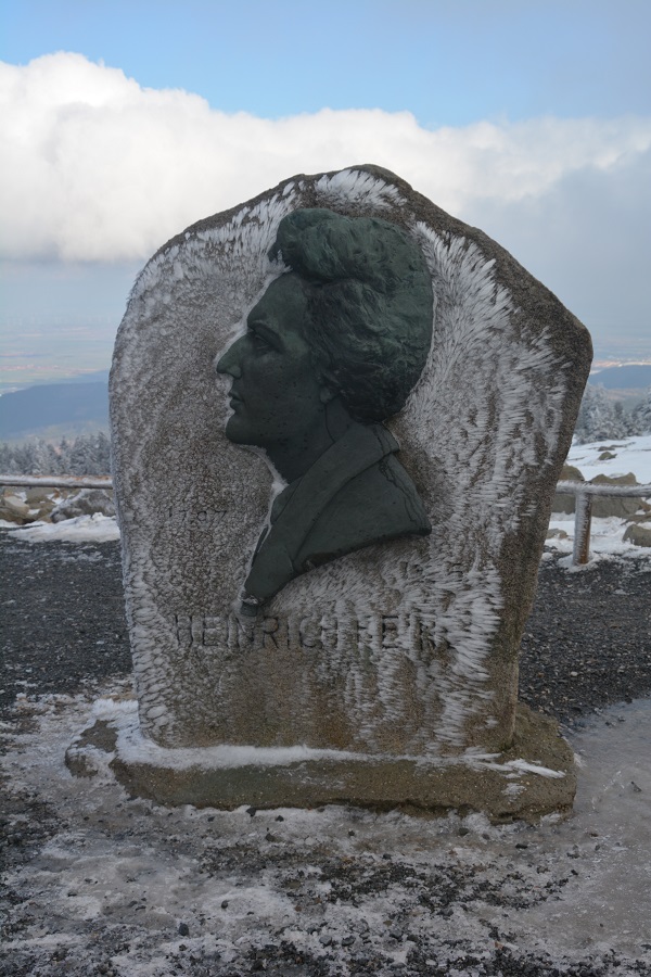
The Summit
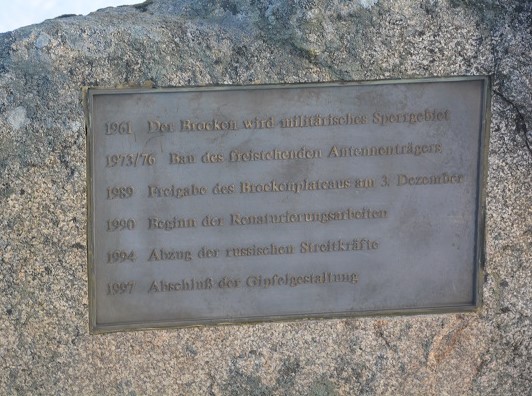

Remnants of a lost border
The journey up
Borders and steam trains, what is not to like…


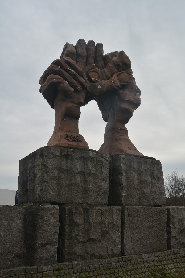
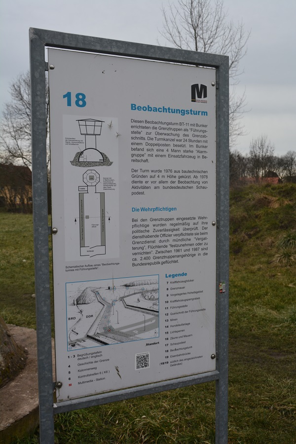
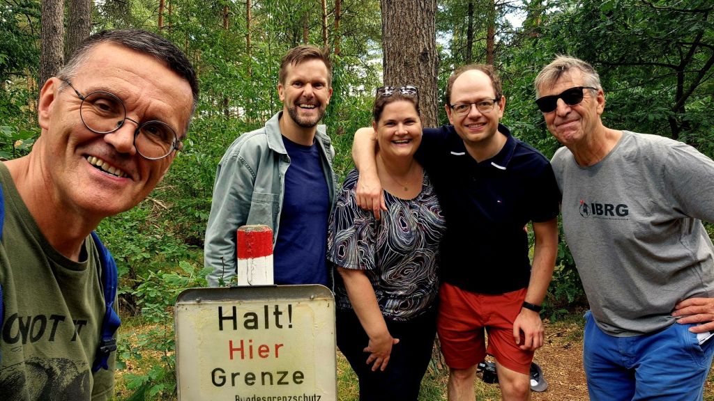
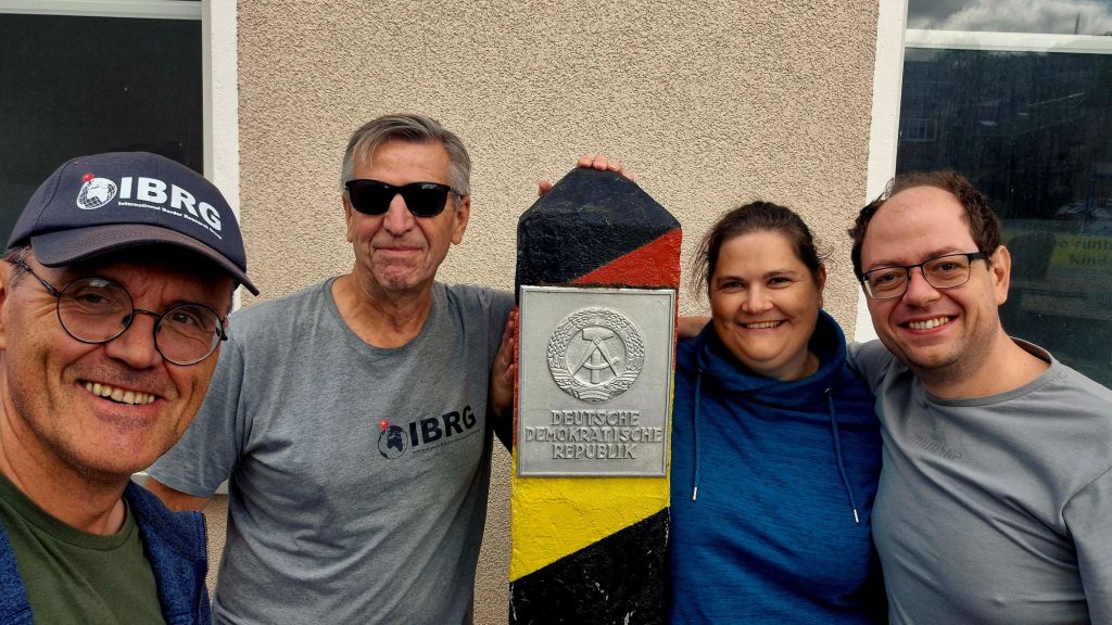
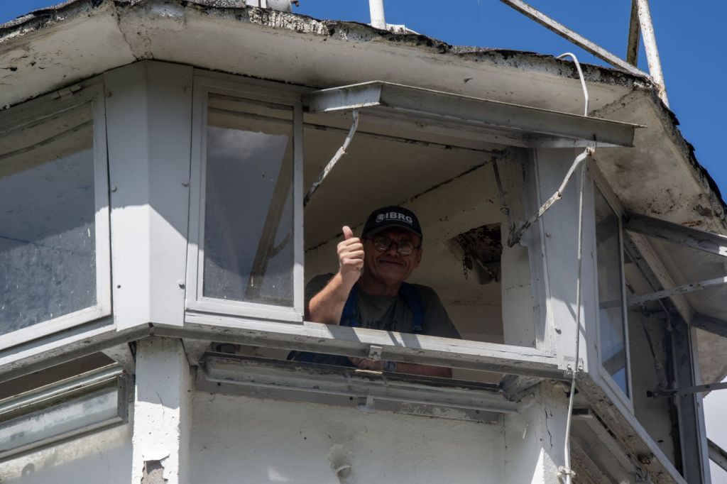
In August 2025 I visited further sections of the inner German border as part of the IBRG LIVCO-25 expedition. The sites visited were varied from small memorials, forgotten border strips and missing border markers, to large museums commemorating the inner German border.
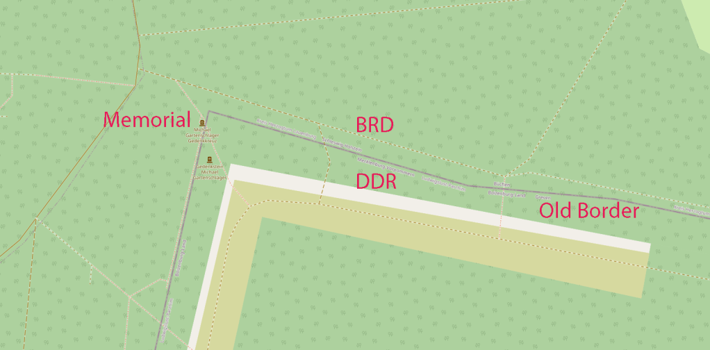
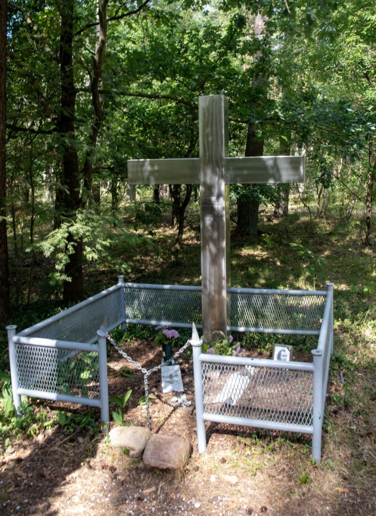
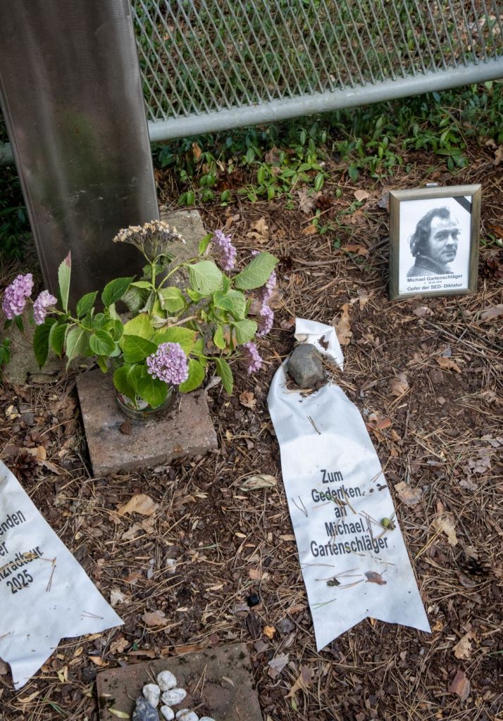
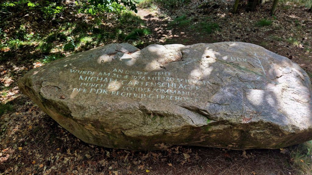
Michael Gartenschläger memorial
Michael Gartenschläger was born in 1944 in Straußberg near Berlin. As a teenager, he and his friends protested against the events of August 13, 1961, and were sentenced to life imprisonment. After ten years in prison in the DDR, Michael Gartenschläger was ransomed by the Federal Republic of Germany. In 1976, he dismantled two SM-70 self-firing devices on the inner-German border near Büchen. This action generated considerable media attention as the DDR denied their existence – during the third attempt to dismantle them, Gartenschläger was ambushed by East German border troops and shot dead on the night of April 30 to May 1, 1976. Gartenschläger advertised his intentions perhaps unwisely. No one was held accountable for his death. Near the site of his death a memorial has been erected.
We visited the following points as part of the IBRG LIVCO-25 expedition.
Per, a German member of IBRG met us at the memorial site and explained the history and tragedy surrounding it.
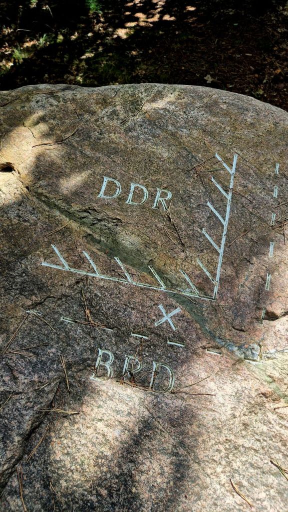


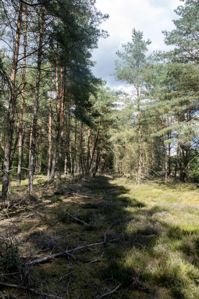
A short distance from the memorial the border strip that existed between east and west Germany was still visible and the remnants of border roads and ditches are defying the passage of time.
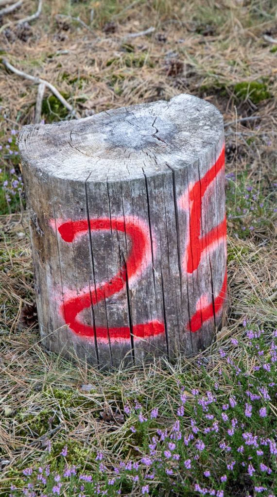
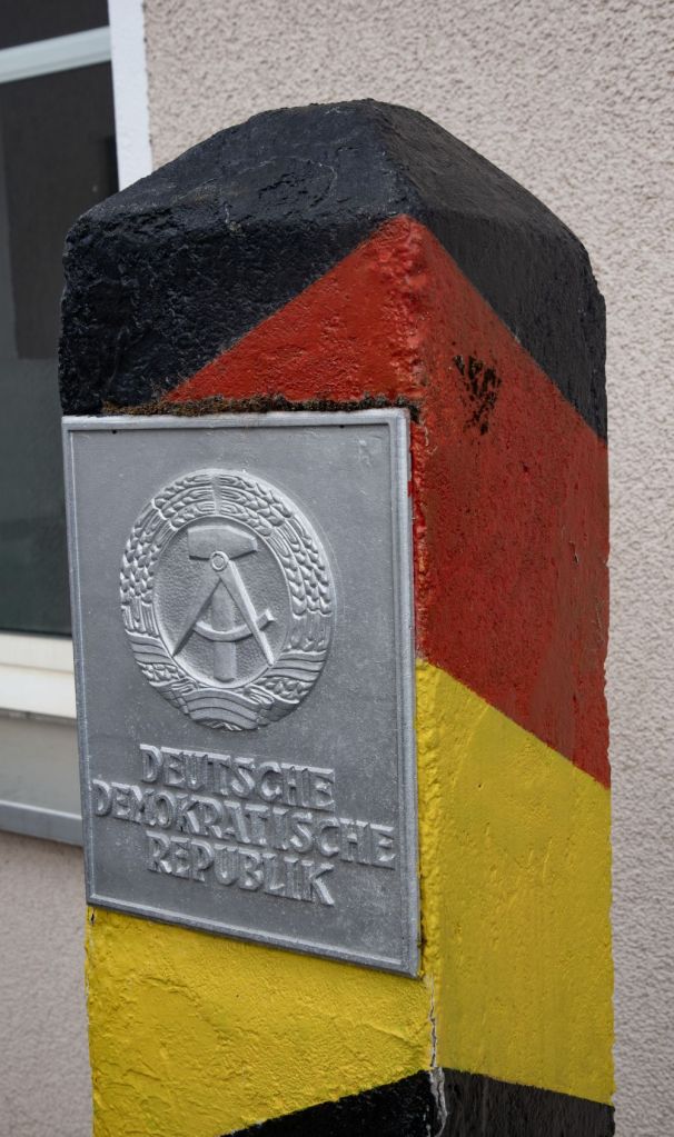
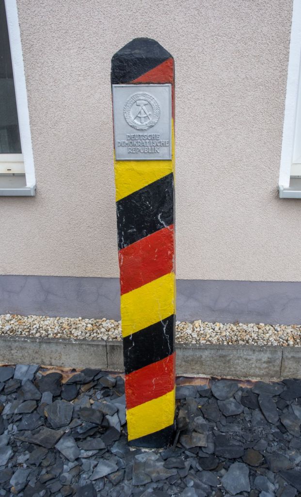
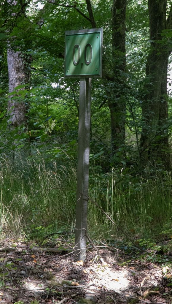
Armed with old border maps that indicate the location of border markers we spent some time exploring. The stones which were there as little as 4 years ago now appear to have been removed.
At one point we found a wooden stump marked with #25. The granite marker was however nowhere to be seen.
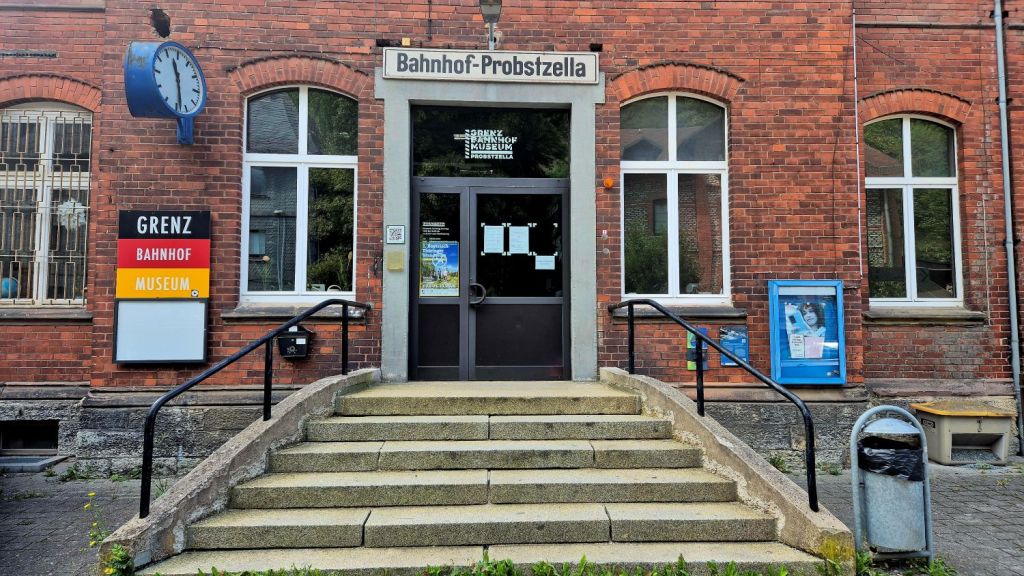
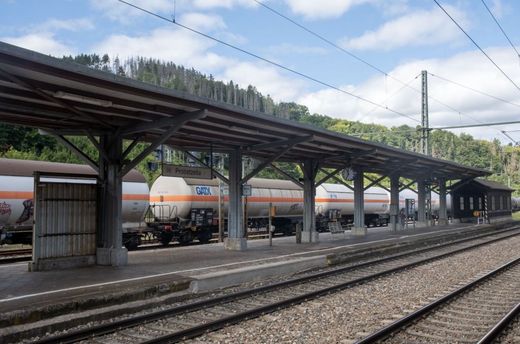
Probstzella station
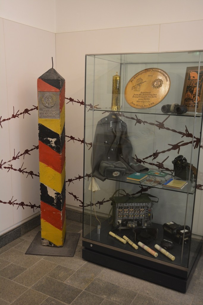
Probstzella station is the station of the Thuringian town of Probstzella, The station is 1.3 km from the Bavarian-Thuringian border and after the Second World War until German reunification in 1990, it served as the point of entry for traffic passing from West Germany to East Germany and is considered the last remaining border station on the Inner German border. During the division of Germany, Probstzella served as a border station, with a building erected specifically for this purpose from 1976 onwards, which was demolished in 2008. On November 6, 2010, the “Grenzbahnhof Museum” opened in the station’s historic reception building. It presents a detailed history of border controls at inner-German border stations.

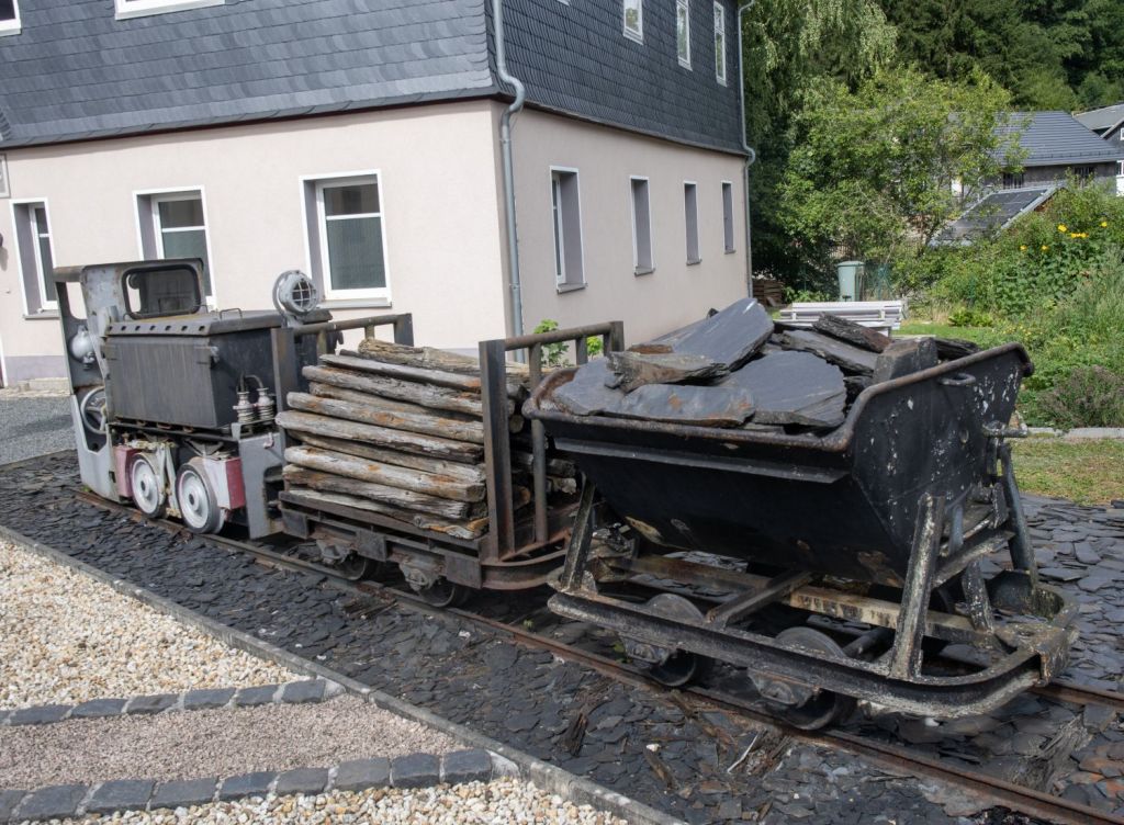
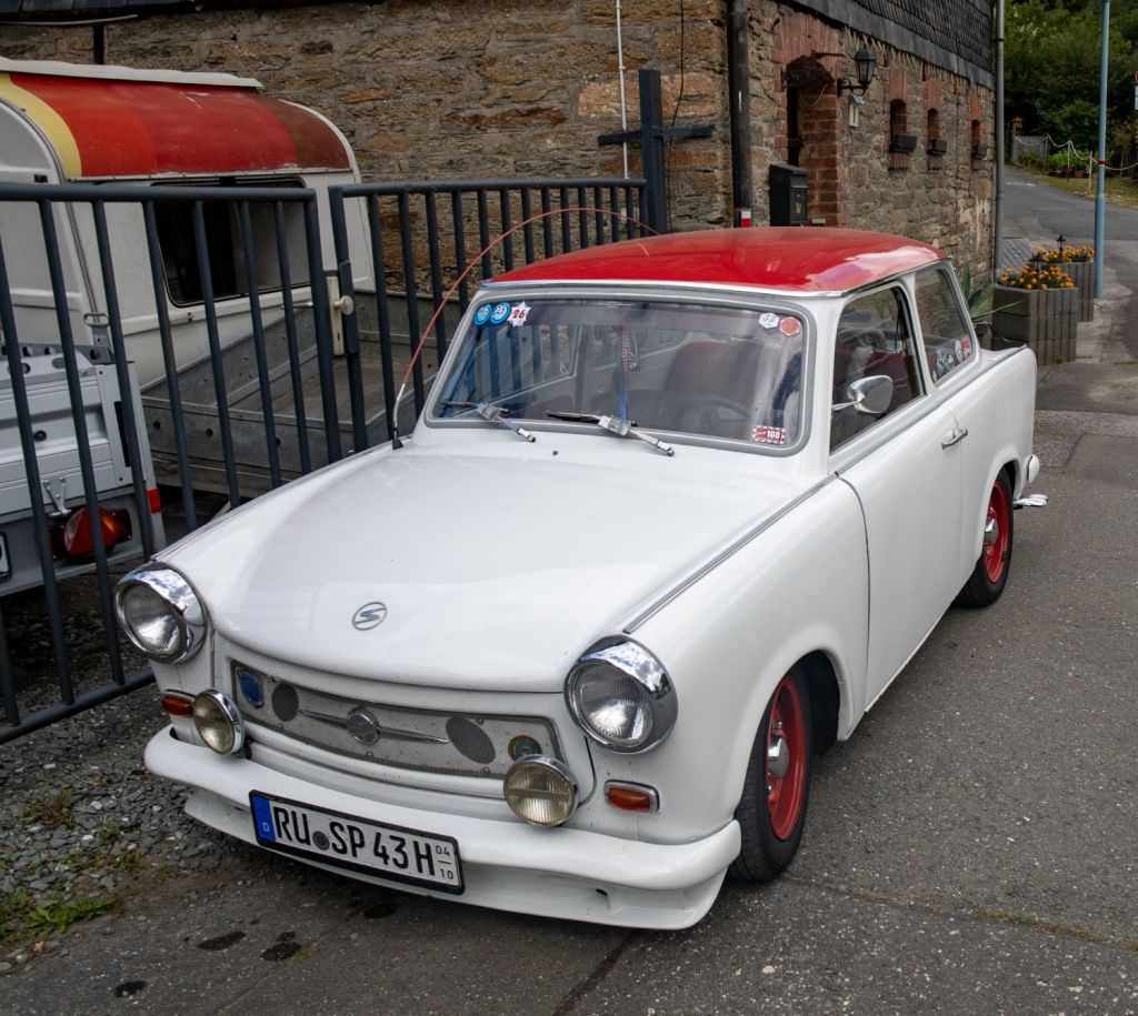
In the center of town there were some border related displays and surprisingly several Trabants, the iconic car of the DDR.

The Station
With the exception of the museum, it would be difficult to identify the station as a key transit point. However it was interesting looking for echoes of those past times where DDR border guards persecuted travelers to the DDR.

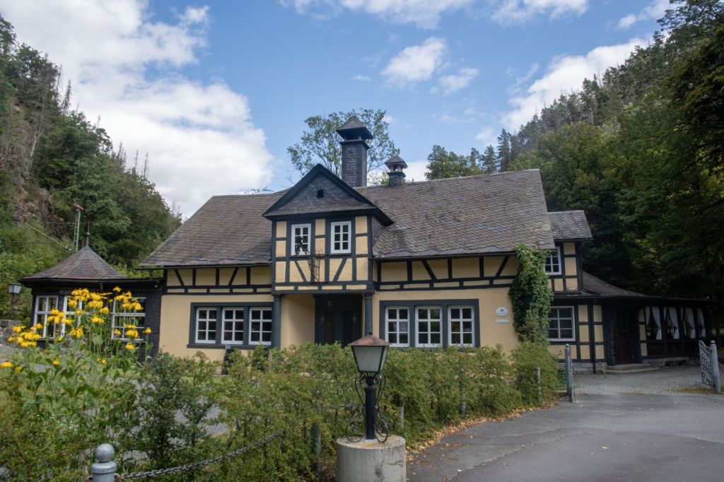
Villa Falkenstein
Villa Falkenstein is marked on the map above at A and was situated right by the inner German border. It is now a private residence but was in the past a brewery. Some legacy signs on the river and road (which was closed during the cold war) indicate its unique location.

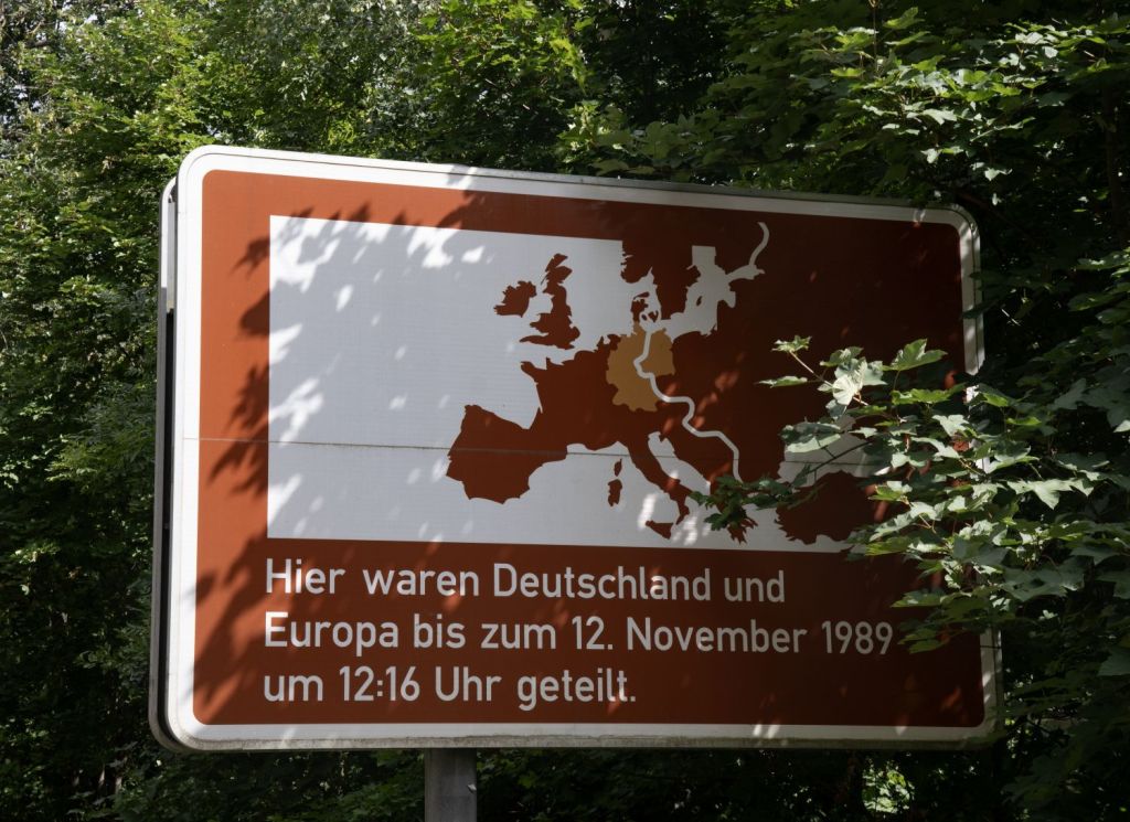
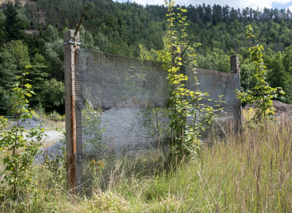
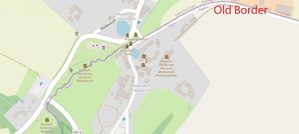
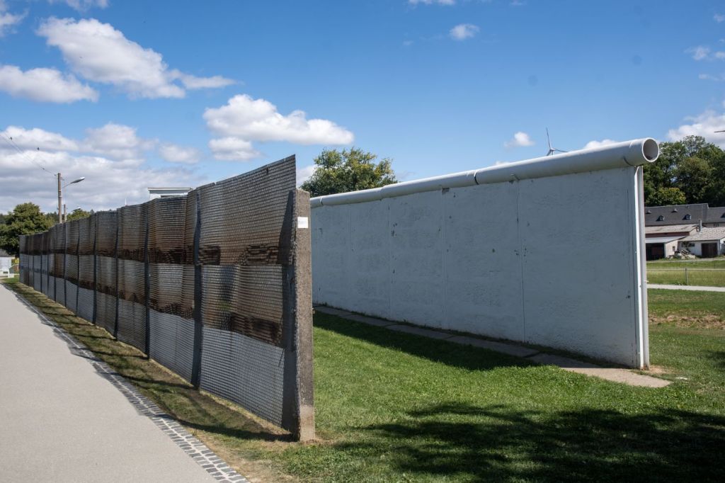
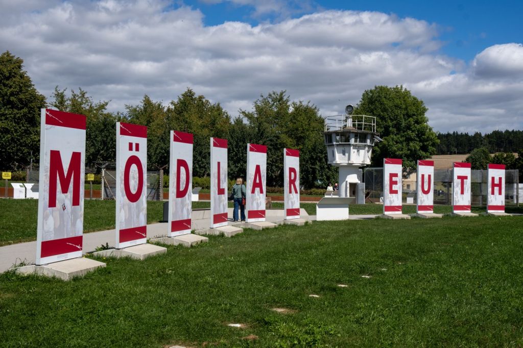
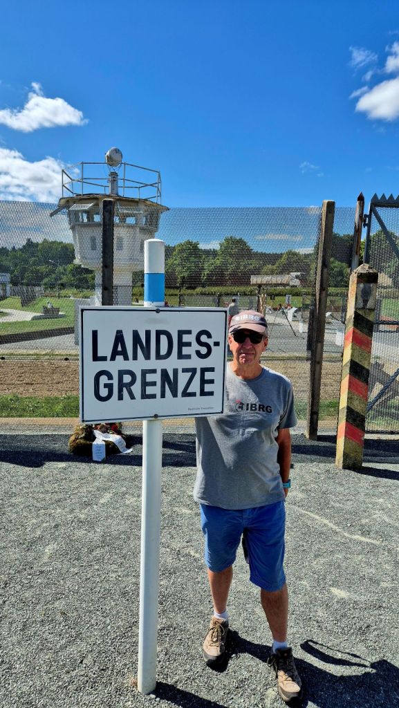
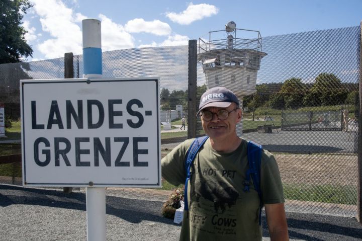
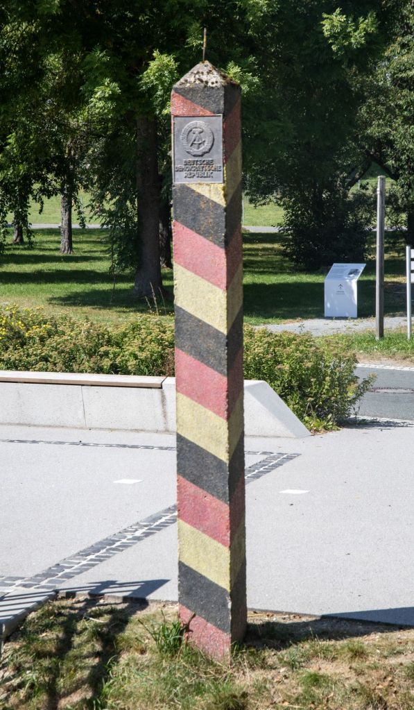
Deutsch-Deutsches Museum Mödlareuth
Mödlareuth is a German village situated partly in Bavaria and partly in Thuringia. Between 1949 and 1990, the northern part was in East Germany and the southern part in West Germany. It was called “Little Berlin” by the Americans because a wall divided it until 1989, like the Berlin Wall divided Berlin. “Little Berlin” became a symbol of separation between the West and East by the wall, but also a symbol of reunification. Today the Museum Mödlareuth shows the history of the village and gives information about the political system at that time and probably the best example of what the inner German border looked like and how it impacted on individuals lives.
Since 1994, Mödlareuth has had an open-air museum about the border between East and West Germany. It includes a portion of the original wall as well as a rebuilt barrier typical of those on the border at the time. Border markers, DDR symbols, watchtowers and border fortifications all add to the sense of history, There is also a large collection of vehicles from the period and a section of the Berlin Wall.
Although there is free movement between the two parts of the village today, there are still many differences. They have different postal codes and telephone area codes; the residents vote separately and send their children to different schools as they are in different German Federal states.


Two differing tripoints…
Click on the images below for individual visit reports.
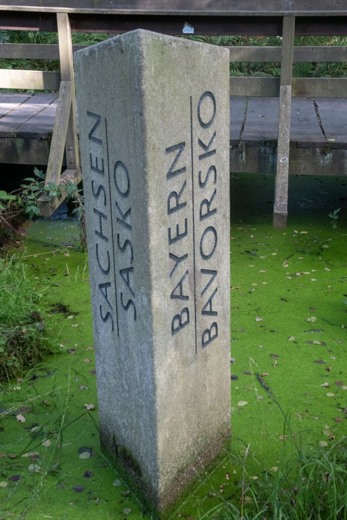
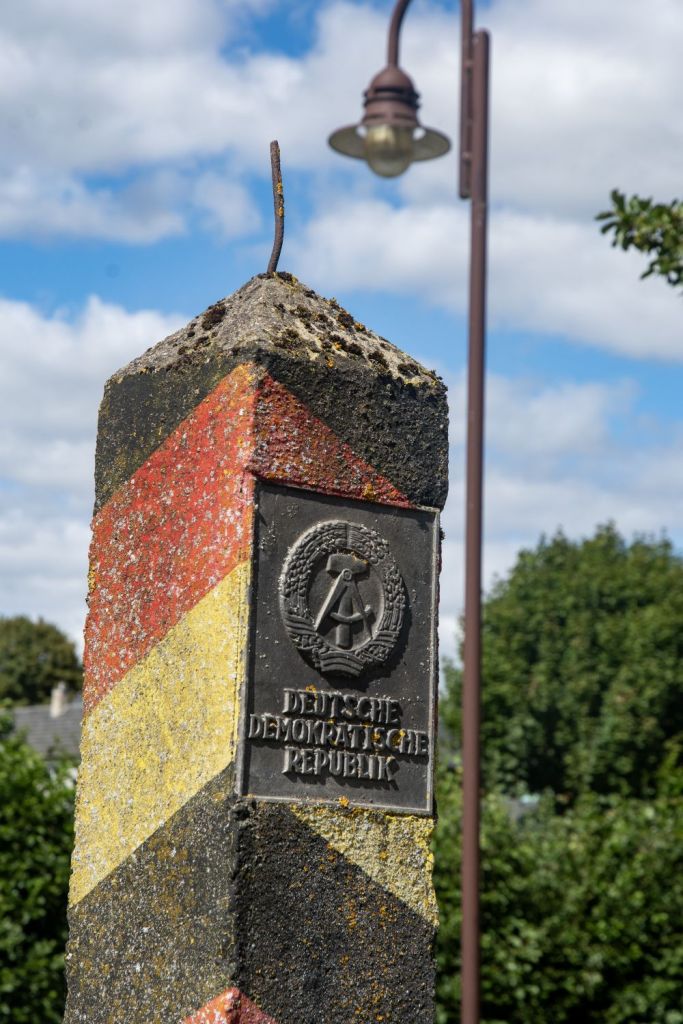
These are both historic tripoints, during the division of Germany the Drei Freistaaten Stein did not exist, but this was a significant point, being the tripoint of the 3 German states with “Free” in their title and was established in 1854. In 2007 the current monument was created. The second tripoint is at the southern end of the inner German border where East and West Germany met Czechoslovakia. None of these states remain but Bavaria, Saxony and the Czech Republic have marked this point with a series of markers and information boards.

Date of Visits: 18-20 February 2014 and 22 August 2025
