
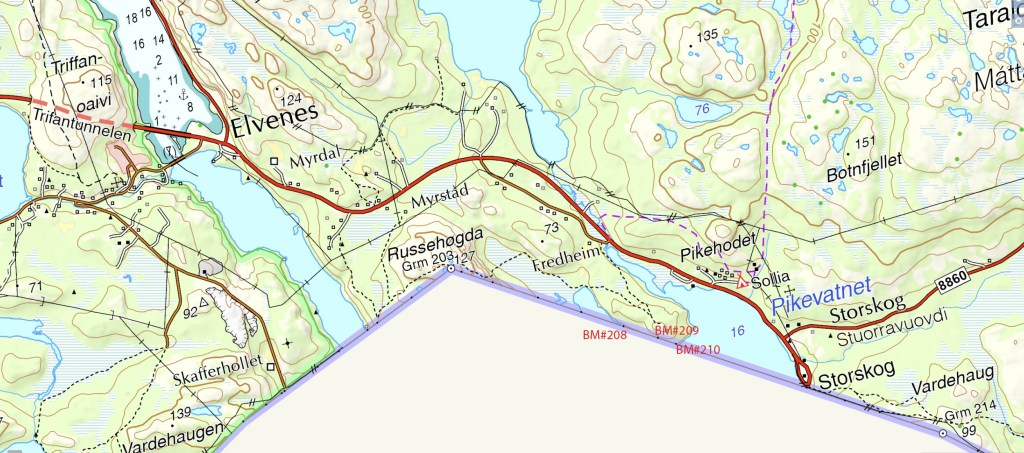
The planning phase for any border expedition raises area of possible exploration and also poses questions about access, feasibility and what we are likely to find. In this instance it appeared as if there was a small Russian pene enclave at the southern portion of the Pikeneset peninsula. Closer examination found that the border was delineated with 3 border markers BM #208 to BM#210 (west to east) and that there appeared to be a strip either side of the border markers. A small track led from the E105 to a Norwegian border observation post. The border was only a short distance from there. I visited this point as part of the IBRG ARTEX-24 expedition.
A pene enclave is a segment of land which for practical purposes is separated from the rest of the territory and can only be accessed via another country, in this instance Norway. It is not a full enclave because in this instance it would be possible for Russia to access the area by boat. Other examples of pene enclaves are Point Roberts in Washington State that can only be accessed by car via Canada and Kleinwalsertal Valley is connected only to Germany and not to Austria.


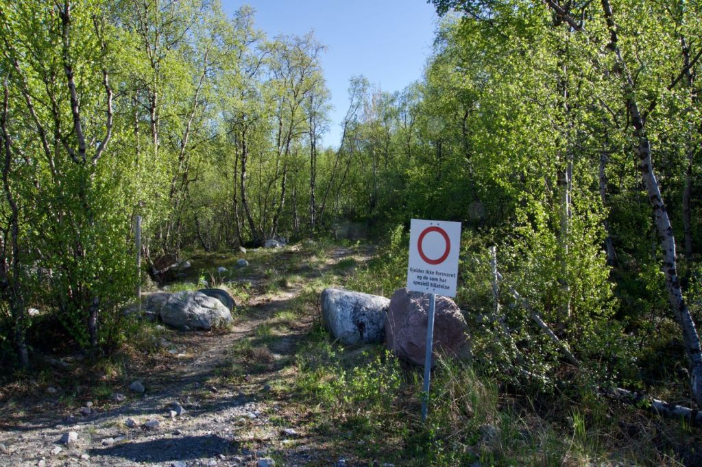
The walk in
Looking at a map does give some indication about what to expect. Note the contour lines that indicate a increasing slope up to the Norwegian Border Control Facility following a track. South of the building there is a steep slope down to the border line, with no tracks indicated.

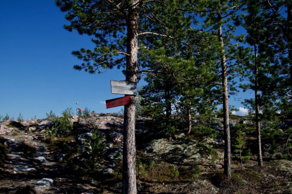

Norwegian Observation Post


Naming of the enclave. It was not immediately clear what the name of this small Russian enclave should be. We looked at adjacent names of lakes and land masses. In the end the border treaty documentation (below) provided the clue.
Views of Russia
Our first views of Russia on the IBRG ARTEX-24 expedition.


The border
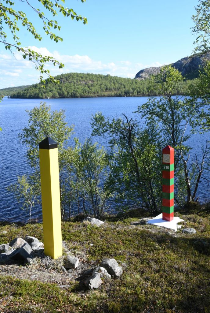
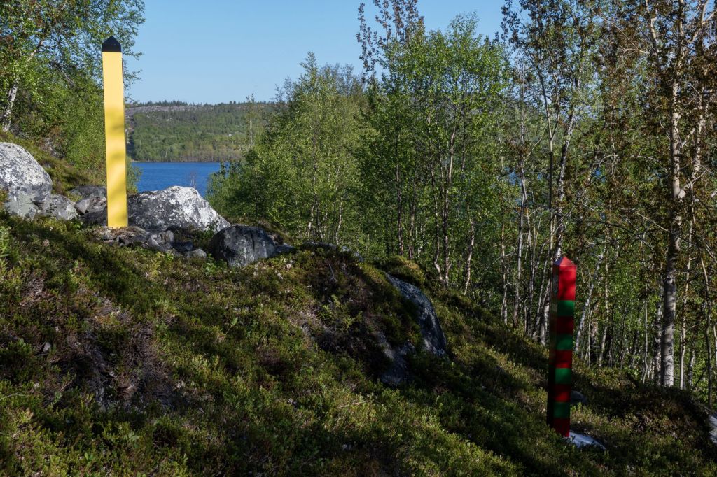
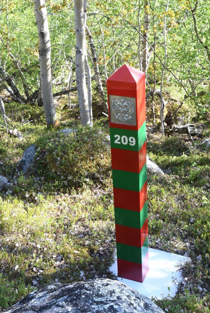
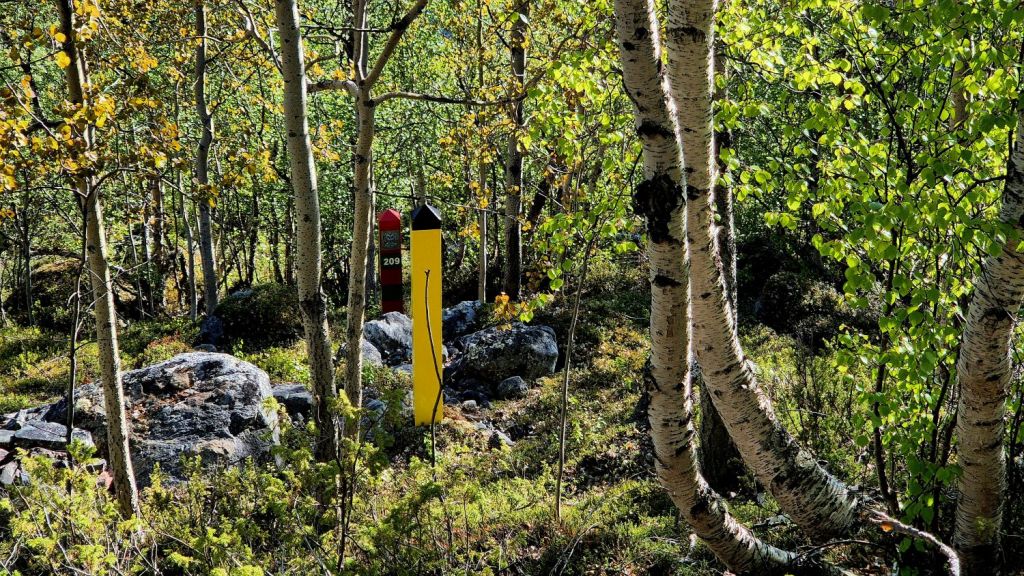
After navigating slowly up to the building and then steeply down the other side we finally reached the border marker #210. The Norwegian-Russian border is marked with 396 border markers. These include concrete pedestals, cairns, posts and leading marks. The border posts are set up in pairs across from each other. The Norwegian posts are yellow with black tops, while the Russian posts are red and green striped. On land, the border posts in a pair are 4 (four) meters apart in a cleared border corridor that is 8 (eight) meters wide, and the border line is located midway between the posts.
NO/RU BM#210


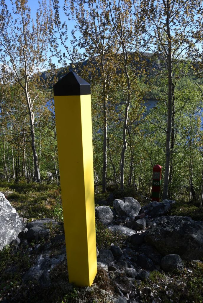
NO/RU BM#209
Walking west through the vegetation we reached NO/RU #209, it was tempting to walk within the 8m border corridor although it was not always clear where the actual border line was and the concern over the high level of fines for transgressing meant we moved north and pushed through the scrub.


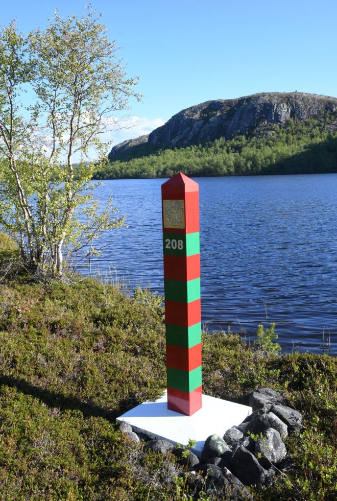
NO/RU BM#208
It was possible to see the pair of border markers #208 from #BM 209. Nevertheless, we moved north away from the border to be sure of no issues. The border moves in a straight line until it enters the Lake Nietijarvi.


Border Treaty Documentation
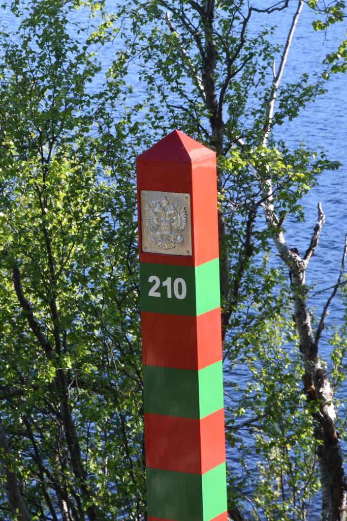
BM#210


Date of Visit: 14 June 2024
