
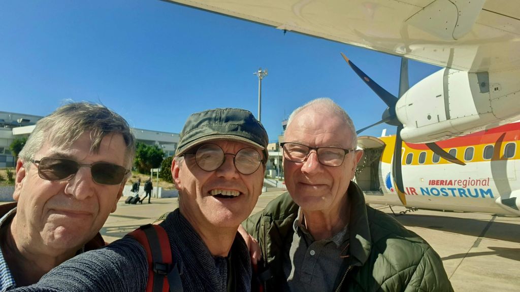
Melilla is an autonomous city of Spain on the North African coast. It lies on the eastern side of the Cape Three Forks, bordering Morocco and facing the Mediterranean Sea. It has an area of 12.3 km2. Colonized by the ancient Phoenicians (later Carthaginians) and Romans under the name of Rusaddir, it fell as a Berber town to Spain in 1497 and remained Spanish thereafter despite a long history of attack and siege. After acquiring the adjacent area in about 1909, Spain modernized Melilla’s port and made the town into a garrison post for Spanish Morocco. I visited Melilla as part of the IBRG MOMEX-24 expedition.

In 1921 during the Rif War, Moroccan tribes under the leadership of Abd el-Krim almost captured the town. Melilla was the first Spanish town to rise against the Popular Front government in July 1936, thus helping precipitate the Spanish Civil War. Melilla was retained by Spain as an exclave when Morocco attained independence in 1956.

Melilla is one of the plazas de soberanía, and its sovereignty is disputed by Morocco. The plazas de soberanía (places of sovereignty)
are divided into 2 groups, major which includes Ceuta and Melilla, and minor that includes the rest that are mainly little islands and a peninsula. They include (west to east) Perejil Island, Peñón de la Gomera, the Alhucemas Islands, Alboran Island and small islote de La Nube and finally the Chafarinas Islands.
It was part of the Province of Málaga until 14 March 1995, when the Statute of Autonomy of Melilla was passed. Melilla is one of the special territories of the member states of the European Union. Movements to and from the rest of the EU and Melilla are subject to specific rules, provided for inter alia in the Accession Agreement of Spain to the Schengen Convention.
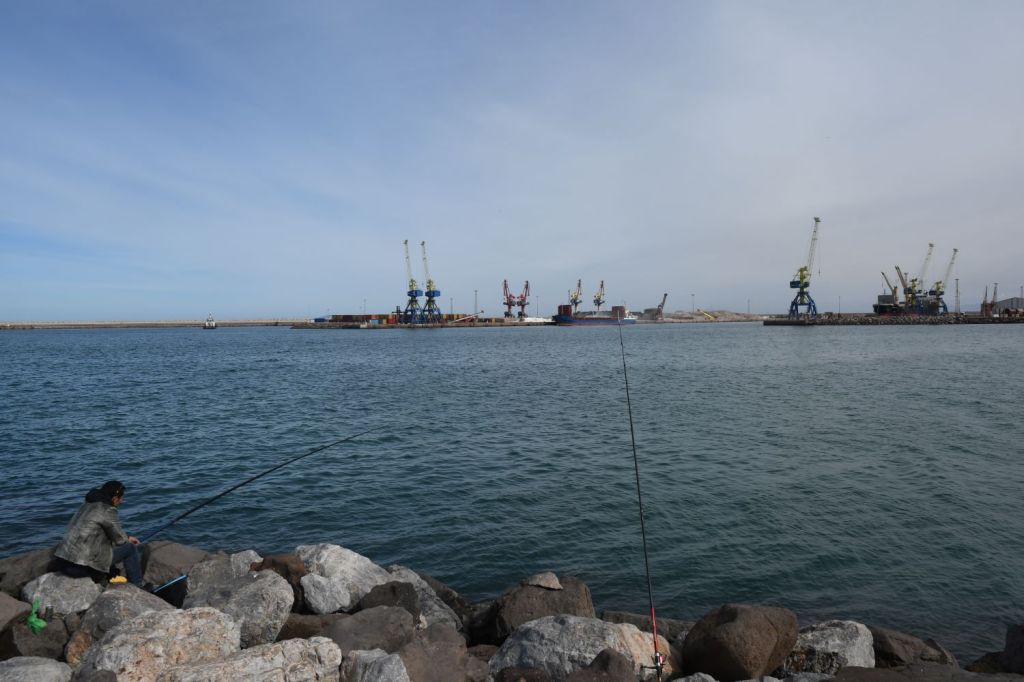
Today, Melilla is a modern Spanish town with a diverse multi faith population. Two-thirds of the exclave’s population is Roman Catholic, while the remainder is mostly Muslim, with small Hindu and Jewish groups too. There is a local dialect influenced by both Spanish and Berber. The modern quarter of the city spreads south and west on the mainland, while the old walled city is situated between the port and the new quarter. The port exports iron ore that is transported by rail from mines in the the adjacent (Moroccan) hinterland. In many respects Melilla is a normal Spanish town, it had a higher percentage of its GDP from tourism and because its location more of its population are either involved in law enforcement or belong to the military.
Melilla – a variety of images
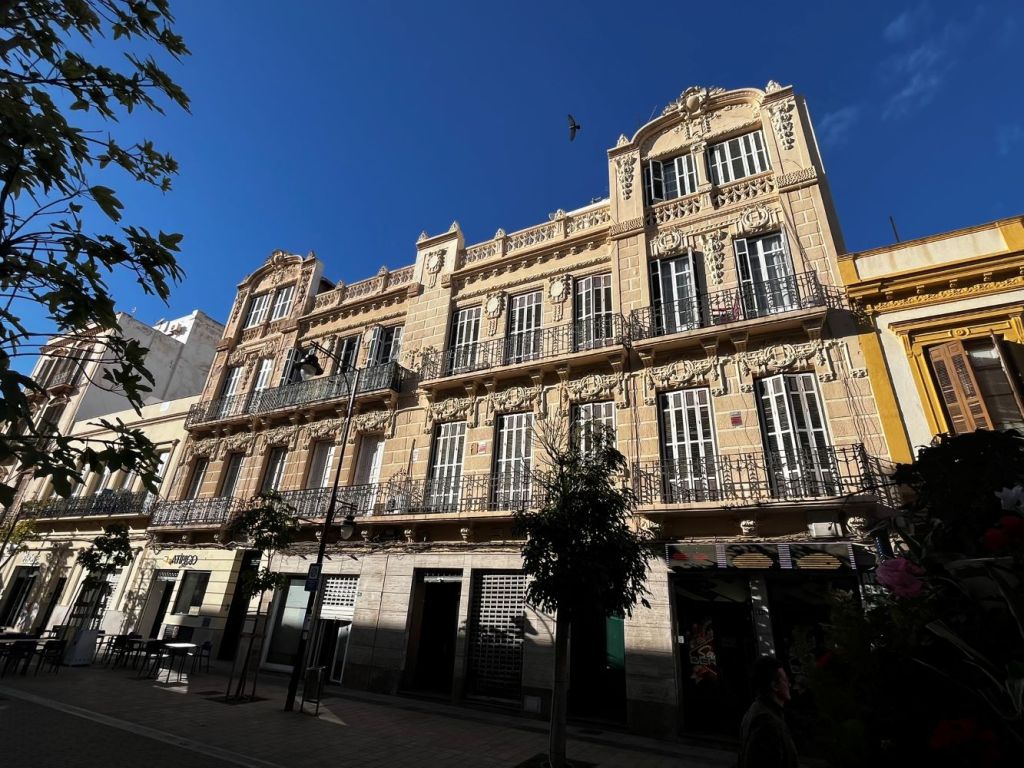
Unlike Ceuta, the other Spanish exclave we visited in 2022 where our focus was exclusively on the border fence, in Melilla we had a couple of days to stroll around. Melilla is known for its modernist architecture primarily through the works of the prolific Catalan architect Enrique Nieto, street art, open plazas and parks. The fort overlooking the harbour is also a focal point.
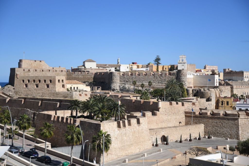
The Fort
Melilla la Vieja (“Old Melilla”) is the name of a large fortress which stands immediately to the north of the port. Built during the 16th and 17th centuries, much of the fortress has been restored in recent years.


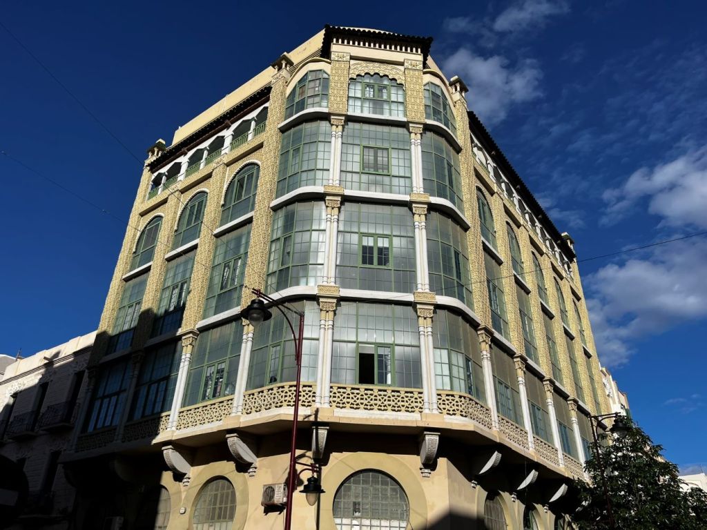
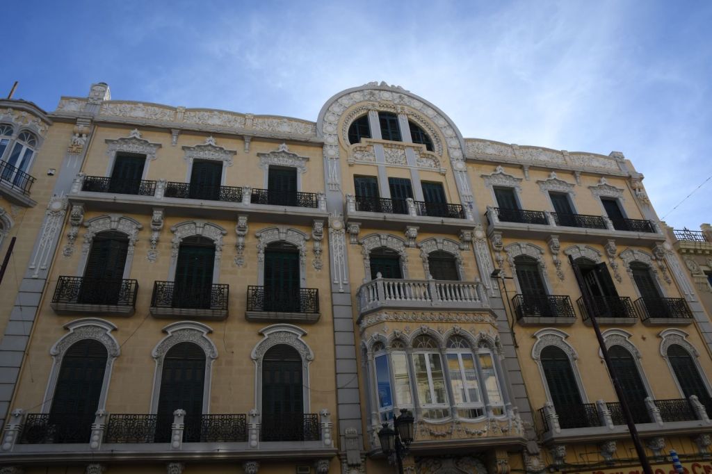
Modernist Architecture
Melilla is the Spanish city with the most Art Nouveau and Art Deco buildings, after Barcelona. You can see hundreds of examples on the streets, elegant façades appearing one after another, with curved forms, floral and plant motifs, wrought iron and stained glass. The origin of this rich heritage was the architect Enrique Nieto, a student of Gaudí, who revolutionised the city’s architecture when he introduced this style in the early 20th century.

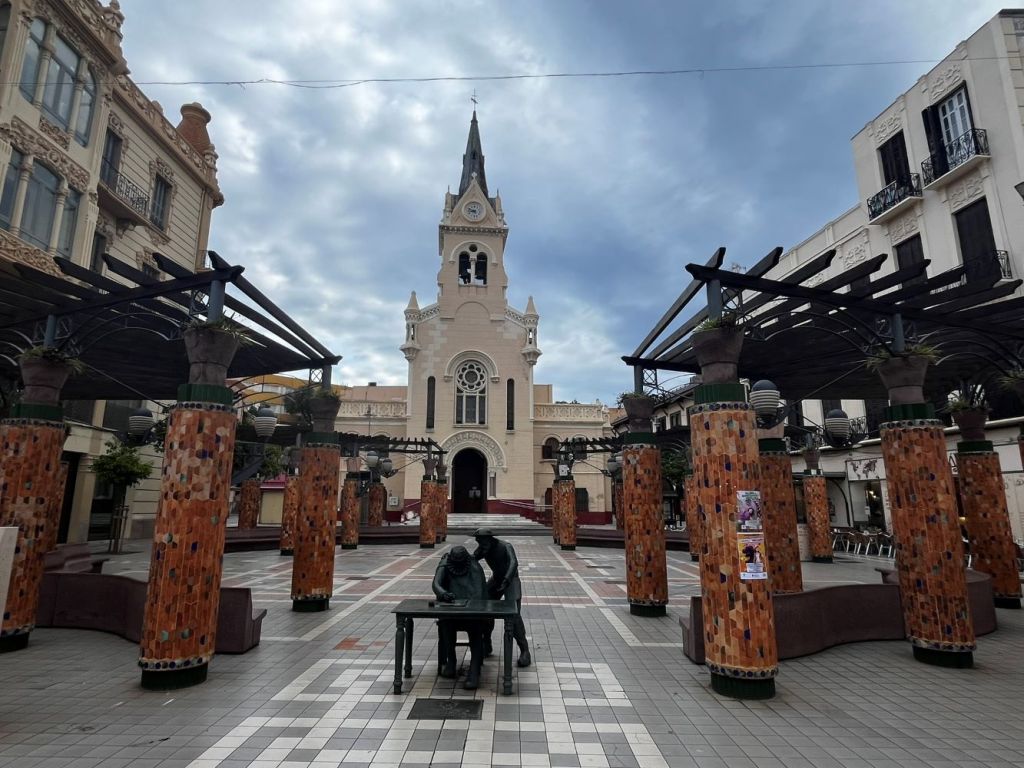

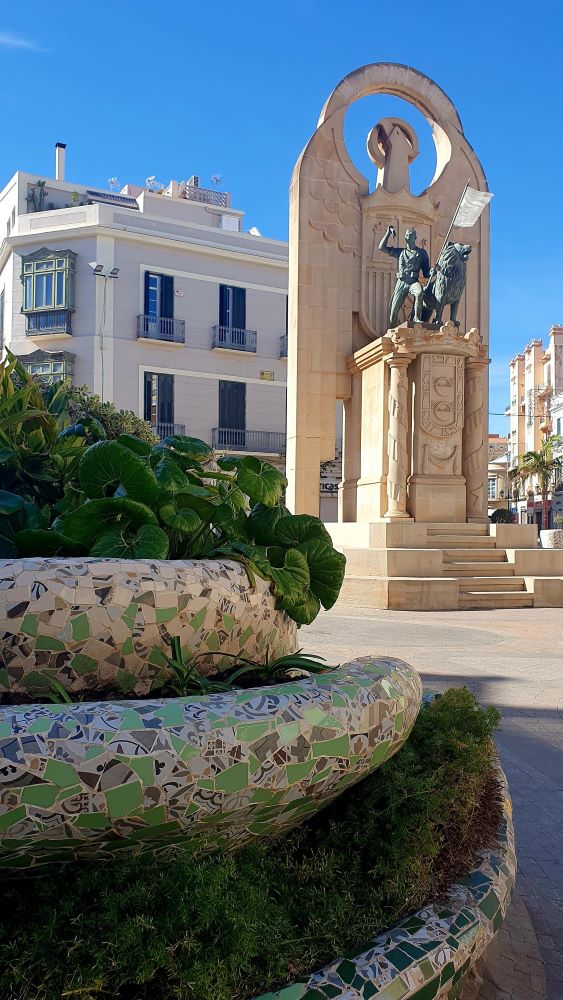
Open Spaces
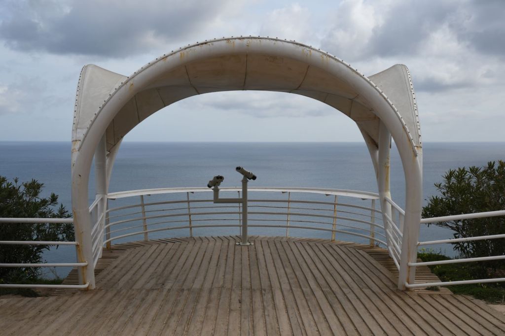
One of the joys of Melilla is simply strolling around and finding nice places to sit and watch the world go by.


The Border
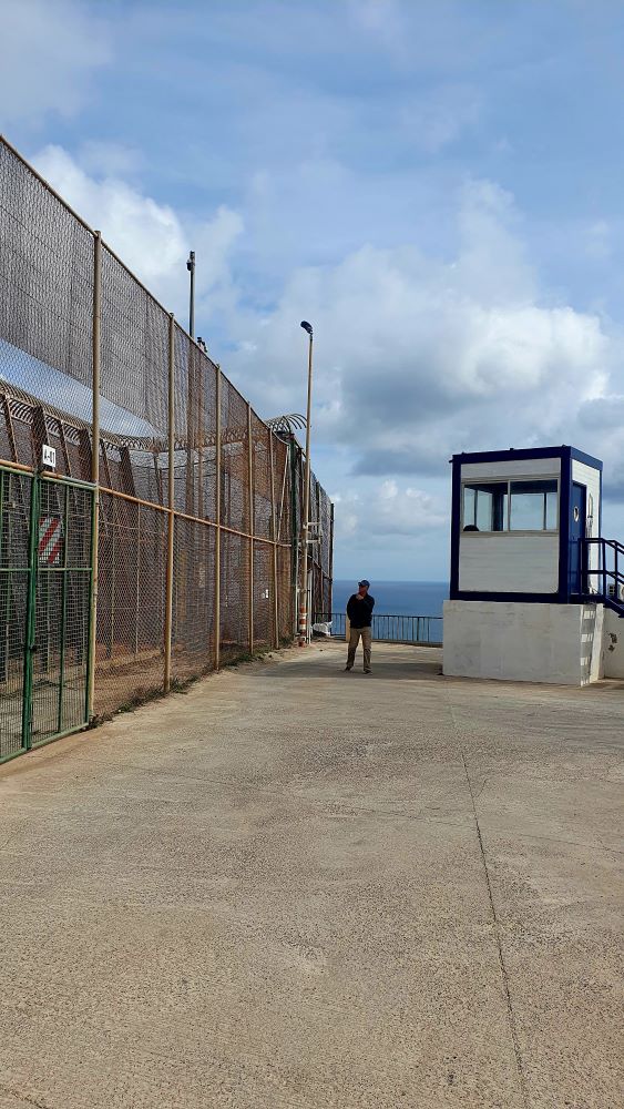
The inhabitants of Melilla do not wish their town to be defined by the border however in many respects it always nearby and present. It is very easy to access, although if you linger or take photos then the Guardia Civil check on what you are doing and why.


Car hire is not available in the exclave so in true IBRG tradition we improvised. These e scooters proved ideal and allowed us to access the length of the border.
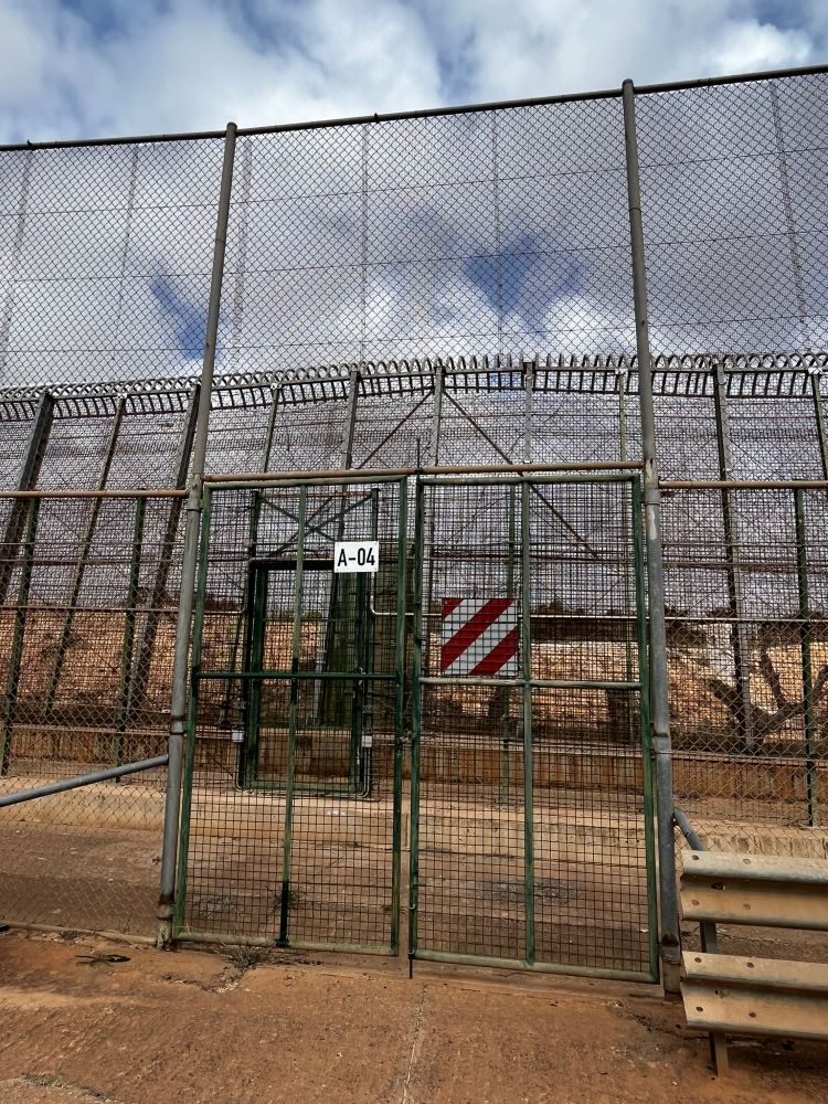
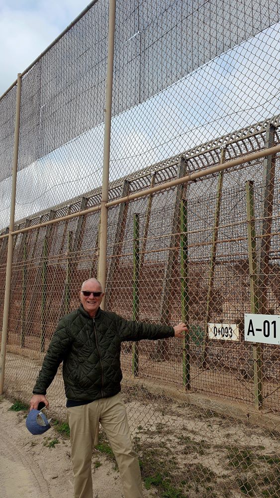
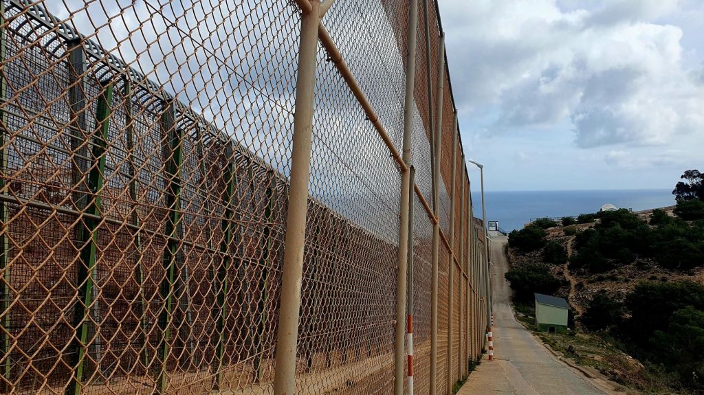
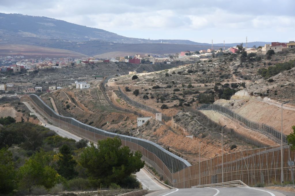
The Melilla border fence forms part of the Morocco–Spain border in the city of Melilla, one of two Spanish cities in north Africa. Constructed by Spain, its stated purpose is to stop illegal immigration and smuggling. Melilla’s border and its equivalent in Ceuta, also bordering Morocco, are the only two land borders between the European Union and an African country.he barrier between Spain and Morocco, consists of a triple Spanish fence. The fence is approximately 11 km long. The triple fence was doubled in height in 2005 to 6m. It has watch towers, access roads, and a range of surveillance equipment. On the Moroccan side of the border, there are a further 2 fences, set back from the border and earthworks and ditches to prevent access. The Spanish side have mobile patrols whereas the Moroccan side have fixed observation points
This border-fence structure is located on Spanish territory and its supervision, including the operation of its gates, remains under the exclusive control of Spanish authorities at all times. Spain acknowledges that its territory includes the border-fence structure. The EU, Spain, and Morocco cooperate closely on border control, a partnership that grants political and economic favors to Morocco for assisting the EU with the protection of its borders from irregular entry. Through this partnership, the EU delegates the responsibility for third-country nationals in search of protection to countries at its external borders to Morocco.
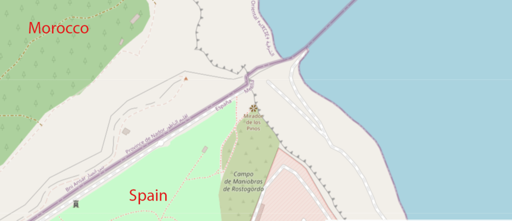
We visited this border as part of IBRG MOMEX -24 expedition. We travelled from the north western point point where the border meets the sea, to the southeastern point where the border enters the harbour area.
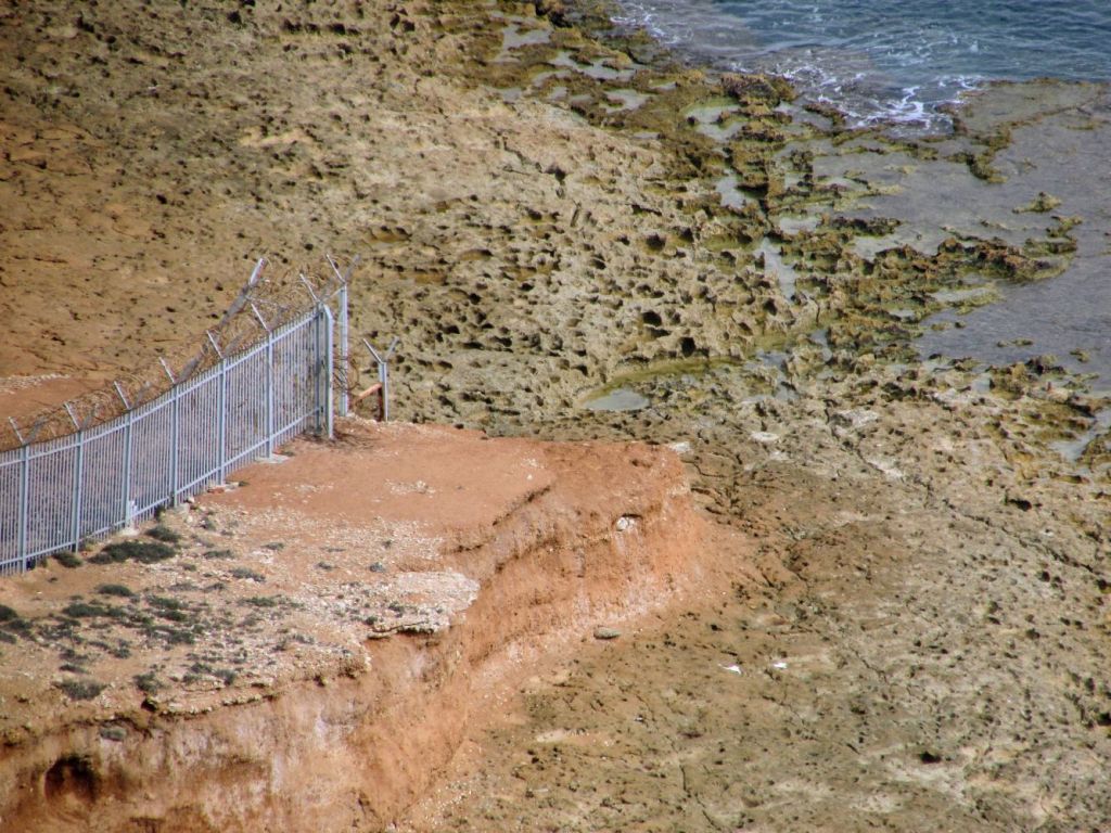
North western point
Tourists who travel to this rather remote point do so to visit the Mirador del Barranco del Quemadero, a scenic spot with cliff and coastal views. We on the other hand focused on the border fortifications as they reached the sea.
The small number of people at this point were focused on the sea birds and the views.

Our focus was different as you might expect. It is always interesting where land borders meet the sea, especially when those borders are heavily demarcated.


Views of the Moroccan side of the border
At this point it was relatively easy to see across the border and identify the Moroccan border defences and facilities. At some points the Moroccan personnel were patrolling right against the fence and were very close.


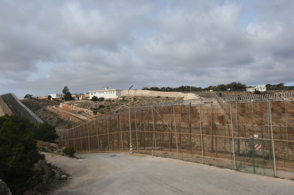
The western border

This part of the border was perhaps the most interesting. The Spanish road followed the border fence very closely and it was possible to get a clear view of the scale and drama of the fortified border. In this section there are also 3 closed border crossing points. These points are deemed sensitive areas and we were challenged at 2 of them about why we were there and what we are doing. The map to the left shows how close Melilla’s airport is to the border. The flight path on landing and take off is directly over Moroccan territory. No flight restrictions as is the case from Gibraltar Airport.
We travelled from north to south until we reached the southernmost point of the exclave when the border turns sharply east.


Border Crossings
The 3 border crossings are reported separately, they are the crossings to Mariguari , Farhana and Barrio Chino (north to south). These were sensitive areas and we were challenged at 2 of them. For the reports for these, with maps, additional photos and reports please click on the photos below.


The southernmost point
Just south of the Melilla – Barrio Chino border crossing, the border turns sharply east. This marks the southernmost point of the exclave. We had the opportunity to see this point from both sides and the contrast is striking.


The Spanish side fence is clearly at right angles and there is a watch tower, reachable by a narrow track used by border personnel.
On the Moroccan side, it is much more developed with roads, buildings and fences. It does not seem to be the same place at all.

The southern border
The border turns east and heads towards the coast. On the Spanish side much of this border is within the port and harbour areas and the road moves away from the fence.

There are however 2 points of interest on this section of the border. The open border crossing Melilla – Beni Ansar is used by vehicles and pedestrians. I used this crossing point on 2 occasions.
The other point of interest is the pier that extends out into the sea on the Spanish side of the border.
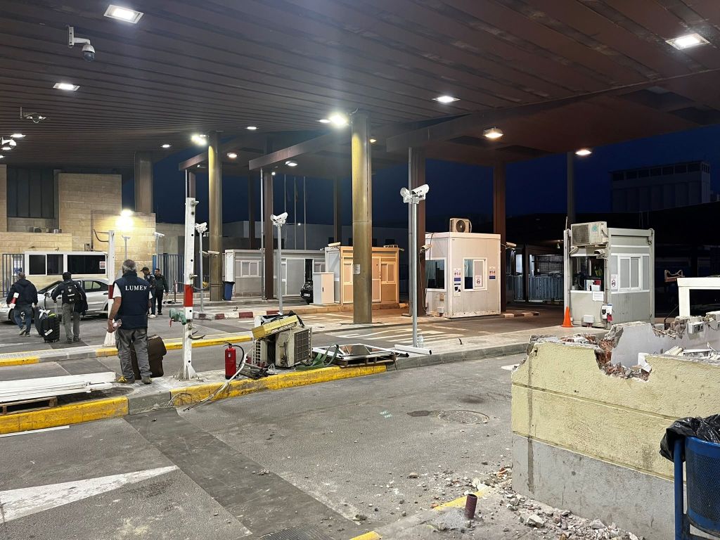
The Border Crossing
The Melilla -Beni Ansar border crossing is the only border crossing between the Spanish exclave and Morocco that is open. This crossing had a dilapidated feel about it, and was much less modern than the Melilla – Farhana crossing that is currently closed. The crossing point is open for both vehicles and pedestrians. It was in March 2024 being renovated on the Spanish side. Please click on the photo below to access the full report of my visits to this point.

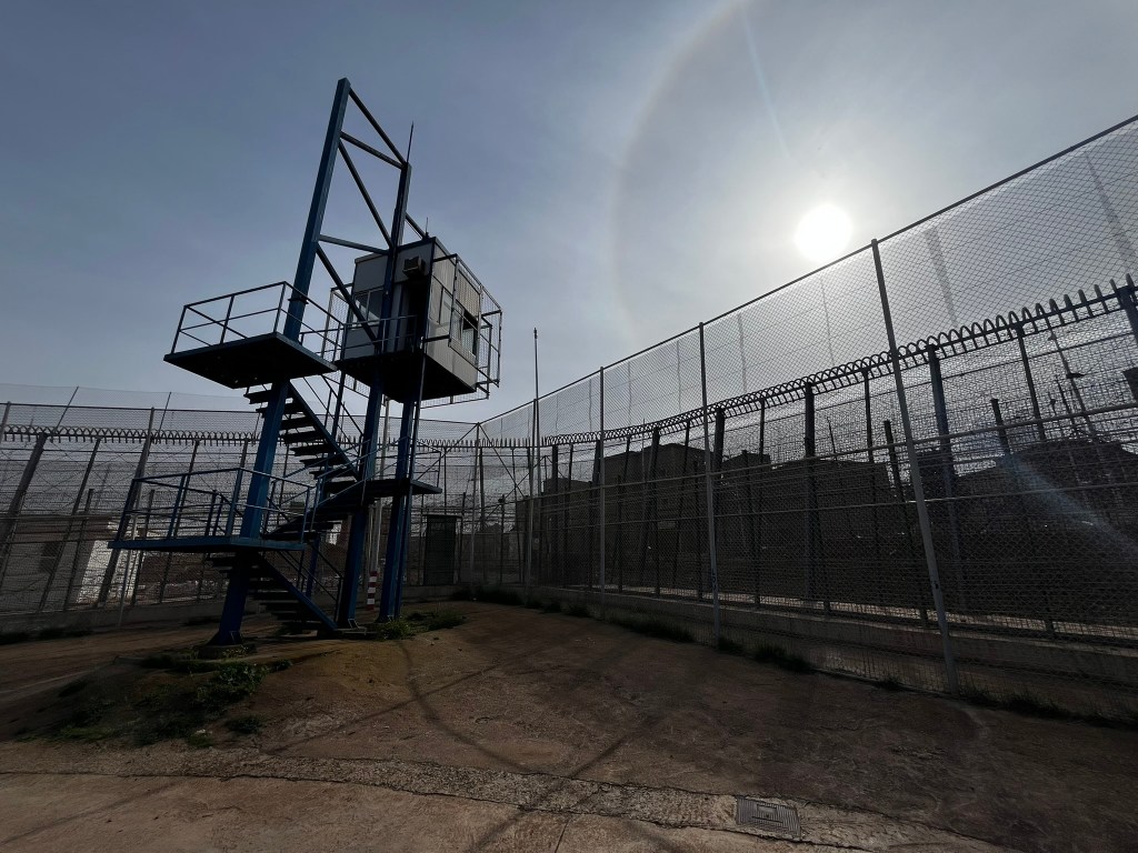
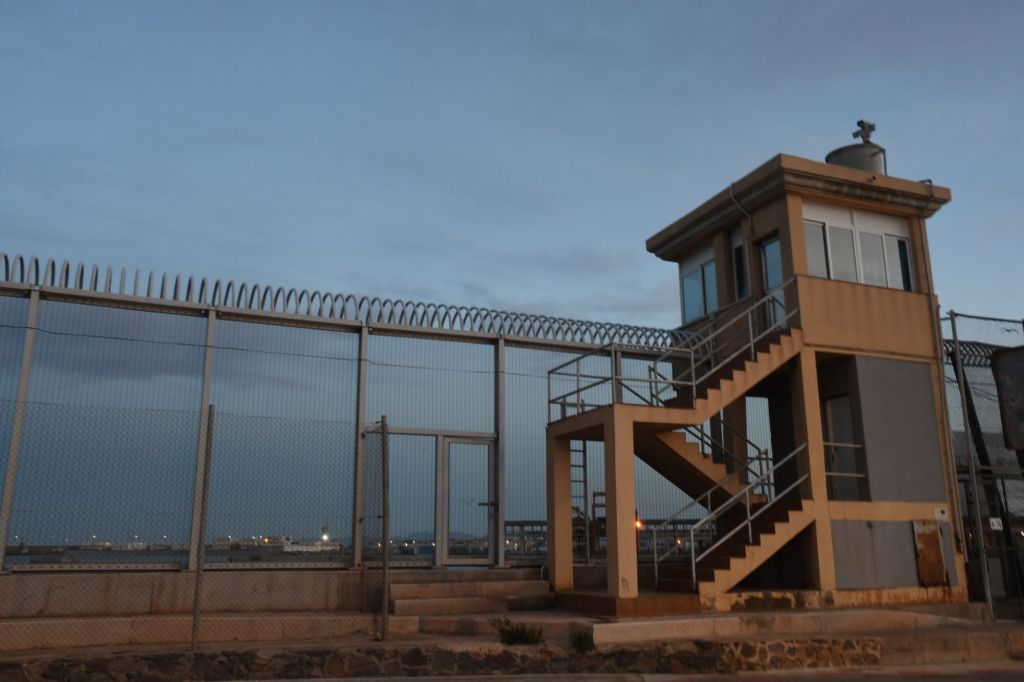
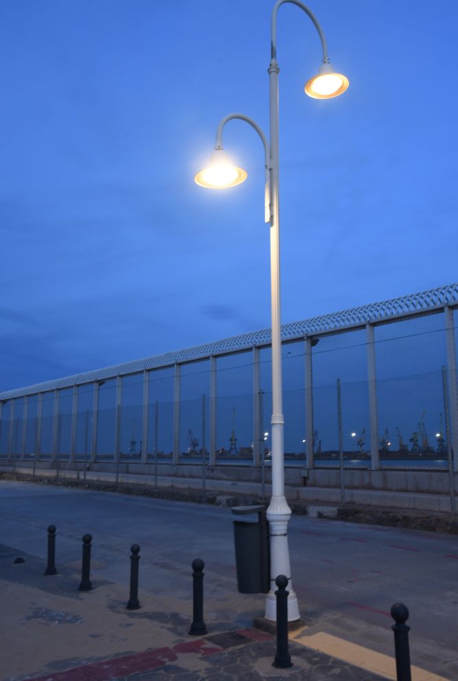
The Pier
The pier was the first point we visited as we went for a trial ride on our e scooters. We revisited it as the last point on our ride along the border too. The pier or jetty is built on the Spanish side of the border and has high fences and watch towers for most of its length, it offers a good view of the harbour on both sides of the border.

At night

During the day
Even here in this very accessible point, Spanish police were present and taking photos of border installations was not advised.


Dates of Visit: 4-8 March 2024
