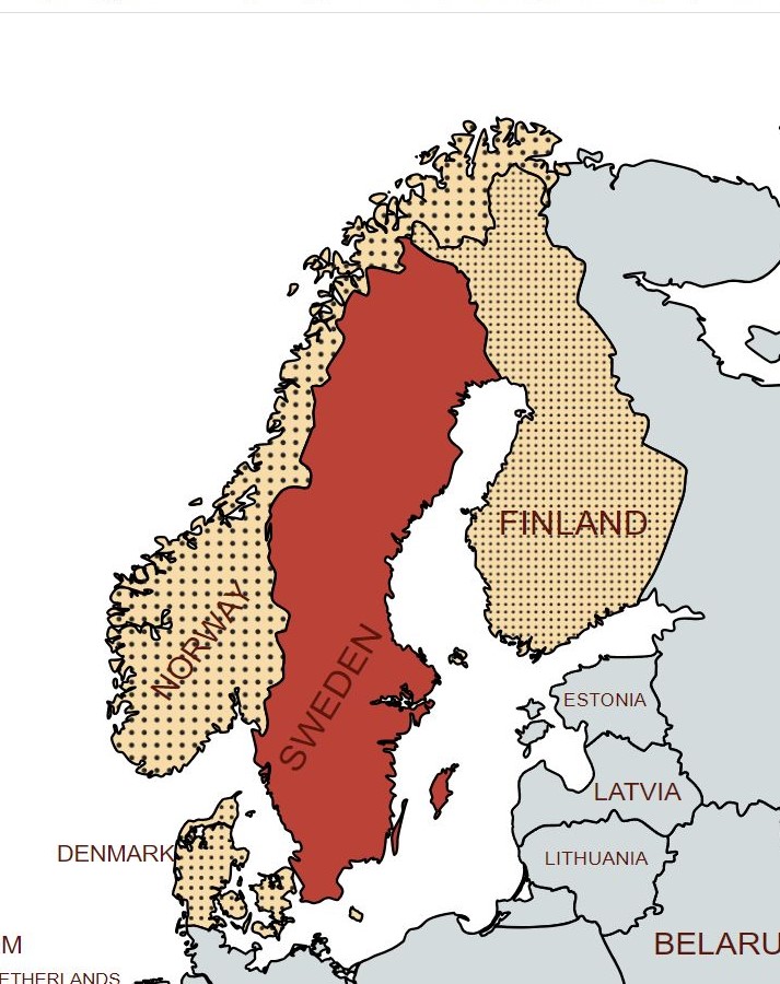
Sweden, formally the Kingdom of Sweden, is a Nordic country located on the Scandinavian Peninsula in Northern Europe. It borders Norway to the west and north, Finland to the east, and is connected to Denmark in the southwest by a bridge–tunnel across the Öresund. At 447,425 square kilometres (172,752 sq mi), Sweden is the largest Nordic country, the third-largest country in the European Union, and the fifth-largest country in Europe.
Sweden is economically and culturally advanced. Unemployment is low and the economy strong. Public-private partnership is at the core of “the Swedish model”, which was developed by the Social Democrats, who have governed for most of the time since the 1920s. It scores highly on indices such as media freedom, equality and access to human rights. It’s cultural reach is global, historically with the Vikings and more recently with ABBA and IKEA.
Relative to its population size, Sweden has taken in far more migrants than any other EU country since the beginning of the migration crisis in 2015. This has put pressure on public services, and prompted a rise in support for the far-right Sweden Democrats party. Sweden is known throughout the world for its neutrality. With the ending of the Cold War, Sweden felt able to join the European Union in 1995. It further altered its long-standing neutrality in the wake of Russia’s invasion of Ukraine and, with Finland, applied to join Nato in 2022.
Border Facts
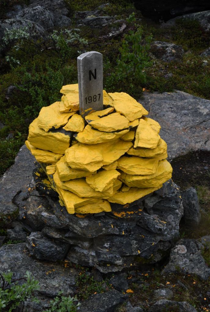
Sweden – Norway Border runs from the western shore of Idefjorden in Bohuslän up to Treriksröset. This border is the longest land border in Europe. It is approximately a total of 1620 kilometres long and runs through very varied landscapes. It is the longest border for both countries. It was established by the Treaty of Brömsebro (1645), the Treaty of Roskilde (1658) and the Treaty of Copenhagen (1660). During the boundary demarcation that followed after the Strömstad Treaty (1751), 293 boundary markers were erected. These have during boundary reviews over the centuries been supplemented with new markers, and some have also been removed. After the review 1984–1987, there are 642 markers and 11 unmarked breakpoints in the official designation series. Of the 642 markers, 612 are cairns, some of which are more or less constantly under water. The other 30 markers are mainly marked by natural stones, memorial monuments and wooden poles (with sign). A review of the national boundary between Sweden and Norway 2020–2024 is currently underway.
In Dalarna and north of it, the border usually follows the drainage divide in the Scandinavian Mountains between rivers that flow to the Norwegian Sea or Skagerrak and rivers flowing to the Baltic Sea. Exceptions to this are Rogen and Lierne which are not located on the same side of the border as the drainage divide. South of Dalarna, the border in part follows local drainage divides, but also across lakes and along rivers. Some border marks were placed on small islands which got divided by the border.
Both countries are members of the Schengen Area and Nordic Union, and there are therefore no immigration controls. However, only Sweden is part of the European Union (and crucially the European Union Customs Union) and there are customs checks between the two countries.
Each side of the border forms a zone where officers from each country can act irrespective of the border.
Sweden – Finland Border was created in 1809 by the Treaty of Fredrikshamn, as Sweden ceded Finland over to the Russian Empire. Almost the entire border runs through water: along the Tornio River and its tributaries, and in the Gulf of Bothnia. Only a few kilometres of the border are on dry land. Because of the Schengen treaty and the Nordic Passport Union, the border can be crossed mostly freely.
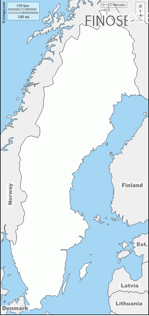
In the north, the Finnish–Swedish border begins from the Treriksröset tripoint FINOSE at the border of Norway, located in the Koltajärvi lake near Kilpisjärvi, which is also the northernmost point of Sweden. The first 230 m of the border are in straight lines and marked with border signs. The border continues as a river border: first along a small river to Kuohkimajärvi, then along Kuohkimajoki to Kilpisjärvi, then along the rivers Könkämäeno, Muonionjoki and Tornionjoki, a total of 555.5 km (345.2 mi) down to Tornio. The river border runs along the deepest parts of the rivers (the Thalweg), and is not marked with border signs; instead the border location is defined by the official maps of the border protocol. There are some border markers near Tornio where the border runs on land.
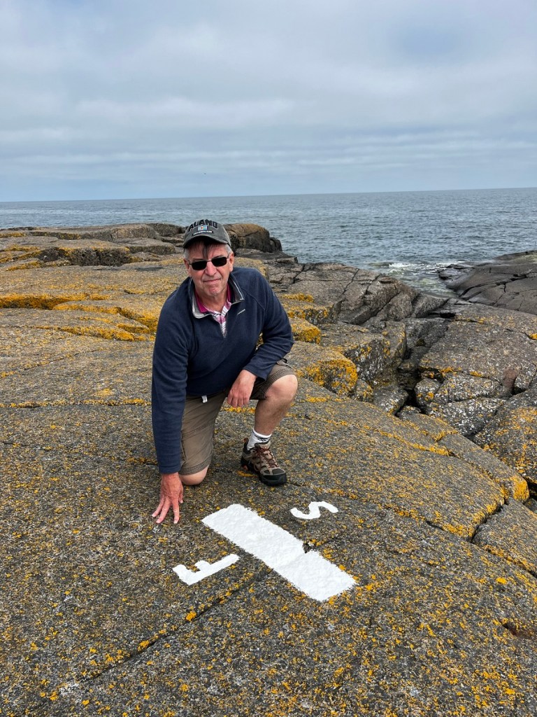
In the Bothnian Bay and the Bothnian Sea, the Finnish and Swedish territorial waters are separated by international waters. In the Norra Kvarken, the distance between land is down to 22.4 kilometres (12.1 nmi), giving less than the normal 12 nautical miles (22 km) to each country. Here a narrow channel of international water goes along an agreed path. The territorial waters meet again in the Sea of Åland, where the countries have a maritime border of 15 kilometres. The border crosses the island of Märket, which has a 470-metre long, complexly shaped border marked with border signs.
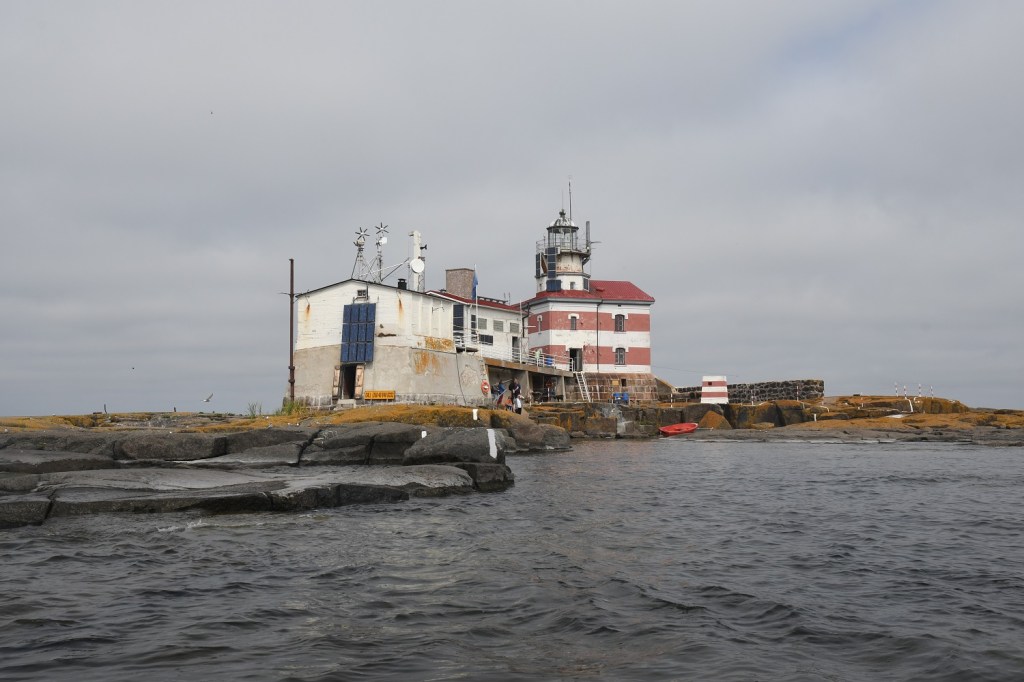
The island of Märket was decided to be split in two parts in a topographical description made in 1811. The border was decided to run through the geographical centre of the island (defined by coordinates) in the treaty of Åland in 1921 and in the treaty of continental plates in 1972. The Märket lighthouse, built in 1885 by Finland and operated by them, was left on the Swedish side. In 1981, the border on the island was modified so that the Lighthouse was within Finland. My Märket Island visit report is here.
Sweden – Denmark Border dates from 1658. It is entirely a maritime border, along Kattegat and Øresund, and in the Baltic Sea between Bornholm and Scania. The territorial waters (12 mile zone) of the two countries meet exclusively along the Øresund, extending to about 115 kilometres (71 mi), approximately between Höganäs and Falsterbo. There is one road and rail connection, the 16 kilometres long Øresund fixed link, opened in 2000, besides a number of ferry links.
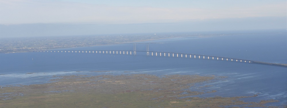
The towns of Malmö (Sweden) and Copenhagen (Denmark) are linked by the Øresund Bridge which crosses the strait of the same name. Construction of the bridge began in 1995 and was completed in 1999. Initially inferior to forecasts, traffic flow increased significantly in 2005, likely linked to the growing phenomenon of Danish citizens acquiring homes in Sweden (where property prices are lower).
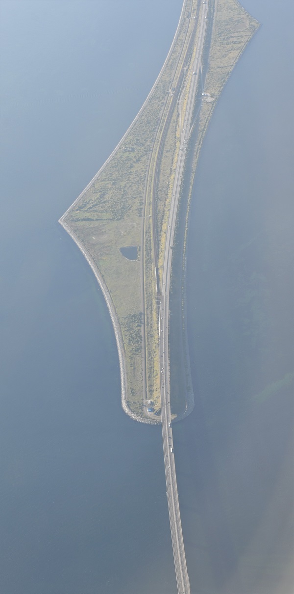
The Øresund Bridge (Danish: Øresundsbroen is a combined railway and motorway bridge across the Øresund strait between Denmark and Sweden. It is the longest in Europe with both roadway and railway combined in a single structure, running nearly 8 kilometres from the Swedish coast to the artificial island Peberholm in the middle of the strait. The crossing is completed by the 4-kilometre Drogden Tunnel from Peberholm to the Danish island of Amager.
Denmark is situated 4km off the Swedish coast and the bridge is of a total length of 7845 metres. The two regions linked by the bridge form the Øresund cross-border territory. This space comprises more than 3,730,000 inhabitants, and by way of its unique situation, is very advanced in terms of cross-border cooperation.
With both Sweden and Denmark being part of the Nordic Passport Union since the 1950s, border controls between the two countries have been abolished for decades and travellers can normally move freely across the Øresund Bridge. In 2001, both countries also joined the Schengen area, and since then the abolishment of border controls is primarily regulated by European Union law. However, in November 2015, during the European migrant crisis, Sweden introduced temporary border controls at the border to Denmark.
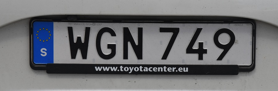
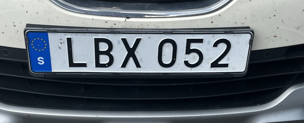
Swedish Registration Plates
Swedish Passport Stamps
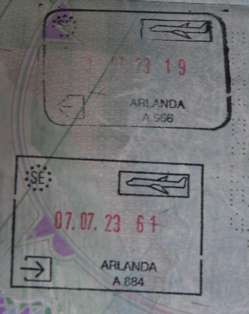
Passport control for flights from the UK at Arlanda Airport, Stockholm were lengthy with each passport scanned and stamped. Return flight details needed to be shown too. Danish friends who landed at the same time from Copenhagen saved 1 hour over those from the UK. Another Brexit bonus clearly.
Swedish Tripoints
| NUMBER | NAME | COUNTRIES | COORDINATES | TYPE | NOTES/links |
|---|---|---|---|---|---|
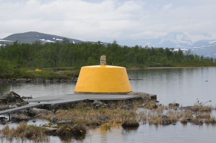
| 1 | FINOSE | Finland – Norway – Sweden | 69°03′35″N 20°32′49″E | Dry | The Three-Country Cairn marks the tripoint. The current tripoint monument was built in 1926 and was originally beige, conical frustum made of concrete, located about 10 metres out in Lake Goldajärvi. The monument is large and there are engraved headstones with symbols of each country. Technically walking around the monument on the platform means leaving Sweden, entering a small pene enclave of Norway and then entering Finland if you walk in a clockwise direction. The are several border markers in the vicinity. Krogh Van der Giessen (2024) |
Tripoint Gallery

Site Navigation
In order to find your way around the site, either click on the links (text in red) or use the menus at the top and side of the pages. About leads you to the main areas of the site. The European Tripoints menu leads directly you to my visit reports whereas the Country Visits page allows you to choose which country to look at first. Clicking on photos can lead you directly to reports too
Mobile Users Advice
Tables display correctly when holding your mobile horizontally.
To access the links to other pages please click on the 3 horizontal dots at the bottom of the page.