Switzerland, officially the Swiss Confederation, is a landlocked country located at the intersection of Central, Western, and Southern Europe. Switzerland shares a border with five countries: Germany to the north, France to the west, Italy to the south, and Austria and Liechtenstein to the east. Switzerland is geographically divided among the Swiss Alps, the Swiss Plateau, and the Jura mountains. Switzerland is a federal republic composed of 26 cantons, with Bern serving as the federal city and the seat of the national government. The country encompasses four principal linguistic and cultural regions—German, French, Italian, and Romansh.
Switzerland has maintained a policy of armed neutrality since the 16th century and has not fought an international war since 1815. It joined the Council of Europe in 1964 and the United Nations in 2002, pursuing an active foreign policy that includes frequent involvement in peace building and global governance. Switzerland is the birthplace of the Red Cross and hosts the headquarters or offices of most major international institutions, including the WTO, the WHO, the ILO, FIFA, the WEF, and the UN. It is a founding member of the European Free Trade Association (EFTA) and participates in the European single market and the Schengen Area.
Switzerland is among the world’s most developed countries, with the highest nominal wealth per adult and the eighth-highest gross domestic product (GDP) per capita. It performs highly on several international metrics, including economic competitiveness, democratic governance, and press freedom.
Apart from the United Nations headquarters, the Swiss Confederation is host to many UN agencies, including the World Health Organization (WHO), the International Labour Organization (ILO), the International Telecommunication Union (ITU), the United Nations High Commissioner for Refugees (UNHCR) and about 200 other international organisations, including the World Trade Organization and the World Intellectual Property Organization. The annual meetings of the World Economic Forum in Davos bring together business and political leaders from Switzerland and foreign countries to discuss important issues.
Border Facts
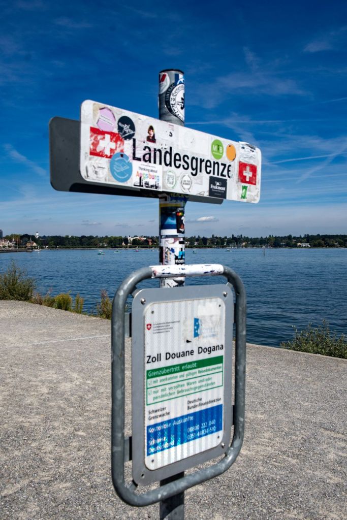
Switzerland shares a border with five countries: Germany to the north, France to the west, Italy to the south, and Austria and Liechtenstein to the east. The country is landlocked and its total border length is approximately 1,935 km, shared with these five neighbouring countries
Switzerland – France Border is 573 km long and was established in 1815 with the Congress of Vienna. The border ends with 2 tripoints, in the north CHDEFR in the Rhine (with a monument nearby) and in the south ACHITFR on near Mont Dolent (3700m). The border is divided between rural and mountainous areas and urban conurbations around Basel and Geneva. 155000 French citizens commute to Switzerland to work each day.
Since Switzerland’s accession to the Schengen Area in 2008, there have been no permanent passport controls along this border, even if there can be customs controls.
There are two airports near the border which have both Swiss and French passport and customs control, where the passengers can choose one of them. These are the EuroAirport Basel Mulhouse Freiburg which is located in France, but passengers can go to Switzerland without going through French border controls, and the Geneva Airport which is located in Switzerland, but passengers can go to France without going through Swiss border controls.
Switzerland – Germany Border is 334 km long. It begins at the CHDEFR tripoint in the west and finishes at the ATCHDE tripoint in the east. The border runs through the lake to the mouth of the river Rhine, it broadly follows
the course of the Rhine westwards avoiding a number of Swiss towns such as Schafhausen. A peculiarity of the German-Swiss border is the German enclave of the municipality of Büsingen. In 1815 at the Congress of Vienna, the European powers recognized the neutrality of Switzerland as well as its internal and external borders, largely those of today. Switzerland having maintained its neutrality during World War II, the German-Swiss border did not undergo changes related to the war, which differentiates it from other German borders.
The entry of Switzerland into the Schengen area in 2008 means no controls exist, although in 2019 Germany posed the idea of their reintroduction to curb illegal immigration.
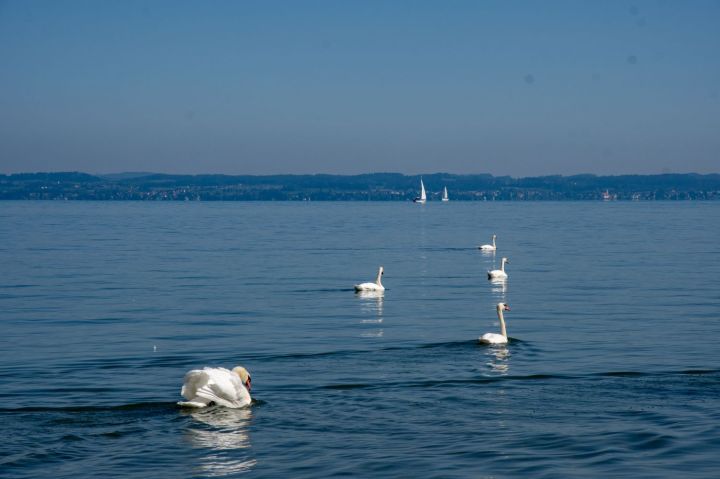
There is a difference in opinion regarding the status of Lake Constance, with the Swiss believing the border is as described above. Austria however believe the lake is neutral and therefore a condominium whereas the Germans have no opinion.


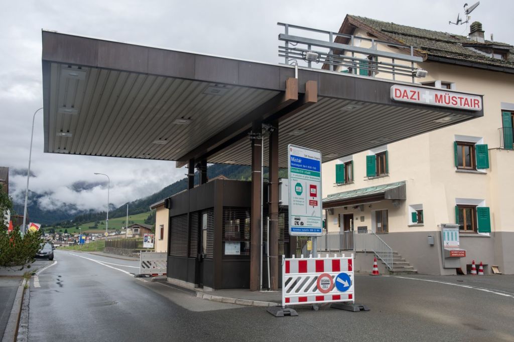
Switzerland – Austria border is 164 km long, the Austro-Swiss border has the peculiarity of being divided into two segments. Liechtenstein, divides the border into 2 parts. The northern segment of the border begins at the ATCHDE tripoint. The second portion begins south of Liechtenstein and comes to an end near the Resia Pass, at the geographic ATCHIT tripoint between Austria, Italy and Switzerland, which lies at 2000 metres above sea level. This border has been in existence since the signing of the Treaty of Westphalia in 1648, which put an end to the Thirty Years War and firmly established Switzerland’s independence with regard to the Holy Roman Empire.
In 1719, the birth of Liechtenstein changed the demarcation of the border, dividing it into two distinct portions. Lastly, in 1919, the border underwent another change when South Tyrol became part of Italy following the end of the Austro-Hungarian Empire.
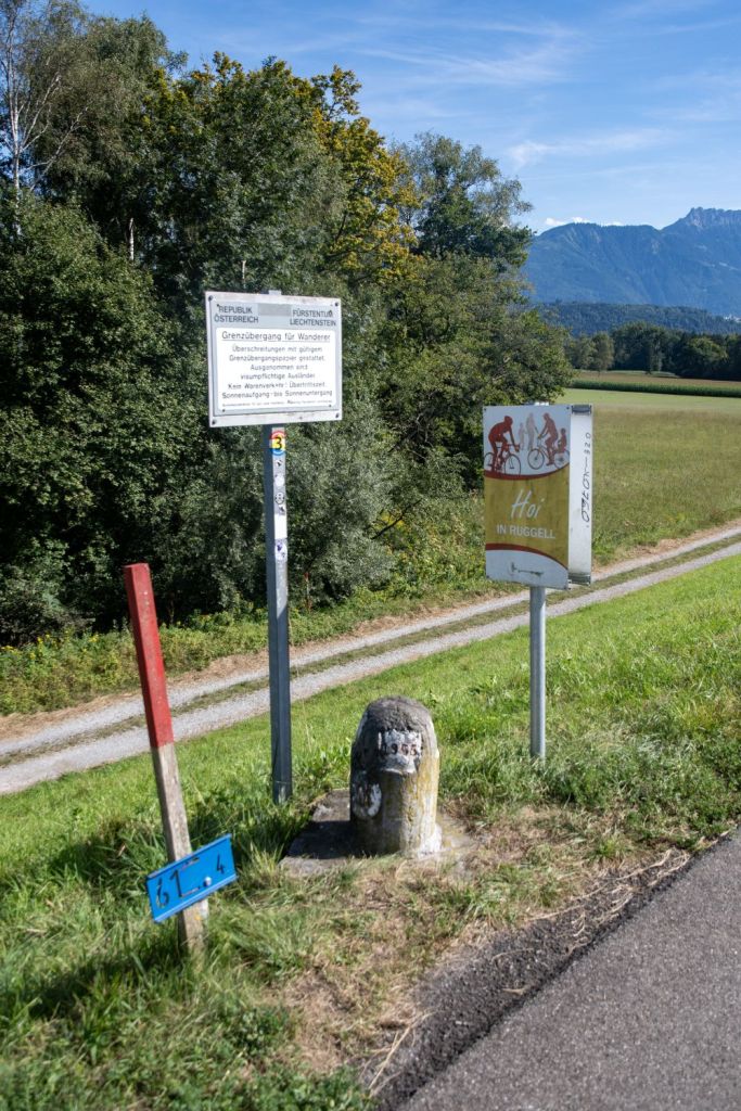
Switzerland – Liechtenstein Border is 37 km long and consequently creates 2 additional tripoints, one on the Rhine and one on the summit of Naafkopf. Largely defined by the Rhine River in the west and the Alps (Rätikon range) in the south. It’s an open border, part of the Schengen Area, meaning no passport checks for travelers moving between the two countries. They share a customs union (since 1924) and the Swiss Franc (CHF) is Liechtenstein’s currency, creating a strong economic union. Switzerland represents Liechtenstein’s diplomatic interests in many countries, with a strong, integrated relationship.
Switzerland – Italy Border extends for 744 kilometres from the French-Swiss-Italian tripoint at Mont Dolent in the west to the Austrian-Swiss-Italian tripoint near Piz Lad in the east. Much of the border runs across the High Alps, rising above 4,600 metres. While this border existed as a border of Switzerland from 1815, it was not until 1861 with Italian Unification that it the current border was established. Since 1946, it has remained unchanged. In 2008 Switzerland became part of the Schengen Area, meaning that border controls were removed along this border as of 12 December 2008. However, while border guards from both countries are no longer allowed to stop travellers for the sole purpose of passport checks, they can still carry out customs checks, as Switzerland is not in the EU Customs Union.

Swiss Registration Plates


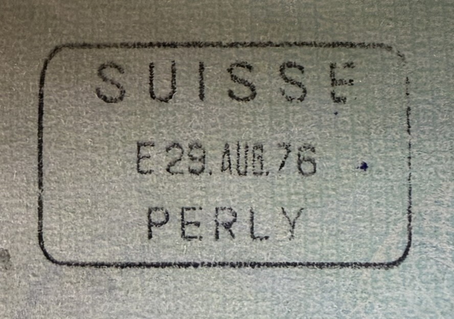
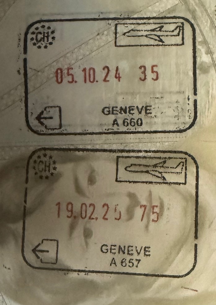
Swiss Passport Stamps
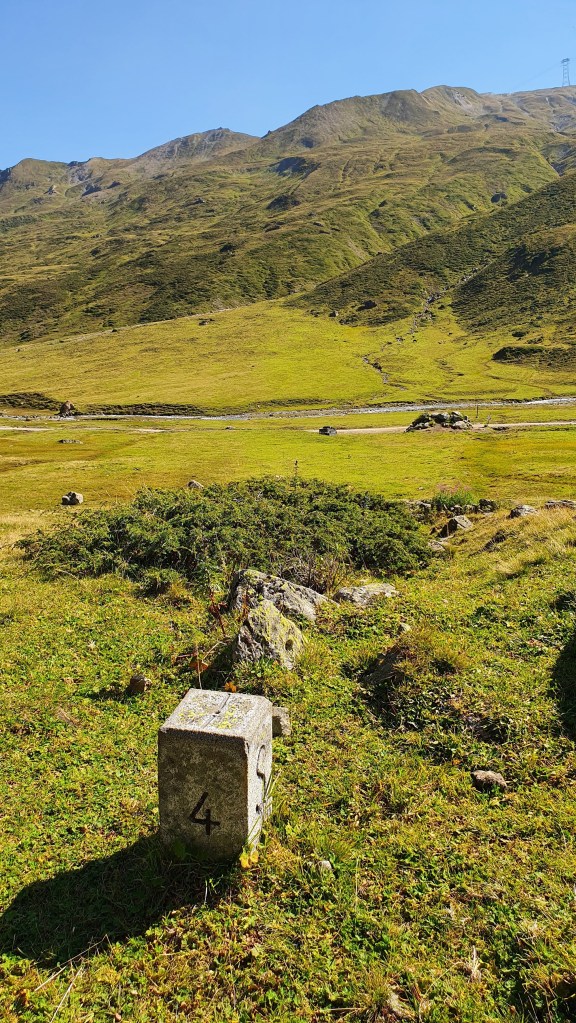
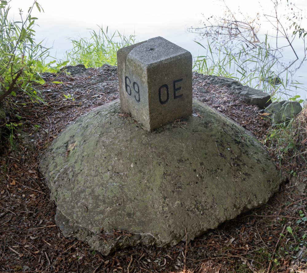
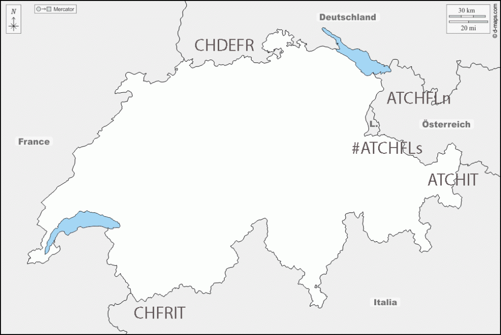
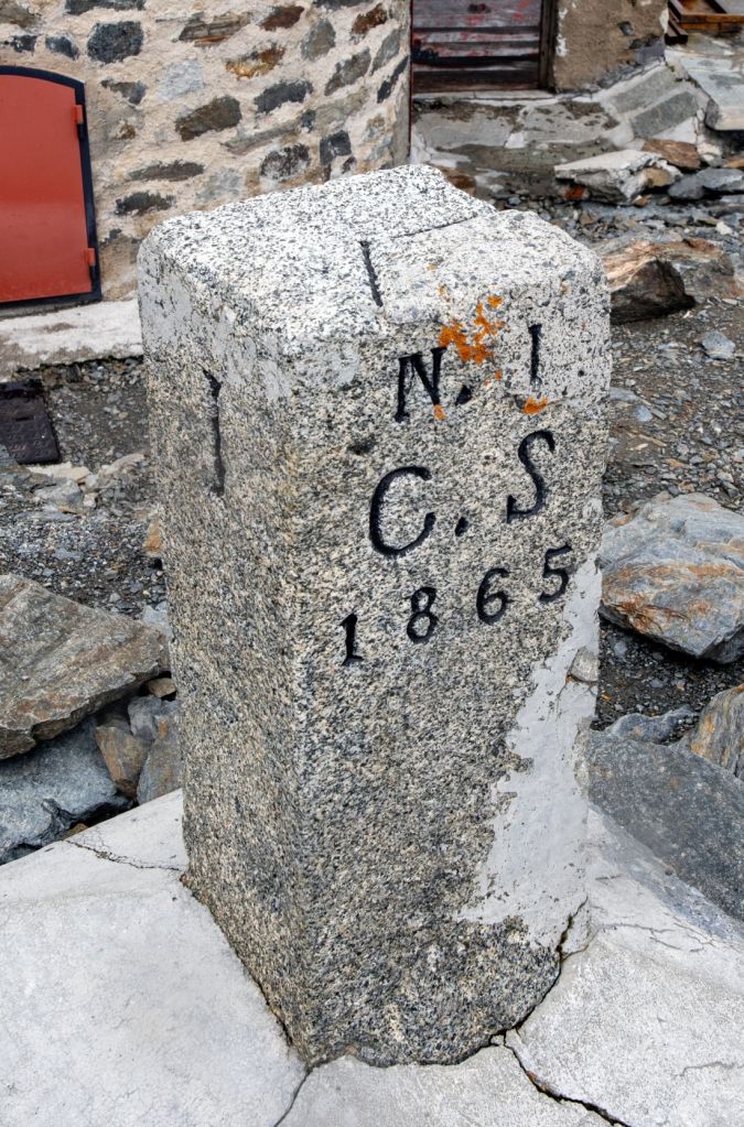
Switzerland Tripoints
| Number | Name | countries | coordinates | Type | notes |
|---|---|---|---|---|---|
| 1 | ATCHDE | Austria – Germany – Switzerland | 47°31’45″N 09°36’41″E | Wet | In theory the tripoint is located in Lake Constance, in practice there has never been any agreement between the three parties involved on how to “divide” the lake. CH regards the mid-line between DE/CH as the natural borderline, Austria’s opinion is that the Eastern part of the lake should be governed by all states, and Germany’s point of view is not really known.. These different points of view haven’t yet had any consequences of any practical sort, since matters of fishing rights and navigation on the lake have been agreed upon by all parties. |
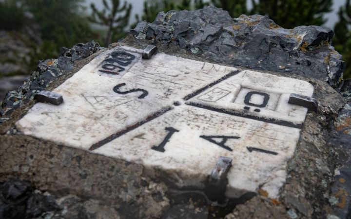
| 2 | ATCHIT | Austria – Italy – Switzerland | 46°51’16″N 10°28’08″E | Dry | The tripoint is located at the Resia Pass (2174m) near Piz Lad. The tripoint is marked by a border marker placed flat on top of a rock. The Dreiländergrenzstein is usually reached by taking the Mutzkopfbahn chair lift from Nauders (AT), walking in direction of Schwarzer See, and then the Grünsee Lake. A steep climb up the ATIT border leads to the tripoint. Van der Giessen (2024) |
| 3 | ATCHLIn | Austria – Liechtenstein – Switzerland (north) | 47°16’11″N 09°31’49″E | Wet | The tripoint is located in the river Rhine, south of the Bangs-Lienz (ATCH) border crossing. The ATLI border is demarcated and there are border markers on each side of the Rhine with BM#135 in AT commonly described as marking the westernmost point of Austria. BM#136 in CH is the tripoint marker. Van der Giessen (2024) |
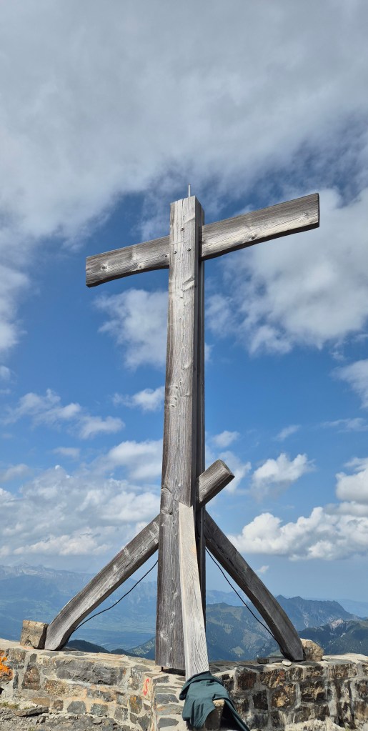
| 4 | ATCHLIs | Austria – Liechtenstein – Switzerland (south) | 47°03’35″N 09°36’24″E | Dry | The tripoint is located on the summit of the Naafkopf, a mountain in the Rätikon Alps. The tripoint is marked by a large wooden cross on a brick base that extends in three directions. Naafkopf is the third highest peak in Liechtenstein. Most people approach on the northeastern ridge which marks the Austrian-Liechtenstein border via the Pfälzerhütte, one of the two refuges operated by the Liechtenstein Alpine club. |
| 5 | CHDEFR | France – Germany-Switzerland | 47°35’23″N 07°35’20″E | Wet | The Dreiländereck is located on the Rhine River, along the borders of Basel, Saint-Louis, and Weil-am-Rhein. It is marked indirectly by an impressive tripoint monument designed in 1957 by Wilhelm Münger (150m to the SE). The monument is a large iron pylon in the shape of a rocket with the flags of France, Germany and Switzerland on the tails. North of the tripoint there is a Three Countries Bridge for pedestrians and cyclists. Opened in 2007 and is the world’s longest span pedestrian bridge at 229m. Van der Giessen (2024) |
| 6 | CHFRIT | France – Italy _Switzerland | 45°55’21″N 07°02’39″E | Dry | This is the hardest European tripoint physically to reach. Mont Dolent is regarded as the tripoint. The tripoint is located at Pointes Supérieures de Pré de Bar (3658m), on the ridge that leads east (100m) to the summit of Mount Dolent (3749m). In 1954, a statue of the Virgin Mary was erected on Mont Dolent’s summit by the young people of Valais. A 2 day trek with an overnight in a mountain hut. Competency with glacier, ice and using ropes. A guide is recommended. |
Tripoint Gallery
Historical Tripoints


Site Navigation
In order to find your way around the site, either click on the links (text in red) or use the menus at the top and side of the pages. About leads you to the main areas of the site. The European Tripoints menu leads directly you to my TP visits reports whereas the Country Visits page allows you to choose which country to look at first.

Mobile Users Advice
Tables display correctly when holding your mobile horizontally.
To access the links to other pages please click on the 3 horizontal dots at the bottom of the page.