
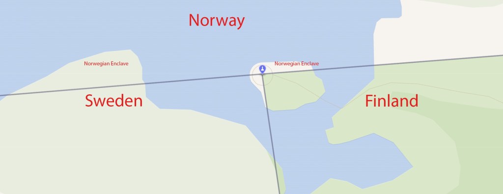
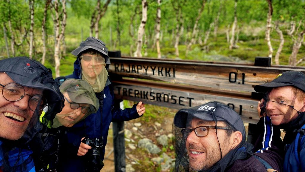
The Three-Country Cairn (FI: Rajapyykki, NO: Treriksrøysa, SE: Treriksröset) is the tripoint at which the international borders of Sweden, Norway and Finland meet, and the name of the monument that marks the point. It is the northernmost international tripoint in the world. The border between Norway and Sweden including Finland was decided in the Strömstad Treaty of 1751 and marked with cairns the following years, including cairn 294 which is located on a hill 150 meters east of today’s Three-Country Cairn. When Sweden ceded Finland to Russia in 1809, it was decided that the new Finland–Sweden border should follow the rivers. But actually two rivers cross the Norwegian border and the northern river was originally used.
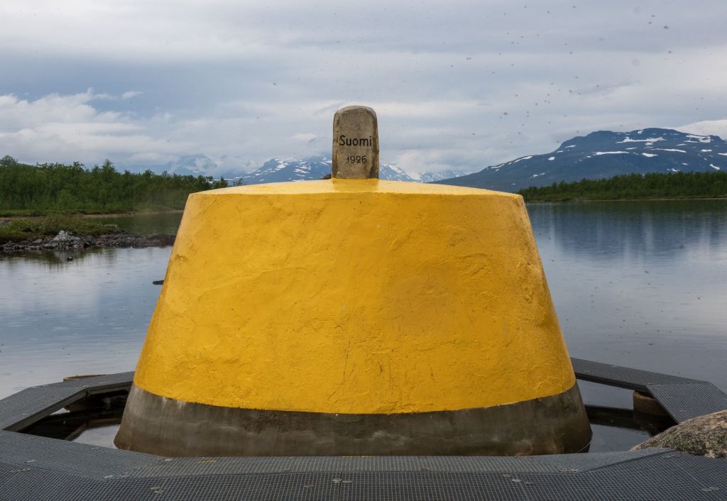
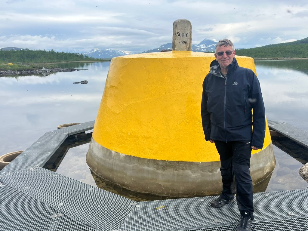
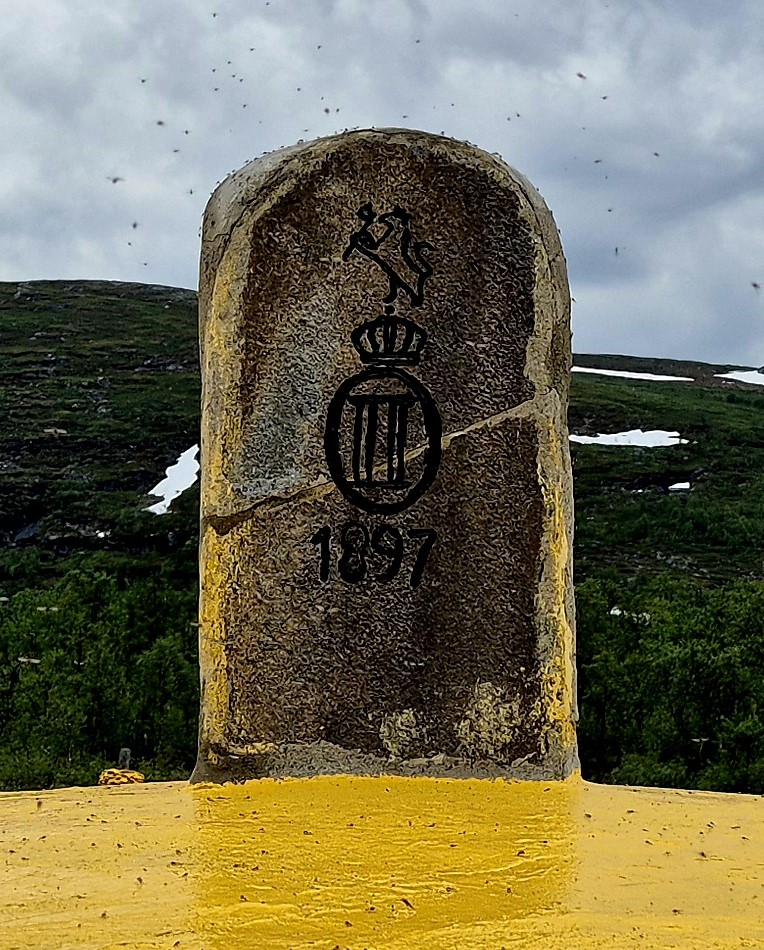
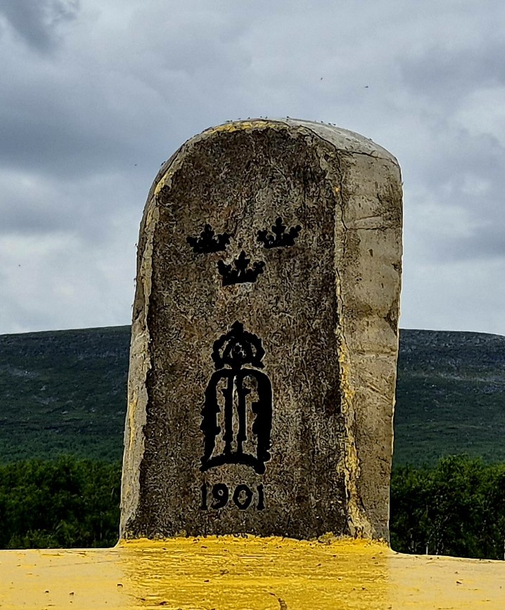
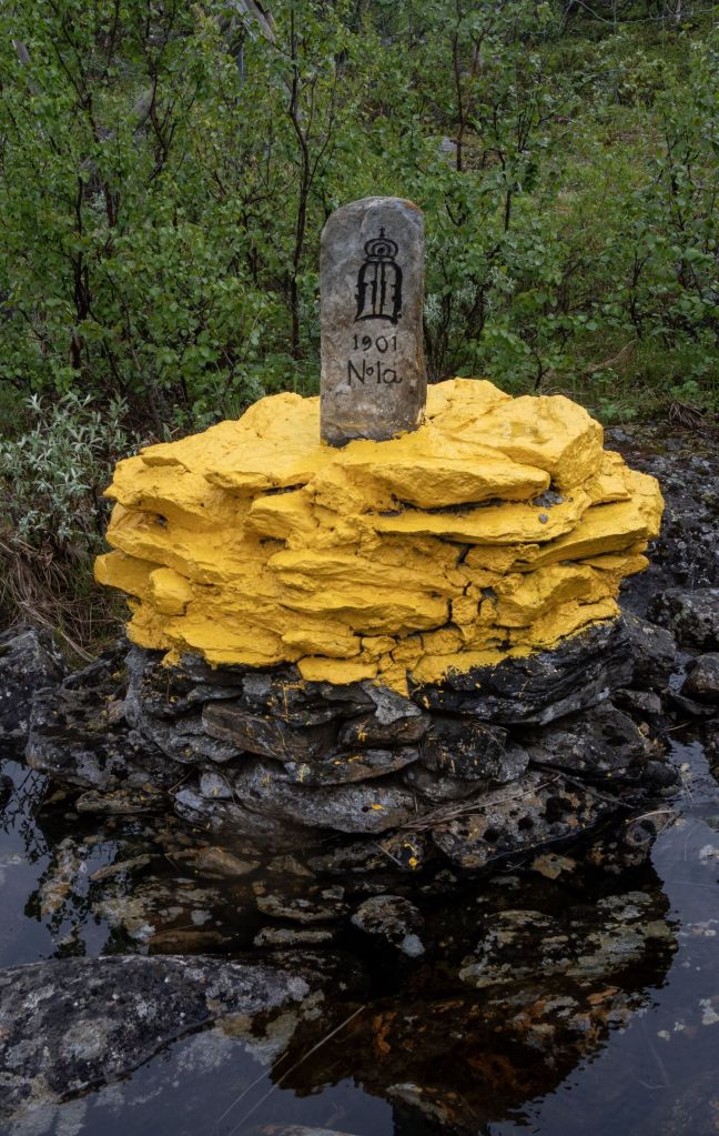
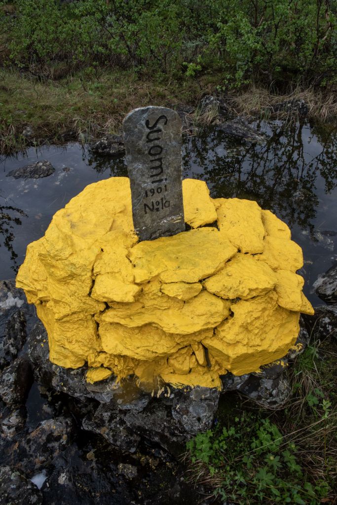
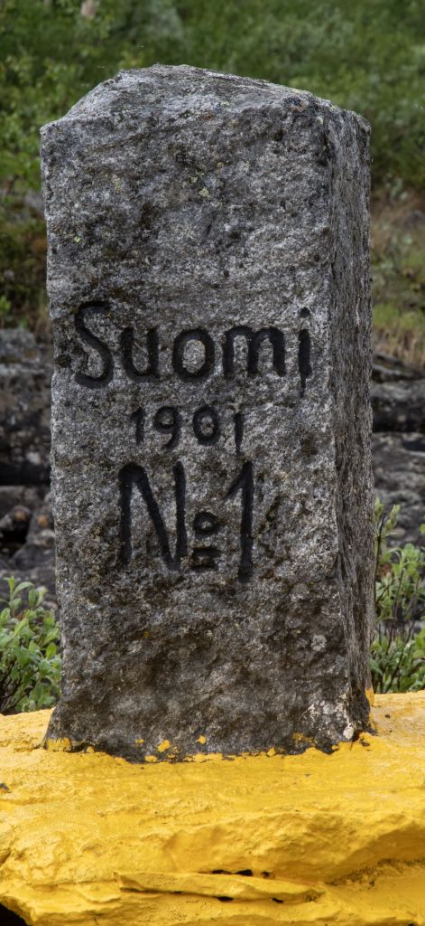
In 1897 the location of the tripoint changed when the southern river was chosen as the border. A monument of stones was erected on the site by Russia in 1897. The Swedish could not agree on a boundary commission with the Norwegians and did not contribute their stone until 1901. On the Norwegian side it says 1897 (from the previous Russian inscription) and Swedish side it says 1901, which is the year when the top stone was erected.
This is the westernmost point of mainland Finland. The actual most western point of Finland is Märket Island which was visited by the IBRG in July 2023. Details of our visit are here. It is also Sweden’s most northernly point.
I visited this point as part of the IBRG ARTEX-24 expedition. More border extremities can be found on my Oddities and Extremities page.
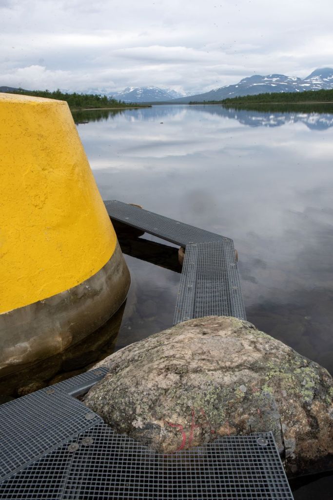
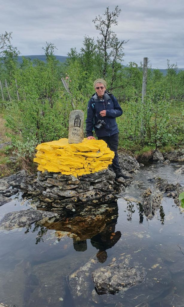
The Tripoint monument
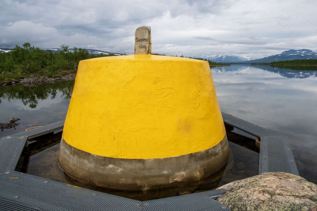
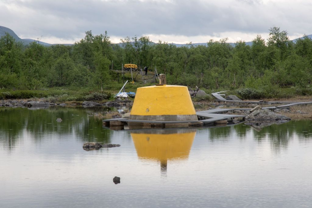
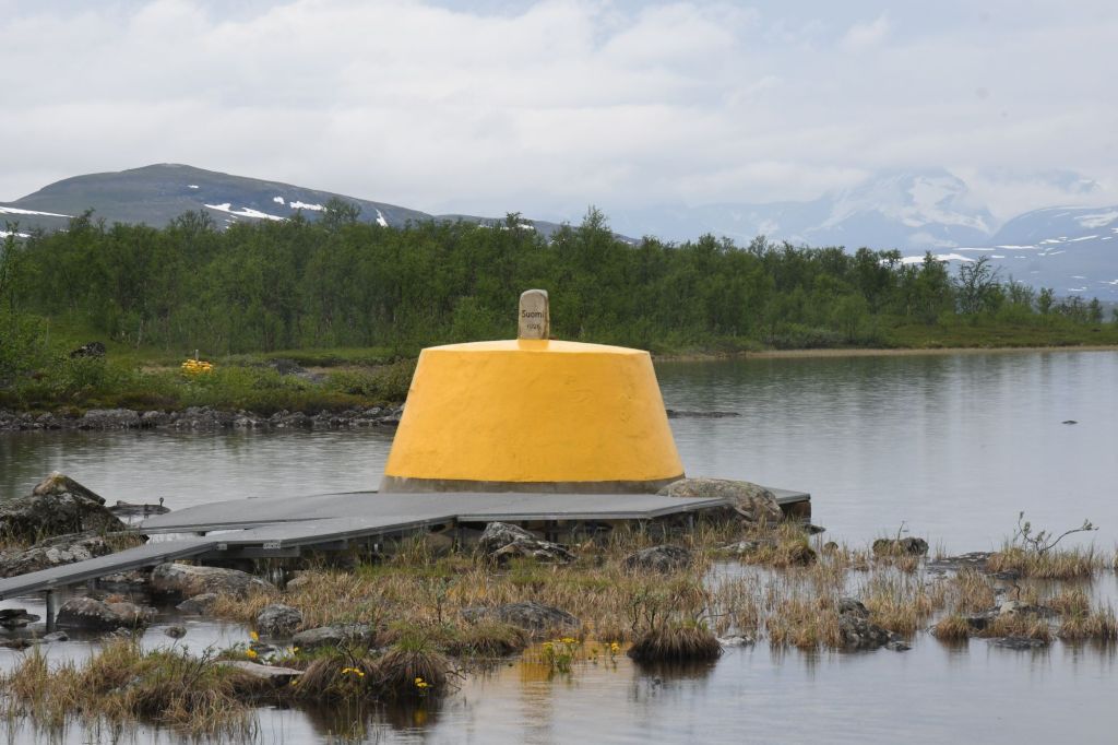
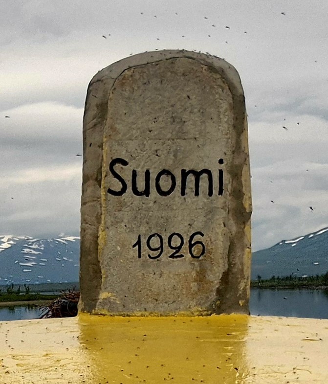
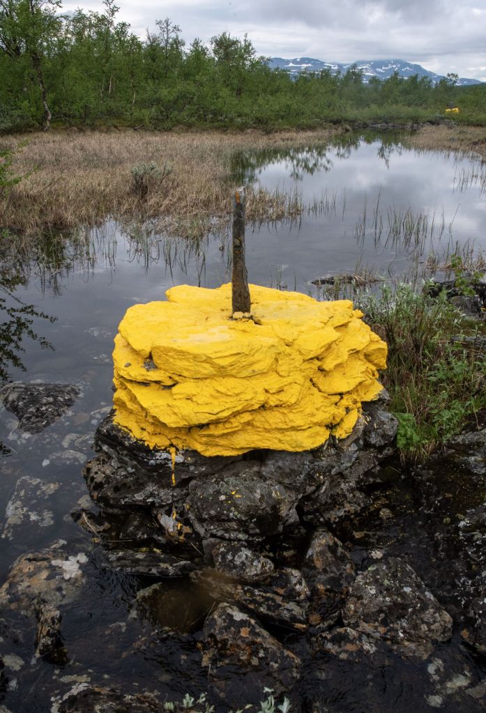
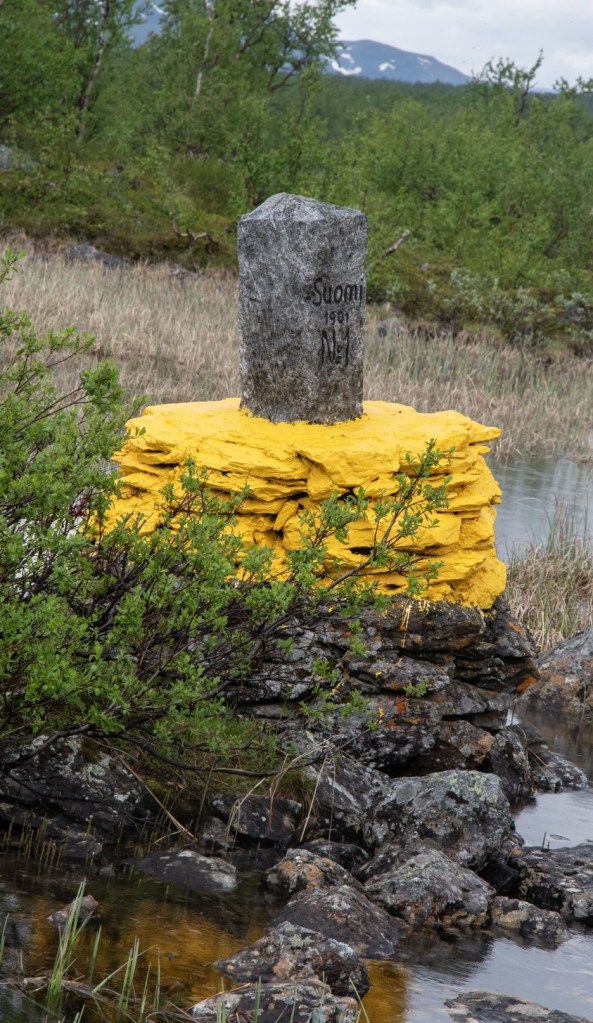
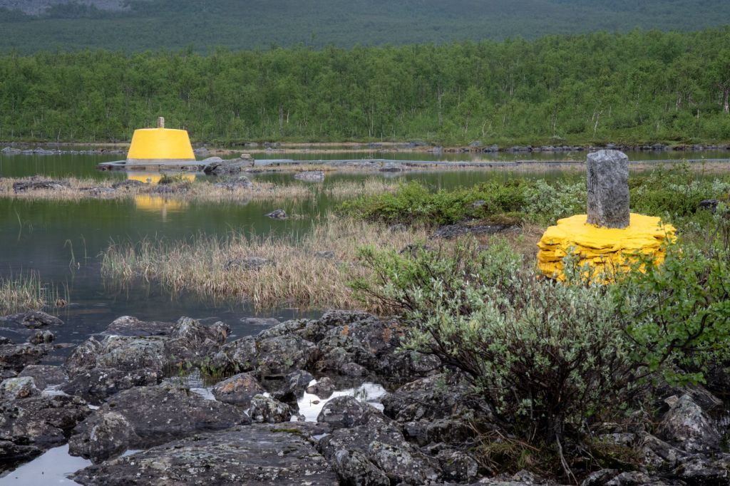
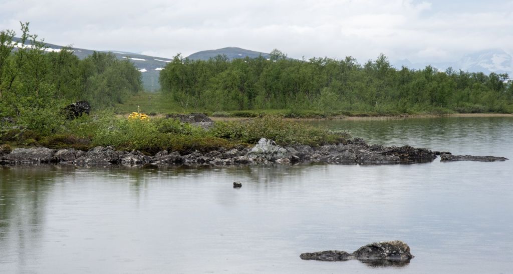
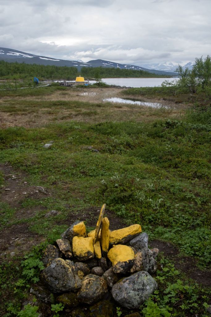
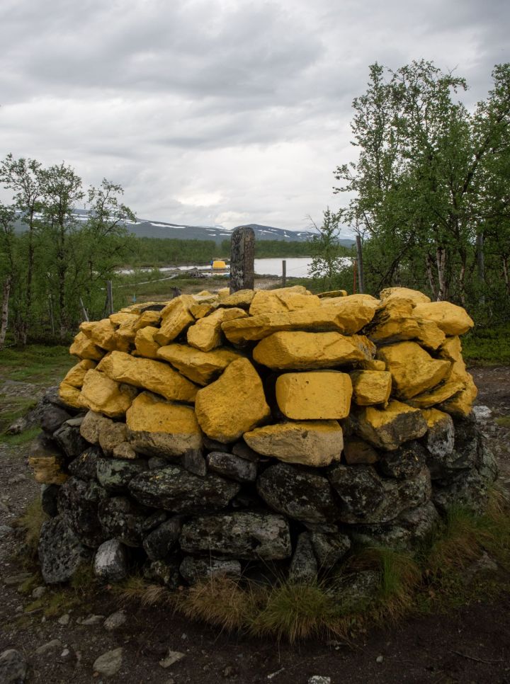
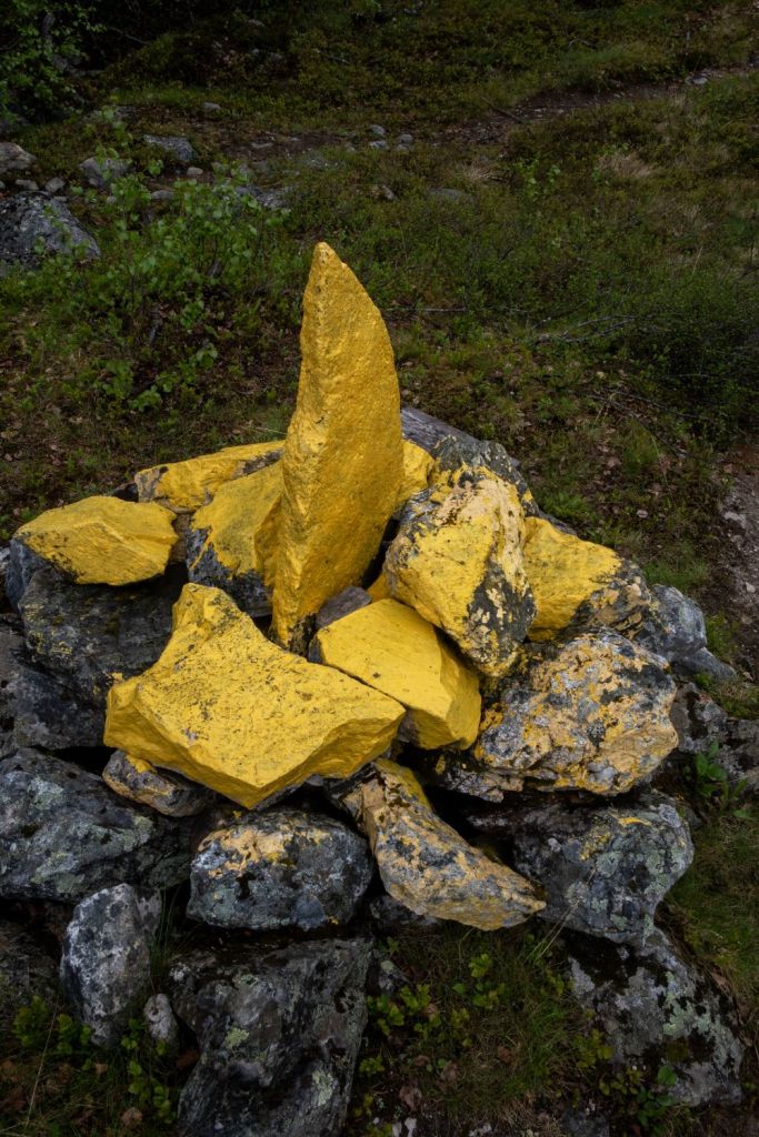
The current tripoint monument was built in 1926 and was originally beige, conical frustum made of concrete, located about 10 metres out in Lake Goldajärvi. It is located at 489 metres above sea level. The size is about 14 m2 with diameter of about 4 metres. A minor modification of the cairn occurred in 1926, and “1926” was engraved on the top stone on the Finnish side. In 1926 the cairn was brushed down, later the upper part was painted yellow. The island itself is artificial.
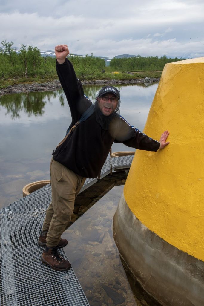
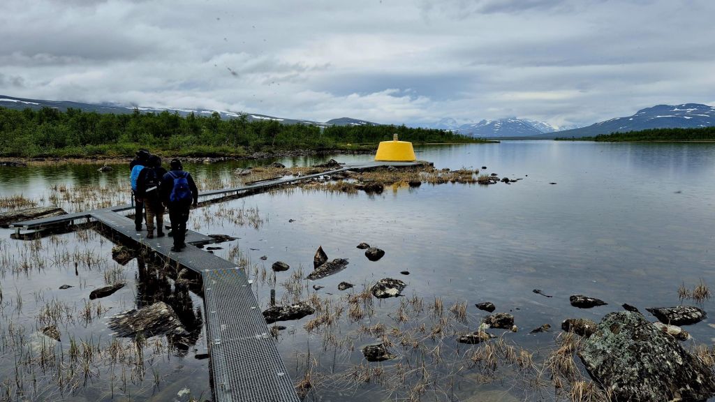
Technically walking around the monument on the platform means leaving Sweden, entering a small pene enclave of Norway and then entering Finland if you walk in a clockwise direction.
The Finland – Sweden border
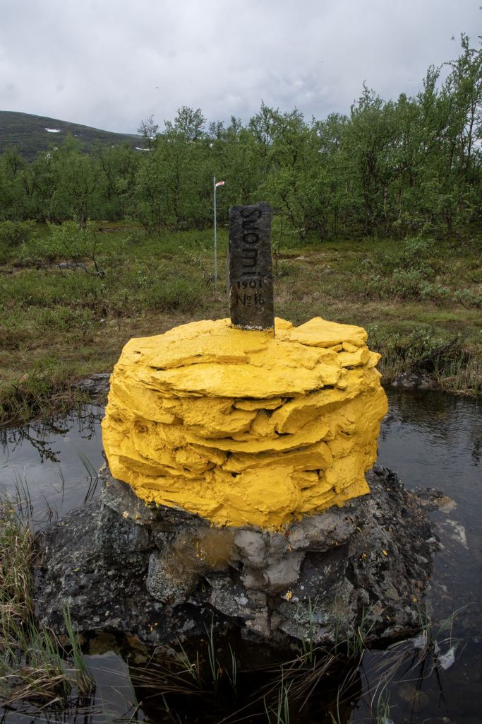
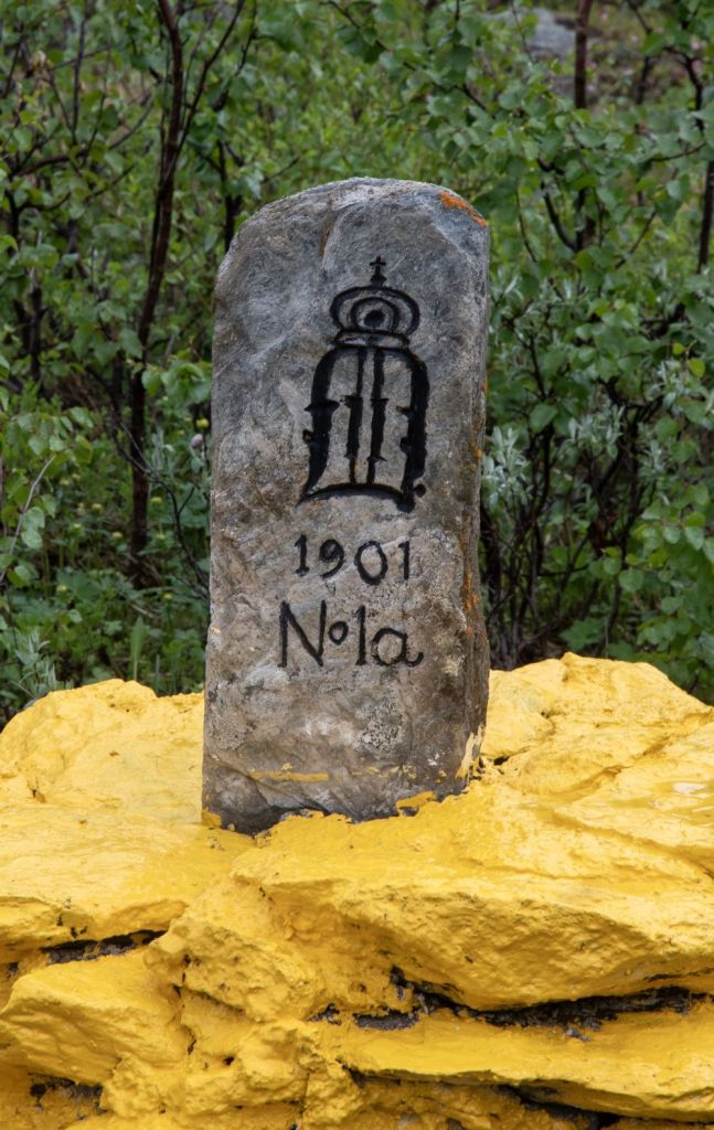
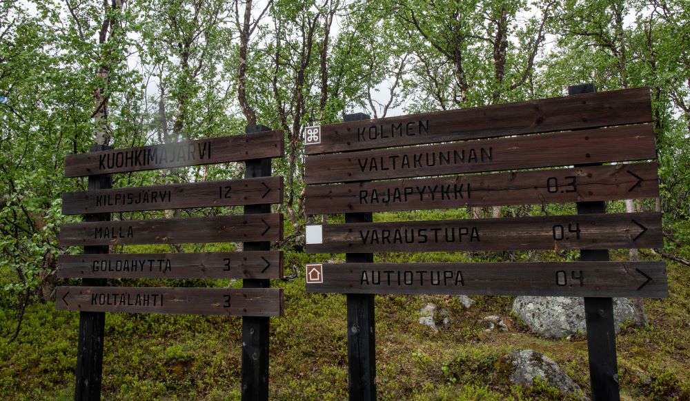
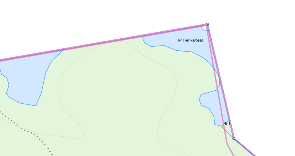
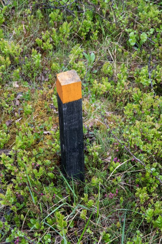
In the planning phase we identified the additional border markers in the tripoint area. There were few or any photographs of these supplementary markers. The terrain was on the margins of the lake so wet and boggy underfoot. In the section of the Finland – Sweden border leading to the tripoint there were 3 BM’s.
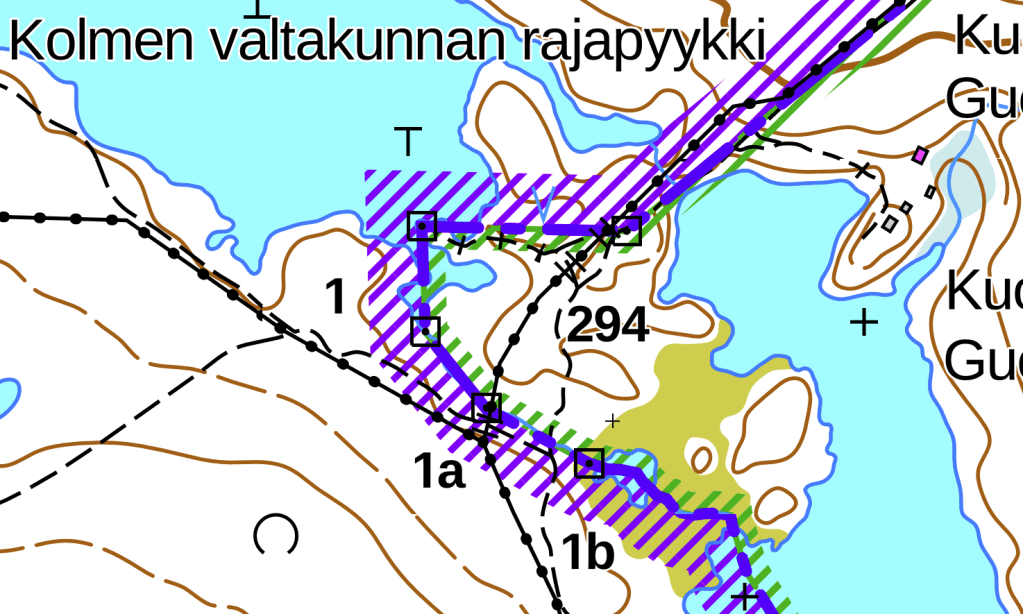
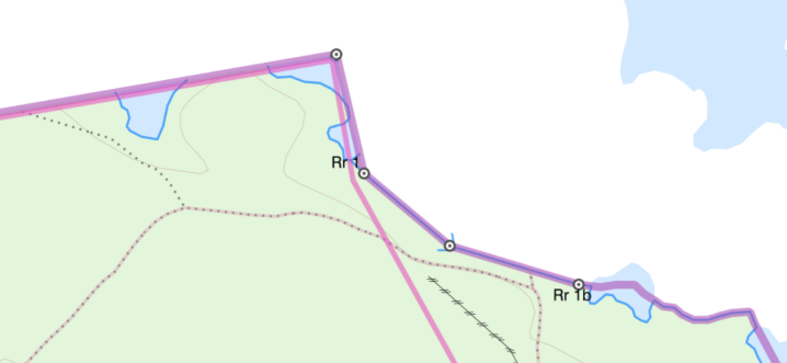
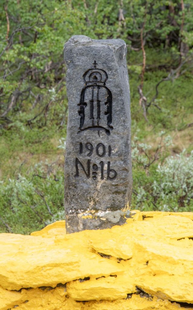
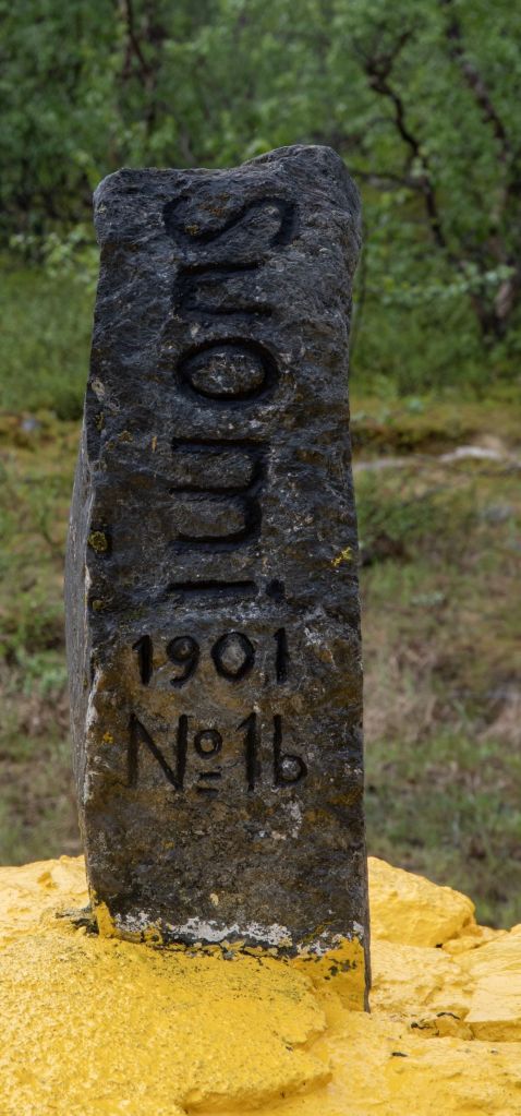
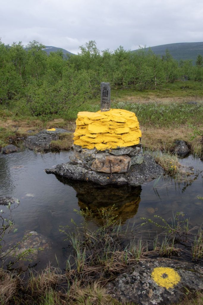
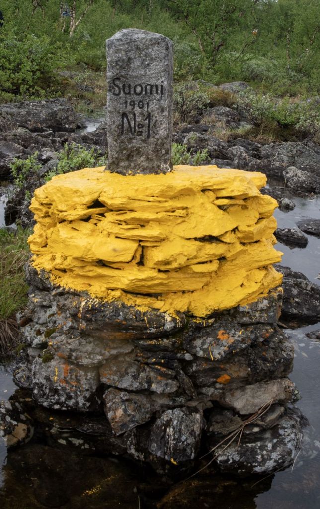
BM#1b
The first border marker we came to after following the trail from the boat harbour.
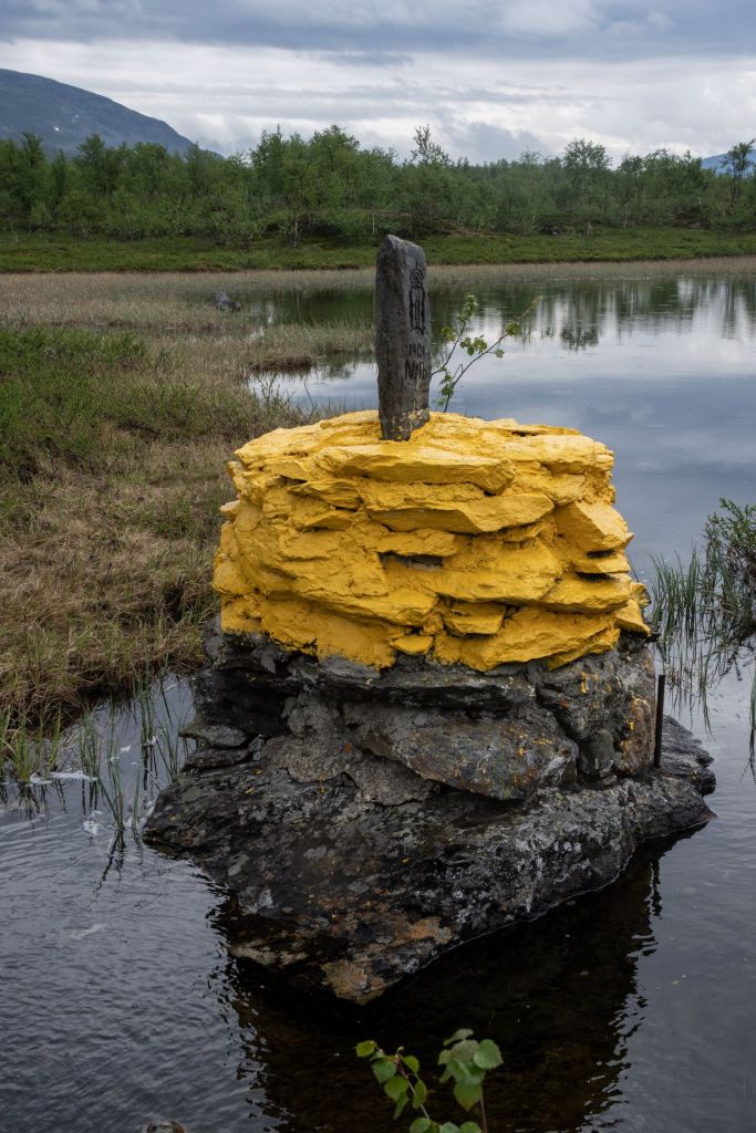
BM#1a
BM#1
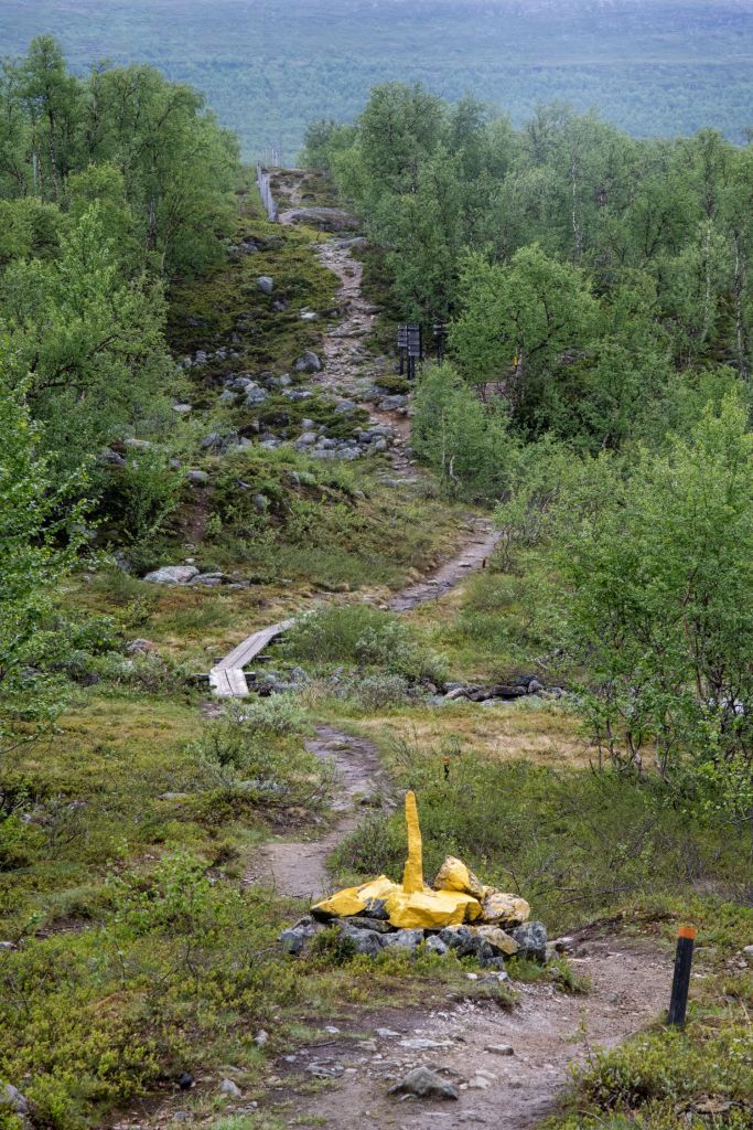
There were many paths and lots of signs, but sometimes it was line of sight that was the most helpful, nevertheless, progress was slow picking ones way using rocks as stepping stones.
The Norway – Sweden Border
There are 2 small sections of border between Norway and Sweden, one is by the tripoint monument itself, where walking around the monument means moving from Sweden into Norway. Fun is had trying to find the exact point. Slightly west of the tripoint monument is a small Norwegian pene enclave where the border cuts off a small sliver of Norwegian territory. Access to this section is through Sweden unless you have a boat!
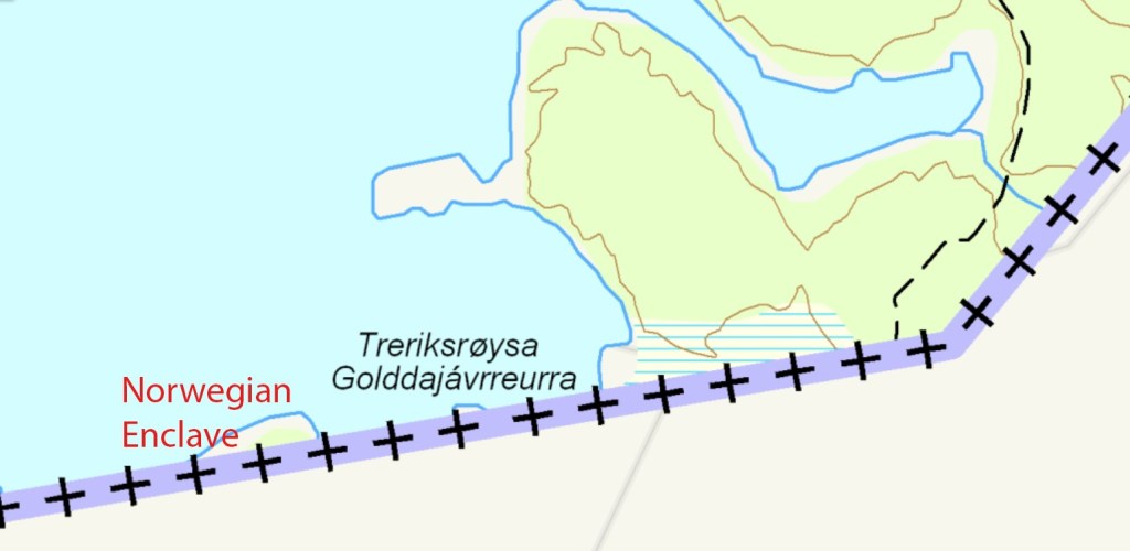
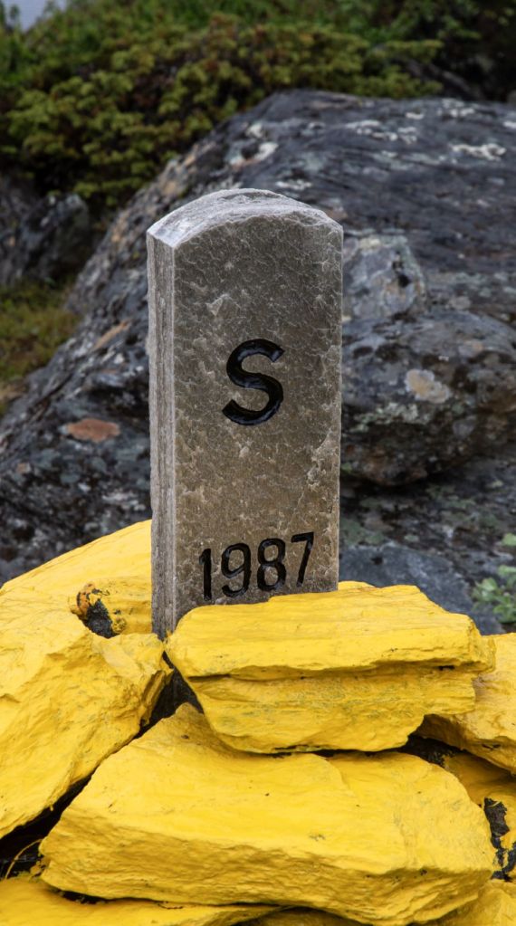
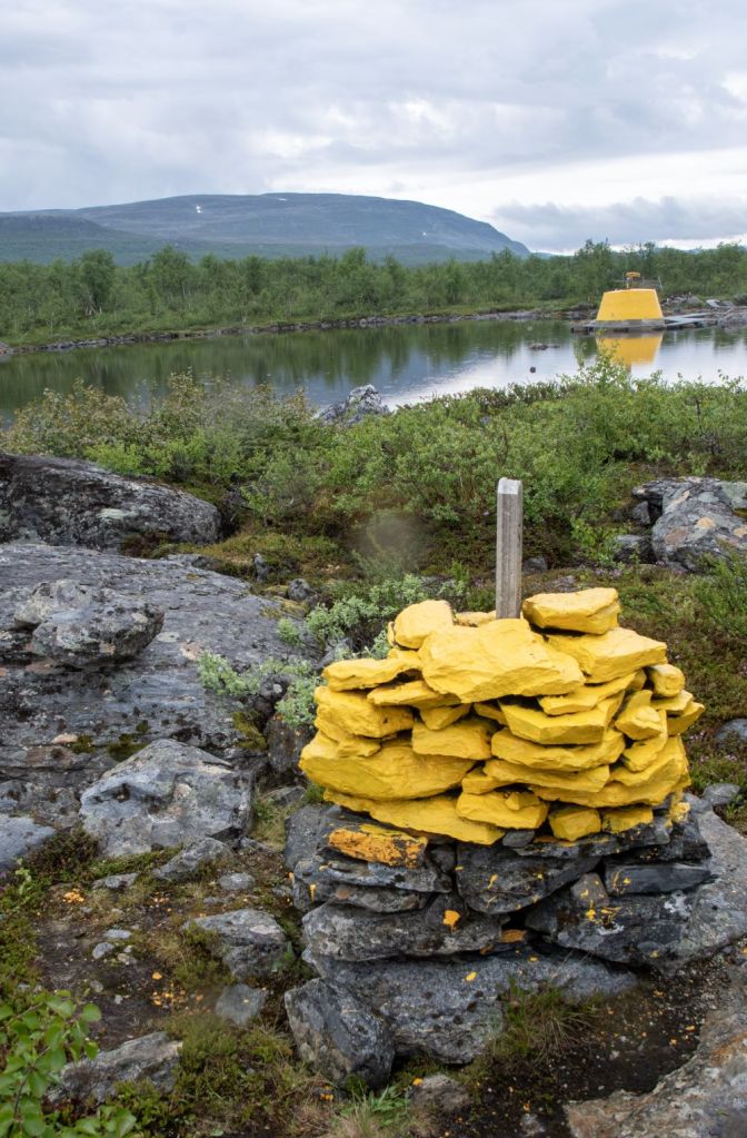
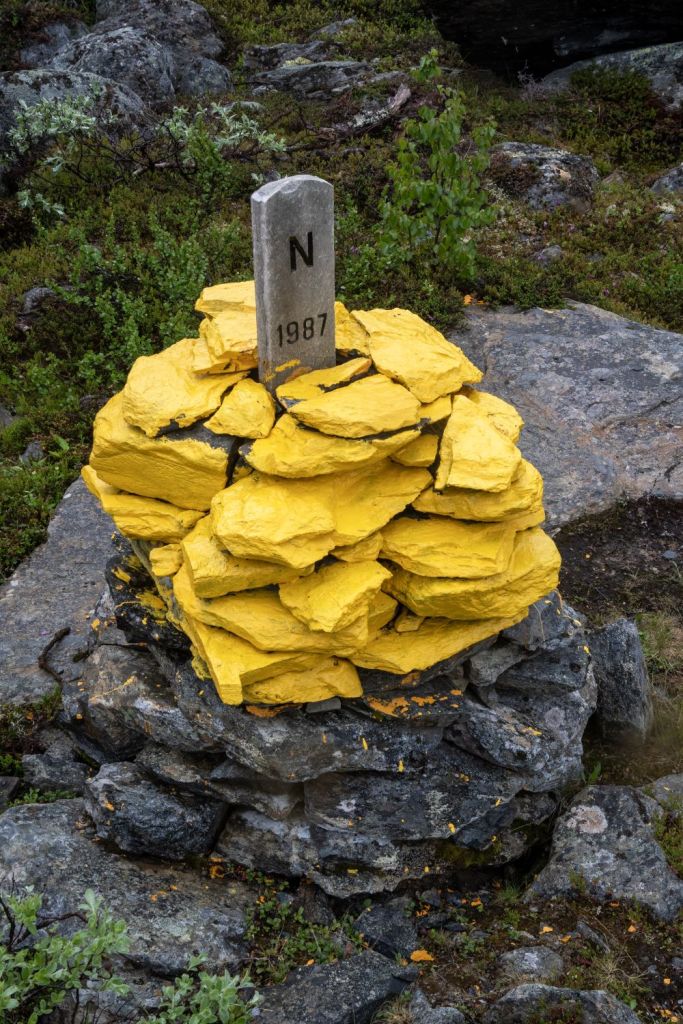
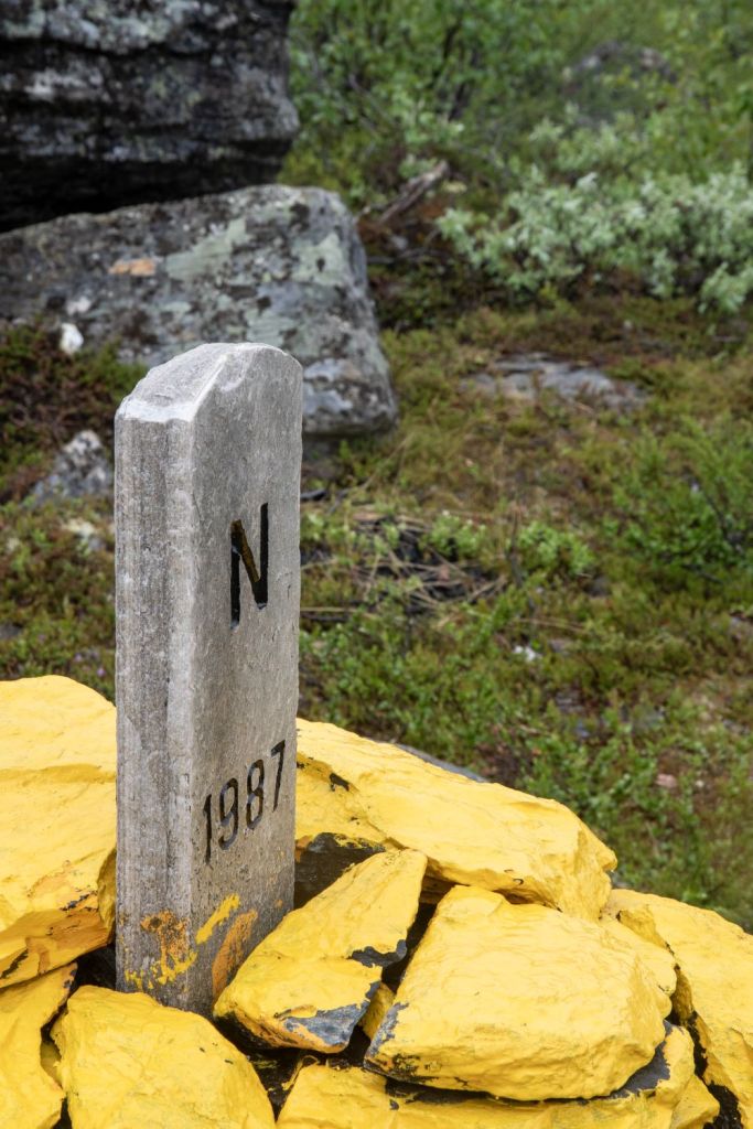
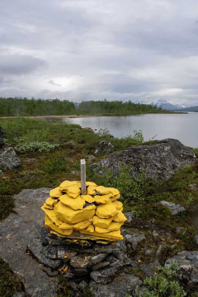
Golddajárvi enclave
The enclave was marked by a marker built in 1987. It is however unnumbered and does not appear on the countries maps.
Swedish map

Finland – Norway Border
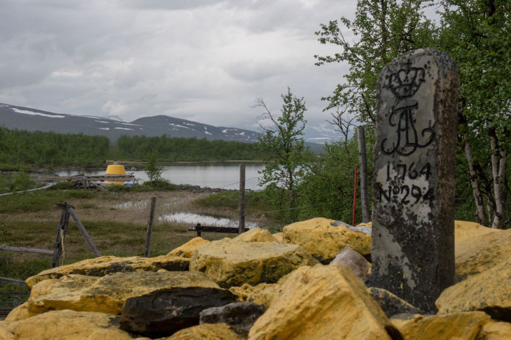
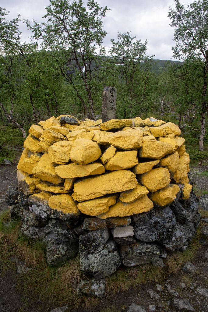
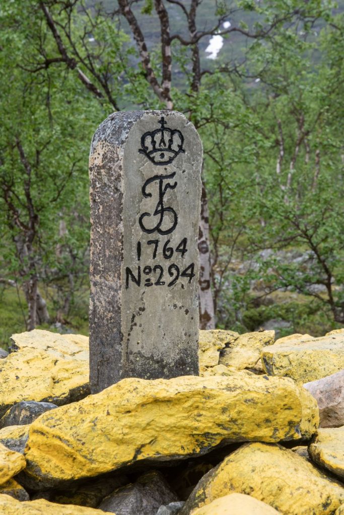
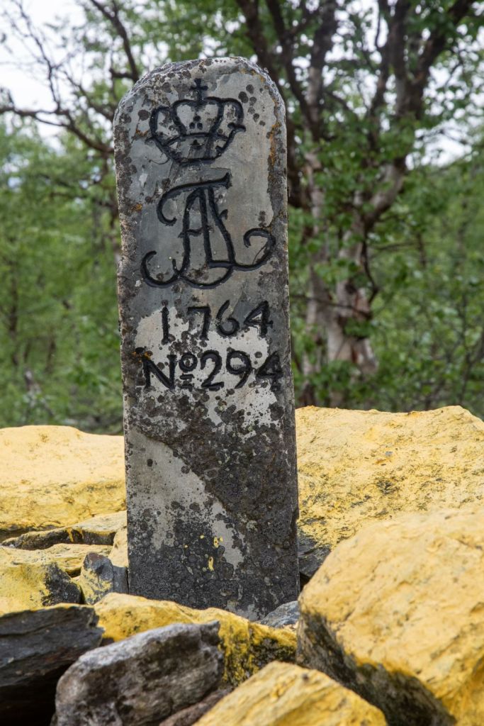
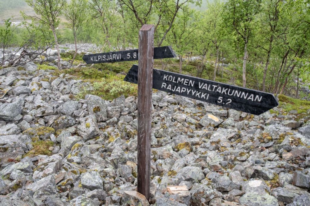
The Finland – Norway border near the tripoint is relatively short with the BM#294 being approximately 150 m east of the tripoint. It was an easy stroll between the two.
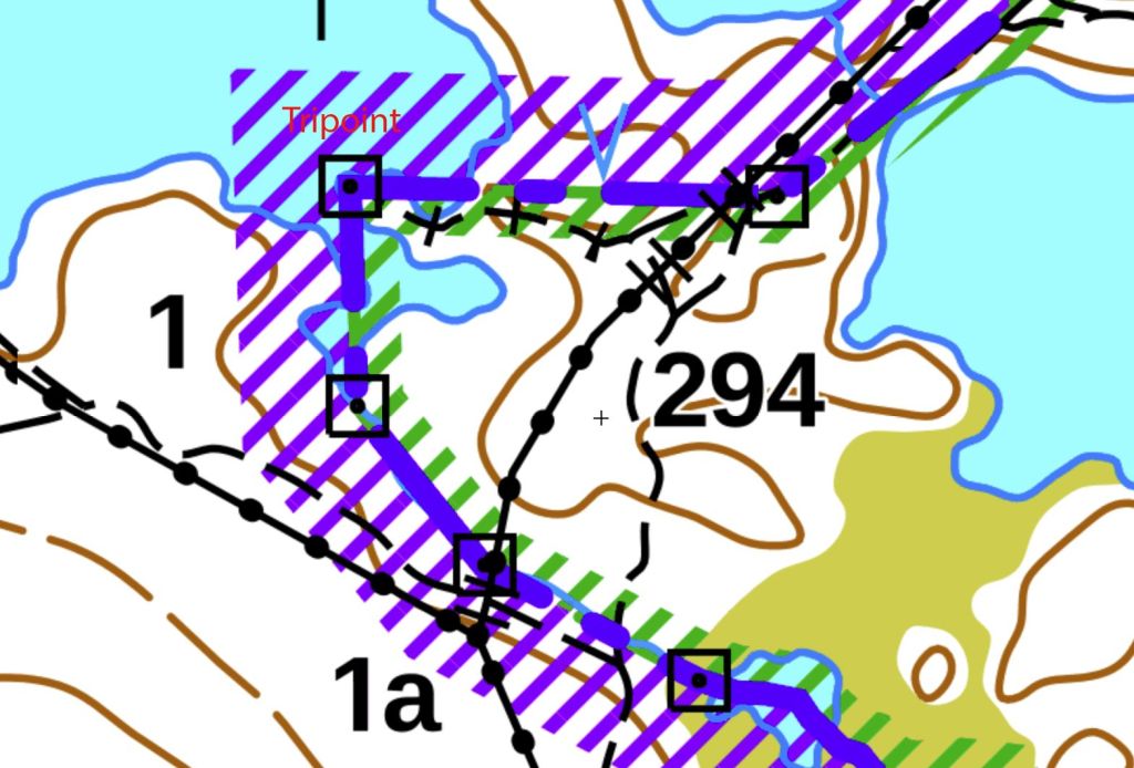
BM#294
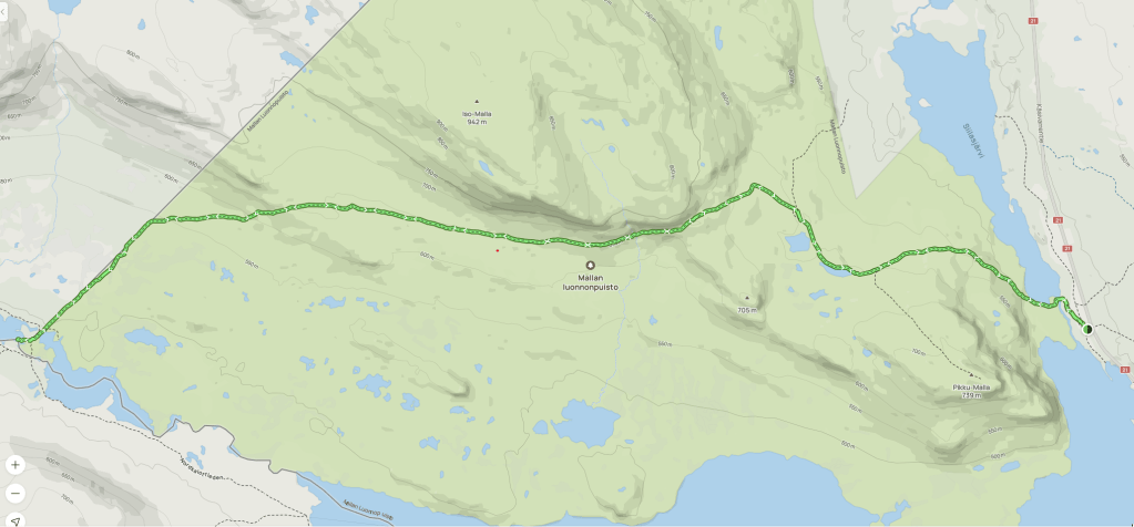
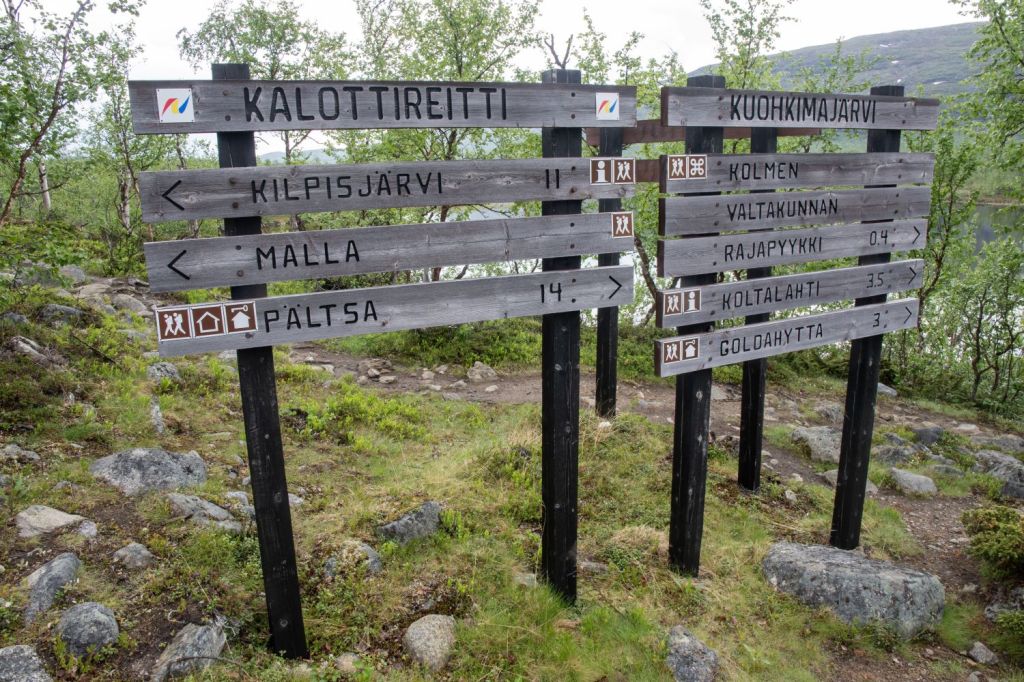
The journey in…
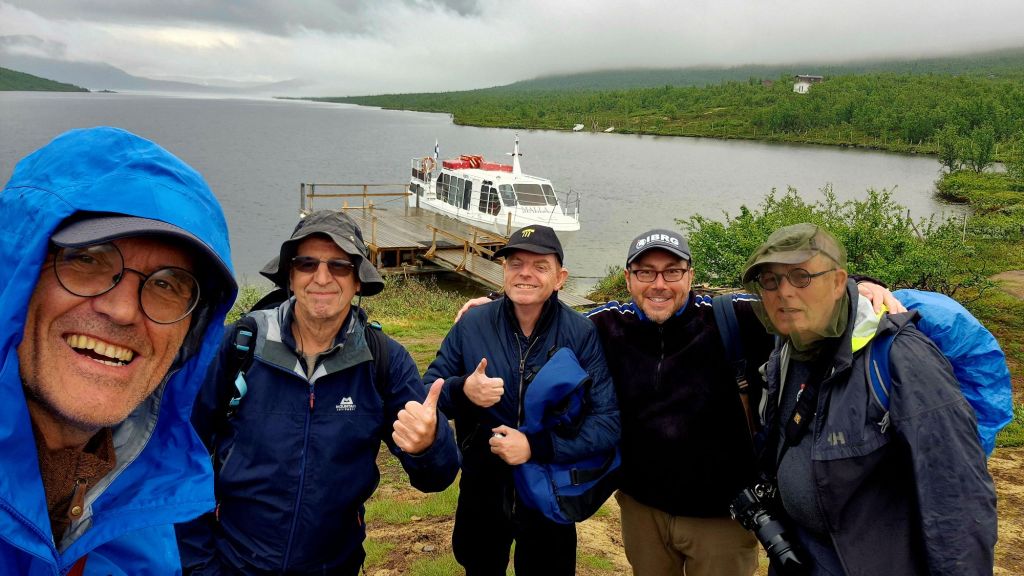
We opted for the ferry from the small boat harbour at Siilastupa near the village of Kilpisjävri across Lake Kilpisjävri to Koltalahti/Koltaluokta at Swedish side of the lake. The boat trip takes 30 minutes and the boat stays 2 hours before returning. The 3 km walk to the tripoint takes 30 minutes meaning there is only 1 hour in the tripoint area. We wanted to explore the area in detail and visit all the border markers in addition to the tripoint. We therefore choose to walk back the 11 km back to Kilpisjävri. Details of the boat trip are here.

It was a pleasant journey across the lake, once we arrived at the Swedish harbour those who opted for a single way trip were given additional advice about the terrain, weather and route. Most people opted for a return trip however that would not give us enough time in the tripoint area.
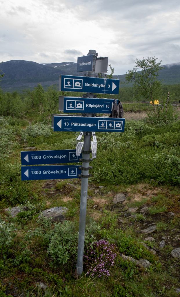
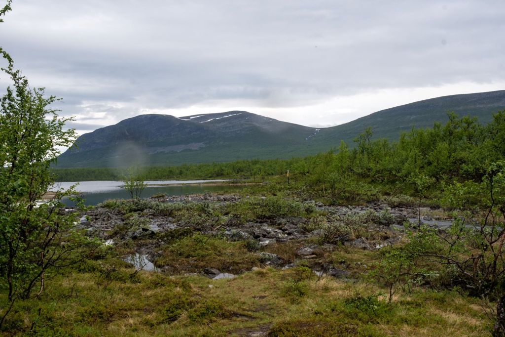
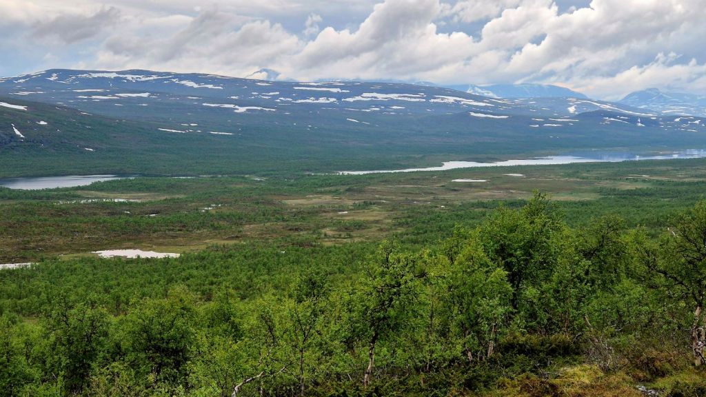
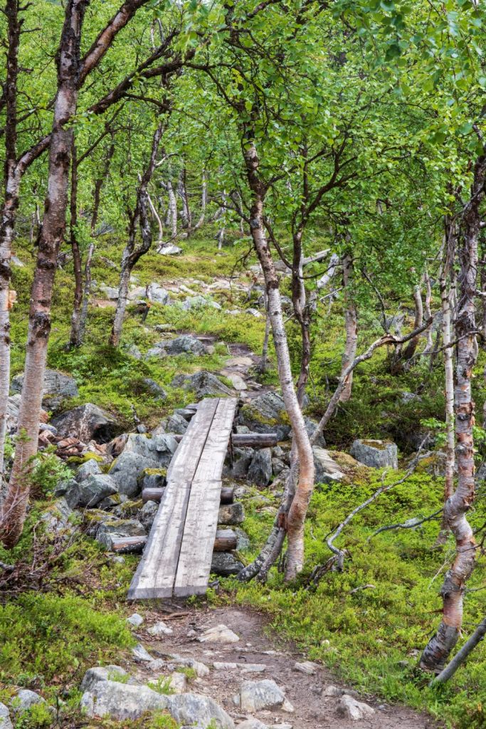
The 3km hike was pleasant and undulating. The trail follows the Swedish-Finnish border, now and then popping into the birch forest. The rest of the trail runs along the shore of Lake Kuohkimajärvi.
The walk out…
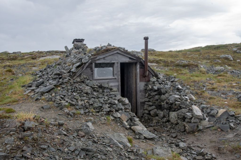
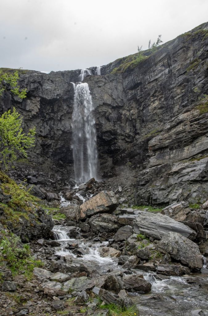
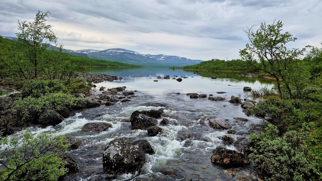
We opted to follow the Malla Trail (11 km) back to Kilpisjärvi. After leaving Lake Kuohkimajärvi, the trail makes a winding ascent through birch forest. The trail then follows the reindeer fence and there are a number of small brooks to cross. The trail continue across heathland with great views of the surrounding hills and lakes. The trail begins to ascend and crosses boulders and rocky terrain until it reaches Kitsiputous Falls also known as the “tears of Malla” is the highest series of waterfalls in Finland, only 5 km and 2 hours to go. The trail continues to rise but eventually the ridge is reached. An interesting shelter build by the German Army is a suitable place to pause. There was snow there in June when we visited.
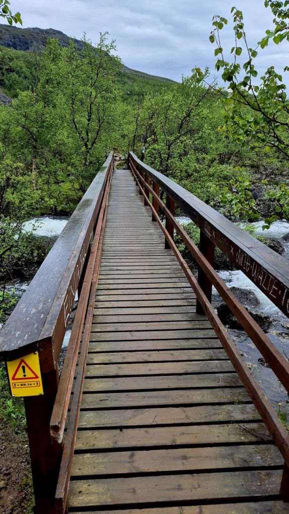
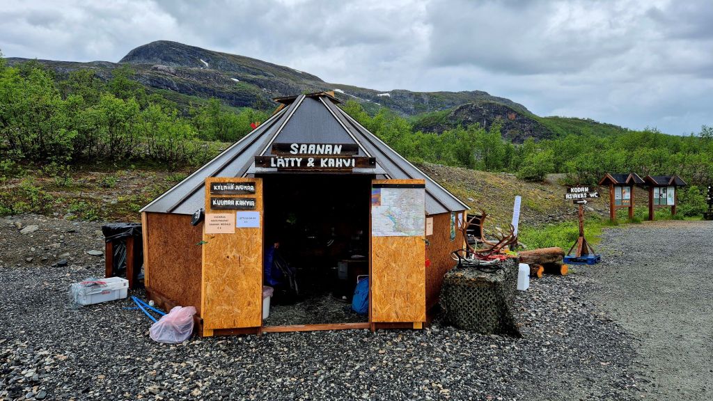
The trail descends through heath until the birch forest is once again reached. The trail descends sharply and undulates, ultimately we reached the bridge across the River Siilasjoki and then it is a short walk to the car park where pancakes and coffee are sold.
Videos

Date of visit: 17 June 2024
