
AD and FR border markers
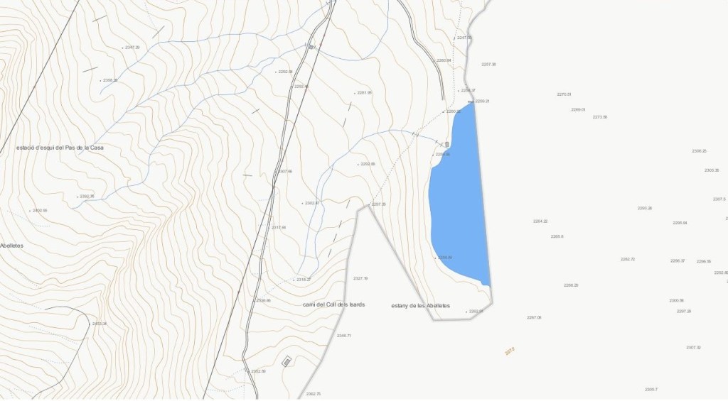
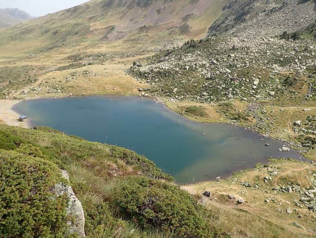
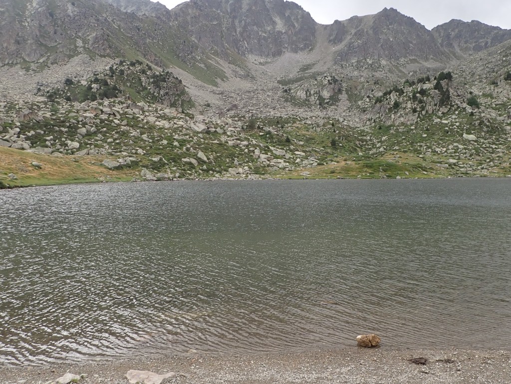
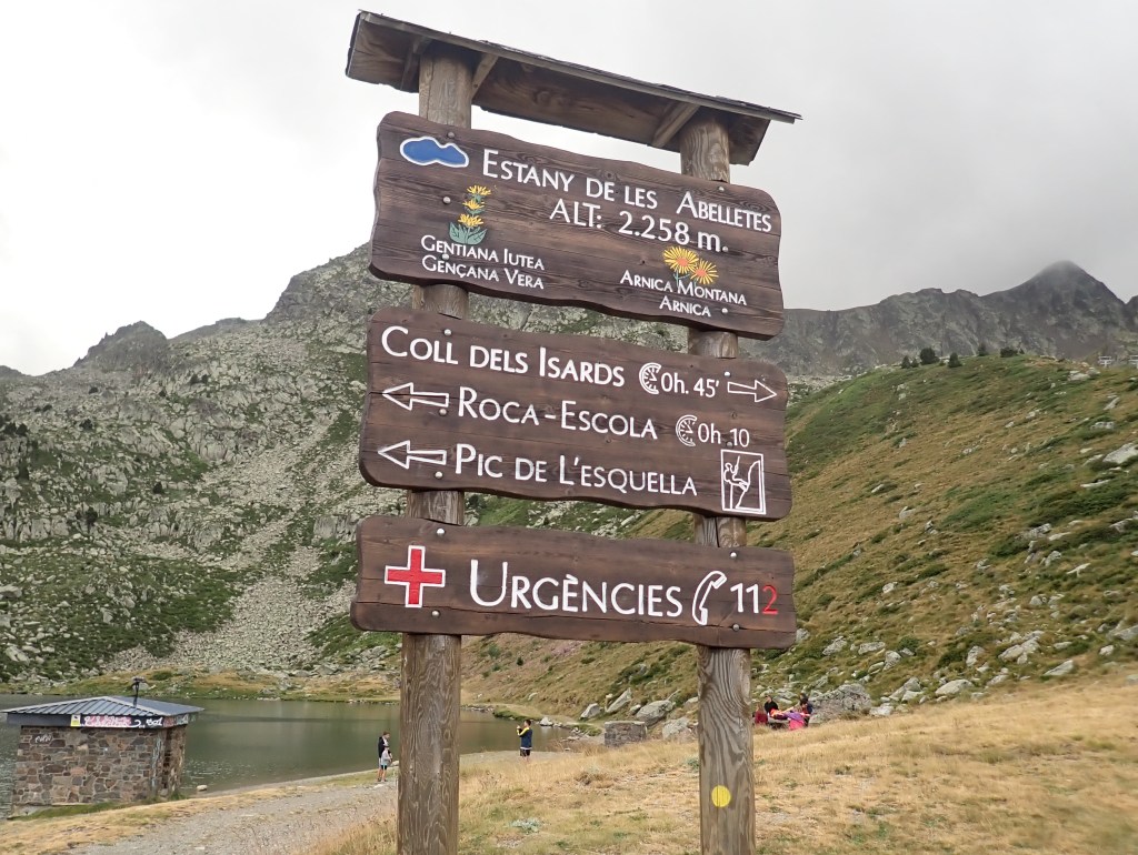
L’Estany de les Abelletes is located above Pas de la Casa, at 2,260 m, at the head of the Airège river basin, a tributary of the Garonne, a popular destination for picnics in summer. I visited the lake en route to ADESFRe (both there and back). The lake is of particular interest to border enthuiasts for 2 reasons, firstly the border between Andorra and France goes through it and secondly, newly designed and erected border markers (the first and only ones on the Andorran border) mark the new border.

Andorra’s borders have never been clearly deliminated and have been based on traditional divisions. In the case of Estany de les Abelletes there was a disagreement to where the border was. Andorran maps had the border transcecting the lake whilst French maps had the whole lake as part of France. In 2012 an agreement was reached to resolve the issue and also to secure water supplies for Pas de Casa.
The disputed area was divided approximately in half following the trail from the Coll dels Isards down hill towards (and above) the lake. As the trail was well established it was easy to agree the route. BM#2 and BM#3 are located on the trail (although I was the only one who paid them any notice).
It was offically agreed that the lake was to be divided in half and it is this part of the border where the 6 bordermarkers have been placed. The border follows a curved route and it was considered necessary to mark this on the ground.

Location of the border markers

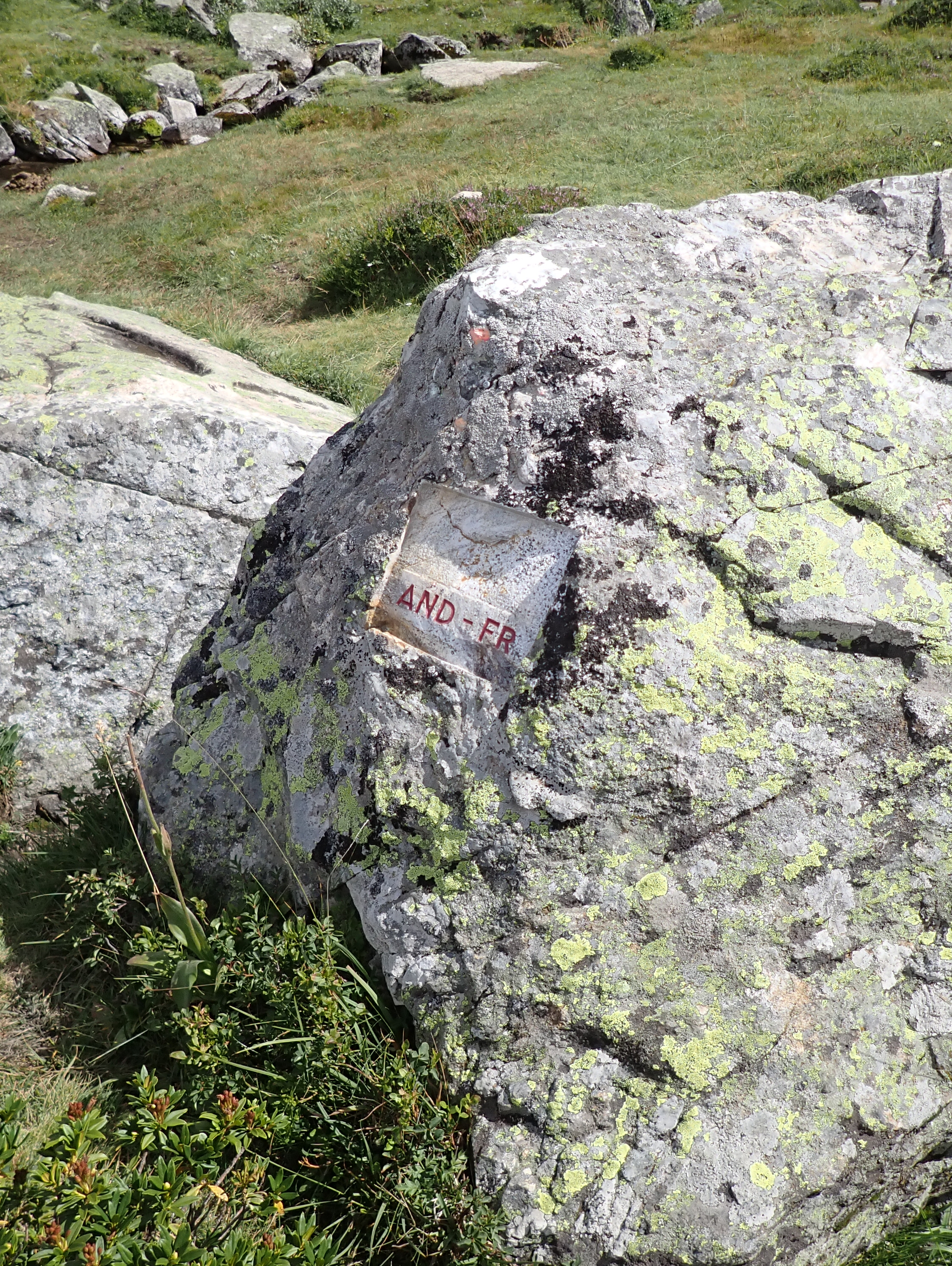
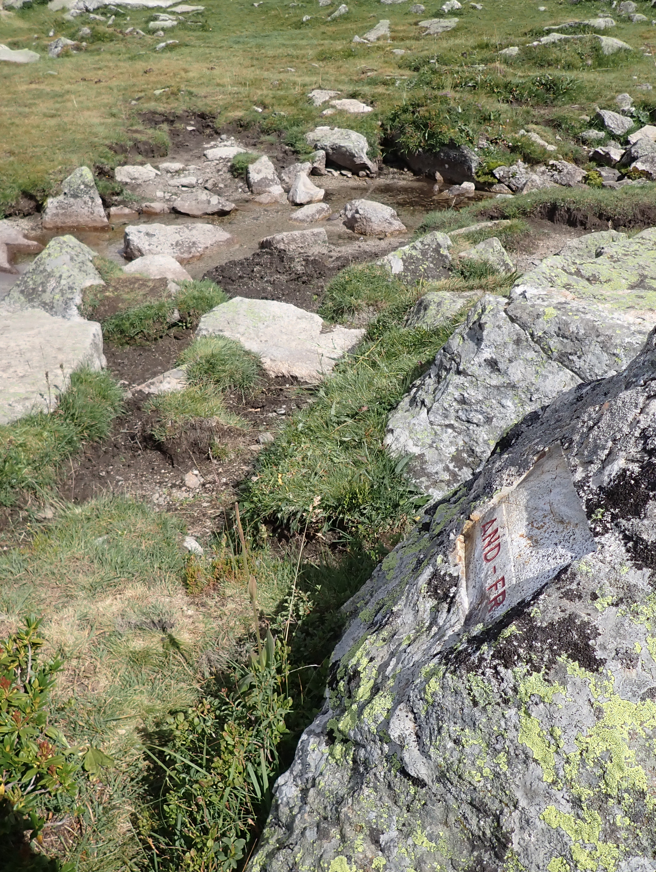
There were 6 markers, 3 stone pillars (90kg local granite) and 3 with the letters AND and FR engraved into rocks. The reason for this was financial and practical, the landscape allowed for existing rocks to be utilised in such a way. Eef Burns (2019) established a way of numbering the engraved rocks as follows: ADFR1a, ADFR0a and ADFR0b. It saddens me to report the even with GPS I could not find ADFR1a (and I tried really hard!!).
AD/FR Bordermarker Gallery (in numerical order rather than in sequence).
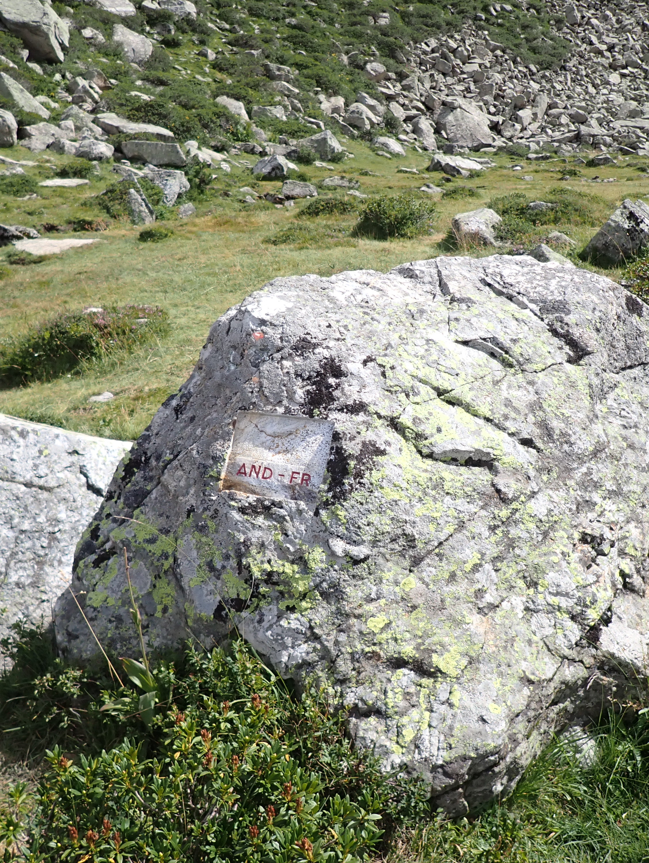
ADFR0a is the south of the lake and was the last one I visited. I cross with the countries letters neatly engraved in the rock.


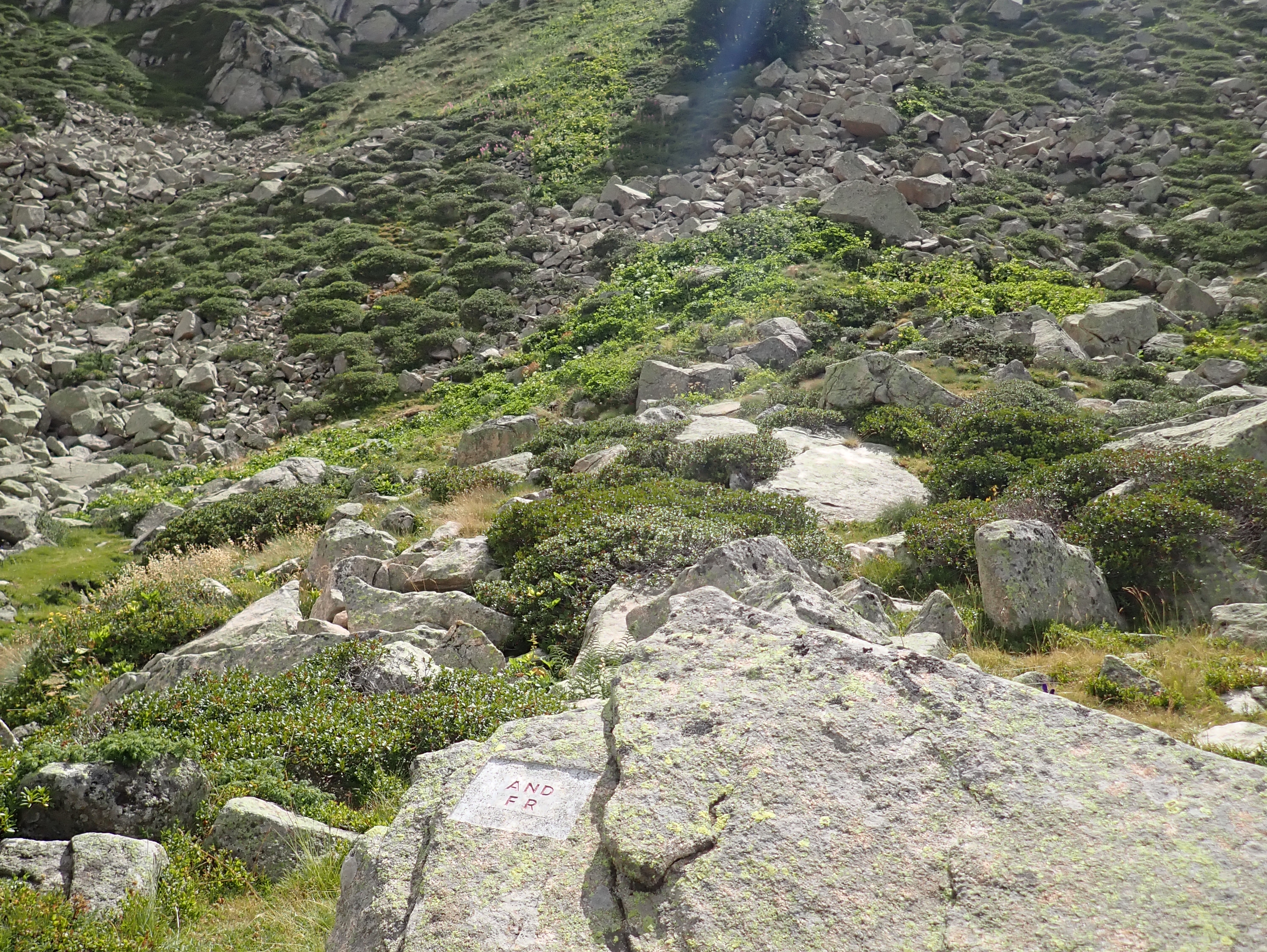
ADFR0b relatively close to the above marker south of the lake.

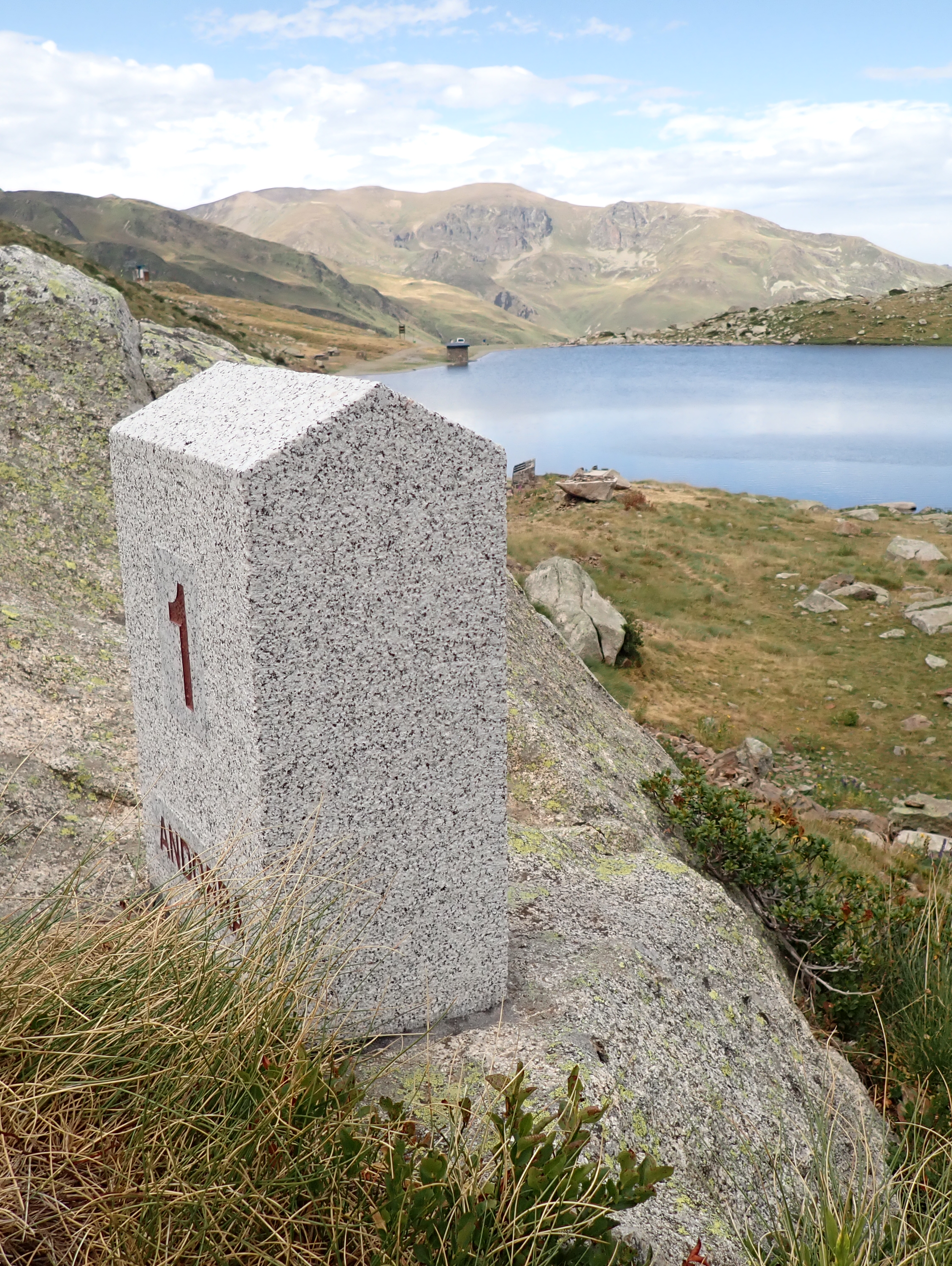

ADFR1 is located to the south of the Lake

ADFR1a I tried to find this marker both on the way up and down from the tripoint. According to my GPS I was right there but I could not see it on the ground, even with a grid pattern search.
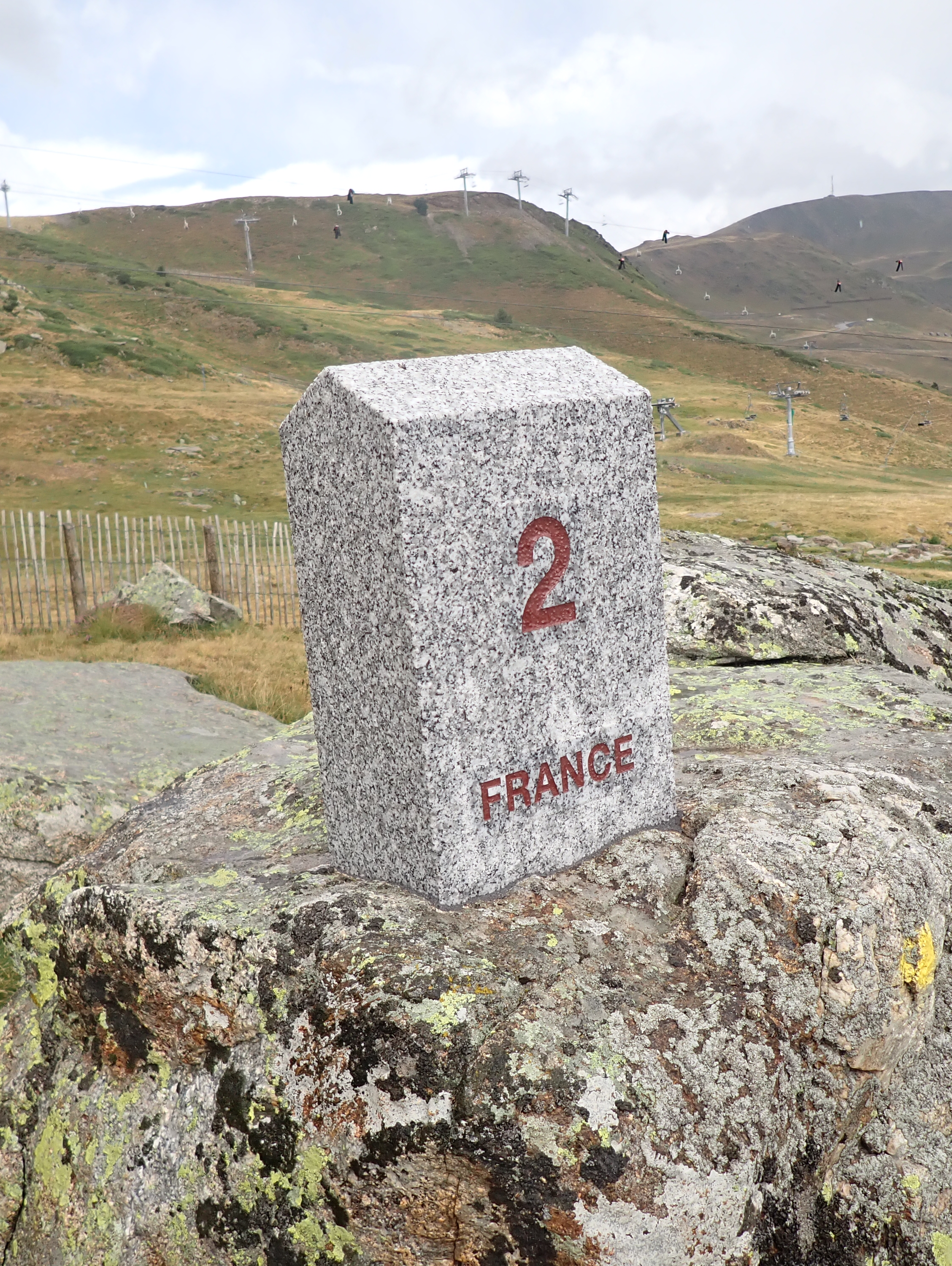

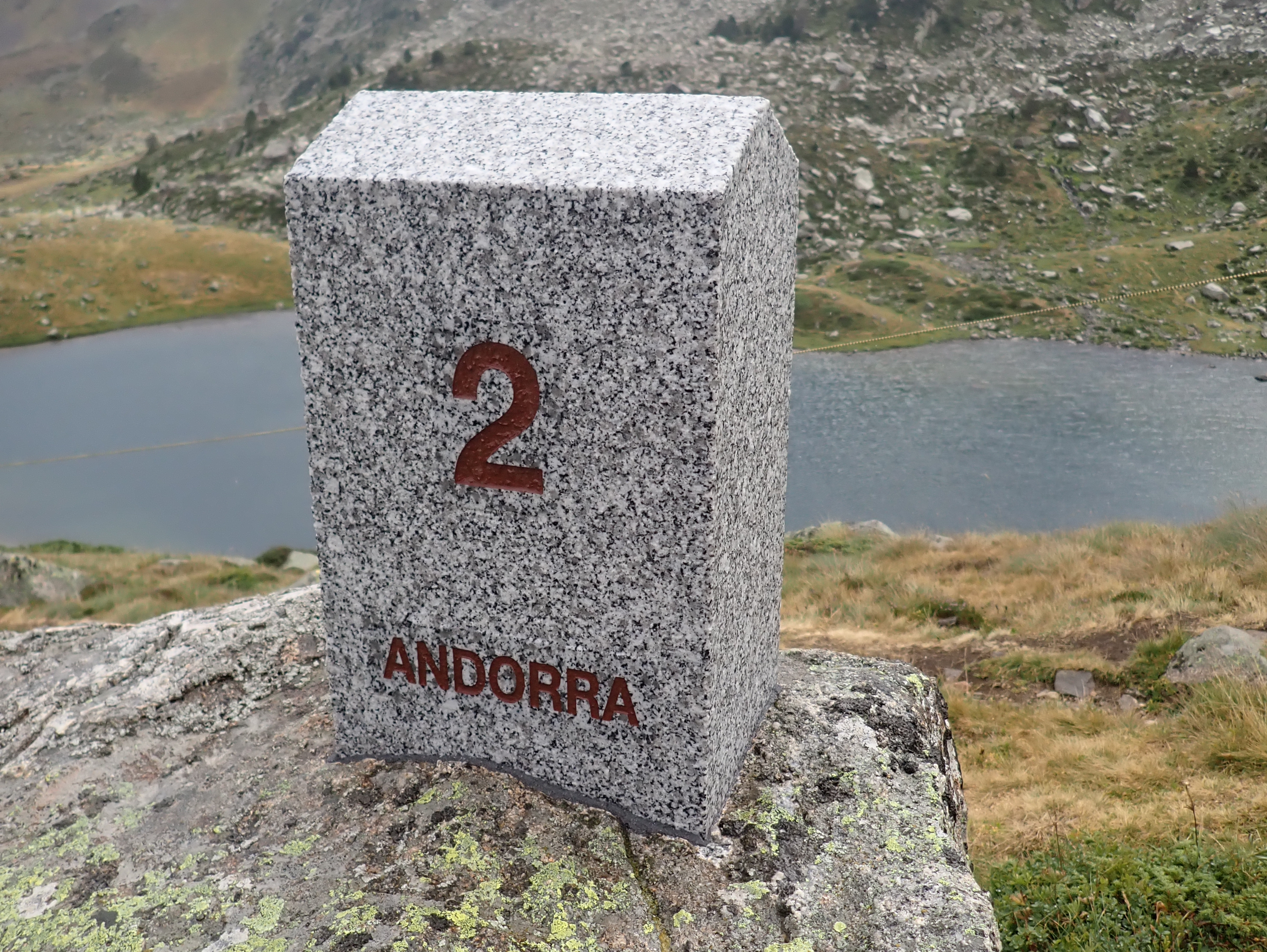
ADFR2 is located to the west of the Lake and was the first one I came to on the trail.

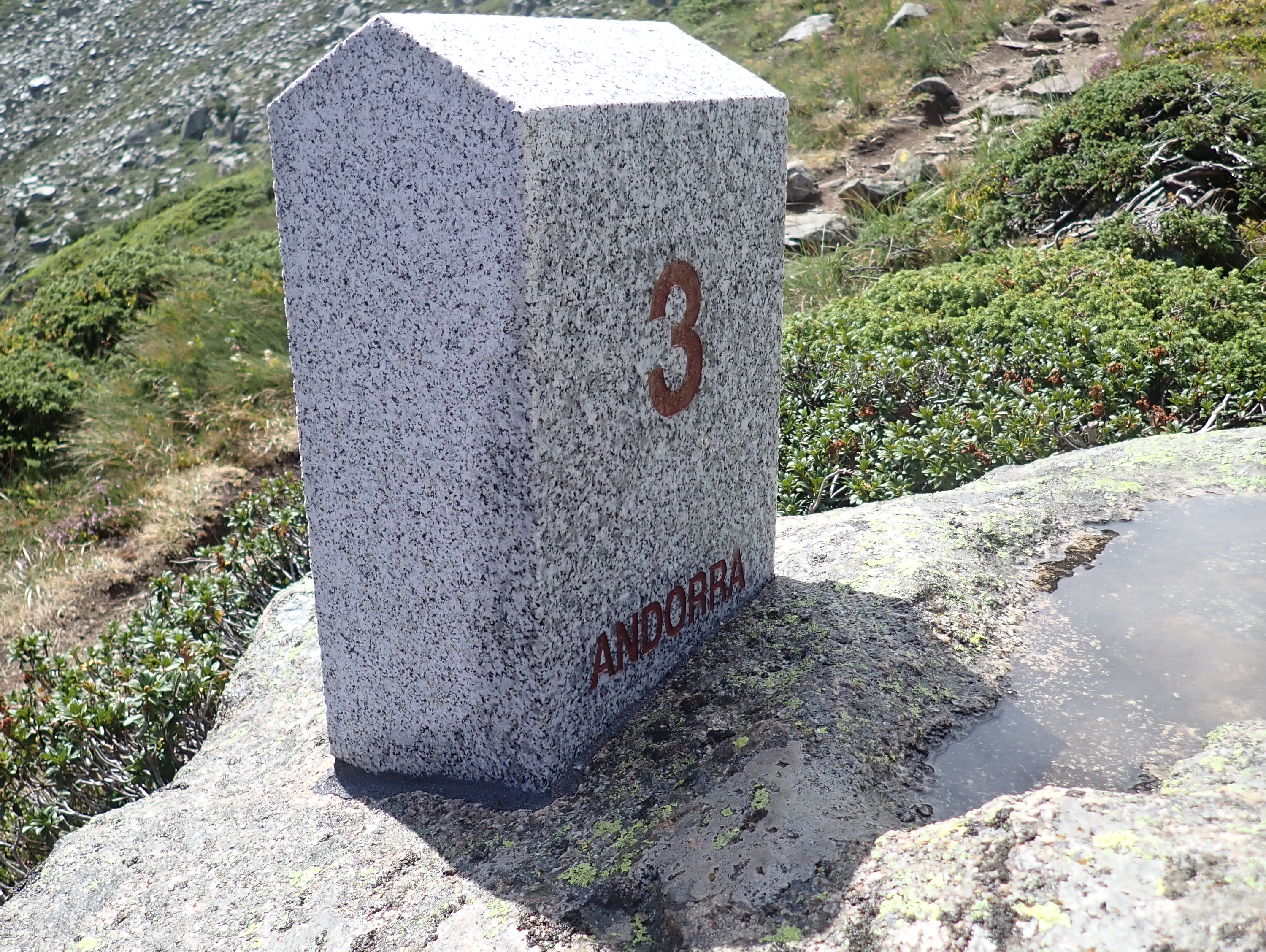
ADFR3 is located to the west of the Lake and a short walk up hill from ADFR2
The Lake


Date of Visit: 12.08.2020
References:
- The bordermarkers of the Pyrenees : all markers ( Eef Berns) Website here
