

The puzzle which is BM #192a
I visited this point as part of the IBRG DEDK21 expedition. Sometimes what might be seen as initially straightforward becomes really quite difficult. In this case it was the single border marker #192a at Vindtved. The questions arose about where was the actually border, how did it orientate from this point, and had the border changed over time? As with all these things, especially when border enthusiasts meet there is never one viewpoint, and the discussions continue to take place long after the visit.


Extract from the 1920 Border Treaty

Treaty Amendment 1957
What becomes a little clearer is that in the 1950’s the border stream east of Vindtved was made more straight and a canal was build here. Border marker 192a was placed to further delineate the border. What is confusing still is that on the map below it appears that the Süder Au stream is under the marker and continues west. This is not confirmed by various satellite images over time.
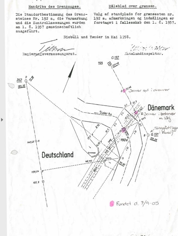

The extract from the border treaty (1920) confirms that the lines on top of the border markers mark the line to the next marker. This is important to note because markers may be some distance away or offset and therefore deviate from the actual border.
Changes to the border rivers


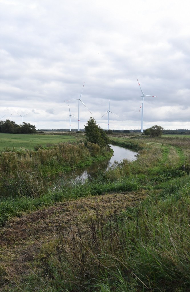
The 2 maps to the left show how the border has changed over time. In the upper map the border followed the river. In the 1950’s the river was regulated to become straighter and most likely to improve the quality and efficiency of the adjacent farmland. Note BM #189 which was originally further south.
The border streams between BP 89 and 192 were manually regulated which meant land swops between DE and DK. The old BMs were replaced and new sketch maps of their locations were produced. In this regard the treaty is not helpful, because it states the “border follows the middle line of the stream” but it also says “the border follows the natural meandering”. What does that mean? Does it mean the border automatically changes with the meandering over time and what is the middle line?
In discussions with my Danish friends, the border between Denmark and Germany is reviewed every 10 years, the next time being 2024. In one place where the stream meandered, they decided not to change the border but convert an indirect BM into a direct one. So in this instance the border does not follow the meandering stream as the treaty described.
Further research by Jesper Neilson, a fellow member of the IBRG found that in 1994 border commission protocol:
“Between border point 2 and 3 the course of the Krusaa doesn’t not follow the official specifications“. Since this condition has been known since the beginning of the current border, and has not caused any practical problems, the commission has decided to let it be.
Final thoughts
How does this help with BM #192a? Our conclusions are that this marker is direct, the canal has been straightened and perhaps the position of BM #192 may have altered. The lines on the top of the marker point to the next markers in the sequence, and with BM #193 some distance away it’s important to recognise they will not follow the border
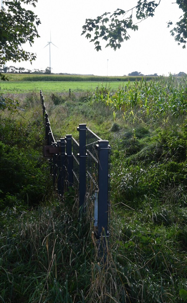
Photos from our visit


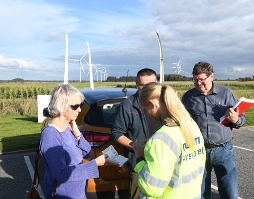
The final surprise
As we returned to our cars, and crossed the border once again from Germany to Denmark we were subject to an ad hoc border control check by the Danish authorities. I must say they were the most pleasant law enforcement officials I have ever met.

Closed border during the COVID pandemic.
Along with all other crossings this one was closed during the pandemic. All photos: Steen Schelde with thanks.


Date of Visit: 25 September 2021

Oh yes! Bm 192a IS a tricky one ! Very good explanations on this part of the border….and: a good match: our New Vice President and the Danish Police Officer dressed in yellow😉😍👍
LikeLiked by 1 person