
Turtuk is one of the northernmost villages in India and is situated in the Leh district of Ladakh. It is located within the Nubra Valley and is only 205 km from the capital Leh. It however has a very isolated feel being close to the LOAC. Geographically, Turtuk lies in the Baltistan Region and is one among four such villages in India, the other three being Tyakshi, Chalunkha and Dhothang. The residents of Turtuk and its adjoining villages speak Balti language along with Ladakhi and Urdu. Turtuk is the gateway to the last outpost of India at Dhothang (Thang) after which Pakistan-controlled Gilgit-Baltistan begins. If circumstances were different it would be possible to travel between the 2 countries through the Shyok Valley.

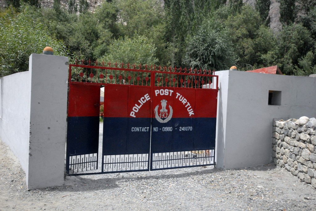
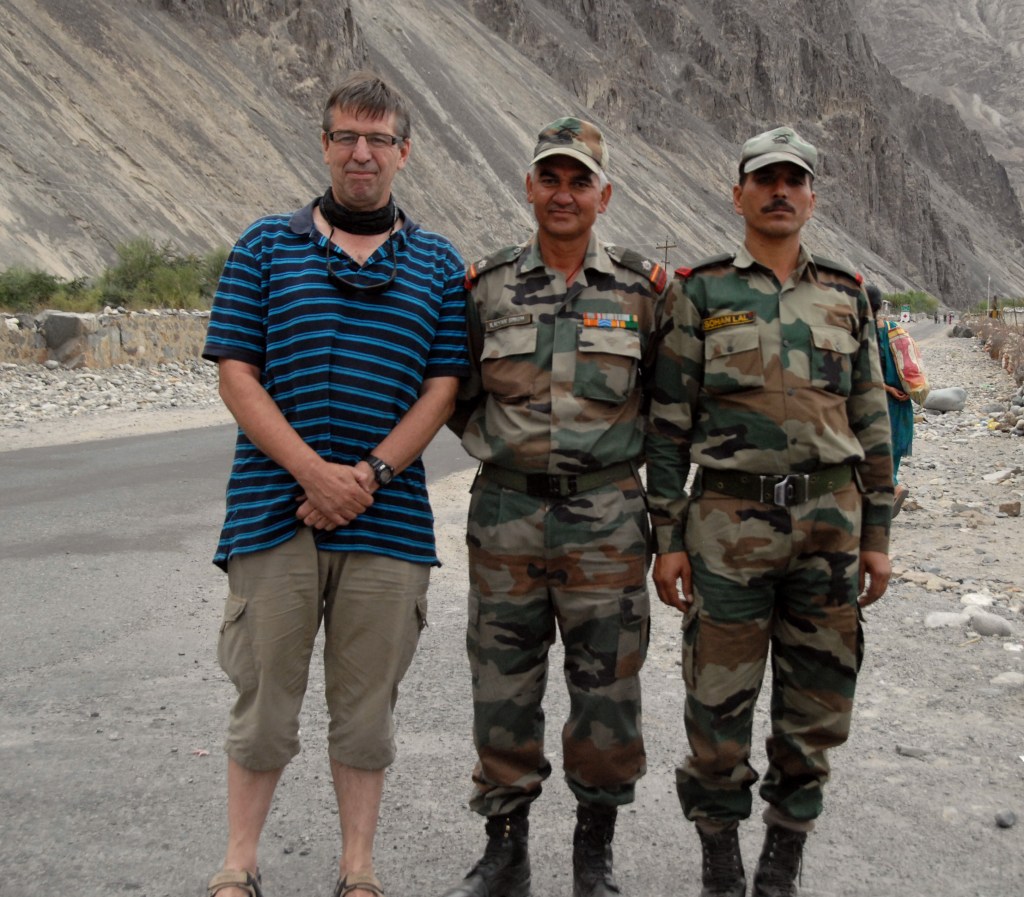
Tourists require an Inner Line Permit to travel anywhere outside Leh. I needed further permission from the local police station to be here.
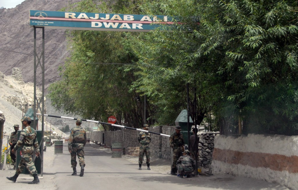
Travelling north towards the LOAC we reached the Indian Army checkpoint but alas no further, it was frustrating as we were only 7 km from the village of Thang which overlooks the line of control. In 2012 however even Indian tourists were not permitted to travel further. This rule was relaxed in 2018 and there are now Tripadvisor reports (here), only from Indian tourists so I don’t know if I could get there even now.
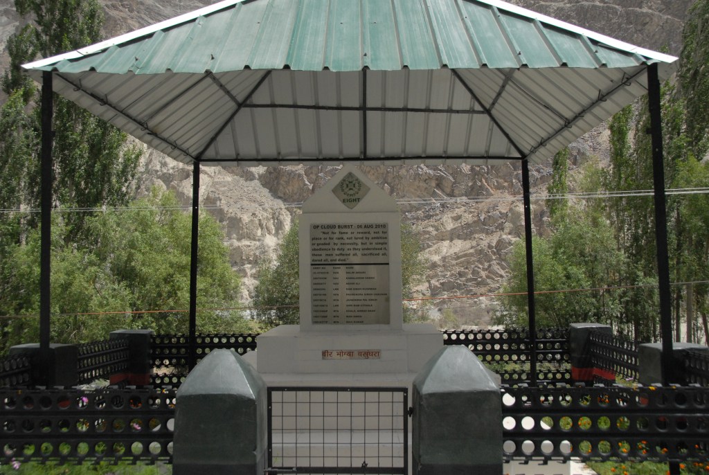
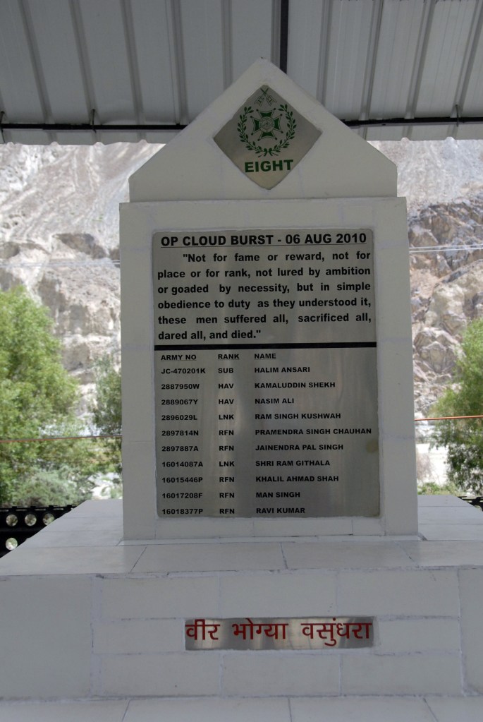
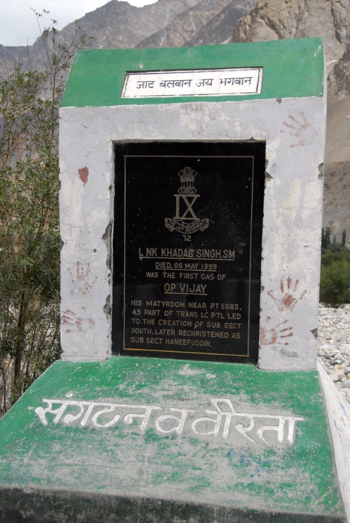
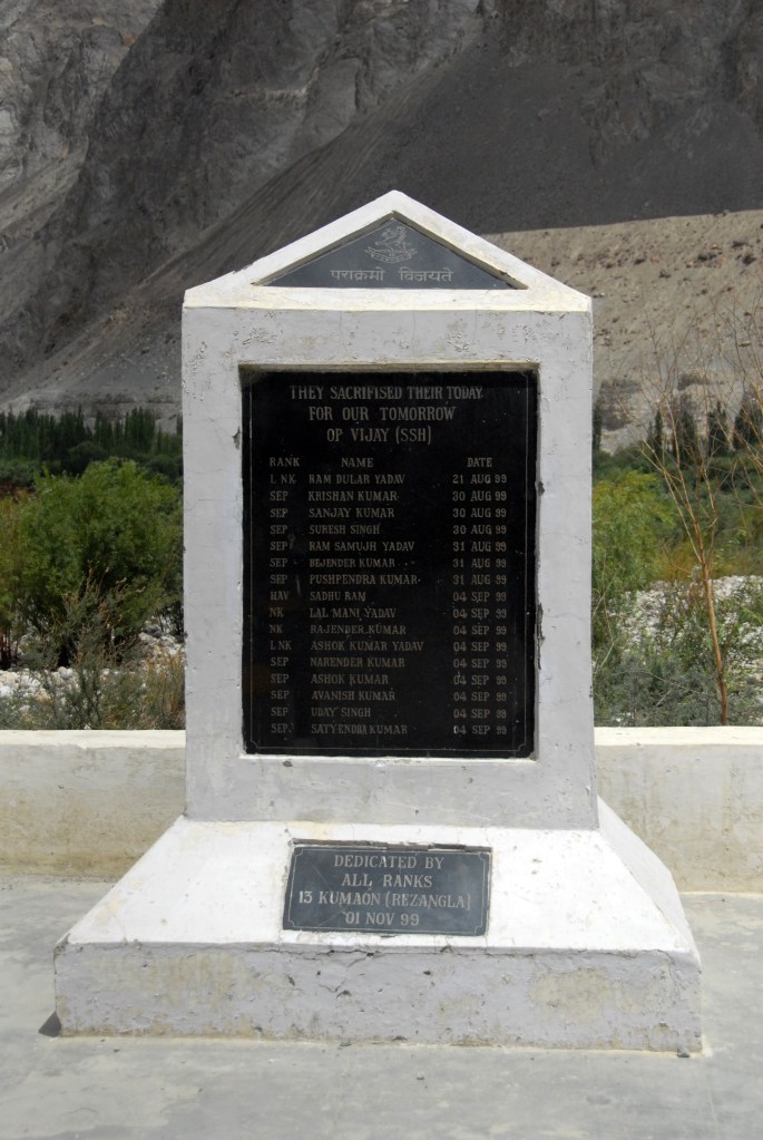
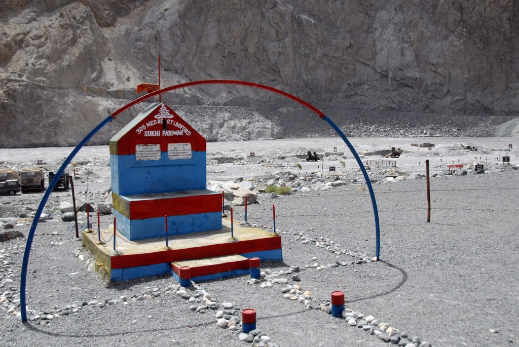
Military Monuments
At the end of the Indo-Pakistani War of 1947, Turtuk came under the control of Pakistan. Three other villages- Dhothang, Tyakshi and Chalunka of Chorbat Valley, came under control of India. India’s Ladakh Scouts and Nubra Guards under the command of Brigadier Udai Singh Bhati and his second in command Major Chewang Rinchen recaptured it during the Indo-Pakistani War of 1971. Brigadier Udai Singh Bhati and Major Rinchen were both honoured with a Maha Vir Chakra for their gallantry. Military monuments dot the countryside.


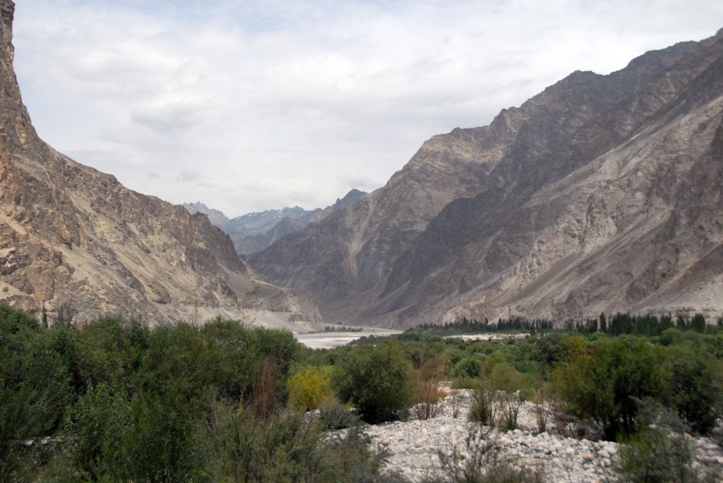
Shyok Valley
Turtuk is located within the Shyok Valley and the landscape is awesome. The Shyok river originates at the Rimo Glacier, one of the tongues of Siachen Glacier. It is also known as the river of death.


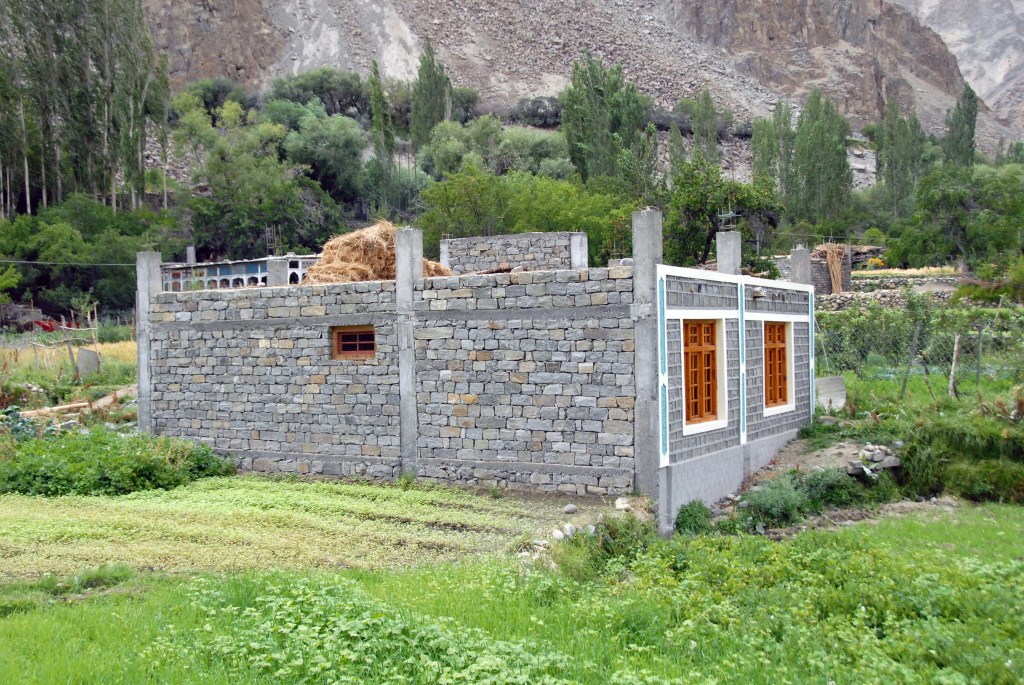
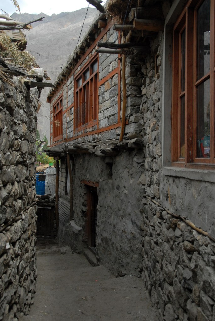
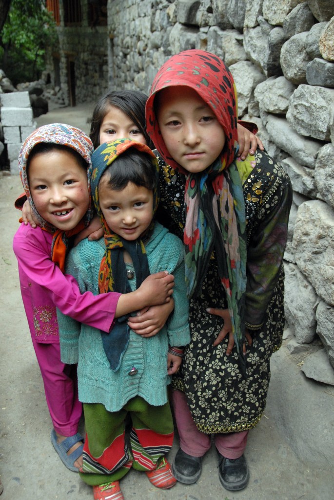
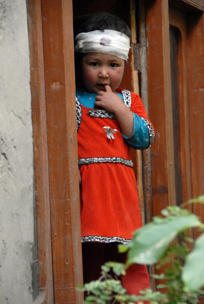
The village
Claimed by Pakistan after the end of British rule in 1947, Turtuk was annexed to India in 1971 during the Indo-Pakistani war, when the province of Baltistan was partitioned between the two countries. As a military border, it remained closed to outsiders – even other Indians – until locals, weary of their long isolation, petitioned for the remote, scenic valley to open up. For years, Turtuk was kept secluded not only by the government, but by its uniquely imposing geography: cradled by the Karakoram mountains, it’s a hard trek from surrounding villages. Yet the predominantly Muslim province of Baltistan – an anomaly within mostly Buddhist Ladakh – once served as an important gateway to the Silk Road, the ancient trading route that connected India with China, Persia and Rome. The mixed backgrounds of Turtuk’s villagers, who are of Tibetan and Indo-Aryan descent, speak to Baltistan’s once important role as a connector of goods, cultures and people.
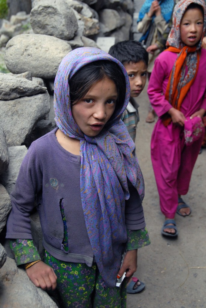
A small village with limited facilities, however since tourism has been allowed from 2010 in this region signs of economic benefit is there to see with new homes being built. Children run everywhere, trying to keep out of the way of camera but laughing loudly all the time. Apricots are one thing that makes the village famous and are renown for being the best in India .


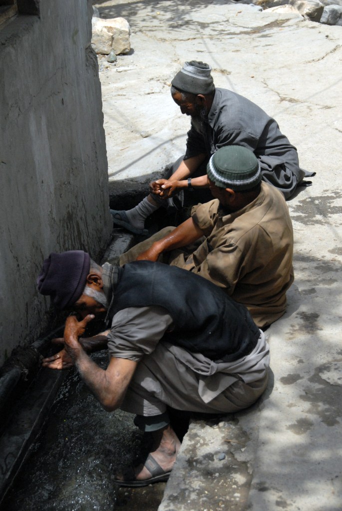
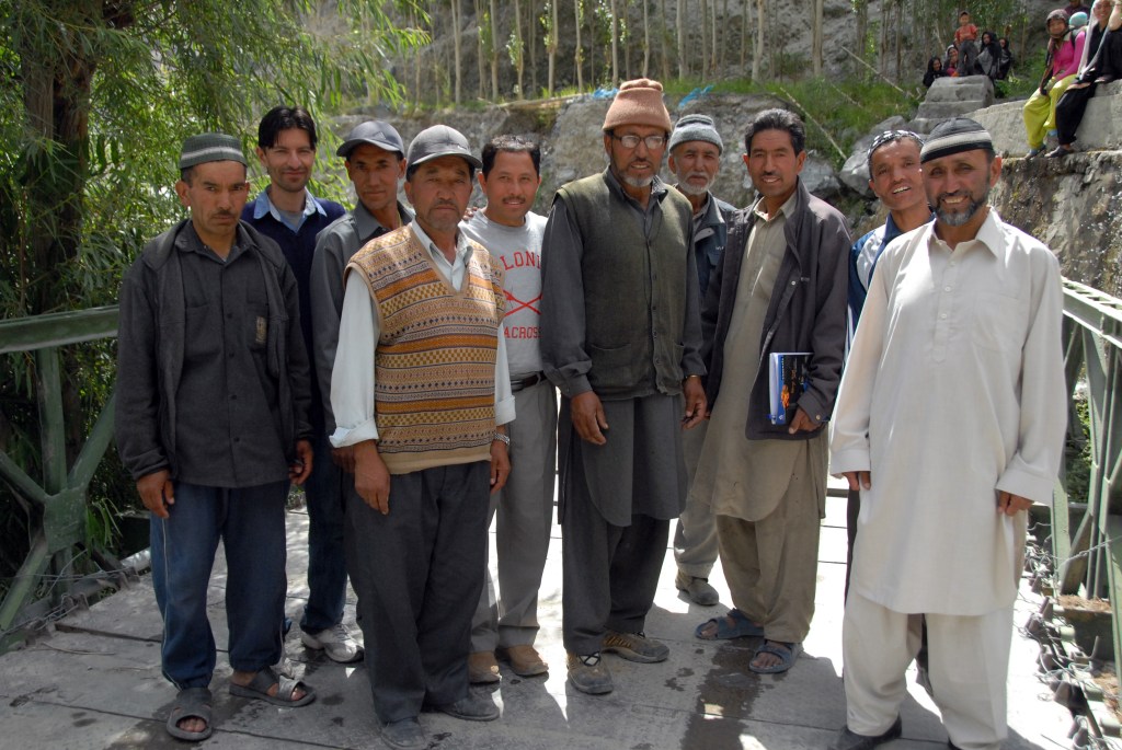
The People – faces of Baltistan


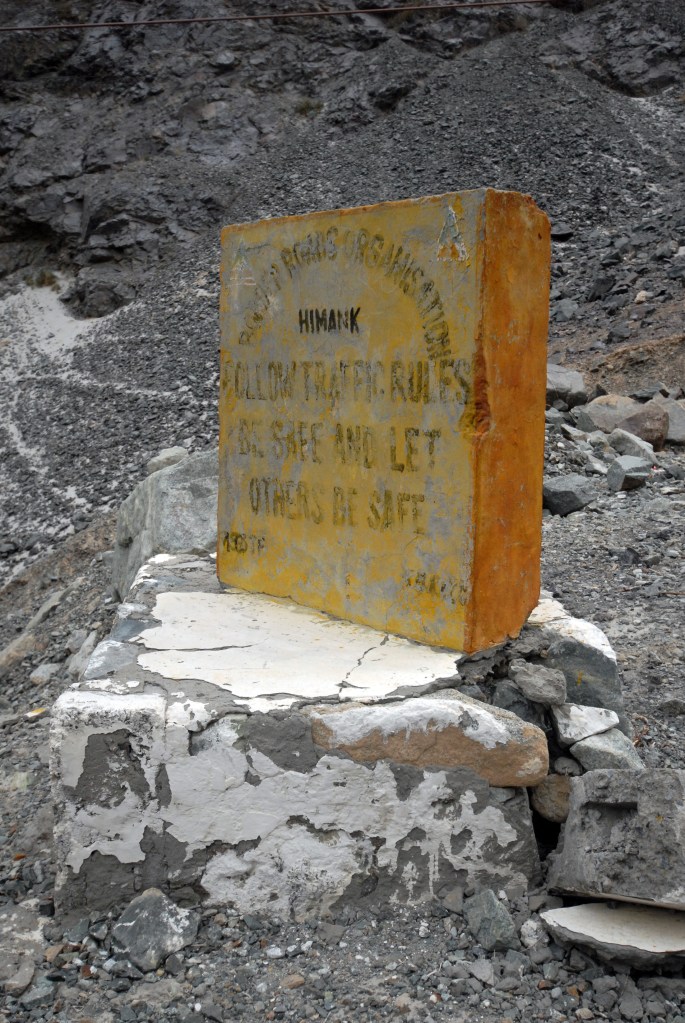
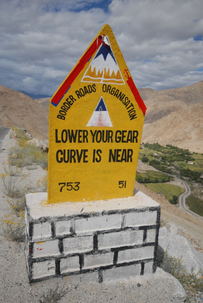
The Border Road Organisation
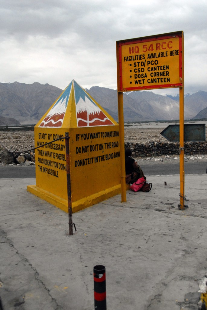
The Border Roads Organisation (BRO) develops and maintains road networks in India’s border areas and friendly neighboring countries, has, in 2019, constructed and developed approximately 60,000 km of roads . Officers from the Border Roads Engineering Service (BRES) and personnel from the General Reserve Engineer Force (GREF) form the parent cadre of the Border Roads Organisation. It is also staffed by officers and troops drawn from the Indian Army’s Corps of Engineers on extra regimental employment.
Two things strike you when travelling in Ladakh, firstly the inhospitable nature of the terrain and how tough it is to keep access routes open. Given the proximity of the borders the strategic dimension of the BRO is obvious. Secondly, the necessity and humour that goes into their traffic signs.


Date of Visit: August 2012
