
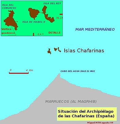
The Chafarinas Islands, also spelled Zafarin, Djaferin or Zafarani, are a group of three small Spanish islets located in the Alboran Sea off the coast of Morocco with an aggregate area of 0.525 km2, 45 km to the east of Nador and 3.3 km off the Moroccan town of Ras Kebdana. I visited these islands as part of the as part of the IBRG MOMEX-24 expedition.


These offshore islands were were uninhabited and unclaimed in 1848, when the French government decided to occupy them, they were however beaten by the Spanish who occupied the islands by despatching a warship in January 1848.
The Chafarinas Islands are made up of three islands (from west to east, with areas in hectares):
Isla del Congreso (25.6 ha)
Isla de Isabel II (15.3 ha) (with garrison)
Isla del Rey (11.6 ha)
Under Spanish control since 1848, there is a 30-man military garrison on Isla Isabel II, is the only stable population on the small archipelago, down from 426 people in 1900 and 736 people in 1910. Small numbers of scientists, anti-trafficking police, and other authorized personnel sometimes increase the population to around 50.

The plazas de soberanía (places of sovereignty) are divided into 2 groups, major which includes Ceuta and Melilla, and minor that includes the rest that are mainly little islands and one which is a peninsula. They include (west to east) Perejil Island,
Peñón de Vélez de la Gomera. the Alhucemas Islands, Alboran Island and small islote de La Nube and finally these islands.
The Islands
The islands are clearly visible from the Moroccan shoreline. Whilst we visited off season there were several Moroccan visitors also taking photos. Left to Right the islands are Isla del Congreso, Isla de Isabel II and finally Isla del Rey.

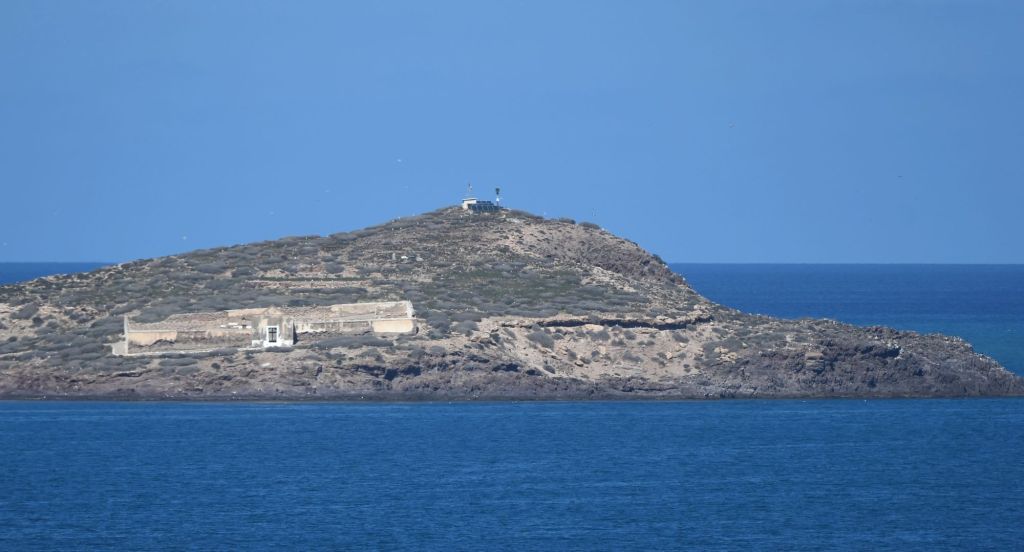
Isla del Congreso
The island is uninhabited. It has some rabbits and a pigeon colony. The west coast is very inaccessible, with very steep cliffs, while the east coast is more accessible. The island is very rocky, with very little grass or plants.


Although uninhabited, there are 2 structures on the island and a track leading up to the summit. It is the steepest, highest and most extensive of the island group, and historically served as a prison for Melilla which may be the larger building visible.
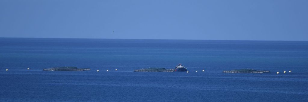
There is also a navigation light to the west of the island, perhaps to aid the Moroccan fisherman who have fish farms close by.
Isla de Isabel II
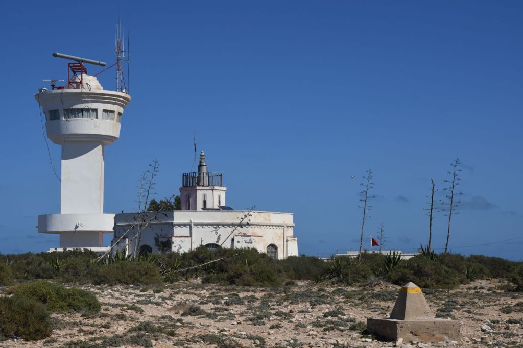
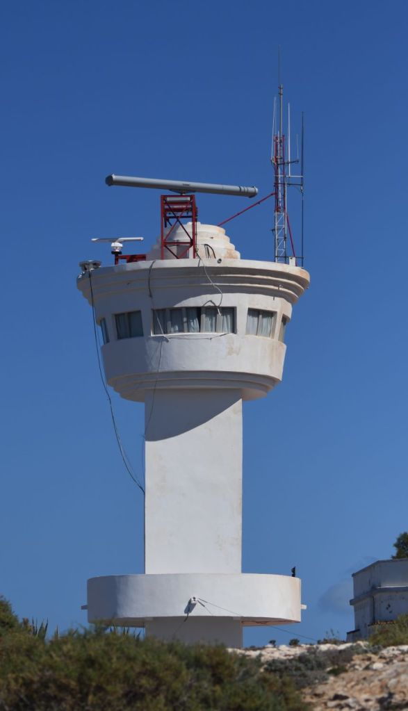
Isabel II Island (Spanish: Isla de Isabel II) is the central island of the Chafarinas Islands, in the Mediterranean Sea. The island belongs to Spain. It is located only 3.3 kilometres away from the North-African shore, in front of the Moroccan town of Ras Kebdana. Its area is 0.153 km2 (15.3 ha), and there is a military base and a church. The name of the island comes from Isabella II, Queen of Spain from 1833 to 1868. Between 1910 and 1915 the island was connected through a dike with the Isla del Rey. One of the unique buildings on the island of Isabel II is the church of Nuestra Señora de la Concepción, which was built between 1851 and 1853. There are military buildings and a lighthouse visible from the shore.


Isla del Rey
An inhabited island with a small cemetery.

The cemetery and navigation aid on the summit on the east of the island.
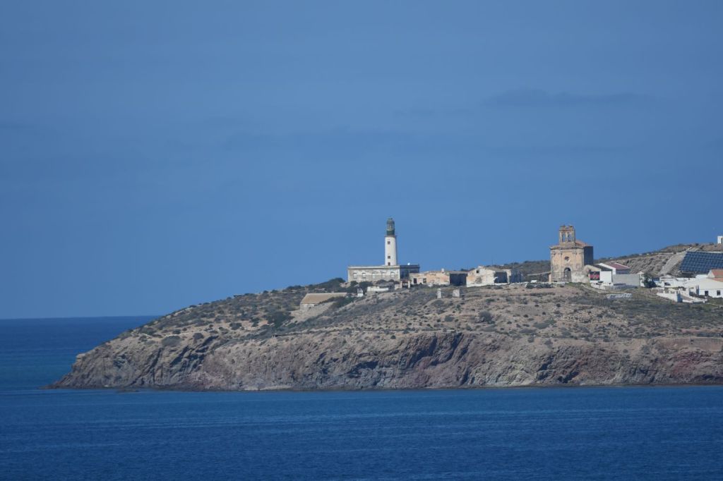
Moroccan Base
Opposite the islands at Cap de l’Eau-les-Rochers there is a Moroccan base which appeared to be manned by a small contingent. Morocco appears to place installations close to any of the Spanish possessions.


Date of Visit: 06 March 2024

thanks for this information. could I ask how you traveled to the islands from the mainland of Morocco?
achiches@umw.edu
LikeLike
It is not possible to visit the islands directly. I observed them from the Moroccan shore.
LikeLike