

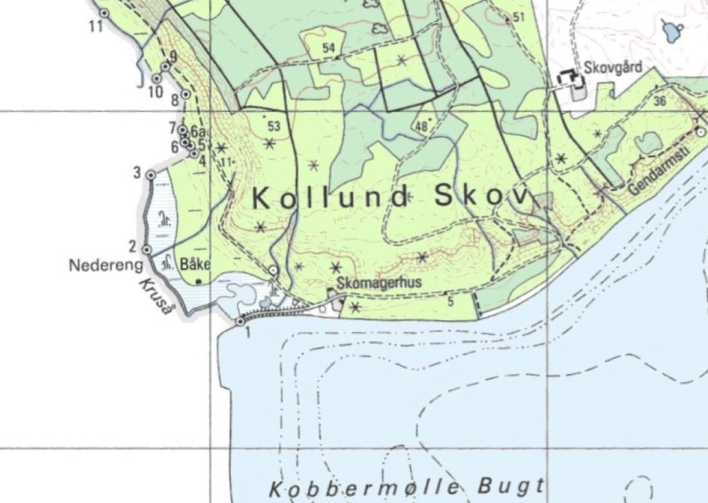
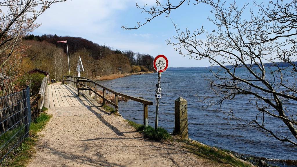
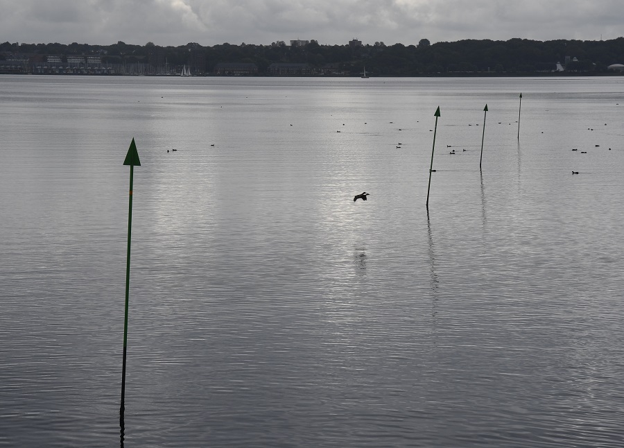
I visited Skomagerhus as part of the IBRG DEDK21 expedition. Skomagerhus (in German Schusterkate ) is a border crossing between Denmark and Germany , consisting of a narrow wooden footbridge, Dambroen, over the Krusåen , where it flows into Flensburg Fjord. The bridge also connects the nearby Danish Gendarmstien and the German Fördesteig (Fjord Trail), which runs along the Flensburg Fjord.
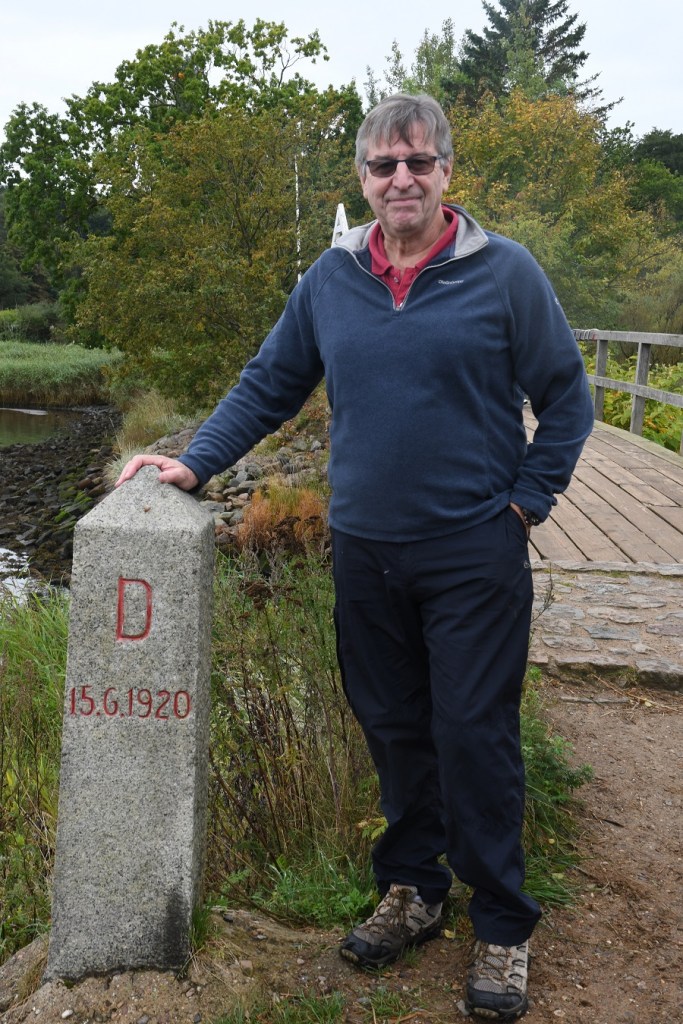
It is the easternmost point on the Danish – German border after the establishment of the 1920 border. We had visited the 1864 point on the previous day at Hejlsminde.
The first border marker on the Danish German border is situated here. It would be the next day that the group stood next to the last border marker BM #280 at Norddeich-Sieltoft. The border crossing was established in 1920 . It could only be passed by a limited group of locals with special permission. During the Second World War, the border crossing was closed, and was only fully reopened when Denmark acceded to the Schengen Treaty on 25 March 2001. The crossing has been partially open with Danish border control during the corona crisis.

Extract from the 1920 Treaty

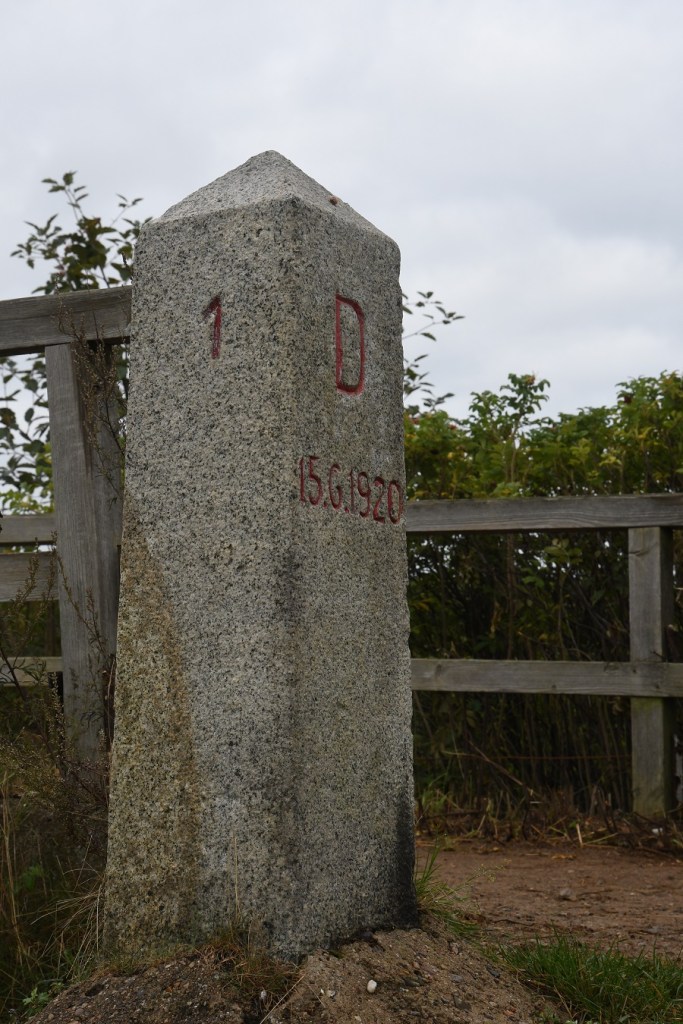
Photos from our visit
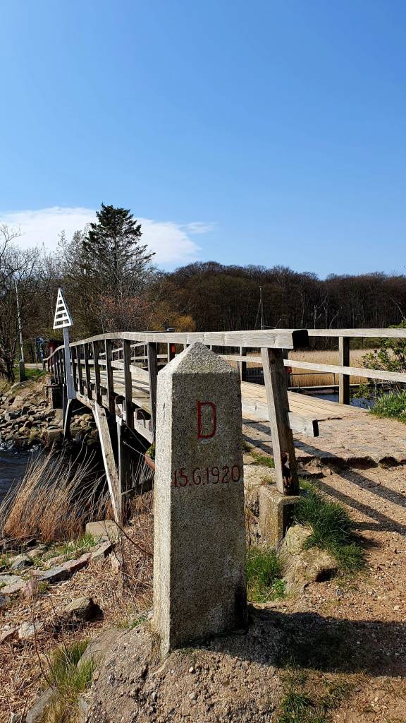
Border markers


Buildings

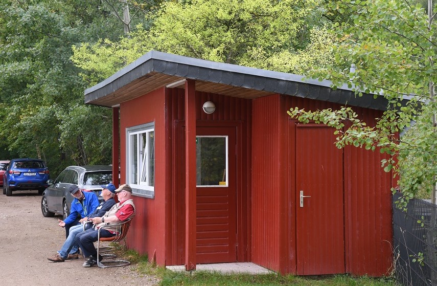
Two small buildings on either side of the border, the Danish one was originally a shoemakers cottage, hence the border crossing name. Both now redundant border control posts repurposed for local community use.
Art with a message
On the day of our visit, there were a series of displays with a message about borders.


One last question

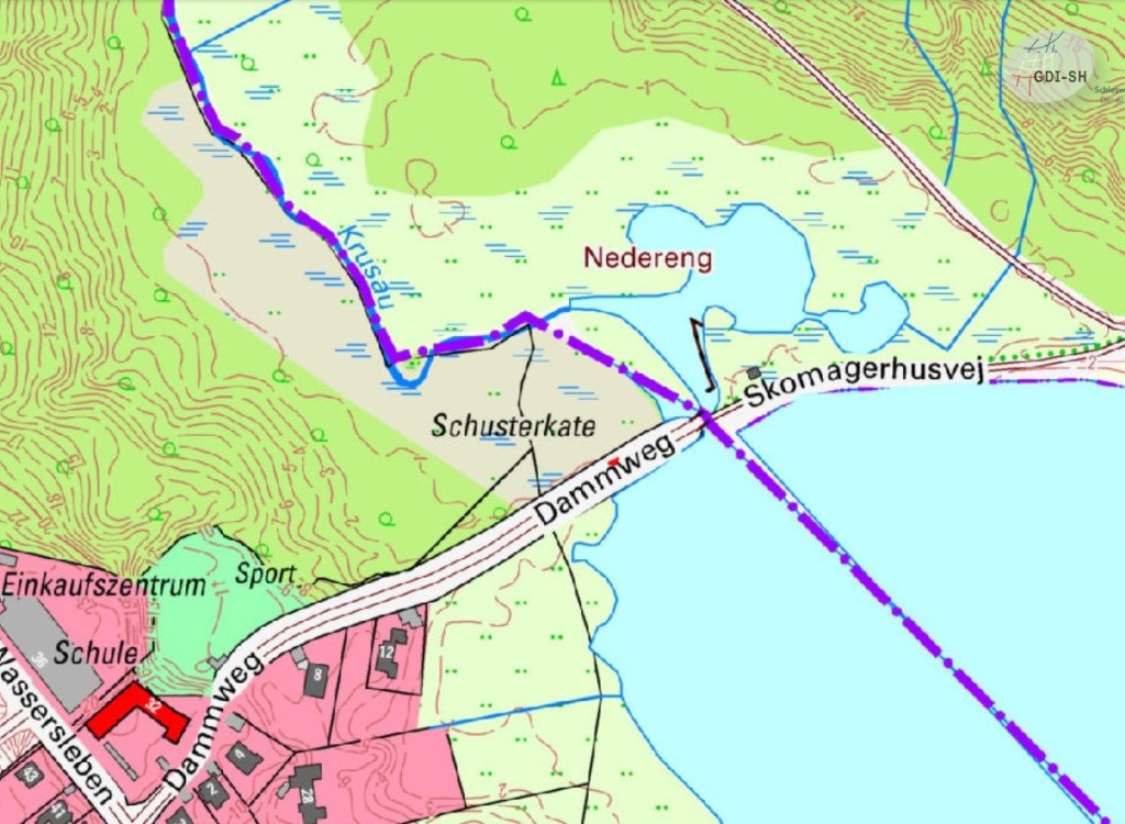
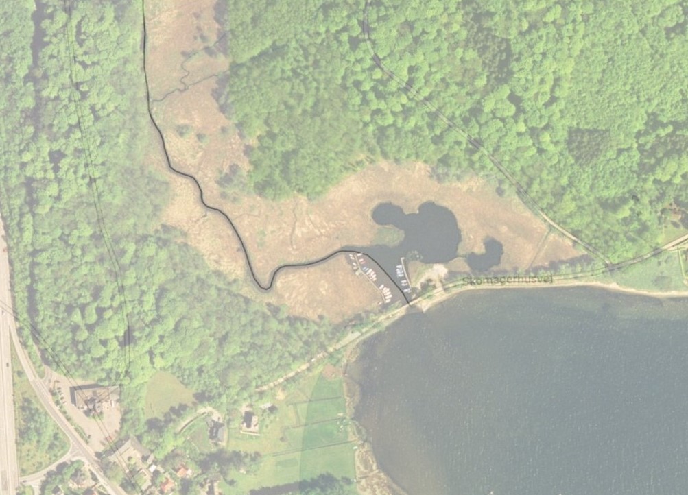
Looking at the above maps there is a question mark about where the border goes within the Krusåen river. The Danish state map (right) service sfdekort.dk seems to show the border line along the thalweg in the river, whereas the German digital atlas (left) has the German pier within Denmark. Perhaps this map draws a straight line between the 2 marine border markers. Other maps come out with different variations. At the moment it is not certain exactly where the border is located.

Date of Visit: 25 September 2021

Impressive! Great report- as usual👍
LikeLiked by 1 person