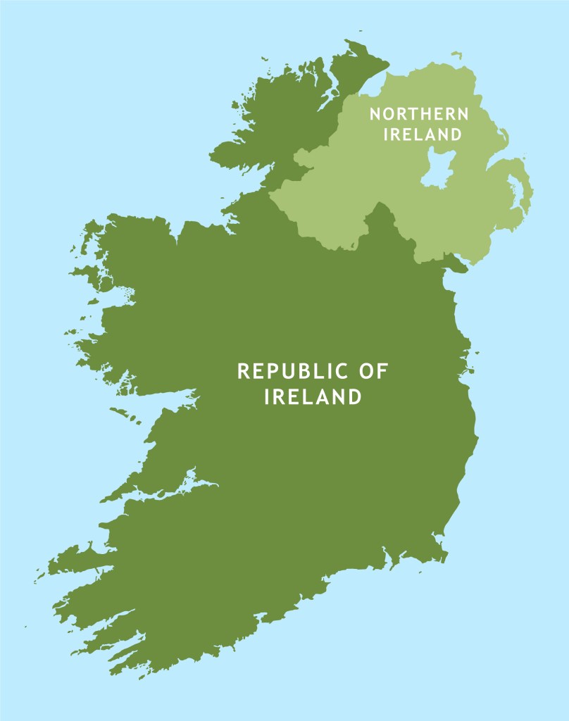
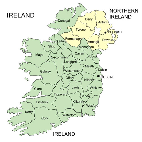
Ireland is an island in the North Atlantic Ocean, in Northwestern Europe. Geopolitically, the island is divided between the Republic of Ireland (officially named Ireland – a sovereign state covering five-sixths of the island) and Northern Ireland (part of the United Kingdom – covering the remaining sixth). It is separated from Great Britain to its east by the North Channel, the Irish Sea, and St George’s Channel. The island of Ireland is divided into two separate jurisdictions: the Republic of Ireland (a sovereign nation) and Northern Ireland (part of the United Kingdom). Republic of Ireland: Covers 26 of the island’s 32 counties, has its capital in Dublin, uses the Euro, and is an independent European Union member state. Northern Ireland: Covers the remaining 6 counties (Antrim, Armagh, Tyrone, Fermanagh, Down, and Derry) in the northeast, has its capital in Belfast, uses the British Pound, and forms part of the United Kingdom.
Until 6 December 1922, the island of Ireland was part of the United Kingdom of Great Britain and Ireland. During the Great Famine, from 1845 to 1849, the island’s population of over 8 million fell by 30%. One million Irish died of starvation and disease and another 1.5 million emigrated, mostly to the United States. This set the pattern of emigration for the century to come, resulting in constant population decline up to the 1960s. The division of Ireland came as a result of armed struggle that led to a political and legislative compromise, the Government of Ireland Act 1920 and the Anglo-Irish Treaty to resolve deep-seated sectarian, religious, and economic divides. It provided for the establishment of the Irish Free State within a year as a self-governing dominion within the “community of nations known as the British Empire”, a status “the same as that of the Dominion of Canada”. It also provided Northern Ireland, which had been created by the Government of Ireland Act 1920, an option to opt out of the Irish Free State (Article 12), which was exercised by the Parliament of Northern Ireland.
Northern Ireland opted out of the Irish Free State on December 7, 1922, under Article 12 of the Anglo-Irish Treaty. The unionist-dominated Northern Ireland parliament, led by Prime Minister James Craig, rejected joining the new dominion to maintain its political union with the United Kingdom and preserve a Protestant and unionist majority. This was followed by a bitter civil war within the south between pro treaty and anti treaty factions that ultimately the pro treaty faction won.
Republic of Ireland
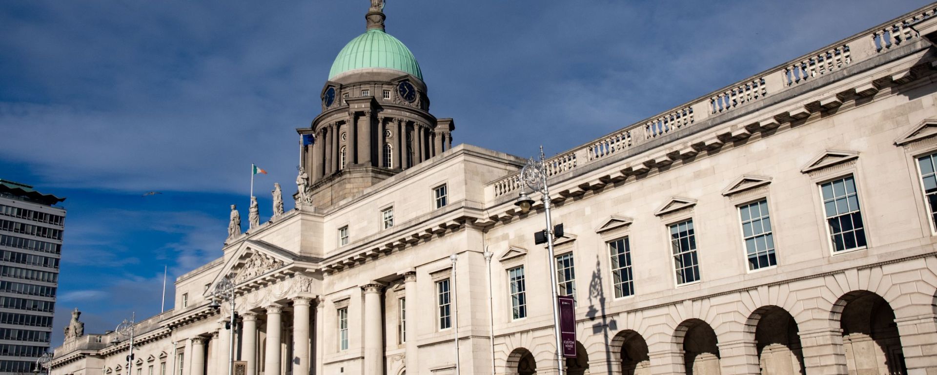
The Republic of Ireland was officially founded on April 18, 1949, when the Republic of Ireland Act 1948 came into effect, which formally declared the state a republic and ended its remaining ties with the British Commonwealth. Its capital is Dublin. Ireland is a constitutional republic with a parliamentary system of government. The Oireachtas is the bicameral national parliament composed of the President of Ireland and the two Houses of the Oireachtas: Dáil Éireann (House of Representatives) and Seanad Éireann (Senate). Formerly reliant on agriculture, Ireland transformed into the “Celtic Tiger” during the 1990s through economic liberalization. Today, it has a highly developed, high-income market economy. The Republic is formally neutral, and is an active member of key global and regional organizations, including the United Nations (since 1955), the European Union (since 1973), the Council of Europe, the Organisation for Economic Co-operation and Development (OECD), and the OSCE.
Northern Ireland
Northern Ireland is a constituent country of the United Kingdom, located in the northeast of the island of Ireland. It covers six counties, has a population of about 1.9 million people, and features Belfast as its capital. A devolved part of the UK with its own assembly at Stormont, while key powers like defence and foreign affairs remain with Westminster. Uses the British pound sterling (£). It was formed historically out of 17th-century British colonization that settled Protestant populations in the region and created in 1921 when the rest of Ireland gained independence, leaving six northern counties inside the UK. Known for the troubles, a 30-year sectarian and political conflict (late 1960s to 1998) between Unionists/Loyalists (mostly Protestant) and Nationalists/Republicans (mostly Catholic).
The Good Friday Agreement: Signed in 1998, this historic peace accord largely ended the violence and established a power-sharing government. Northern Ireland operates under a unique post-Brexit arrangement governed by the Northern Ireland Protocol and the 2023 Windsor Framework. It remains an integral part of the UK, yet stays aligned with EU single-market rules for goods to avoid a hard border on the island of Ireland, creating a regulatory trade border in the Irish Sea. Anyone born in Northern Ireland is entitled to Irish citizenship and post Brexit, the number of applications has increased dramatically, with annual applications from the UK reaching over 242,000, more than half originating in Northern Ireland.
Irish Culture
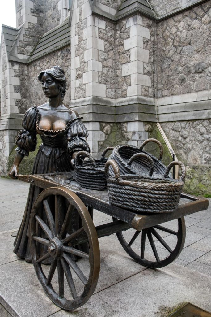
Irish culture is now global, primarily as a function of mass migration, but also because it is accessible and fun. Irish culture blends a rich Gaelic foundation with centuries of Christian, Viking, Norman, and global influences. Key pillars include a world-renowned literary and storytelling tradition, traditional folk music and fast-paced dance, iconic social hubs like the local pub. Ireland sporting presence in both traditional (Gaelic football, camogie, and handball) and modern sports (Football and Rugby amongst others) promotes this.
Both English and Irish (Gaeilge) hold official status, in both parts of Ireland and is taught in schools.
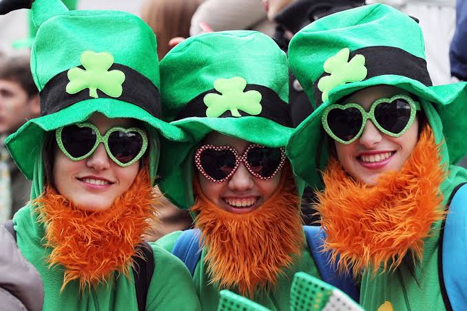
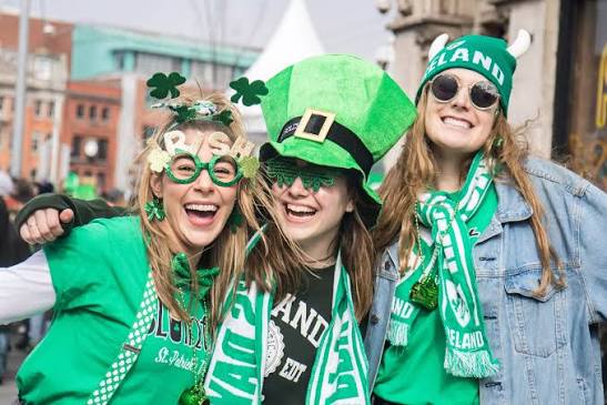
St. Patrick’s Day is a global cultural and religious holiday celebrated annually on March 17. It commemorates Saint Patrick and the arrival of Christianity in Ireland, but now is a worldwide celebration of Irish heritage, culture, and community. Major public parades, music, dance (céilithe), and gatherings take place in Ireland, the United States, and around the world. Associated with all things Irish is Guinness. Guinness is a world-famous Irish stout owned by Diageo. Founded in Dublin in 1759, it is sold in over 150 countries and brewed in nearly 50.
Border Facts
The Republic of Ireland–United Kingdom border, sometimes referred to as the Irish border or the British–Irish border, runs for 499 km from Lough Foyle in the north-west of Ireland to Carlingford Lough in the northeast, separating the Republic of Ireland from Northern Ireland. Legal partition took effect on May 3, 1921, and the border path was formally locked in on December 3, 1925, after the Boundary Commission report was suppressed, border areas with high proportions of catholic residents therefore remained part of the north. Proposed land swaps did not happen: east Donegal into Northern Ireland, and small parts of Tyrone and Fermanagh to the south.
During the the Troubles the border was heavily militarized with British Army checkpoints, watchtowers, and road closures from the late 1960s until the 1998 Good Friday Agreement. Physical infrastructure was removed following the 1998 peace accord and Irish and UK citizens can live, work, and travel freely across the border without passports. Borders remain unmarked with county signs and road speed signs (kilometre versus miles) being the only indications.
Please click on the images below to access visit reports, with maps, more photos and analysis.
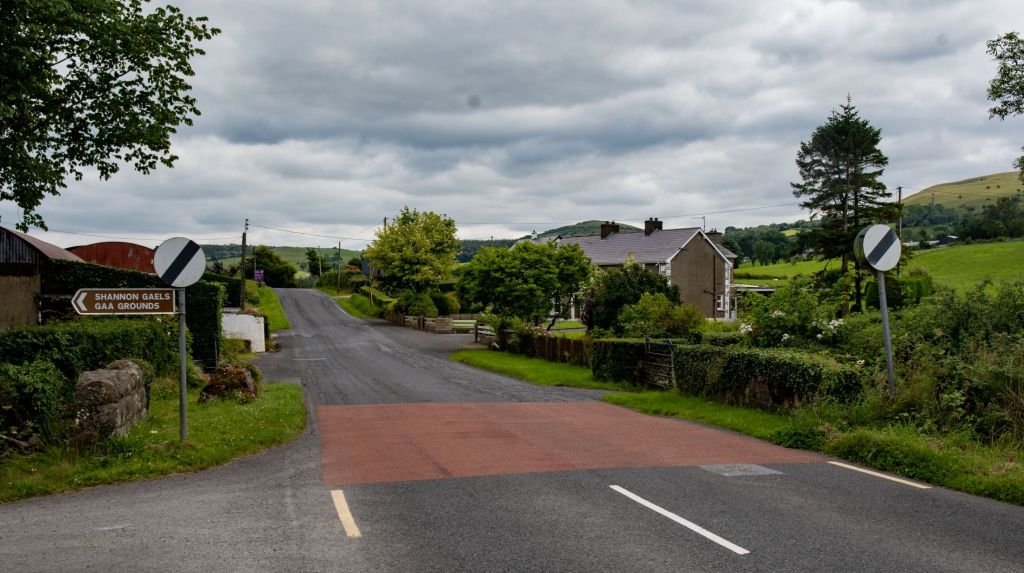

The border features around 275 public road crossings (such as the N54, which crosses the border multiple times in just a few miles), outnumbering the total land crossings on the entire eastern border of the European Union, it weaves through complex drumlin belts, rivers like the River Erne (which splits towns like Pettigo), and valleys rather than straight topographical lines. It slices through rural homes, farms, and pubs.
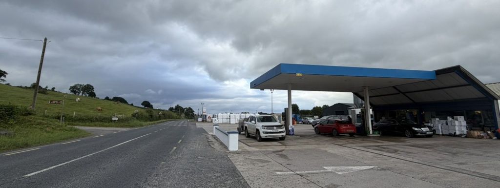
The international boundary between the Republic of Ireland (County Cavan) and Northern Ireland (County Fermanagh) cuts directly across the property’s petrol station forecourt and storage facilities.
The garage operates as a 24-hour fuel pump station, convenience shop, and fuel supplier, handling heavy cross-border traffic daily. Historically, the expansion of this garage forecourt in the 2000s resulted in the demolition of a famous border house that previously sat on the exact line.
Daily life relies on cross-border integration, with thousands of residents regularly commuting across the line for employment, education, and public services
Irish Number Plates
Northern Irish plates (three letters always containing an ‘I’ or ‘Z’ followed by 1 to 4 numbers) and Republic of Ireland plates which display the year, county name in Irish, and an EU flag. There were more GB generic plates than I expected in the north which have been imported by dealers, the new owners need to pay a transfer fee to get a NI plate.
North
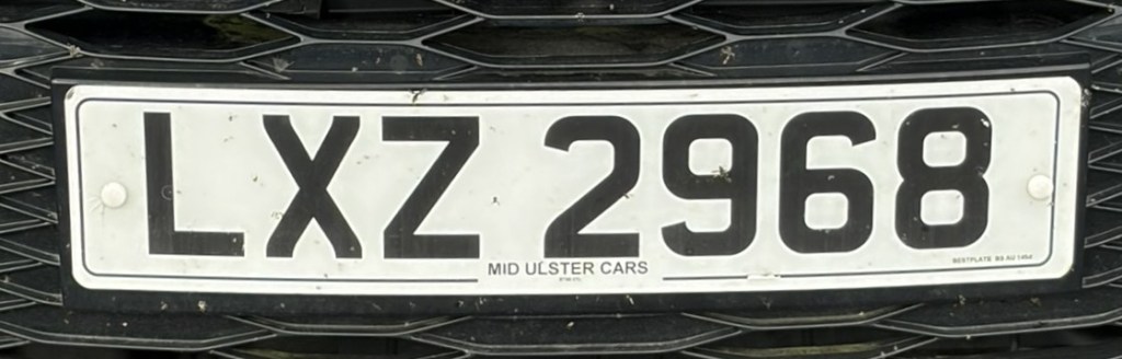
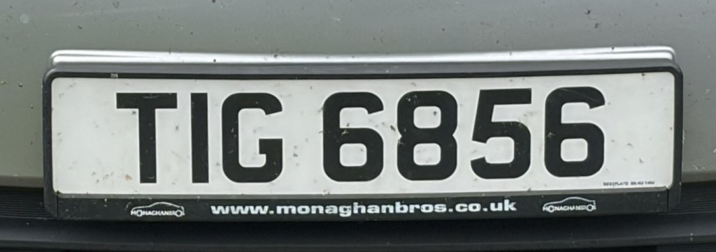
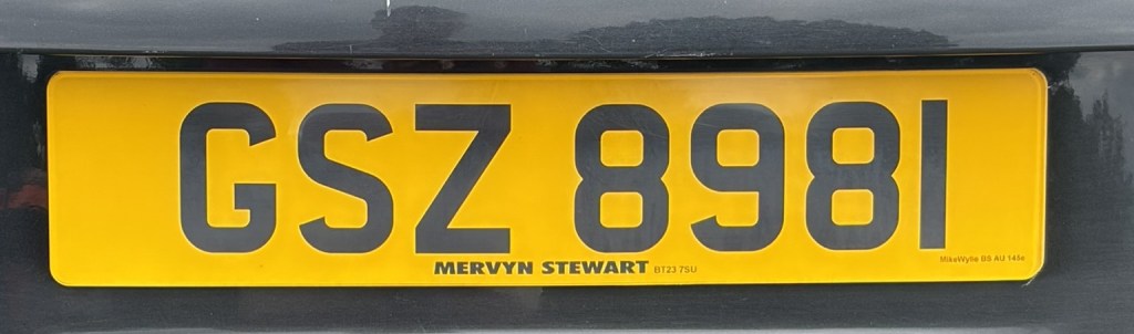
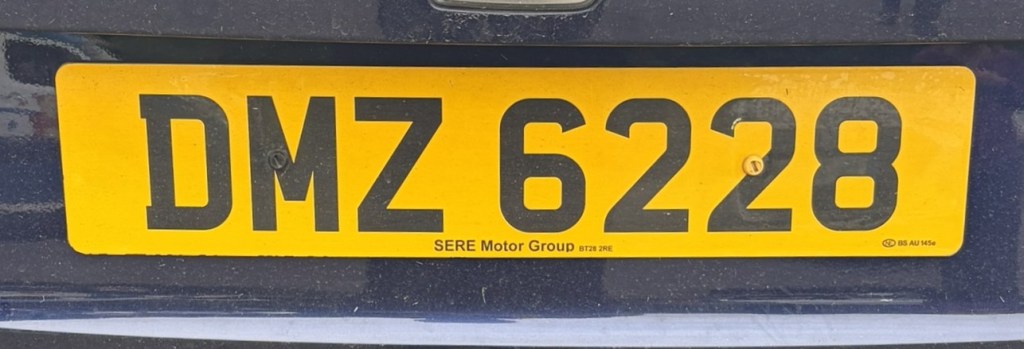
White = front plate. Yellow = rear plate.
South
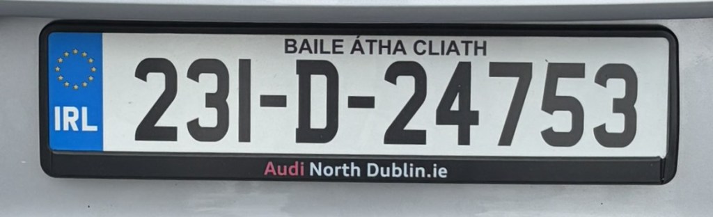
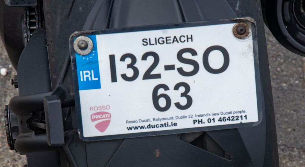
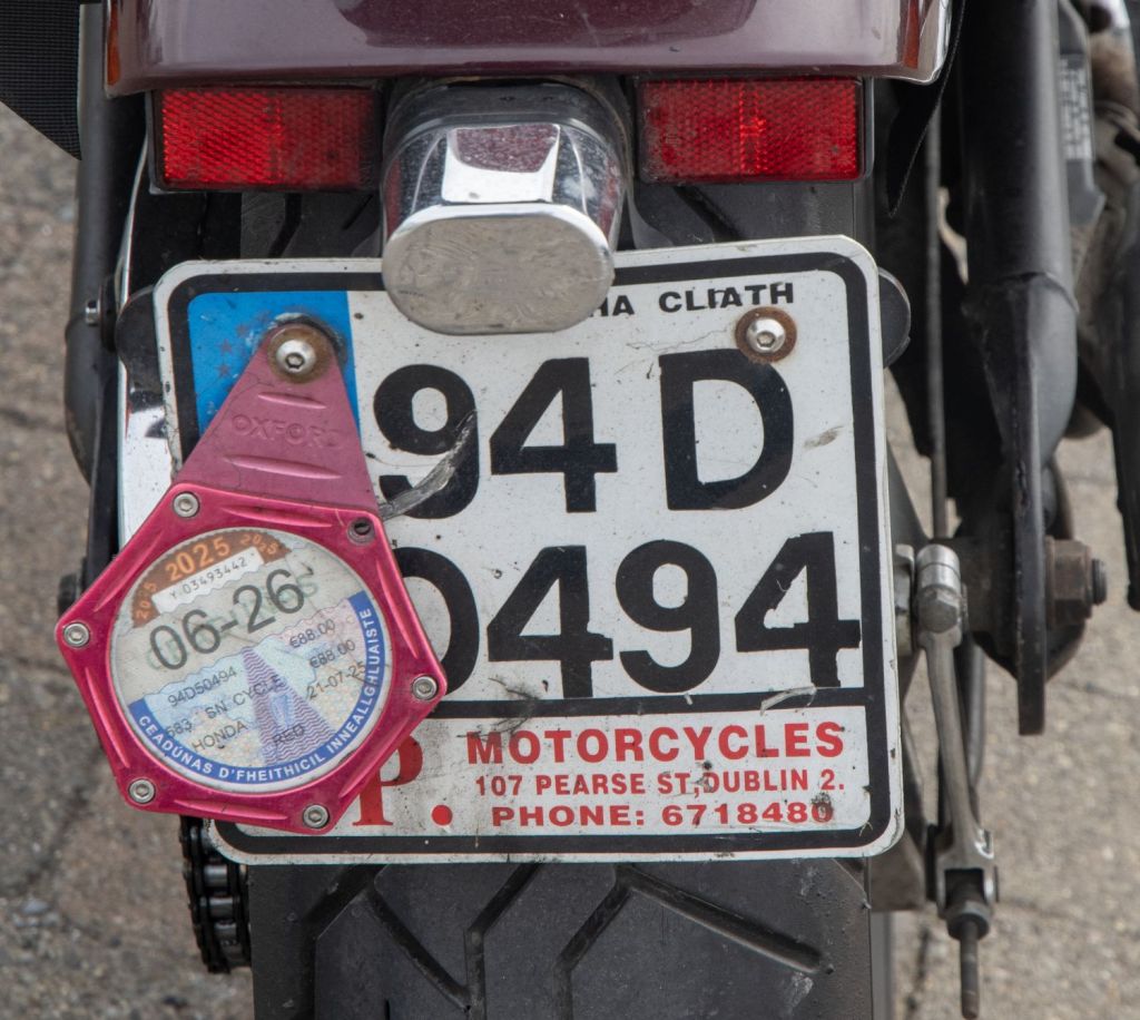
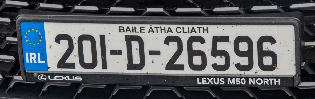
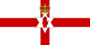
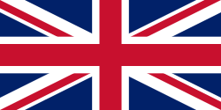
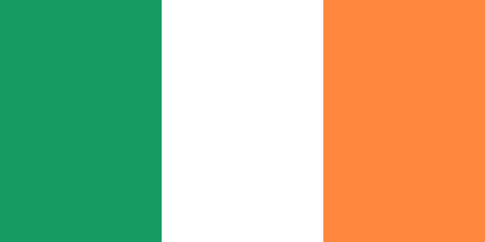
As with many things in Ireland flags are contested. The Irish tricolour, is a vertical tricolour of green (at the hoist), white and orange. It was intended to symbolise the inclusion and hoped-for union between Roman Catholics (symbolised by the green colour) and Protestants (symbolised by the orange colour). Northern Ireland has no official flag of its own. The official flag used is the Union Flag of the United Kingdom. The unofficial Ulster Banner is also widely used by sports teams and unionist communities but is seen as divisive by Catholic communities who prefer the tricolour.
North
South
Site Navigation
In order to find your way around the site, either click on the links (text in red) or use the menus at the top and side of the pages. About leads you to the main areas of the site. The Americas Tripoints menu leads directly you to my visit reports whereas the Country Visits page allows you to choose which country to look at first. Clicking on photos can lead you directly to reports too.
Mobile Users Advice
Tables display correctly when holding your mobile horizontally.
To access the links to other pages please click on the 3 horizontal dots at the bottom of the page